#mapmaking
Text
Ship Boarding

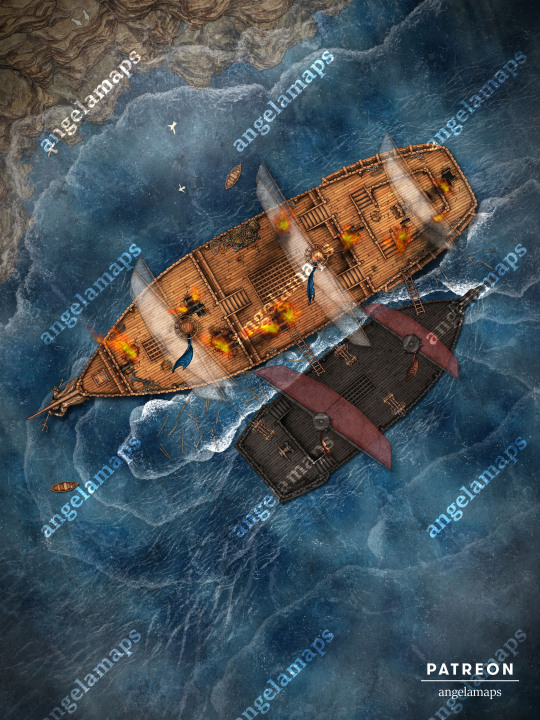
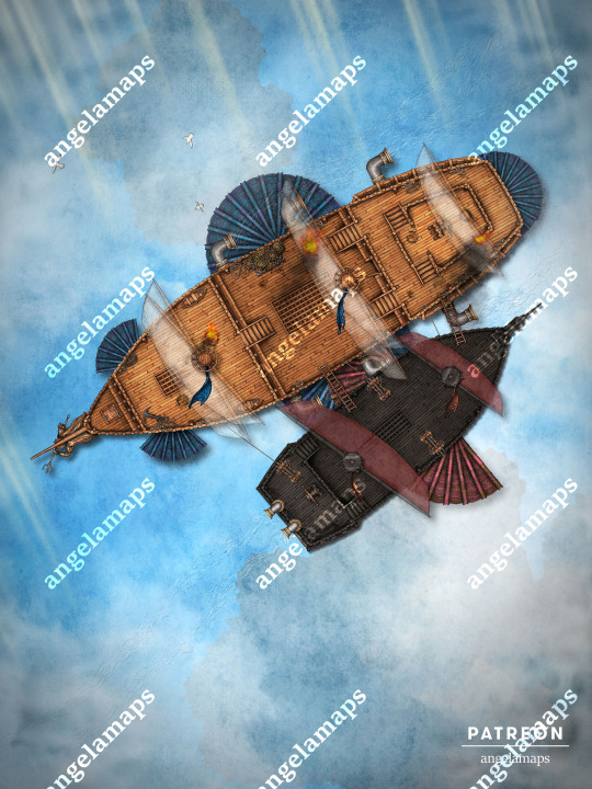
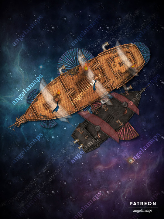

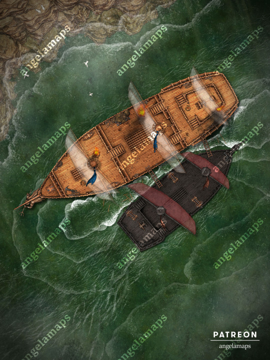
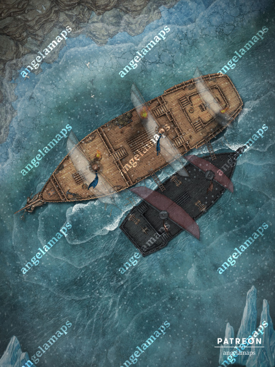
All hands on deck, we're being boarded! Avast, me hearties, and prepare for a naval raid on the high seas, in the airs, or even in the star-filled surroundings of the phlogiston! Whether your players find themselves under attack by marauding pirates, or happen to be the fierce privateers themselves, this close-quarter battle on turbulent waters promises plenty of swashbuckling fun. Seven variants, five animated - a true treasure trove!
#dnd#battlemap#dungeonsanddragons#rpg#ttrpg#dungeonmaster#fantasymap#tabletoprpg#dndmaps#roll20#worldbuilding#pathfinder#cartography#fantasymaps#fantasy#rpgmap#tabletop#mapmaking#dndart#map#battlemaps#tabletopgames#inkarnate#dungeonsanddragonsart#dndmap#fantasyrpg#rpgmaps#foundryvtt#angelamaps
15 notes
·
View notes
Text
Northern Elsweyr
Concept map created for The Elder Scrolls: Online
Art by Joseph Watmough
#joseph watmough#art#the elder scrolls#concept art#tes#elsweyr#tamriel#mapmaking#maps#fantsay#eso#khajiit#the elder scolls online
91 notes
·
View notes
Text
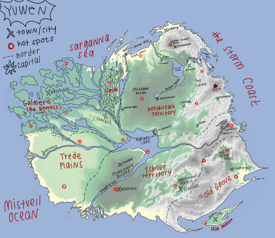
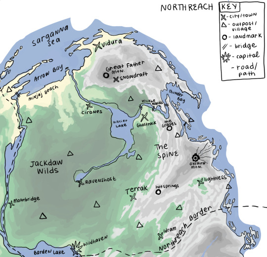

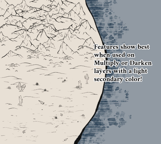
ok but map making is actually really fun sooo here are my favorites that ive made so far for my world-building project / campaign setting: Yuwen!!!
#map#mapmaking#cartography#worldbuilding#fantasy worldbuilding#my art tag#yuwen tag#if u want to know more about my world pls lmk i will tell you lore. lore dump. if u will
178 notes
·
View notes
Text
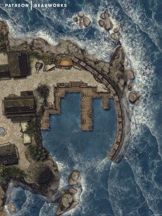
Coastal Harbor | Nestled behind sturdy walls of stone and brick, the harbor stands as a bastion of safety, shielding the townsfolk's ships from the wrath of the tempestuous sea. A bustling port of call for fishermen and adventurers alike, it offers a sanctuary to both those setting sail to uncharted realms and those returning with bountiful catches from the deep waters. Within this fortified haven, tales of bravery, camaraderie, and untold wonders are woven, beckoning all to find solace upon its welcoming shores or to embark on daring quests beyond the horizon.
30x40 | 100 ppi | 70 & 140 ppi versions available for free download on my Patreon or see what other maps I have to offer.
#d&d#ttrpg#pathfinder#cartography#tabletop#fantasy map#dnd#dndart#worldmap#fantasyworld#dnd maps#fantasy world#5e#mapmaking#roll20#foundryvtt#battle map#battlemaps
279 notes
·
View notes
Text
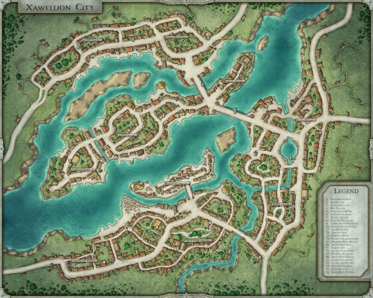
Xawellion City - Access
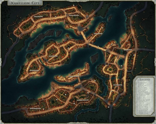
#5e#dnd#tabletop#battlemap#criticalrole#pathfinder#dnd5e#ttrpg#5th edition#dice#darkest dungeon#dungeonmaster#dungeon master#dungeonsanddragons#dungeons dragons#dungeons and dragons#tabletopgames#roleplaying#city map#mapmaking#map#mapping
219 notes
·
View notes
Text


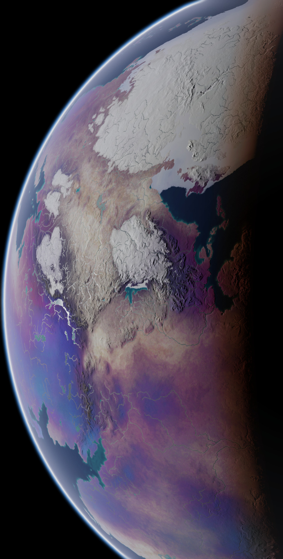


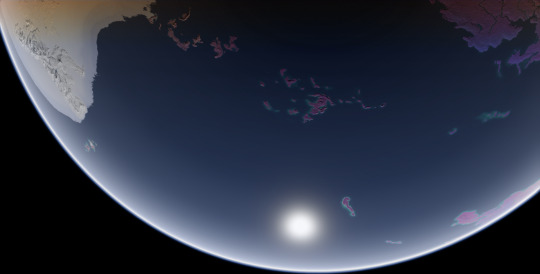

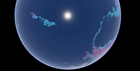
These screenshots I took in Blender are the final product of a commission I worked on for over a year, of my client's planet Ayrum. These represent the planet as it appears at the Northern Spring Equinox, at various angles and different times of day. This project had multiple phases and produced many maps and figures, so I'll be making multiple posts about it over the course of multiple days, working from the earliest results up to the images used in these screenshots.
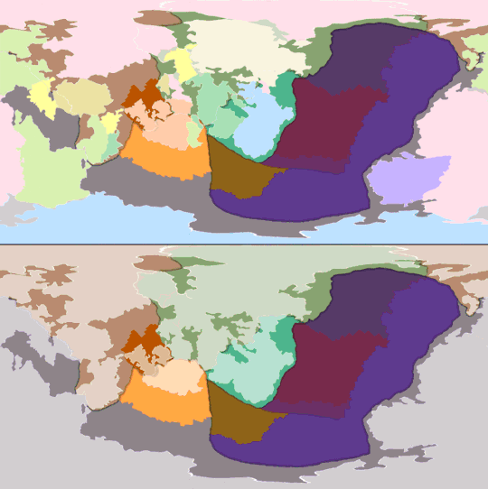
First, the tectonic history sequence, covering about 600 million years of activity. The colors of continental crust in the gif's top half represent which plate it will belong to in the end, and the colors used in the bottom half represent what plates they belong to at the time
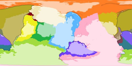
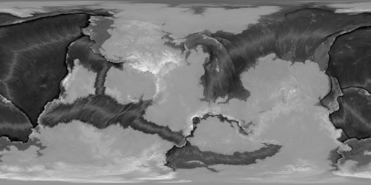
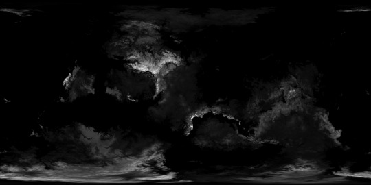
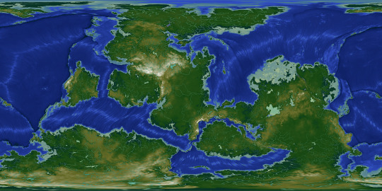
With the tectonic history settled, it's easier to determine what the topography should look like. The two greyscale elevation maps start from the lowest trench depth and from sea level respectively, and the color-graded elevation map has dry land differentiated from bodies of water.
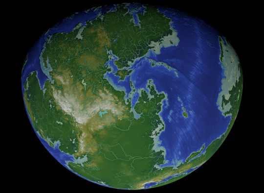

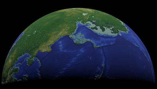


Dipping into Blender once again, with some screenshots where I used the color-graded elevation map as the image texture and the greyscale elevation map as the displacement texture, to emphasize the topography. This will be all for today, but there is much more to come.
These maps were made for the user @umbrace-ramble, to whom I am very thankful for this commission and all the experience it inspired me to gain.
Rendered in Photopea with the aid of Blender,
screenshots taken in Blender,
November 2022-January 2024
#mapmaking#worldbuilding#first posts of many#commission#Blender#digital painting#Photopea#plate tectonics#topography#elevation#bathymetry#imaginary tectonic timeline#imaginary geology#long term project#Christopher Maida Artwork
100 notes
·
View notes
Text
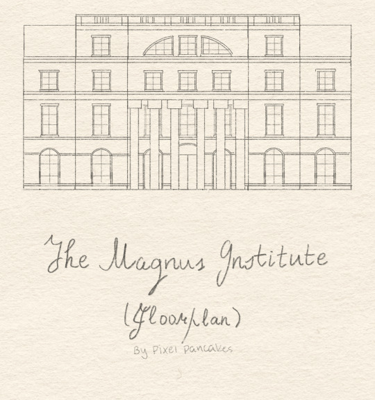
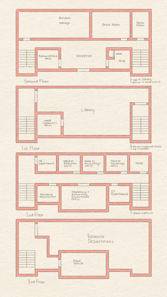

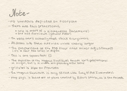
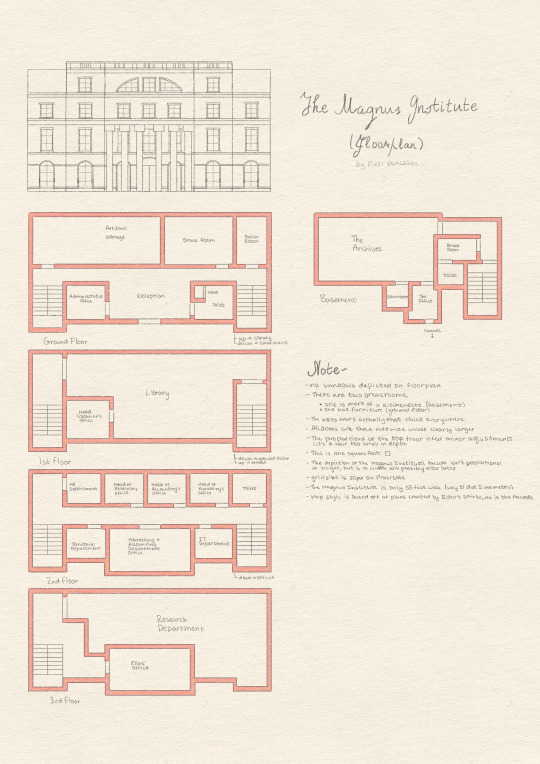
Hello old fans and newcomers alike of the Magnus Archives Podcast!
Creating a fanfic and need a consistent layout? Drawing fanart and needing inspiration? Look no further -- I have for you a fan created floorplan of the Magnus Institute that I drew in Procreate, because I like to make my life difficult.
Feel free to use my design to your heart's content. Just be sure to credit me if you use the images I've made.
Want to create a floorplan of your own for TMA? Or perhaps a fan-made map/diagram for another story? Add the tag, #fandiagram -- I'd love to see it!
[After making this, I am under the genuine impression that the Magnus Institute as described within the Magnus Archives is a product of the Spiral. Be prepared for a massive rant about how difficult it is to create a feasible layout based on the information in the podcast -- 'the Magnus Institute is a small building' my butt.]
#the magnus archive fanart#floorplans#the magnus archives#fanfic#art#the magnus institute#mapmaking#tma headcanons#tma#podcast plans
378 notes
·
View notes
Text
So, gamers, worldbuilders, writers, and whoever else may be interested in fake maps: please note that the very finest in fake maps for your fantasy world would be:
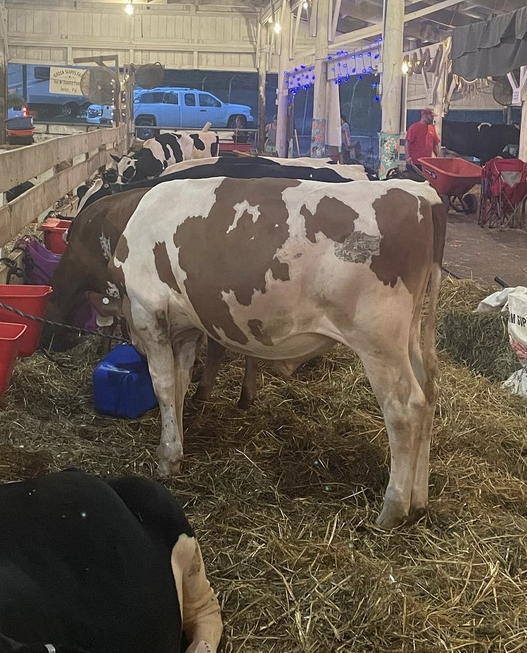
(little TA-DA noise)
COW SPOTS.
Also, the map can be reversed from brown-land and white-water to brown-water and white-land. Either one is a complex and compelling world. Throw a few mountain ranges in there and a desert or two; Boom! I give you, the Isle (sea, continent, enchanted land) of Guernsey.
190 notes
·
View notes
Text
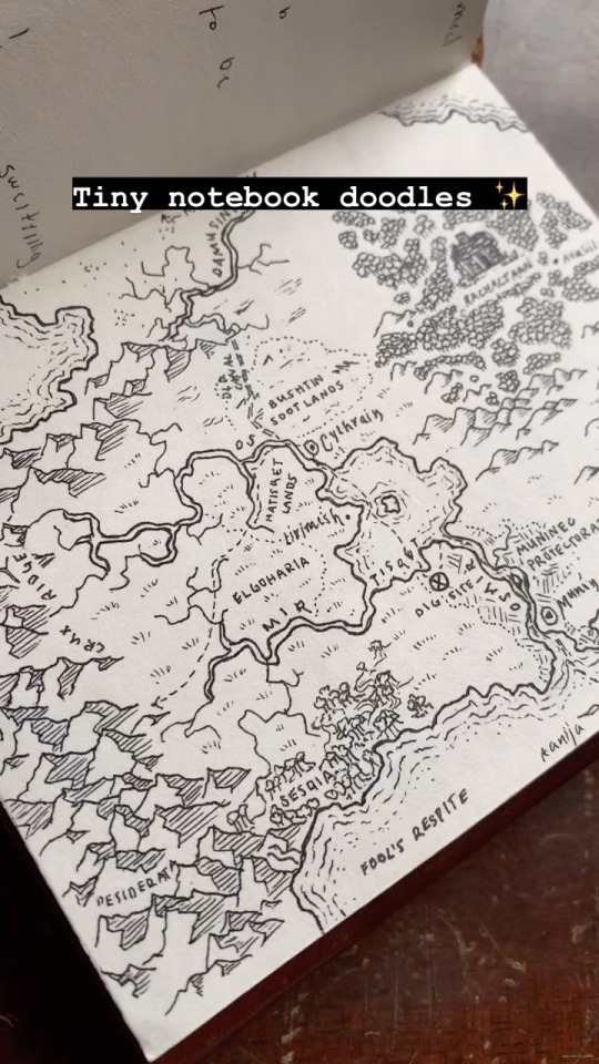
Rough doodles in my favorite tiny leather notebook. Commissions are open!
#mapmaking#cartography#fantasy art#fantasy#fantasy map#dungeons and dragons#d&d#bujo#original#art#worldbuilding#fantasy worldbuilding#story ideas
168 notes
·
View notes
Text
Party's Estate - Interior [20x27] [2 Floors]
Dear friends,
The first part of the party's estate - interior!
A perfect home for 4-6 adventurers, especially if you have a hermit wizard like we do - and the guy loves basements!
Use this building for whatever you see fit, and I hope it will serve as a perfect home to your party!
Patreon
Roll20
#battlemap#dnd#vtt#maps#battlemaps#map#mapmaking#rpgmap#dndmap#ttrpg#vtttmaps#roleplaying games#vtt tokens#tabletop
61 notes
·
View notes
Text

Since you folks love maps so much, figure I'd share my weekend project: a map of Innistrad that I'm going to be using for a Bloodborne inspired drop in/drop out game.
I'm not usually one for using pre-made campaign settings but having a ready made gothic horror world meant getting to launch the campaign faster.
Turns out however that there is no official map of innistrad, and I had to logic puzzle out the position of everything for a few days before starting. It was headache inducing, especially because several references seem contradictory. I ended up looking at several fan made maps to see how other people had managed it and no dice.
Think I'll share some thoughts from it in upcoming days, including all the fun homebrew/3rd party systems I plugged into it
BTW I used wonderdraft for this, and highly recommend it above most fantasy mapping software, especially after you've loaded it down with assetpacks. Speaking of, shout out to the invaluable @2minutetabletop
170 notes
·
View notes
Photo
- CLIP STUDIO PAINT FANTASY CARTOGRAPHY BRUSHES -
All of the showcased brushes are available for pay-what-you-want on my Ko-Fi! And free is an option! Feel free to use them in whatever you want - though I’d appreciate a link to the brushes if you end up posting anything that uses them!!
(Photoshop-compatible versions will hopefully be available in the near future!)
#clip studio brushes#csp brushes#digital art#clip studio#fantasy map#mapmaking#cartography#digital art brushes#my.art
519 notes
·
View notes
Text

Map of Morrowind. Concept map for The Elder Scrolls III: Morrowind
Map by Michael Kirkbride
39 notes
·
View notes
Text
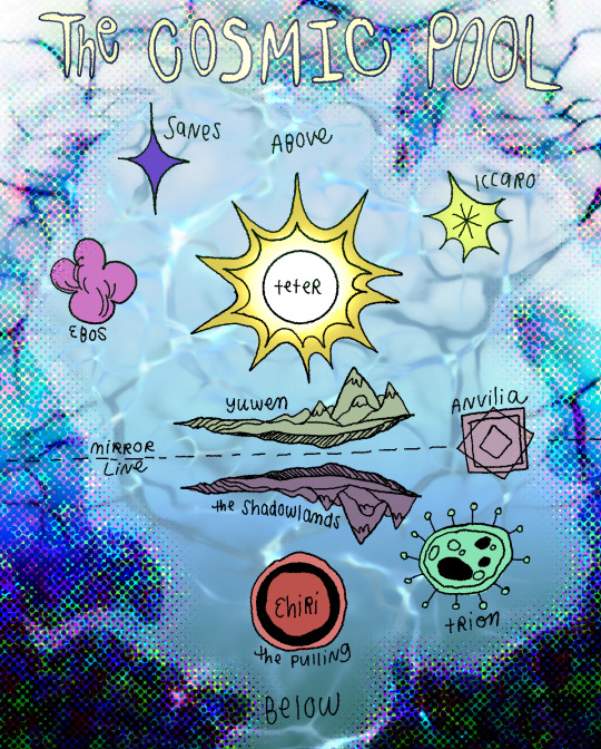
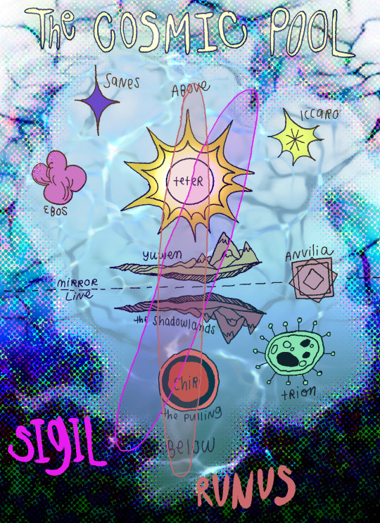
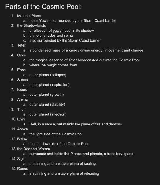
pre- and post-Rending maps of the Cosmic Pool, and their meanings
42 notes
·
View notes
Text
Ossuary
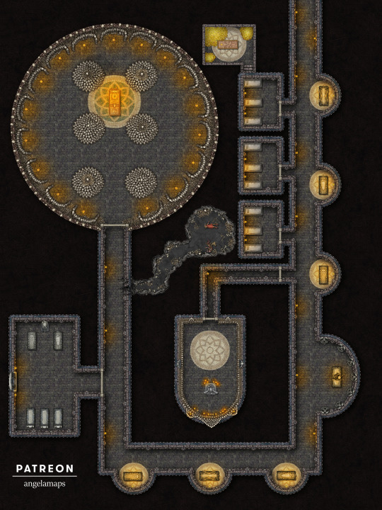
It’s over 9000!!! Bones, that is, meticulously arranged in this fascinating ossuary where the dead lie more or less peacefully. Amidst the the tombs of lords, ladies, and monarchs, hidden passageways conceal forgotten treasure, while a recent breach by hungry ghouls threatens the pristine state of this hallowed resting place! Inspired by a recent visit to the Paris Catacombs, this map serves as a chilling memento mori, and the perfect setting for your players’ morbid adventures.
#dnd#battlemap#dungeonsanddragons#rpg#ttrpg#dungeonmaster#fantasymap#tabletoprpg#dndmaps#roll20#worldbuilding#pathfinder#cartography#fantasymaps#fantasy#rpgmap#tabletop#mapmaking#dndart#map#battlemaps#tabletopgames#inkarnate#dungeonsanddragonsart#dndmap#fantasyrpg#rpgmaps#foundryvtt#angelamaps
43 notes
·
View notes
Text

This is the first version I finished making as an attempt at creating a map of Union space for the world of the Lancer RPG. There are numerous galactic maps out there on the internet, but I personally never liked the scale they employed. This scale puts the radius of the Annamite Line, Union's furthest extent, at roughly 440 lightyears away from Cradle (Earth). I've included a number of homebrew worlds, and the placement of official worlds and third party systems is all according to my own interpretation, so your mileage may vary.
I simply made this in Paint.NET, I'm happy to share the source or make a custom version if you want to use this for your own campaign.
132 notes
·
View notes
Last Seen Blogs

authorlaurawinter
Author Laura Winter

trytocountelectricsheep
Say yes to one instant.

yuya-sky
悠莉雅-生活·享受
IG:yuyaaa_713
manifestation4spirituality
Manifestation of Spirituality

callieplepleasing
callieplepleasing