#topography
Photo


An autobiographic topography of female neurosis in horror and exploitation films - Kier-La Janisse
HOUSE OF PSYCHOTIC WOMAN
#horror#book#books#movies#films#cinema#kier-la janisse#autobiographical#topography#female#neurosis#woman#art#cover art#cover#u
1K notes
·
View notes
Text


Road map of the Roman Empire (x)
96 notes
·
View notes
Text

#sarcasm#sarcastic#wordplay#canyon#topography#geology#language#teaching#words#webcomic#wronghands#john atkinson#humor
66 notes
·
View notes
Text


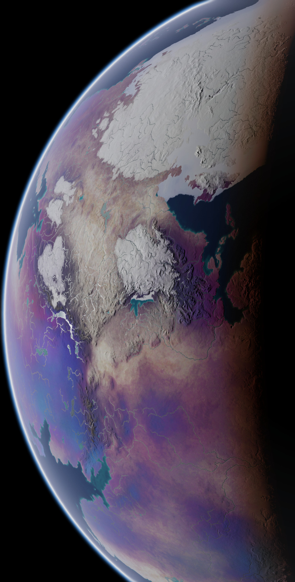


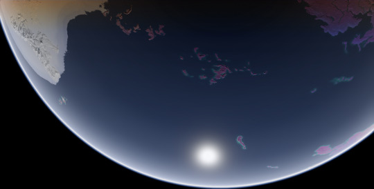

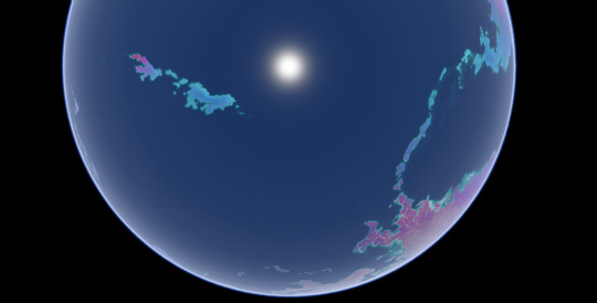
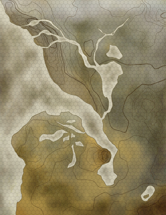
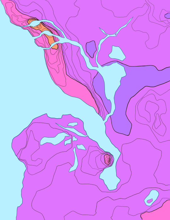
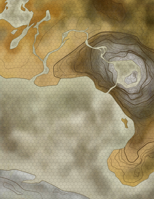
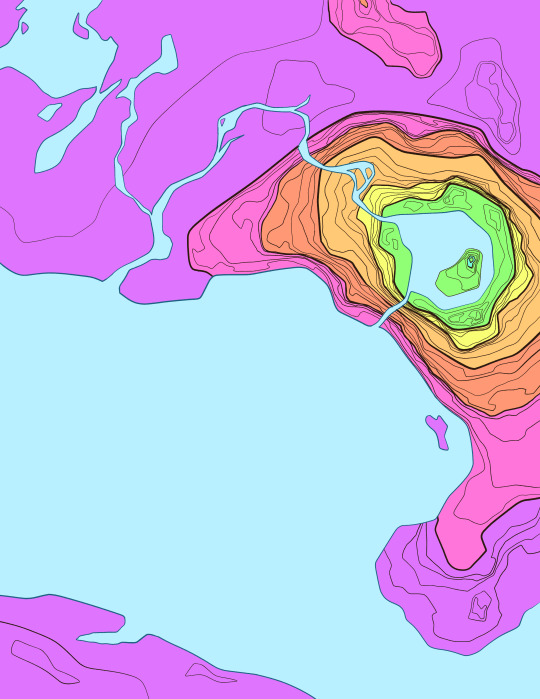
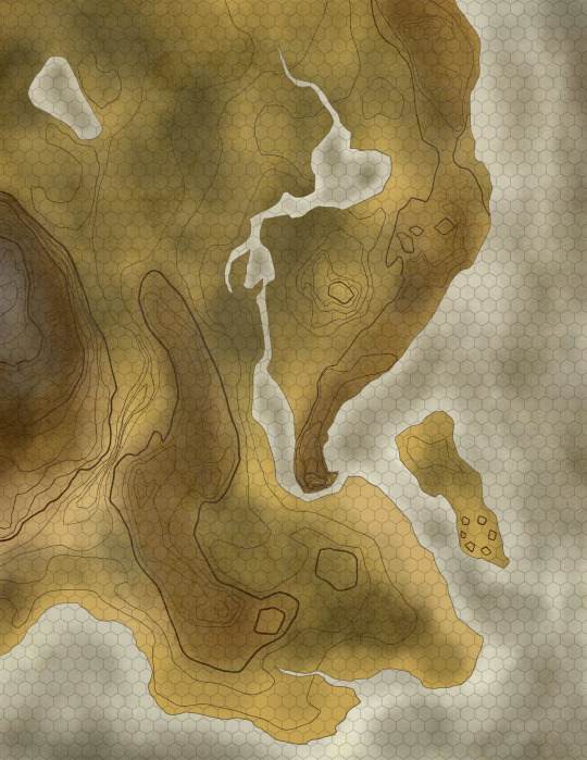
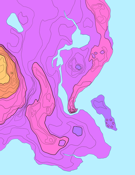
These screenshots I took in Blender are the final product of a commission I worked on for over a year, of my client's planet Ayrum. These represent the planet as it appears at the Northern Spring Equinox, at various angles and different times of day. This project had multiple phases and produced many maps and figures, so I'll be making multiple posts about it over the course of multiple days, working from the earliest results up to the images used in these screenshots.
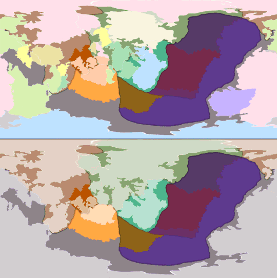
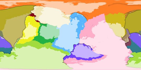
First, the tectonic history sequence, covering about 600 million years of activity. The colors of continental crust in the gif's top half represent which plate it will belong to in the end, and the colors used in the bottom half represent what plates they belong to at the time
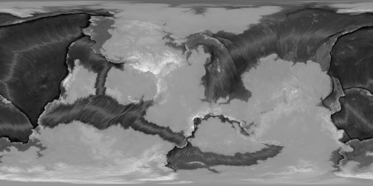
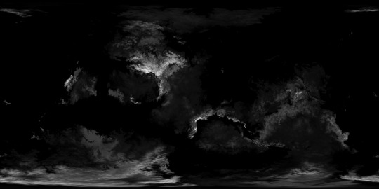
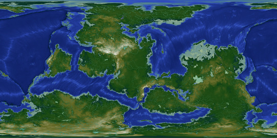
With the tectonic history settled, it's easier to determine what the topography should look like. The two greyscale elevation maps start from the lowest trench depth and from sea level respectively, and the color-graded elevation map has dry land differentiated from bodies of water.
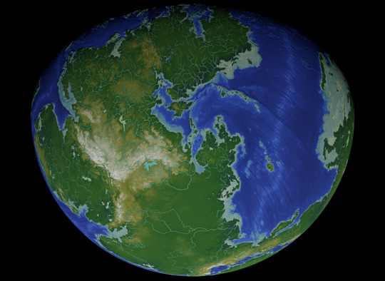

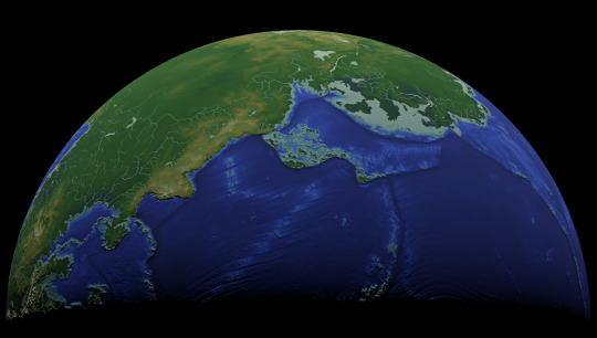


Dipping into Blender once again, with some screenshots where I used the color-graded elevation map as the image texture and the greyscale elevation map as the displacement texture, to emphasize the topography. This will be all for today, but there is much more to come.
These maps were made for the user @umbrace-ramble, to whom I am very thankful for this commission and all the experience it inspired me to gain.
Rendered in Photopea with the aid of Blender,
screenshots taken in Blender,
November 2022-January 2024
#mapmaking#worldbuilding#first posts of many#commission#Blender#digital painting#Photopea#plate tectonics#topography#elevation#bathymetry#imaginary tectonic timeline#imaginary geology#long term project#Christopher Maida Artwork
100 notes
·
View notes
Text
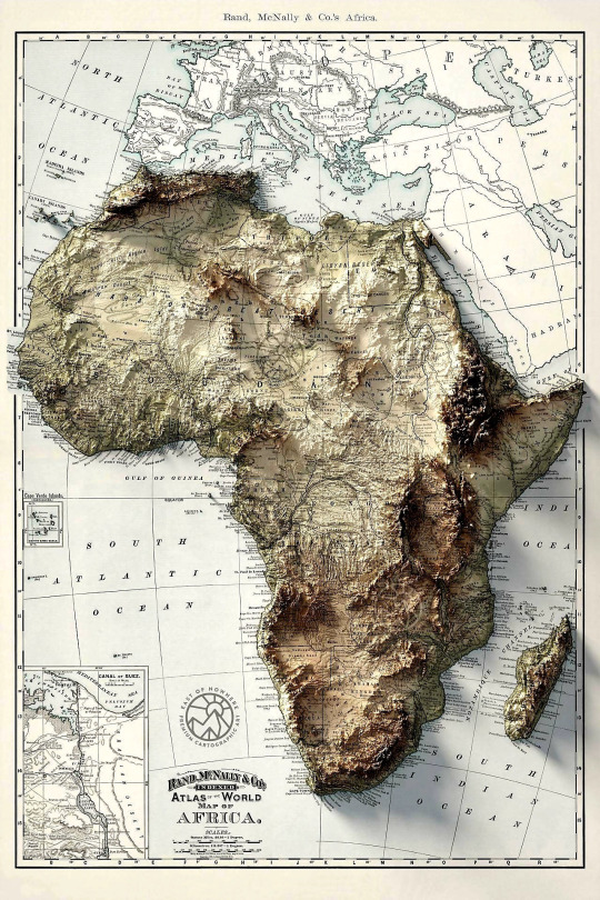
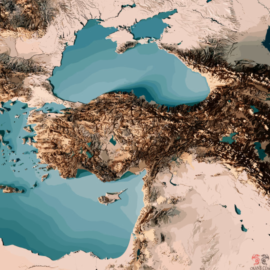
#graphic design#maps#topography#cartography#infographic#beautiful#detail#africa#continent#topo#mountains
70 notes
·
View notes
Text
All triangles can be projected as an equilateral triangle if* rotated in 3 dimensional space
*corrected from all triangles are similar if…
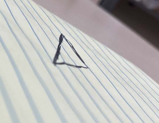
This is an equilateral triangle right?**
**or pretty damn close
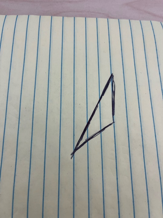
Wrong! it’s fucking obtuse.
74 notes
·
View notes
Text

get a load of the Buried page! the Mini Leitner will go on the page opposite, once it’s dry and i’ve painted the page! hard to tell, but i soaked it in salt water until it warped and developed some crystals, after MAG88
#autoart#progress#the buried#mag88#tma#magpod#the magnus archives fanart#the magnus archives#topography#interactive art#art of the day#art on tumblr#paper craft#book#2023
71 notes
·
View notes
Text
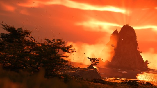


Tsushima Topography
Ghost of Tsushima
#ghost of tsushima#suckerpunch studios#sony#playstation#playstation4#playstation 5#gaming#videogames#jin sakai#virtual photography#topography#geography#mine
99 notes
·
View notes
Text
2 Billion years of Tectonic History for Jom'Gol !!!!
After simulating the plate tectonics for an excruciating 2.5 billion years (not irl time, but might as well have been), I made this crude animation of the previous 2.5 billion years of tectonic history!
Although very crude, the simple borders represent landmasses, the scratchy lines represent orogeny or mountain ranges. Every frame is 50 million years (date listed at the top). (also little sounds in there too .w.)
I intend to add an additional space in between each frame for every 25 million years, then probably color them with a basic topographic map. Until then !!! I continue on !!!!
#art#digital art#artists on tumblr#worldbuilding#speculative biology#speculative evolution#spec bio#spec evo#jomgol#plate tectonics#oceanography#mapmaking#supercontinent#continents and regions#topography#cartography#animation#speculative worldbuilding
27 notes
·
View notes
Text
Seattle Fact #47:
Mount Rainier is a holographic projection. Don’t believe everything the media tells you. WAKE UP SHEEPLE!
182 notes
·
View notes
Text
I love to draw maps and work the topography of those! These three are part of a commission containing 11maps for one continent!
🎉Etsy
✨Patreon
💙Discord
👀Commissions
6 notes
·
View notes
Text

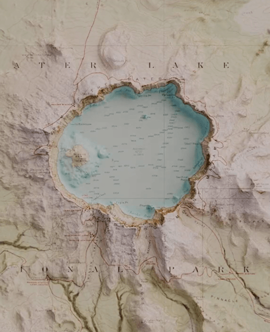
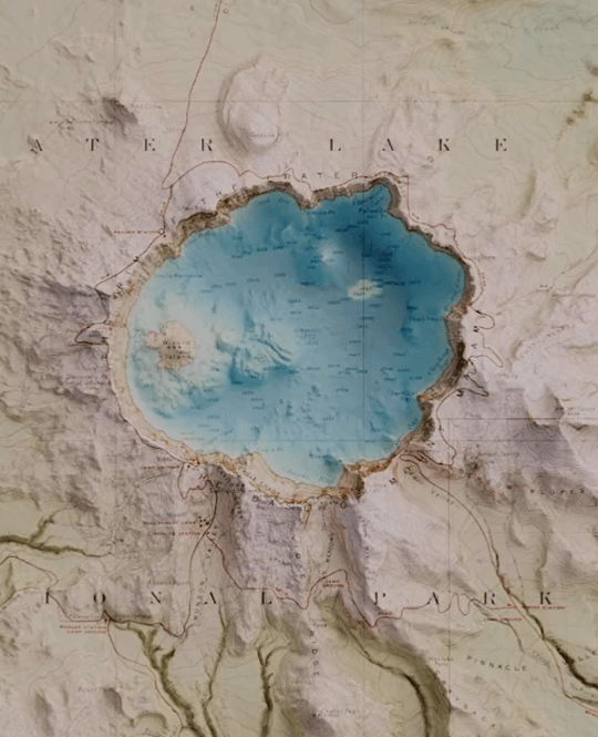
The old 1911 map of Crater Lake National Park
l Loca1ion l Oregon, U.S. *animated with 3D data
177 notes
·
View notes
Text
Reblog/share for wider results!!! :]
#periodic-polls#tumblr polls#poll#polls#periodic polls#topography#tbh i found it stupid#but now i enjoy it actually
6 notes
·
View notes
Text
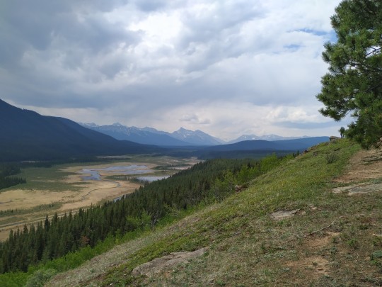
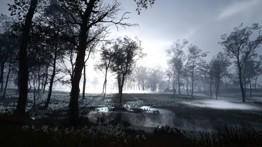
Grande Cache, Alberta, Canada
#my photos#photography#nature#landscape#valley#mountains#wetland#glacial valley#topography#alberta#canada#home
9 notes
·
View notes
Text
hmu if youre into topography, i have some things i needa map out
#😉😏😏🤔🤓#topography#sapiosexual#pick up lines#map it out babyy#voyage#mapped out#life#love#trippy#drugs#smoke#weed#marijuana#cannabis#420#710#stoner#hippie#blunts#joints#bongs rips#girls who rip bongs#girls who smoke weed#girls who smoke#saying stuff#dating apps#lgbt#lgbtq#tinder
10 notes
·
View notes
Last Seen Blogs

songsofbloodandfire
Songs of Blood and Fire

raphaelemine
Raphaele Mine
burkesguidetodnd
Burke's Guide to D&D

tenshichan1013
Fallen Angel

mr-fishs
Mr-Fish's