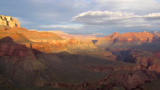
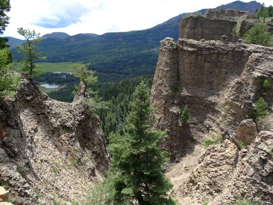
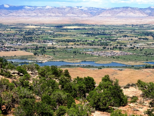
#Glen Canyon Park
Text
#my videos#San Francisco#Glen Canyon Park#welcome back to Static Shots With Bird Sounds#warblers in there
2 notes
·
View notes
Text

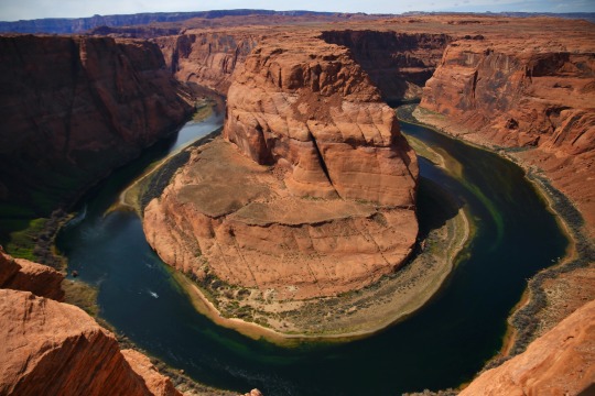
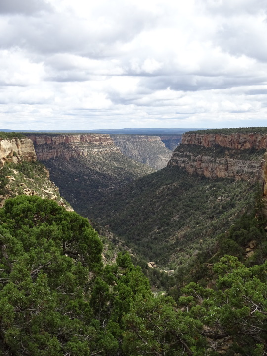
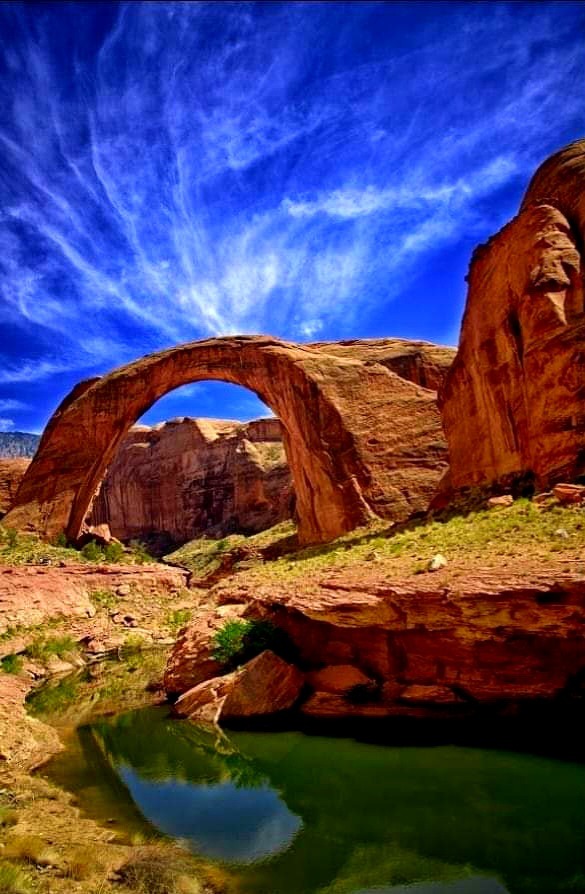
Horseshoe Bend, in Glen Canyon National Recreation Area, Arizona.
#horseshoe bend#desert#colorado river#glen canyon#national park#national park service#travel#original photography#photographers on tumblr#photography#landscape#landscape photography#lensblr#nature#nature photography#wanderingjana
75 notes
·
View notes
Text

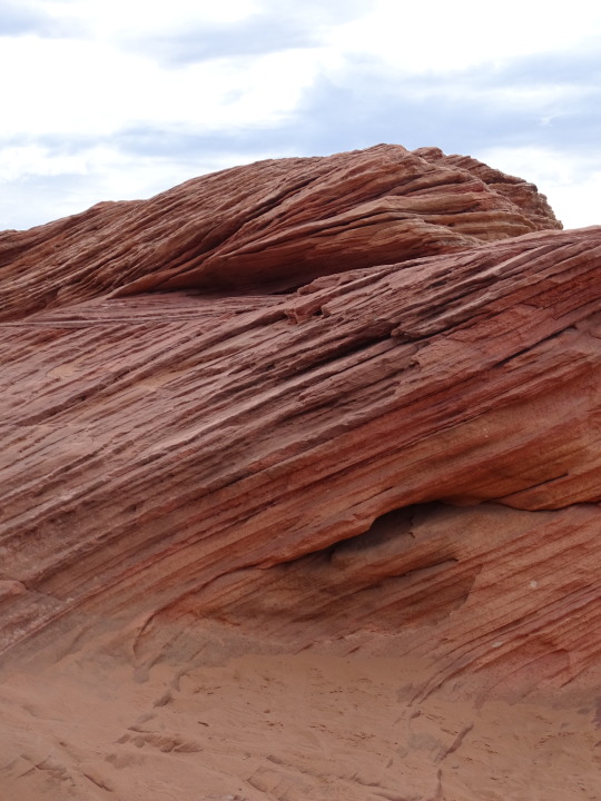
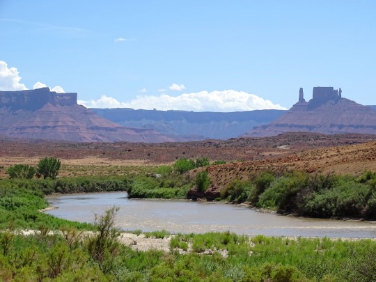
#the colorado river#adventure#travel#my photo#southwest#desert#utah#grand canyon national park#arizona#dead horse point state park#horseshoe bend#glen canyon national recreation area#aesthetic#photography#scenery#nature
387 notes
·
View notes
Text

Watkins Glenns State Park
When you say New York, most people think about Manhattan, New York City, the Liberty Statue, or the Niagara Falls. But, there is much more than that, like the beautiful Long Island. Personally, I find more worth it the landscape scenery, the small towns, walking in nature than just a regular day in the city.
All the way up in Upstate New York, we can find the finger lakes, including this State park called Watkins Glenns. An overall easy hike in the gorge with beautiful waterfalls. The Trail to the gorge can be too narrow for wheelchairs, also you will also find some stairs. The most challenging thing you will find in the State Park will be the stairs and they are not bad at all.
#Photographers on tumblr#New York#upstate ny#upstate new york#Watkins glen#east coast#united states#travel photography#landscape photography#landscape#waterfalls#river#mountains#sunlight#valley#canyon#national park#state park#nature#nature hikes#hike#hiking#camping#nature photography#waterfall photography#waterfall photographers#lake#lakes#finger lakes#watkins glen
72 notes
·
View notes
Photo


Geologists’ Day
Don’t take the ground beneath your feet for granted: honor the scientists that have delved into the Earth to teach us more about it on National Geologist’s Day.
For many people, geology could be considered an underappreciated science. This may be especially true when it is compared to other sciences such as physics, biology or chemistry. However, if the human race didn’t have geologists, then we wouldn’t know how the earth was formed!
Geologists’ Day dedicates this time towards thanking them for all the research they do to help further understand how our world works.
Not only that, but this day also seeks to learn about historical geologists that have helped people understand our world better and even possibly inspire some people to become geologists themselves!
History of Geologists’ Day
Geology, or the study of the composition of rocks, soil and other materials, has been around since the times of Ancient Greece. In their pursuit of understanding the world around them, Greek scientists, who wondered how the rocks were formed, began studying fossils and generating theories to go along with their ideas and research.
Later, during the Middle Ages, when science was thought to have challenged the Catholic Church, more advances came (albeit sometimes subversively) in the field of geology. During this time, Leonardo da Vinci explored the functions of the human body but also, one of his lesser-known pursuits, is that he became a pioneer in geology.
One of da Vinci’s interesting lines of research was related to fossils. He concluded that the fossils he and others had found embedded on mountain tops must have been from animals that swam on an ancient sea bed, though none of them were exactly sure how they could have gotten there.
During the 17th-century, scientists began to make important links between certain sedimentary deposits in the oceans and the strata observable in rock formations. Much of the explanation as to how that happened, however, continued to remain a mystery until James Hutton and William ‘Strata’ Smith came along.
These two well-known geologists helped find the explanation of the earth’s long and slow development over the course of thousands of years. Smith was also credited as the creator of the first, geologically detailed, national map of any country in the world. In this case, the country was England and he has since become known as the ‘Father of English Geology’.
Geologists’ Day, itself, was actually the idea of a group of well-known Soviet geologists who established it in April, 1966. The day was chosen in the spring because it notes the end of winter and is a time that ramps up to the summer season field work when geologists are so active.
While it continues to be a favorite day of the Russian Mineralogical Society, the day eventually made its way beyond the former Soviet Union and began to be celebrated by geologists, geophysicists and geochemists in various places in Europe, the United States and other countries around the world.
How to Celebrate Geologists’ Day
Typically held on a Sunday, the celebration of Geologists’ Day can be fun for professional rock lovers and hobbyists alike! This day strives to help further the study of how the earth came to be. Geologists’ Day is all about learning the history of the earth, the geologists who studied the earth, and helping to inspire people out there to study geology.
Consider the following ways to celebrate the day or come up with other creative ideas:
Learn More About Geology
Give a nod to Geologists’ Day by learning a bit about what the discipline of geology is and how it works. Digging in rocks, observing maps, and studying how they all came to be is what a geologist’s job is all about. Make use of these online resources to learn more about geology:
The Geological Society of America
International Association for Promoting Geoethics
Society of Economic Geologists
Those who are even more interested might take the time to join a few online classes to further their studies. Take a look into the history of geologists, what they believed about the earth at the time they lived. If it turns out there’s an inner rock-lover in there, just waiting to get out, why not go for a degree while you’re at it?!
Show Appreciation to a Geologist
Geologists’ Day aims to show appreciation for the geologists that continue to study rocks and all their formations.In fact, this is the perfect day to gather with some friends or family to thank some of those favorite geologists, or even just a science teacher, who may have made a difference in the understanding of the world we live in.
Listen to a Geology Themed Playlist
Hop onto Spotify or another favorite music hosting site and enjoy these songs that are reminiscent of the study of the earth, rocks, landslides and all the beautiful things that go along with geology:
We Will Rock You (1977) Queen
The Geologists are Coming! (2017) The Amoeba People
Landslide (1975) Fleetwood Mac
The Petroleum Age (2011) Philip Gibbs
Geology Rocks (2017) Los Beekeepers
Uranium Rock (1973) Warren Smith
Sweet Geology (aka The Mineral Song) (2007) The Akkademiks
Share Geology Day with Friends
Show appreciation for the studies of geologists by sharing this holiday with friends and family. Go big by throwing a geology party, or keep it small by simply gifting friends or coworkers with a small stone or rock as a token of the day. Whatever method is chosen, just the acknowledgment of this day is a step in the right direction toward appreciating the earth and its scientists!
Source
#Dinosaur National Monument#Split Mountain#Colorado National Monument#Upper Colorado RiverScenic Byway U-128#Arches National Park#Canyonlands National Park#Wolf Creek Valley#Mesa Verde National Park#Monument Valley Navajo Tribal Park#Glen Canyon National Recreation Area#Earthquake Fault#Mammoth Lakes#Geologists’ Day#first Sunday in April#2 April 2023#GeologistsDay#USA#summer 2016#Rocky Mountains#landscape
5 notes
·
View notes
Text
#steventure#australia#blog#hike#hiking#bushwalk#adventure#nature#bushwalking#fairy bower falls#bundanoon#grand canyon#bundanoon creek#southern highlands#morton national park#nsw national park#Australian hiking#nsw bushwalk#glow worm glen#eden brewery#cancer#cancer survivor#leukemia#stem cell transplant#kangaroo#leech#bushwalking blog#travel blog#travel
6 notes
·
View notes
Text
Arizona Road Trip - Part 2
Exploring the Beauty of Lake Powell and Wupatki National Monument
May 2023 – Exploring the Beauty of Lake Powell and Wupatki National Monument
The next part of our trip took us to Page Arizona where we had lunch at Big John’s Texas BBQ. The food was good and the staff, super friendly, they even took care of Sadie with her own water dish and a very delicious bone. After lunch we headed over to the Antelope Point Launch Ramp. We parked at the end of the ramp but…

View On WordPress
#Adventures with the Dee&039;s#Arizona road trip#az#big john&039;s Texas bbq#box canyon pueblo#desert monuments#dirt road adventures#Glen Canyon Dam#lake powell#lake Powell water levels#living our best life#lomaki pueblo#lone rock beach#lovz2hike#married life adventures#monument valley#national parks#overlanding in Arizona#page#sand stone buttes#spirit totem#Truck Camping#try that in a small town#Utah road trip#Wupatki National Monument#Wupatki visitor center
0 notes
Photo
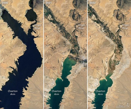
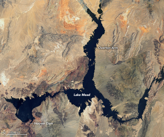
Lake Mead Keeps Dropping
Continuing a 22-year downward trend, water levels in Lake Mead stand at their lowest since April 1937, when the reservoir was still being filled for the first time. As of July 18, 2022, Lake Mead was filled to just 27 percent of capacity.
Continuing a 22-year downward trend, water levels in Lake Mead stand at their lowest since April 1937, when the reservoir was still being filled for the first time. As of July 18, 2022, Lake Mead was filled to just 27 percent of capacity.
The largest reservoir in the United States supplies water to millions of people across seven states, tribal lands, and northern Mexico. It now also provides a stark illustration of climate change and a long-term drought that may be the worst in the U.S. West in 12 centuries.
The low water level comes at time when 74 percent of nine Western states face some level of drought; 35 percent of the area is in extreme or exceptional drought. In Colorado, location of the headwaters of the Colorado River, 83 percent of the state is now in drought, and the snowpack from last winter was below average in many places.
The natural-color images above were acquired on July 6, 2000, and July 3, 2022, by Landsat 7 and Landsat 8. The detailed images below also include a view from Landsat 8 on July 8, 2021 (middle). The light-colored fringes along the shorelines in 2021 and 2022 are mineralized areas of the lakeshore that were formerly underwater when the reservoir was filled closer to capacity. The phenomenon is often referred to as a “bathtub ring.”
The lake elevation data below come from the U.S. Bureau of Reclamation (USBR), which manages Lake Mead, Lake Powell, and other portions of the Colorado River watershed. As of July 18, 2022, the water elevation at the Hoover Dam was 1041.30 feet (317.4 meters) above sea level; the water elevation at the end of July 2000 (around the time of the Landsat 7 image above) was 1199.97 feet (341 meters). Lake levels at the dam should stay above 1000 feet to continue operating hydropower turbines at normal levels.
At maximum capacity, Lake Mead would reach an elevation 1,220 feet (372 meters) near the dam and would hold 9.3 trillion gallons (36 trillion liters) of water. The lake last approached full capacity in the summers of 1983 and 1999.
About 10 percent of the water in Lake Mead comes from local precipitation and groundwater each year, with the rest coming from snowmelt in the Rocky Mountains that flows down the Colorado River watershed through Lake Powell, Glen Canyon, and the Grand Canyon. The Colorado River basin is managed by USBR and other agencies to provide electric power and water to roughly 40 million people—most notably the cities of San Diego, Las Vegas, Phoenix, Los Angeles—and 4 to 5 million acres of farmland in the Southwest. The river water is allotted to states (including tribal lands) and Mexico through laws like the 1922 Colorado River Compact.
Above Lake Mead, Lake Powell is currently filled to just 27 percent of capacity, and the entire Colorado river system stands at 35 percent. USBR announced in August 2021 that state water allocations would be cut in 2022; further modeling and negotiation is underway for 2023 allocations. In June 2022, USBR issued an emergency request to the Colorado River basin states to reduce water usage by 2 million to 4 million acre-feet over the next 18 months.
In addition to serving as a major drinking and irrigation source for the Southwest, Lake Mead is a national recreation area that is particularly popular with boaters. According to the National Park Service, five of six boating ramps/launches are now closed. “Declining water levels due to climate change and 20 years of ongoing drought have reshaped the park’s shorelines,” the Park Service said on its website. “As Lake Mead continues to recede, extending launch ramps becomes more difficult and more expensive due to the topography and projected decline in water levels.”
NASA Earth Observatory images by Lauren Dauphin, using Landsat data from the U.S. Geological Survey and and lake elevation data from the Bureau of Reclamation. Story by Michael Carlowicz.
410 notes
·
View notes
Text
In May 1903, President Theodore Roosevelt visited Grand Canyon for the first time. He was, in a word, gobsmacked.
“It is beyond comparison—beyond description; absolutely unparalleled throughout the wide world,” he wrote. “Let this great wonder of nature remain as it now is. Do nothing to mar its grandeur, sublimity, and loveliness. You cannot improve on it. But what you can do is to keep it for your children, your children’s children, and all who come after you, as the one great sight which every American should see.”
Roosevelt’s wishes, in a sense, have come true. Since Grand Canyon’s inception as a national park in 1919, the 1,904-square-mile preserve has seen more than 212 million visitors who come to hike its trails, spot its 373 species of birds and 91 types of mammals, observe the rock formations, raft the Colorado River, and, of course, post to Instagram.
But that grandeur, sublimity, and loveliness Roosevelt spoke of? It has been marred by the tramplings of feet and the inevitable trappings of time. The Glen Canyon Dam, completed in 1963, has dramatically altered downstream ecology, and the park has a nearly $330 million deferred maintenance backlog that includes much-needed repairs to roads and trails and upgrades to the infrastructure for visitors, whose numbers keep growing. Add to this list climate change and the ways it will affect how we experience the park—and what we’ll see in it.
But just how will Grand Canyon National Park, which celebrated its 100th birthday on February 26, 2019, change in the next century? Here’s what eight experts think.
#long reads#for those wondering: this article contains stuff about the people indigenous to the area too#it's a good read
17 notes
·
View notes
Text
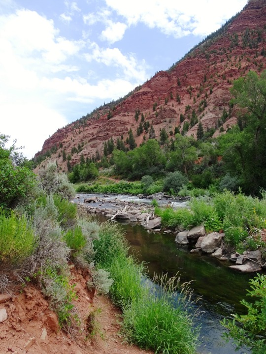
Rainbow Bridge National Monument is administered by Glen Canyon National Recreation Area, southern Utah, United States. Rainbow Bridge is often described as the world's highest natural bridge.
According to definition by the Natural Arch and Bridge Society in 2007 resulted in a value of 71 m. At the top it is 13 m thick and 10 m wide. The bridge, which is of cultural importance to a number of area Native American tribes, has been designated a Traditional Cultural Property by the National Park Service.
29 notes
·
View notes
Text
There's something I have to explain about the song that plays during Dr. Manhattan and Vecna's origin scenes.
youtube
For starters, "Pruit Igoe and Prophecies" from Zack Snyder's Watchmen are two different conpositions that were put together for the Dr. Manhattan's origin scene.
The original songs are called "Prophecies" and "Pruit Igoe" composed by Philip Glass for a film called "Koyaanisqatsi" that was released back in 1982.
youtube
youtube
This is what I found in the film's article on Wikipedia:
The film consists primarily of slow motion and time-lapse footage of cities and many natural landscapes across the United States. The visual tone poem contains neither dialogue nor a vocalized narration: its tone is set by the juxtaposition of images and music. Reggio explained the lack of dialogue by stating "it's not for lack of love of the language that these films have no words. It's because, from my point of view, our language is in a state of vast humiliation. It no longer describes the world in which we live." In the Hopi language, the word koyaanisqatsi means "life out of balance".
The film is the first in the Qatsi film trilogy: it is succeeded by Powaqqatsi (1988) and Naqoyqatsi (2002). The trilogy depicts different aspects of the relationship between humans, nature and technology. Koyaanisqatsi is the best known of the trilogy and is considered a cult film. However, because of copyright issues, the film was out of print for most of the 1990s. In 2000, the film was selected for preservation in the United States National Film Registry by the Library of Congress for being "culturally, aesthetically, or historically significant".
And this is the sypnosis of the film:
The film begins with the Great Gallery pictograph in Horseshoe Canyon, Canyonlands National Park, depicting several tall figures standing near a taller, crowned one. The next scene depicts the Saturn V rocket during its Apollo 11 launch. It then fades to a desolate desert landscape, before progressing to various natural phenomena.
The film then incorporates humanity in the environment, with shots of choppy water, cultivated flowers, the artificial Lake Powell, a large mining truck causing billows of dust, power lines, mining operations, oil fields, the Navajo Generating Station, the Glen Canyon Dam, and atomic bomb detonations in a desert. A shot sees sunbathers on a beach, with the San Onofre Nuclear Generating Station in the background, before moving on to an aircraft, cars, and military vehicles. Time-lapses of cloud shadows move across skyscrapers, and various housing projects are in disrepair. Destruction of large buildings were depicted, including the demolition of the Pruitt-Igoe housing project in St. Louis. A time-lapse of a crowd queueing is followed by shots of people walking along streets in slow motion.
The next sequence features a sunset reflected in the glass of a skyscraper, before depicting people interacting with modern technology. It sees visceral depictions of traffic, followed by people hurrying to work, and the operation of machines packaging food. Many labors are aided with the use of technology. The sequence begins to come full circle as the manufacture of cars in an assembly-line factory is shown. Daylight highway traffic are shown, followed by the movement of cars, shopping carts, televisions in an assembly line, and elevators. Time-lapses of various television shows being channel surfed are shown. In slow motion, several people react to being candidly filmed; the camera stays on them until the moment they look directly at it. Cars then move speedier.
Shots of microchips and satellite photography of cities are shown, comparing the lay of each of them. Night shots of buildings are shown, as well as of people from all walks of life, from beggars to debutantes. A rocket is seen lifting off to sudden explosion; the camera follows the flaming engine and a white smoky trail as the debris falls. The film concludes with another image of the Great Gallery pictograph, this time with smaller figures. It ends with the definition of the titular Hopi noun ("crazy life; life in turmoil; life out of balance; life disintegrating; a state of life that calls for another way of living") as well as the translation lyrics that was sung in "Prophecies", one of the musical tracks in the film.
And when we look at the meaning of the film in the same article, we read this:
Reggio stated that the Qatsi films are intended to simply create an experience and that "it is up [to] the viewer to take for himself/herself what it is that [the film] means." He also said that "these films have never been about the effect of technology, of industry on people. It's been that everyone: politics, education, things of the financial structure, the nation state structure, language, the culture, religion, all of that exists within the host of technology. So it's not the effect of, it's that everything exists within [technology]. It's not that we use technology, we live technology. Technology has become as ubiquitous as the air we breathe ..."
According to Hopi Dictionary: Hopìikwa Lavàytutuveni, the Hopi word koyaanisqatsi (Hopi pronunciation: [kojɑːnisˈqɑtsi]) is defined as "life of moral corruption and turmoil" or "life out of balance". The prefix koyaanis- means "corrupted" or "chaotic", and the word qatsi means "life" or "existence", literally translating koyaanisqatsi as "chaotic life". The film also defines the word as "crazy life", "life out of balance", "life in turmoil", "life disintegrating", and "a state of life that calls for another way of living".
In the score by Philip Glass, the word "koyaanisqatsi" is chanted at the beginning and end of the film in an "otherworldly" dark, sepulchral basso profondo by singer Albert de Ruiter over a solemn, four-bar organ-passacaglia bassline. Three Hopi prophecies sung by a choral ensemble during the latter part of the "Prophecies" movement are translated just prior to the end credits:
"If we dig precious things from the land, we will invite disaster."
"Near the day of Purification, there will be cobwebs spun back and forth in the sky."
"A container of ashes might one day be thrown from the sky, which could burn the land and boil the oceans."
During the end titles, the film gives Jacques Ellul, Ivan Illich, David Monongye, Guy Debord, and Leopold Kohr credit for inspiration. Moreover, amongst the consultants to the director are listed names including Jeffrey Lew, T. A. Price, Belle Carpenter, Cybelle Carpenter, Langdon Winner, and Barbara Pecarich.
In my opinion, it's very on brand for Zack Snyder to use two songs from a cult film known from its visuals, the use of slow motion and with the intention to create an experience for the viewer. I don't know if the Duffers are familiar with koyaanisqatsi or its influence, but it's very intriguing that they decided to use the same ost Zack Snyder used for a film that Christopher Nolan thought was "before its time", a film that it's an adaptation to one of the most influential comic books ever created and a film that reflects the 80's nostalgia that the Duffers have infused to Stranger Things.
tagging @heroesbyler and @wibble-wobbegong because they said they were interested in my thoughts.
11 notes
·
View notes
Video
flickr
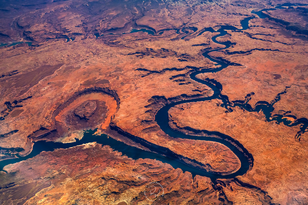
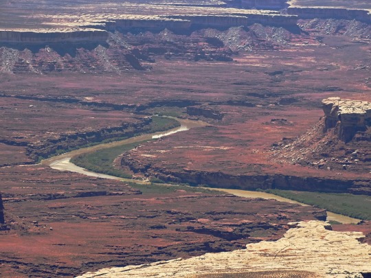
Confluence by Raja Ramakrishnan
Via Flickr:
Confluence of San Juan, Escalante and Colorado River in Glen Canyon National Park
#raja ramakrishnan#photographer#aerial photography#san juan river#escalante river#colorado river#glen national park#nature
12 notes
·
View notes
Text

Cavern Cascade Waterfalls in Watkins Glen Park, New York, USA.
📸 Joe Braun Photography
Cavern Cascade is the third waterfall encountered in Watkins Glen as one works upstream along the Gorge Trail, as well as the tallest waterfall along Glen Creek, and is almost certainly the most unique waterfall found in the canyon.
19 notes
·
View notes
Photo


International Day of Action For Rivers
International Day of Action For Rivers, observed on March 14 every year, is a day that is dedicated to saving, celebrating, and creating awareness about the importance of rivers. Did you know that two million tons of sewage, industrial and agricultural waste are discharged into the world’s water every day? Yes, it is the equivalent of the weight of the entire human population of 6.8 billion people! This is why it is our time to save our rivers for the good of humanity.
History of International Day of Action For Rivers
The International Day of Action For Rivers is a day created by the International Day of Rivers to sensitize people about the importance of rivers. It brings people across the world together to talk about and save rivers by addressing the issues related to river management, river pollution, river conservation, etc.
The history of the origin of the International Day of Action For Rivers is an interesting one. In September 1995, several organizations, including International Rivers Network (I.R.N.), India’s Save the Narmada Movement (N.B.A.), Chile’s Biobio Action Group (GABB), and European Rivers Network (ERN) came together and conducted a preparatory meeting in Brazil. As a result, they formed an international Organizing Committee headed by Brazil’s Movement of People Affected by Large Dams (MAB).
In March 1997, in Curitiba, Brazil, participants of the First International Meeting of People Affected by Dams adopted the International Day of Action Against Dams and For Rivers, Water and Life. Furthermore, they decided that the International Day of Action For Rivers will take place on March 14.
Every year there will be a theme for the International Day of Action For Rivers, and last year, in 2021, the theme was ‘Rights of Rivers.’ It demanded that rivers be declared a national asset and given legal rights to stop the rivers from becoming dumping sites for waste and sewages.
Environment enthusiasts conduct workshops, seminars, and activities to celebrate this day to raise awareness and spread the message. So, let’s take a stand against the activities that harm the rivers and protect them at all costs.
International Day of Action For Rivers timeline
1995 Formation Of An International Organizing Committee
A preparatory meeting is held in Brazil, and an International Organizing Committee is formed.
1997 The First International Day of Action For Rivers
The first International Day of Action For Rivers is adopted by representatives from 20 countries in Curitiba Brazil.
2010 People Get More Awareness
People across the world get to know more about the importance of rivers.
2021 The First Virtual Celebration
Due to the pandemic, many organizations conduct events online to celebrate International Day of Action For Rivers.
International Day of Action For Rivers FAQs
What does the International Rivers organization do?
This organization strengthens movements of communities and civil society to defend rivers by exposing destructive projects.
Is International Day of Action For Rivers the same as World River day?
No International Day of Action For Rivers is different from World River Day, which is celebrated every year on September 26.
What is the theme of the International Day of Action For Rivers 2022?
The International Rivers organization will announce the theme of the International Day of Action For Rivers.
How to Observe International Day of Action For Rivers
Join the movement
Educate others about the importance of rivers
Share your favorite river story
If you want to make a difference in this world, you can plan an event in your locality to save or conserve the rivers and share the details and descriptions to [email protected].
Rivers are the lifeline of the Earth, and without them, humankind will perish. So, educate your friends and family about the significance of rivers and clean water.
This day, you can share your favorite personal stories related to rivers. Whether it is related to a fun family picnic or any activities to save the rivers, you can share it on your social media.
5 Important Facts About Rivers
Rivers are being polluted each day
River’s mouth
The shortest river is very short!
Rainbow river
The holy river
More than 80% of sewage in developing countries is discharged untreated in the rivers and other water sources, thereby polluting them.
The end of a river is called ‘a mouth,’ it takes the water from the river into the sea or large lakes.
The shortest river, Roe River, is only 201 feet and is located in Montana in the U.S.
River Cano that flows through Columbia is one of the most beautiful rivers in the world due to its striking colors.
River Ganga in India is considered a holy river and is even worshipped as a Goddess there.
Why International Day of Action For Rivers is Important
Rivers are the lifeline of the world
We need to educate people
It brings people together
Rivers are not just some scenic views of the water; they are the lifeline of this world. They create lives and enrich the ecosystem around us. International Day of Action For Rivers is a great day to raise awareness among people.
Today, most rivers across the world are being polluted each day due to the greed of some humans. This day we can address those issues and can do our part to stop them.
The global event is proof that communities and individuals around the world can come together and make a difference in this world.
Source
#Green River#Utah#Upper Colorado RiverScenic Byway U-128#Colorado RIver#San Miguel River#Colorado#Glen Canyon National Recreation Area#USA#Eagle River#Arizona#Page#Yosemite National Park#Napa River#Canyonlands National Park#summer 2022#original photography#landscape#countryside#nature#International Day of Action For Rivers#14 March#InternationalDayofActionForRivers#tourist attraction#Colorado Plateau
3 notes
·
View notes
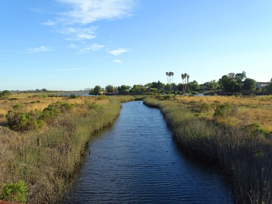
Text
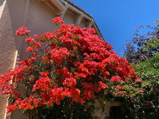
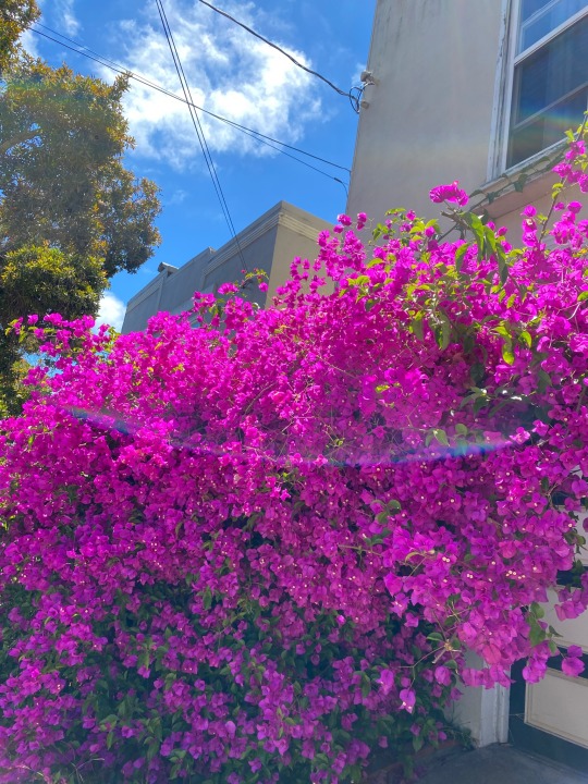
A couple of gorgeous bougainvilleas, top one in Westwood Park and bottom one near Glen Canyon
2 notes
·
View notes
Photo


Lake Mead Keeps Dropping Continuing a 22-year downward trend, water levels in Lake Mead stand at their lowest since April 1937, when the reservoir was still being filled for the first time. As of July 18, 2022, Lake Mead was filled to just 27 percent of capacity. The largest reservoir in the United States supplies water to millions of people across seven states, tribal lands, and northern Mexico. It now also provides a stark illustration of climate change and a long-term drought that may be the worst in the U.S. West in 12 centuries. The low water level comes at time when 74 percent of nine Western states face some level of drought; 35 percent of the area is in extreme or exceptional drought. In Colorado, location of the headwaters of the Colorado River, 83 percent of the state is now in drought, and the snowpack from last winter was below average in many places. The natural-color images above were acquired on July 6, 2000, and July 3, 2022, by Landsat 7 and Landsat 8. The detailed images below also include a view from Landsat 8 on July 8, 2021 (middle). The light-colored fringes along the shorelines in 2021 and 2022 are mineralized areas of the lakeshore that were formerly underwater when the reservoir was filled closer to capacity. The phenomenon is often referred to as a “bathtub ring.” The lake elevation data below come from the U.S. Bureau of Reclamation (USBR), which manages Lake Mead, Lake Powell, and other portions of the Colorado River watershed. As of July 18, 2022, the water elevation at the Hoover Dam was 1041.30 feet (317.4 meters) above sea level; the water elevation at the end of July 2000 (around the time of the Landsat 7 image above) was 1199.97 feet (341 meters). Lake levels at the dam should stay above 1000 feet to continue operating hydropower turbines at normal levels. At maximum capacity, Lake Mead would reach an elevation 1,220 feet (372 meters) near the dam and would hold 9.3 trillion gallons (36 trillion liters) of water. The lake last approached full capacity in the summers of 1983 and 1999. About 10 percent of the water in Lake Mead comes from local precipitation and groundwater each year, with the rest coming from snowmelt in the Rocky Mountains that flows down the Colorado River watershed through Lake Powell, Glen Canyon, and the Grand Canyon. The Colorado River basin is managed by USBR and other agencies to provide electric power and water to roughly 40 million people—most notably the cities of San Diego, Las Vegas, Phoenix, Los Angeles—and 4 to 5 million acres of farmland in the Southwest. The river water is allotted to states (including tribal lands) and Mexico through laws like the 1922 Colorado River Compact. Above Lake Mead, Lake Powell is currently filled to just 27 percent of capacity, and the entire Colorado river system stands at 35 percent. USBR announced in August 2021 that state water allocations would be cut in 2022; further modeling and negotiation is underway for 2023 allocations. In June 2022, USBR issued an emergency request to the Colorado River basin states to reduce water usage by 2 million to 4 million acre-feet over the next 18 months. In addition to serving as a major drinking and irrigation source for the Southwest, Lake Mead is a national recreation area that is particularly popular with boaters. According to the National Park Service, five of six boating ramps/launches are now closed. “Declining water levels due to climate change and 20 years of ongoing drought have reshaped the park’s shorelines,” the Park Service said on its website. “As Lake Mead continues to recede, extending launch ramps becomes more difficult and more expensive due to the topography and projected decline in water levels.” NASA Earth Observatory images by Lauren Dauphin, using Landsat data from the U.S. Geological Survey and and lake elevation data from the Bureau of Reclamation. Story by Michael Carlowicz.
2 notes
·
View notes
Last Seen Blogs

scaletree
A Nest on the Canopy
endekashi
えんでかし

cookieloverdeluxe
@dealgonewrong

souliebird
Set Phasers To Fun, Ensign

trashy-alyssa
basically an & Juliet stan account