#silk road history
Text

x
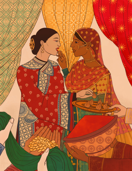
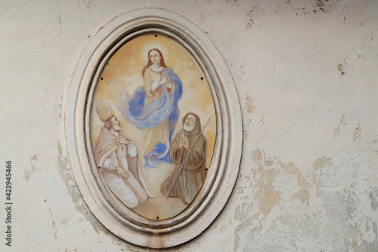
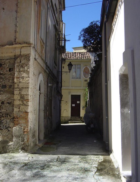
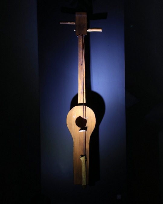
#Jaisalmer#fort#history#Jaisalmer Fort#inspo#sandstone#historical site#historycore#medieval#medievalcore#castlecore#12th century#india#Rajasthan#silk road#silk road history#medieval history#living fort#desert#desertcore
18 notes
·
View notes
Text
I'd like to think that we ruled the world for a short moment in time.
femslash february day 1: POWER
#hetalia#indchu#nyo india#nyo china#femtalia24#yes I am ONE WEEK LATE to DAY 1 of femtalia#I’m so embarrassed I am never promising anything again I am a fool I'm so sorry#but indchu…. god they’re amazing…. literally crying as I go thru their history#the real Silk Road pair don’t @ me#kikidoodlez
288 notes
·
View notes
Text

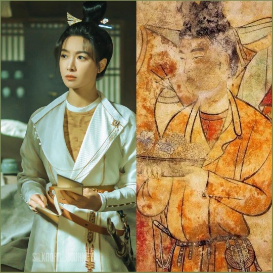


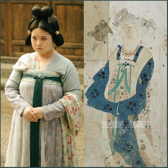

Tang dynasty period drama (Luoyang 风起洛阳) 2021
Vast majority of the C-drama costumes are restored based on real Tang dynasty paintings from the Mogao Caves. These are some examples.
Photos credit: silkroad_journey on Instagram.
#chinese history#chinese culture#hanfu#tang dynasty#Buddhism#mogao caves#China#silk road#ancient china#Medieval China#chinese drama#cdrama#hanfu recreation#Hanfu restoration#dynastic china#art
225 notes
·
View notes
Text
German linguists appear to have made an important breakthrough in cracking a previously unknown script, revealing it to be a Kushan language used by traders along the Silk Road.
#language#Silk Road#Tajikistan#script#Kushan#linguistics#decode#ancient#history#ancient origins#egypt
281 notes
·
View notes
Text
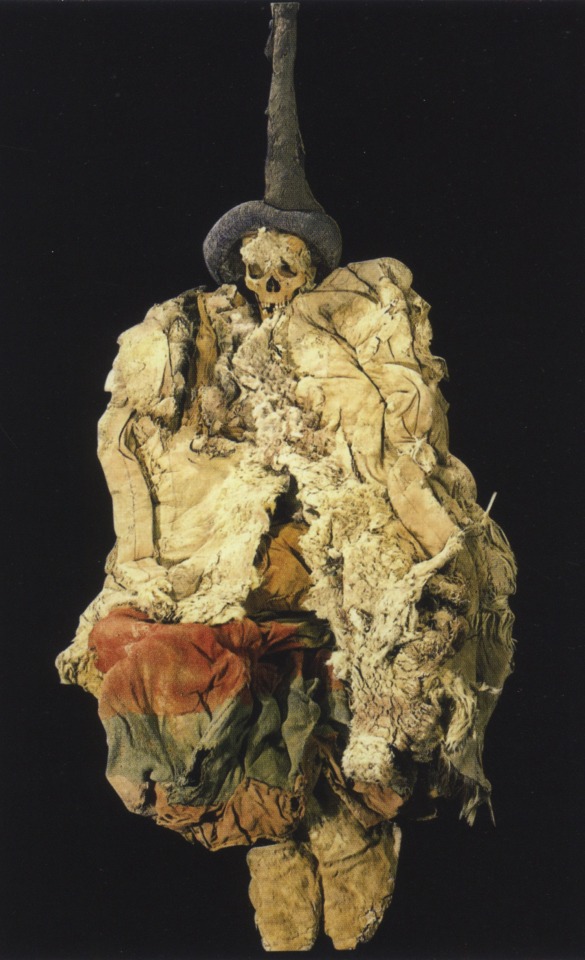
Female Europid Mummy from the Necropolis of Subexi III, Grave M6, Turfan District, Xinjiang. 5th-3rd C. BCE. Source: Baumer, Christoph.The history of Central Asia. Vol.1. The age of the steppe warriors. London : I.B. Tauris, 2012. pg. 218 left DS329.4 .B38 2012. Image via University of Pennsylvania. See maps in the post before this one for a better understanding of the geography discussed.
"Section 26 – The Kingdom of Nearer [i.e. Southern] Jushi 車師前 (Turfan)
1. ‘Nearer Jushi’ 車師前 refers to the kingdom or state centered in the Turfan oasis or, sometimes, to the tribe which controlled it. There can be no question that Nearer Jushi refers here to the Turfan Oasis. See for example: CICA, p. 183, n. 618; also note 1.5 above. For the etymology of the name Turfan see Bailey (1985), pp. 99-100, which is summed up in his sentence: “The name turpana- is then from *druva-pāna- ‘having safe protection’, a name suitable for a walled place.”
“One other oasis town is currently under excavation. At Yarghul (Jiaohe), 10 km (16 miles) [sic – this should read 10 miles (16 km)] west of Turpan, archaeologists have been excavating remains of the old Jushi capital, a long (1,700 m (5,580 ft)) but narrow (200 m (656 ft)) town between two rivers. From the Han period they uncovered vast collective shaft tombs (one was nearly 10 m (33 ft) deep). The bodies had apparently already been removed from these tombs but accompanying them were other pits containing form one to four horse sacrifices, with tens of horses for each of the larger burials.” Mallory and Mair (2000), pp. 165 and 167.
“Some 300 km (186 miles) to the west of Qumul [Hami] lie [mummy] sites in the vicinity of the Turpan oasis that have been assigned to the Ayding Lake (Aidinghu) culture. The lake itself occupies the lowest point in the Turpan region (at 156 m (512 ft) below sea level it is the lowest spot on earth after the Dead Sea). According to accounts of the historical period, this was later the territory of the Gushi, a people who ‘lived in tents, followed the grasses and waters, and had considerable knowledge of agriculture. They owned cattle, horses, camels, sheep and goats. They were proficient with bows and arrows.’ They were also noted for harassing travellers moving northwards along the Silk Road from Krorän, and the territories of the Gushi and the kingdom of Krorän were linked in the account of Zhang Qian, presumably because both were under the control of the Xiongnu. In the years around 60 BC, Gushi fell to the Chinese and was subsequently known as Jushi (a different transcription of the same name).” Mallory and Mair (2000), pp. 143-144.
“History records that in 108 BC Turpan was inhabited by farmers and traders of Indo-European stock who spoke a language belonging to the Tokharian group, an extinct Indo-Persian language [actually more closely related to Celtic languages]. Whoever occupied the oasis commanded the northern trade route and the rich caravans that passed through annually. During the Han Dynasty (206 BC-AD 220) control over the route see-sawed between Xiongnu and Han. Until the fifth century, the capital of this kingdom was Jiaohe.” Bonavia (1988), p. 131.
“Turpan is principally an agricultural oasis, famed for its grape products – seedless white raisins (which are exported internationally) and wines (mostly sweet). It is some 80 metres (260 feet) below sea level, and nearby Aiding Lake, at 154 metres (505 feet) below sea level, is the lowest continental point in the world.” Ibid. p. 137.
“The toponym Turfan is also a variation of Tuharan. Along the routes of Eurasia there are many other place names recorded in various Chinese forms that are actually variations of Tuharan.” Liu (2001), p. 268."
-Notes to The Western Regions according to the Hou Hanshu. Second Edition (Extensively Revised and Expanded). John E. Hill. University of Washington.
#tocharian#celtic#indo european#tarim basin#xinjiang#chinese history#mummies#history#ancient history#archaeology#anthropology#silk road#pagan
458 notes
·
View notes
Text

Camping on the largest and maybe windiest of the Silk Cayes.
Belize
1992
#vintage camping#campfire light#belize#silk cayes#gladden spit#camping#road trips#travel#exploring#history
150 notes
·
View notes
Text
Chemistry Behind Ancient Pigment, 'Chinese Purple'

In ancient times, rare non-natural pigments, especially blues and purples. 'Chinese Purple' or 'Han Purple' a Barium Copper Silicate BaCuSi₂O₆ pigment, emerged from the Western Zhou to the Han Dynasty, found in terracotta army garments at the Qin Shi Huang Mausoleum. Initially linked to Egyptian Blue, Chinese Purple predates Silk Road contacts by centuries, suggesting an independent discovery.
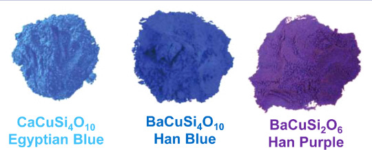
Likely an alchemical serendipity during Daoist experiments, its compounds—copper, barium, and lead—aligned with materials used by Daoist alchemists in creating ancient lead-barium glass.
#purple#ancient history#pigment#ancient china#chemistry#ancient culture#terracotta#silk road#interesting stuff#amazing facts#history
67 notes
·
View notes
Text

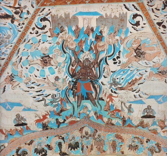
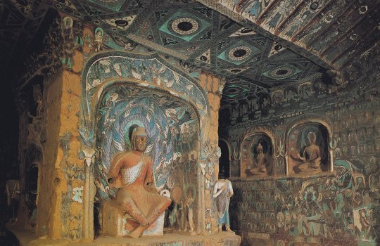

Much of the art in the medieval Buddhist temple-caves at Dunhuang was meant to inspire monks in their meditation. This is the art that is truly spectacular. It’s meant to be mind-blowing, to obliterate monks’ egos and help them to attain nirvana — literally, the blowing out of the flame of desire.
Artists created swirling, complex tableaux of people, animals, and supernatural figures. This was known as the "thousand-Buddha" style -- every square inch of the caves was covered with religious art.
{WHF} {Ko-Fi} {Medium}
195 notes
·
View notes
Note
Did the Ottoman Empire ever express any interest in the New World?
Not particularly, for two main reasons:

Accessing the New World would involve very disadvantageous naval wars with the Spanish Empire, who would use their incredible defensive position at the Straits of Gibraltar to interdict Ottoman vessels in the name of God and Glory.
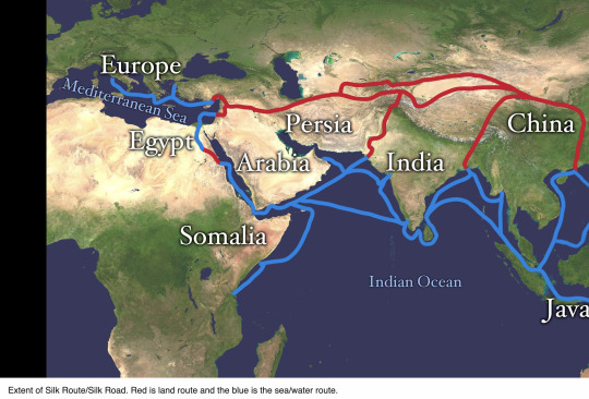
They didn't really need the New World. The main reason why the Portuguese and Spanish had begun their overseas expansion was to bypass the Ottomans and their middle-men position athwart the Silk Road and between the Europeans and access to the Indes. Through investing in their Indian Ocean fleet and working out trade deals with the Mughal Empire, the Ottomans had direct access to the largest and richest textile markets and the Spice Islands of Indonesia.
Why go to the effort and expense of an Atlantic voyage when they had all the riches of the world practically on their doorstep?
#history#historical analysis#ottoman empire#mughal empire#silk road#spice islands#geopolitics#world history#early modern history
48 notes
·
View notes
Text
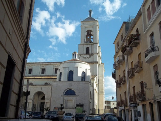


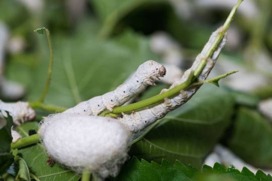
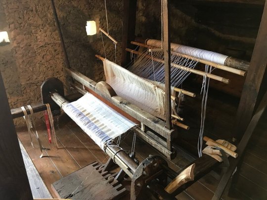
Catanzaro, Calabria, Italy
This ancient town which rises on a rock is the capital of the Calabria region. It was founded in 9th century by the Byzantines and was built over three hills in order to protect the town from the Saracen attacks arriving from the lonian sea.
At the beginning of the tenth century (c. 903), the city of Catanzaro was occupied by the Muslim Saracens, who founded an emirate and took the Arab name of قطنصار - Qatanşār.
An Arab presence is evidenced by findings at an eighth-century necropolis which had items with Arabic inscriptions. Around the year 1050, Catanzaro rebelled against Saracen dominance and returned to a brief period of Byzantine control.
Under the Byzantine dominion, between the end of the 9th and the beginning of the 10th century, Calabria was one was one the first places in Italy to introduce the breeding of the silkworm in the 11th century.
According to French historian André Guillou, mulberry trees for the production of raw silk were introduced to Calabria by the Byzantines at the end of the 9th century. Mulberry leaves are the only leaves that silkworms eat.
Around 1050, the theme of Calabria had cultivated 24,000, mulberry trees for their foliage, with growth still ongoing.
The peasants of the countryside around the city produced the raw silk, which was then woven in the silk workshops of Catanzaro. A large part of the population was involved in this business, and the silk of Catanzaro supplied almost all of Europe.
The silk was sold in a large market fair in the port of Reggio Calabria, to Spanish, Venetians, Genovese and Dutch merchants.
Today, three young friends have come together to bring local traditions back to the fore. In 2014 they decided to build their future in San Floro, a tiny village of 600 inhabitants near the city of Catanzaro and restore the traditional mulberry tree planting and cultivation needed for the rearing of silkworms. Historically, San Floro was famous for a very significant production of raw silk in the 17th century, though this heritage had been completely lost in modern times.
The only surviving elements of this rich legacy were the 3,000 abandoned mulberry trees and the memory of the elderly villagers. Miriam and her friends brought back the production of silk, rewinding the threads of history and travelling across the world to exchange best practices with silk institutes in Thailand, India, Switzerland, and France.
As part of its development, they trained people interested in their new, sustainable production model and also brought thousands of tourists from all over the world to visit their farm (Nido di Seta) to experience how silk is produced first-hand.
Catanzaro is a windy city due to its altitude and position between two seas. In fact, there is only 30 km separating the Ionian Sea from the Tyrrhenian Sea and Catanzaro is wide open to the constant strong breezes from the Ionian Sea and the Sila mountains.
Follow us on Instagram, @calabria_mediterranea
#catanzaro#calabria#italy#italia#south italy#southern italy#italian#mediterranean#silk#the silkworm#silk road#europe#architecture#textile#loom#mulberry tree#history#muslim#saracens#italian landscape#landscape#mediterranean sea#arab#byzantine#byzantine empire#weaving#nido di seta
21 notes
·
View notes
Text

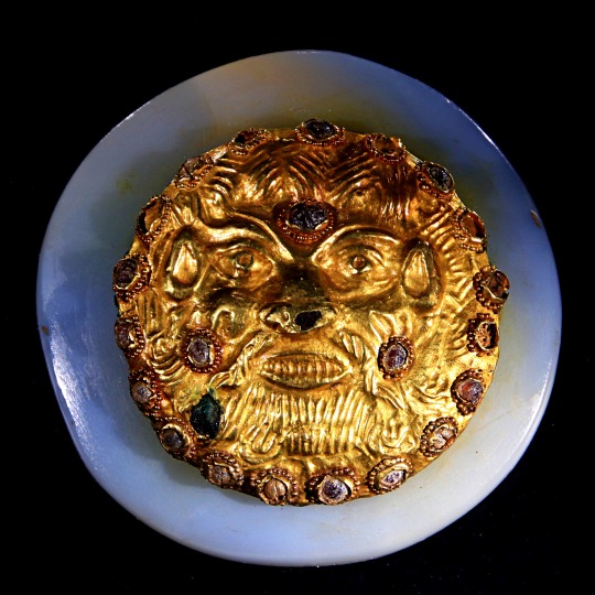

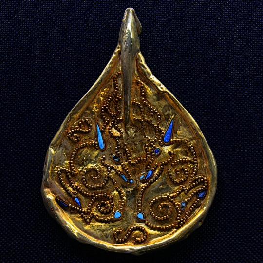


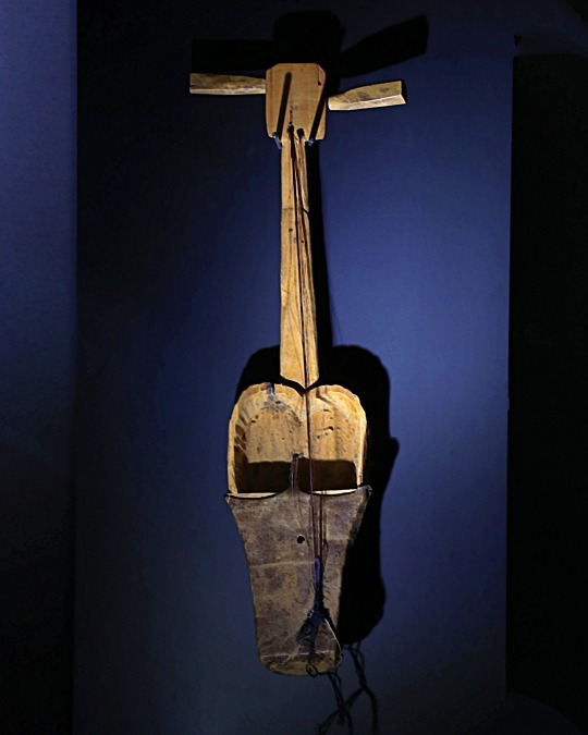
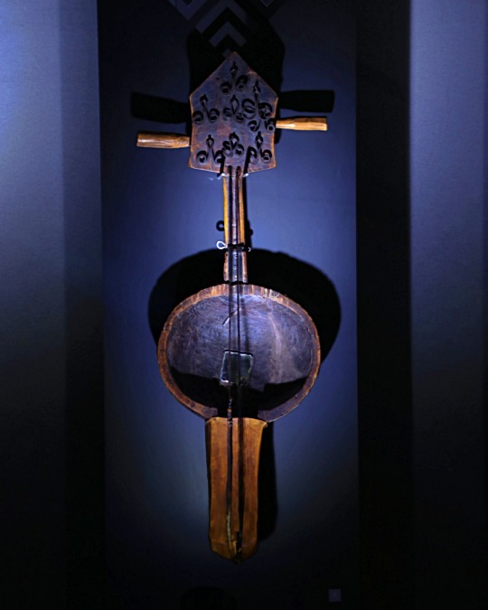
National Museum Astana ( Kazakhstan )
#travel#travelphotography#museum#astana#kazakhstan#musical instruments#gold#national museum#kazakh history#kazakh culture#silk road#central asia#nationalmuseumastana#visitastana#kazakhstantravel#visitkazakhstan#history#culture#photooftheday#pickoftheday#around the world
46 notes
·
View notes
Text
i learned that in 550 AD the Byzantine Emperor dispatched two monks to smuggle silk worms out of China to bypass Persian control over the Silk Road. Hidden in the monks' walking sticks, the silk worms produced a Byzantine silk industry that fueled the economy for the next 650 years (x)
267 notes
·
View notes
Text
an ancient letter calling out a shitty husband
18 notes
·
View notes
Text
I'm genuinely beyond stoked that all kingdom names in Sha Po Lang are real kingdoms and stupidly disappointed that the translation I'm reading didn't bother to translate any of them other that Dong Ying which means at some point I'll be compiling a list of kingdom names and their translations. Stay tuned.
#sha po lang#liveblogging#sha po lang liveblogging#mind you i wont be doig this because im considerate#but i will be doing this because im insane and will be compelled by my hyperfixation of history of the silk road
2 notes
·
View notes
Text
Two ancient Ming dynasty shipwrecks have been discovered in the South China Sea, revealing a treasure trove of porcelain artifacts and shedding light on reveal China’s oversea ties centuries ago.
#shipwreck#China#porcelain#trades routes#Silk Road#Ming Dynasty#timber#ancient#history#ancient origins
56 notes
·
View notes
Text
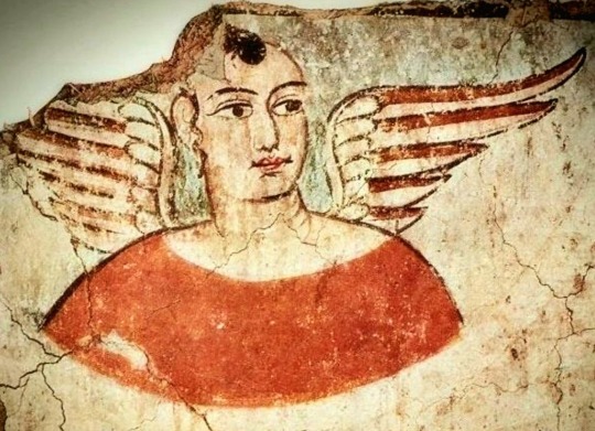

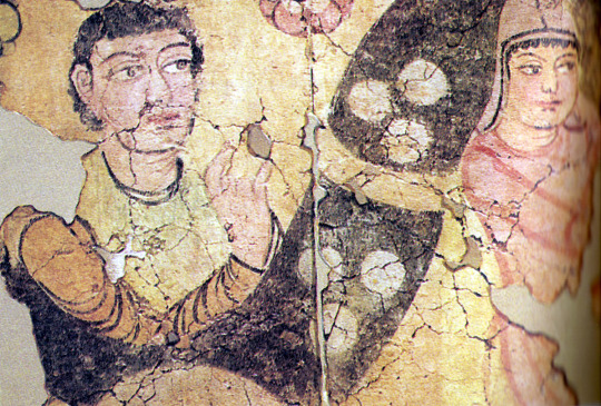
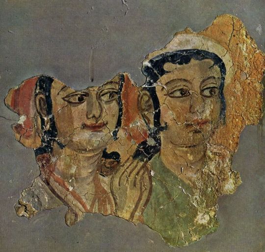


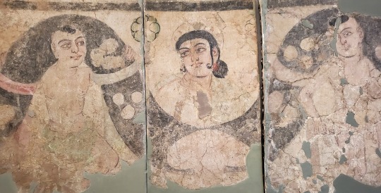
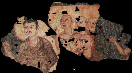


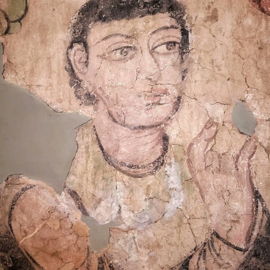

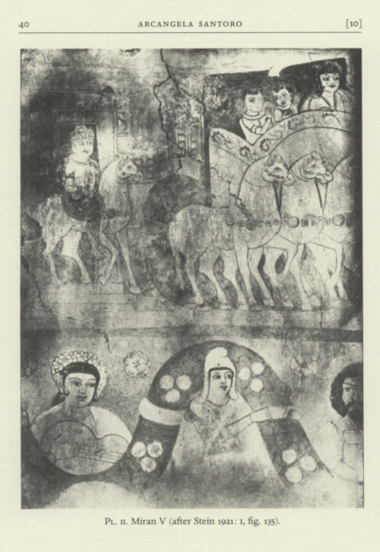
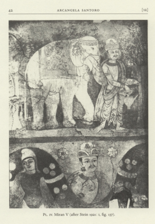


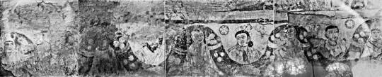
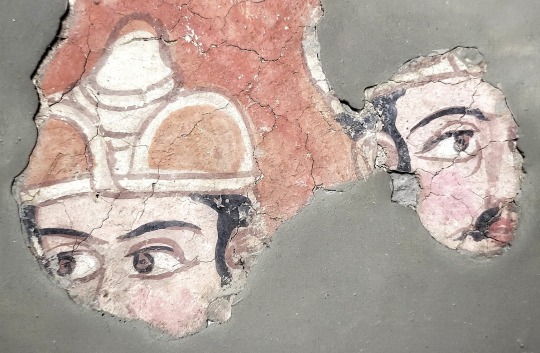
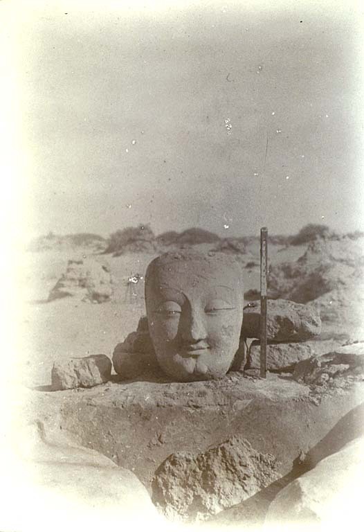
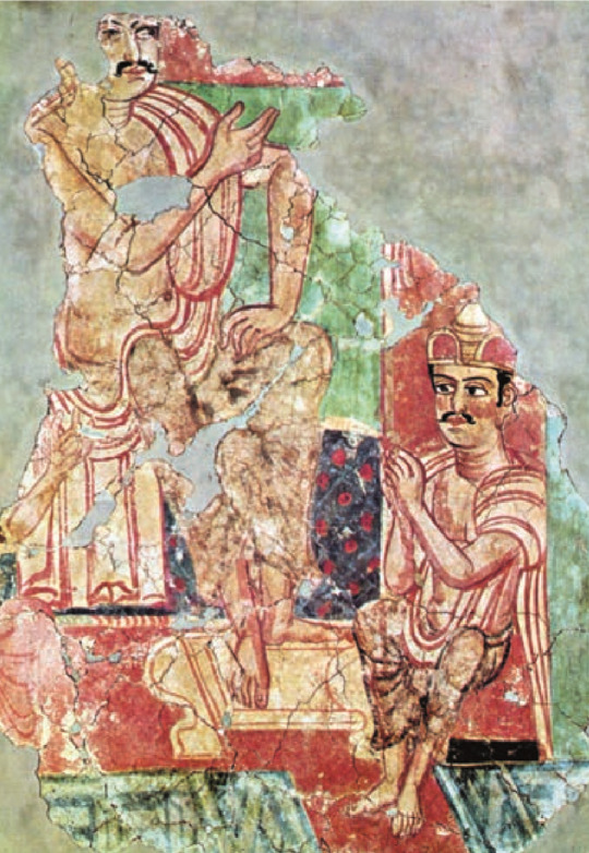

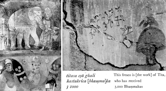
Fragments of the Buddhist monastery at Miran (Xinjiang) 3rd-5th C. CE by Titasa (Tita/Titus?) & other unknown artists. More images (and sources) on my blog, link at bottom.
I'm not 100% sure what nations the people in the photos belong to. They lived in Loulan (aka Kroraina). They used the Indo-European Gandhari language in their writing. They wrote in Kharosthi script which was also (at least partially) used by the Saka of Khotan, Kushan Empire, Sogdians, and Bactrians. Some suspect the artist (or one of the artists) may have been a traveler from the Roman Empire because of his art style and the name "Titasa".
"The Miran murals, now housed in the National Museum of New Delhi, are too delicate to travel (see frontispiece) but Stein found thousands of other items at the many desert ruins at the ancient town of Cadota, north of present-day Niya. These included Gandhari documents in Kharosthi script (cats. 27, 40, 44, 45, 46, 47) 74, 75, 76, 77, 89, 141): administrative records, letters and legal documents, some sent by the king of Kroraina to the ruler of Cadota. They offer a unique glimpse into the concerns of these oasis settlements, especially when placed in context of the archaeology. Stein explains how the sites had been abandoned over time and thus cleared of any items of intrinsic value, but ‘...the manifold other relics, however humble, which had safely rested in the sand buried dwellings and their deposits of rubbish... all help to bring vividly before our eyes details of ancient civilisation that without the preserving force of the desert would have been lost for ever.'
Miran, Cadota and the other towns of Kroraina seem to have been largely deserted by the fifth century. Defeated by the Northern Wei in 445 and with a warming climate making the route through the Lop Desert to Dunhuang no longer viable, people started moved out. The irrigation canals silted up and the dwindling population was unable to provide enough labour to continue to make the land sustainable.
Although not an ocean of emptiness, the analogy of an ocean for this area is a useful one.” The peoples and cultures moved like currents some, like the Gulf Stream, travelling great distances while retaining distinct characteristics, influencing the lands they passed by. Others were merged into more powerful currents, or soon settled on the ocean floor to nourish local cultures. The Yuezhi/ Kushan and the Xiongnu were examples of the first — powerful swirling currents whose origins and many sub-currents are difficult to map. The Hephthalites, who controlled Khotan, Kroraina and Gaochang as well as Gandhara and Northern India by the fifth century, were another powerful current. They exemplify the difficulties of Central Asian scholarship. Even though they ruled a considerable area for over two centuries, had their own language and script and minted their own coins, historians are still trying to piece together a coherent pictures of the nature of the people, their language, social structure, beliefs and art."
-The Silk Road: Trade, Travel, War and Faith by Susan Whitfield
https://paganimagevault.blogspot.com/2023/09/fragments-of-buddhist-monastery-at.html
#xinjiang#history#ancient history#indo european#loulan#buddhism#art#frescoes#fresco#museums#art history#silk road#archaeology
33 notes
·
View notes
Last Seen Blogs