#deathvalley
Text

Fossilized camel footprints at a secret location in Death Valley National Park. These are probably somewhere between 10 and 15 million years old.
#geology#california#deathvalley#fossils#death valley geology#death valley#eastern california#california desert#trace fossil
60 notes
·
View notes
Photo
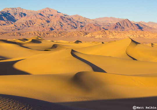
Dunes 5, Death Valley National Park, CA
230 notes
·
View notes
Text
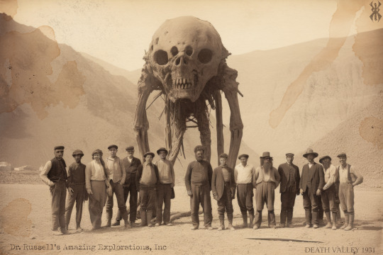
Rare photo of Dr. F Bruce Russell and Dr. Daniel S. Bovee's team and the mummified giant from "ritual hall' discovered in a series of complex tunnels deep below Death Valley, 1931
#1931#deathvalley#deathvalleynationalpark#mummy#giant#1930s#Amazingexplorations#desert#cryptid#cryptidhunter#Paiute#legend#mythology#archeology#catacomb#antiquephotography
4 notes
·
View notes
Photo

Death Valley National Park, California
Explore Death Valley: https://wanderingjana.com/DeVa1
#nationalpark#deathvalley#sunset#california#landscape#blog#travel#nationalparkservice#deathvalleynational park#optoutside#nature#naturephotography#original content#original photogrpahy#wanderingjana
7 notes
·
View notes
Photo

Desert Mosaic by Jim Patterson Photography https://flic.kr/p/2jAZcd7
48 notes
·
View notes
Video
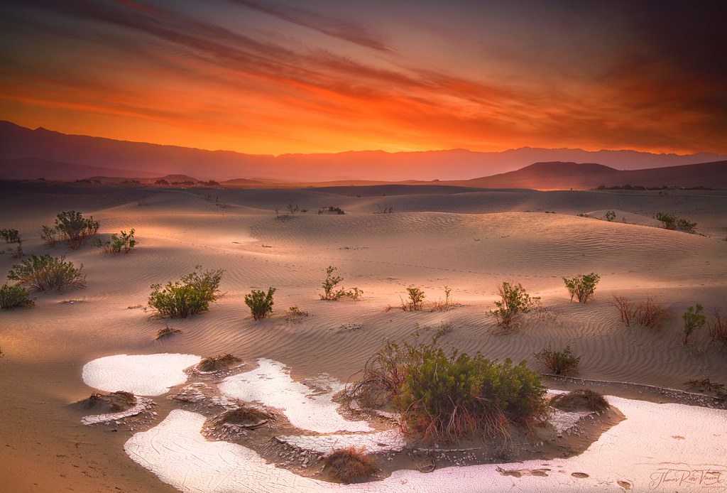
flickr
Mesquite Sand Dunes by Thomas Vincent
#breathtaking#deathvalley#sunset#red#orange#photooftheday#california#dunes#mesquitesanddunes#flickr#thomas vincent#photographer#landscape#nature
19 notes
·
View notes
Photo

Take a breath and enjoy the little things in life that makes you happy! #nature . • Abandoned Playground • 📷© www.martinvogt.ch . #california #night #stars #astrophotography #deathvalley #naturelovers #sky #night #fujifilm #hasselblad #peace #naturephotography #photography #usa #lasvegas #canon #blackandwhite #dreams #landscape #lifestyle #passion #travel #mojavedesert #weekend #summer #sunday #outdoor #camping #globetrotter #leica https://www.instagram.com/p/ChP3xDZIidt/?igshid=NGJjMDIxMWI=
#nature#california#night#stars#astrophotography#deathvalley#naturelovers#sky#fujifilm#hasselblad#peace#naturephotography#canon#blackandwhite#dreams#landscape#lifestyle#passion#travel#mojavedesert#weekend#summer#sunday#outdoor#camping#globetrotter#leica
25 notes
·
View notes
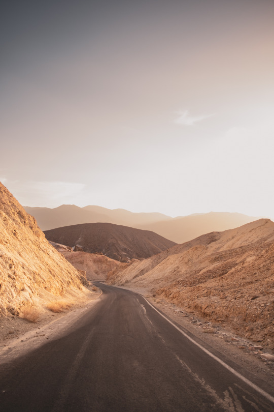
Photo

sunset in death valley. #shotoniphone • • #photography #travel #sunsets #deathvalley #california #roadtrip #deathvalleynationalpark #furnacecreek #iphonephotography (à Death Valley National Park) https://www.instagram.com/p/ConNz1Dvzdh/?igshid=NGJjMDIxMWI=
#shotoniphone#photography#travel#sunsets#deathvalley#california#roadtrip#deathvalleynationalpark#furnacecreek#iphonephotography
3 notes
·
View notes
Text
4 notes
·
View notes
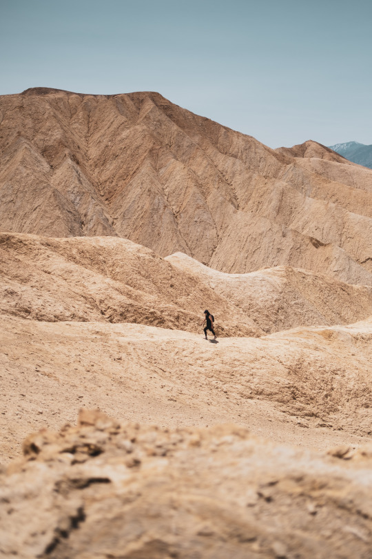
Photo
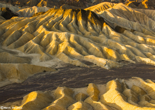
Badlands Detail, Death Valley National Park, CA
203 notes
·
View notes
Photo

Take a refreshing dip in Lone Pine Lake, elevation 10,050 feet, on the trail to Mt. Whitney. It’s a non-strenuous day hike--up and back-- from Whitney Portal. This photo was taken in the autumn with no one in sight, except my friend and a ring-tailed cat who was studying our descent.
Just as a reminder, if you’re tempted to hike further, you need permits to summit Mt. Whitney. Most hikers begin their trek in the dark hours of the morning with the goal to summit the peak before noon and to return to Whitney Portal before dark. It can be done but you really have to know what you are doing. It is a good idea to stop by the visitors center before heading up the Mt. Whitney trail.
Mt. Whitney is the highest point in the contiguous United States and the Sierra Nevada mountains, at an elevation of 14,505 feet. To say that the weather at that elevation is subject to change is an understatement.
If crampons, climbing ropes, and snow-weather hiking gear is not your thing, and/or you just need a hike to break up your Highway 395 road trip, then a hike up to Lone Pine Lake is a very good alternative to quell your mountain fever.
Moving on from this crested majesty and the crisp mountain air, is Death Valley National Park just 64-miles away. In an hours time, you’ll be traveling more than miles in this disparity of highs and lows. With Mt. Whitney at 14,050 feet; Whitney Portal at 8,000 feet; in a lunch breaks time, you’ll descend into the lowest point in the United States at at 282-feet below sea level; at Badwater Basin, in Death Valley National Park. What wonder in geology form and time.
If the gateway to the Great Basin with it’s other-worldly landscape, and, depth beauty in striations of color, doesn’t capture your imagination, then perhaps, an ultra-marathon may be the best next-test in adventure you’re looking for?
In the punishing heat of July ultra-marathoners take on the weather and distance to literally run day and night from Badwater Basin to Whitney Portal covering a distance of 135-miles. As the LA Times points out, “There’s no prize money, but you must finish in less than 48 hours to receive the coveted Badwater 135 belt buckle.”
Well, okay! (?) Don’t knock it, till you try it, I suppose, but, I think I’d rather keep driving south to Del Mar.
#Mt.Whitney#WhitneyPortal#LonePineLake#Bishop#California#hiking#deathValley#deathValleyNationalPark#Ultramarathon#Badwater#BadwaterBasin#landscapes#photography#landscapephotographty
7 notes
·
View notes
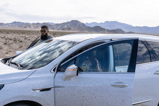
Photo


Exploring and camping in death valley on day #1
Hiked around Dante’s view and found a spot in the hills near furnace creek wash to camp. Greeted by a beautiful sunrise and howling winds, we head north to a series of the longest straight away roads, horizon to horizon.
#life#travel#nature#deathvalley#nationalparks#overland#adventure#mine#gx470#lexus#view#earth#sunset#outdoors#roadtrip#manifested
5 notes
·
View notes
Video

flickr
SUNRISE by pjshuleski
Via Flickr:
DEATH VALLEY CALIFORNIA The remnants of past life in the dunes are visible as the early morning sun floods the valley.
#deathvalley#mesquiteflatdunes#nationalparks#dunes#sanddunes#sunrise#morning#shadows#stovepipewells#california#flickr#nature
17 notes
·
View notes
Last Seen Blogs

inflationdudepuffsbigger
*fwoooooooooomp!*

harm0ney
💎Tough Luck, Buttercup💎

wolfy-959
The creature within us

saladesignstudio
SALA DESIGN STUDIO

jacobbaeluvr
syaf | 18