
Last Seen Blogs

nowheretobefound101
Li'lMissy

smol-yuebing
♡ピクルー♡

anessavili
Your Escape

mmmmulbery
If I knew you, I'd love you the same

immoren
Immy's Tumbling
Photo

Take a refreshing dip in Lone Pine Lake, elevation 10,050 feet, on the trail to Mt. Whitney. It’s a non-strenuous day hike--up and back-- from Whitney Portal. This photo was taken in the autumn with no one in sight, except my friend and a ring-tailed cat who was studying our descent.
Just as a reminder, if you’re tempted to hike further, you need permits to summit Mt. Whitney. Most hikers begin their trek in the dark hours of the morning with the goal to summit the peak before noon and to return to Whitney Portal before dark. It can be done but you really have to know what you are doing. It is a good idea to stop by the visitors center before heading up the Mt. Whitney trail.
Mt. Whitney is the highest point in the contiguous United States and the Sierra Nevada mountains, at an elevation of 14,505 feet. To say that the weather at that elevation is subject to change is an understatement.
If crampons, climbing ropes, and snow-weather hiking gear is not your thing, and/or you just need a hike to break up your Highway 395 road trip, then a hike up to Lone Pine Lake is a very good alternative to quell your mountain fever.
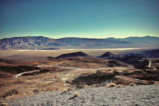
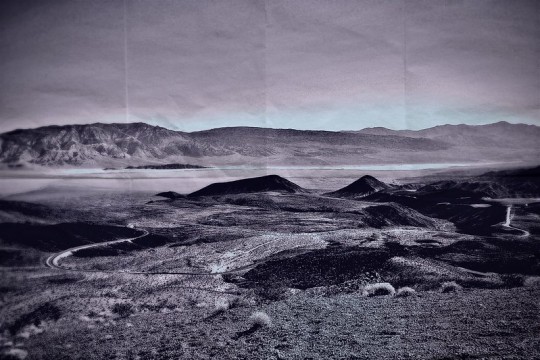
Moving on from this crested majesty and the crisp mountain air, is Death Valley National Park just 64-miles away. In an hours time, you’ll be traveling more than miles in this disparity of highs and lows. With Mt. Whitney at 14,050 feet; Whitney Portal at 8,000 feet; in a lunch breaks time, you’ll descend into the lowest point in the United States at at 282-feet below sea level; at Badwater Basin, in Death Valley National Park. What wonder in geology form and time.
If the gateway to the Great Basin with it’s other-worldly landscape, and, depth beauty in striations of color, doesn’t capture your imagination, then perhaps, an ultra-marathon may be the best next-test in adventure you’re looking for?
In the punishing heat of July ultra-marathoners take on the weather and distance to literally run day and night from Badwater Basin to Whitney Portal covering a distance of 135-miles. As the LA Times points out, “There’s no prize money, but you must finish in less than 48 hours to receive the coveted Badwater 135 belt buckle.”
Well, okay! (?) Don’t knock it, till you try it, I suppose, but, I think I’d rather keep driving south to Del Mar.
#Mt.Whitney#WhitneyPortal#LonePineLake#Bishop#California#hiking#deathValley#deathValleyNationalPark#Ultramarathon#Badwater#BadwaterBasin#landscapes#photography#landscapephotographty
7 notes
·
View notes
Photo
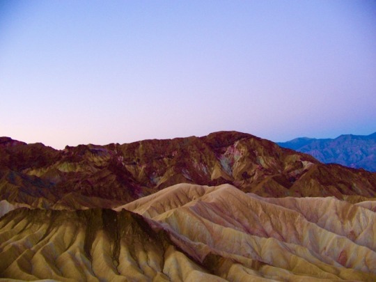
Overlooking Death Valley National Park, California.
©Ana Elisa Fuentes
4 notes
·
View notes
Photo

Death Valley National Park, California.
“various mineral pigments have colored these volcanic deposits. Iron salts produce the reds, pinks and yellows. Decomposing Mica causes the green. Manganese supplies the purple color on the platte are reproduced in a larger scale on the mountains around death valley.”
©Ana Elisa Fuentes
2 notes
·
View notes
Photo
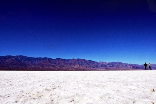
Salt Flats, Badwater Basin, Death Vally, National Park, California. ©Ana Elisa Fuentes
0 notes
Photo

What it says. Badwater Basin, Death Valley National Park, California.
“various mineral pigments have colored these volcanic deposits. Iron salts produce the reds, pinks and yellows. Decomposing Mica causes the green. Manganese supplies the purple color on the platte are reproduced in a larger scale on the mountains around death valley.”
©Ana Elisa Fuentes
#Badwater#lowestpointUnitedStates#belowsealevel#BadwaterBasin#DeathValleyNationalPark#landscape#landmark
0 notes
Photo
The beauty of the Artists Palette at Death Valley National Park. With so much rich color and beauty, why is it called Death Valley?
“various mineral pigments have colored these volcanic deposits. Iron salts produce the reds, pinks and yellows. Decomposing Mica causes the green. Manganese supplies the purple color on the platte are reproduced in a larger scale on the mountains around death valley.”
©AnaElisaFuentes
0 notes
Photo

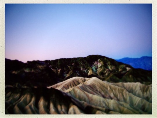
Zabriskie Point, Death Valley National Park. It is the most well known vantage point in the park. The vantage point offers a magnificent view of the badlands below.
“various mineral pigments have colored these volcanic deposits. Iron salts produce the reds, pinks and yellows. Decomposing Mica causes the green. Manganese supplies the purple color on the platte are reproduced in a larger scale on the mountains around death valley.”
©AnaElisaFuentes
0 notes
Photo
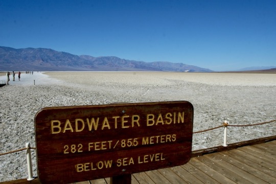
Bah-Bah-Bah-Badwater Basin is the lowest point in North America and the United States of America.
0 notes
Photo
The Artists Palette after glow, Death Valley National Park, California.
“various mineral pigments have colored these volcanic deposits. Iron salts produce the reds, pinks and yellows. Decomposing Mica causes the green. Manganese supplies the purple color on the platte are reproduced in a larger scale on the mountains around death valley.”
©AnaElisaFuentes
0 notes
Photo
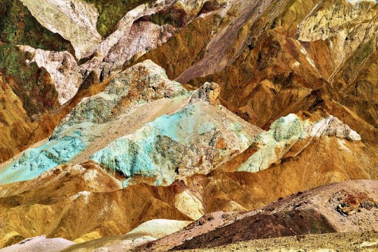
Detail of hillside rock formations at Artists Palette, Death Valley National Park, California.
“various mineral pigments have colored these volcanic deposits. Iron salts produce the reds, pinks and yellows. Decomposing Mica causes the green. Manganese supplies the purple color on the platte are reproduced in a larger scale on the mountains around death valley.”
©AnaElisaFuentes
4 notes
·
View notes
Photo

Somewhere on the Yosemite Valley floor admiring the lilting Merced River.
#Yosemite#hiking#exercise#breathing#breathe#planeterth#trees#climate#YosemiteValleyFloor#MercedRiver#water
0 notes

Photo

View of Half Dome from North Dome with Olmstead Point in the distant background. This direct view of Half Dome and the ample plateau for for rest and reflection is the gift earned from the strenuous Snow Creek Trail. A trail with a steep and numerous switchbacks and just as many view of all the treasured and revered Yosemite landmarks. With binoculars you can see aspiring hikers climb the cables to Half Dome’s summit. The cloud formations also hint at incoming weather and serve as advisory to the kind of weather making the summit to Half Dome very dangerous. Lightening strikes the Half Dome every month and you don’t want to get caught climbing the steel cables under these weather conditions.
If climbing or hiking is not your thing, turn up the sound and take in Yosemite views virtually.
This digital image post processed with Hipstamatic Jack London lens and Love81 film.
#Yosemite#YosemiteNationalPark#HalfDome#NorthDome#hiking#health#exercise#planetearth#climate#nature#california
0 notes
Photo

Along the trail you will notice these round impressions embedded in the rock. The impressions were used as pounding rock by the Miwok people to crush, pound and grind acorns. This photo taken along the Snow Creek trail.
0 notes
Photo

Direct view of Half Dome from North Dome with Olmstead Point in the distant background. This direct view of Half Dome and the ample plateau for for rest and reflection is the gift earned from the strenuous Snow Creek Trail. A trail with a steep and numerous switchbacks and just as many view of all the treasured and revered Yosemite landmarks. With binoculars you can see aspiring hikers climb the cables to Half Dome’s summit. The cloud formations also hint at incoming weather and serve as advisory to the kind of weather making the summit to Half Dome very dangerous. Lightening strikes the Half Dome every month and you don’t want to get caught climbing the steel cables under these weather conditions.
If climbing or hiking is not your thing, turn up the sound and take in Yosemite views virtually.
This digital image post processed with Hipstamatic Lumiére
#yosemite national park#Northdome#HalfDome#hiking#planetearth#clouds#health#exercise#climatechange#peace#enjoyment
0 notes
Photo

Gazing at Half Dome from the North Dome, Yosemite National Park.
0 notes
Photo
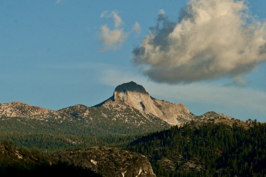
The view of Gray Point from North Dome, in Yosemite National Park, on a beautiful and warm autumn day.
0 notes