#Guthook Guides
Text
A Different Kind of Record
There are numerous records associated with the PCT. The most obvious is the FKT or fastest known time. Then there is the variation of FKT* or fastest known time without support. In addition there are such things as the 'Oregon challenge' which is based on how fast hikers can walk the length of the Oregon PCT.
My partners and I have joked about our SKT or slowest known time in reference to how long it took us to complete the PCT and more importantly how we approach each day on the trail. Our style is not to crush miles but to more generally embrace them. We don't necessarily approach any of our hikes with the thought of setting specific records. Our goal is to simply enjoy our time together as that establishes a different kind of record. A record of yet another memorable time together.
Our lives today are absolutely saturated with technology. In 2022, an app monitoring firm found that people across the world were spending an average of 4.8 hours per day on mobile apps. Studies on digital addiction and screen time published by the National Bureau of Economic Research and the Pew Research Center reveal a lack of choice when it comes to our phones and the places they take us: sites designed, often explicitly, to tether us by the eyeballs to our screens. The impacts can be devastating to our mental health and wellbeing, and may be tied to rising rates of depression and anxiety.
On the other hand part of the conversation around technology centers on those who have accessed technology in the past generally were those who possessed the financial resources to pursue it. Over the past few decades as computers and later cell phones got more than a hand hold in people's lives technology began to spread its influence. With this spread came inherent privilege. The people who were welcoming technology into their lives could also afford it. As time has passed, affordability became less an obstacle and technology more a tool for a majority of people. But we are not going to further that discussion here as this point of view only sets up where I am going next.
I am sure we can agree technology does offer people many benefits. One appears to be a connection to others. Technology can also provide a link to safety. In the hiking world it provides route guidance and a modicum of connection to others and for potential rescue.
One of my hiking partners has shared that every so often he takes a technology break. He unplugs for a day and experiences life without the 'assistance' of technology. In other words, no phone, no computer. Unplugging gives Jim space for less interrupted reflection. I have admired his determination to free himself from technology even for a day.
Given the various potential challenges or aka. 'records' that have emerged since the numbers of hikers has continually increased over the decades a different kind of record comes to mind. Consider this a 'throwback' record. How about an attempt to hike all or part of the PCT without technology? You know, paper maps and printed guides...even access to a compass (a former techno marvel). I admit that Halfmile's and later Guthooks and now Far Out have proven useful to me on the PCT. I wonder what a PCT experience would be without actively accessing phone or earbuds but instead fully seeing and hearing the world around me. No online blogs but a pencil and paper journal if one was so inclined. I don't think it would be dis-qualifier to bring a Garmin or similar device in case of emergency as that could be prudent.
To me this could be every bit as meaningful a record as how fast someone(s) walked a section or the whole length of the PCT. It raises some great questions too. Such as, what did it feel like to not be technologically connected? Was it scarier without technology? Was your confidence lifted over time as a result of unplugging? Did going without technology enhance or take away from your overall experience and if so, in what ways? How hard was it to hike unplugged?
In a time when so much of what people do or attempt to do is synonymous with being an extreme sport maybe a throwback record of unplugging is just another extreme form. I don't know to be honest but I do find it intriguing. Back when my partners and I started hiking sections of the PCT we were unplugged as there was nothing to plug into. For example the ski area parking lot at Stevens Pass still had a pay phone that we actively accessed for contact with friends and family. That was technology but it was stationary and now there is no trace of it there or many other places. We checked in, providing someone answered on the other end, and then walked on. Ignorance beyond the trail was some kind of bliss. We had maps and a guidebook to show us the way.
As I write this and read it back I sound ancient. I am not too ancient but just wondering how this might be for someone in the first third of the 21st century? Does it have any appeal? Is it even necessary? To be fair, is it necessary to go as fast as possible between Campo and the Canadian border or from the Oregon-California border to the Columbia River? Isn't the most necessary challenge making your hike the most memorable experience you can plugged or unplugged? It is all a great challenge if to do nothing else but to simply imagine.
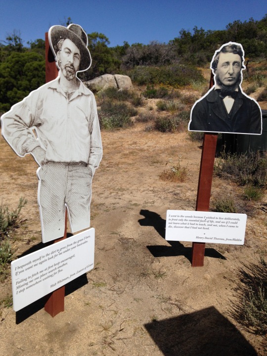
Thoreau and Whitman unplugged
1 note
·
View note
Text
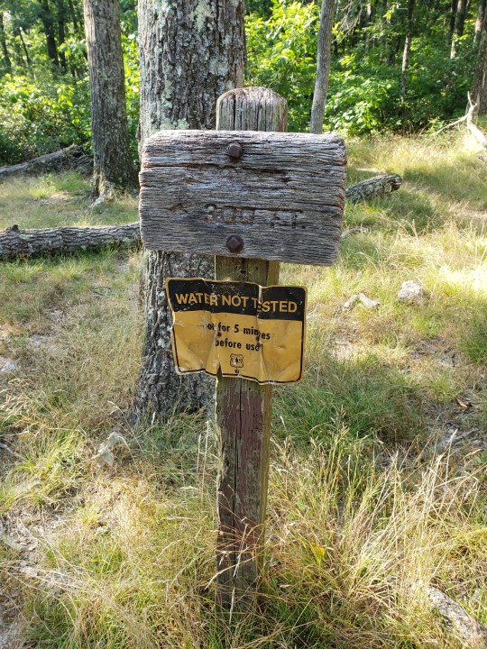
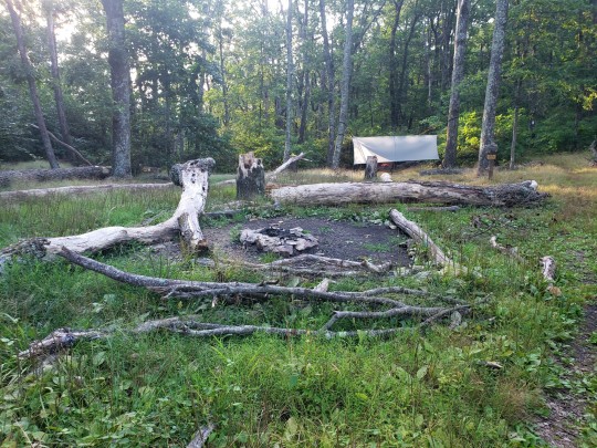
We became very stinky on the AT this weekend on an overnight trip! 3 miles in, 6 miles out. We stopped at a campsite and a natural spring, and even though it has been so dry (no rain in a month, the creeks were dry save for a few puddles and a slow trickle), the spring was still putting out cold water.
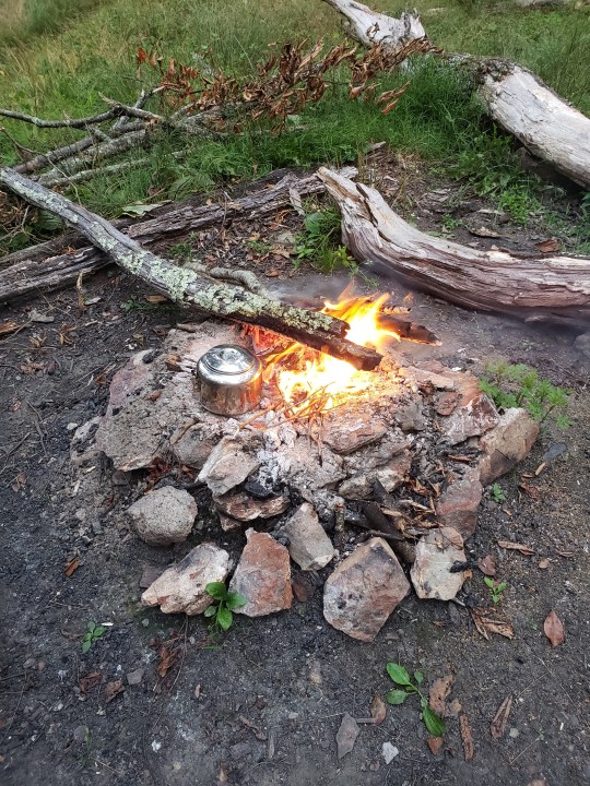
The campsite was empty, so we put up the hammocks and made a fire and ate dinner. After dark, maybe 830-9pm, a thru-hiker showed up. He said "there was no water for the past 200 miles." He was out of water for the last 2 miles to the spring. I said, "so you've gone 200 miles?" He said, "no - 780." He is doing the whole thing.
He said "I've walked only 13 miles today." And he started at 1pm.
He said, about a day before, a thru-hiker had OD'd and died on the trail, and his body was partially eaten by a bear. That's the only bear he has seen on his trip this year.
He said he had walked 600 miles 2 years ago, but life got in the way, so he started the trip again after graduating college this year.
He said he usually "sleeps in" and today he woke up at 830, then packed up his tent and immediately left. He said he was out of food and had a 3 hour walk to the next town.
We met 2 more thru-hikers. The first one said that there's no water behind them. We told him the spring was just ahead with cold and he was thankful because he too was out of water. The second one also said there's no water were he came from and was thankful the spring was running. We told them we were only 6 miles to a car... I guess we look legit with our packs and sweat.
They all talked about Guthook. I looked it up - it's a $70 trail guide that shows water sources, campsites, and has a way to communicate with other hikers about conditions and general trail things.
Could you imagine walking 2,100 miles by yourself?
1 note
·
View note
Text
7 Dec 2015
Welcome to my reliving of my 2015 AT hike. I have decided to share my trip as a day by day memory. Each day I will share my personal journal (what I captured while hiking the trail), my comments (thoughts about the journal/trail from present day), and pictures from the day of the hike.
Miles hiked (day / trip) - 21.8 / 2108.9
Staying - Muskrat Creek Shelter
Journal
Some easy hiking today.
4 days left.
~80 miles.
Feels a lot colder than yesterday. I think I’m going to shelter tent.
View from Standing Indian only OK. Not sure if it was worth the side trip.
Saw 3 section hikers. 2 were on their honey moon trip. That was 3 more than I expected to see.
Comments
I got lost hiking off Albert Mountain. I somehow lost the trail and found myself in the middle of the woods. I had to use my phone / Guthook (AT guide) to get back to the trail. I think this was first first time I “lost” the trail since New York state.
I continued to see NOBO’s. That surprised me. I didn’t think I would see people hiking north at the start of winter. Good luck to them.
Pictures
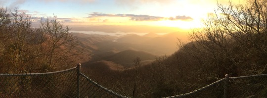
View from Albert Mountain Fire tower
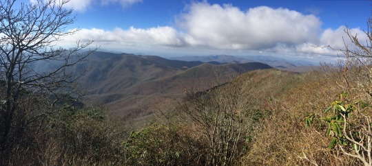
Standing Indian Mountain
5 notes
·
View notes
Link
0 notes
Text
August 21, 2021 IAT Portage
Forecast called for thunderstorms this morning, so we were ready with waterproof clothing, ponchos, gaiters and umbrella. The morning started out cooler, and although we had some light showers on the drive north, it wasn’t raining as we started out. We had a few intermittent drops of rain throughout the day, but no real rain. However, it did become very warm and humid!
We trekked just over 9 miles to Portage, arriving just after 11am and time for a car shuttle and late breakfast at the diner. We walked along the Fox River for a while, which was extra special to me having grown up in Green Bay and Oshkosh along the Fox!
After lunch, we drove to the trail head where the Portage Canal meets the Fox River. It was a wooded area, so we experienced mosquitoes for about the first time this year so we covered ourselves in Deet products! We were delighted to find that we actually had a bit of a trail along the Canal. There were story plaques along the way, but our group was moving fast due to mosquitos!! Here is what I learned later, thanks to http://www.heritageparkway.org/sites-directory/portage-canal/
The Portage Canal connects the Fox River with the Wisconsin River at the City of Portage. Named for the historic 1.5 mile “portage” between the two rivers, this piece of land was the only break in the entire Fox-Wisconsin Waterway, which connects the Great Lakes to the Gulf of Mexico. Constructed between 1849 and 1876, it was the dream of investors that the canal would make the Fox-Wisconsin corridor the greatest water highway through the middle-United States.
This divide in land was formed by the outwash of glaciers nearly 11,000 years ago, where the Fox and Wisconsin Rivers curve into opposing horseshoes. The portage is geographically important because it divides the southwest draining Lower Wisconsin River, which eventually empties into the Gulf of Mexico, and the headwaters of the northeastern draining Fox River, which empties into the Atlantic Ocean.
Used by Indians for thousands of years, the land between the Fox and Wisconsin Rivers was known as “wauona,” which means “the place where one takes up his canoe and carries it on his back.”
One of the first mentions of the portage is found in the journals of Jacques Marquette in 1673, on his journey to find the Northwest Passage with Jean Nicolet. From the Fox River, two Miami tribesmen guided the team to the Wisconsin River. He recorded a portage of 2,700 paces, through this marshy divide. In the end, Marquette would remark that this was the only stretch of land they would have to cross, from the Great Lakes down the Mississippi River, making it one of the most famous and historically important portages in the entire country.
As the region’s population continued to grow throughout the 19th century, the success of modern canal systems in the East prompted investors to begin looking at creating a canal between the Fox and Wisconsin Rivers. The canal would create a continuous water route, enabling goods to be easily transported through the corridor.
Construction of the canal was slow and marked by difficulty. Planning began in the 1820s, and on March 7, 1837, the Portage Canal Company was formed. However, after months of digging by hand through the muddy terrain a shortage of funds forced the project to close.
In 1838, canal work was handed over to the U.S. Government, and after Wisconsin admitted into the Union in 1848, the state took over the project. In 1849, a new route was chosen for the canal, which is the present one. After misunderstandings between the contractor and the state the project was transferred to the fox and Wisconsin Improvement Company. Work progressed slowly, and the project was finally abandoned.
The Army Corps of Engineers revived construction in 1874, finally declaring the canal complete in 1876. Upon completion, the canal was 75 feet wide, 7 feet deep, 2.5 miles long with a draw of 6 feet.
According to the Fort Winnebago Lock Tenders book, from 1878 – 1908, the canal was used heavily by large boats, some of 300-ton capacity, and pleasure crafts. In 1851, however, declining use forced the closure of the canal. The Fort Winnebago Lock was demolished and the Wisconsin River Locks were welded shut.
In 1981, ownership of the canal was transferred to the Wisconsin Department of Natural Resources. Several efforts have been made by the Portage Canal Society and City of Portage to save and revive the canal. The south bank of the canal is now part of the National Ice Age Trail. In 2006, a significant renovation began, which included cleaning up the canal and creating a pedestrian walkway.
In elementary school in Green Bay, we learned about Marquette and Nicolet, who were among the first to arrive in Wisconsin. I recalled hearing about the important river routes for trading and working on discovering land to the west, and it was neat for me to be walking along the route.
We walked about a half mile, and a sign said the trail was blocked at the Railroad bridge and IAT hikers should use Hwy 33 to detour. Well, we didn’t want to walk on the highway, we wanted to walk on the canal path! The path was mowed, and our Guthook app didn’t have a detour so we decided to go for it. Under the RR bridge, the path was on a boardwalk that was falling apart, but we were able to pick our way across it without wet feet. We walked about another 100 yards and an Amtrak came speeding over the bridge – so glad I wasn’t under it at the time or I’d have probably freaked out and fallen into the scuzzy water!
We came to a spot where a fence blocked our path, and we could see that there was serious construction ahead. We walked along the fence and came to a street, and in a few blocks, we were able to rejoin the paved path. After about another half mile, we came to the end of the canal. We climbed a levee and had an awesome view of the Wisconsin River. Then a short walk through a beautiful Portage neighborhood, back out to Hwy 33 and over the Wisconsin River, before turning onto Levee Road.
Just over 14 miles in today – another great day!
0 notes
Text
Have you seen this encyclopedia of Buck Knife?
Do you Know Where are buck knives made?
Fueled by faith and a lot of determination, the original Buck Knife started out with the humble Model 110 Folding Hunter Knife back in 1964 to become one of America’s most revolutionary knife brands today.
With the breakthrough in their folding locking system, Buck Knives is probably one of the most famous and reputable knife companies out there.
Buck is renowned for their durability, reliability and elegant simplicity and produces some of the best knives ever made.
Buck Knives is a 4 generation family business that thrives on always bringing the public the best in quality and durability. The thing that sets Buck Knives apart is that all their knives are hand crafted with the finest workmanship and all come with a Forever Warranty!
Yes, FOREVER warranty! Their knives are all warranted to be free of defects in material and workmanship for as long as the knife lives, and if something goes wrong, they’ll replace your Buck Knife! It pretty much goes without saying that the knives are not warranted against misuse and normal wear and tear.

Whether It’s Hunting, Bushcraft or EDC, Steel Matters
Anyone who only buys their knives in a certain kind of steel is the kind of person who’s going to have an opinion about S30V. Or S35V. Or 154CM versus CPM154, or D2 and why a $50 price increase for Crucible Powder steels is worth it. Buck is a little late getting to this party, but regardless of where anyone stands on steel types, they were happy to see Buck finally show up.
Everyone has this weird idea that getting a knife in one of the S30V steels automatically makes it the best version of that knife. That is nonsense, but it is a nice steel if you like really high edge retention and corrosion resistance. Like any steel though, not all S30V or S35V steels are equal. Some companies are just better at handling it than others, and Buck’s S30V heat treatment method goes a long way toward making their Crucible steels some of the best out there.
I should qualify something really quick, though since we are talking about two different types of steel. The distinction is minute for most people. S35VN is essentially the same steel with a few more chemicals added in to make S30V steel tougher and easier to machine. I suspect that’s the reason you’ll mostly see S35V on Buck’s larger knives.

Here are 10 of our favorite fixed blade and folding Buck knives with SV30 or SV35 steel:
Fixed Blade
537 Open Season Skinner — 4.5″ Drop Point Blade | Wood or Thermoscopic Handle | Leather or Nylon Sheath
141 PakLite Trophy Knife Kit — 3.5″ Guthook Blade & 2.5″ Caping Blade | Stainless Steel Handle | Polyester Sheath
Buck Pursuit Pro — 4.55″ Drop Point Blade | GFN/ Versaflex Handle | Nylon Sheath
119 Special Pro — 6″ Clip Point Blade | Micarta Handle | Leather Sheath
102 Woodsman Pro — 4″ Clip Point Blade | Micarta Handle | Leather Sheath
Folding
110 Hunter — 3.75″ Clip Point Blade | Wood Handle | Lockback Lock
112 Ranger — 3.0″ Clip Point Blade| Wood Handle | Lockback Lock
722 Spitfire — 3.25″ Drop Point Blade | Aluminium Handle | Lockback Lock
347 Vantage Pro — 3.25″ Drop Point Blade | G-10 Handle | Liner Lock
294 Momentum — 3.1″ Drop Point Blade | Textured Aluminum Handle | Liner Lock
What Buck Knife to choose?
Because they have such an extensive collection of knives on offer, choosing just one can be a task that seems a little overwhelming. Typically you need to determine:
How you’ll use your knife
What features you’ll need to have on the knife
What material would you like your knife to be made of
What safety features you expect to get
Different Buck Knife Models
Buck Knives come in many shapes and sizes; let’s look at what’s on offer:
The Fixed Blade Knife — this is a sturdy and dependable knife that’s always ready for use
The Folding Knife — These knives are compact and great to carry along with you wherever you go
The Thick Blade Knife — These knives are for heavy duty tasks
The Lightweight Knife — These knives are super lightweight to carry around and great for popping into your pocket when heading outdoors
The Gut Hook Knife — These knives are essential for field dressing and game skinning purposes
The Saw Tooth Knife — If you’re a hunter, you’ll want to have one of these because they’re great for cutting through wood or bone.
If you need the best edge retention, great corrosion resistance and a tool that’s fit for heavy cutting jobs, you’ll want to consider the 154CM steel.
Custom Buck Knives
As if the wide variety Buck Knives has on offer isn’t enough already (they’ve got an unbelievable 157 knives on offer), you have the freedom to customize some of their knife models to your liking. You can design it just the way you like it with its own unique materials, treatments, blade steels and options for bolsters and engraving!
Buck’s Custom Knife Shop
Most of the knives in Buck’s customizing page can come in S30V or S35V. The only exceptions seem to be incredibly large knives like the 916 Bowie (and probably don’t want it in that big of a blade anyway), and the handful of models that they still make in China. Other than those, this is a great resource if you not only want a Buck knife in a Crucible steel, but if you want it engraved with a specific handle material.
Some of their most popular customizable knives are:
The 110 Folding Hunter Knife
The 112 Ranger Knife
The 113 Ranger Skinner Knife
The 501 Squire Knife
The 503 Prince Knife
The 505 Knight Knife
Did you know?
Buck Knives manufacture a pretty awesome fish filleting knife, which has been ranked as one of the best out there.

Conclusion
Buck Knives is a legendary name that has been bringing out the best in the business when it comes to anything and everything knife related. With their wide variety and superior quality, this American knife manufacturer is set to survive the test of time. When will you take the plunge and invest in a Buck?
Any of our winning options are quality knives that will serve you well, but selecting the perfect one is about your preferences and ideal price point.Want more recommendations for the best EDC knives and cutlery to complete your knife set? Check out our guides to the yier buck knife.
WHY CHOOSE YIERCITY
● We have a huge selection of authentic professional knife sets.
● Excellent customer service before and after sales.
● Return guarantee on all products.
● Free shipping and tax/custom clearance service.
● Made of premium high-quality materials to ensure safety and durability.
●Continuously optimize the manufacturing process and design style, and pursue product innovation.
● We listen to our customer’s needs and adopt their feedback.
We are an official knife vendor who are verified on the knife forum with lots of third party five star reviews…and not one negative review to date.
0 notes
Text
Guthook Guides Hike & Bike Offline 8.1.23 Unlocked AtlasGuides APK Download
Guthook Guides Hike & Bike Offline 8.1.23 Unlocked AtlasGuides APK Download

Guthook Guides Hike & Bike Offline 8.1.23 Unlocked
Guthook drivers trust hikers and long-distance hikers around the world. You can be sure that you are on the right track with real-time location on a GPS map and extremely detailed guides that show you what to expect.
Characteristics:
* Detailed maps, including GPS location, detailed routes and locations
* View elevation profiles with GPS…
View On WordPress
0 notes
Text
How an App Made Hiking Easier (perhaps too easy)
An excerpt from Taylor Gee’s article in The Guardian examining the unintended consequences of Guthook Guides’ maps that have made outdoor adventures far less wild. I must admit being old school myself and even feel sometimes that all of the information on Halfmile’s maps makes me feel a bit lazy. Guthook Guides’ seems, at times, to remove the mystery from the trail. What’s your reaction to Gee’s critique?
In March 2012, the Pacific Crest Trail changed for good when Cheryl Strayed’s memoir Wild, about her 1995 thru-hike of the trail, hit shelves and quickly became a New York Times bestseller. [Between the book and the movie] from 2013 to 2018, PCT applications nearly quadrupled.
But Wild wasn’t the only thing that transformed the trail that March. The same month, a thru-hiker named Ryan Linn quietly released an iPhone application called Guthook Guides. It took the entire set of tools needed for thru-hiking – a map, compass, guidebook and water reports – and consolidated them into a single virtual location. It functioned offline and crowdsourced updated information about trail conditions and campsites when online. Such an app might have been inevitable, but for ultralight-obsessed thru-hikers, it was a revolution.
Linn’s timing couldn’t have been more perfect. In the last three years, the app has been downloaded 337,000 times, and in 2018, a survey of 500 PCT hikers found that 85% used the app. What started in 2010 as a passion project is now a company that employs five people full-time and has mapped more than two dozen long trails around the world.
But as the the app’s empire continues to grow, many thru-hikers worry about its unintended consequences. They see themselves and fellow hikers depending on their phones to decide where to sleep and eat and to discover exactly how far, down to the tenth of a mile, they are from those places. They fear that American thru-hiking, once the ultimate test of self-reliance, is no longer as wild as it once was.
While attending Vassar College in 2002, Linn joined an outdoors club. The upperclassmen decided that the new recruits needed intimidating nicknames. One day, Linn and two other club members were driving past a hunting and fishing store and pulled over to wander the aisles for inspiration. Linn became “Guthook”, and it stuck through college and afterward, when he hiked the AT in 2007 and the PCT in 2010.
It was while hiking the PCT that Linn met Paul Bodnar, a guidebook author who was collecting GPS data on trail with the intent of updating a PCT guide he had published in 2009. In the era of “there should be an app for that”, it didn’t take long for the two to start talking about what a smartphone-based guide would look like. “We figured it would be something for us to do on the side, in between seasonal work,” says Linn, who since college had been doing various trail-crew and outdoor-education jobs.
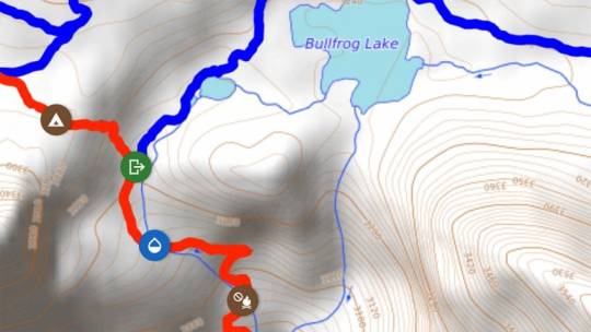
After they finished their hike, Linn spent the next year and a half using the GPS data Bodnar had collected to create the first version of Guthook Guides, learning to code as he went. Visually, the app looks similar to the paper topographical maps hikers have used for decades. Virtual icons along the trail designate campsites, water sources, intersecting roads, and trail-town information. But unlike paper maps, Guthook Guides is GPS-enabled, and users can click on an icon to learn more or add a comment. The ability to leave comments, in particular, made Guthook Guides more than a guidebook. Hikers could tell other users whether a water source had gone dry, the quality of a campsite, and the friendliness of local businesses.
After the 2012 release, the app made just enough money for Linn to pay a friend to collect data while hiking the AT in 2013. (The app is free to download, but users must purchase guides for each trail.) The AT guide was released the next year. In 2015, Guthook Guides became available on Android phones. By then, Linn and Bodnar, the app’s co-creators, understood that Guthook Guides was no longer a side project. They went all in.
A sense of surviving in the wilderness is a major reason why a 2,000-mile hike is more than just a feat of athleticism. Taking a wrong turn, getting lost, navigating back – all that misadventure and the intellectual challenge of sorting it out makes for better stories than does walking in a straight line dictated by an app. Yet thru-hiking the PCT last year, I had to stop myself from checking the Guthook app as often as every hour. At one point, my hiking partner even instituted a no-Guthook rule, with the hope that we’d reclaim some sense of agency over our endeavor. Our self-imposed app ban didn’t last, because pretending we didn’t have this all-knowing resource in our pockets felt somehow inauthentic. Especially when most everyone else on trail was embracing it as reality.
It’s hard to overstate the impact that Guthook has had on the experience of thru-hiking. I talked to nearly a dozen hikers and trail managers who all seemed simultaneously concerned that the app enables hikers to lose self-reliance and awareness of their surroundings but couldn’t deny its supreme usefulness.
[PCT hiker Eric] Lee compares the impact of Guthook Guides to what Google Maps has done for driving. “We no longer have to think about landmarks and turns and street names. We just type our address into the phone and press go,” he says, noting that it undoubtedly makes thru-hiking an easier, more stress-free experience. But because of the app, he sees more hikers today who are not as viscerally connected to the trail. “They’re walking from waypoint to waypoint. It’s just a set of numbers.”
This effect has led to some pushback against the app. “I’ve encouraged people to not use it,” says Lucas Weaver, a 29-year-old fiber-optic technician who used Guthook Guides while hiking the Continental Divide Trail last year. “I’m not saying don’t get it, I’m saying don’t let it dictate, don’t rely on it.” Weaver is glad he hadn’t yet downloaded the app when he hiked the AT in 2015. “Being out there without any guide or technology makes it more adventurous,” he says.
The app’s popularity has coincided with the use of phones creeping into trails more generally. Now hikers have Instagram accounts to update with selfies, blogs to write, and loved ones to keep in touch with.
Sometimes use of the app enters into the absurd. “We came across many hikers who would use the app to the point they would lose common sense,” says Jen Nicholson, a 29-year-old physical therapist who also thru-hiked the Continental Divide Trail last year. She recalls hikers who insisted on walking five feet off to the side of the trail because their GPS told them that’s where the path was.
Then there are the stories of hikers relying on trail apps who lose or break their phones or even just run out of battery. For those who forgo paper backup maps to save weight (I was guilty of this myself), a dead phone makes getting lost more frightening than thrilling. Rachel Brown, membership-services manager for the Continental Divide Trail Coalition, recalls encountering this multiple times when hiking the trail in 2015. A friend of hers lost her phone, spent hours searching for it, didn’t find it, and had no backup maps. “She ended up camping out at a really confusing trail junction for three days until somebody else came,” Brown says. Another time, Brown hiked with a man who dropped his phone into a creek. “He ended up sticking like glue to my partner and me,” she recalls. “It was a little frustrating for us, because it kind of felt like we were babysitting. He was always there.”
Perhaps most telling is Guthook’s own experience. Last summer on a backpacking trip, Linn found he had drifted off of a poorly marked trail. “I stopped, and I was about to grab my phone,” says Linn. “Now I have to really consciously tell myself, ‘No, no, no. You just noticed you’re off the trail, go and find it.’” Linn is thoughtful about how his app has affected life on trails. “There are downsides to every new technology in the wilderness,” he admits. “Probably people are using Guthook a little more than I would have wanted.”
For all the good and the bad attributable to Guthook Guides, the consensus is things are just different now. In 2003, Eric Lee accidentally turned off the PCT and hours later ran into another hiker who told him he was going the wrong way. Lee didn’t believe him. “We brought out paper maps and discussed it for 15 minutes” before the other hiker convinced Lee of the truth. Back then that was part of the experience, and maybe even charm, of the trail. “Today that would never happen,” says Lee. “But I’m OK with that.”
1 note
·
View note
Photo
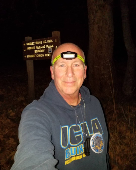
My original workout was going to be 5k on the treadmill, however when I arrived at the gym I opted outside for a trail run. I have run in the dark at Vasquez Rocks before and it can be a challenge staying on the trail in the dark and this morning was no exception. I did take some alternate trails which is okay, but I lost the trail where it goes through the dirt parking lot for the picnic area and had to use the Guthook guide to find my way back to the PCT. The rest of the run was uneventful. #runningafter60 #runselfie #roadid #brookscadia #garmin #rosary #marymiraculousmedal #roadrunnersports #pct #obeseathlete #relive #optoutside #slowaf #vasquezrocks https://connect.garmin.com/modern/activity/4385655484?share_unique_id=7 (at Vasquez Rocks) https://www.instagram.com/p/B6v8lzanEMY/?igshid=6josrp6jgpi1
#runningafter60#runselfie#roadid#brookscadia#garmin#rosary#marymiraculousmedal#roadrunnersports#pct#obeseathlete#relive#optoutside#slowaf#vasquezrocks
0 notes
Link
Appalachian Trail Guides & Maps
The A.T. Guide (everyone planning or hiking the trail carries pages from this book)
Guthooks Guide App – iPhone/Android App for AT, also excellent
National Geographic Appalachian Trail Maps
Appalachian Trail Conservancy Maps
Appalachian Trail Planning Resources
How to Section Hike the Appalachian Trail: Beginner Advice
Advantages and Disadvantages of Section Hiking the Appalachian Trail
Planning an Appalachian Trail Section Hike
How to Hike the 100 Mile Wilderness (in Maine)
Appalachian Trail Parking Guide
Appalachian Trail Cell Phone Guide
Section Hiker’s Appalachian Trail Journals
My trip reports are listed from north to south, even though I dart around from state to state and switch directions all the time. Most of my hikes have been solo with a few exceptions. I started section hiking the AT in 2007 and continue to this day. I’ve hiked about 1400 miles so far (updated April, 2016).
David Brodosi
Maine
100 Mile Wilderness
Monson to Maine Highway 27
Maine Highway 27 (Stratton) to Rangely
Grafton Notch to Gentian Pond
New Hampshire – completed in 2010
Rt 2 to Gentian Pond
Rt 2 to Zeta Pass
Zeta Pass to Mt. Washington, Day 1
Zeta Pass to Mt. Washington, Day 2
Zeta Pass to Mt. Washington, Day 3
Westside Trail to Edmands Path
Edmands Path to Crawford Notch
Crawford Notch to Ethan Pond Shelter
Zealand Pond to Ethan Pond
Zealand Pond to South Twin
Gale River Trail to South Twin
Mt Garfield to Gale River Trail
Skookumchuck Tr to Mt Garfield
Franconia Notch to Skookumchuck Tr
Franconia Notch to Kinsman Pond
Kinsman Pond to South Kinsman
Reel Brook to South Kinsman
Mt Wolf to Reel Brook
Kinsman Notch to Mt Wolf
Kinsman Notch to Glencliff
Mt Cube, New Hampshire
Atwell Rd to Glencliff
Hannover to Atwell Rd.
David Brodosi
Vermont – completed in 2009
Note: The southernmost 100 miles of The Long Trail overlap with the Appalachian Trail in Vermont. The two trail split at Maine Junction, about a mile north of Rt 4, where the AT continues north another 45 miles before reaching the New Hampshire border.
Hannover, NH to Rt 4
Clarendon Gorge to Rt 4
Clarendon Gorge to Rt 9
Rt 9, Bennington to Rt 11/30, Manchester
Massachusetts – completed in 2009
Dalton, MA to Rt 9, VT
Lee to Dalton
Lee to Sheffield
Guilder Pond to Sheffield
Bear Mountain (CT) to Guilder Pond, April 2007
Connecticut – completed in 2011
Bear Mountain to Rt 7
Cornwall Bridge to Rt 7
Ten Mile Lean-to to Cornwall Bridge
New York – completed in 2011
Greenwood Lake (NY) to Ten Mile Lean-to (CT)
David Brodosi
New Jersey
Mohican Outdoor Center to Greenwood Lake (NY)
Pennsylvania
Mason Dixon Line to US 30 near Fayetteville
US 11 Footbridge to Peters Mountain Shelter
Maryland – completed in 2016
Harper’s Ferry Railway Bridge to Mason Dixon Line
West Virginia – completed in 2016
Keys Gap to Harper’s Ferry Railway Bridge
David Brodosi
0 notes
Text
Ice AgeTrail November 6 and 7, 2020
Last time we were here, we had the experience of “winter” hiking with 6” of snow and we were all pleasantly surprised with how much we enjoyed that, as long as it’s not too cold. During one of our dinners last time, Dan commented about someone’s post in the Facebook group about night hiking, and we thought we’d want to try that sometime. Well, as usual, we jumped right in and night hiked on Friday. But it’s a long story about how that happened.
As a group, we could only swing a two-day hike in November, so we agreed to do to 15+ mile days to still cover some good miles and make the trip there worthwhile. I booked a VRBO for two nights, on the Wisconsin River in the township of Irma, a little east of where we’d be but lucky to find that in this remote part of Wisconsin. Everyone but Gary came up on Thursday night and we all arrived around 4pm in time to enjoy the beautiful weather on the deck and the sunset over the river.
Independently, Dan and I both scouted the drop off and shuttle route so we confidently told Gary to drive directly to the starting point and we’d meet him there at 8am Friday morning. The rest of us left the cabin at 7am in two cars and drove into the New Wood State Wildlife Area with a plan to drop a car at the beginning of the Camp 27 segment and then travel to meet Gary. We ran into a snag when the gravel roads on Dan’s route were gated closed, and the roads on my map never materialized. Of course, no one had cell signal to pull up a map. Using the Guthook app I figured out that we were at the END of the Camp 27 segment so we decided to leave Lynn’s car there, even though it’d add 2.9 miles onto our 15+ mile day. Then we set out to drive to meet Gary, but with no detailed maps or cell service, we decided to drive the route that we knew would get us there, which was north to Tomahawk and around the way that became so familiar to us last month. Along the way, we got enough signal to let Gary know we’d be an hour late. If you’re doing the math, we now added nearly three miles, but lost an hour of daylight in our car shuttle. Plus, with going off daylight savings last week, we knew it’d be dark about 4:30pm.
The weather was spectacular. Two weeks ago when we started the Wood Lake segment, it was 17 degrees and the snow was crusty. Friday morning most people started in shorts and T-shirts and the temperature reached into the high sixties and most of the day felt HOT!
Both days of this hike took us through logging areas, some currently being logged, but mostly old camps and logging roads from the early 1900s. Our guide book said that parts of today’s trail would be on an old railroad right-of-way that was constructed in 1902 and ran between Rib Lake and Tomahawk.
There were some wonderful interpretive signs in the area around New Wood Lake - a beautiful area purchased by the state for $250,000 in the 1970s. We passed through Wood Lake County Park, and were delighted to find pit toilets open! There were three groups of people camped there, enjoying the unseasonable November weather. The lake was beautiful, and I was delighted to see that motors are prohibited – this would be a great place to come back to! The signs told of Hemlocks that were so big two people couldn’t stretch their arms around them – the kind they’d use those huge two person saws and axes to fell. The lumberjacks worked primarily in the winter, icing the roads to transport the logs by sleds. Besides the human logging activity, we saw lots of beaver activity and traversed quite a few beaver dams over these two days.
With the pressure of burning daylight on Friday, we kept our focus on moving and took limited breaks and photos during the day. We’d hiked over 4 miles before we took our first “packs off backs” break! I thought back to some of our guided trips and how the guides would get so frustrated with our dawdling ... they’d have been proud of how focused we can be when it’s necessary.
We finished off the beautiful Wood Lake segment, and promptly went into the Timberland Wilderness segment with lots of ups and downs and over eskers. In this segment, we crossed from Taylor into Lincoln county. Our guidebook describes Lincoln County as “some of the most isolated experiences on the Trail,” we found that to be true!
The Wood Lake segmet ended at Tower Road, which we were supposed to have driven along during this morning’s shuttle?! It also marked the Guthook app official 300 mile point. We walked the 1.9 mile CR to where we were should have ended the day, but we had 2.9 miles to get to the car and about 30 minutes of daylight. With breaks, we average 2 miles an hour typically but on Friday we were averaging a mile every 24 minutes.
The Camp 27 segment started with a large beaver dam and then a river crossing, lucky that we did those while we still had a bit of daylight! Most of the trail today was a thick pile of dry leaves. While they were soft and crunchy for walking through, they camouflaged rock and roots, so we all did a lot of stumbling, more so as we got tired. The sky through the trees turned pretty pink, and then it turned from dusk to dark. Many of us had headlamps or flashlights and we agreed to stay close as we picked our way through the woods. We had a pretty easy time of seeing the blazes, and enough people had been through ahead of us that you could usually count on crushed leaves as a way to ensure you’re on the trail. The creepiest part was when you stepped in soft mud without anticipating it. It was a little unsettling to have your feet just start sliding. We’re so noisy that I didn’t expect we’d see wildlife, but from time to time I did look into the woods to see if I’d see eyes shinning back at me. The only time I did see “eyes,” it was a large black spider right on the trail. Not a fan of spiders, but that was pretty cool.
We hiked about 2 miles in the dark. We’d left Lynn and Kent’s car at a trailhead, but there was a locked gate and we knew we’d have to walk about 1/4 mile down the road to get to their car. Dan was watching on the Guthook app as we neared the end of the Camp 27 segment so that directed us out to the road. When we got there though, it was so disorienting to me! It was a two-way road, and we could see the next segment New Wood beginning across the road. I also had a paper copy of the map which showed the gate and the parking area, but I just couldn’t reconcile this road going into two directions. Tam, who self-admittedly is bad with directions, had a feeling it’d be to the right so she and I marched off in the direction. After about 0.5 miles and no gate, I knew it wasn’t right. I stopped and looked at the paper map again, and realized the New Wood segment would be on our right, not our left. I turned the group around, and while I was feeling confident (finally) I was also feeling a lot of pressure from the whole group to lead them to out of here. This area is the New Wood conservation area and it has dozens of parking areas, I prayed I was leading us to the right one. I can’t describe the joy and relief when my headlamp picked up the reflective tape on the gate, and behind that, the reflectors on the car!
And while that was relief, there was still the matter that Gary and Dan’s cars were still an hour away, and then an hour back to the cabin! It wasn’t as late as it seemed, it was not quite 6pm when we got to the car. Kent drove us back to the cabin, dropped most of us there, Jeff and I showered, Lynn finished dinner prep and by 8pm they were back from the car shuttle and we all sat down to dinner: beef stew, salad and pumpkin bars for dessert. It was easy to say grace and thank God for getting us through the tough and trying day, and not just though it, but to have had such a glorious day in a beautiful wilderness.
Jeff confessed he’d been doing a mental inventory of what was in his pack in case we ended up spending the night out there, and most agreed they’d been doing the same thing. It was a mild night and we would have been just fine, but I’m glad we didn’t have to test it out!
Saturday morning, we were up at 6am with the goal of being out of the cabin around 7. The. group is good at the morning routine, although we were challenged by a smaller kitchen this time.
We headed out with all 4 cars packed, we were in the lead due to my retained status as chief navigator. However, even though Dan had just said to me that this morning would be our shortest drive to the drop site, I was messing with getting my boots on and completed missed it! We were halfway to the starting point before I realized it, bummer to have to turn around and go back. Nonetheless, we completed the drop, drove two cars to the start, and just a little after 8am, we were walking back through the gate and taking a left into the New Wood segment.
I was feeling really flat today and it was great to be able to hang back and not feel rushed. The leaves were heavy with dew, so the sound was more muted today. It was another amazing unseasonably warm November day!
A couple miles into the trail, we spotted a partially deflated balloon over in the woods. We can’t stand little pieces of trash on the trail, and that pink balloon was really harsh to see so Tam walked over to retrieve it. When she discovered it said ‘Happy Birthday,’ she tied it to my backpack, and my birthday week continued (plus by then I was wearing a black shirt and green pants to it added to my visibility)!
A lot of today’s hike followed old logging roads so we could easily walk side by side. The guidebook stated that the Timber Wolf have reestablished themselves here and are thriving, but all we saw today was scat (containing fur) on the trail which was probably from wolves.
The end of the segment walked along the New Wood River, which was beautiful and had several benches to sit and enjoy the view. Tam and Dad had a porcupine cross the trail in front of them and climb a pine tree – that was exciting!
We met a couple hiking towards us. They didn’t have much gear and Gary asked how long they were out for. They said they’d tried to do the next segment, but the river crossing was too deep so they turned back. We got to the parking area at the end of the segment and took a sit-down break. We ate snacks and started brainstorming silly ideas about how we’d get across the river. Someone recalled that the guidebook said if the river was too deep to cross, we’d have to road walk all the way around and bypass the whole segment.
We did a quick 0.6 miles road walk down the dusty County Highway E, then turned into the Averill-Kelly Creek Wilderness segment. It is mostly private land with an IAT easement, and we were grateful for that – it was so beautiful!! The first part was beautiful new growth of white birch trees with a few hemlocks mixed in, felt like walking through a Christmas decoration!
The trail walked along the New Wood River again for a bit – it looked tranquil, but too deep to ford for sure! Our map had the word “ford” twice, and we weren’t sure if that really meant two river crossings! The first was the New Wood River – Gary took off his socks, and walked through in just his boots, making it look easy and not quite knee high. Dan went next, in just socks! Jeff went third, in bare feet – about 2/3 of the way through, he started yelping from the cold. I went next and learned he wasn’t just being dramatic!! The first few steps the cold water feels fabulous, but your feet quickly go numb and you don’t want to hurry across the slightly slippery rocks! I got my socks and shoes on while I waited for the others to cross. Then we set off feeling wonderfully refreshed.
After about 300 feet, we got to Averill Creek, which the guidebook says we’d be able to “rock hop.” Gary again went first, making it look easy. I followed in my boots and made it without wet feet. Others took the time to walk across barefoot again.
After that excitement, we had about another 3 miles on mostly wide trails – detouring around a few low muddy spots. We’d known that the last mile of this segment was closed until after hunting season. We hit the detour sign, and continued on to where we’d parked two cars. We drove them both around to the start, then caravanned to nearby Merrill in search of burgers. There we failed to find an option, so we headed to Red Eye Brewing Company in Wausau, where Dan and Tam had previously stopped. Had great burgers and stouts in a funky bicycle-themed brew pub where they were adhering to mask and social distancing protocols, which made us happy. Along the way, I got enough signal to get a notification that Tuesday’s election had finally been called in favor of Joe Biden.
It was a great two days, and we felt awesome for having hiked 31+ miles over two days, hiked in the dark, and forded a river! Happy to be home before 8pm – unpacked and had a bubble bath!
0 notes
Video
Take a hike with Ryan Linn, the Co-Founder and Head of Technology at Atlas Guides / @guthookguides. Tune in to learn how the name Guthook was chosen, how the trail guides came to life, and what Atlas Guides offers to make Guthook a go-to app among thru-hikers. On top of the Guthook goodness, Ryan and I discussed how he became a hiker, and how he taught himself how to code to make his idea a reality. #withguthook #guthookguides #podcast #naturehike #naturetrail #idhikethat #hikeitbaby #mountainbabes #hikeit #hikingtrails #hikingislife #hikingwithfriends #hiking365 #hikingtheglobe #hiking_daily #trekkinglovers #trekkingdiaries #hiking_hobby #hikelife #createyourtrail #thehikemovement #themoderndayexplorer #idhikethatcrew #werehikers #thatviewthough #peoplewhohike #happypeoplehike #beyondthesummit #whyihike (at Appalachian Trail Conservancy) https://www.instagram.com/p/Bs7zUVUFu_s/?utm_source=ig_tumblr_share&igshid=1l4azxc364sv5
#withguthook#guthookguides#podcast#naturehike#naturetrail#idhikethat#hikeitbaby#mountainbabes#hikeit#hikingtrails#hikingislife#hikingwithfriends#hiking365#hikingtheglobe#hiking_daily#trekkinglovers#trekkingdiaries#hiking_hobby#hikelife#createyourtrail#thehikemovement#themoderndayexplorer#idhikethatcrew#werehikers#thatviewthough#peoplewhohike#happypeoplehike#beyondthesummit#whyihike
0 notes
Photo
Guthook’s Pacific Crest Trail Guide on the App Store on iTunes Guthook's Pacific Crest Trail Guide on the App Store on iTunes.
0 notes
Text
Guthook Guides (Atlas Guides) CDT App Review
Guthook Guides (Atlas Guides) CDT App Review
There exist two distinct epochs on the Continental Divide Trail – pre and post-Guthook. What is Guthook? Guthook, by Atlas Guides, is an app made specifically for the Continental Divide Trail. It’s not a mapping or GPS tracking app that also happens to have the ability to help you out with your CDT thru-hike. It is an app made for CDT hikers and for hiking the CDT. I hope I’ve made this clear.
Th…
View On WordPress
0 notes
Text
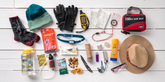
The Ten Essentials and Beyond
By Howard Shapiro
The Mountaineers Ten Essentials dates back to their climbing courses of the 1930s. This widely respected safety and packing system was formalized in the third edition of Mountaineering: The Freedom of the Hills, released in 1974. The list has always tried to answer two basic questions:
Can you prevent emergencies and respond positively should one occur?
Can you safely spend a night (or more) outside?
Certain equipment deserves space in every pack. One may not need every item on every trip, but essential equipment can be a lifesaver in an emergency. Exactly how much equipment “insurance” should be carried is a matter of healthy debate. Rather than get into that debate here let’s consider any essentials beyond the basic 10.
The Ten Essentials serves as a guide that should be tailored to the particulars of any outing. Weather, remoteness from help, and complexity should be factored into any selected essentials. The Mountaineers organization tells us the first seven essentials tend to be compact and vary little from trip to trip, and can be grouped together. they are:
1. Navigation: map, altimeter, compass, [GPS device], [PLB, satellite communicator, or satellite phone], [extra batteries or battery pack]
2. Headlamp: plus extra batteries
3. Sun protection: sunglasses, sun-protective clothes, and sunscreen
4. First aid: including foot care and insect repellent (if required)
5. Knife: plus repair kit
6. Fire: matches, lighter and tinder, or stove as appropriate
7. Shelter: carried at all times (can be a lightweight emergency bivy)
The first item on the list, navigation, has clearly evolved over the years. For PCT hikers paper maps have given way to navigation apps such as Guthooks. Cell phones have become the device of choice for many hikers. Included in a cell phone are numerous downloadable apps such as Guthooks, as well as a compass and flashlight. In addition a PLB or Personal Locater Beacon such as a ‘SPOT’ device is something many hikers have determined to be ‘essential’.
Of course the dependence on more electronics or just a phone requires power. The easiest way to keep things powered up is either with a solar charger or an external battery pack. This may sound like poison to people trying to go as light as possible since every little addition is a weight gain. The need for power is hard to work around.
With the advent of more electronics in the backcountry the desire for access to podcasts and music may require headphones or earbuds. For some purists these items are not ‘essential’.
The remaining items on the Mountaineers’ list are:
8. Extra Food, beyond the minimum expectation
9. Extra Water, beyond the minimum expectation or a means to purify
10. Extra clothes, enough to survive an emergency overnight
PCT hikers will likely have these last three ‘essentials’ covered in their basic equipment. However, there are those that are squeaking by and leave little allowance for an extra snack or meal portion. Water can be challenge in some parts of the trail so having adequate capacity is a not so hidden essential.
Purification is another essential that can easily be ignored or overlooked. In this regard even having a way to purify water may rely on number 5 on the list under ‘knife’. Having an ability to do a field repair on a purification device can prove to be a real game changer. Simple elements in order to make a repair such as a safety pin or duct tape can be unsung heroes in a crisis or emergency.
As far as extra clothes go, most hikers will have at least one layer to fall back on. Being in the desert/ mountains can be very unpredictable so only having one layer may not be enough. Again, this can be the source of much debate over how much and how little is really necessary. Erring on the side of safety seems to make a great deal of sense.
No matter what you think you may need using the Ten Essentials as a starting point can be a perfect touchstone. Certainly in today’s world your list may be a little longer than ten items. Deciding what additional items are necessary versus the ten core items that have proven themselves over and over again can be a great challenge.
Whether or not you take the 10 essentials the key seems to be in being able to answer those two key questions spoken of earlier in this post. Adding a few more ‘essentials’ is a personal preference. The most important essential is to go have a great time for however long you go and get back safely and soundly.
3 notes
·
View notes
Last Seen Blogs

justaguywhowrites
Just another writing blog

yaroslavayakovenko
I know that I know nothing

trijyacustommotorcycles
TRIJYA CUSTOM MOTORCYCLES

comiclysmic
Comiclysmic

xzinbdg
emi!!