#半島
Text
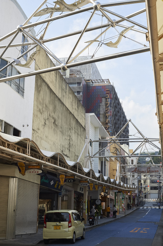
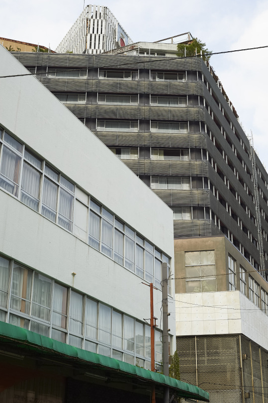


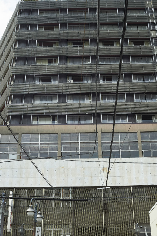
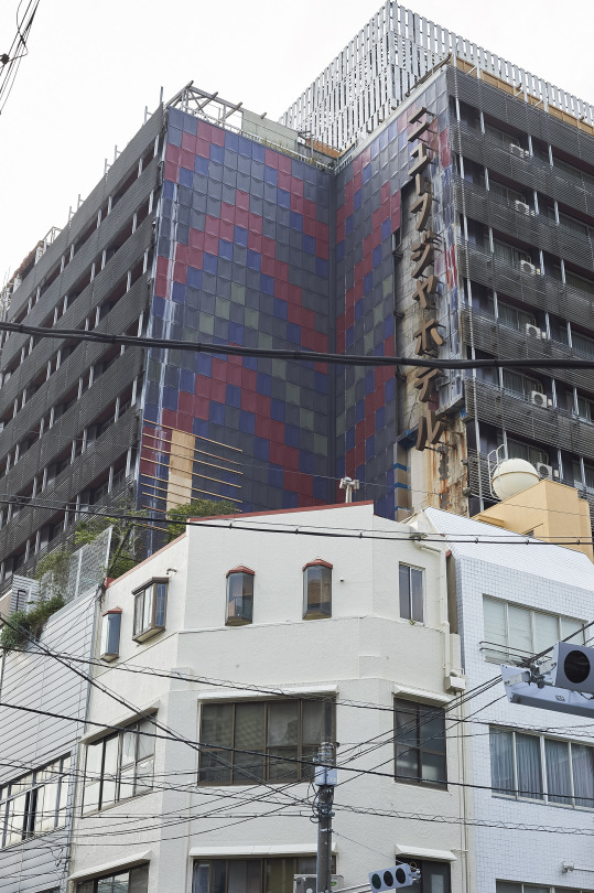
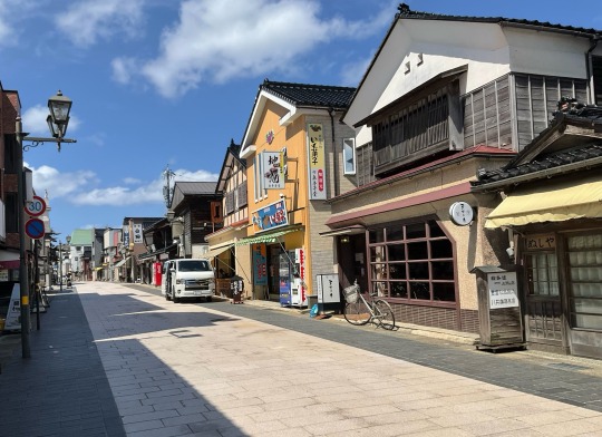
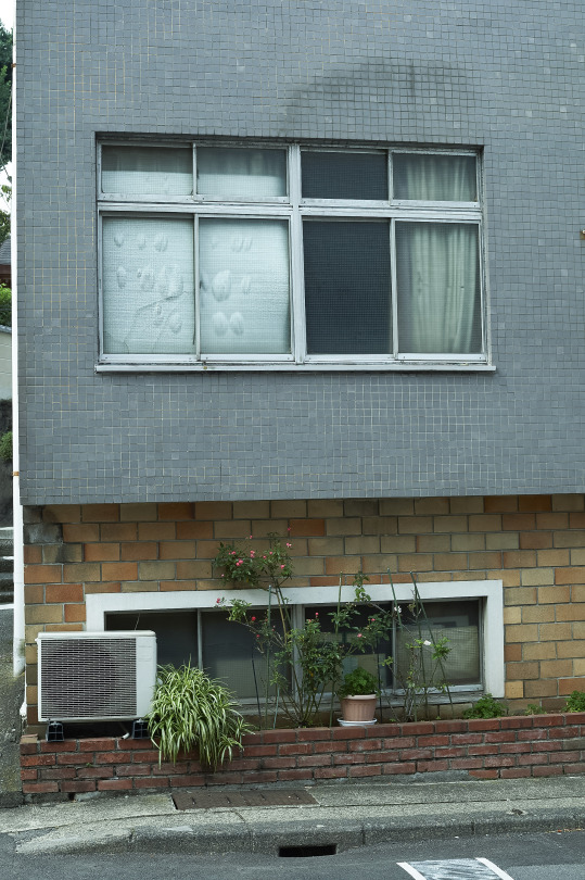
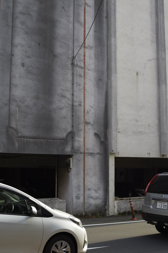
熱海 ATAMI
静岡県熱海市 Atami City, Shizuoka Prefecture
MASATOSHI SAKAMOTO : PHOTOGRAPHS
0 notes
Text
あとは、ケタミンへの、注意やろね。独立国家たる、台湾��台中で、刑事事件化しとる。車が転倒して、ブツが露見した。身から出たサビやろね。もちろん、コカもだめや!ヘロインもな!だめや!
0 notes
Text
《大韓民國與中華民國文化體之別〉元明微小說
大韓民國,國土面積9.96萬平方公里,人口總數達51,829,023人,他們傾全國之力形塑一個半島文化體。中華民國,國土面積3.61萬平方公里,人口總數達23,548,633人,我們傾半島之力分裂一國多元文化體。
創作主題:大韓民國與中華民國文化體之別創作者:元明創作時間:中華民國壹佰壹拾壹年玖月廿捌日
View On WordPress
0 notes
Text
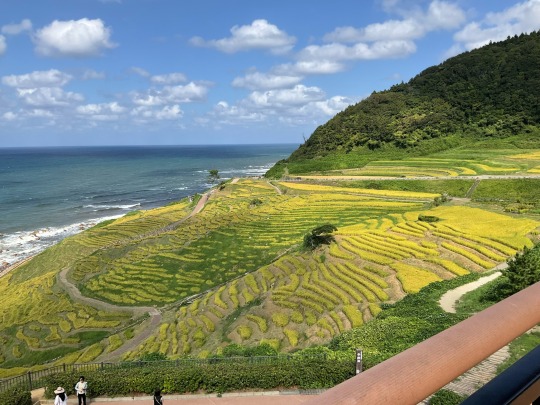
野付半島/北海道別海町【後編】トドワラ〜野付埼灯台
野付半島とは
野付半島(のつけはんとう)は、北海道野付郡別海町野付( ほっかいどうのつけぐんべつかいちょうのつけ)にある半島だ。
延長26kmにわたる日本最大の砂嘴(さし)で、ラムサール条約に登録されている。
知床半島と根室半島の中間に位置し、オホーツク海に腕を伸ばすようにして広がるのが野付半島。全長約26kmの日本最大の砂嘴(さし)です。 砂嘴とは、海流により運ばれた砂が、長年に渡って堆積して作られた地形のことです。海流の浸食によってできた複雑に入り組んだ海岸線も、野付半島が多様な生命を育んでいる要因のひとつです。
また、野付半島沖の海底は起伏が多く、潮流も早いことから、道内でも有数の漁場となっています。
野付半島 | 別海十景 | 景観スポット | 観光スポット | 観光・イベント | 北海道別海町…

View On WordPress
#センダイハギ#トイレ#トドマツ#トドワラ#トドワラ展望台#トドワラ広場#トラクターバス#ハマナス#フラワーロード#ラムサール条約#別海十景#別海町#北海道#半島#木道#桟橋#知床連山#遊歩道#道道950号線#野付#野付半島#野付半島ネイチャーセンター#野付埼灯台#野付郡#鹿
0 notes
Photo

豊後高田市都甲からグリーンモンスター(グリーンロード)粟島神社⛩へ自転車トレーニング🚴♀️ やっぱりこの季節は国東半島を走るのはいいなぁ🚲 #都甲 #グリーン #モンスター #ロード #グリーンモンスター #グリーンロード #粟 #島 #粟島 #神社 #粟島神社 #自転車 #トレーニング #やっぱり #この #季節 #国東 #半島 #国東半島 #走る #いいなぁ #真玉 #香々地 #自転車トレーニング #Bianchi #豊後高田市 https://www.instagram.com/p/CdICSoHu1Mq/?igshid=NGJjMDIxMWI=
#都甲#グリーン#モンスター#ロード#グリーンモンスター#グリーンロード#粟#島#粟島#神社#粟島神社#自転車#トレーニング#やっぱり#この#季節#国東#半島#国東半島#走る#いいなぁ#真玉#香々地#自転車トレーニング#bianchi#豊後高田市
0 notes
Photo
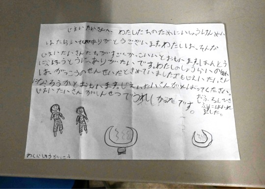
じえいたいさんへ、わたしたちのためにいっしょうけんめいはたらいてくれてありがとうございます。 わたしは、そんなじえいたいさんたちがすごくかっこいいとおもいます。ほんとうにほんとうにありがたいです。わたしのしょうらいのゆめは、がっこうのせんせいだときめていました。でもじえいたいさんになろうかとおもいます。じえいたいさんがんばってください。 じえいたいさんがしんせつでうれしかったです。 おふろにもぶじにはいれました。 令和6年能登半島地震 和倉小学校 自衛隊さんへ 私達のために一所懸命に働いてくれてありがとうございます。 私は、そんな自衛隊さん達が凄くかっこよいと思います。本当に本当にありがたいです。 私の将来の夢は学校の先生だと決めていました。でも自衛隊さんになろうかと思います。 自衛隊さん、頑張ってください。 自衛隊さんが親切で嬉しかったです。 お風呂にも無事、入れました。 令和6年(2023年)1月12日
331 notes
·
View notes
Text

コーヒー豆を買いに行くと店先の畑にいた猫ちゃん。ゆっくりおしゃべりして買い物を終え帰る時にもさっき見た同じ場所でくつろいでいました。日差しがポカポカしていて気持ちよさそう。のどかやなぁ。
49 notes
·
View notes
Video

flickr
パフェ by パメラ
Via Flickr:
Parfait
#food#パフェ#sweets#dessert#Kumano cafe#Kii Peninsula#Wakayama#NachiKatsuura#Japanese food#Japanese sweets#Japanese cafe#日本#和歌山県#那智勝浦町#熊野#紀伊半島#flickr
23 notes
·
View notes
Text


Last year I traveled to Noto Peninsula in Ishikawa Prefecture. It was a very nice place and the town was beautiful. It is hard to believe that it was lost in the earthquake, but I am sure that it will recover. Beautiful scenery, delicious fish, and tasty sake. I definitely want to visit this place again.
27 notes
·
View notes
Text


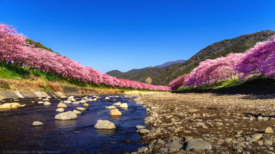
Chasing Early Bloom: Kawazu-Zakura Festival 2024
Location: Kawazu River, Kawazu, Shizuoka, Japan
Timestamps: 08:18, 08:20, and 08:40 on February 14, 2024
Pentax K-1 II + DFA 28-105mm F3.5-5.6 + CP
① 68 mm ISO 100 for 1/100 sec. at ƒ/10
② 28 mm ISO 100 for 1/160 sec. at ƒ/9.0
③ 31 mm ISO 100 for 1/200 sec. at ƒ/7.1
My first visit to the Kawazu-Zakura Cherry Blossom Festival was on March 2, 2022, two days after the festival had officially ended. This year, I timed my visit to the festival to coincide with a photo shoot at Imaihama Beach, which is just a 10-minute from the Kawazu River where the cherry trees are situated.
While the annual cherry blossom festival officially extends until February 29th, locals I spoke with anticipated tourists continuing to visit as late as the first week of March.
Here are three of my favorite shots along the Kawazu River:
① The first shot was taken on the eastern end of Kinomiya Bridge (来宮橋), crossing Kawazu River, about an 18-minute walk from Kawazu Station. Looking north, a glimpse of the vermilion-colored Hosen Bridge (豊泉橋) adds to the scenic view.
② The second shot was taken a few meters north of Kinomiya Bridge on the eastern riverbank. This spot provided ample foliage and shadows to almost hide the buildings and man-made structures behind the cherry trees, creating a nice contrast with the dark Kawazu-zakura pinks against the evergreen hills in the background.
③ The third shot was captured from the middle of the riverbed, right across from the tourist information booth on the northern riverbank, a 26-minute walk from Kawazu Station.
For those planning to visit the festival by train, I have included a link to Donny Kimball’s “Come to Kawazu | Enjoy Japan’s Cherry Blossoms in February” blog post, where he recommends the best way to reach the festival by train.
If, like me, you travel with a border collie, driving is the only option. From central Tokyo, it's a 2-hour 30-minute to 3-hour drive (depending on traffic). Kawazu Town is only 185 km southwest of central Tokyo, so even if you avoid the expressways, you can still reach this destination in less than 4 hours if you leave early enough in the morning.
For photographers attending this festival, try to schedule your visit on a weekday early in the morning. With very few crowds, it becomes easy to set up a tripod to bracket your shots, take long exposures of the river, or capture some panoramas.
If you have time, I'd recommend taking a leisurely drive home via Route 135, running the entire length of the eastern coastline of the Izu Peninsula. Roll down the windows, let the sea breeze enter the cabin, and be sure to stop at any of the numerous roadside rest stops that often offer spectacular views of the coastline.
I've gone into greater details on how to access the festival by car and have gathered with great info, downloadable PDF maps, and have Google Maps links to 3 of the larger parking lots. The write-up is less than a 3-minute read (https://www.pix4japan.com/blog/20240214-kawazu-zakura).
#風景写真#伊豆半島#河津町#河津桜#pix4japan#pentax_dfa28105#pentaxk1mkii#landscape photography#Japan#Shizuoka Prefecture#Kawazu Town#Kawazu cherry blossoms
22 notes
·
View notes
Text


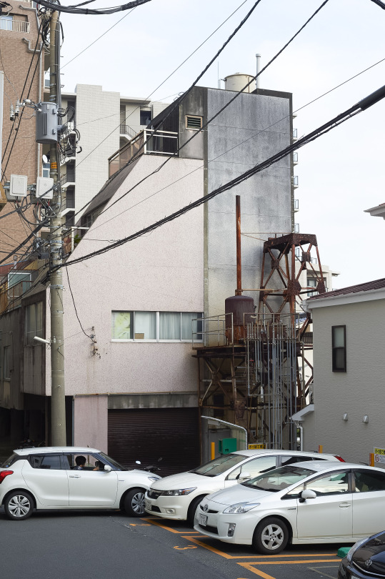


熱海 ATAMI
静岡県熱海市 Atami City, Shizuoka Prefecture
MASATOSHI SAKAMOTO : PHOTOGRAPHS
0 notes
Text

2009年に輪島市を訪れた時の写真を見つけた。綺麗な街並みだった。
その時は能登島にも来ていた。海が綺麗だった。
1人でも多くの人が救われることを祈ります。
23 notes
·
View notes
Text
youtube
Noto Peninsula Earthquake (January 1, 2024)
Current Situation in Wajima, Ishikawa Prefecture (January 7)
災害マップ
23 notes
·
View notes
Text
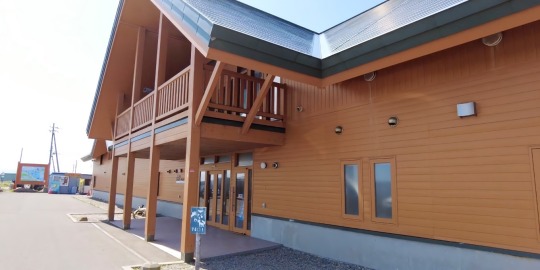
野付半島/北海道別海町【前編】ラムサール条約登録湿地のネイチャーセンターを見学
野付半島とは
野付半島(のつけはんとう)は、北海道野付郡別海町野付( ほっかいどうのつけぐんべつかいちょうのつけ)にある半島だ。
延長26kmにわたる日本最大の砂嘴(さし)で、ラムサール条約に登録されている。
知床半島と根室半島の中間に位置し、オホーツク海に腕を伸ばすようにして広がるのが野付半島。全長約26kmの日本最大の砂嘴(さし)です。 砂嘴とは、海流により運ばれた砂が、長年に渡って堆積して作られた地形のことです。海流の浸食によってできた複雑に入り組んだ海岸線も、野付半島が多様な生命を育んでいる要因のひとつです。
また、野付半島沖の海底は起伏が多く、潮流も早いことから、道内でも有数の漁場となっています。
野付半島 | 別海十景 | 景観スポット | 観光スポット | 観光・イベント | 北海道別海町…
View On WordPress
#エゾカンゾウ#トイレ#トドワラ#ナナワラ#ナラワラ展望スペース#ミズナラ#ラムサール条約#別海町#北海道#半島#国後島#国道244号線#砂嘴#立ち枯れ#第二しべつ展望パーキング#遊歩道が#道道950号線#野付#野付半島#野付半島ネイチャーセンター#野付郡#駐車場
0 notes
Last Seen Blogs

heroicsx
東京森1/2

thatssowwe
Untitled

vhaijan
Vhaijan

gently-decaying-flowers
always the artist and never the muse

mrsrdlw
Eddie’s Girl