#watersheds
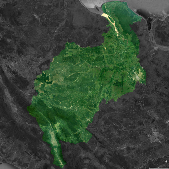
Photo
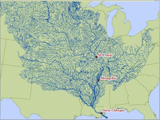
The Mississippi river and its tributaries.
13K notes
·
View notes
Text
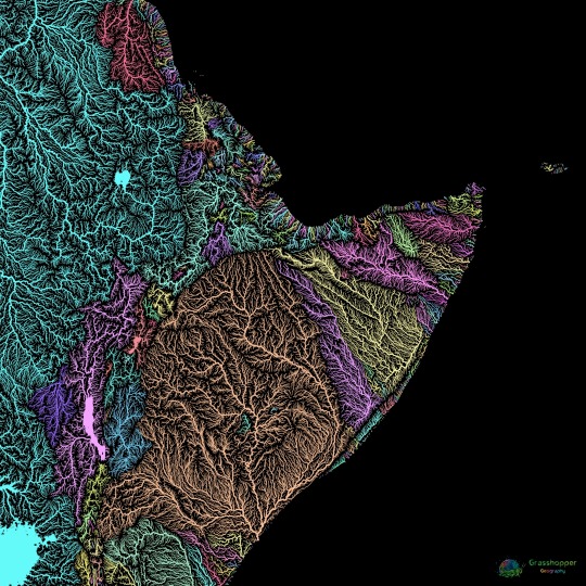
River basin map of the Horn of Africa. Colours represent different catchment areas.
Read more and buy prints here.
Ko-fi | RedBubble | Etsy (digital prints)
#horn of africa#africa#ethiopia#eritrea#somalia#djibouti#kenya#sudan#south sudan#uganda#rivers#river map#watersheds#watershed map#geography#mapping#map#maps#cartography#maps reimagined
443 notes
·
View notes
Text
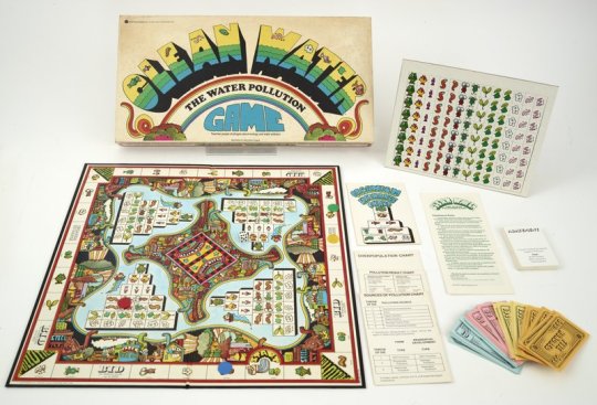


Clean Water: the Water Pollution Game!
According to the game's rulebook, to play the game "each player assumes the role of a water pollution control official who is responsible for stocking his lake. [They do] so by collecting appropriate organisms as he moves around the game board, confronting the problems of water pollution each time he lands on a 'pollution' triangle. Throughout the game, [they] must learn to anticipate possible pollution of his lake, attempt to avoid the problem of overpopulation, manage his finances efficiently, and consider the problem of possible pollution coming from upstream. A player wins the game by controlling water pollution successfully and thereby being the first to completely stock [their] lake."
Urban Systems, Inc., the game's publisher, was a consulting and research firm, whose president, Richard H. Rosen, was an ecologist and environmental engineer. While teaching undergraduate air pollution classes at Harvard, Rosen produced a number of anti-pollution board games for educational purposes.
Image citation: Science History Institute. Clean Water. Photograph, 2022. Science History Institute. Philadelphia.
#boardgame#board game#board game night#water#clean water#watersheds#environmental protection#pollution#water pollution#watershed protection#science history#digital collections#digitization#object photography#special collections#museum collections#othmeralia
96 notes
·
View notes
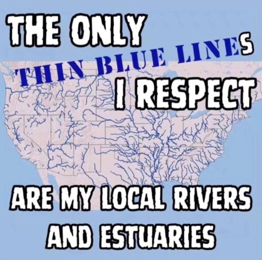
Text

A new map visualizes the flow of ever river in the United States. (Image credit: Robert Szucs, Fejetlenfej/Imgur)
The striking image also reveals that the vast majority of the Midwest and much of the Mountain West are threaded with streams, rivers and tributaries that fan out from the Missouri and the mighty Mississippi. The Missouri River is the longest river in North America, while the second-longest, the Mississippi holds the most water. The Mississippi meanders 2,350 miles (3,781 kilometers) from Lake Itasca in Minnesota before emptying into the Gulf of Mexico (The Missouri River is longer). At Lake Itasca, the river is less than 30 feet (9 m) wide, but it sprawls 11 miles (17 km) across near Lake Winnibigoshish in Minnesota, according to the National Park Service.
Tia Ghose at LiveScience. Every US River Visualized in One Glorious Map
Robert Szucs sells the map at the Etsy shop Grasshopper Geography.
4 notes
·
View notes
Text
SCOTUS basically just nerfed the EPA’s ability to regulate under the Clean Water Act. This is INFURIATING as a hydrologic engineer since it shows a fundamental lack of understanding of basic hydrology, hydraulics, and ecosystem dynamics in a changing climate.
Basically the definition of a wetland is now limited to areas connected to federally regulated waters by a “continuous surface connection”. The legal history of groundwater rights in the US is a whole different story, but this is such a narrow definition that shows a surface level (no pun intended) understanding of hydrology. People like to think of rivers and lakes as discrete units. But they’re not. They’re part of a larger interconnected watershed. Hence why federal regulations make sense in the context of wetlands. Not to mention that it’s just ridiculous to classify wetlands based on flowing surface water, when several key wetlands really aren’t related to any rivers.
This shows a greater trend about our unwillingness to adapt to climate change as well. Basically a couple built a house on an area that wasn’t a wetland, but was later classified as one, and regulatory agencies wanted them to return and restore the land. Obviously that’s shitty, and it’s probably a good thing that SCOTUS sided with them. But the legal precedent for reclassifying wetlands is insane.
We’re already seeing pushback from homeowners buying land in FEMA designated floodplains, and this certainly won’t help matters. The sad reality is that we will not be able to create a sustainable built environment in areas where we historically may have been able to. Like Florida coastlines, for example. Sticking our head in the sand and pretending that wetlands aren’t important, floodplains aren’t changing, and the climate is stationary is just a road to disaster in the long term that will have serious consequences.
When it’s legal to build in a floodplain or wetland, who do you think ends up in these high-risk areas? Often it’s the most underprivileged members of society who can’t afford to live elsewhere. This is just as much of a socioeconomic catastrophe as it is an environmental one.
The way we regulate water in the US is already insane, with agencies like the EPA, USACE, state governments, and interstate compacts causing a mess of tangled legislation. The complexities of our hydrologic cycle in a changing climate really can’t be left to individual stakeholders since we all live here and drink the same water that goes through the water cycle at the end of the day.
11 notes
·
View notes
Photo

Schneider’s Creek
I just learned that an Environmental Study will be conducted on this concrete creek to determine what sort of improvements can and should be made. The reason for this change is flood mitigation (to prevent flooding). The brochure discussed widening and naturalizing the banks of the creek, this is something I am 100% in favour of! This could become a really beautiful area when the naturalization project is approved and completed.
13 notes
·
View notes
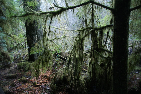
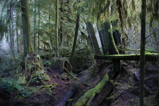
Text

Marsh
#just a marsh pic for today#nothing much#milynspics#photography#picture#artists on tumblr#outside#nature#lensblr#woods#watersheds
7 notes
·
View notes
Text
25K notes
·
View notes
Text
Practice taking photos on the bus. Totally worth it. Lol 😂
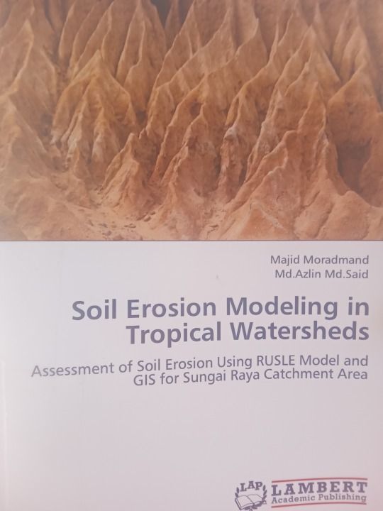


This research is quite useful in my remote sensing study.(But I don't have RUSLE model.....er...nevermind.)
#My camera#books#soil erosion modeling in tropical watersheds#Malaysia#Camera#Tropical#watersheds#remote sensing#Topographic map
0 notes
Text
Resilient rivers: counting fish from forests

Recognising that forests and freshwater ecosystems are inextricably linked within watersheds, the Fisheries and Aquaculture Division (NFI) and Forestry Divisions of the Food and Agriculture Organization of the United Nations (FAO) are jointly implementing a series of activities under the umbrella “Resilient Rivers: Counting Fish from Forests”. Under this initiative, innovative technologies…
youtube
View On WordPress
#Build capacity for integrated forest and fisheries management across watersheds#Drone footage#e-learning#Fisheries and Aquaculture Division (NFI)#Fresh water ecosystems#Innovative technologies#satellite imagery#surveys and water temperature#watersheds#World Rivers Day 2023#INFOFISH
0 notes
Photo

(via DAS Rokan)
0 notes
Photo
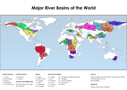
The 26 major river basins of the world
4K notes
·
View notes
Text
How to River
This is a video for all of you who tagged my ocean drainage basin maps with #worldbuilding or #reference. It explains and walks you through most things you need to know about creating river basins and placing rivers on your (fantasy) map. It' also a great educational video on its own.
youtube
The video is made by @Artifexian, and uses one of my maps as a reference as well.
#worldbuilding#fantasy worldbuilding#mapmaking#cartography#reference#how to river#rivers#watersheds#mapmaking reference#Youtube
29 notes
·
View notes
Quote
The enthusiasm of farmers who are learning to manage prairie on their land spurs her on. 'This diverse, native, perennial polyculture of prairie is the antithesis of the exotic, highly engineered, annual monocultures they’re used to,' she says. 'It’s fun to watch them engage with the ecology of their farms as they learn about the history of prairie, the species in the seed mixes, what happens in soil under prairie strips, and the insects, birds, and butterflies they attract.'
Lisa Schulte Moore quoted in an article by George Spencer in Grow. The Genius of Prairie Strips
Lisa Schulte Moore and her team of researchers are advancing the use of native plant rows in agriculture to promote conservation, and the world is taking notice.
Science-Based Trials of Rowcrops Integrated with Prairie Strips
14 notes
·
View notes
Link
The Ontario government gave municipalities and conservation authorities just three days notice before imposing sweeping changes that stripped away key environmental oversight powers and budgets, reveal leaked letters obtained by The Narwhal.
#Ontario#Municipalities#Environmental Conservation#Environmental Protection#Land Development#Watersheds#Species at Risk
0 notes
Text

Watershed in mid-winter can be such a chaotic mess. I love it.
1K notes
·
View notes
Last Seen Blogs

kingkold29
Untitled

pan-magi
A Sleepy Blog for All Things Magi*

firstpointmortgagebrokers
Untitled

robertleeunderwood-blog
Here and There Again

vampiredaries
be a vampire-be like delena