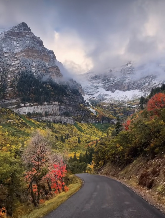
#scenic vista
Text

The beauty of this mountain is unparalleled! 🌟🌅
#Akchour#Morning#Park#Morocco#mountains#sunlights#rocks#landscape#mountaineers#mountaineering#tranquility#calm#trees#plants#Akchour Park#Northern Morocco#Landscape Photography#Natural Beauty#Mountain Scenery#Morning Light#Nature's Majesty#Rock Formation#Scenic Vista#Outdoor Adventure#travel#beauty#sky#green#nature#blue sky
2 notes
·
View notes
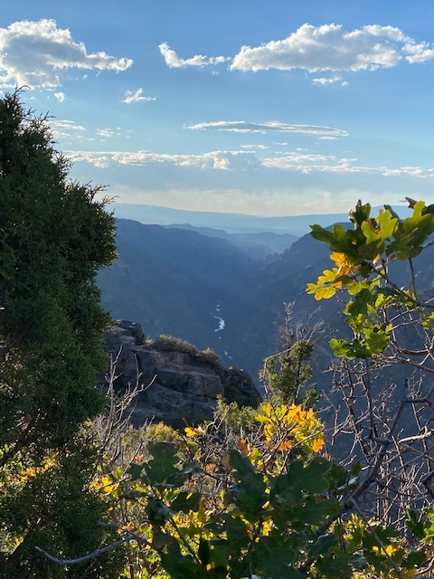
Text

Black Canyon of the Gunnison National Park, Colorado, USA
My Photo - September, 2022
38 notes
·
View notes
Photo
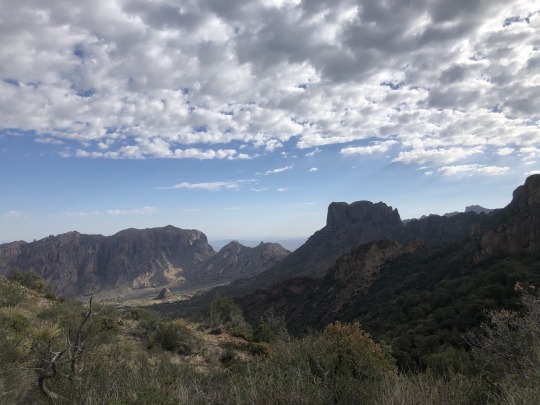
Caught a breathtaking view at Big Bend National Park – the rugged mountains stand proudly under a vast sky speckled with clouds. The dance of light and shadows across the landscape is a true masterpiece of nature, isn't it?
#Big Bend National Park#nature photography#rugged mountains#vast skies#cloudscape#light and shadows#nature's masterpiece#outdoor adventure#Texas nature#breathtaking views#landscape photography#national parks#scenic vista#travel#wilderness exploration
1 note
·
View note
Text
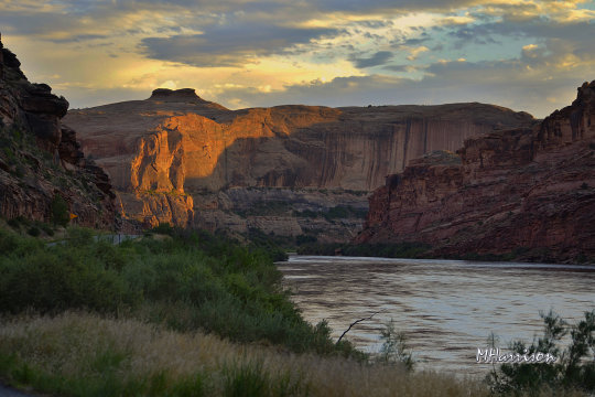
The Colorado river near Moab, Utah
#Utah#moab utah#colorado river#color photography#nikon#travel photography#photographers on tumblr#landscape photography#scenic views#scenic vistas#rivers and lakes#nature#mountains#peaceful#sunlight#usa
555 notes
·
View notes
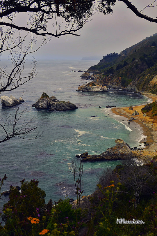
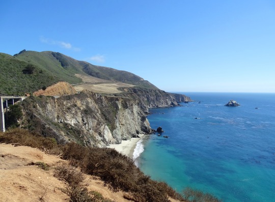
Text


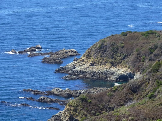


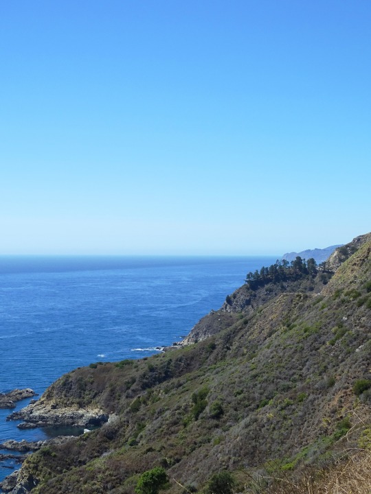

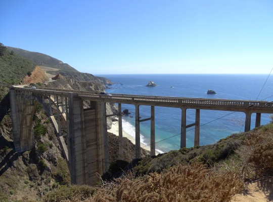
Julia Pfeiffer Burns State Park Vista Point, CA (No. 2)
The drive along Highway 1 has been described as "one of the best drives on Earth", and is considered one of the top 10 motorcycle rides in the United States. Highway 1 was named the most popular drive in California in 2014 by the American Automobile Association. Condé Nast Traveler named State Route 1 through Big Sur one of the top 10 world-famous streets, comparable to Broadway in New York City and the Champs-Élysées in Paris. Most of the nearly 7 million tourists who currently visit Big Sur each year never leave Highway 1, because the adjacent Santa Lucia Range is one of the largest roadless coastal areas in the entire United States; Highway 1 and the Nacimiento-Fergusson Road offer the only paved access into and out of the region. In January 2021, the Nacimiento-Fergusson Road was washed out due to the impacts of the Dolan Fire and closed, cutting off the only alternative route out of the area. It is not expected to reopen until December 2023.
The beauty of the scenery along the narrow, two-lane road attracts enormous crowds during summer vacation periods and holiday weekends, and traffic is frequently slow. Visitors have reported to the California Highway Patrol hours-long stop-and-go traffic from Rocky Creek Bridge to Rio Road in Carmel during the Memorial Day weekend. The highway winds along the western flank of the mountains mostly within sight of the Pacific Ocean, varying from near sea level up to a 1,000-foot (300 m) sheer drop to the water. Most of the highway is extremely narrow, with tight curves, steep shoulders and blind turns. The route offers few or no passing lanes and, along some stretches, very few pullouts. The sides are occasionally so steep that the shoulders are virtually non-existent.
Source: Wikipedia
#Julia Pfeiffer Burns State Park Vista Point#Monterey County#California State Route 1#Highway 1#Pacific Coast Highway#National Scenic Byway#Big Sur#Pacific Ocean#travel#original photography#vacation#tourist attraction#landmark#landscape#seascape#countryside#street scene#road trip#summer 2022#California#West Coast#Big Sur Coast Highway#nature#flora#grass#tree#USA#blue sky#blue sea#beach
11 notes
·
View notes
Text

14 notes
·
View notes
Photo

Black Dragon Canyon by byron bauer https://flic.kr/p/2o6Pjum
18 notes
·
View notes
Text
2 notes
·
View notes
Photo


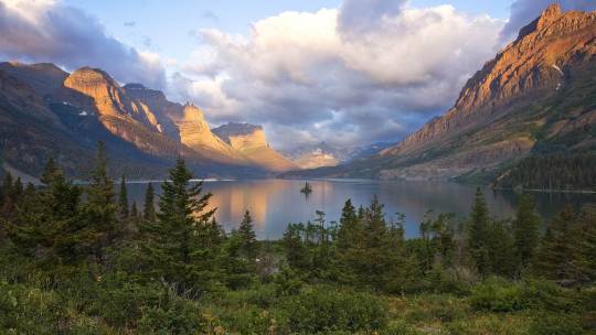
saint mary lake in glacier national park, montana by paul e. martin
#paul e martin#saint mary lake#glacier national park#montana#photography#elements#flora#nature#vista#scenic#landscape#detail
3 notes
·
View notes
Text

Boat cutting thru the scene on a drive home in the Adirondacks.
#newyork#adirondacks#lake#mountains#trip#travel#mylife#photooftheday#photo#photography#travelphotography#explore#scenic#vista#color#picoftheday#wanderlust#love#life#amazing#happy#nature#travelgram#instalike#followforfollow#instadaily#instagram#follow#instagood
7 notes
·
View notes
Text
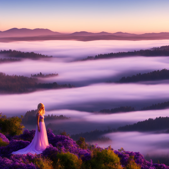
Sunrise in the mountain
#nature#outdoors#hiking#adventure#landscape#mountains#sunrise#wildflowers#purple#beauty#girl#standing#scenic#breathtaking#vista#horizon#sky#clouds#sun#rays#sunshine#peaceful#serene#tranquil#meditation#mindfulness#reflection#gratitude#appreciation#awe
2 notes
·
View notes
Text

Mountain trees 🏞️💙
#Akchour#Morning#Park#Morocco#mountains#sunlights#rocks#landscape#mountaineers#mountaineering#tranquility#calm#trees#plants#Akchour Park#Northern Morocco#Landscape Photography#Natural Beauty#Mountain Scenery#Morning Light#Nature's Majesty#Rock Formation#Scenic Vista#Outdoor Adventure#travel#sky#green#nature#beauty#blue sky
4 notes
·
View notes
Text
Sunset View Overlook at Black Canyon of the Gunnison National Park, Colorado, USA
My Photo ~ September 19, 2022
#black canyon of the gunnison#light#shadows#leaves#fall foliage#oak#autumn#juniper#canyons#gunnison river#view#vista#scenic overlook
62 notes
·
View notes
Photo
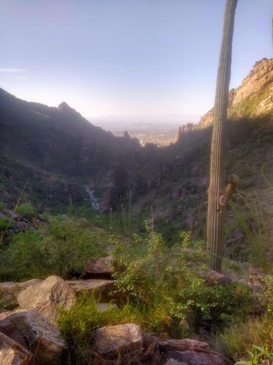
Bask in the golden hour glow of Ventana Canyon, Tucson. Saguaro sentinels stand tall amid rugged cliffs, while the city whispers below. A serene invitation to wander and wonder. 🌵✨
#golden hour#Ventana Canyon#Tucson#Saguaro cactus#rugged cliffs#desert landscape#nature photography#city views#wanderlust#serenity#explore Arizona#scenic vistas#Southwest beauty#desert magic#tranquil moments
4 notes
·
View notes
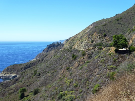
Text
Big Sur California
#california#color photography#nikon#travel photography#photographers on tumblr#landscape photography#scenic views#scenic vistas#pacific coast#nature#big sur
410 notes
·
View notes
Text
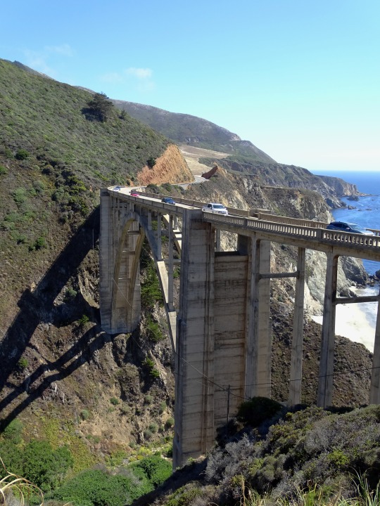


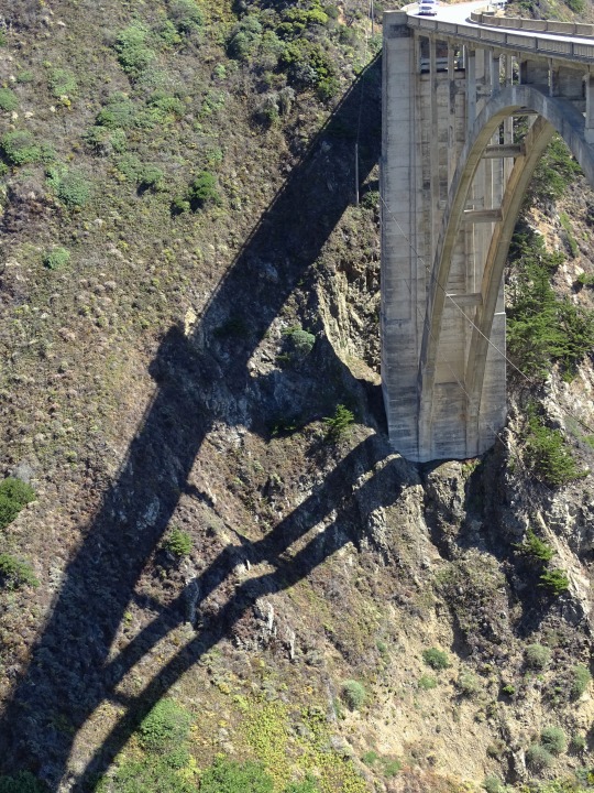

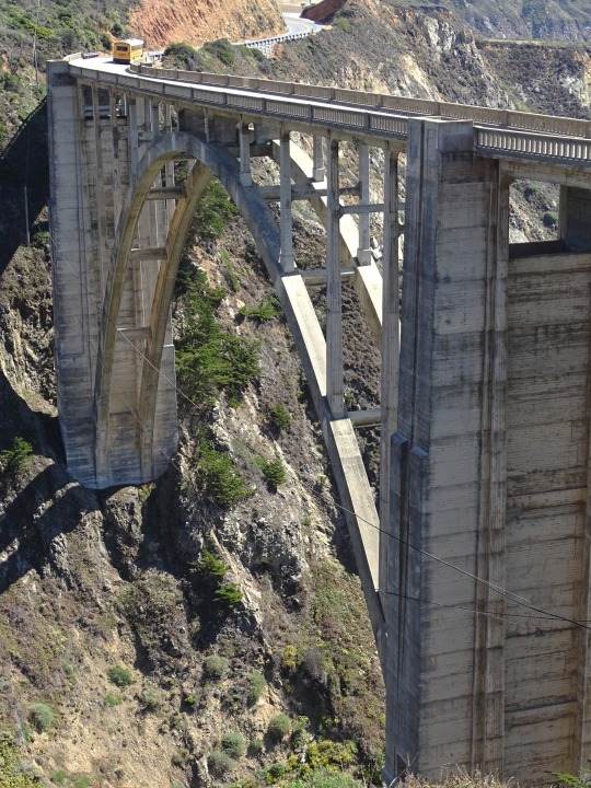
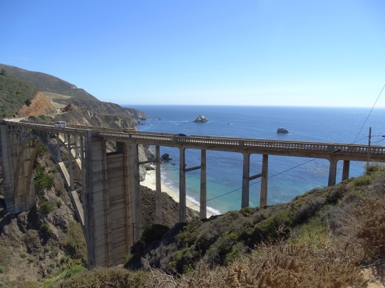
Bixby Bridge, CA (No. 3)
Over 300,000 board feet (700 m3) of Douglas fir timber, used to build a 250-foot (76 m) high falsework to support the arch during construction, was transported from the railroad terminal in Monterey over the narrow, one-way road to the bridge site. The falsework, built by crews led by E. C. Panton, the general superintendent, and I. O. Jahlstrom, resident engineer of Ward Engineering Co., was difficult to raise, because it was constantly exposed to high winds. Some of the falsework timbers were 10 by 10 inches (250 mm × 250 mm).[18] It took two months to construct the falsework alone. When high waves threatened the falsework foundation, construction was halted for a short time until winter storms abated.
The crews excavated 4,700 cubic yards (3,600 m3) of earth and rock. Eight hundred and twenty-five trucks brought in 600,000 pounds of reinforcing steel. Sand and gravel were supplied from a plant in Big Sur.
Construction required 45,000 sacks or 6,600 cubic yards (5,000 m3) of cement which was transported from Davenport, near Santa Cruz, and from San Andreas. Crews began placing concrete on November 27. The concrete was transported across the canyon on platforms using slings suspended from a cable 300 feet (91 m) above the creek.
The bridge was completed on October 15, 1932, although the highway was not finished for another five years. At its completion, the bridge cost $199,861 and, at 360 feet (110 m), was the longest concrete arch span on the California State Highway System. The bridge was necessary to complete the two-lane road which opened in 1937 after 18 years of construction. The completion of construction was celebrated with a ribbon-cutting ceremony led by Dr. John L.D. Roberts, who had conceived of the need for the road.
Source: Wikipedia
#Bixby Creek Bridge#Bixby Bridge Vista Point#Bixby Bridge#Monterey County#California State Route 1#Highway 1#Pacific Coast Highway#National Scenic Byway#Big Sur#Pacific Ocean#travel#original photography#vacation#tourist attraction#landmark#landscape#seascape#countryside#street scene#road trip#summer 2022#California#West Coast#Big Sur Coast Highway#nature#flora#grass#USA#blue sky#cliff
3 notes
·
View notes
Last Seen Blogs

cesareclair-blog
César Éclair Oficial

beleemcano
belemcano13

pls-explodingstars-pls
✿:* exploding stars *:✿

glushchenkonatali
Glushchenko Natali Photographer

funhaversclub
the Fun Havers Club