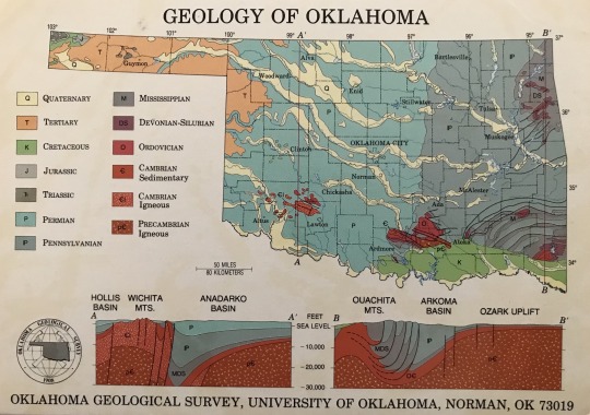
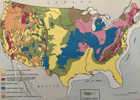
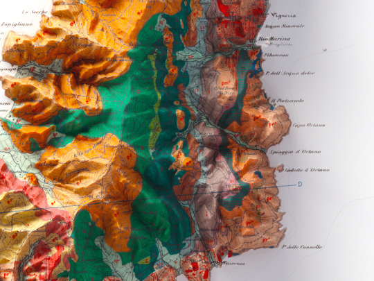
#geologic maps

Photo
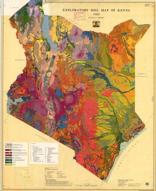
Geological map of Kenya, 1980.
357 notes
·
View notes
Text
i love how hgsn has just become Yoshiki’s independent research project with the occasional ghost roadblock
#Our next enemy will be Yoshiki’s pencil breaking while he’s in the middle of a sentence!#hikaru ga shinda natsu#the summer hikaru died#hgsn#my hgsn shit#I’ll need about 5 maps of varying styles (political; topographical; geologic; physical; and maybe a resource map)#And 7 more flow charts and a comprehensive time line before I truly understand what’s going on#How many mountains are there again
22 notes
·
View notes
Text


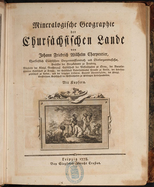

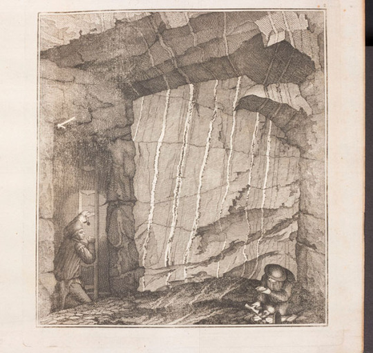
Johann von Charpentier – Scientist of the Day
Johann Friedrich Wilhelm von Charpentier, a German geologist and mining engineer, died July 27, 1805, at the age of 67; he was born in Dresden in 1738.
read more...
#Johann von Charpentier#geology#geological maps#vulcanism#histsci#histSTM#18th century#history of science#Ashworth#Scientist of the Day
21 notes
·
View notes
Photo

Eastern Indonesia Bouguer gravity classification
#geophysics#physics#Bouguer anomaly#geodesy#science#gravity#Earth#nature#Indonesia#geological map#maps
64 notes
·
View notes
Text
the hazard of being a night owl during nano is that Calendar Days and Writing Days aren't actually perfect equivalents, so i end up with asinine timekeeping like "november 18, technically," and "november 18, actually," scribbled in my margins to keep track of nighttime vs daytime writing
#text#personal#writing#wf#nano2023#nano#this is Very Necessary To Me Actually#ive been reading through old stuff intermittently and keep getting pissed at past!Me for not dating any of this shit 🤣#im like combing through geological records over here trying to carbon date shit#(like the beginning of this notebook is from when cramer was a woman and siku Existed and i CAN map that to a draft of avian initiative--#--but gotdamn i dont wanna have to lmao)#so im trying to get better about scribbling a date if not a date and time for my writing sessions when relevant#so future me doesn't lose their fucking mind about it#but i like my words to be counted in the calendar days#but cards can be accomplished in Writing Days#anyway its 1AM and im just now crawling into bed about it but i had fun!!#love unhinged dreams!!!!#does it count as animal death if 1. its in a dream and 2. its in a kitchen in a dream#or is that just Dream Cooking at this stage#(its fuzzy because theyre not uh. theyre not food animals.)#i dont kill real animals in stories but apparently i do what i want in dreams
8 notes
·
View notes
Text
stained glass window that's a geologic map
6 notes
·
View notes
Text
Book 44: The Map That Changed the World
RNG put me in the 500s, and I kinda forgot to go deeper so I ended up with general science books. There were a ton of all time greats, but I ended up with Simon Winchester's The Map That Changed the World.
This book was about William Smith (1769-1839) a groundbreaking geologist who started out as a surveyor/coal mine manager/canal builder/land drainer. He made the first large-scale geological map in existence. Even after listening to the book twice I'm not entirely sure what the rock he mapped out was, I mean, there are lots of layers of rocks under places, right? I guess it was the type of rock just under the surface of the ground? Anyway, it is considered by many to have birthed the science of geology and kickstarted investigations into the age of the Earth, etc.
William Smith himself had a hard life, his blacksmith father died when he was a child and his mother abandoned him to his cheapskate uncle who Smith had to borrow against his inheritance to get basic reference materials that would further his career as a surveyor. Eventually he ended up in debtors prison after some speculation went wrong and spending on making his extensive geological map. He was prevented from joining the prominent Geological Society by a rival who also made a rival map that stole from Smith's and cut into his sales which landed him in the debtor's prison (Wikipedia disputes this as the rival map came out after Smith landed in jail, but this book shows how anticipation of the rival map cut into his sales, not just when the map finally came out.) Smith's map was championed by our old friend Joseph Banks of the ever-present-in-these-books Royal Society.
Should you read this book: Sure, it's interesting and has lots of good facts about the life of William Smith and life and science in the 1700s-1800s. The author is a bit British, throwing around names like Boswell as if we all know him offhand here in America (I know him, just not offhand).
ART PROJECT: It was kind of impossible to not do the map, and I thought I'd laser burn it then hand color it, but it turns out I don't have the patience to hand color it like William Smith did. So here it is laser burned anyway.

#william smith#joseph banks#royal society#geology#geological map#52books#52booksproject#dewey decimal system#rng
9 notes
·
View notes
Text

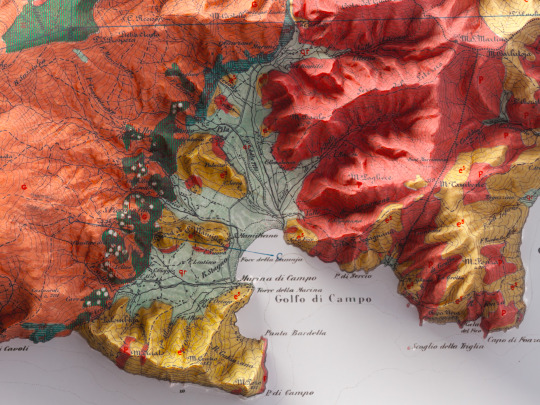
This was one of our first maps and we had to heavily restore it in order to make it.
Now it looks like a modern geological map, instead it is from 1880 and we think it deserves to be published!🙃
Original map info:
Carta geologica dell'Isola d'Elba, B. Lotti, P. Fossen, E. Mattirolo, G. Meneghini, 1885.
If you like our work, want to see our daily updates (or want to say hello to our studio), consider to follow our Instagram or Twitter account. Otherwise if are interested in our prints or have a custom request check our shop.
#maps#googlemaps#vintage#vintagemaps#vintagemapsforsale#elba#isoladelba#isoladelbamylove#tuscanygram#tuscanyitaly#tuscanyexperience#tuscanylovers#tuscanypeople#geological#geologicalsurvey#geologicalmapping#italygram#italytrip#italytravel#discoveritaly#discoveritalytravel#cartography#cartographyproject#cartographyart#shadedreliefmap#3dmapping#3dmaps
11 notes
·
View notes
Text
Not me learning about tectonic plates because I wanted to play a solo RPG.
#i'm over-doing it with the setting#i don't need a fully realized world#I barely need a fully realized settlement in order to start#but if I'm already tearing a little eladrin boy from his home plane I may as well give a geologically-realistic plane to grow up in#at least a continent#*sigh*#it's fun at least#map making and such#map making#dnd#ttrpg#adhd
1 note
·
View note
Video
44 Tidal Channels—Skagit River Delta 4:3 ratio, 7200x5400 pixels, no text by Washington DNR
Via Flickr:
Tidal channels in the expansive Skagit River Delta in Skagit County. Image by Daniel E. Coe, Washington Geological Survey Other versions of this image: High-resolution 16:9 ratio image with text High-resolution 16:9 ratio image without text High-resolution 4:3 ratio image with text Learn and see more: WGS Lidar page The Bare Earth lidar story map Washington Lidar Portal You may use this image for any purpose, commercial or non-commercial, with or without modification, as long as you attribute us. For attribution please use ‘Image from the Washington Geological Survey (Washington State DNR)’ if it’s a direct reproduction, or ‘Image modified from the Washington Geological Survey (Washington State DNR)’ if there has been some modification. For more information, see the linked Creative Commons Attribution-ShareAlike license.
#lidar#washington geology#washington geological survey#washington dnr#geology#geomorphology#pacific northwest#pacific northwest geology#wa100#lidar art#cartography#maps#map#high resolution#hi-res#flickr#nature
16 notes
·
View notes
Photo

Geologic Relief Map State Of Colorado 1979
by odisdca
168 notes
·
View notes
Text
Thinking of a mob boss Kitsune women in her 80,000’s-
#mun says things#old woman that completely flattened an island with her weight after their food festival and forced numerous geological maps to be redrawn
2 notes
·
View notes
Text
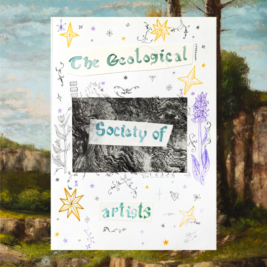
the geological society of artists
2 notes
·
View notes
Text
havent rimposted on here in a while. here's the base of my current save
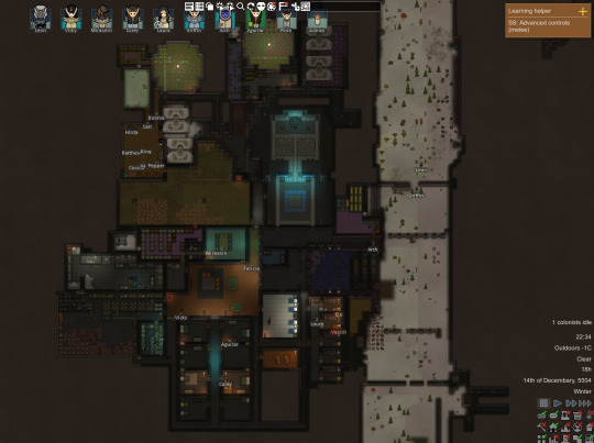
i have ideology+biotech dlcs and im playing as a custom* race of cave dwellers whose ideology resolves around being cave dwellers. lights bad dark good eclipse is perfect their diet is entirely cave grown fungus with occasional meat from a raider** and everyone who isnt a raxdactyl and/or a caveist is fucking miserable here
#my post#*by custom i mean i made all starting pawns to have the same xenotype and saved it. not sure if thats a mod thing or not tho. oops#but sometimes i encounter other raxdactyls in the wild#**the irony is that i had a hen and a rooster but they didnt make it thru winter of the first year and now i cant find any roosters#so no easy meat for now#also acquired that highmate (the purple one) from a crashed pod event captured him converted to caveism recruited him#and paired him up with the other pawn whos also incapable of violence. they are already married and have a baby#you may ask how did i get steam geysers inside a cave that i fully dug out? and the answer is cheatingofc<-the dev tools are in the top of#for those who arent familiar with rimworld: nutrifungus grows in complete darkness and is usually hated by all ideologies#and highmates are biologically engineered perfect lovers who are always incapable of violence and will have a special bond with their partn#they are so rare tho! i dont think ive ever seen one in my other save thats like 30+ in game years#rimposting#oh also its cropped bc the rest of the map is just undug mountain. thanks to geological formations mod i have a perfect set up for this sav
2 notes
·
View notes
Text
Like you may already know, some great Bloodborne maps have been made. They're really cool but I do wonder what's the orientation in them (north, sud, west, east) because I think I need it for a few things.
I can't play the game to go check but I do remember where the moon was in some areas and where it moves (in central Yharnam). I obtain the following . But I'm sure if I'm accurate or not. What do you think ?

#bloodborne#bloodborne map#bloodborne lore#the white circles represent the moon yeah#why did you put moon skybox who might not have too much sense T_T#fromsoftware please I just wanna know where the north is please !#oh and give me a geological map too !
10 notes
·
View notes
Last Seen Blogs

wenbeez
Wenbeez Draws

cyberfreaky
VIXEN

evoones
suka tetek besar

cheetahf
Still Crying Over C!tommy (cheeto)

osgtransbordar
Sem título