#lecartographe
Photo

Map of the Extraordinary Voyages of Jules Verne
Source : L’Atlas global, Sylvain Venayre, sous la direction de C. Grataloup et G. Fumey, Éd. Les Arenes 2014.
by @lecartographe
127 notes
·
View notes
Photo
❤️ L O N D O N ❤️ • 🇫🇷 J-1 avant de retrouver Londres, cette ville magnifique où nous avons vécu deux ans ✈️ D’ailleurs, je suis autant fan de ma carte signée @lecartographepointcom sur laquelle j’ai ajouté deux petits repères sur nos deux anciennes adresses 📌 Si vous avez envie de suivre nos aventures, je partagerais probablement quelques stories/photos de notre séjour par ici 😊Bonne semaine 😘 • 🇬🇧 D-1 before returning to London, this magnificent city where we lived for two years ✈️ On that note, I am still a big fan of my map from @lecartographepointcom on which I added two small markers on our two former addresses 📌 If you want to follow our adventures, I will probably share some stories/pics of our stay here 😊 Have a great week 😘 • #homesweethome #teamconstruction #interior4all #decorationinterieur #deco #homedesign #decorar #decoracão #decoracioninteriores #decor #homedecor #decorationscandinave #plantaddict #plantsofinstagram #fortheloveofplants #plantgang #urbanjungle #london #londonbound #lecartographe #citymap #londonmap https://www.instagram.com/p/B2uKZnICFIb/?igshid=1lpdd9z17oqjw
#homesweethome#teamconstruction#interior4all#decorationinterieur#deco#homedesign#decorar#decoracão#decoracioninteriores#decor#homedecor#decorationscandinave#plantaddict#plantsofinstagram#fortheloveofplants#plantgang#urbanjungle#london#londonbound#lecartographe#citymap#londonmap
1 note
·
View note
Text
@geoinquiets: RT @lecartographe: Petit #QuizzGéo ! Saurez-vous reconnaitre ces villes ? https://t.co/RL1MjN5DG5
from http://twitter.com/geoinquiets
via IFTTT
0 notes
Photo

Small guide from a manual from 1964 on how to draw France.
via @lecartographe
490 notes
·
View notes
Photo
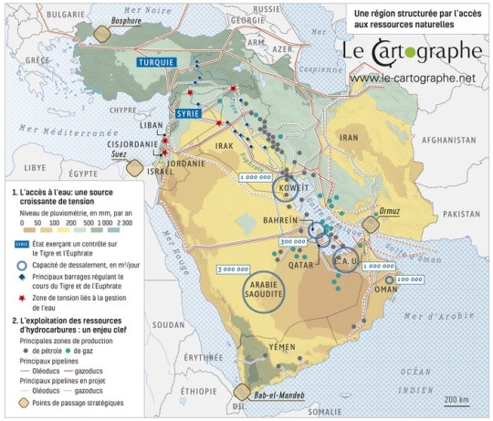
The Middle East, a region structured by access to natural resources.
Source: Atlas de l'École de Guerre "Une géopolitique du monde", 2022.
by lecartographe
53 notes
·
View notes
Photo

The boundaries of the European Union.
by lecartographe
53 notes
·
View notes
Photo

Map of the peoples of Gaul at the time of Caesar.
by @lecartographe
109 notes
·
View notes
Photo

Cities and trans-Saharan trade routes at the end of the 15th century
by @lecartographe
167 notes
·
View notes
Photo
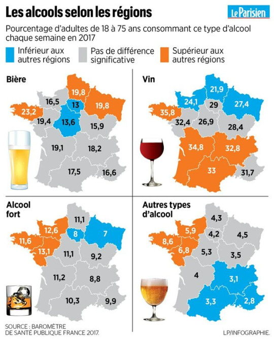
Alcohol consumption by region in France, 2017.
Source: Le Parisien 2017
172 notes
·
View notes
Photo

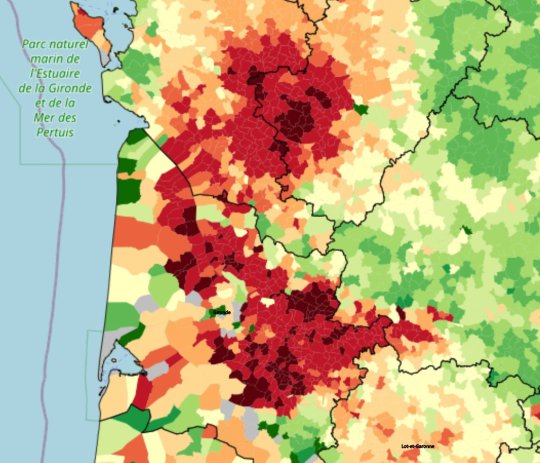
Pesticide use in France
Phytosanitary treatment frequency index for agricultural land.
via @lecartographe
68 notes
·
View notes
Photo
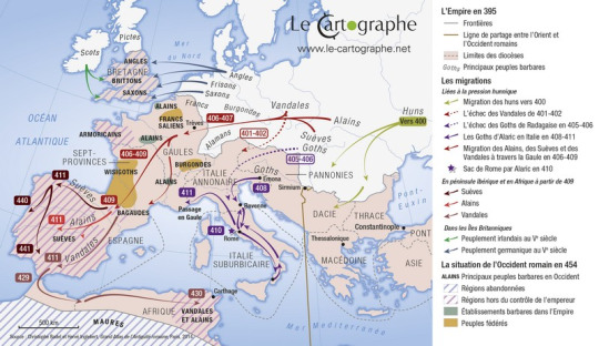
Barbarian migrations and invasions in the first half of the 5th century.
by @lecartographe
110 notes
·
View notes
Photo

Population density in Corsica.
by @lecartographe
61 notes
·
View notes
Photo

France at the time of stagecoaches, electric trains, aviation. Handbook of Geography of 3e under the direction of V. Prévot, J. Boichard and À.-M. Whistle at Belin Editions - 1972.
via @lecartographe
125 notes
·
View notes
Photo
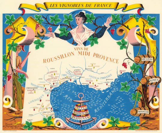

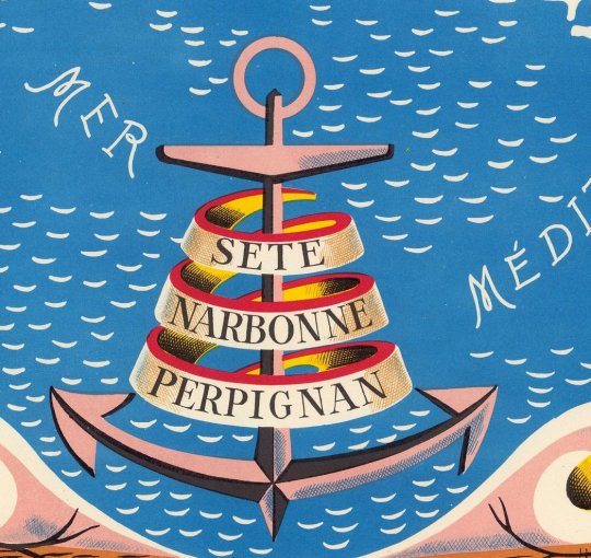

France used to have a so-called National Propaganda Committee in Favor of Wine. Created on July 4, 1931 and dependent on the Ministry of Agriculture, it made pretty cards such as this one: Vins de Roussillon Midi Provence
by @lecartographe
113 notes
·
View notes
Photo

The French colonies in the Caribbean archipelago in the 18th century.
by @lecartographe
90 notes
·
View notes
Photo
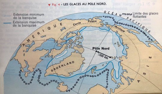
Ice at the North Pole. 6th grade geography manual under the direction of L. Pernet, Éditions Hachette - 1961
via @lecartographe
84 notes
·
View notes
Last Seen Blogs