
Last Seen Blogs

everlarkism
stay with me.


honeybeanboo
honeybean

mydogjelly
Super Normal About It

sirpainbagel
chaos brain
Photo

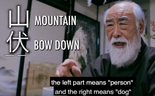
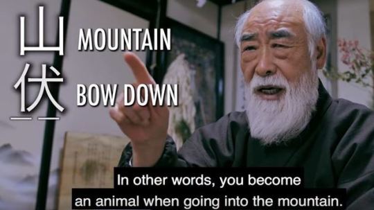
「因果は絶えず、大日は常在なり。心に受けたる早晩より時を生ず。大日に取りては現在あるのみ。過去、未来一切なし。人間の見様と大きく反す。空間また然り。故に今日の科学、因果は分かるが(もしくは分かるべき見込みはあるが)縁が分からぬ。この縁を研究するがわれわれの任なり。しかして、縁は因果と因果の錯雑して生ずるものなれば、諸因果結体の一層上の因果を求むるがわれわれの任なり。」
http://notebookers.jp/?m=201801
2 notes
·
View notes


Photo

-Apamar. Charts, metrics and politics of space, Centre d’Arts Contemporàbies, Barcelona, 2010-2011. “The projects intersect through proposing alternatives to the representation of space, its interpretation and how to live in it,” and “In this sense, Beirut: Mapping Security by Mona Fawaz, Ahmad Gharbieh and Mona Harb, depicts the numerous types of security measures that have been established in municipal Beirut as a result of the armed conflicts the country has witnessed since the 70s. Sara Nelson Wright’s visual mapping of six individuals’ travels in Brooklyn, Locations and Dislocation, is a reflection on the effects of gentrification and urban expansion. In LRPT (La región de los pantalones tranfronterizos), the Tijuana-based collective Torolab makes visible the transnational mobility of the inhabitants of the twin cities of Tijuana and San Diego. Isaki Lacuesta and Isa Campo visit Places that do not exist, and provide us with an account of the reality of these places that have disappeared from Google earth for being protected areas. Geografie dell’Oltrecittà and Agroculture nomadi of Stalker/Primavera Romana are common design projects that generate and share social knowledge and awareness on urban changes, while Guifi.net in Catalunya, Mapeo Colectivo from Iconoclasistas in Buenos Aires, and Mapping the Commons, Athens by Hackitectura.net all spur us into participation with the aim of creating common resources.” The extraordinary show was curated by Maral Mikirditsian, Ramon Parramon and Laia Sole.
0 notes
Photo

Joyce Kozloff: Navigational Triangles, DC Moore, New York, 2010. “Long before Google Maps or GPS, seafarers used navigational triangles to pinpoint their location and to chart their course in relation to celestial bodies and the earth’s poles. This exhibition comprises paintings and mixed media works that expand upon this concept and continue the artist’s longstanding engagement with cross-cultural issues.” The show also included pieces from Kozloff’s newest series, China Is Near (Charta, Milan, 2010, with an essay by Barbara Pollack).
0 notes
Photo
Julie Mehretu: Grey Area, Guggenheim Museum, New York, 2010. “Asking what it means to be an American artist in Germany during the Iraq and Afghanistan wars of the Bush years, Mehretu’s canvases meditate on the idea of the modern ruin,” in “maplike networks” of lines evoking trade routes and shapes drawn from architectural plans, city plans, and aerial imagery. The show is accompanied by a richly illustrated catalogue.
0 notes
Photo

“Indirect firing at the longer ranges requires a proper fixed rifle stand, something on the lines of the stand shown in plate No. 25.”
0 notes
Photo

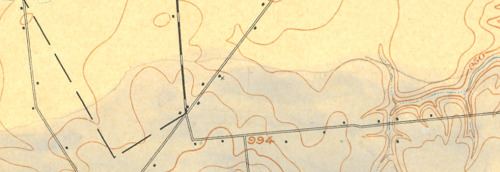
“Among the most expressive of map making tools are pencils, pens and other analog devices. The certainty of the topographic map contrasts with the precursory aesthetic of the hand drawn annotations.This posting contains a series of hand-sketched glacial geomorphology annotations on topographic maps by Dr. George Crowl (1910-87) who taught geology at Ohio Wesleyan University from 1947-1975. The topographic maps are from the USGS 15′ series, covering the area around Delaware, Ohio. Crowl was known for his field trips for students in Ohio and surrounding states. These manuscript maps, in the archives of the Geology & Geography Department at Ohio Wesleyan, were likely created for a generalized map of central Ohio glacial landforms for use on his field trips.“
0 notes
Photo

“Nighttime light imagery was selected and analyzed for dates after the U.S. invasion of Iraq (November 16, 2003, 9pm), before the “Surge” (March 20, 2006, 9pm), and after the “Surge” (March 21 and December 16, 2007, both 9pm).The results seem to contradict proclamations of the success of the “Surge.” In general, Baghdad’s nighttime light increased between the initial U.S. invasion and mid 2006, then begins a rapid decline prior to the implementation of the “Surge” strategy.Even more interesting, the mid-2006 decrease in nighttime light is not evenly distributed in Baghdad. The areas of declining nighttime light correspond with areas of ethnic violence and cleansing as documented in the Jones Report and its maps.“
0 notes
Quote
Holistic representations of spatial reality. The map is initially and primarily an intellectual abstraction of spatial reality but this must be subsequently communicated, i.e. modelled and coded, in a form that exploits the human and/or digital spatial processing capablities.
A holistic representation and intellectual abstraction of geographic reality intended to be communicated for a purpose or purposes, transforming relevant geographical data into an end-product which is visual, digital or tactile.
John Krygier
0 notes
Photo

“This dynamic element is usually absent from the impersonal atlases produced by governments, societies and publishing houses, which merely give a graphic report of a given moment of time. Our objective is to give a living picture of Cuban geography as far as possible in 64 pages. Our approach is as follows: 1. What are the facts?, 2. What are the essential problems?, 3. What will be their effects in the future and what may be done about them? For instance, Cuba, by reason of its close proximity to the United States become its chief source of tropical products, especially sugar. Thus the Cuban economy has become dependent on the fluctuating sugar demand, whereas a diversification of crops and industries would be advisable.“
0 notes
Photo

“When Bill Bunge mapped out the locations of car/pedestrian collisions in Detroit (Detroit Geographical Expedition, 1968) he and the map were advocating a way of thinking about what was happening to the black community in Detroit – and advocating for change.“
0 notes
Photo

“In the key, Boylan Heights is the point of tangency of these six fronts of radio waves. On the map, you can see which waves belong to which stations by their shape and direction. Because radio waves are concave to their point of origin, a wave concave to the lower right (southeast) is coming from Auburn, and one concave to the upper left (northwest) is from Durham. The degree of curvature depends on the size of the wave front and its distance from the source: the straighter the line, the farther away the transmitter. (Sensible curvature decreases with size which is why the earth seems flat.) These wave fronts, ever expanding, make different patterns in other places.“
0 notes
Photo
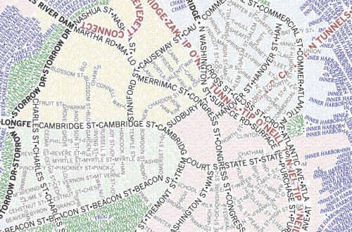
“ The Axis Typographic Maps use typography as line and area map symbols, providing a nuanced exposition of the geography of these places, the grid of Chicago or the meandering roads of Boston. Again, both meaning and structure are generated by words alone. “
1 note
·
View note
Photo

“Finally Mesquita addresses the counter-cartography practices developed between the 1990s and 2010’s by three activist art collectives: Bureau d’Études(France), the Counter-Cartographies Collective (United States), and Iconoclasistas (Argentina). Based on the interrelations between contemporary art, political activism, and critical cartography, Mesquita holds that the work of these activists-artists has created a significant opposition to the “neutral and objective” maps made in the interests of corporate, governmental, and military bodies.”
0 notes