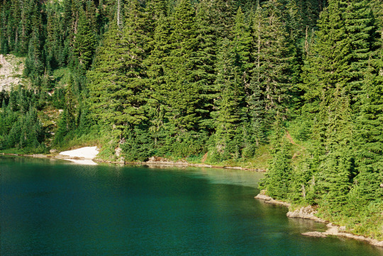
#tolmie peak trail
Text
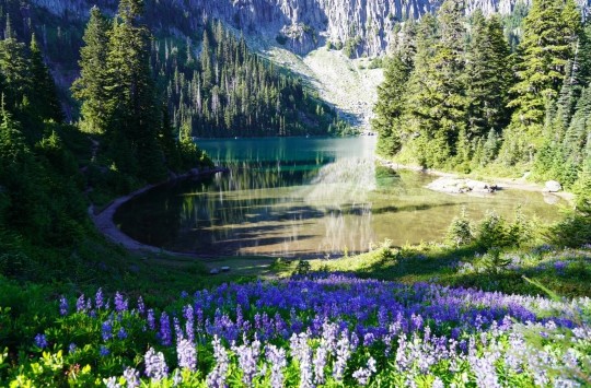
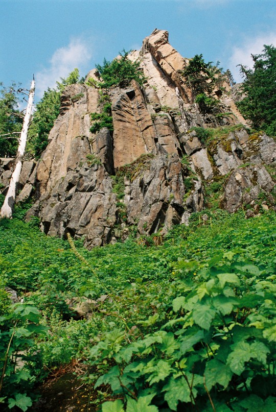
Tolmie Peak Trail by Liddy_L
#tolmie peak trail#lavender#lavender field#lavanda#montanha#mountains#mountain#nature#cottagecore#naturecore#nature aesthetic#beautiful#flowers#flowercore#purple flowers#petitworld favs#petitworld
6K notes
·
View notes
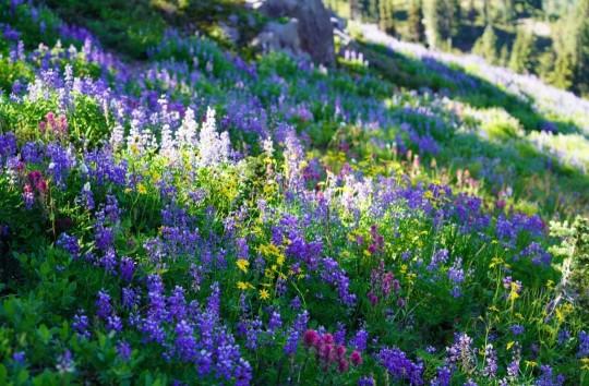
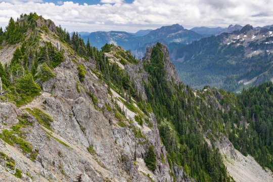
Photo


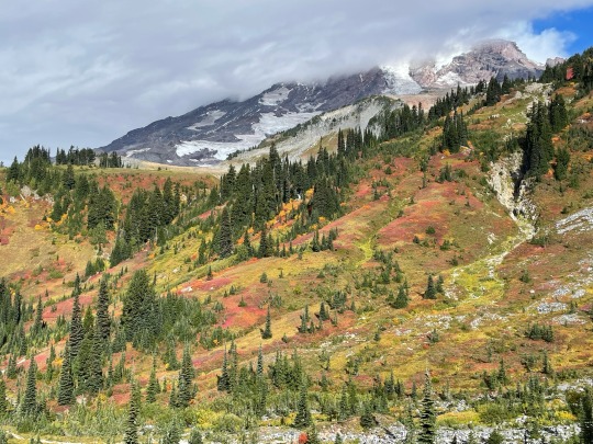
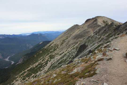
Views along the Tolmie Peak trail - Mt. Rainier National Park
301 notes
·
View notes
Text
Finish this sentence: hiking to Tolmie Peak lookout this summer was great because ______.
With the start of fall, our days of accessing Mowich Lake and the trailhead to Tolmie Peak Fire Lookout are numbered. The high elevations around the mountain can get start piling up snow any time now. Depending on the weather, the road to Mowich is scheduled to close to motor vehicles October 17. Which means this is a great time to look back at all our memories of hiking this fabulous trail.
The trail from Mowich Lake up to the lookout is 6.5 miles round trip with 1,010 feet of elevation gain. It’s a bit of a climb taking your from forest up to the pass, then Eunice Lake, and finally up to the lookout. But those are just the numbers. What was you favorite part of the trail? Best view? Most wonderful wildflowers? Did you have an alpine start (up long before dawn) to see sunrise from the lookout? ~ams
It’s almost time when weather and snow close the door on another year at Mowich Lake and Tolmie Peak. For more information on the Tolmie Peak trail, start with this park website https://www.nps.gov/mora/planyourvisit/tolmie-peak.htm Check road status before driving out the long dirt road at https://www.nps.gov/mora/planyourvisit/road-status.htm
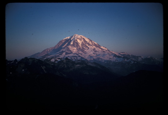
NPS/Bender Photo. View from Tolmie Peak of Mount Rainier. September, 1961.
#encuentra tu parque#find your park#fire lookout#lookout#trail#hiking#mount rainier#mount rainier national park#national parks
16 notes
·
View notes
Text

On the trail to Tolmie Peak, Mountain Rainier National Park
8.5.22
2 notes
·
View notes
Photo
Tolmie Peak Trail, Mt. Rainier National Park, Washington, USA [OC] [4032x3024]
4 notes
·
View notes
Text
10 Eastern Washington Hikes for a Day Trip

Lace up your kicks, because it’s time to take a hike! Eastern Washington is home to scenic wildlife and landscapes that are best seen on foot traversing through steep inclines, alongside rivers, and winding through mountainous forests.
If you’re Places to Visit in Washington State area, your trip won’t be complete without these top day trip worthy Eastern Washington hikes. Check them out!
Enjoy All The Beauty That Washington Has To Offer With These Eastern Washington Hikes
Hoh Rainforest Trail
Don’t miss the Hoh Rainforest Trail in the Olympic National Park! The trail is home to Roosevelt elk, various species of cascading moss, and large trees that look like something out of a sci-fi movie. This 10.6-mile hike ascends 500 feet—perfect for first-time backpackers and adventurous nomads.
Horseshoe Basin
Trek through the great outdoors of the North Cascades on the Horseshoe Basin trail near the Canadian border. This trail is home to an abundance of wildlife, including bears, deer, and bighorn sheep. However keep in mind, that this 12-mile roundtrip day hike is not for the faint of heart.
Anderson And Watson Lakes
You haven’t seen the best of Eastern Washington’s hiking trails until you’ve journeyed to the Anderson and Watson Lakes. This relatively easy hike is perfect for families and inexperienced hikers. Along the six-mile trail are copious opportunities for breathtaking glimpses of mountain ranges, and of course sleek views of the glassy Anderson and Watson Lakes.
Spider Meadow And Phelps Basin
Strap on your day pack for this 13-mile hike across the Central Cascades. Spider Meadow and Phelps Basin is an arduous hike with rewarding views of the glorious Glacier Peak Wilderness. As a result, this hike will challenge even the most seasoned hikers as it ascends nearly 2000 feet.
Rialto Beach And Hole-In-The-Wall
Escape to the beach! Stroll the rocky shore of Rialto Beach to explore the seaside wildlife, including whales, sea lions, otters, and seabirds. In addition, the beach hike has spectacular views of James and Little James islands.
Bird Mountain Loop
Get away from the hustle and bustle at Bird Mountain! The Bird Mountain Loop is a 10-mile trek in the Mount Adams area. This intermediate level hike ascends 1,875 feet and reaches an elevation of 5,230 feet. Additionally, this winding hike through the South Cascades has several campsites perfect for an overnight stay.
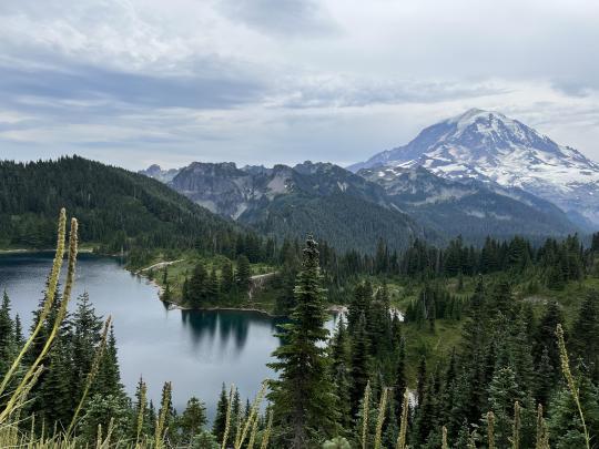
Tolmie Peak Lookout
You won’t be able to get enough of the views at Tolmie Peak Lookout! This trail begins at the Mowich campground with immediate views of Mowich Lake. In addition, the hike reveals scenic views of Eunice Lake, Carbon River Valley, and Mount Rainer.
Tipsoo Lake-Naches Peak Loop
Pack up the family car for this easy day hike! Tipsoo Lake-Naches Peak Loop is an all-levels three-mile hike in Steven’s Canyon. Even more, this hike is short and flat, only gaining about 600 feet in elevation. In the peak months of August and September, visitors are treated with spectacular views of fields of wildflowers—perfect for an impromptu photo-op.
Quinault River-Pony Bridge-Enchanted Valley
Keep your eyes peeled in the Enchanted Valley! The Valley is home to deer, elk, black bears, woodpeckers and more! Because this lush area receives about 14 feet of rain each year, the wildlife and flora here grow in abundance.
Larch Lake
Larch Lake is a year-round destination that provides beautiful scenery! Visitors especially appreciate the beautiful green, red, and yellow colors of the autumn foliage. Hikers travel along the McCue Ridge to reveal an all-encompassing view of the crystal-like Larch Lake and Chiwaukum Lake.
Turn Your Day Trip Into A Weekend Affair!
Eastern Washington is home to a plethora of scenic hikes! However, to see it all, you might consider making your day trip into a weekend-long trip of nature hikes.
Experience all that Washington has to offer at the conveniently located Soap Lake Resort—a resort town located less than two hours away from Spokane. The resort sits on top of Soap Lake, a body of mineral waters with Healing Mud Treatments properties. Recuperate after a long day of hiking in Soap Lake to naturally improve blood circulation, or take a swim in the cooling water. Contact Soap Lake Resort at 509-246-0462 to book your stay at this luxurious resort.
#HealthandWellnessResort#BestSpaResortsinUSA#SpaResortAccommodation#WellnessSpaRetreat#RetreatVenuenearSeattle
1 note
·
View note
Photo

It was a great day on another awesome adventure, this time Tolmie Peak, Mt. Rainier. Great hike, lots of great views, wildflowers, glaciers, lakes, a friendly ground squirrel, trails, rocks a waterfall, and of course all with my amazing partner Carisa. I couldn’t ask for a partner to share adventures with. ❤️#makingmemories #hikingadventures #tolmiepeak (at Tolmie Peak Fire Lookout) https://www.instagram.com/p/ChNa5GupotvWNDAtnA2e_kIYIEv_yojwDzw3aQ0/?igshid=NGJjMDIxMWI=
0 notes
Text

Tolmie Peak trail, loved it!
9 notes
·
View notes
Text


13/52 Hike Challenge: Tolmie Peak Trail
SO MANY MOSQUITOES. I didn’t have bug spray and now look like I have the pox I’m so covered in bites. So yeah, bring bug spray because it’s beautiful and you’ll want to be able to stop and appreciate it without being exsanguinated
1 note
·
View note
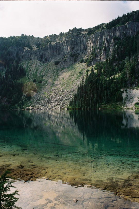
Photo
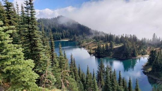
Eunice Lake, Tolmie Peak Trail, Mt. Rainier National Park, WA, USA https://ift.tt/2BXzodL
Hey Tumblr! I found an awesome travel contest that I want to share with my followers. Travel for free to France, The Netherlands, Switzerland, or Serbia. Just click here and read my blog for more details!
41 notes
·
View notes
Note
Are those lake videos from Washington state? I had to google it because your lake videos make me want to travel there to experience the beauty of it all.
Yes, the lake vids are from the Tolmie Peak Trail on Mount Rainier. It’s absolutely breathtaking up there!
Please come! I feel like Washington’s beauty is a best-kept-secret :)
14 notes
·
View notes
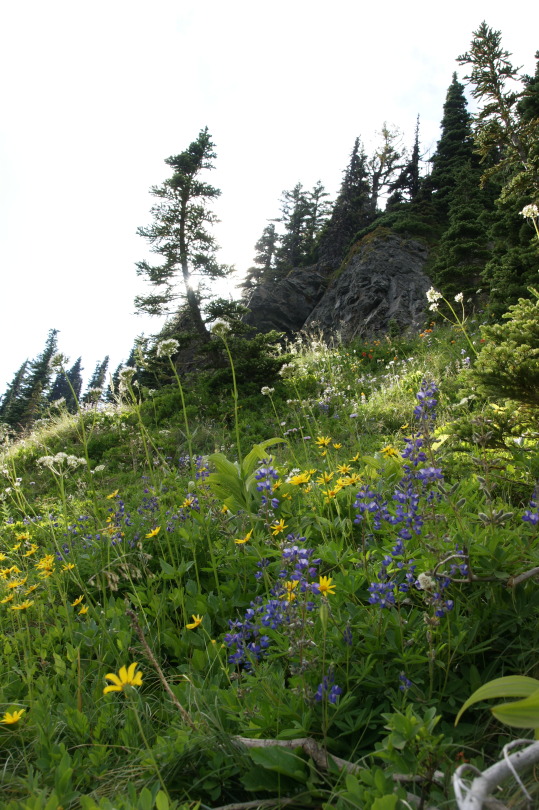
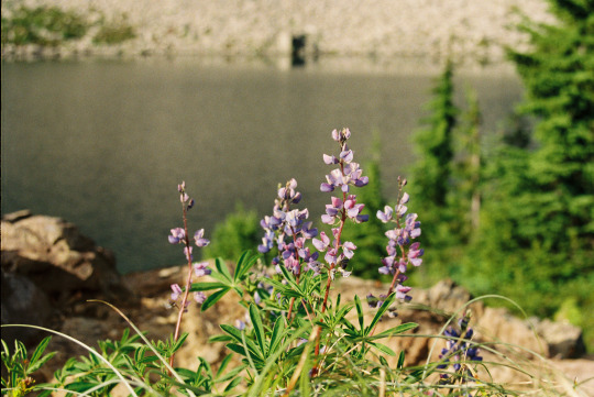
Text
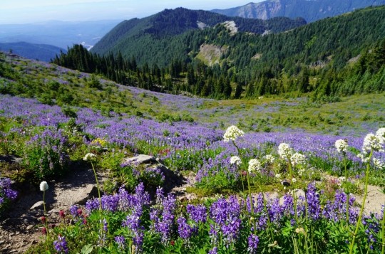
Tolmie Peak Trail by Liddy_L
#tolmie peak trail#landscape#purple flowers#mountain#mountains#nature trail#trail#mountain peak#nature#cottagecore#naturecore#nature aesthetic#beautiful#flowers#flowercore#petitworld favs#petitworld
3K notes
·
View notes
Text
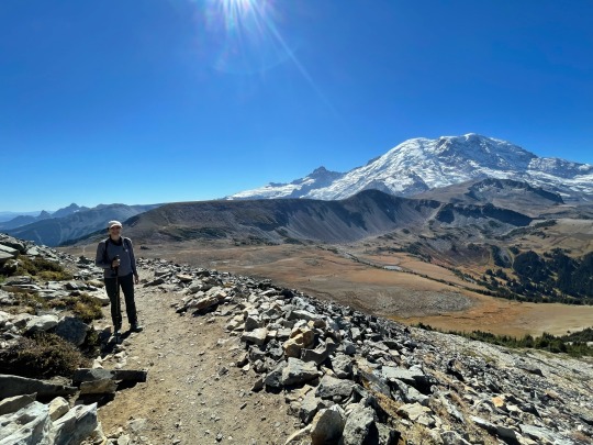
Weekend Trip to Mount Rainier National Park

Mount Rainier from the Skyline Trail
The Verdict:
Mount Rainier has one of our favorite hikes from any U.S. National Park -- the Skyline Trail! We highly recommend this park for this hike, and also, of course, for generally awesome views of stunning Mount Rainier.
We stayed near the southeast entrance of the Park (by Packwood), but the accommodations were overpriced for what they were. You could do the Skyline Trail and another sight or two at the park in a day trip from Seattle.
We visited in the last weekend of September and the weather was great -- if anything, a bit too hot and sunny one of the days, and pleasantly cool on the other (we managed to dodge rainy days). It seems like a generally nice time to visit.
Deciding between Mount Rainier and Olympic National Park? We loved Mount Rainier more (because of the Skyline Trail), but found accommodations more comfortable and better bang for your buck at Olympic (Port Angeles is really nice).
What to do

Ice and clouds along the Skyline Trail
The park has four main areas that, through our research, were recommended to visit: 1) Paradise, 2) Sunrise, 3) Ohanapecosh, 4) Carbon River [listed fourth because we didn't visit this one].
#1. Hike the Skyline Trail to Panorama Point (~6 miles, loop, ~1,900 ft elevation gain).
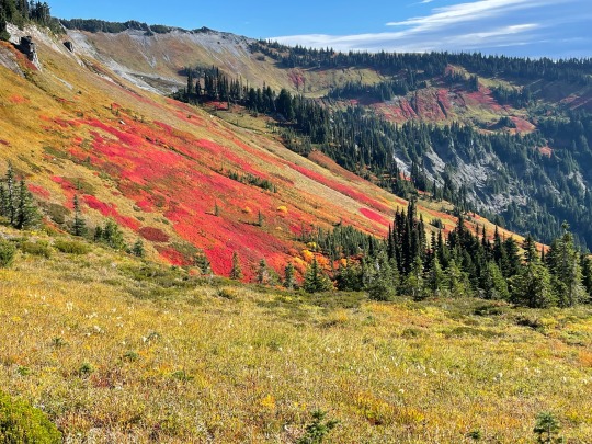
Wildflowers!
This hike starts from the Paradise area of the park and is absolutely stunning from start to finish. It is known both for its views of Mount Rainier and for the colorful wildflowers along the trail. It is the rare hike that is extraordinarily beautiful every step of the way, not just at certain points or peaks. We took a leisurely 3h 10m to complete this hike and loved every step of it. We read from AlllTrails reviews that many people saw wildlife (mountain goats, bears, marmots, pika) along the trail, but we did not see anything apart from squirrels. Still, if you can only do one thing at Mount Rainier National park, do this!!
A few logistical tips:
What to wear: It was VERY windy and at times bitingly cold for much of the hike -- it was one of the rare hikes that we actually needed all of our layers (full sleeve UPF shirt + bubble jacket + windbreaker). We went on a beautiful day with a low in the mid-50s and a high of 70 degrees F.
Getting there: 1) Google mapping to "Skyline Trailhead" will cause you to overshoot the start of the hike and end up on a one-way road that will add 5-10 mins to your drive. The actual trailhead starts by a large visitor center & park lodge. 2) We drove from Packwood to the trailhead (~an hour) via Paradise Valley Road. The clouds were so low that we were literally driving through them for several miles, and visibility was terrible. We were lucky we hardly passed any other cars on the road. It was a bit of a scary drive.
Parking: The parking lot does seem to fill up. There were loads of spots when we arrived around 7:30 a.m., but it was full when we left around 11 a.m.
Toilets: There are toilets by the trailhead (plentiful, and decently clean when we visited) and by Panorama Point (we didn't check this one out, though).
Other Hikes: There are lots of hikes that start at Paradise and share parts of this trail. We didn't get a chance to try them, and we chose this hike based on Earthtrekkers' recommendation.
#2. Hike the Sourdough Ridge Trail & Fremont Fire Lookout Trail (~6 miles, out and back, ~1,200 ft elevation gain)
This is a highly recommended hike on many blogs and podcasts about Mount Rainier National Park. It is located in the Sunrise area (east), is considered moderately difficult, and has good views of Mount Rainier. It took us 2.5 hours in total, including a 20 minute lunch break at the top. We thought the hike was nice, but to be honest it didn't knock our socks off. Probably because we are spoiled from all of the beautiful hikes we have gotten to do this year.

#3. Hike in the forest at Grove of the Patriarchs (1.5 miles, out and back, easy) and Silver Falls (depending on where you start, 1-3.4 miles, out and back or a loop, easy to moderate)
After a very hot, sunny afternoon hike to the Fremont Fire Lookout, we were glad to walk in the shaded Grove of Patriarchs in the Ohanapecosh area of the park (southeast). This is a beautiful and peaceful hike amongst massively tall trees; it reminded us a bit of walking in the Hoh Rainforest at Olympic National Park. There is a lovely swinging bridge that can be fun to walk across. However, since the hike is easy, it gets very crowded, especially with families with smal children. It does not have views of Mount Rainier, so while it is nice, we would not prioritize it if strapped for time.

Literally just across the streets from the Grove of Patriarchs trailhead, you can go to see Silver Fall, a waterfall amidst striking blue-green waters. We have a fairly high bar for waterfalls and thought this one was very pretty. If you start the trail from opposite Grove of Patriarchs, it's just a 1-mile out-and-back, fairly inclined walk to the waterfalls (0.5 mi each way). If you want a longer walk in the woods -- which we didn't, since we had just done that at Grove of Patriarchs -- it seemed like you could start the hike somewhere else and walk a ~3-mile loop with the waterfall as a stop along it.

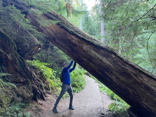
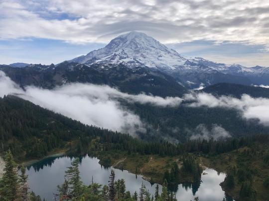
#4. Tolmie Peak Fire Lookout (~5.6 miles, moderate)
This hike starts from a lake in the Carbon River area of the park (north). It is said to have very nice views of Mount Rainier and is highly touted by Earthtrekkers. That said, it is a pretty long drive to get there -- it would have added 2.5 hours to our drive from Paradise to south Seattle -- so we did not try it. We did read that it requires driving ~11 miles down an uncomfortable unpaved road.
Itinerary
Since we started from Seattle, we drove around the park in a clockwise loop: Seattle > Sunrise (east side of the park) > Ohanapecosh (southeast side) > Packwood [overnight by Ohanapecosh] > Paradise (south side) > Ashford [town by southwest side] > back up to Seattle along the west side of the park.
Where to stay + eat:
We stayed at the Cowlitz River Lodge in Packwood, as it was very close to Grove of Patriarchs/Silver Falls (~15 min drive) and Paradise (~50-60 min). The lodge was adequate but overpriced for what it was, and nowhere near as nice as our similarly priced hotel in Port Angeles (by Olympic National Park).
There was not a lot going on in the town: there were very few food options, but we really enjoyed White Pass Taqueria + Taproom, the Mexican restaurant in town . Their vegetarian burrito with butternut squash was amazing, and they had tons of outdoor seating.
0 notes
Text
Perched near the top of Mount Fremont is a fire lookout. Built in 1934, it follows the design “Standard Lookout House – Type No. 1 for All Parks” created by the National Park Service Western Division, Branch of Plans and Designs. It matches its sibling fire lookouts at Tolmie and Shriner Peaks in design though they each have radically different views of the mountain.
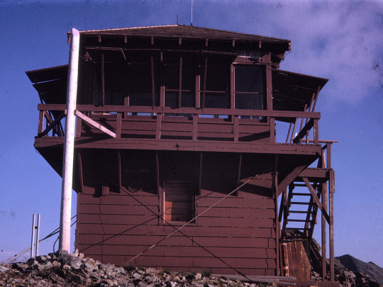
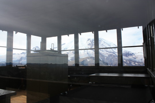
Originally used by park staff to find and monitor fires in the park and surrounding lands, the fire lookout lives on now as a historic building. It once played a key role in protecting our natural resources. Through the windows, you can imagine how a person staffing the lookout might have lived and worked. The tall stand in the middle of the room had an Osborne fire finder, like so many fire lookouts across the country. Using the fire finder, the lookout could pinpoint a fire’s location. Then they communicated fire information back to ranger and fire staff via radio.
Can you imagine working at the Mount Fremont fire lookout? Would you have enjoyed hiking from Sunrise to the lookout, carrying all your food and supplies? Would the quiet and seclusion of the lookout have been a positive or negative for you? ~ams
The inside of the fire lookout is closed to the public. Please respect the privacy of any staff that might be working at the lookout. For more information on the trail to Mt Fremont lookout https://www.nps.gov/mora/planyourvisit/mount-fremont-lookout.htm Check for trail conditions and updates https://www.nps.gov/mora/planyourvisit/mount-fremont-lookout.htm For more information on the history and archaeology of the park, see https://www.nps.gov/mora/learn/historyculture/index.htm and https://www.nps.gov/mora/learn/historyculture/archaeology.htm
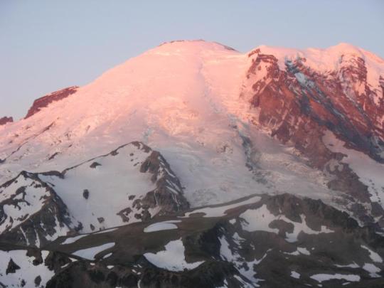
NPS/Spillane Photo. View looking north along Mount Fremont to fire lookout with trail visible. October, 2014. NPS Photo. Brown wooden fire lookout at Mount Fremont. 1963. NPS/Spillane Photo. View through window of interior of fire lookout. Stand for Osborne fire finder in middle of floor. View of Mount Rainier through far windows. October, 2014. NPS/D. Killam Photo. Pink light on Mount Rainier from Mt Fremont Lookout.
#encuentra tu parque#find your park#mount rainier#mount rainier national park#history#national parks#fire lookout
21 notes
·
View notes
Text


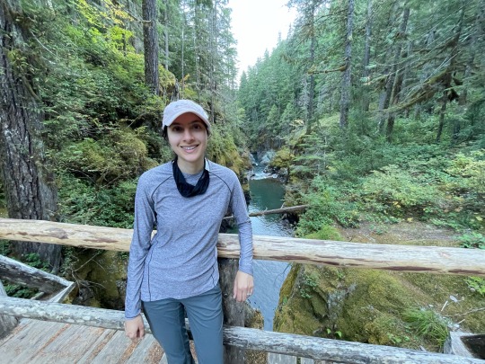
On the trail to Tolmie Peak, Mountain Rainier National Park
8.5.22
1 note
·
View note
Photo
[OC] Tolmie Peak Trail, Mt. Rainer, Washington, USA [4032 × 3024]
2 notes
·
View notes
Last Seen Blogs

zzevkmeselesiii
Avazım çıktığı kadar susuyorum.

nobetawesuffer
I'm the problem, it's me

project-sekai-facts
Hatsune Miku broke space-time and here's how

yasminaababyy
The Zone

newskin4theoldceremony
Antique Store Whore