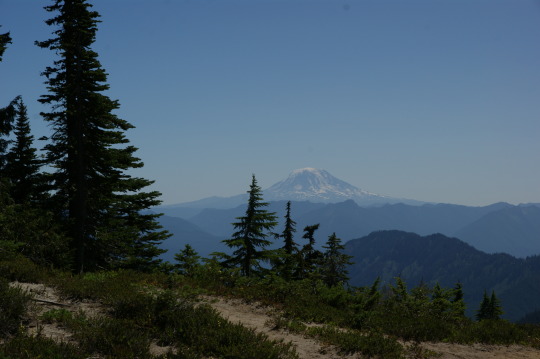
#cascade mountains
Text


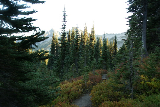
Some moody forest shots from Mt. Hood National Forest, Oregon (Oct. 2021).
#oregon#photography#not geology#pacific northwest#forest#clouds#aesthetic#cozycore#mount hood#cascade mountains#pnwonderland#pnw vibes#pnwexplored#pnw#pnw photography#original photography#original photography on tumblr#lensblr#nikon#my photography
1K notes
·
View notes
Photo
Taking the slow way back to the car
3K notes
·
View notes
Text
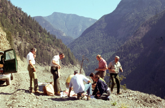
A group of entomologists stop for lunch somewhere in the Cascades
Oregon
1975
#vintage camping#campfire light#oregon#PNW#cascade mountains#washington#BC#entomology#camping#history
588 notes
·
View notes
Text

I love the Cascade mountains. It's sooooooo serene and beautiful 😍 being there restores my soul and brings me peace. 😍😊😌
187 notes
·
View notes
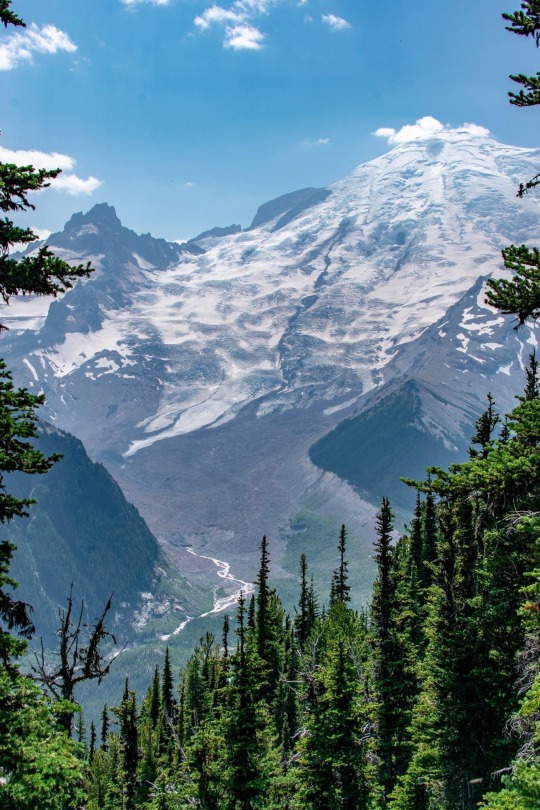
Photo
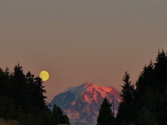
Tahoma / Rainier
Western Washington, September 7 2022
Mary Howerton (shop)
#moon#tahoma#rainier#mt rainier#pnw#sunset#moonrise#pink#nature#mountains#volcano#pink sky#original photography#photographers on tumblr#lensblr#photography#washington#cascade mountains#scenery#aesthetic
1K notes
·
View notes
Text
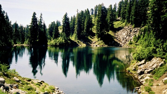
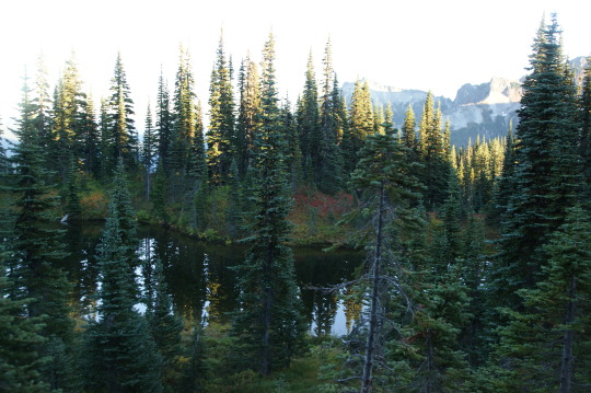
Gem Lake, Washington, 2005.
#landscape#lake#forest#cascade mountains#washington state#2005#photographers on tumblr#pnw#pacific northwest
65 notes
·
View notes
Text

It’s Tell a Friend Friday!
Please enjoy this photo I took of Wy'east (Mt. Hood) a few years ago on a backpacking trip on Section G of the Pacific Crest Trail.
Then tell someone you know about my work–you can reblog this post, or send it to someone you think may be interested in my natural history writing, classes, and tours, as well as my upcoming book, The Everyday Naturalist. Here’s where I can be found online:
Website - http://www.rebeccalexa.com
Rebecca Lexa, Naturalist Facebook Page – https://www.facebook.com/rebeccalexanaturalist
Tumblr Profile – http://rebeccathenaturalist.tumblr.com
BlueSky Profile - https://bsky.app/profile/rebeccanaturalist.bsky.social
Twitter Profile – http://www.twitter.com/rebecca_lexa
Instagram Profile – https://www.instagram.com/rebeccathenaturalist/
LinkedIn Profile – http://www.linkedin.com/in/rebeccalexanaturalist
iNaturalist Profile – https://www.inaturalist.org/people/rebeccalexa
Finally, if you like what I’m doing here, you can give me a tip at http://ko-fi.com/rebeccathenaturalist
#Wy'east#Mt. Hood#Oregon#Pacific Northwest#PNW#backpacking#through hiking#hiking#nature#nature photography#mountain#Cascade Mountains#landscape#landscape photography#Tell a Friend Friday#volcano#geology#PCT#Pacific Crest Trail
20 notes
·
View notes
Text
81 notes
·
View notes
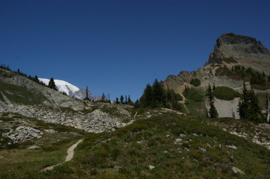
Text
Mount Hood

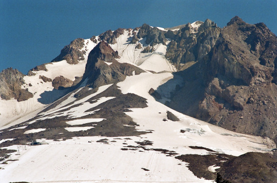

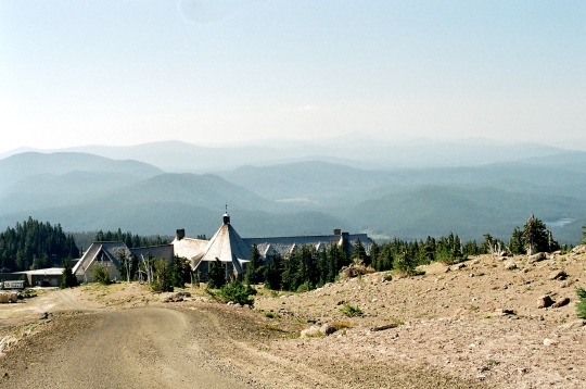
Mount Hood is the tallest peak in Oregon, over 11,240 feet. It's an active stratovolcano covered in glacial ice that last erupted about 240 years ago (in the 1780s, exact years unknown). The large crater that opens to the south near the summit was formed about 1,500 years ago, and the pinnacle standing in the middle - Crater Rock - was squeezed out like toothpaste in the most recent eruption (~240 years ago). The crater contains many active fumaroles and steam vents, hinting at the heat still within. The eruption that formed the crater is called the Timberline Eruptive Period. The collapse of the south face of the volcano deposited a huge debris fan that now appears as a gentle slope to the summit area. Timberline Lodge, a 1936 Works Progress Administration (WPA) project owned by the US Forest Service, is built on this debris fan and offers tremendous views of the southern glaciers, the summit cliffs, and the ski slopes that remain open to skiing through August most years.
These photos were taken in early August, 2022 on Kodak Gold film. Find more at my Flickr!
#oregon#geology#photography#pacific northwest#volcano#glacier#alpine#kodak#kodak gold 200#film photography#analog photography#my photgraphy#photographers on tumblr#mount hood#Nikon#high cascades#cascade mountains
68 notes
·
View notes
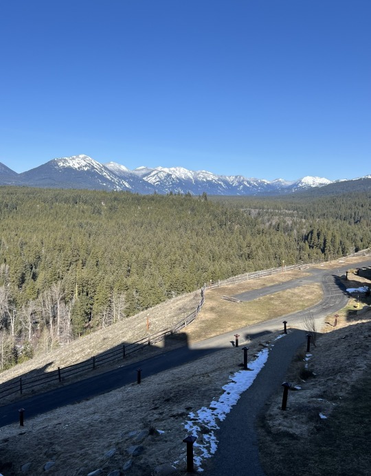
Text
Wandering around the backside of the Tatoosh Range - MRNP
330 notes
·
View notes
Text
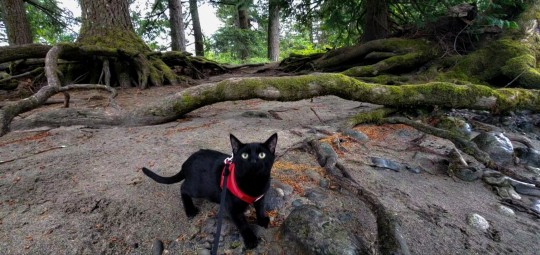
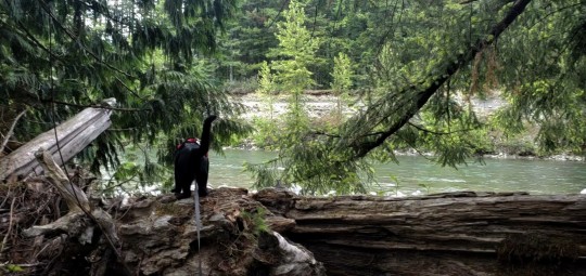

Adventure Bean
Skylar Moon 2021
#bean#adventure cat#travel cat#pnw#original photographers#washington state#forest#mountains#travel#forestcore#moody aesthetic#my photography#cat#kitten#river#aesthetic#green#hiking#cascade mountains
14 notes
·
View notes
Text
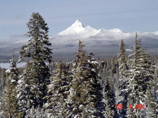
Diamond Peak, Oregon Cascades - February 2004
#oregon#diamond peak#cascade mountains#cascade range#cascades#mountains#snow#winter#original photography#photographers on tumblr#pnw#the great pnw#oregonexplored#pnwadventures#pnwlife#pnwexplored#pacific northwest#pnwonderland
83 notes
·
View notes
Text

Mt. Pilchuck, Snohomish County, WA 5,344 ft elevation. The name Pilchuck originated from the native American name for red water. It was named after a creek in the area. It is part of the Cascade mountain range.
15 notes
·
View notes
Photo
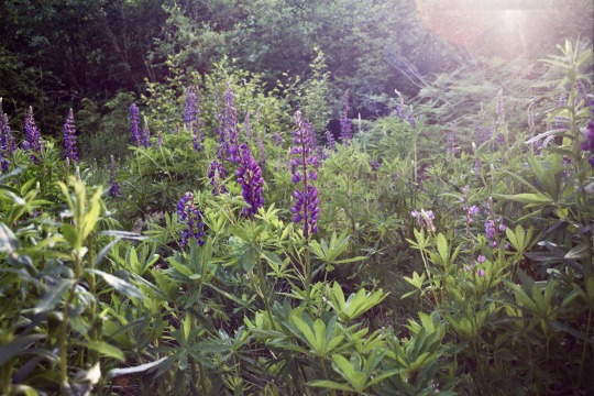
lupine valley
Snoqualmie, Washington
#washington#35mm#analogue#film photography#pnw#pacific northwest#nature photography#alpine#mountains#cascade mountains#wildflowers#alpine flowers#original photography on tumblr#photographers on tumblr#lupine#lupines
47 notes
·
View notes
Photo
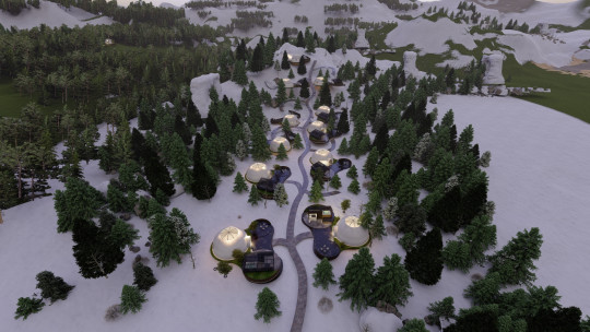

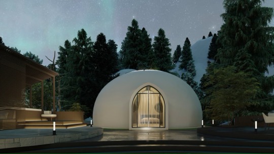

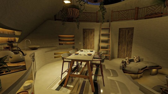


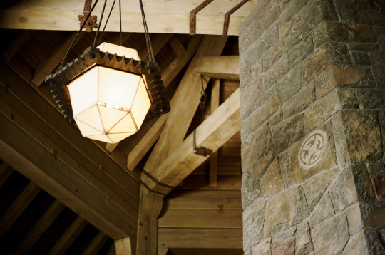
Oculis Lodge, Glacier, Washington's Cascade Mountains, United States,
Oculus means “eye” in Latin. And in architecture, it refers to a window or shape that has an opening of an oval or circular shape. For the Oculis Lodge, that means a striking 15-foot slylight at the top of every unit, which drenches the space in light during the day and offers prime stargazing at night.
The name also calls attention the eco-conscious structure of the dome-shaped cabins. Each build has a rock-solid airform structure that requires 50 percent less energy to heat and cool than conventional structures. Only recycled concrete, reclaimed wood and recycled materials were used to build the pods.
#art#design#Architecture#oculis lodge#lodging#lodge#retreat#glacier#washington#cascade mountains#glamping#eco-tourism#eco-retreat#boutique hotel#hiking#eco-conscious#travels#luxurylifestyle
105 notes
·
View notes
Last Seen Blogs

ashveralds
searching for a little serotonin.

sinfulspencer
Aurora


astroninaaa
nina
ashveralds
searching for a little serotonin.