#the Monterey coast
Text
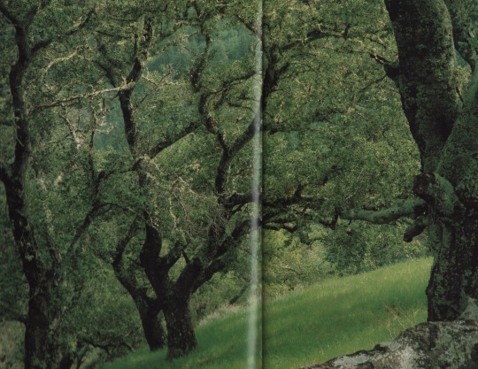
The Monterey Coast, 1980
#scans#mine#my scans#nature#photography#the Monterey coast#1980#1980s#books#trees#plants#landscape#landscapes#forest#woods#nature photography
8K notes
·
View notes
Text

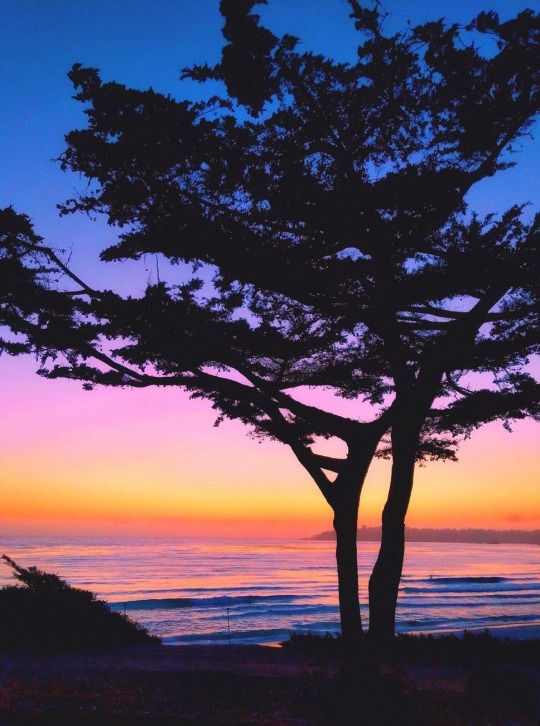
Last light on the coast
shinndierock
2K notes
·
View notes
Text
Rise and brine! It’s king tides day! 👑🌊
#monterey bay aquarium#king tides rule the coast#why are they called king tides?#because of their highness#from high high to low low thats a long way to go go
2K notes
·
View notes
Text
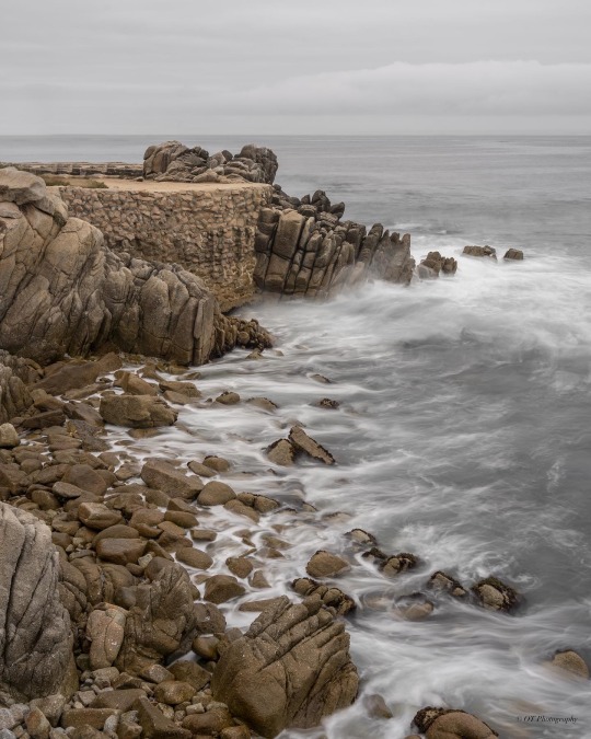
Rocks of Monterey
Monterey Coast, CA
#photographers on tumblr#original photographers#california#monterey#montereybay#ocean#oceanphotography#seascape#seascape photography#peaceful#scenic#landscape#landscape photography#pacificocean#long exposure#longexposurephotography#beach#west coast#beachphotography#pacific coast
180 notes
·
View notes
Text
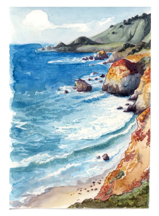
The shore, the shore.
(Another one of the watercolor illustrations I contributed to Serpentine, a lovely collection of poems by Tara K. Shepersky which will be funding on Kickstarter for the next two weeks. Give it a look.)
#watercolor#northern california#monterey#coast#west coast#serpentine#painting#lucy bellwood#tara shepersky#illustration#personal work#crowdfunding
249 notes
·
View notes
Text
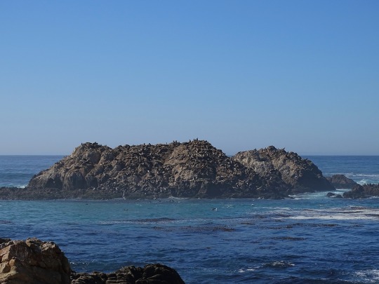

Seal Island is completely covered by seals and sea lions. Maybe a few birds as well. You can hear the seals from the mainland.
Pebble Beach, California
Explore the area:
#pebble beach#monterey#california#nature#nature photography#seal#sea lion#elephant seal#wildlife#wildlife photography#travel#original photography#photographers on tumblr#pacific coast highway#pacific coast#wanderingjana
32 notes
·
View notes
Text


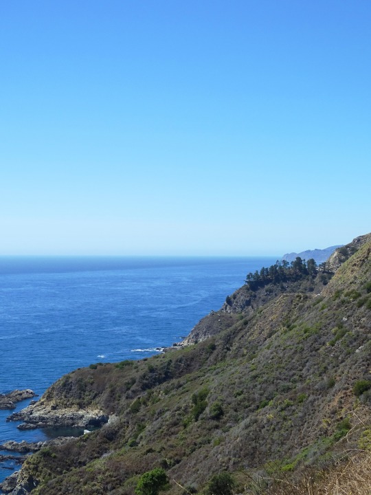

Julia Pfeiffer Burns State Park Vista Point, CA (No. 2)
The drive along Highway 1 has been described as "one of the best drives on Earth", and is considered one of the top 10 motorcycle rides in the United States. Highway 1 was named the most popular drive in California in 2014 by the American Automobile Association. Condé Nast Traveler named State Route 1 through Big Sur one of the top 10 world-famous streets, comparable to Broadway in New York City and the Champs-Élysées in Paris. Most of the nearly 7 million tourists who currently visit Big Sur each year never leave Highway 1, because the adjacent Santa Lucia Range is one of the largest roadless coastal areas in the entire United States; Highway 1 and the Nacimiento-Fergusson Road offer the only paved access into and out of the region. In January 2021, the Nacimiento-Fergusson Road was washed out due to the impacts of the Dolan Fire and closed, cutting off the only alternative route out of the area. It is not expected to reopen until December 2023.
The beauty of the scenery along the narrow, two-lane road attracts enormous crowds during summer vacation periods and holiday weekends, and traffic is frequently slow. Visitors have reported to the California Highway Patrol hours-long stop-and-go traffic from Rocky Creek Bridge to Rio Road in Carmel during the Memorial Day weekend. The highway winds along the western flank of the mountains mostly within sight of the Pacific Ocean, varying from near sea level up to a 1,000-foot (300 m) sheer drop to the water. Most of the highway is extremely narrow, with tight curves, steep shoulders and blind turns. The route offers few or no passing lanes and, along some stretches, very few pullouts. The sides are occasionally so steep that the shoulders are virtually non-existent.
Source: Wikipedia
#Julia Pfeiffer Burns State Park Vista Point#Monterey County#California State Route 1#Highway 1#Pacific Coast Highway#National Scenic Byway#Big Sur#Pacific Ocean#travel#original photography#vacation#tourist attraction#landmark#landscape#seascape#countryside#street scene#road trip#summer 2022#California#West Coast#Big Sur Coast Highway#nature#flora#grass#tree#USA#blue sky#blue sea#beach
12 notes
·
View notes
Text

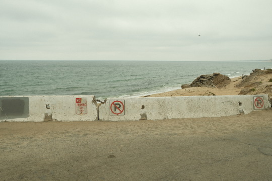
sand city, ca | aug 2023
#sand city#california#monterey#carmel#original photography on tumblr#photography#west coast#monterey bay#fujifilm xt30#norcal#nature photography#overcast#cloudy
50 notes
·
View notes
Text


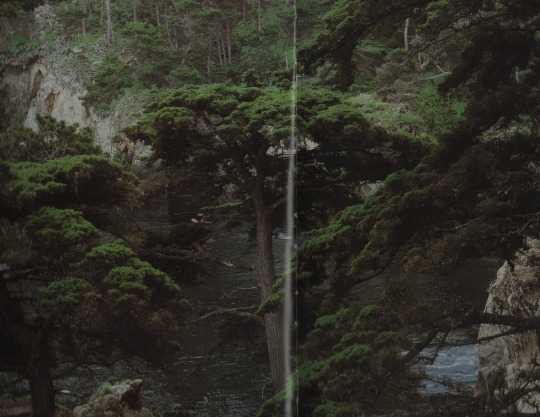
Fog and Sun, Sea and Stone The Monterey Coast, 1980
#the Monterey coast#Steve crouch#my scans#scans#books#nature#beach#sea#ocean#plants#water#photography#landscapes#mine#waves#rocks#dark#1k
7K notes
·
View notes

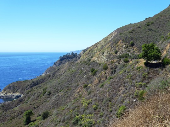
Text

Magnificent Big Sur, Highway 1 and Bixby Bride in the distance.
#Big Sur#california#california coast#bixby bridge#pacific northwest#pacific coast#California state highway#monterey county#road travel#travel photo blog#travel#photographers on tumblr#photography#fujifilm#curators on tumblr#landscape#nature#beautiful#Fujifilm x100t#x100t#fujifilm x series
71 notes
·
View notes
Photo
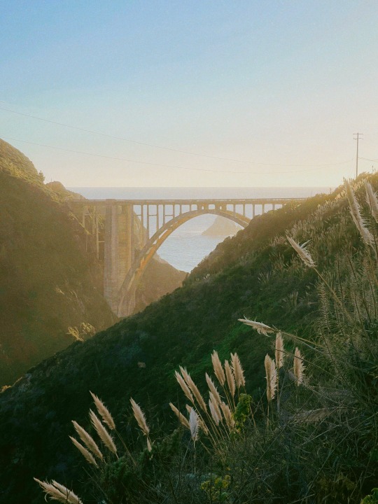
bixby bridge.
big sur. monterey county, ca.
my instant gram.
#bixby#bridge#bixby bridge#monterey county#sunset#sun light#coast#ocean#california#architecture#arch
96 notes
·
View notes
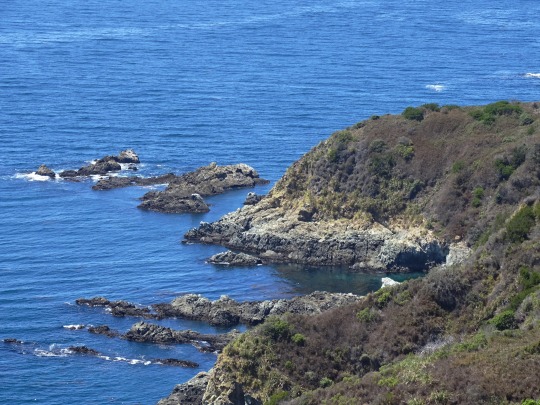
Text
The Central California Coast

This location in California near Monterey/Pacific Grove is (to the best of my knowledge) permanently fenced off to the public to allow these harbor seals and their pups a safe and secure place to lounge.
This stretch of the California coast is replete with views and vistas for landscape/nature photographers. This shot is just a middle of the day kinda image, but if you caught this scene with the right kind of sunset light and cloud interest, you could really have something.
Let's go exploring.
#harbor seals#opt outside#nature#outdoors#the hikers eye#landscape#no people#go outside and play#landscape photography#nature photography#original photography#monterey#california#pacific grove#travel#california coast#original photographer
23 notes
·
View notes
Text

From August, 2022
#car#Ferrari#Ferrari 212 export#Vignale#black and white#Monterey Bay#pacific coast highway#Leica sl2 s#original photography on tumblr#february 2024
11 notes
·
View notes
Photo
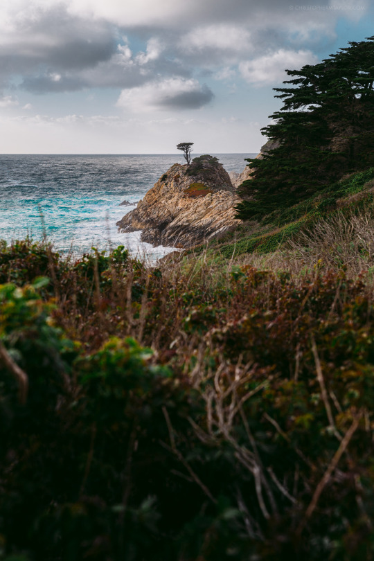
Lone Tree, California
#california#monterey#cypress#tree#Evergreen#landscapes#landscape photography#cmt photography#original photographers#photographers on tumblr#pacific coast highway#Pacific Coast#ocean#lone tree#rocky coastline#Visit California
165 notes
·
View notes
Text

Edward Weston, Monterey Coast, 1932,
Gelatin silver print, mounted on board,
Sheet: 7¼ x 9½ in (18.4 x 24.1 cm).
#art#photography#black and white#vintage photography#history#edward weston#monterey#coast#landscaping#1932
7 notes
·
View notes
Last Seen Blogs


baby-bunbun-mtu
Baby_BunBun_MTU

latestudy
latestudy
baby-bunbun-mtu
Baby_BunBun_MTU
baby-bunbun-mtu
Baby_BunBun_MTU