#shadedreliefmaps
Text
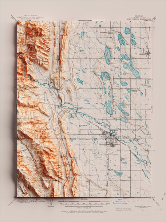
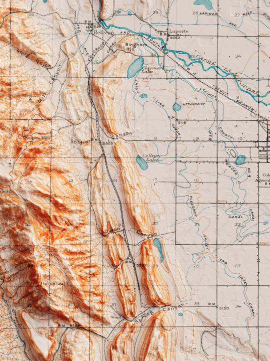
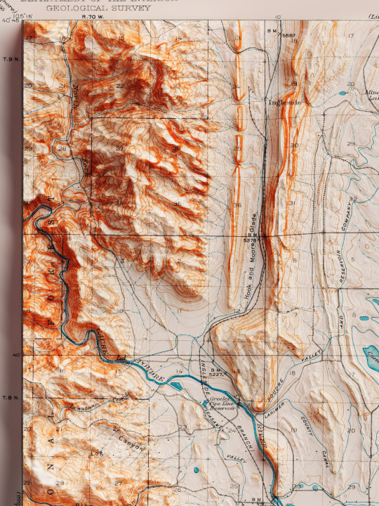
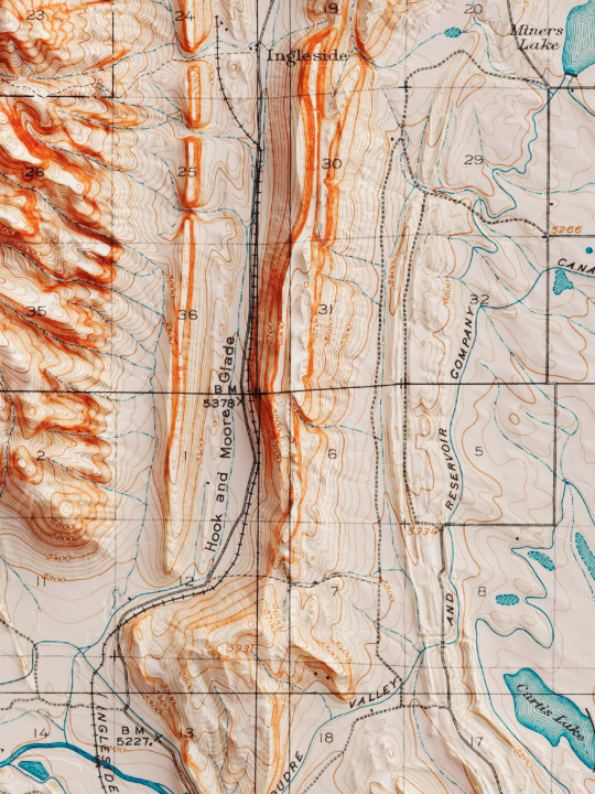
Shaded relief map with 3D effect of a topographic map of Fort Collins, Colorado (United States of America), in the quadrangle series and prepared and published by U.S. Geological Survey in 1906.
If you like our work, want to see our daily updates (or want to say hello to our studio), consider to follow our Instagram or Twitter account. Otherwise if are interested in our prints or have a custom request check our shop.
#homedecor#shadedrelief#shadedreliefmaps#map#cartography#cartographer#cartographie#cartographycommunity#vintagecartography#usa#usa🇺🇸#fortcollins#fortcollinsart#fortcollinscolorado#coloradogram#coloradotography#coloradosprings#3darts#digitalart#digitalartist#blendercycles#blenderartist#fineartprints#fineartprintshop#fineartprintstore#fineartprintstudio
7 notes
·
View notes
Text
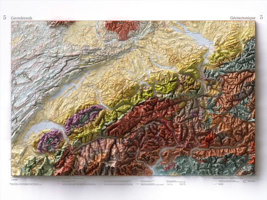
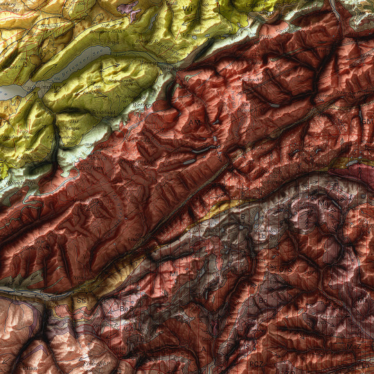
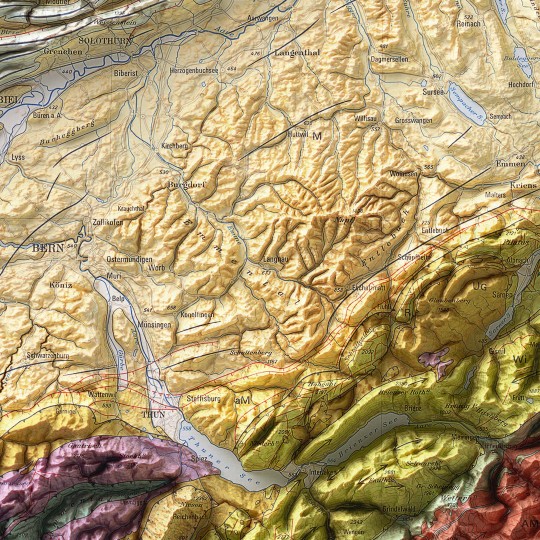
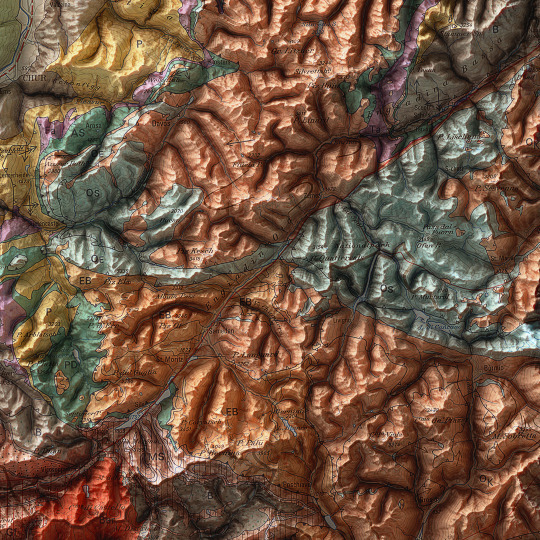
As announced, a new map has been added to the European collection.
We had started this paper years ago, but it had never been finalized. Since we didn't even have a dedicated map of Switzerland yet, we thought it was appropriate to remediate!
This is a geotectonic map of Switzerland that among the authors also has Imhof. It was realized in 1972 but published in 1978 inside the Atlas of Switzerland.
You can find the original sheet in the David Rumsey Map Collection.
If you like our work, want to see our daily updates (or want to say hello to our studio), consider to follow our Instagram or Twitter account. Otherwise if are interested in our prints or have a custom request check our shop.
#switzerlandnature#switzerland🇨🇭#switzerlandtour#switzerlandmylove#switzerlandvacations#berna#ticino#ticinoturismo#geneva#ginevra#geotettonica#geotectonic#geologia#geologist#MapCenter#designmap#shadedreliefmap#shadedrelief#gis#blenderart#blenderartist#cartography#imhof#imhoff#digitaldesign#digitaldesigner
8 notes
·
View notes
Text

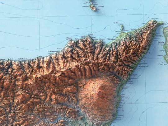


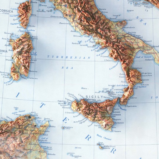
With this map, one of the last for the time being dedicated to Italy, we return a little to the beginning by presenting the island of Sicily, of which we have already published a soil map from 1967.
This map required a longer intervention because it was split in half and ruined by time, being a document from 1943. We chose to leave behind the dusty look of an archive document and give it new life with a stronger colouring.
🗺️ 𝗠𝗔𝗣 𝗜𝗡𝗙𝗢
Isola di Sicilia, prepared and published by Istituto Geografico Militare (Florence) in 1943.
Source: Gallica BNF
If you like our work, want to see our daily updates (or want to say hello to our studio), consider to follow our Instagram or Twitter account. Otherwise if are interested in our prints or have a custom request check our shop.
#ShadedReliefMap#Cartography#VintageMap#HistoricalMap#MapRestoration#IsleOfSicily#SicilyHistory#sicily#MapCollectors#MapEnthusiast#Geography#MapArt#AntiqueMap#MapGeeks#ArtOfMaps#ThrowbackMap#GeographicFeatures#SicilyExploration#GeographicInformation#MapDiscoveries#dataviz#italytravel#sicily italy#sicilia#south italy
2 notes
·
View notes
Text
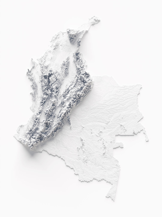

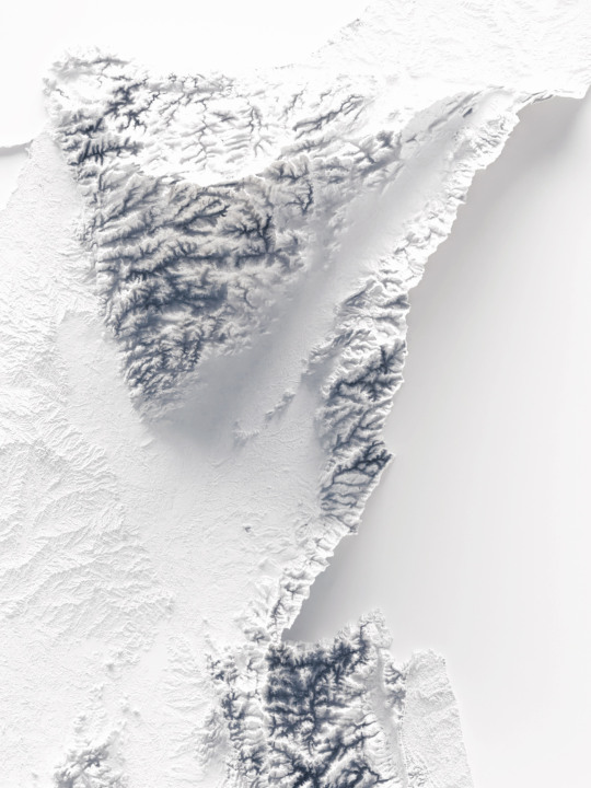
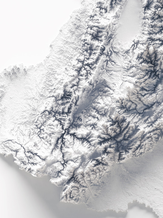
Not a really hypso, but a shaded relief of course!
This elevation map shows the soil of Colombia on minimal white tint.
If you like our work, want to see our daily updates (or want to say hello to our studio), consider to follow our Instagram or Twitter account. Otherwise if are interested in our prints or have a custom request check our shop.
#colombia#colombia🇨🇴#southamerica#southamericatravel#maps#mapstagram#geography#naturegeography#wildgeography#datavizsociety#datavizualization#datavizart#cartographyart#cartography#shadedreliefmap#blender3d#blenderart#blendercycles#QGIS#qgisitalia#vizart
2 notes
·
View notes
Text
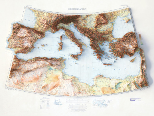


This map is not a revamped map, just a little improved with soft color correction.
We made this map with great effort, both because the map we started from was very beautiful and because of what the Mediterranean represents to us.
So let's reintroduce the Mediterranean Sea map.
If you like our work, want to see our daily updates (or want to say hello to our studio), consider to follow our Instagram or Twitter account. Otherwise if are interested in our prints or have a custom request check our shop.
#printdesign#topographic#VintageMap#topography#shadedrelief#shadedreliefmap#3dmap#3dcartography#Mediterranean#mediterraneansea#mediterraneansea🌊#mediterranee#italy🇮🇹#spain🇪🇸#france#turkey#greece#tunísia#morocco#tripoli#tripolitania#cyrenaica#Libya#gulfofsuez
0 notes
Last Seen Blogs

elea-goddess
𝐄𝐥𝐞𝐚 𝐄𝐝𝐞𝐧 ✦ TOP 4%

capybaraonabicycle
You don't have to compete

tnmk
songs
tnmk
songs
greenycacteable
All for my little kingdom