#Topographic Survey
Text
#Tomography Survey in India#Topographical Survey Company in India#Topographic Survey in India#Topographical Survey in India#DGPS Survey company in India#Land Survey Company in India#Detailed Project Report Preparation in India#Topographic Survey#Topographical Survey#Land Survey in India#DGPS Survey in India#DGPS Survey#DGPS#Land Survey#epitome
0 notes
Text
Discover the Topographic Survey of Your Property With Us.
A topographic survey is essential for anyone looking to develop or modify their property. As you learn more about how we can help you get the most out of your property, we will also provide you with a detailed report that includes information on your land's contours, elevations, and other features.
0 notes
Text
How Modern Technology is Revolutionizing Contemporary Land Surveying Methods?

For the longest time, land surveyors resorted to traditional methods for land surveying, be it topographical, construction, or boundary surveying. While these methods accomplished the data collection goal, the entire process was sluggish, resource-intensive, and prone to errors. It was also impossible to use these in adverse weather conditions.
Today, LiDAR, GPS, mobile mapping, and other modern technologies have revolutionized the way surveys are conducted. Surveyors are now able to remotely operate UAVs and access difficult terrains in the most hostile weather conditions.
In this article, we will talk about how technological disruptions have paved way for efficient and accurate land surveying. But first, we need to understand why surveying should be done.
Read the full article here:
#Land Survey#Land Surveying#Construction#Survey#Boundary Survey#Construction Survey#Topographic Survey#Site Planning Survey
1 note
·
View note
Text
What is the Impact of Civil Engineers on Topographic Surveys?
A topographic survey is different from other surveys as it locates all face features of a property and depicts all-natural features. It's a 3- dimensional chart of a 3- dimensional property showing all natural and manmade features and advancements. Moreover, it shows their position, size, height, and elevation changes. Sera Engineered LLC civil engineers create 3D plot designs for construction projects. Contact us for more information in detail.
0 notes
Text
It doesn't matter if you are buying, building a house, or designing a commercial development; you probably need some land survey during the project. You might be aware that there are different types of land surveys for home and construction projects. Each has its own purposes and uses, two of which are topographical surveys and boundary surveys.
0 notes
Text

A topographical map of Alpine, the highest town in Arizona at an elevation of 8,050 feet. This perspective image was created by joining Landsat 7 data and Digital Elevation Model (DEM) data. (Earth Observatory)
#archive#archiving#web archive#map#topography#topographies#topographical survey#topographical map#3d mapping#arizona#alpine arizona
13 notes
·
View notes
Text
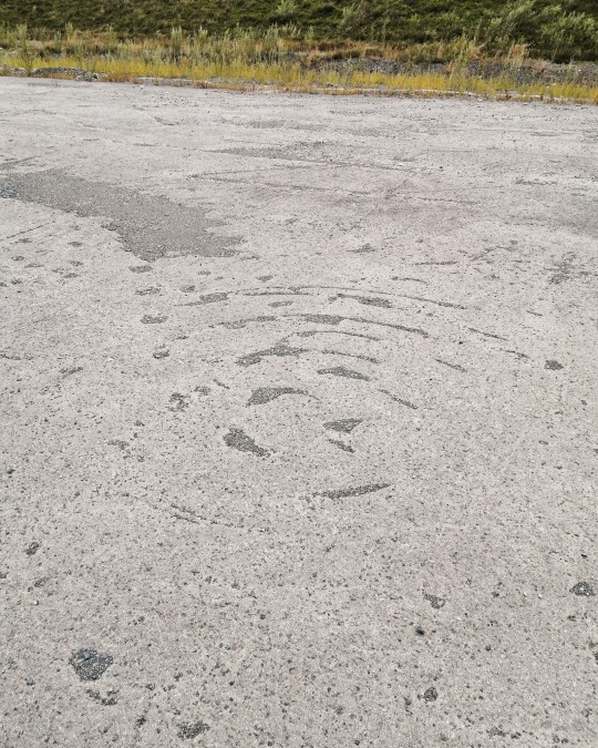
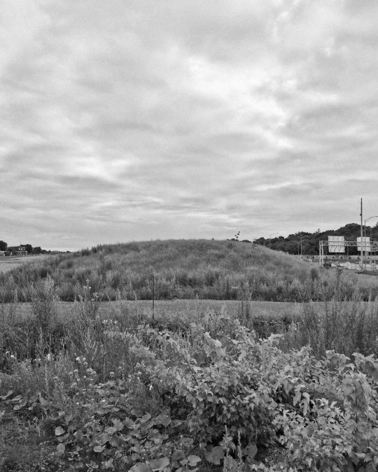
Cell phone notes:
I found a fossilised leaf last night that looked like an arrowhead on my evening stroll to collect materials for my art pieces from the abandoned stretch of highway near to where I live.
I started thinking about interventions I could make in the landscape there, sketched out a few ideas and began a piece which I'll go back to and finish on Sunday and photograph in black and white film with my 6×6 camera.
I'm still feeling rather shy about some of the bigger ideas I had yesterday and may wait until September to start making them.
August 12th 2022


#photography#nowherediary#photo#photographers on tumblr#land art#stones#stone art#fossilhunter#fossil#fossilised#new topographics#new topographers#topographic land surveys#black and white#black and white photography#cell phone photography#diary entry#journal#daily notes
4 notes
·
View notes
Text
Road Cross Section
Road Estimator automates road construction quantity calculations. Import design or survey data, generate cross sections, and calculate volumes for cut, fill, embankments, and pavement layers. Manage various cross-section types, including single lane, multilanes, and expressways construction. Reduce manual calculations and errors with automated workflows. User-friendly interface and comprehensive reports provide reliable data for informed project decisions.
#civil engineering and civil software#topographical survey#road design#civil technology#road and highways
0 notes
Text
#gpr scan#topographical surveyor#underground utility surveyor#utility mapping#utility surveying#gpr surveys#utility survey#across the spiderverse#drainage surveys#pas128 surveys
0 notes
Text
#Tomography Survey in India#Topographical Survey Company in India#Topographic Survey in India#Topographical Survey in India#DGPS Survey company in India#Land Survey Company in India#Detailed Project Report Preparation in India#Topographic Survey#Topographical Survey#Land Survey in India#DGPS Survey in India#DGPS Survey#DGPS#Land Survey#epitome
0 notes
Text
Elevate Your Project Planning | How Topographic Surveys Shape Construction Design
A topographic survey is also known as a Topo survey or Topographical land survey. This survey is usually used to measure and identify the exact location and specification of natural and man-made things within an area of land. This survey helps provide accurate data to elevate your infrastructure or development project. You can contact Salt Lake City Land Surveying for a Topographic survey. Visit our website to contact us.

0 notes
Text
Precision Mapping: Accurate Survey Leading Topographic Solutions in the UAE
Accurate Survey emerges as a frontrunner among Topographic Survey Companies in UAE, offering unparalleled expertise and precision mapping solutions. With a steadfast commitment to excellence, Accurate Survey employs cutting-edge technology and a team of seasoned professionals to deliver comprehensive topographic surveys tailored to meet the unique needs of clients across various industries. Whether navigating the intricate urban landscapes of Dubai or mapping the vast desert expanses of Abu Dhabi, Accurate Survey's meticulous approach ensures accurate and reliable data for informed decision-making in land development, infrastructure projects, and environmental management. In the fast-paced environment of the UAE, Accurate Survey remains a trusted partner, providing topographic solutions that set the benchmark for quality and reliability.

0 notes
Text
Peja Surveying is your trusted partner in the UK, offering a comprehensive range of surveying services, including land, building, and topographical surveys. Our team of experts utilises the latest technology to deliver precise and reliable results, ensuring that your projects are completed with the highest level of accuracy and detail. Trust us to provide the insights you need for successful planning and development.
#Peja Surveying UK#land surveying services#building survey experts#topographical surveying#advanced survey technology#precise surveying results#UK surveying specialists#project planning accuracy#development survey insights
0 notes
Text

Looking for topographical survey costs in London? Our professional services offer accurate assessments at competitive rates. Whether for construction, development, or land management projects, our surveys provide crucial insights into terrain and features. With meticulous attention to detail, we deliver comprehensive reports tailored to your specific needs.
0 notes
Last Seen Blogs

chwilowkishbbsuhunx2-blog
Pożyczki online


u-friend-or-ufo
Let Chick go with Destiny

lovegods-world
无标题
u-friend-or-ufo
Let Chick go with Destiny