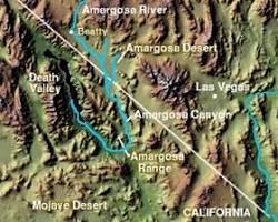
#AMARGOSA DESERT
Text
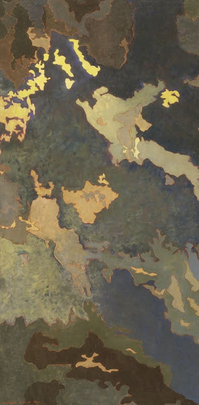
NIGHT AMARGOSA DESERT BY AUGUSTUS VINCENT TACK (1935)
5 notes
·
View notes
Video
Smith Mountain and Distant Views of the Northwest Mojave Ranges (Death Valley National Park) by Mark Stevens
Via Flickr:
While walking the Dantes View Trail with a view looking to the south in Death Valley National Park. My thought on composing this image was to use the ridge I was on as a leading line into the image and then down the mountainside to the basin and valley below. While I did want to angle my Nikon SLR camera slightly downward to bring out more of a sweeping view, I was also limited by how much because of the sun's position in the sky and minimizing any artifacts across the camera lens.
#Amargosa Range#At Dantes View#Azimuth 186#Blue Skies#Brown Mountain#Creosote Bush#Dantes View#Day 4#Death Valley National Park#Desert Landscape#Desert Mountain Landscape#Desert Plant Life#DxO PhotoLab 6 Edited#Great Basin Ranges#Intermountain West#Joshua Tree National Park and California#Landscape#Landscape - Scenery#Looking South#Mojave Desert#Mojave Desert Ranges#Mountain Peak#Mountains#Mountains in Distance#Mountains off in Distance#Mountainside#Nature#Needle Peak#Nikon D850#No People
3 notes
·
View notes
Text
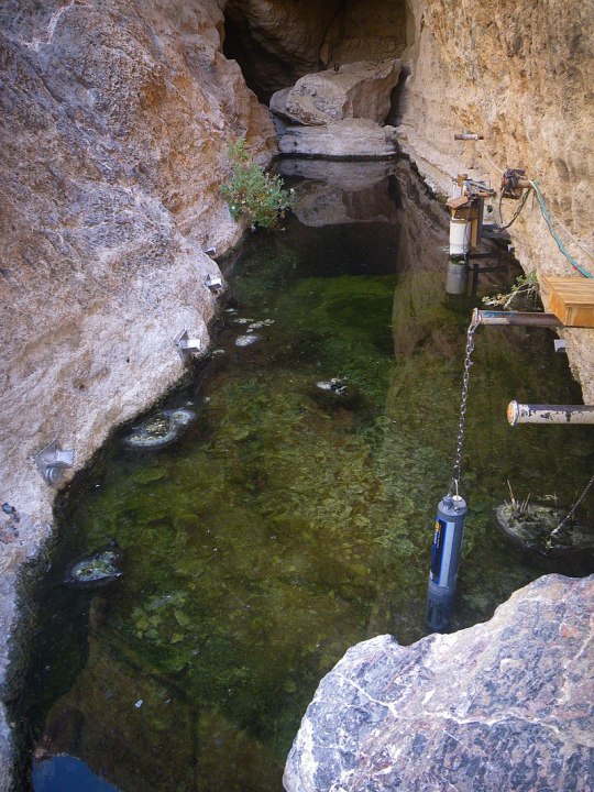
This is from last summer (I found it while trying to clean up browser tabs--oops.) Anyway, it's one of many examples of critically endangered species showing an upturn in population with support. The Devils Hole pupfish is particularly imperiled because it is only found in one flooded cavern in Nevada's Amargosa Desert; the species is likely descended from fish that were washed in there by flooding thousands of years ago, and have managed to eke out a living in the hot, oxygen-deficient water ever since.
This is one of the first species ever listed under the U.S. Endangered Species Act. Devils Hole is threatened by groundwater depletion from well drilling, and after the pupfish's ESA listing there were numerous legal battles between conservationists and farmers over water usage. Water levels reached their lowest point in the early 1970s, but have been slowly rising since then.
Scientists are excited because the current wild population (at least as of last fall) is at 263 fish. That's up from just 35 in 2013, the lowest recorded population ever. There are a few hundred more in captivity, being used to breed more young for reintroduction. The hope is that this fall's wild count will break 300, a good sign for the world's most endangered fish.
By the way, THIS is the entirety of the Devils hole pupfish's habitat, the only place in the world where they are found:
#Devils Hole pupfish#Devils Hole#fish#icthyology#vertebrates#animals#wildlife#endangered species#endangered animals#extinction#nature#ecology#environment#conservation#science#scicomm#Nevada#United States#Endangered Species Act#Endangered Species List
1K notes
·
View notes
Text
Hundreds of new mining claims have been staked within the community of Amargosa Valley, Nevada, on thousands of acres directly adjacent to Death Valley National Park.
These new mining claims, documented here for the first time, are staked above groundwater aquifers that feed the springs at Furnace Creek in Death Valley National Park and provide drinking water to the Timbisha Shoshone Reservation. Furnace Creek hosts the park’s visitor center, hotels and other tourist amenities.
“We are extremely concerned about this dramatic rise in mining activity directly adjacent to Death Valley National Park,” said Mason Voehl, executive director of the Amargosa Conservancy. “These claims were filed right next to people’s homes and businesses, and mining there would threaten the groundwater that communities and the environment rely on for survival.”
The new claims were filed by Canadian-based Rover Critical Minerals and follow a year of controversy over claims filed near Ash Meadows National Wildlife Refuge just a few miles away. The company's proposed mining project in that area sparked a lawsuit that led to the withdrawal of project approval and prompted efforts to secure a mineral withdrawal within the Amargosa Valley area.
Local governments, including the towns of Beatty and Amargosa Valley, have expressed support for pausing new mining claims in the area so that a mineral withdrawal planning process can be undertaken. The Timbisha Shoshone Tribe has also supported that proposal.
“Our national parks were set aside for future generations to experience abundant wildlife and iconic landscapes and learn from our rich cultural stories. These new mining claims are encroaching on our ability to tell that shared story across the California desert,” said Luke Basulto, California Desert program manager at the National Parks Conservation Association. “We have a fleeting opportunity to protect this place — Congress and the administration can act now to save Death Valley National Park, Ash Meadows National Wildlife Refuge and the rare waters that sustain them.”
The claims have not yet been registered in the U.S. Bureau of Land Management’s Minerals and Land Record System. But in recent field reconnaissance, local residents encountered hundreds of claim markers staked in the ground, with numbers indicated on the claim notices as high as 387. These claims appear to be blanketing an area of approximately 8,000 acres on the border of Nevada and California, just 1 mile away from the park.
Drilling and mining in the area could harm springs and groundwater wells in Death Valley and impair Timbisha Shoshone Tribal water rights. While new mine claims do not guarantee full-scale mining operations, lax regulation means that exploratory drilling alone, with limited regulatory requirements, can have an impact on scarce groundwater sources and natural resources.
“These new mining claims are a real escalation against our efforts to save Ash Meadows and the Amargosa River Basin,” said Patrick Donnelly, Great Basin director at the Center for Biological Diversity and a longtime resident of the area. “Now one of our country’s most beloved national parks and a sovereign Native American nation are also under attack. We need immediate action to pause further expansion of the mining industry in this sensitive region.”
#ecology#enviromentalism#death valley#nevada#mining industry#mining#fresh water#water pollution#bureau of land management#indigenous rights
4 notes
·
View notes
Text

Badwater Basin Refills
An ephemeral lake in Death Valley’s Badwater Basin is showing its staying power. After forming in August 2023 in the aftermath of Hurricane Hilary, the lake gradually shrank but persisted throughout the fall and winter. A potent atmospheric river filled it back up in February 2024.
This series of images compares the desert basin before flooding (left) with its more-waterlogged state following each major storm. In both August 2023 (middle) and February 2024 (right), a shallow lake several kilometers across fills in the low-lying salt flat. The images were acquired by the OLI (Operational Land Imager) sensor on Landsat 8 (left and right) and the OLI-2 on Landsat 9 (middle). They are false-color, shown with the OLI and OLI-2 band combination of 6-5-3, which emphasizes the presence of water in shades of blue.
The driest place in North America, Death Valley typically receives about 2 inches (51 millimeters) of rain per year. However, in the past six months alone, more than double that—4.9 inches (125 millimeters)—fell at the national park’s official weather gauge at Furnace Creek. Two events were responsible for most of that precipitation. The remnants of Hurricane Hilary delivered 2.2 inches on August 20, 2023, and an atmospheric river brought another 1.5 inches from February 4–7, 2024, according to park officials.
Following the August deluge, “most of us thought the lake would be gone by October,” said Death Valley National Park ranger Abby Wines in a news release. “We were shocked to see it still here after almost six months.” That was before the rains returned in February.
After the early February atmospheric river moved through, observers on the ground saw the lake continue to expand as water drained into the area. On February 11, park ranger Matthew Lamar noted: “The Amargosa River [which feeds the basin from the south] is really flowing, and we’ve noticed the water level continue to rise over the last couple of days as waters make their way to the basin.”
Badwater Basin is endorheic, meaning that water flows into but not out of it. Typically, evaporation far outpaces inputs, rendering the lake ephemeral. But in the past six months, the influxes have changed the equation.
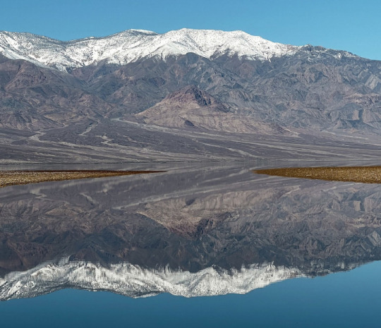
Based on satellite imagery, the lake appears to have grown to a similar size in February 2024 as it did in August 2023, thereby extending its months-long tenure. This comes as welcome news to visitors, who have enjoyed witnessing stunning reflections of the surrounding peaks in its calm waters.
As of February 14, the lake is 1 foot deep in places, according to park officials, and it is uncertain how long it will last. Past appearances of the lake are rare and offer little insight into the current situation; when a lake formed in 2005, for example, it reportedly lasted about one week. It is also too early to know how the precipitation will affect the wildflower season, which runs from late-February to mid-April, they said.
NASA Earth Observatory images by Wanmei Liang, using Landsat data from the U.S. Geological Survey. Photo by K. Skilling/National Park Service. Story by Lindsey Doermann.
3 notes
·
View notes
Text
🎶✨Rules: When u get this u have to put 5 songs u actually listen to, publish. then, send this ask/tag 10 of your favourite followers 🎶✨
Tagged by @kirkwallsokayesthero. Thanks! 🌼💜🌼
1. “Dancin” - Aaron Smith, Luvli, Krono
2. “Call Me Little Sunshine” - Ghost
3. "Save Your Tears” - The Weeknd
4. "Human” - Rag‘n’Bone Man
5. "Soldier” - Fleurie
Tagging all of these lovelies: @madangel19 @fiadhaisteach @steamcaptain @st0nergh0ul @ranaspkillnarieth @theluckywizard @the-desert-dancer @kenais-posts @madman-of-amargosa @thegaymanifesto and YOU! No pressure!
5 notes
·
View notes
Text
When it comes to sheer resilience, few, if any, species can match the tiny Devils Hole pupfish.
Cyprinodon diabolis, as the species is known, has the most ruthlessly circumscribed natural habitat of any vertebrate: Devils Hole, an exceptionally deep, water-filled cave in a limestone formation in the unforgiving Nevada desert, where the fish mostly stay on a rock shelf little more than 200 square feet. Not only that, but the pupfish are believed to be one of the most inbred of all species, a lack of genetic variation that makes it difficult for the creatures to procreate and thrive.
And yet, improbably, Devils Hole pupfish are thriving. Late last month, the National Park Service announced that the spring population of the species had grown to 191, the highest in 25 years, according to a count conducted twice a year by scuba divers. Because of seasonal fluctuations in food sources, fall counts tend to be higher, meaning that this year’s tally could be a watershed.
“If, this fall, we have over 300, I’ll be really ecstatic,” said Kevin Wilson, an aquatic ecologist at the National Park Service who has studied the Devils Hole pupfish for more than two decades. (Devils Hole is officially part of Death Valley National Park, most of which is in California.)
If the pupfish census does not seem especially impressive, consider that there were only 35 pupfish left in Devils Hole in 2013, prompting worries about extinction. For now, that danger has receded ever so slightly.
“This is a tremendous success story,” said Christopher Martin, an evolutionary biologist and pupfish expert at the University of California, Berkeley. “Ten years ago, we couldn’t have expected this level of success.”
Biologists have been feeding the pupfish frozen food to supplement their regular diet of algae since 2007. In 2019, the biologists finally arrived at the optimal formula of mysid shrimp, water fleas and blood worms. “This change in the supplemental food probably did enhance that increase in population numbers we’re seeing,” Dr. Wilson said.
Hurricane Hilary, which hit last summer, also helped. Even though the storm caused flooding and damage to the park, it benefited the pupfish living in Devils Hole by “adding nutrients that washed off the surrounding land surface in a fine layer of clay and silt,” according to the National Park Service.
The tiny pupfish, usually about an inch in size, is believed to have lived in Devils Hole for at least 10,000 years and probably much longer, Dr. Martin said. Its name alludes to a playful, puppylike disposition.
How the pupfish ended up in the Nevada desert is not known for certain. Much of Nevada was once underwater. The waters eventually receded, but somehow the pupfish found a refuge in the vast expanse of scrubland and sand.
To this day, no person is known to have completed an exploration of the lowest depths of Devils Hole, which is hundreds of feet deep. (A submersible would never fit into the narrow cavern, Dr. Wilson said.) In a notorious accident in 1965, two young men died during a dive in Devils Hole.
Not much for deepwater exploration, the pupfish stay at depths of 80 feet or less. There, the temperature is 93 degrees Fahrenheit, potentially even hotter near the surface.
Because the pupfish are effectively perched on a shallow underwater ledge, changes to the water table can harm prospects for survival. Dr. Wilson worries that the profusion of enormous solar panel farms in the surrounding desert could drastically increase water usage, damaging the delicate Amargosa River system. Mining is booming again in Nevada. Pahrump, a desert town near Ash Meadows, has seen its population explode.
“There’s increasing pressure on groundwater,” Dr. Wilson said. A well could inadvertently tap the Devils Hole aquifer, causing a drastic drop in the water level there.
Perhaps the greatest danger to the species is its lack of genetic diversity, which increases the incidence of harmful genetic mutations and thus makes it harder for the population to grow. In a classic Catch-22, the pupfish have only one way of inbreeding less: by growing their population.
To prepare for potential catastrophe, the U.S. Fish and Wildlife Service has been breeding Devils Hole pupfish in captivity since 2013. Introducing bred pupfish into Devils Hole is unfeasible for a variety of reasons, but should something happen to the wild pupfish, the species will live on.
For now, however, the wild pupfish are hanging on in Devils Hole. Christopher Norment, a vertebrate ecologist and the author of “Relicts of a Beautiful Sea,” a book about Death Valley, said that although he was “somewhat jaundiced” about the long-term prospects of the Devils Hole pupfish, he was impressed by its tenacity.
“It’s the story of survival in the face of overwhelming odds,” he said.
0 notes
Text
New Victorville Sprouts Farmers Market Set to open on March 15, 2024
VICTORVILLE, Calif. (VVNG.com) — Sprouts Farmers Market has announced it will open its newest store in Victorville on Friday, March 15 located at12450 Amargosa Rd. in Victorville. A ribbon cutting will take place Friday morning at 6:45 a.m. The doors to the store will open at 7 a.m.
“We are ecstatic to welcome the very first Sprouts Farmers Market in the High Desert to the great City…

View On WordPress
0 notes
Text
Amargosa Valley NV Properties
Amargosa Valley NV properties is a small town located in Nye County, Nevada, about 100 miles northwest of Las Vegas.
The area is known for its natural beauty, with the Amargosa Desert and the Amargosa River running through the area, and for its proximity to the Ash Meadows National Wildlife Refuge and the Death Valley National Park.
Rural NV Properties
Amargosa Valley NV Properties offers a diverse range of homes and properties to cater to various needs and preferences.
Whether you're looking for a cozy single-family home or a spacious estate, the options available in Amargosa Valley NV Properties are sure to meet your requirements.
With a buyer-friendly housing market and a favorable climate, Amargosa Valley presents an enticing opportunity for real estate investment.
We will explore the different property types, delve into the housing market trends, highlight the amenities and facilities, and identify the best neighborhoods in Amargosa Valley.
We will provide valuable tips for buying property in this promising region.
Let's dive into the world of Amargosa Valley NV Properties and discover the exciting possibilities that await.
Available Property Types
The diverse range of available property types in Amargosa Valley, NV caters to a variety of preferences and budgets, offering options such as single-family homes, condos/townhomes, luxury apartments, and large acreage properties.
These properties provide ample opportunities for individuals and families looking to invest in the Amargosa Valley NV Properties real estate market.
Whether someone is looking for a cozy single-family home, a stylish condo or townhome, a luxurious apartment, or a sprawling acreage property, there is something to suit every taste and budget.
The real estate listings held by the site owner are marked with detailed descriptions and specifications, making it easy for potential buyers to find the perfect housing option in Amargosa Valley, NV.
With a wide range of property types available, Amargosa Valley offers something for everyone in the housing market.
Housing Market Trends
The Amargosa Valley NV properties housing market in NV exhibits noteworthy trends that reflect the current state of real estate in the area.
According to data from the Greater Las Vegas Association of Realtors' Internet Data Exchange Program, the median listing home price in Amargosa Valley, NV is $48,000.
Houses for sale in the area typically spend an average of 194 days on the market, indicating a slower-paced market.
Amenities and Facilities
Amargosa Valley NV properties offers a wide range of amenities and facilities to cater to the diverse needs of its residents and visitors.
In terms of real estate, Amargosa Valley NV Properties provides various options for renting, including apartments, luxury apartments, and townhomes.
The area boasts real estate listings with large acreage, ranging from 9.53 acres to 320 acres, offering different preferences to potential buyers.
Access to social media platforms allows users to connect with listing brokers and stay updated on available properties.
Home sizes in Amargosa Valley vary significantly, from a modest 728 sqft to expansive properties spanning 268.13 acres.
With decreasing home prices and a slowdown in market activity, now is an opportune time to explore the amenities and facilities that Amargosa Valley NV Properties has to offer.
Tips for Buying Property in Amargosa Valley
When considering a property purchase in Amargosa Valley, there are several key tips to keep in mind.
It is important to do thorough research on the real estate market in the area.
This includes understanding the current trends, prices, and availability of houses in Amargosa Valley NV Properties.
It is advisable to work with reputable brokerage firms that specialize in the area.
These firms have extensive knowledge and experience in the local market and can provide valuable insights and guidance throughout the buying process.
Potential buyers should carefully consider their budget and financing options to ensure a smooth transaction.
Visiting the property in person and conducting inspections is crucial to ensure that the house in Amargosa Valley meets all requirements and is in good condition.
Frequently Asked Questions
What Is Amargosa Valley Known For?
Amargosa Valley NV properties is known for its diverse range of homes and properties, favorable housing market for buyers, and inviting climate with pleasant temperatures throughout the year.
It offers something for everyone, making it an attractive destination for residents and tourists.
What is the source of the Amargosa River?
The Amargosa River proudly claims two sources, depending on who you ask – a surface water one and a hidden, subterranean one.
On the surface: The Amargosa's story begins near Beatty, Nevada, at the southern foot of Pahute Mesa.
Here, at an elevation of around 3,900 feet, Thirsty Canyon Wash dumps its precious cargo into the thirsty earth, marking the official start of the river's visible journey.
From there, it flows southwestward into Oasis Valley, painting streaks of life across the parched desert landscape.
Opens in a new window

fr.wikipedia.org
Amargosa River source, Pahute Mesa, Nevada
Below the surface: But the Amargosa's tale goes deeper. Its true source lies in a vast underground reservoir known as the Carbonate Aquifer.
This hidden treasure trove of water stretches across the Mojave Desert, fed by a complex network of springs and seeps.
The Amargosa River taps into this aquifer at various points along its course, replenishing its surface flow and sustaining the fragile desert ecosystem.
So, there you have it!
The Amargosa River, a desert lifeline, draws its lifeblood from both the visible and the unseen, a testament to the intricate dance of water in this arid land.
What is the elevation of Amargosa Valley?
Amargosa Valley sits at an elevation of 2,664 feet (805 meters) above sea level.
This places it in the lower to moderate range of elevations typically seen in the Mojave Desert, contributing to its characteristic landscape of flat, sandy expanses interrupted by rocky mounds and hills.
What county is Amargosa Valley in?
Amargosa Valley is located in Nye County, Nevada, although the Amargosa River itself straddles the border between Nevada and California.
The vast majority of the valley, including the unincorporated town of Amargosa Valley, falls within Nye County's jurisdiction.
Amargosa Valley NV Properties
The area is relatively rural and is primarily used for farming and ranching.
As for land and properties, there is a variety of options available in Amargosa Valley, including residential properties, commercial properties, and large plots of land that are ideal for farming or ranching.
Prices for land and properties in the area vary depending on the size and location of the property, with some properties costing as low as $50,000 and others going as high as several hundred thousand dollars.
It is worth noting that this area is still relatively rural and many properties are not connected to city services such as water, sewage and electricity, so buyers should be prepared to install their own septic systems and wells if they choose to purchase a property in the area.
Nye County NV Properties
There are several reasons why someone might consider purchasing land or property in Amargosa Valley NV properties, Nevada:
- Scenic beauty: The Amargosa Valley is known for its natural beauty, with the Amargosa Desert and the Amargosa River running through the area, and for its proximity to the Ash Meadows National Wildlife Refuge and the Death Valley National Park.
- Outdoor activities: The area offers a wide range of outdoor activities, such as hiking, camping, fishing, and hunting, making it a great place for outdoor enthusiasts.
- Privacy: The area is relatively rural, and many properties are located on large plots of land, providing a sense of privacy and seclusion.
- Investment potential: The area is growing in popularity, and as more people discover the beauty and potential of the area, the value of land and properties is likely to increase.
- Self-sufficiency: Many people who purchase land in the area are interested in living a more self-sufficient lifestyle, growing their own food, and raising animals.
- Affordable: compared to other locations in the state or nearby cities like Las Vegas, the land and properties in Amargosa Valley are relatively affordable.
- Natural Resources: The area offers natural resources such as water and minerals, which can be beneficial to those who plan to establish a business or use the land for farming or ranching.
Keep in mind that this area is relatively remote and can be isolated in terms of services and access to amenities, so it's important to research the area and make sure it fits your needs before making a purchase.
Amargosa Valley NV properties are active in both Clark County and Nye County, Lincoln County.
The Amargosa Valley near Pahrump and Death Valley and about 2 hours from Las Vegas.
Rural areas real estate services including Amargosa Valley, Beatty, Indian Springs, Las Vegas, Pahrump, Sandy Valley, Searchlight, Alamo, Moapa.
Research homes, lots and land for sale in Amargosa Valley, NV including acres of undeveloped land, small residential lots, farm land, commercial lots, and large rural located in 89020 zip code.
Amargosa Valley NV Properties
Amargosa Valley NV properties offers a diverse range of homes and properties that cater to various needs and preferences.
The buyer-friendly housing market in Amargosa Valley presents a promising opportunity for real estate investment.
The region's pleasant year-round climate further adds to its appeal for residents and tourists.
With a variety of property types available and a range of amenities and facilities, individuals with different requirements can find a suitable option in Amargosa Valley.
Top Realtor!
When buying Las Vegas homes for sale.
Amargosa Valley NV Properties
Read the full article
0 notes
Text
[4] thesis excerpt : "A"
[July 6th, 2019, 07:19 PST]
Belonging to the family Cyprinodontidae, the Devils Hole pupfish (Cyprinodon diabolis) live in the upper shelf of the titular geological formation situated in the Amargosa Desert, southeast of the California-Nevada border. The Devils Hole is an ecological enigma, but more on that later.
Let’s take an example for our studies—a four-month old male specimen. Let’s call him “A.” While colors may vary between pupfishes, even within a given subspecies, and are notably distinguished between males and females, A is a brilliant and expensive-looking blue, coated in an iridescence that makes him appear laced with silver. The margins of his fins (pectoral, dorsal, and caudal) are black-tiped, for distinction. A is 1-inch long, just slightly above the average 0.9 inches. Not that the fishes are making such comparisons between themselves, though. That’s a pastime among different species.
Like other pupfishes, the Devils Hole pupfish are found in extremely isolated habitats and, due to the female’s low fecundity and the hatched eggs’ slim survival rate, reproduce slowly. Such biological combinations make the species particularly prone to endangerment. While population censuses have been sparsely conducted, so as to not disturb the fishes’ highly delicate ecosystem, the most recently conducted survey (just this past spring) counted 136 observable pupfish. The Devils Hole pupfish numbers have always been low (with record population high just clocking under 550 in the 90s), but this current downward trend has earned the species new designation as “critically endangered.” And with ex situ conservation projects proving generally unsuccessful (there’s nothing like home), the threat of extinction within the next few decades is undeniable.
The end is not on A’s tiny mind. He goes about his day gobbling inorganic particulate matter and limestone algae in his hot tub of a habitat. (Devils Hole’s water temperature remains stable at 33 degrees Celsius, or 92 Fahrenheit, which is uncharacteristically warm for Cyprinodontidae species and most other aquatic vertebrate species.) Perhaps he’ll bounce around with some of the other male pupfish, nipping and zooming much like a puppy indeed—how else would they have earned their name? A has nothing but the ever-refreshing present. Second by second. The future is an abstraction.
This is a necessary bliss, because life is short (for A). The Devils Hole pupfish’s lifespan hovers around 10-14 months.
The fishes’ precarious location contributes to the instability of their life. The Devils Hole appears at first to be a small, sunken body of water arbitrarily placed in the hostel stretches of the Death Valley desert. The Hole is a hole, which is to say, an opening. Through the opening, sunlight and meager rainfall reach the vast groundwater system flowing underneath the barren land. Spelunkers have been unable to determine the exact depths of the subterranean caverns, with some estimates reaching beyond 1,000 feet. When two boys jumped into the Hole in 1965, they lost their bodies to the unarticulated waters.
Because the bottom has never been reached. It remains unknown.
What is known is that the aquatic caves run deep enough to make the waters sensitive to seismic activity from across the world. Vibrations sent by shifting plates resonate in the lowest regions of the chamber walls and cause the water at the surface to slosh in response, effectively creating a microscopic tsunami—a seiche. If geologists are correct in their calculations that these limestone labyrinths were formed over 500,000 years ago (half a megaannum!), then the Devils Hole has gurgled up history’s cataclysms. Picture Mount Vesuvius erupting in AD 79, an eruption powerful enough to preserve entire civilizations in its ashfall. The Devils Hole must’ve rippled a few inches or so. When a nearly eight-degree magnitude earthquake devastated Lisbon on All Saints’ Day in 1755 and brought every European man to his knees, rejecting the promise of God’s providence for the new faith of rational thought, the blue pool burped excitedly. The Great Chilean earthquake, which all but crumpled the city Valdivia in late May of 1960 and remains the largest seismic event in recorded history, certainly caused quite the swirl.
On July 4th, 2019 (just two days ago), the southern Californian town of Ridgecrest experienced a 6.4 earthquake, triggering a sequence of hundreds of other aftershocks. Now, the earth quivers again—the seismographs indicate a 7.1 magnitude shock. Car alarms go off across the city. People yell across the city in different languages. ¡Cuidado! Electricity momentarily flickers.
The Devils Hole is just about 160 miles away from Ridgecrest. The event laughs into the caves, disturbing the water at the opening. Waves form in the mouth of the Hole. They quickly increase in magnitude, crashing up against the Hole’s walls. To the pupfish, a real disaster is at hand. There goes A, tumbling in the seiche. All these rare creatures—their bodies break as they slam into stone and suffocate under shooting sediment.
Suddenly, the seiche flicks A out of the water. He loses his body to the unarticulated air, the heights of which have never been reached and remain unknown. The aftershocks subside and the water is still again. A barn owl (Tyto alba) flies over the opening and grieves for the throttled fish. The rest of the world moves forward unthinkingly. The car owners click their keys and silence the streets. Lovers across the country kiss and go swimming in their own pools. But they can understand it too, the loss of form felt when flung from their enclosures.
AA 12.21

#pupfish#devils hole#age of enlightenment#fig tree analogy#gay fish#earthquakes#vesuvius#literature#desert
1 note
·
View note
Text
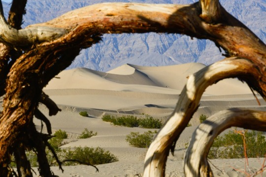
Hikers are seen in the distance at the Mesquite Sand Dunes in Death Valley National Park, California. This rugged desert landscape holds the world's record for the hottest air temperature—134°F in 1913. Tourists still flock here to experience the blistering heat. Photograph By Raul Touzon, National Geographic Image Collection
How Did Death Valley 🏜️ Gets Its Name? Not From The Heat
In December 1849, a group of settlers seeking their fortunes stumbled upon this inhospitable valley. The few who made it out alive assigned the haunting moniker.
— By Erin Blakemore | July 25, 2023
As a heat wave continues to blanket the Northern Hemisphere, tourists are making pilgrimages to the hottest place on Earth—Death Valley, California—in hope of experiencing a new world-record high temperature. The valley already holds the record for hottest air temperature ever recorded, a whopping 134°F in 1913.
But if they think the valley was named after its scorching summer temps, they’re wrong—it actually got its name from a winter disaster. Here’s how Death Valley got its name, and why it continues to lure visitors with its extreme weather and barren landscape.
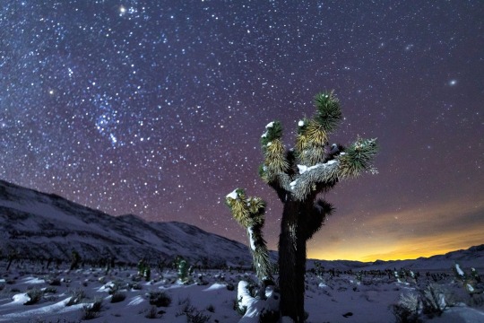
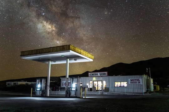
Photographing Death Valley’s starry skies shines a light on pollution. A national park artist-in-residence captures the fragility and beauty of the desert at night. August 20, 2020! As an artist-in-residence at Death Valley National Park, photographer Harun Mehmedinović captured images of its night skies and increasing light pollution. In this snowy shot, he caught both stars and, on the right, the glow of the city of Las Vegas. Photograph By Harun Mehmedinović
Inside A Desolate Desert
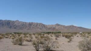
Located in southeastern California near the Nevada border, Death Valley is nestled in the northern Mojave Desert between four mountain ranges: the Panamint Range to the west, the Amargosa Range to the east, the Grapevine Mountains to the north, and the Owlshead Mountains to the south.
The area’s original inhabitants, the Timbisha Shoshone, lived in harmony with the valley for millennia. But when European settlers encountered it during their westward migration, they were flummoxed by the landscape. Though surrounded by mountain ranges, the valley is situated at the lowest elevation in the United States. The alkaline desert floor is bone dry and lacks vegetation, while the surrounding mountains trap the heat reflected by the sparse desert floor—making it blindingly hot in the summer and inhospitable even in winter.
Even before gold was discovered there in 1849, California attracted white settlers searching for a new life filled with natural riches. Many of these emigrants were completely unprepared for the arduous trip across both mountain and desert—and some fell victim to people who falsely claimed they knew the safest, fastest routes.
In one particularly famous case in 1846, a group of pioneers known as the Donner Party became snowbound after following the shortcut that a booster named Lansford Hastings had advertised. Stuck in the Sierra Nevadas, some of these pioneers eventually resorted to cannibalism and lost nearly half of their group to starvation and exposure.
Photographing Death Valley’s starry skies shines a light on pollution. A national park artist-in-residence captures the fragility and beauty of the desert at night. August 20, 2020! The Milky Way looks brighter above Death Valley’s Panamint Springs thanks to the dim lighting at this gas station. Mehmedinović says the image shows the benefit of cutting out excessive light around national parks. Photograph By Harun Mehmedinović
On The Trail To Death Valley
Despite the Donner Party disaster—and the fact that they lacked familiarity with the terrain—boosters and wagon train leaders still attempted to find shortcuts on their journeys to California, especially after gold was discovered there.
In October 1849, members of trail leader Jefferson Hunt’s Mojave San Joaquin Company wagon train grew impatient with Hunt’s pace and his preferred route, known as the Old Spanish Trail. Some worried they’d be stuck in the mountains during the winter like the Donner Party if they didn’t move more quickly. They briefly convinced Hunt to try an alternative route, but Hunt returned from a reconnaissance mission nearly dead of thirst and told them he’d keep to the Old Spanish Trail.
A subset of the party still thought they could find a path west across the Mojave Desert, however—and when they met up with another, smaller party on the trail, they were shown a hand-drawn map of a cutoff that was endorsed, they were told, by some of the region’s most experienced trappers and mountaineers. After Hunt refused to take the shortcut, which would shave 500 miles and potentially months off the journey, much of the party broke off to try out the supposedly superior route.
At first, it seemed like they’d made the right choice: travel was easy, and they made good time. But soon they encountered more and more inhospitable terrain, and increasing disputes about how to proceed. One group headed toward a nearby mountain in hopes of finding water. The other, a group of younger, unmarried men who called themselves “Jayhawkers,” broke off into their own party and attempted to press due west to find the mountaineers’ advertised trail—a route that, it turns out, didn’t really exist.
As both groups journeyed, water became harder to find, and many turned back in search of Hunt rather than face the coming winter in the deadly Sierras. “Grass there is scarce, wood there is none,” wrote Jayhawker Sheldon Young of the landscape. “It is a dubious looking country.”
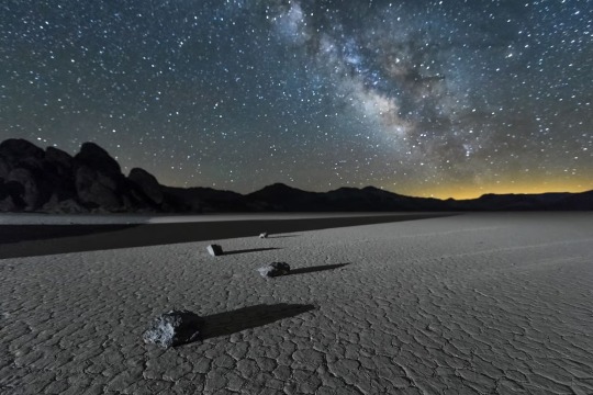
Photographing Death Valley’s starry skies shines a light on pollution. A national park artist-in-residence captures the fragility and beauty of the desert at night. August 20, 2020! Light pollution from cities can encroach on rural areas. Here, in Mehmedinović’s photograph of Death Valley’s Racetrack Playa, the glow on the right comes from Las Vegas, more than 200 miles away. Photograph By Harun Mehmedinović
Disaster Strikes
Weak and exhausted, in December 1849 both groups eventually entered a massive valley filled with salt flats and surrounded by mountains on all sides. Water was scarce in the desert valley; they were only able to locate highly alkaline water sources.
The Jayhawkers slaughtered many of their own oxen to eat and walked across the valley, eventually finding a Native American who guided them to safety. The other party tried going the other direction. As they pressed onward, this time another group of men decided to strike out on their own, and would ultimately die of exposure along their preferred trail.
On the verge of dehydration, the remaining members of the original party were briefly saved by a snowstorm. But over time, oxen dropped dead from thirst and exhaustion, and several men died. Finally, all but a few of the men broke off find their way over the mountains. The others waited patiently at the bottom of the valley.
Finally, after more than a month, the remaining party members—mostly women and young children—were rescued by two young men they’d sent off to get supplies. As they made their final crossing of the Panamint Mountains, one of the party members is said to have turned toward the valley and said “Goodbye, Death Valley.” Overall, it took the shortcut seekers more than four months to find their way to the part of California they sought.
Photographing Death Valley’s starry skies shines a light on pollution. A national park artist-in-residence captures the fragility and beauty of the desert at night. August 20, 2020! "These images are meant to evoke a sense of wonder and curiosity,” says Mehmedinović. “I see images as a gateway to a discussion on the importance of the night sky and our impact on the environment.” Photograph By Harun Mehmedinović
The Highest Temperature Recorded on Earth?
The name stuck—and today, the valley is still known as one of the most barren and dangerous places in the United States. In 1913, the ambient air temperature reportedly rose to 134 degrees, still the world-record high air temperature.
Modern-day meteorologists dispute this reading, pointing out that the temperature was not in line with that of other nearby places and that even freak “hot spots” in the valley cannot account for those variations.
“It is possible to demonstrate that a temperature of 134°F in Death Valley on July 10, 1913, was essentially not possible from a meteorological perspective,” wrote meteorologist Christopher C. Burt in a 2016 analysis. However, the World Meteorological Organization, which validates world-record temperatures, still considers the reading a world record.
The group “is always willing to investigate any past extreme record when new credible evidence is presented,” the WMO wrote in a 2020 release, but to date the analysis has never been officially invalidated.
In the meantime, as a potential new extreme approaches, the organization says it’s ready to examine and validate any new records. Death Valley may not have gotten its name from a scorching summer’s day. But 174 years after it was named, the barren, salty valley is still as inhospitable as it was in 1849.
#Death Valley 🏜️#Inhospitable#California#High Temperature World Record#Desolate Desert 🐪#Mojave Desert#Timbisha Shoshone#European Settlers#United States 🇺🇸#The Alkaline Desert 🌵#Donner Party#Sierra Nevadas#Cannibalism#Jefferson Hunt#Mojave San Joaquin#Jayhawkers#Deadly Sierras#Panamint Mountains ⛰️#Meteorologist Christopher C. Burt#World Meteorological Organization (WMO)
0 notes
Text
Biden's $105M Solar Auction Ignites Nevada's Green Wave
The Biden administration has made history. A solar energy auction in Nevada raised a staggering $105 million. It's an unprecedented move that is stirring up a green revolution.
Solar power developers fought for a lease. The lease covers 23,675 acres of the Nevada desert. The battle marked a notable move toward sustainability.
The auction took place on June 28th. The Biden administration was at the helm. When the final gavel fell, the total stood at an impressive $105 million. This sum breaks all records for federal onshore renewable energy auctions. It shows the growing demand and backing for clean energy.
Climate concerns are on the rise. So is the pressure to cut carbon emissions. The auction's results signal a turning tide in the energy sector. It shows that renewable energy development is not only feasible but also lucrative.
NV Energy Inc., a prominent energy supply company, emerged as the auction's front runner. The company placed towering bids of over $80 million, securing leases for two highly sought-after parcels located within the Amargosa Valley Solar Energy Zone. This grand investment by NV Energy Inc. underscores the escalating demand for clean energy solutions.

Biden's Solar Auction in Nevada
Complementing NV Energy Inc.'s contribution, two other influential companies made significant plays during the auction. Boulevard Associates, a subsidiary of NextEra Energy Resources, and Silver Star Solar, a subsidiary of Leeward Renewable Energy, secured the remaining two parcels. Their winning bids were substantial, standing at $21 million and $2.3 million, respectively.
Deb Haaland, the Interior Secretary, expressed her enthusiasm about the auction's success in a recent press release. “This record-breaking auction for solar energy development is further evidence that the demand for clean energy has never been greater," she stated. This successful auction is undeniably an encouraging step towards the realization of a greener future.
According to the Interior Department, these leases are not just about present profits. They represent an investment in a sustainable future. It anticipates that these leases will eventually contribute a staggering 3 gigawatts of power to the grid. For perspective, that's enough energy to power around 900,000 homes for an entire year.
The Biden administration is harnessing these strides in renewable energy to combat the adverse effects of climate change, and this auction forms an integral part of that mission. It's a multi-pronged strategy aimed at promoting and expanding renewable energy development on federal lands.
In conclusion, the record-breaking $105 million Nevada solar energy auction is a remarkable achievement, signaling a new era in renewable energy development. By championing clean energy solutions, the Biden administration, along with the participating companies, is showing the world that the path to a sustainable future is not only desirable but also economically viable.
Read the full article
0 notes
Video
I Found Myself Driving, Hours Upon Hours (Death Valley National Park) by Mark Stevens
Via Flickr:
I Found Myself Driving, Hours Upon Hours Just for the possibility of seeing this again Recent snow storms had allowed me To see another beauty of southern California But it also closed roads, with the one here being one At least, until earlier that day You didn’t disappoint years ago And you’re still wondrous today Mountain peaks and Badwater An imaginary Mos Eisley The wind takes away my breath, Literally and figuratively, when I take in this view Dante’s View, you only bring out awe Another work of short poetry or prose to complement the image captured one afternoon in Death Valley National Park at Dantes View. My thought on composing this image was a simple landscape one with my Nikon SLR camera angled slightly downward to capture a sweeping view down the mountainside, across Badwater Basin, and then to the snowcapped peaks of the Panamint Range. I would lose much of the blue skies above, but I felt this alignment helped to bring out a wider angle, almost panoramic feel with the image captured. My thought on this location brought back memories from April 2015 on an earlier visit seeing this wondrous landscape in a national park. I could imagine a Star Wars setting with Mos Eisley as well as just the natural beauty present. There was a wind blowing that could easily take one’s breath away but had that crisp, cool feel with the low temperatures to make for an enjoyable, brisk walk along the trails and ridges. If you look at the lower portion of the image just left of center, you will notice a what looks like a thin white walkway jutting out. You can zoom in and notice tiny ant people walking along Badwater Basin, almost 6000 feet below!
#Aguereberry Point#Amargosa Range#At Dantes View#Azimuth 311.90#Badwater Basin#Bald Peak#Bennett Peak#Blue Skies#Canvas#Dantes View#Day 4#Desert Landscape#Desert Mountain Landscape#Desert Plant Life#DxO PhotoLab 6 Edited#Free Verse Poetry#Great Basin Ranges#Intermountain West#Joshua Tree National Park and California#Landscape#Landscape - Scenery#Looking NW#Mountain Peak#Mountains#Mountains in Distance#Mountains off in Distance#Mountainside#Nature#Nikon D850#No People
5 notes
·
View notes
Text
A Step-by-Step Guide to Taking the Ultimate Death Valley Tour From Las Vegas
Overview of Death Valley and Its Incredible Natural Wonders
Death Valley is a vast, arid region located in eastern California, in the United States. The valley stretches over 3,000 square miles and is the lowest, driest, and hottest area in North America. Despite its harsh environment, Death Valley is home to many unique and incredible natural wonders.
One of the most striking features of Death Valley is its landscape. The valley is surrounded by towering mountains, including the Panamint Range to the west and the Black Mountains to the east. The valley floor is a vast expanse of salt flats, sand dunes, and rocky canyons, which provide a unique and otherworldly landscape to explore.
Death Valley is also home to several natural wonders, including:
Badwater Basin: This is the lowest point in North America, with an elevation of 282 feet below sea level. The basin is a vast expanse of salt flats that are beautiful to explore.
Mesquite Flat Sand Dunes: These are some of the most beautiful sand dunes in the park, and they offer a great opportunity for hiking and photography.
Zabriskie Point: This is a popular viewpoint that offers stunning panoramic views of the surrounding landscapes, including the badlands and the Amargosa Range.
Artist's Drive and Palette: This is a scenic one-way drive that offers breathtaking views of the colorful rock formations, including the famous Artist's Palette.
Scotty's Castle: This is a historic mansion that was built in the 1920s and offers a glimpse into the park's history and architecture.
Dante's View: This is a viewpoint that offers stunning panoramic views of the valley and the surrounding mountains, and it's a great place to watch the sunrise or sunset.
Ubehebe Crater: This is a volcanic crater that offers a unique and otherworldly landscape to explore.
Overall, Death Valley National Park is a unique and incredible natural wonder, offering a glimpse into the harsh beauty of the desert landscape. Visitors can explore the park's stunning landscapes, natural wonders, and rich history, making it an unforgettable destination for adventure seekers and nature lovers alike.
Preparing for the Ultimate Tour of Death Valley - What You Need to Know
If you're planning a tour of Death Valley, here are some things you need to know to prepare for an ultimate experience:
Plan your visit: Death Valley is a vast park, and it's important to plan your visit to make the most of your time. Consider which attractions you want to see, and plan your itinerary accordingly.
Dress appropriately: The weather in Death Valley can be extreme, with hot days and cool nights. Dress in layers, and wear comfortable clothing and shoes suitable for hiking.
Bring plenty of water: Dehydration is a real danger in Death Valley, so bring plenty of water, and drink it regularly to stay hydrated.
Watch out for wildlife: Death Valley is home to several species of wildlife, including snakes, scorpions, and coyotes. Be aware of your surroundings, and take precautions to avoid encounters with wildlife.
Stay on designated trails: To protect the fragile ecosystem of Death Valley, it's important to stay on designated trails and not venture off into areas where you could cause damage.
Respect park rules and regulations: To help preserve the park's natural beauty and protect its resources, be sure to follow all park rules and regulations.
Bring a map and compass: Cell phone coverage can be spotty in Death Valley, so bring a map and compass to help you navigate the park.
Be prepared for emergencies: In case of an emergency, be sure to bring a first aid kit, and let someone know your itinerary and when you plan to return.
By following these tips, you can prepare for an ultimate tour of Death Valley and have a safe and enjoyable experience exploring this unique and beautiful landscape.
Exploring Death Valley - Tips for Making the Most Out of Your Trip
If you're planning a trip to Death Valley, here are some tips to help you make the most out of your experience:
Visit during the off-season: The summer months can be incredibly hot in Death Valley, so consider visiting during the fall or winter when the weather is more mild.
Take your time: Death Valley is a vast park, and there's a lot to see and explore. Take your time and don't try to cram everything into one day.
Start early: If you plan on hiking or exploring outdoors, it's best to start early in the morning when the temperatures are cooler.
Bring a camera: Death Valley offers some incredible opportunities for photography, so be sure to bring a camera and capture some amazing shots.
Take guided tours: If you're not sure where to start, consider taking a guided tour with a knowledgeable guide who can show you the best spots in the park.
Check the weather: The weather in Death Valley can be unpredictable, so be sure to check the forecast before you go and plan accordingly.
Be prepared for the terrain: Death Valley offers a range of terrain, from rocky canyons to sand dunes. Be prepared for the terrain you plan to explore.
Bring snacks and food: There are limited food options in Death Valley, so be sure to bring snacks and food to keep you fueled throughout the day.
Respect the park: Death Valley is a beautiful and fragile ecosystem, so be sure to follow all park rules and regulations and respect the park's natural beauty.
By following these tips, you can make the most out of your trip to Death Valley and have an unforgettable experience exploring this unique and beautiful landscape.
The Best Way To Get From Las Vegas To Death Valley and Back Again
There are several ways to get from Las Vegas to Death Valley and back again, depending on your preferences and budget. Here are some options to consider:
Rent a car: Renting a car is a popular option for those visiting Death Valley from Las Vegas. There are several car rental companies located at the Las Vegas airport, and it's about a 2-3 hour drive to Death Valley.
Book a guided tour: If you prefer not to drive, you can book a guided tour from Las Vegas that includes transportation to and from Death Valley, as well as a knowledgeable guide who can show you the best spots in the park.
Take a shuttle: There are several shuttle services that operate between Las Vegas and Death Valley, such as the Death Valley Express Shuttle or the Death Valley Adventure Tour.
Hire a private car or driver: If you prefer a more luxurious and personalized experience, you can hire a private car or driver to take you from Las Vegas to Death Valley and back again.
No matter which option you choose, be sure to plan ahead and book your transportation in advance to ensure a smooth and enjoyable trip to Death Valley.
0 notes
Text
Death Valley Scraps - D1.
[Stitching together this weekend.]
I.
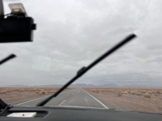
We were driving into a storm on our way into Death Valley. Fat quarter-sized drops of rain splattered against the windshield as we cut through the desolate landscape, through sparse towns that were either already dead or dying. The road beneath us grew narrower and rougher with every turn we hung.
"I feel like we're running away somewhere," J said.
"Our disappearing act," I replied.
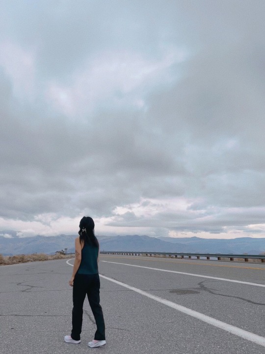
Friends on the east coast always go on about the trees and the foliage, how lush it is, how they love nature and The Seasons. My gaze swept over the surrounding landscape, over the scrublands and the Amargosa Range rising ahead of me, their shoulders soaked dark with rain, raw and barren. The desert is harsh and inhospitable, but there is an alien beauty here that is raw and undeniable. It's in the mountains' strange striations, in the overwhelming expanse, in how even with a direction in mind you feel lost, adrift in the emptiness. The landscape a little frightening, a little lonely to travel through, and still, absolutely breathtaking.
II.
Maybe the absolute absence of life brings my own into sharp focus. There were a few moments where it was easy for me to imagine being the last soul on the planet. What would be left of me? I wondered, but found myself pushing the thought away. Maybe another time. A dark little rabbit hole I was keen on skirting around.
III.
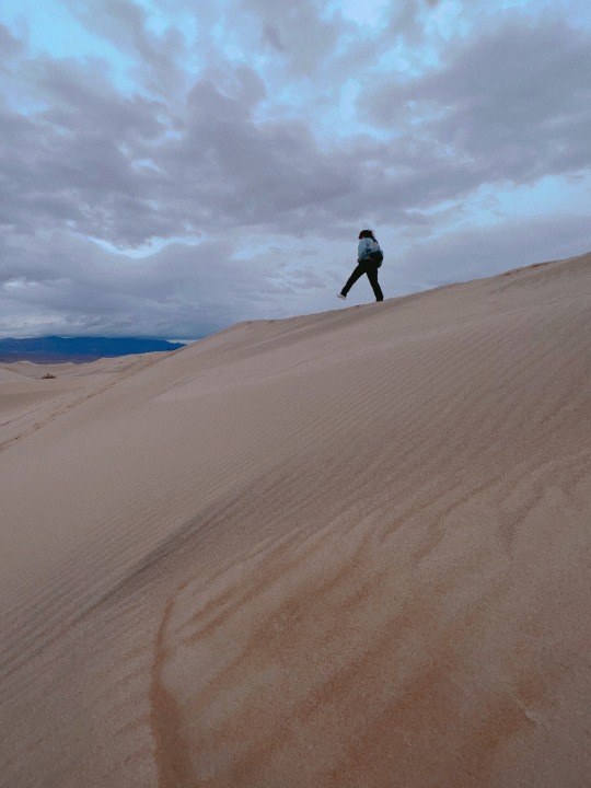
When I came with A last year, we explored the desert under the glare of the a white hot sun and empty blue skies. As I sat on top of the dunes, I watched the rain clouds snagged on the jagged edges of the valley's rim in the far distance. I thought about how I had preserved this place my memories: the sand soft and warm, the way my body had slowly sank into it. The sand beneath me now was cold and hard, compacted from the earlier rains. This place was so different under a ceiling of gray clouds.
My thoughts drifted to my old story about Roy who wandered through space and time, leaving everything behind in the name of freedom and adventure. How he had travelled eons to surf diamond dunes on that made-up planet just because. I loved that story, but I could never quite get that part about him and Anise right. I grabbed a fistful of the sand and watched as the grains trickled from my hands. I should finish that one, I thought.
0 notes
Text
Deep into the Valley of Death We Go
Perhaps Death Valley’s name is what gives the land its sinister, otherworldly reputation. Certainly, the searing heat and the moonscape panoramas also contribute to the mystery that surrounds the park.
And of course there are the legends. Tales tell of rotting wagons and gingham dress-clad skeletons half buried in the shifting sands, of the fabulously rich Lost Gunsight Mien and Breyfogle’s elusive gold vein.
A more macabre mythology has taken hold in the wake of serial killer Charles Manson’s capture here in 1969. Manson retreated to Death Valley with his gang of killer flower children after two bloody nights of slaughter that he hoped would set off a cataclysmic race war. An adherent of a variety of occult doctrines, Manson believed that Devil’s Hole, a deep, water-filled cavern on Death Valley’s Nevada side, was the portal to an underground world where he and his followers could wait out the apocalypse, reemerging as leaders of a purified world. But he was arrested before he could figure out how to get his band through several feet of hot, salty water that had drowned two skin divers just a few years earlier.
Manson may have learned of the underground world from a story of Tom Wilson, a Cahroc Indian who was a Death Valley guide in the 1920s. Wilson said that he had found a tunnel that extended for miles beneath the valley. Walking its length, the man ended up in an underground chamber where a race of fair-skinned people dwelt. The people spoke a strange foreign language, whose clothes made of leatherlike substance, and illuminated their home with a pale greenish yellow light of unknown origin.
The Indian eventually resurfaced and returned to his people, who were skeptical about his adventure. But Tom Wilson believe that the old man hadn’t lied, and he spent the rest of his life searching for the entry to this underground world. At one point, he teamed up with a prospector named White, who claimed that he too had found a strange underground dwellings in Death Valley.
White’s story was that he had been exploring an abandoned mine in Wingate Pass when he fell into a hidden tunnel that led to a series of rooms that were filled with leather-clad human mummies. Gold bars and other fabulous treasures were stacked in piles around them. There was a passageway leading beyond the rooms as well, lit by an eerie greenish yellow light. White dared not explore any farther, fearful of what might lie beyond.
He visited the rooms three more times, once with his wife and once with another prospector. But he was unable to locate the cavern later, when accompanied by Wilson and a group of archaeologists. The area around Wingate Pass was eventually absorbed into the China Lake Naval Weapons Center and is now closed to the public.
But other mysteries sites in Death Valley are still accessible. One is the Amargosa Mountains, in the southeast corner of the valley. Years ago a desert rat was driving through this range in his Jeep when he came to a group of boulders blocking the road. He parked his vehicle, found a narrow pass between the rocks, and walked down into a sandy valley, where he saw about thirty wooden buildings half covered by sand dunes and laid out like a planned community.
The explorer went inside some of the buildings and found wooden tables set for meals, brass candlesticks, scraps of cloth, and even an empty picture frame on the wall. There were no human remains, and no signs of violence or natural disaster.
No ghost turns were known to exist in these arid mountains. Whether the unnamed explorer had really located a lost community or was just spinning a tall tale has never been determined.
0 notes
Last Seen Blogs

spread-the-jam
SPREAD THE JAMBZ

urbanwrist
Your 'JOINT' for Personalized Gifts

the-enbyrat
WEST0N
THE_QUEER


nadiacamuc
Nádia Camuça