ptolemio-blog
Ptolem.io
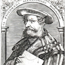
We love geography as much as Claudius Ptolemy did.
16 posts
Don't wanna be here? Send us removal request.
Last Seen Blogs

kabokotimetraveler
Kaboko
Time Traveler

raedalumity
Blog for Seretonin

shotomyheart
may your daydreams begin...

treachery-and-betrayal
fandoms mostly
shotomyheart
may your daydreams begin...
Photo


DYMAXION QUILT
Searching for a mappy Christmas gift? What about this beautiful quilt by Haptic Lab with a Fuller Projection map on it?
Go get it at https://www.hapticlab.com/collections/new/products/dymaxion-quilt (for $289).
0 notes
Photo


WHEN CALIFORNIA WAS AN ISLAND
After Cortés sent the navigator Francisco de Ulloa to explore the region, early maps in the 16th century (e.g., Mercator or Ortelius) correctly depicted Baja California as a peninsula. However, someone messed up and from 1622 on, starting with Michiel Colijn, cartographers began depicting California as an island. This misconception survived on the maps long until the 18th century.
Ferdinand Konščak, a Croatian missionary, explorer, and cartographer, was one of the key persons to set the matter right. In 1748 he created a correct map of Baja California and in 1750 a map of the Gulf of California. The issue was definitively laid to rest by the expeditions of Juan Bautista de Anza (1774-1776).
Find more: Old Cabo, Frank Jacobs @ BigThink, Wikipedia
Maps: Joan Vinckeboons (circa 1650), Peking in 1674 (Glen McLaughlin Map Collection), English map from 1646 (Glen McLaughlin Map Collection), Michiel Colijn (1622)
0 notes
Photo


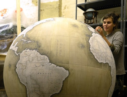
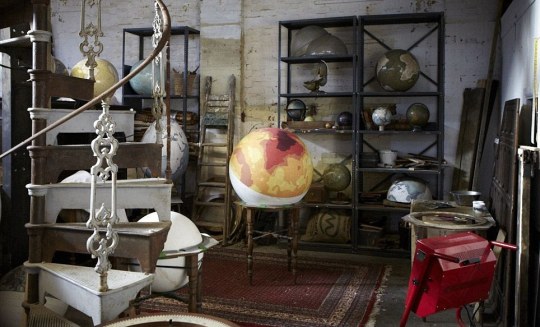
BELLERBY & CO. GLOBEMAKERS
What started as an unsuccessful search for a present turned into a unique London-based workshop crafting amazing globes. Peter Bellerby and his small team of artisans have been creating one-of-a-kind globes since 2008.
Look at the process, check some more pictures or watch a short documentary about the studio.
0 notes
Photo
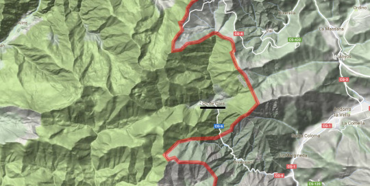
The town of Os de Civís is a “practical exclave” because the only road out goes through Andorra.
149 notes
·
View notes
Photo


CARTA HISTÒRICA DE BARCELONA
Explore the evolution of Barcelona through the centuries in this interactive visualization.
http://cartahistorica.muhba.cat/
0 notes
Photo
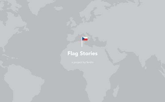


FLAG STORIES
Jeppe & Birger Morgenstjerne from Ferdio analyzed flags from many different angles in their infographic called “Flag Stories”. I think that Sheldon Cooper would be very happy with their work and you can go and check it out at flagstories.co or ferdio.com/flagstories.
1 note
·
View note
Photo
16 CENTURY MAP OF SCANDINAVIA

16 century map of Scandidavia(1500x1111)
Source: http://imgur.com/7s5HIPe
4 notes
·
View notes
Video
youtube
MEASURING DISTANCES IN ASTRONOMY
by Crash Course Astronomy
How do astronomers make sense out of the vastness of space? How do they study things so far away? Today Phil talks about distances, going back to early astronomy. Ancient Greeks were able to find the size of the Earth, and from that the distance to and the sizes of the Moon and Sun. Once the Earth/Sun distance was found, parallax was used to find the distance to nearby stars, and that was bootstrapped using brightness to determine the distances to much farther stars.
0 notes
Photo
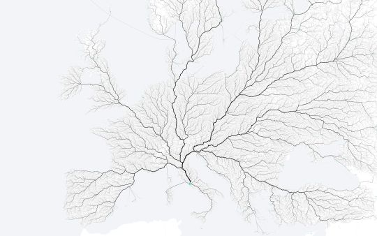


ALL ROADS LEAD TO ROME
http://roadstorome.moovellab.com/
We all know the saying mentioned in the title of this post, but who has ever seen these roads actually leading to Rome? Now you can due to Benedikt Groß, Philipp Schmitt and Raphael Reimann from moovel lab. They carried out this amazing project called Roads to Rome, which visualizes paths from hundreds of thousands of locations in Europe to this metropolis. It’s done in such a great way that it is literally a piece of art. And indeed, you can buy prints. Or browse an interactive version with Rome or all other European cities as the destination.
The map is based on Open Street Map data using the GrassHoper API for routing and leaflet.js + mapbox + turf for the interactive visualization.
#moovellab#rome#roads to rome#Benedikt Groß#Philipp Schmitt#Raphael Reimann#map#cartography#interactive#leaflet.js#mapbox#turf.js#open street map#grasshoper
0 notes
Photo

BACK 2 SCHOOL
http://jonahadkins.github.io/noland-trail-gl/back2school.html
An interactive version of the school map we all loved is here. Thanks to Jonah Adkins and his skills in Mapbox Studio.
3 notes
·
View notes
Photo
SMELLYMAPS
http://bit.ly/smellymaps
THINK ABOUT YOUR NOSE. NOW THINK ABOUT BIG DATA. YOU PROBABLY DIDN’T REALIZE IT, BUT YOUR NOSE IS A BIG DATA MACHINE. SMELLYMAPS ANALYSES SOCIAL MEDIA DATA TO MAP THE ENTIRE SMELLSCAPE OF CITIES, NOT ONLY THE BAD ODORS BUT ALSO THE POSITIVE ONES.
Project by - Daniele Quercia, Luca Maria Aiello, Rossano Schifanella, and Kate McLean. (http://goodcitylife.org)
#smellymaps#smell#urban#goodcitylife.org#daniele quercia#Luca Maria Aiello#Rossano Schifanella#Kate McLean
0 notes
Photo

Kiritimati - such a small island and so many important destinations: London, Paris, Poland, Tabwakea & Banana.
https://www.google.no/maps/@1.8799057,-157.4496066,62947m/data=!3m1!1e3
1 note
·
View note
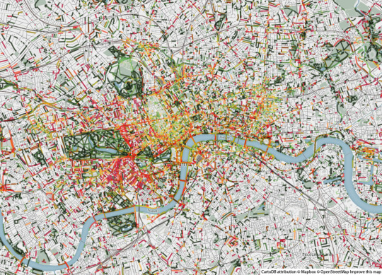
Photo

Subway Systems at the Same Scale by Neil Freeman
We’ve covered to-scale maps on Transit Maps before (See here and here), but I do really like this poster of every subway/rapid transit system in the world – 140 in all – to scale, organised by system size by Neil Freeman. Posters are available from his website for $20 plus postage – a late addition to the Holiday Gift Guide!
Source: Fake is the New Real
280 notes
·
View notes
Photo

One of the earliest surviving copies of Ptolemy’s 2nd century map of the British Isles. Originally published in Ptolemy’s Geographia. This is the second issue of the 1482 map, also printed at Ulm, which was the first woodcut map of the British Isles and the first to be printed outside Italy.
398 notes
·
View notes
Photo
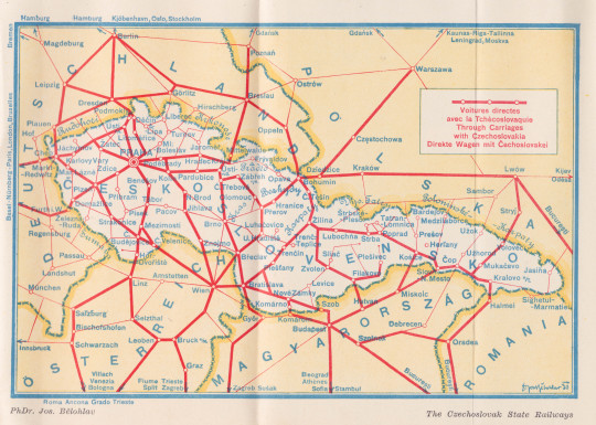
Josef Bělohlav’s map of state railways, Czechoslovakia, 1930 (via mikey)
21 notes
·
View notes
Photo
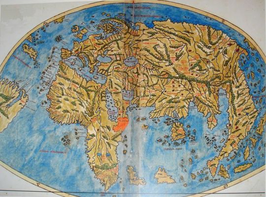
World map by Pietro Coppo, Venice, 1520 #map #world
via [Pinterest pinned to the Nordpil Interesting Maps Pinterest Board]
7 notes
·
View notes