
nmnomad
New Mexico Nomad
Exploring the state of New Mexico; finding new places to visit, meeting new people, learning about the history and culture of the region, and posting the highlights online for anyone who might find it useful.
2409 posts
Don't wanna be here? Send us removal request.
Last Seen Blogs

ignorvnte
Capricorn

glukoskot
GlukosKot

100wish
100wish

cutydraw
cute drawings :3

athenasaorikido
AthenaSaoriKido
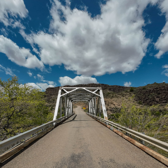
Text
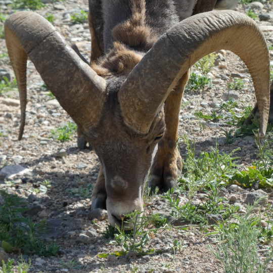


Bighorn sheep lounging at the Rio Grande gorge bridge.
10 notes
·
View notes
Text
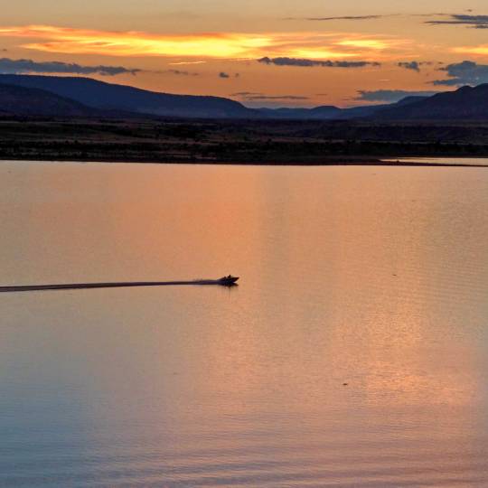
Sunset at Abiquiu Lake 😍
#New Mexico#sunset#NewMexico#roadtrip#weekendgetaway#nature#OptOutside#waterisprecious#gonefishing#fishing#walleye
17 notes
·
View notes
Text
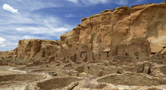
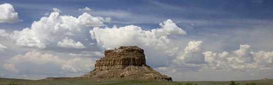
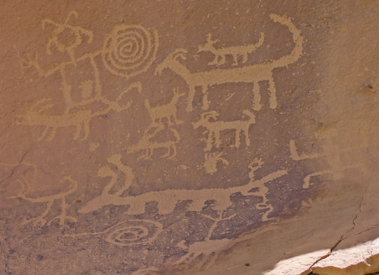
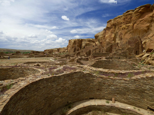
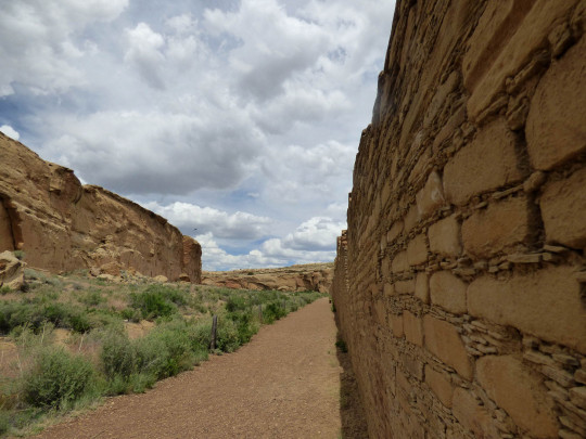
Chaco Canyon is one of the most inaccessible National Parks in the country. Although it is well-known, there is no easy way to get there and there are no amenities once you arrive. The closest town is 60 miles away. There’s a gas station on the main road, near where you turn off on Highway 550. That’s the last opportunity for gas, water, snacks, sunscreen and supplies.
Furthermore, there is no good road to Chaco Canyon. Bluntly, it feels like an Indiana Jones expedition the moment you turn off the main road. The jolting journey evolves from a deceivingly decent dirt road to not so good to face rattling off your skull for a couple of miles. Also, there's a large wash on the way, which can become impassable during heavy storms. Don’t be daring, because there’s no cell phone reception either.
#Native American#New Mexico#roadtrip#NativeAmerican#history#heritage#tradition#culture#daytrip#virtualtravel#instatravel#travelgram#NewMexico#historygeek#offthebeatentrack#leavenotrace#joltyourjourney#earthshotz#AncestralPuebloan#ChacoCanyon#indigenous#archaeology#anthropology#instagramersnm#igersnm
54 notes
·
View notes
Text

Twenty Spanish families established a settlement in 1744, Santa Rosa de Lima de Abiquiú. Located 40 to 50 miles northwest of Santa Fe, they built a small church on a bluff overlooking the river. A series of Comanche raids in 1747 devastated the community, forcing them to a more secure location up-river. They restored the Santa Rosa church. Though it is in ruins now, it was active until the 1930s.
#New Mexico#NewMexico#roadtrip#travel#history#daytrip#offthebeatenpath#ipulledoverforthis#random history
11 notes
·
View notes
Text
Cumbres & Toltec Scenic #Railroad’s passenger service operates May 25th-October 19th, six days a week, Tuesday-Sunday.
18 notes
·
View notes
Text
Located about 50 miles west of Socorro, 25 miles north of Reserve, the Plains of San Agustin span Catron & Socorro counties. Overall, the plains extend 55-miles northeast to southwest, ranging from 5 - 15 miles across.
#New Mexico#NewMexico#roadtrip#travel#daytrip#openspaces#ontheroad#new mexico landscape#new mexico skies
14 notes
·
View notes
Text
Magdalena is also known for its beautiful sunrises and sunsets. The small community is nestled at the base of the Magdalena Mountains at an elevation of 6,548 feet. Mines in Kelly helped to make Magdalena a boom town in the 1800's. As the mining boom came to an end, the ranching industry rose to the fore. Starting in the late 1890's to the early 1970's Magdalena was the end of the trail for cattle drives that went as far as Springerville, AZ.
25 notes
·
View notes
Text
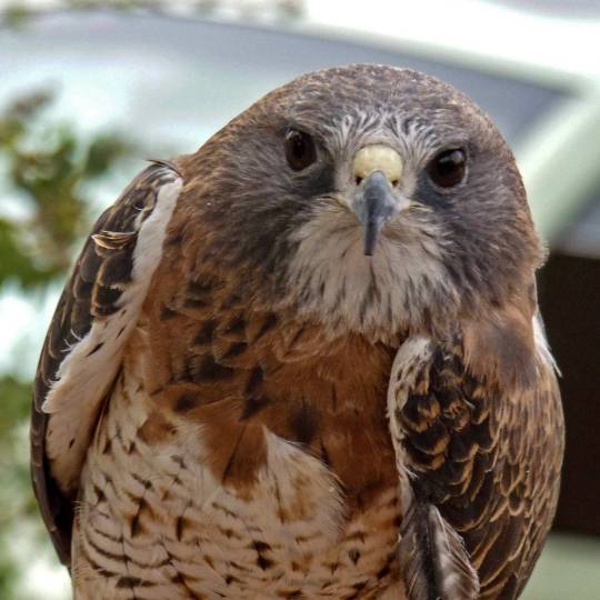

Hawk with the local Raptor Rescue at the Rio Grande Nature Center in Albuquerque.
27 notes
·
View notes
Text

Overlooking the Tularosa Basin from Haynes overlook on the Sunspot Byway in the Sacramento Mountains. Heading back that way soon. Hoping to catch some spring flowers on the way there or on the way back.
#new mexico#NewMexico#roadtrip#travel#scenic#VisitAlamogordo#nature#landscape#Alamogordo#daytrip#naturelovers#landscapelovers#lovenm
16 notes
·
View notes
Text
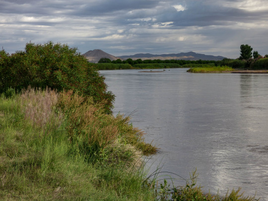
Mesilla Valley Bosque State Park is located on the Rio Grande near Las Cruces, 1.5 miles from historic Mesilla.
#New Mexico#Mesilla#LasCruces#RioGrande#NewMexico#river#daytrip#OptOutside#roadtrip#travel#weekendgetaway#waterisprecious#birdwatching#nature#new mexico landscape
13 notes
·
View notes
Text
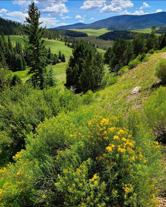
Spring in Taos 😍


#Taos#New Mexico#NewMexico#roadtrip#travel#daytrip#springvibes#springfever#weekendgetaway#hikingadventures#OptOutside#nature#new mexico landscape#naturelovers#landscape
18 notes
·
View notes
Text
Photographer 📸 Marty, aka @martyroams on Instagram - "A drive through Valle Vidal that I always enjoy."
#New Mexico#roadtrip#travel#nature#hiking#OptOutside#hikingadventures#vacation#weekendgetaway#offthebeatenpath#heavenonearth#NewMexico#traveling#landscape
11 notes
·
View notes
Text

Trail of the Mountain Spirits Scenic Byway, outside of Mimbres.
#New Mexico#roadtrip#daytrip#hittheroad#roadlesstraveled#OptOutside#offthebeatenpath#NewMexico#vacation#landscape#lovenm#nature#nature lovers#open spaces
22 notes
·
View notes
Text
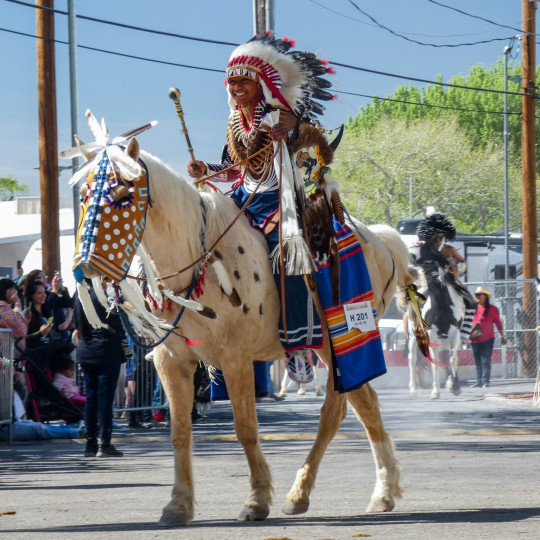


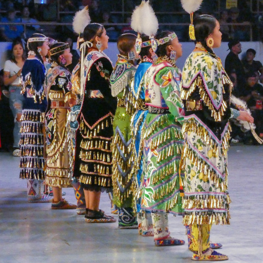
Gathering of Nations Powwow is coming up April 25-27, 2024 at Expo New Mexico in Albuquerque.
#Albuquerque#roadtrip#travel#weekendgetaway#NativeAmerican#culture#dance#heritage#event#bucketlist#New Mexico#road trip#Native American
48 notes
·
View notes
Text
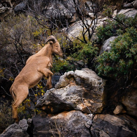
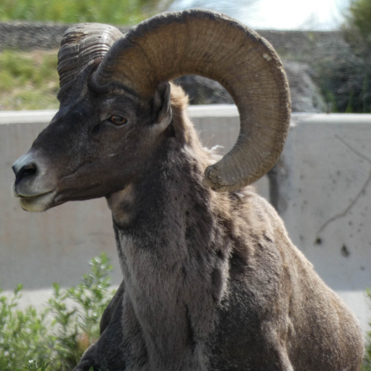
Photographer 📸 @bobsey3 on Instagram - "Surprise (to me) sighting of a huge herd of Barbary sheep near entrance to CCNP. These North African natives were imported to a New Mexico ranch in 1941 and later either escaped or were released into the wild."
5 notes
·
View notes
Text
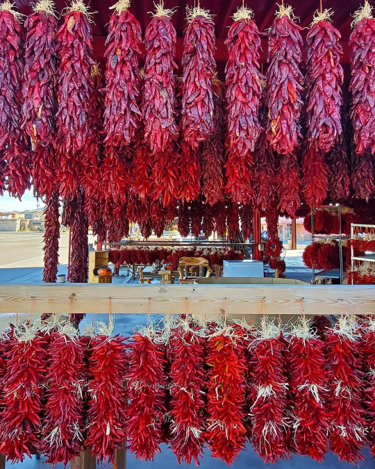
Photographer 📸 Meredith Houx Remiger, aka @mahoux23 on Instagram - "Chile for days🌶❤️" #HatchNM #landofenchantment
#New Mexico#spicy#NewMexico#roadtrip#foodie#NomNom#travel#daytrip#vacation#Hatch#hatchchile#redchile#chileristras
17 notes
·
View notes
Text

Photographer 📸 Brian, aka @dudewheresmycamera on Instagram - "Sunset at White Sands National Park in New Mexico 🌄"
29 notes
·
View notes