#weatherradar
Photo

Avoiding weather over Vietnam. The main route is the magenta line to the left, with the magenta line to the right the limit of our clearance from Air Traffic Control. We need to keep away from the yellow and red as much as possible! #captmiketravels #aviation #aviationlovers #aviationdaily #aviationphotography #aviationgeek #aviationblog #aviationblogger #aviationlife #weather #weatherradar #pilotlife #piloteyes #pilottraining #pilotsofinstagram #travelblogger #travelingram #travelingrams #travelblog #traveldiaries #traveldiary #worldtraveler #worldtraveller #airtrafficcontrol #storms #thunderstorm #travel (at Vietnam) https://www.instagram.com/p/Cdr5A8XOKnT/?igshid=NGJjMDIxMWI=
#captmiketravels#aviation#aviationlovers#aviationdaily#aviationphotography#aviationgeek#aviationblog#aviationblogger#aviationlife#weather#weatherradar#pilotlife#piloteyes#pilottraining#pilotsofinstagram#travelblogger#travelingram#travelingrams#travelblog#traveldiaries#traveldiary#worldtraveler#worldtraveller#airtrafficcontrol#storms#thunderstorm#travel
0 notes
Video
youtube
NOAA Comes Up With A New Phenomena To Explain The 600 K/S Solar Winds Po...
0 notes
Text
Current weatherradar d.c.
DOWNLOAD NOW Current weatherradar d.c.
#Current weatherradar d.c. free#
#Current weatherradar d.c. free#
Put our free WeatherStreet weather lookup on your web page. In all Boeing 707's, Douglas DC - 8's, and other types of aircraft having more. The maps, which are based on analysis of the data, are released each Thursday at 8:30. Terminal radar ensures pilots are aware of wind shear, gust fronts, and heavy precipitation, all of which are dangerous to arriving and departing aircraft. A period of heavier showers and storms is possible this evening. In the event the airborne weather radar becomes inoperative en route. The data cutoff for Drought Monitor maps is each Tuesday at 8 a.m. From our studios in Arlington, VA ABC7 covers national and local news, sports, weather, traffic and culture and carries. Mostly cloudy with showers likely with a chance of thunderstorms in the evening, then partly cloudy with a chance of showers with a slight chance of thunderstorms after midnight. D.C.-area forecast: Minimal sunshine today with scattered showers and storms. WJLA is the local ABC affiliate for the greater Washington DC area. A chance of showers with a slight chance of thunderstorms in the afternoon. 20001 WEATHER WARNINGS (SEVERE T-STORM & TORNADO) Washington DC, DC Weather Radar AccuWeather Today Hourly Daily Radar MinuteCast Monthly Air Quality Health & Activities Washington DC Weather Radar Now Rain Snow Ice Mix Further Ahead Hourly.
DOWNLOAD NOW Current weatherradar d.c.
0 notes
Text
Noaa live weatherradar

#NOAA LIVE WEATHERRADAR FULL#
#NOAA LIVE WEATHERRADAR TRIAL#
The layout is good and it is easy to find the information I am looking for, whether it be current conditions or weather forecasts. Subscriptions and auto-renewal may be managed by going to Account Settings after purchase or by contacting Customer Support. The cost of renewal depends on the Subscription Plan you choose.
#NOAA LIVE WEATHERRADAR TRIAL#
Any unused portion of a free trial period will be forfeited when you purchase a premium subscription during the free trial period. Subscriptions will automatically renew and you will be charged unless auto-renew is turned off or unless you cancel at least 24 hours prior to the end of the current subscription or trial period. Subscription payments will be charged to your App Store account at confirmation of your purchase. Severe weather alerts for all saved locations Governmental severe weather warnings: Australia, Austria, Belgium, Canada, Denmark, Estonia, Finland, France, Germany, Ireland, Italy, Japan, Latvia, Luxembourg, Netherlands, Norway, Poland, Portugal, Spain, Sweden, Switzerland, UK. Precipitation, temperature, satellite maps wind map snow depth forecast hurricane, wildfire, lightning trackers detailed weather info, precipitation alerts: most of the world.
#NOAA LIVE WEATHERRADAR FULL#
See the full list on the developer’s website. Radar images: the US (Continental US, Alaska (except northern), Hawaii, Guam, Northern Mariana Islands and Puerto Rico), Mexico (northern), Canada (southern), Australia, the UK, Ireland, Germany, France, the Netherlands, Italy (northern and north-western), Denmark, Austria, Sweden, Finland, Spain, Portugal, Switzerland, Norway, Poland, Andorra, Japan and more. Pressure, humidity, wind speed, visibility, dew point info Current, today’s min & max and "Feels Like" temperature Monitor important National Weather Service watches, warnings and alerts in the form of interactive polygons on the map. Receive push notifications whenever there’s a weather alert for the bookmarked location (tornadoes, hurricanes, freeze warnings, and more) Read weather alerts with all the details you might need Choose background maps (standard, hybrid, satellite), search locations, add them to bookmarks and stay out of harm’s way. Snow depth map displays the detected snow cover and depth Satellite map illustrates the cloud cover Precipitation map provides precipitation forecast for the next 24 hours Radar overlay shows the areas of rain, snow & mixed precipitation in high resolution and vivid colors right on the interactive map Real-time radar images, severe weather alerts, accurate weather forecasts and much more - precise & timely to help keep you safe! Clime: NOAA Weather Radar Live is an all-in-one weather tracker right on your device.
0 notes
Text
Noaa live weatherradar

NOAA LIVE WEATHERRADAR UPDATE
Since hail can cause the rainfall estimates to be higher than what is actually occurring, steps are taken to prevent these high dBZ values from being converted to rainfall. Hail is a good reflector of energy and will return very high dBZ values. These values are estimates of the rainfall per hour, updated each volume scan, with rainfall accumulated over time. Depending on the type of weather occurring and the area of the U.S., forecasters use a set of rainrates which are associated to the dBZ values. The higher the dBZ, the stronger the rainrate. Typically, light rain is occurring when the dBZ value reaches 20. The scale of dBZ values is also related to the intensity of rainfall. The value of the dBZ depends upon the mode the radar is in at the time the image was created. Notice the color on each scale remains the same in both operational modes, only the values change. Our interactive map allows you to see the local & national weather. The other scale (near left) represents dBZ values when the radar is in precipitation mode (dBZ values from 5 to 75). See the latest Oregon Doppler radar weather map including areas of rain, snow and ice. One scale (far left) represents dBZ values when the radar is in clear air mode (dBZ values from -28 to +28). Each reflectivity image you see includes one of two color scales. See the latest Alabama Doppler radar weather map including areas of rain, snow and ice. The dBZ values increase as the strength of the signal returned to the radar increases.
NOAA LIVE WEATHERRADAR UPDATE
NOW AVAILABLE MAJOR UPDATE Weather Highlights See what to prepare for by checking the weather highlights. So, a more convenient number for calculations and comparison, a decibel (or logarithmic) scale (dBZ), is used. National Oceanic and Atmospheric Administration National Environmental Satellite, Data, and Information Service. Storm Radar Maps and Alerts Stay ahead of nasty weather with real-time NOAA radar, 24h precipitation forecast, and hurricane & lightning trackers. on a phone that provides radar, current weather, alerts and the forecast for a location. Reflectivity (designated by the letter Z) covers a wide range of signals (from very weak to very strong). Doppler Radar National Mosaic - NOAAs National Weather Service. "Reflectivity" is the amount of transmitted power returned to the radar receiver. The colors are the different echo intensities (reflectivity) measured in dBZ (decibels of Z) during each elevation scan.
0 notes
Text
Current weatherradar d.c.

#Current weatherradar d.c. free#
Having analyzed this data, the app shows the current weather forecast and. The new FOX 5 DC Weather App includes a new.
#Current weatherradar d.c. free#
le ) Apepaeat research ( 3920 ) FLOAT - TYPE RESISTANCE RIVER GAGE. RainViewer has access to the data from more than 1000 weather radars across the world. Track your local forecast for Washington D.C., Maryland and Virginia quickly with the free FOX 5 DC Weather app.
0 notes
Text
Current weatherradar d.c.

A weather radar is used to locate precipitation, calculate its motion, estimate its type (rain. Interactive weather map allows you to pan and zoom to get unmatched weather details in your local neighborhood. Get current weather alerts across Canada from the Authoritative Source of. From our studios in Arlington, VA ABC7 covers national and local news, sports, weather, traffic and culture and carries. Canadian weather RADAR, tropical storm tracking, lightning activity, UV index. A period of heavier showers and storms is possible this evening. A weather radar is used to locate precipitation, calculate its motion, estimate its type (rain, snow, hail, etc.), and forecast its.
0 notes
Text
Current weatherradar d.c.

DC celebrates 8th annual Chuck Brown Day. Wednesday: Hot and sunny with falling humidity. Metro weather radars for Washington DC and surrounding areas - from WUSA9 in Washington DC. Weather Alert for the PM, scattered storms. Temperatures will remain in the 80s Thursday through Sunday with sunny skies. ( b ) If the airborne weather radar is required to begin a particular flight. Humidity stays on the low side at the start of the holiday weekend. This paragraph does not apply to the rear window emergency exits of DC - 3. Humidity will fall through the day with continued sunshine. Expect temperatures to rise into the upper 80s to near 90 degrees for Wednesday. There’s a potential to see some stronger storms that could lead to heavy rainfall, as well as strong winds.īy Wednesday morning, it will be dry with clear skies. Get Washington, DC current weather report with temperature, feels like, air quality, humidity, UV report and pollen forecast from. There is a weather alert Tuesday due to the severity of afternoon storms. Our weather radar also has the ability to show past and future weather conditions in the area and. Temperatures still manage to make it into the low to mid 90s, with the heat index in the lower 100s. WTOP’s Weather Radar Map shows current local weather conditions in D.C., Maryland and Virginia. Tuesday will bring increasing cloud cover and an increase in rain chances. A period of heavier showers and storms is possible this evening. Things are about to change Tuesday, as a cold front approaches the D.C. D.C.-area forecast: Minimal sunshine today with scattered showers and storms. Washington, DC Weather Radar AccuWeather Today Hourly Daily Radar MinuteCast Monthly Air Quality Health & Activities Washington Weather Radar Now Rain Snow Ice Mix Further Ahead Hourly Daily. Business & Finance Click to expand menu. Get the forecast for today, tonight & tomorrow's weather for Washington, DC.
0 notes
Photo
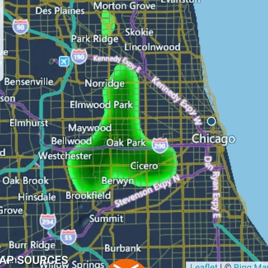
Current weather radar forecast has me giggling like a little schoolgirl. Hehe #chicago #weather #gigglinglikeaschoolgirl #weatherforecast #weatherradar #giggling #doyouseewhatisee #chicagoweather (at Chicago metropolitan area) https://www.instagram.com/p/Bx3ub7EhdWt/?igshid=e9a3gxqw2lhg
#chicago#weather#gigglinglikeaschoolgirl#weatherforecast#weatherradar#giggling#doyouseewhatisee#chicagoweather
1 note
·
View note
Photo
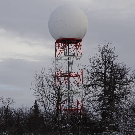
Radome The weather radar in Nikiski. It is much more complex looking up close! Also, it is not geodesic, as other ones I have seen have been. I believe they upgraded this one recently. #sonydschx400v #sonydsc #sonycybershot #SonyCameras #nikiski #nikiskialaska #weatherradar #weatherradarradome #radome #alaska #alaskaphotography (at Nikiski, Alaska) https://www.instagram.com/p/CX8yaWWlwye/?utm_medium=tumblr
#sonydschx400v#sonydsc#sonycybershot#sonycameras#nikiski#nikiskialaska#weatherradar#weatherradarradome#radome#alaska#alaskaphotography
1 note
·
View note
Photo
I sure appreciate this #weatherradar #windyapp https://www.instagram.com/p/CT0o97zFkvz/?utm_medium=tumblr
0 notes
Photo
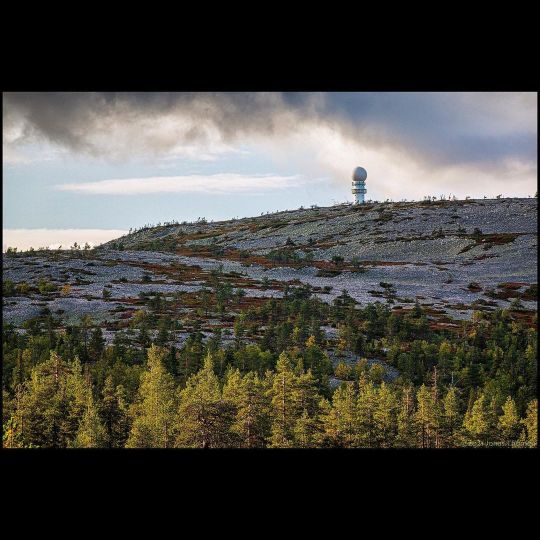
https://flic.kr/p/2mn64jy #radar #weatherradar #fell #forest #woods #stones #rocks #clouds #mountain #lapland #sápmi #landscape #landscapephotography (at Pyhä-Luosto National park) https://www.instagram.com/p/CTiKY-7Ajy7/?utm_medium=tumblr
#radar#weatherradar#fell#forest#woods#stones#rocks#clouds#mountain#lapland#sápmi#landscape#landscapephotography
0 notes
Photo


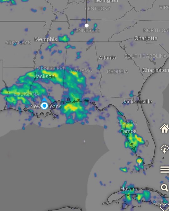
We have a host of maps and radars on the FOX6 Weather page that are updating regularly — to provide you the most accurate assessment
#SevereThunderstormWarning#WeatherRadar#SevereThunderstormWatch#Radar#SevereThunderstormWarningUpdate#Wbay#Fox6News#WbayRadar
0 notes
Photo
Wild Weather In Roswell 6:00 - 6:30 MDT Friday, May 28, 2021 FastMo - Radar -Regular Speed I was watching a weather report about a wild thunderstorm and tornado warning for Roswell. So I grabbed my iPad and looked at my EarthCam Network feed for Roswell and then captured the weather at time periods 3 or so minutes apart. - The first video is a 2:14 minute video sped up to fit in 59 seconds. - The second video is a storm tracker/weather radar for Roswell from 4:35 - 6:30. - Videos 3, 4 & 5 are the 2:14 minute video from Roswell at normal speed divided into 3 clips. #RoswellNewMexico #WildWeather #Thunderstorm #TornadoWarning #WeatherRadar #StormTracker #RoswellNM #RoswellWeather (at Roswell, New Mexico) https://www.instagram.com/p/CPcC4AYrwZw/?utm_medium=tumblr
#roswellnewmexico#wildweather#thunderstorm#tornadowarning#weatherradar#stormtracker#roswellnm#roswellweather
0 notes
Photo
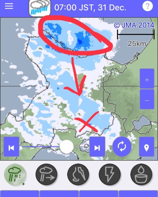
HEAVY SNOW ALERT! Its -15 and it’s snowing at 10cm per hour! And the heavy stuff hasn’t arrived yet! Look at the moisture radar. It’s coming in hard. #rusutsu #niseko #hokkaido #japan #rusutsuholiday #rusutsuholidaychalet #bigsnow #weathernerd #pow #japow #weatherradar #snowalert https://www.instagram.com/p/CJcDYDNsu3Z/?igshid=9o9qlvg5jmdl
#rusutsu#niseko#hokkaido#japan#rusutsuholiday#rusutsuholidaychalet#bigsnow#weathernerd#pow#japow#weatherradar#snowalert
0 notes
Last Seen Blogs

thammytriseo23
Thẩm Mỹ Trị Sẹo

dawebimuso
Untitled

wintercorrybriea
THE DUDE NEXT DOOR

annedrews
indie invasion;

pelaoramos
pelaoramos.cl