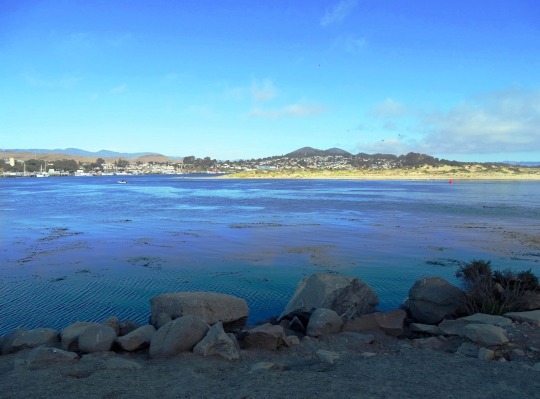
#Morro Rock Ecological Preserve
Text
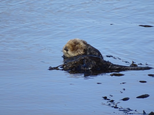
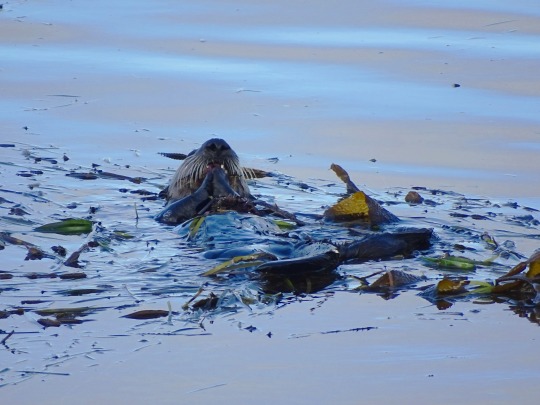
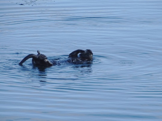
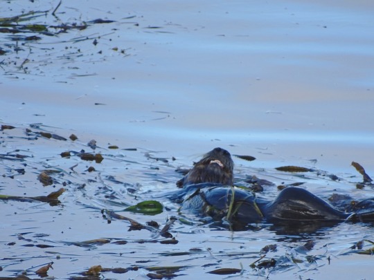
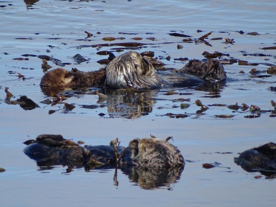
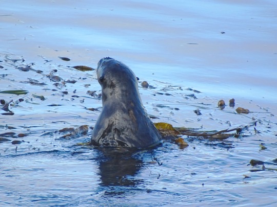
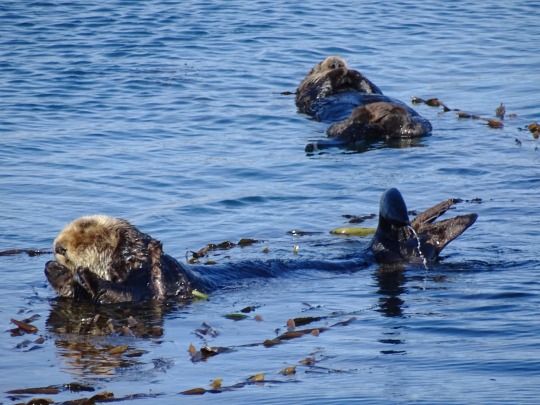
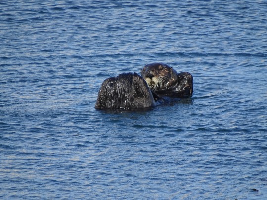
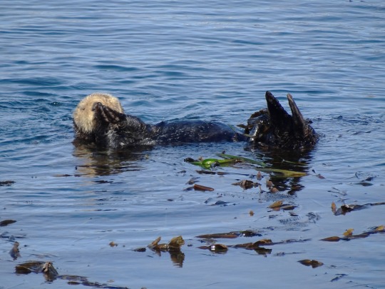
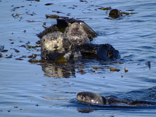
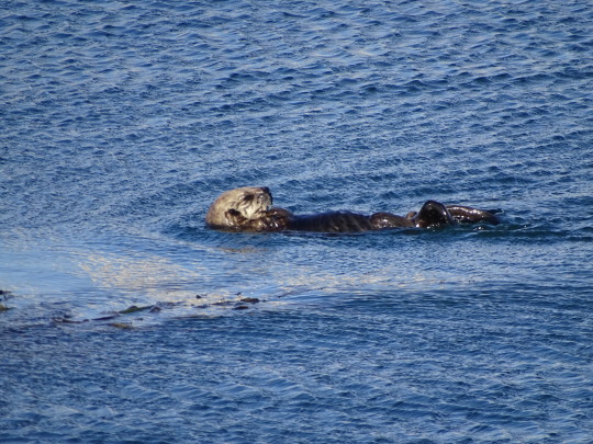
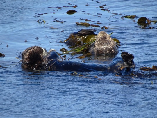
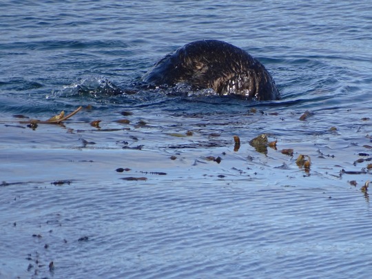
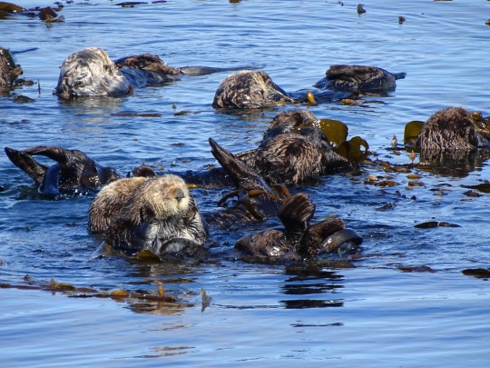
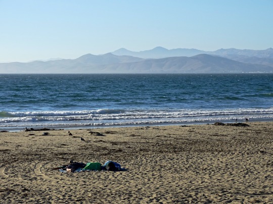
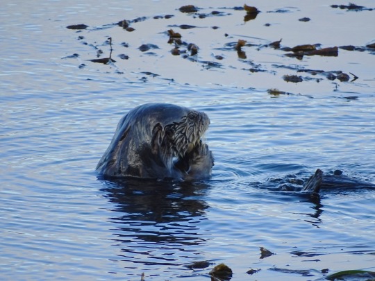
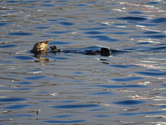
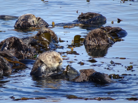
Sea Otter Heaven, Morro Bay (No. 6)
Although the southern sea otter's range has continuously expanded from the remnant population of about 50 individuals in Big Sur since protection in 1911, from 2007 to 2010, the otter population and its range contracted and since 2010 has made little progress. As of spring 2010, the northern boundary had moved from about Tunitas Creek to a point 2 kilometres (1.2 mi) southeast of Pigeon Point, and the southern boundary has moved along the Gaviota Coast from approximately Coal Oil Point to Gaviota State Park. A toxin called microcystin, produced by a type of cyanobacteria (Microcystis), seems to be concentrated in the shellfish the otters eat, poisoning them. Cyanobacteria are found in stagnant water enriched with nitrogen and phosphorus from septic tank and agricultural fertilizer runoff, and may be flushed into the ocean when streamflows are high in the rainy season. A record number of sea otter carcasses were found on California's coastline in 2010, with increased shark attacks an increasing component of the mortality. Great white sharks do not consume relatively fat-poor sea otters but shark-bitten carcasses have increased from 8% in the 1980s to 15% in the 1990s and to 30% in 2010 and 2011.
Source: Wikipedia
#Sea Otter Heaven#California sea otter#Enhydra lutris#Morro Bay#hotel#travel#original photography#vacation#tourist attraction#USA#summer 2022#Califorina#West Coast#San Luis Obispo County#wildlife#animal#seaweed#Morro Rock Ecological Preserve#Pacific Ocean#beach#cityscape#landscape#seascape#kelp#fauna#landmark#marine mammal
10 notes
·
View notes
Text
Our National Parks Sites Bucket List by State
It goes without saying that we plan to eventually conquer all 59 US National Parks, but there are quite a few other sites run by the National Parks Services that we want to see in addition to the parks. Below is our bucket list of all the nationally designated areas we'd like to see in the US in alphabetical order. We hope this inspires you to go out and see some of these sites that are near you!
For more bucket list inspiration: Check out our list of America's best thru-hikes, our epic road trip plan to see all of the contingent US National Parks, and our "get started" map to see what wilderness areas are close to you!
Alabama
Little River Canyon National Preserve • Russell Cave National Monument
Alaska
Alagnak Wild River • Aniakchak National Monument and Preserve • Bering Land Bridge National Preserve • Cape Krusenstern National Monument • Denali National Park • Denali National Preserve • Gates of the Arctic National Park and Preserve • Glacier Bay National Park and Preserve • Katmai National Park and Preserve • Kenai Fjords National Park • Klondike Gold Rush National Historical Park • Kobuk Valley National Park • Lake Clark National Park and Preserve • Noatak National Preserve • Sitka National Historical Park • Wrangell-St. Elias National Park and Preserve • Yukon-Charley Rivers National Preserve
Arizona
Canyon De Chelly National Monument • Chiricahua National Monument • Glen Canyon National Recreation Area • Grand Canyon National Park • Montezuma Castle National Monument • Navajo National Monument • Organ Pipe Cactus National Monument • Petrified Forest National Park • Saguaro National Park • Sunset Crater Volcano National Monument • Tonto National Monument • Tuzigoot National Monument • Walnut Canyon National Monument • Wupatki National Monument
Arkansas
Buffalo National River • Hot Springs National Park
California
Cabrillo National Monument • Castle Mountains National Monument • Channel Islands National Park • Death Valley National Park • Devils Postpile National Monument • Golden Gate National Recreational Area • Joshua Tree National Park • Kings Canyon National Park • Lassen Volcanic National Park • Lava Beds National Monument • Mojave National Preserve • Muir Woods National Monument • Pinnacles National Park • Point Reyes National Seashore • Redwood National Park • Santa Monica Mountains National Recreation Area • Sequoia National Park • Whiskeytown-Shasta-Trinity National Recreation Area • Yosemite National Park
Colorado
Black Canyon of the Gunnison National Park • Colorado National Monument • Currecanti National Recreation Area • Dinosaur National Monument • Florissant Fossil Beds National Monument • Great Sand Dunes National Park and Preserve • Hovenweep National Monument • Mesa Verde National Park • Rocky Mountain National Park • Yucca House National Monument
Florida
Big Cypress National Preserve • Biscayne National Park • Canaveral National Seashore • Dry Tortugas National Park • Everglades National Park • Gulf Islands National Seashore • Timucuan Ecological and Historic Preserve
Georgia
Appalachian National Scenic Trail • Chattahoochee River National Recreation Area • Cumberland Island National Seashore • Ocmulgee National Monument
Hawaii
Haleakala National Park • Hawaii Volcanoes National Park • Kalaupapa National Historical Park • Kaloko-Honokohau National Historical Park • Pu’uhonua O Honaunau National Historical Park • Pu’ukohola Heiau National Historic Site
Idaho
City of Rocks National Reserve • Craters of the Moon National Monument and Preserve • Hagerman Fossil Beds National Monument • Nez Perce National Historical Park
Indiana
Indiana Dunes National Lakeshore
Kansas
Tallgrass Prairie National Preserve
Kentucky
Cumberland Gap National Historical Park • Mammoth Cave National Park
Maine
Acadia National Park
Maryland
Assateague Island National Seashore • Catoctin Mountain Park • Piscataway Park • Potomac Heritage National Scenic Trail
Massachusetts
Cape Cod National Seashore
Michigan
Isle Royale National Park • Pictured Rocks National Lakeshore • Sleeping Bear Dunes National Lakeshore
Minnesota
Mississippi National River and Recreation Area • Pipestone National Monument • Voyageurs National Park
Montana
Bighorn Canyon National Recreation Area • Glacier National Park
Nebraska
Agate Fossil Beds National Monument • Missouri National Recreational River • Niobrara National Scenic River • Scotts Bluff National Monument
Nevada
Great Basin National Park • Lake Mead National Recreation Area • Tule Springs Fossil Beds National Monument
New Mexico
Aztec Ruins National Monument • Bandelier National Monument • Capulin Volcano National Monument • Carlsbad Caverns National Park • Chaco Culture National Historical Park • El Malpais National Monument • El Morro National Monument • Gila Cliff Dwellings National Monument • Petroglyph National Monument • Valles Caldera National Preserve • White Sands National Monument
North Carolina
Blue Ridge Parkway • Cape Hatteras National Seashore • Cape Lookout National Seashore
North Dakota
Theodore Roosevelt National Park
Ohio
Cuyahoga Valley National Park
Oregon
Crater Lake National Park • John Day Fossil Beds National Monument • Oregon Caves National Monument and Preserve
Pennsylvania
Delaware Water Gap National Recreation Area • Middle Delaware National Scenic River • Upper Delaware Scenic and Recreational River
South Carolina
Congaree National Park
South Dakota
Badlands National Park • Jewel Cave National Monument • Mount Rushmore National Memorial • Wind Cave National Park
Tennessee
Big South Fork National River and Recreation Area • Great Smokey Mountains National Park • Obed Wild and Scenic River
Texas
Alibates Flint Quarries National Monument • Amistad National Recreation Area • Big Bend National Park • Big Thicket National Preserve • Guadalupe Mountains National Park • Lake Meredith National Recreation Area • Padre Island National Seashore • Rio Grande Wild and Scenic River
Utah
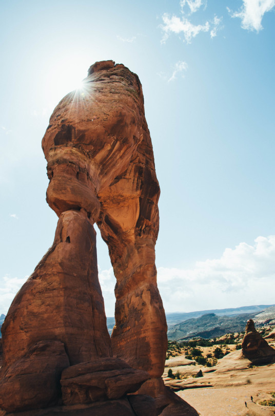
Arches National Park • Bryce Canyon National Park • Canyonlands National Park • Capitol Reef National Park • Cedar Breaks National Monument • Natural Bridges National Monument • Rainbow Bridge National Monument • Timpanogos Cave National Monument • Zion National Park
Virginia
Shenandoah National Park
Washington
Lake Chelan National Recreation Area • Lake Roosevelt National Recreation Area • Mount Rainier National Park • North Cascades National Park • Olympic National Park • Ross Lake National Recreation Area
Wisconsin
Apostle Islands National Lakeshore • Saint Croix National Scenic Riverway
Wyoming
Devils Tower National Monument • Fossil Butte National Monument • Grand Teton National Park • John D. Rockefeller Memorial Parkway • Yellowstone National Park
American Samoa
National Park of American Samoa
Puerto Rico
San Juan National Historic Site
Virgin Islands
Buck Island Reef National Monument • Virgin Islands Coral Reef National Monument • Virgin Islands National Park
See a site you think we missed? We'd love to hear about your favorite nationally designated areas!

5 notes
·
View notes
Text
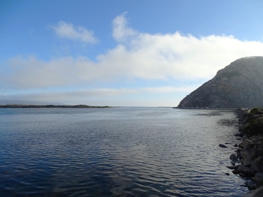
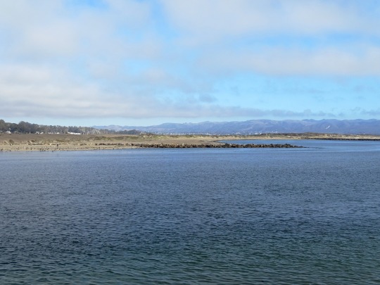
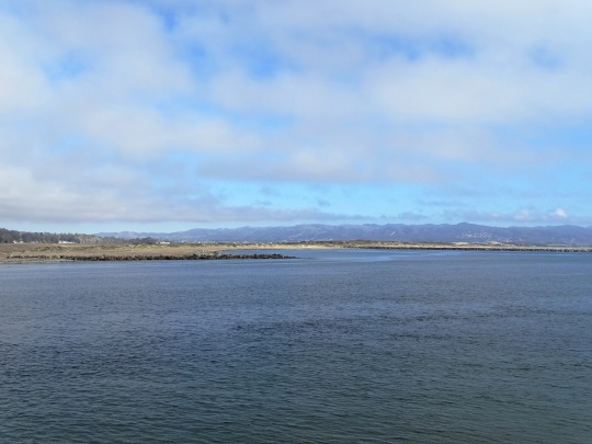
Morro Bay
California > San Luis Obispo County > Morro Bay
Boating
Kayak Connection
Parks
Morro Rock Ecological Preserve
View On WordPress
0 notes
Text
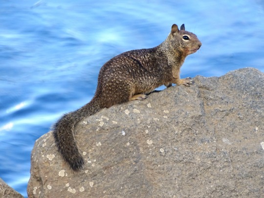
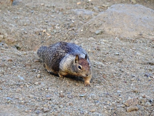
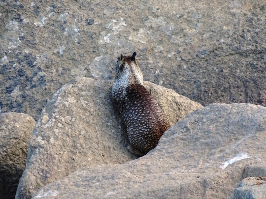
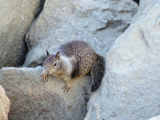
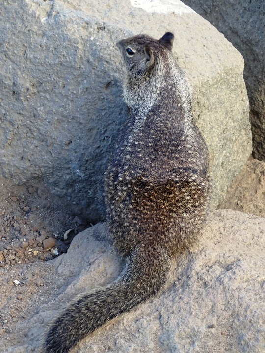
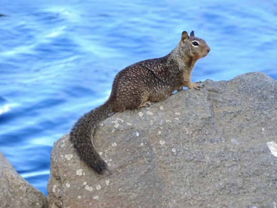


California Ground Squirrel, Morro Bay
The California ground squirrel (Otospermophilus beecheyi), also known as the Beechey ground squirrel, is a common and easily observed ground squirrel of the western United States and the Baja California Peninsula; it is common in Oregon and California and its range has relatively recently extended into Washington and northwestern Nevada. Formerly placed in Spermophilus, as Spermophilus beecheyi, it was reclassified in Otospermophilus in 2009, as it became clear that Spermophilus as previously defined was not a natural (monophyletic) group. A full species account was published for this species in 2016.
John Richardson, who originally described the species as Arctomys (Spermophilus) beecheyi, or "Beechey's marmot", named it after Frederick William Beechey, an early 19th-century British explorer and naval officer.
California ground squirrels' mating season is early spring and tends to last only for a few weeks. The females are considered to be promiscuous, so the individuals of one litter can be from multiple mates. The California ground squirrel has one litter of five to eleven per year, with gestation around one month. The young open their eyes at about five weeks and reach sexual maturity around one year old.
The coloration of the young is slightly lighter than the adults, and molting occurs at about eight weeks of age – when the young leave the burrows. California ground squirrels can live up to six years.
California ground squirrels use their cheek pouches to store more food than can be consumed in one sitting to store it for a later date. They are considered to be mostly herbivorous, with seeds, grains, nuts, fruits, and sometimes roots constituting most of their diet.
Source: Wikipedia
#California ground squirrel#Morro Bay#travel#original photography#vacation#tourist attraction#USA#summer 2022#Califorina#West Coast#San Luis Obispo County#wildlife#animal#Morro Rock Ecological Preserve#Pacific Ocean#beach#cityscape#landscape#seascape#landmark#rock#close up
5 notes
·
View notes
Text


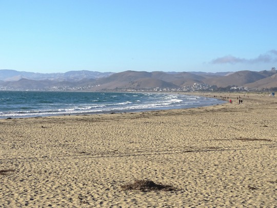

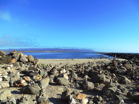
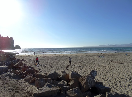
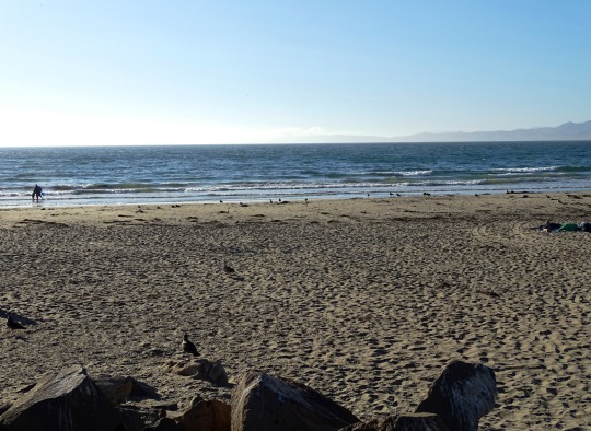
Morro Rock Ecological Preserve, CA (No. 8)
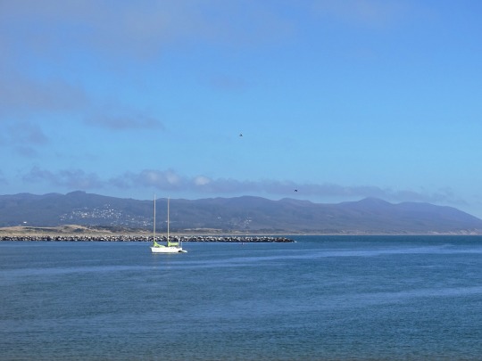
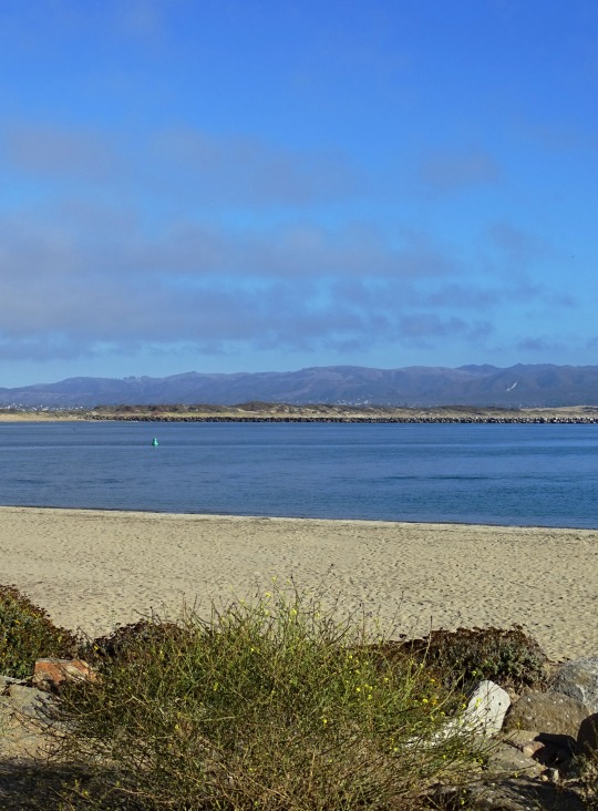
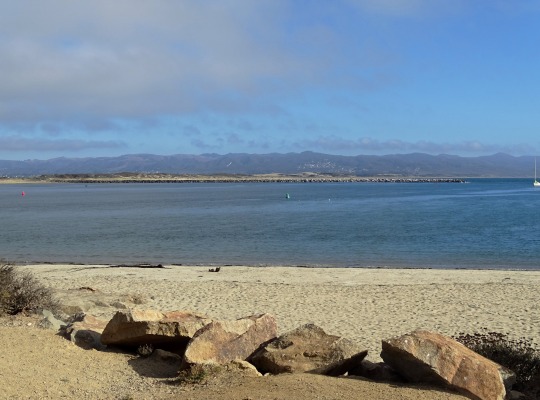
With an oceanfront parking lot located directly under the shadow of awe-inspiring Morro Rock, this popular surf spot is as close to the rock as it gets. Although technically part of Morro Strand, this beach is often referred to as Morro Rock Beach by locals and travelers alike, for reasons that will become obvious the moment you arrive. Easily stroll the base of Morro Rock, keeping an eye out for seabirds (fun fact: the rock is the last of “the nine sisters,” or volcanic mountains that run from the Central Coast to Southern California). Today, Morro Rock is a historic landmark and bird sanctuary home to Peregrine Falcons, Seagulls and all manner of waterfowl which thrive along the rocky landscape. Surfers, picnickers, kite-flyers and sunbathers flock to the beach located just north of the rock, while the south side—protected by the harbor—is popular among kayakers and fishing enthusiasts. Planning on staying in San Simeon or Cambria, two popular Central Coast kayaking destinations in their own right? We encourage you to bring your kayak south to Morro Bay for a unique experience unlike what you’ve already enjoyed. While you might see whales and elephant seals to the north on Highway 1, Morro Bay features its own menagerie of critters, including friendly harbor seals and a year-round otter population that can be observed regularly snacking, napping, and communing among Morro Bay’s plentiful kelp beds.
Similarly, surfers staying in Cayucos love the close proximity to Morro Rock—known as one of the most popular surf spots on the Central Coast. Why not rent a board and catch a few iconic waves for yourself? Depending on the swell, you can also paddle across the harbor side to Sand Spit beach (also accessible from the Los Osos side). Large waves are common here, so it’s important to watch kids while they play in the water (lifeguards are staffed from Memorial Day Labor Day from 10am-6pm). Please note that dogs must be on-leash in this area, but they are welcome to roam freely at the Morro Bay Dog Beach, which stretches six miles north to dog-friendly town Cayucos. With its vast, sandy beach and views of Morro Rock in the distance, you’ll enjoy the walk just as much as your pup. Lastly, parking at Morro Rock Beach is a breeze: just take your pick of spots in this massive parking lot with bathrooms and outdoor showers to clean off sandy toes. Plus, parking wraps south of the rock, providing even more convenience for busy days (you’ll enjoy even greater views of the rock, local wildlife, and glittering back bay as you park the car). That’s a true win-win!
Source
#Morro Rock Beach#Morro Rock Ecological Preserve#Morro Rock#Morro Bay#Pacific Ocean#sailing boat#Morro Bay Harbor#evening light#flora#nature#geology#volcanic plug#Santa Lucia Range#Nine Sisters#San Luis Obispo County#travel#original photography#vacation#tourist attraction#landmark#cityscape#landscape#seascape#summer 2022#USA#architecture
3 notes
·
View notes
Text


Morro Rock Ecological Preserve, CA (No. 4)
Morro Rock was probably seen by Spanish maritime explorers as early as 1542 under Juan Rodríguez Cabrillo, but its current name was given during the first European land exploration of Alta California. The Spanish Portolá expedition came down Los Osos Valley and camped near today's Morro Bay on September 8, 1769. Franciscan missionary and expedition member Juan Crespí noted in his diary that "we saw a great rock in the form of a round morro".
The rock, which was quarried on and off from 1889 to 1969, provided material for the breakwater of Morro Bay and the improvements at Port San Luis Harbor. In 1966, a state law was adopted that transferred title to the State of California. In February 1968, the San Luis Obispo County Historical Society and the City of Morro Bay succeeded in having Morro Rock declared California Historical Landmark number 821.
Source: Wikipedia
#California Buckwheat#Morro Rock Ecological Preserve#Morro Rock#Morro Bay#Pacific Ocean#sailing boat#Morro Bay Harbor#evening light#public art#sculpture#flora#nature#geology#volcanic plug#Santa Lucia Range#Nine Sisters#San Luis Obispo County#travel#original photography#vacation#tourist attraction#landmark#cityscape#landscape#seascape#summer 2022#USA#seagull#bird
3 notes
·
View notes
Text


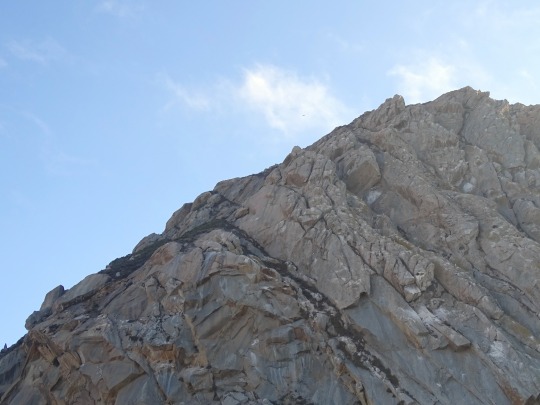
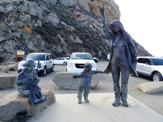
Morro Rock Ecological Preserve, CA (No. 1)
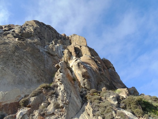
Morro Rock (Salinan: Le'samo; Chumash: Lisamu'; Spanish: El Morro) is a volcanic plug in Morro Bay, California, on the Pacific Coast at the entrance to Morro Bay harbor. A causeway connects it with the shore, making it a tied island. The rock is protected as the Morro Rock State Preserve.
The 581-foot (177 m) Morro Rock is one of 13 volcanic plugs (remnant necks of extinct volcanoes), lava domes, and sheetlike intrusions between Morro Bay on the north and Islay Hill on the south, all in San Luis Obispo County.
Source: Wikipedia
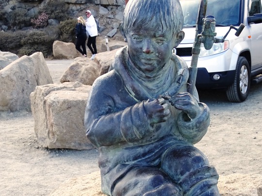
#Morro Rock Ecological Preserve#Morro Rock#Morro Bay#Pacific Ocean#sailing boat#Morro Bay Harbor#evening light#public art#sculpture#flora#nature#geology#volcanic plug#Fisherman's Family by Elizabeth MacQueen#Santa Lucia Range#Nine Sisters#San Luis Obispo County#travel#original photography#vacation#tourist attraction#landmark#cityscape#landscape#seascape#summer 2022#USA#architecture
3 notes
·
View notes
Text
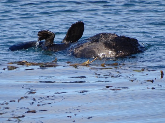

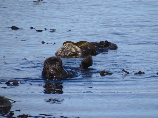
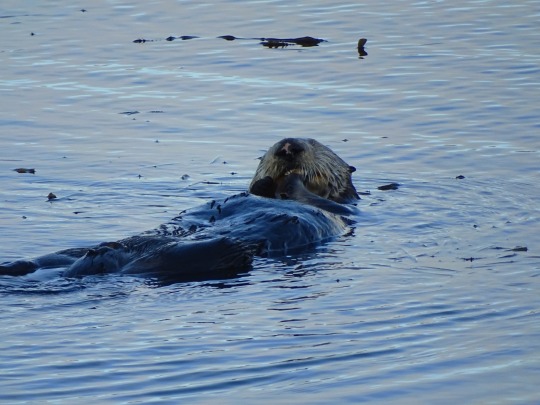
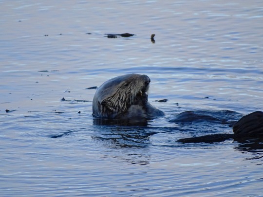
Sea Otter Heaven, Morro Bay (No. 4)
The historic population of California sea otters was estimated at 16,000 before the fur trade decimated the population, leading to their assumed extinction. Today's population of California sea otters are the descendants of a single colony of about 50 sea otters located near Bixby Creek Bridge in March 1938 by Howard G. Sharpe, owner of the nearby Rainbow Lodge on Bixby Bridge in Big Sur. Their principal range has gradually expanded and extends from Pigeon Point in San Mateo County to Santa Barbara County.
Sea otters were once numerous in San Francisco Bay. Historical records revealed the Russian-American Company snuck Aleuts into San Francisco Bay multiple times, despite the Spanish capturing or shooting them while hunting sea otters in the estuaries of San Jose, San Mateo, San Bruno and around Angel Island. The founder of��Fort Ross, Ivan Kuskov, finding otters scarce on his second voyage to Bodega Bay in 1812, sent a party of Aleuts to San Francisco Bay, where they met another Russian party and an American party, and caught 1,160 sea otters in three months. By 1817, sea otters in the area were practically eliminated and the Russians sought permission from the Spanish and the Mexican governments to hunt further and further south of San Francisco. In 1833, fur trappers George Nidever and George Yount canoed "along the Petaluma side of [the] Bay, and then proceeded to the San Joaquin River", returning with sea otter, beaver, and river otter pelts. Remnant sea otter populations may have survived in the bay until 1840, when the Rancho Punta de Quentin was granted to Captain John B. R. Cooper, a sea captain from Boston, by Mexican Governor Juan Bautista Alvarado along with a license to hunt sea otters, reportedly then prevalent at the mouth of Corte Madera Creek.
Source: Wikipedia
#Sea Otter Heaven#California sea otter#Enhydra lutris#Morro Bay#hotel#travel#original photography#vacation#tourist attraction#USA#summer 2022#Califorina#West Coast#San Luis Obispo County#wildlife#animal#seaweed#Morro Rock Ecological Preserve#Pacific Ocean#beach#cityscape#landscape#seascape#kelp#fauna#landmark#marine mammal
2 notes
·
View notes
Text


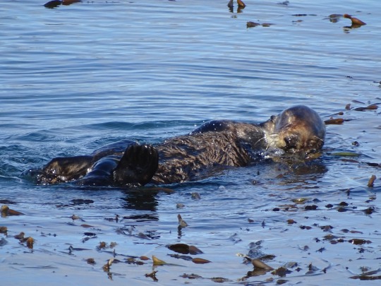

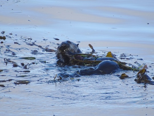
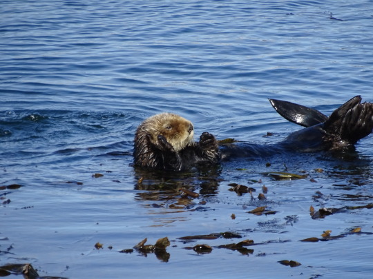
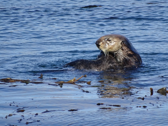
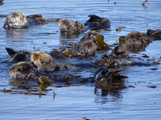
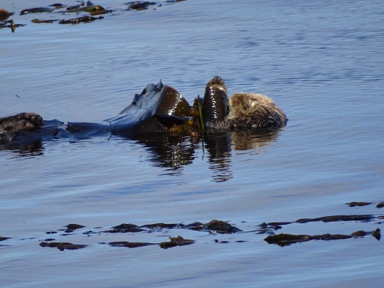
Sea Otter Heaven, Morro Bay (No. 3)
Sea otters live in coastal waters 15 to 23 metres (49 to 75 ft) deep, and usually stay within a kilometre (2⁄3 mi) of the shore. They are found most often in areas with protection from the most severe ocean winds, such as rocky coastlines, thick kelp forests, and barrier reefs. Although they are most strongly associated with rocky substrates, sea otters can also live in areas where the sea floor consists primarily of mud, sand, or silt. Their northern range is limited by ice, as sea otters can survive amidst drift ice but not land-fast ice. Individuals generally occupy a home range a few kilometres long, and remain there year-round.
The sea otter population is thought to have once been 150,000 to 300,000, stretching in an arc across the North Pacific from northern Japan to the central Baja California Peninsula in Mexico. The fur trade that began in the 1740s reduced the sea otter's numbers to an estimated 1,000 to 2,000 members in 13 colonies. Hunting records researched by historian Adele Ogden place the westernmost limit of the hunting grounds off the northern Japanese island of Hokkaido and the easternmost limit off Punta Morro Hermosa about 21+1⁄2 miles (34.6 km) south of Punta Eugenia, Baja California's westernmost headland in Mexico.
In about two-thirds of its former range, the species is at varying levels of recovery, with high population densities in some areas and threatened populations in others. Sea otters currently have stable populations in parts of the Russian east coast, Alaska, British Columbia, Washington, and California, with reports of recolonizations in Mexico and Japan. Population estimates made between 2004 and 2007 give a worldwide total of approximately 107,000 sea otters.
Source: Wikipedia
#Sea Otter Heaven#California sea otter#Enhydra lutris#Morro Bay#hotel#travel#original photography#vacation#tourist attraction#USA#summer 2022#Califorina#West Coast#San Luis Obispo County#wildlife#animal#seaweed#Morro Rock Ecological Preserve#Pacific Ocean#beach#cityscape#landscape#seascape#kelp#fauna#landmark#marine mammal
5 notes
·
View notes
Text


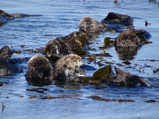
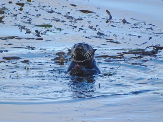
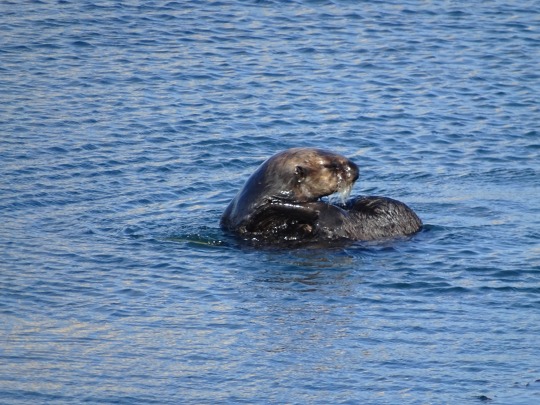
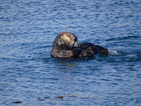
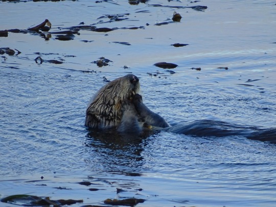
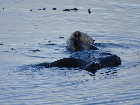
Sea Otter Heaven, Morro Bay (No. 2)
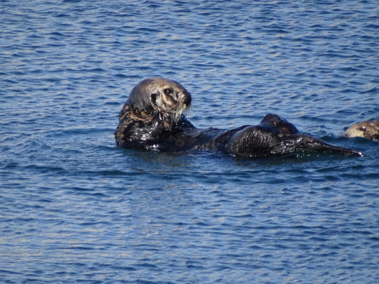
The sea otter (Enhydra lutris) is a marine mammal native to the coasts of the northern and eastern North Pacific Ocean. Adult sea otters typically weigh between 14 and 45 kg (30 and 100 lb), making them the heaviest members of the weasel family, but among the smallest marine mammals. Unlike most marine mammals, the sea otter's primary form of insulation is an exceptionally thick coat of fur, the densest in the animal kingdom. Although it can walk on land, the sea otter is capable of living exclusively in the ocean.
The sea otter inhabits nearshore environments, where it dives to the sea floor to forage. It preys mostly on marine invertebrates such as sea urchins, various mollusks and crustaceans, and some species of fish. Its foraging and eating habits are noteworthy in several respects. Its use of rocks to dislodge prey and to open shells makes it one of the few mammal species to use tools. In most of its range, it is a keystone species, controlling sea urchin populations which would otherwise inflict extensive damage to kelp forest ecosystems. Its diet includes prey species that are also valued by humans as food, leading to conflicts between sea otters and fisheries.
Sea otters, whose numbers were once estimated at 150,000–300,000, were hunted extensively for their fur between 1741 and 1911, and the world population fell to 1,000–2,000 individuals living in a fraction of their historic range. A subsequent international ban on hunting, sea otter conservation efforts, and reintroduction programs into previously populated areas have contributed to numbers rebounding, and the species occupies about two-thirds of its former range. The recovery of the sea otter is considered an important success in marine conservation, although populations in the Aleutian Islands and California have recently declined or have plateaued at depressed levels. For these reasons, the sea otter remains classified as an endangered species.
Source: Wikipedia
#Sea Otter Heaven#California sea otter#Enhydra lutris#Morro Bay#hotel#travel#original photography#vacation#tourist attraction#USA#summer 2022#Califorina#West Coast#San Luis Obispo County#wildlife#animal#seaweed#Morro Rock Ecological Preserve#Pacific Ocean#beach#cityscape#landscape#seascape#kelp#fauna#landmark
2 notes
·
View notes
Text


Morro Rock Ecological Preserve, CA (No. 7)
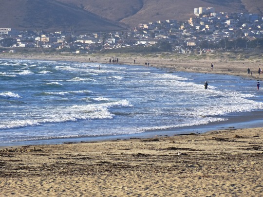
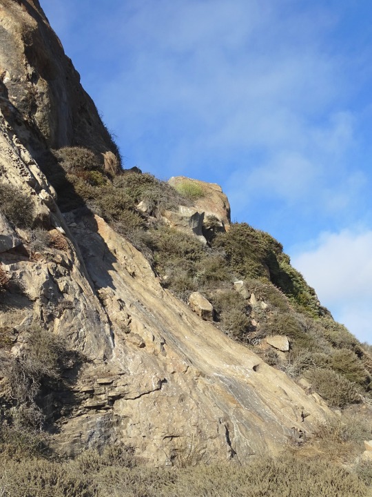
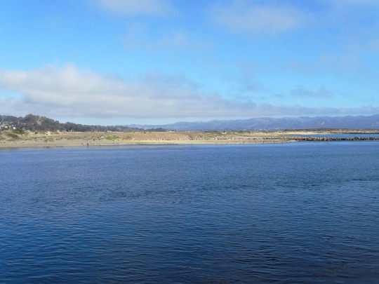
Sprawling from the base of Morro Rock to the north, Morro Rock Beach is where fun and sport collide. Its miles of beach is perfect for playing, beach combing, relaxing, or surfing. Connected to Morro Strand and North Point Beach, you can enjoy walking over six miles of uninterrupted sandy coastline. And with ample parking, public restrooms, and showers onsite, it’s the perfect place to bring the beach chairs, umbrellas, and beach toys for an entire day of fun in the sand. Stay for the sunset to watch Morro Rock come alive with color, utilize one of the City’s fire pits overlooking the beach, and stargaze to the sound of the waves.
Source
#Morro Rock Beach#Seaside woolly sunflower#Sticky monkey-flower#Morro Rock Ecological Preserve#Morro Rock#Morro Bay#Pacific Ocean#sailing boat#Morro Bay Harbor#evening light#flora#nature#geology#volcanic plug#Santa Lucia Range#Nine Sisters#San Luis Obispo County#travel#original photography#vacation#tourist attraction#landmark#cityscape#landscape#seascape#summer 2022#USA
0 notes
Text


Morro Rock Ecological Preserve, CA (No. 6)
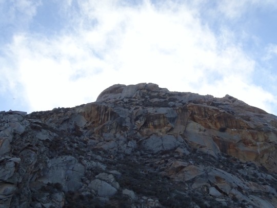
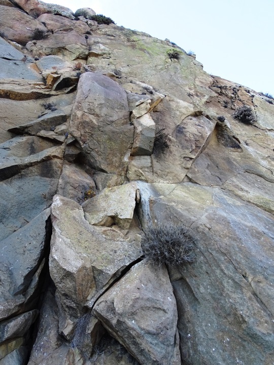
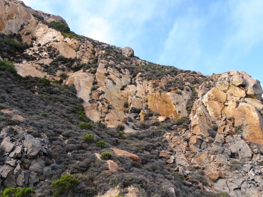
Morro Rock, a State Historic Landmark, was formed about 23 million years ago from the plugs of long-extinct volcanoes. Morro Rock was an important navigational aid for mariners for over 300 because the rock is approximately 576 feet tall which made it the most visible in a chain of 9 peaks. Portuguese explorer, Juan Rodriguez Cabrillo named the rock "El Morro" in 1542. In Spanish "Morro" means crown shaped hill. Morro Rock, sometimes called the "Gibraltar of the Pacific," is the last peak of the Nine Sisters, which extend from San Luis Obispo to Morro Bay.
The rock itself was mined on and off until 1963. Morro Rock provided material for the break water of Morro Bay and Port San Luis Harbor. In 1966, a bill was introduced which transferred the full title to the State of California. Later the San Luis Obispo County Historical Society and the City of Morro Bay succeeded in getting the Morro Rock declared as California Registered Historical Landmark #821. Morro Rock also became State Landmark #801 in 1968. The rock has since been designated a bird sanctuary for the peregrine falcon and other bird species.
Morro Rock is a beautiful Northern California Beach with a rough ocean environment and sandy dunes.
Source
#Morro Rock Beach#Seaside woolly sunflower#Sticky monkey-flower#Morro Rock Ecological Preserve#Morro Rock#Morro Bay#Pacific Ocean#sailing boat#Morro Bay Harbor#evening light#flora#nature#geology#volcanic plug#Santa Lucia Range#Nine Sisters#San Luis Obispo County#travel#original photography#vacation#tourist attraction#landmark#cityscape#landscape#seascape#summer 2022#USA#seagull#bird#wildflower
0 notes
Text


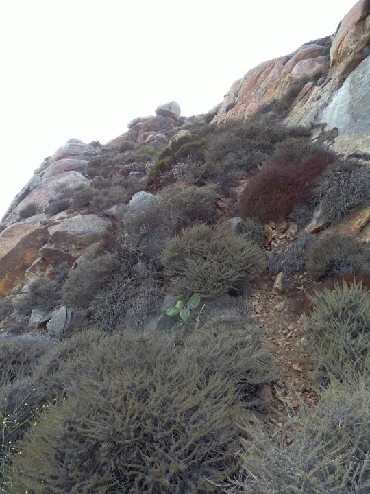
Morro Rock Ecological Preserve, CA (No. 5)
Several types of birds nest on Morro Rock, including three cormorant species and two gull species. It presently serves as a reserve for peregrine falcons, which are locally endangered and cause most of the laws that prohibit intervention with avian life.
Sea lions and sea otters can be seen regularly in the water around the rock. Seals, however, are much more common in the nearby Morro Bay State Park, where they breed.
Other fauna include a wide selection of tide pool animals, like hermit crabs, small fish, starfish, sea cucumbers, mussels, bivalve mollusks, coral, and more.
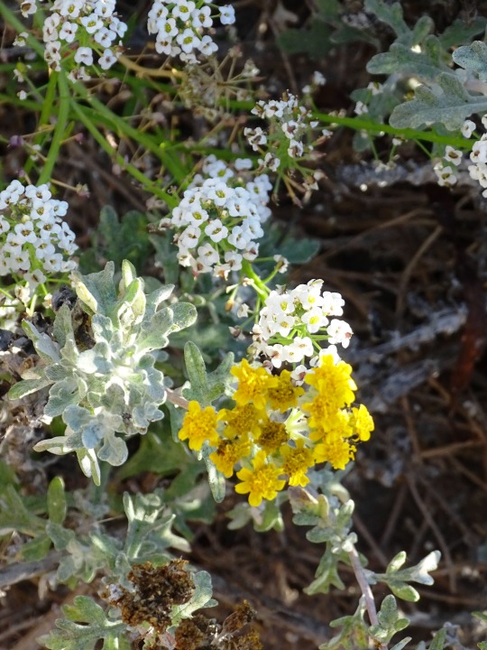
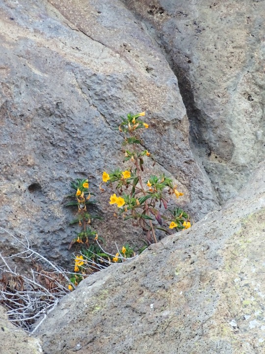
On land few flora can survive the harsh, dry environment on the rock, but in the surrounding bay, kelp, sea grass, kelp forest plants, and tide pool plants can survive, and a few common grasses, mosses, lichens and weeds from the mainland take root on the rock itself.
Source: Wikipedia
#Seaside woolly sunflower#Sticky monkey-flower#Morro Rock Ecological Preserve#Morro Rock#Morro Bay#Pacific Ocean#sailing boat#Morro Bay Harbor#evening light#flora#nature#geology#volcanic plug#Santa Lucia Range#Nine Sisters#San Luis Obispo County#travel#original photography#vacation#tourist attraction#landmark#cityscape#landscape#seascape#summer 2022#USA#seagull#bird#wildflower
0 notes
Text


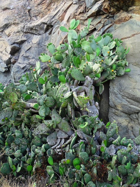
Morro Rock Ecological Preserve, CA (No. 3)
The Salinan and Chumash tribes consider Morro Rock to be a sacred site. The Salinan name for Morro Rock is Le'samo and the Chumash name is Lisamu.
The Chumash had an important nearby prehistoric settlement at least as early as the Millingstone Horizon (6500-2000 B.C.E.), and the village was near the mouth of Morro Creek, at the current site of Morro Bay High School. The right of the Salinan people to climb Morro Rock for their biannual solstice ceremonies has been established, in which they celebrate the time in legend when a hawk and a raven destroyed a two-headed serpent-monster Taliyekatapelta as he wrapped his body around the base of the rock. The established Salinan right to climb the rock has been in legal dispute by the local Chumash tribe, which claims that Morro Rock is Chumash, not Salinan, territory. The Chumash also believe that the rock is so sacred that it should never be climbed. Because of its fragility, it is illegal for the general public to climb it.
Source: Wikipedia
#California Buckwheat#Morro Rock Ecological Preserve#Morro Rock#Morro Bay#Pacific Ocean#sailing boat#Morro Bay Harbor#evening light#public art#sculpture#flora#nature#geology#volcanic plug#Fisherman's Family by Elizabeth MacQueen#Santa Lucia Range#Nine Sisters#San Luis Obispo County#travel#original photography#vacation#tourist attraction#landmark#cityscape#landscape#seascape#summer 2022#USA#seagull#bird
0 notes
Text
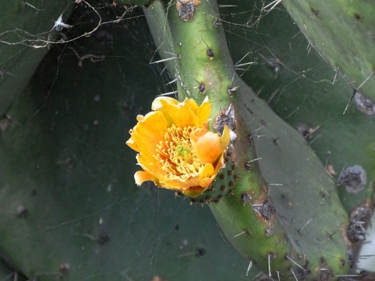
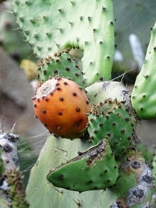
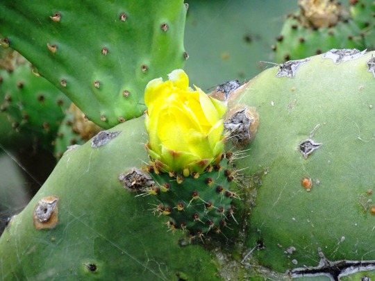
Morro Rock Ecological Preserve, CA (No. 2)
It [the Morro Rock] is composed mostly of dacite, an igneous, volcanic rock. It is a groundmass of plagioclase, with amphibole (hornblende), biotite, pyroxene (augite), quartz, and glass; it also includes phenocrysts of plagioclase. Its silicon dioxide (SiO2) content ranges from 63 to 69 percent.
The dacite volcanic plugs, lava domes, intrusive sheets, and felsitic rhyolite-dacite between Morro Rock and Islay Hill are part of the Morro Rock-Islay Hill Complex of the Oligocene epoch (from 27 to 23 million years ago). The complex lies east of the San Gregorio-San Simeon-Hosgri fault (the SG-SS-H fault). This complex is one of three probable sources of the volcanic clasts within the sandstone and conglomerate of the Miguelito and Edna members of the Pismo Formation in the Point Sur area 145–160 km (90-100 mi) to the north and west of the SG-SS-H fault. Based on paleomagnetic signatures, the Morro Rock-Islay Hill Complex was rotated 40 to 50 degrees, perhaps during late Miocene or early Pliocene time.
Source: Wikipedia
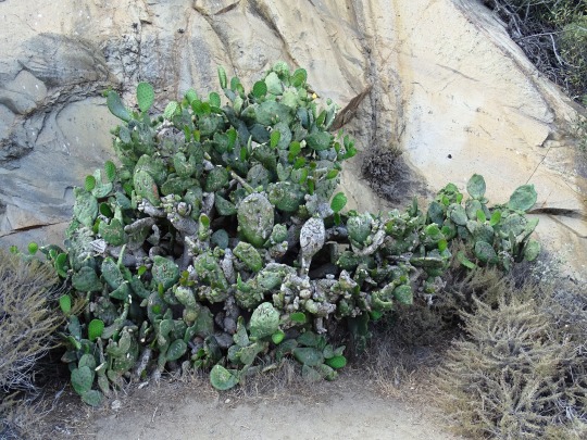
#Opuntia ficus-indica#Morro Rock Ecological Preserve#Morro Rock#Morro Bay#Pacific Ocean#sailing boat#Morro Bay Harbor#evening light#public art#sculpture#flora#nature#geology#volcanic plug#Fisherman's Family by Elizabeth MacQueen#Santa Lucia Range#Nine Sisters#San Luis Obispo County#travel#original photography#vacation#tourist attraction#landmark#cityscape#landscape#seascape#summer 2022#USA#architecture#prickly pear
1 note
·
View note
Text
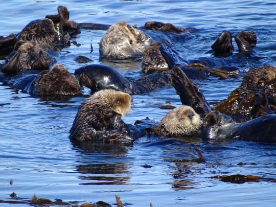

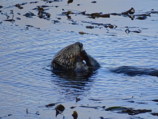
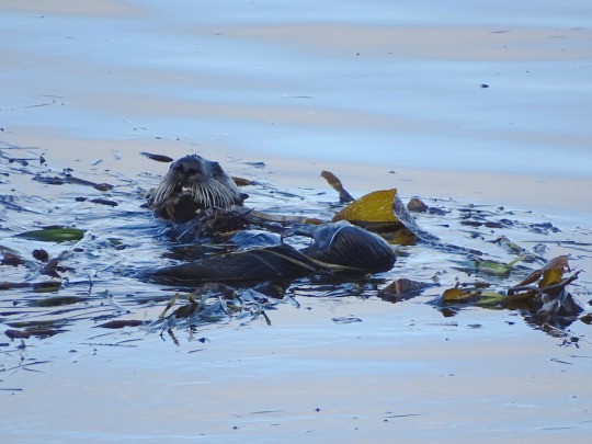
Sea Otter Heaven, Morro Bay (No. 8)
Cute, furry, and playful, Southern Sea Otters make their homes just offshore along the SLO CAL stretch of Highway 1. Sea otters are native to the north Pacific Ocean, with Monterey Bay, Big Sur, and the Central Coast as hubs of activity. They are friendly, and often stay close to shore to raise their young. This makes otter spotting particularly easy on the Central Coast.
Sea otters haven’t always been so easy to find. Their extremely dense fur attracted fur traders of the 18th and 19th centuries, resulting in a severely decreased population along the West Coast. Today, the Southern Sea Otter is considered a threatened species, listed on the Endangered Species Act since 1977. They are also recognized as a depleted species under the Marine Mammal Protection Act, having only reinhabited 13 percent of their historic range.
Southern sea otters don’t rely on blubber or fat to keep them warm, as other sea mammals do. Instead, they rely on their rich, dense fur and a high level of activity to stay warm. And that high level of activity makes Southern sea otters ravenous eaters! They can be on the move and foraging up to 50 percent of their day. In other words, to glimpse a sea otter cracking open a sea urchin for lunch is not uncommon. Mothers of baby otters are especially active, feeding their young and floating their young on their belly.
Otters can be spotted year-round, but the best seasons on the SLO CAL stretch of Highway 1 are often winter and spring. Sea otters avoid inclement weather, so look for them toward shore, near coves, kelp forests and estuaries during these seasons. Here, sea otters can be found during oceanfront walks and hikes, from piers, beaches, boardwalks, and most certainly from kayaks along the shore. And each September, the Defenders of Wildlife, Sea Otter Savvy, and California Department of Parks and Recreation sponsor Sea Otter Awareness Week.
To make the most of your otter spotting experience, bring binoculars and wear layered clothing, as weather can run cool to warm. You may also want to bring a camera as Southern sea otters are extremely photogenic! Make sure to read our Wildlife Viewing Tips, too, for ways to see these sweet, funny creatures up close without threatening their safety.
Sea Otter Fun Facts
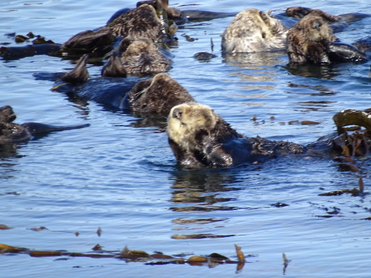
A group of sea otters is called a “raft.”
Sea otters have a pocket under their arm where they may store prey or a rock tool used to crack open their food.
Sea otters need to rest 10-12 hours every day, and often prefer napping in kelp beds to stay anchored and safer from predators.
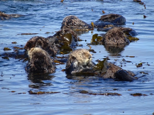
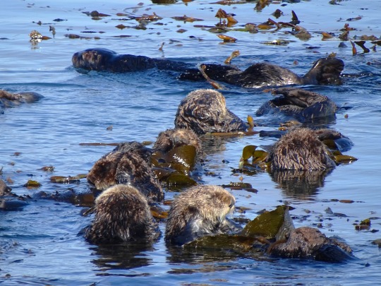
Morro Bay Sea Otters
The protected inlet of Morro Bay serves as habitat for about 40 sea otters, primarily females caring for pups. This number is growing as the sea otter population continues to stabilize in the wake of fur trading. Both the Morro Bay Embarcadero and Estuary provide safety for otters to find food, raise their young, and avoid predators like sharks.
Near the Morro Bay State Park marina, at the south end of Morro Bay, otters can be found near the shoreline. Walk the marina to see otters at work (and play), and be sure to bring binoculars. Perhaps the best way to see otters in the Estuary is from a kayak. Work with a kayak outfitter and/or guide to find the hot spots of sea otter activity. Often, otters will pop up right beside your paddle, just inches away.
Morro Rock provides another way to see otters in the wild. Look for kelp beds in the water to the left of the rock (just by the parking area). If you come around 8am, you’re bound to see at least a few otters bobbing on the water’s surface. The Morro Bay Embarcadero offers yet another viewing opportunity. Walk the town’s waterfront street and find plenty of places to “pull over” for a sea otter spotting. Just be sure to look for kelp beds, as those are common feeding grounds for sea otters.
Source
#Sea Otter Heaven#California sea otter#Enhydra lutris#Morro Bay#hotel#travel#original photography#vacation#tourist attraction#USA#summer 2022#Califorina#West Coast#San Luis Obispo County#wildlife#animal#seaweed#Morro Rock Ecological Preserve#Pacific Ocean#beach#cityscape#landscape#seascape#kelp#fauna#landmark#marine mammal
1 note
·
View note
Last Seen Blogs

jedikaylin
JEDI KAYLIN

popspinaci
story of my life

europesroyals
Europe's Royals

chu-uya
ψ(`∇´)ψ

ticklest
★★★