moreoftheroad
More of the Road
"You know more of a road by having traveled it than by all the conjectures and descriptions in the world." William Hazlitt
350 posts
Don't wanna be here? Send us removal request.
Last Seen Blogs

icsepoint
Untitled

lloyd-the-purrfect-lion
yourrrr favourite actor is herrrre!

radicallledward
Procrastinate the PhD

peterparkerinpajamas
not yet on the dark side

sakuyabell
Tally Ho
Text
A Stroll Along Seattle's Snoqualmie Valley Trail
The Long Walk
Walking Seattle’s Snoqualmie Valley Trail
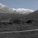
The Snoqualmie Valley Trail (map/information) is nothing short of gorgeous. While other rail trails offer views of tree-draped mountain peaks from tall trestles King County’s Snoqualmie Valley trail offers 31 miles of quiet pathway in the shade of a magnificent forest of black cottonwood and red cedar trees.
Day 1 – Carnation to North Bend
Distance: 15 miles
Wildlife: A beautiful garter snake sunbathing in a spot of sunlight on the trail
Trails: Snoqualmie Valley Trail
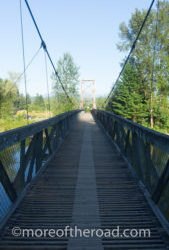
The wood slat suspension bridge at Tolt MacDonald Park in Carnation Washington
Exhausted from my long trek from Kirkland the day before, I got a late start. When I eventually packed everything up, I reluctantly made my way back out of the distant reaches of the Tolt-MacDonald Park tenting sites. I was sorry to leave the pleasant town of Carnation. Unfortunately this is the kind of campground that books up for the weekend. “Reserved” slips adorned the posts at every single campsite. I had no choice but to move on.
After stopping at the grocery store to re-supply, I made a detour to the Starbucks. For more than an hour I chatted with the good people of Carnation. I met spoke with two gentlemen, long-time cyclists who have each made multiple cross-country trips by bicycle. I looked at their pictures of the Chatcolet Bridge on the Trail of the Coeur D’Alenes. This is the trail trail I plan to take to cross Idaho. It was also at the Carnation Starbucks that I met a generous woman with a lovely dog. We talked for a while and then she disappeared into the coffee shop and returned with some trail love (in the form of a gift card) that has managed to boost my spirits as far away as Missoula, Montana and Casper, Wyoming.
Forest Bathing – On the Trail
The Snoqualmie Valley Trail travels 31 miles from Duvall to Rattlesnake Lake
With the pit stops, it was almost eleven before I finally made my way to the Carnation trail-head of the Snoqualmie Valley Trail.
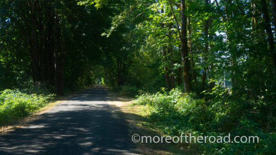
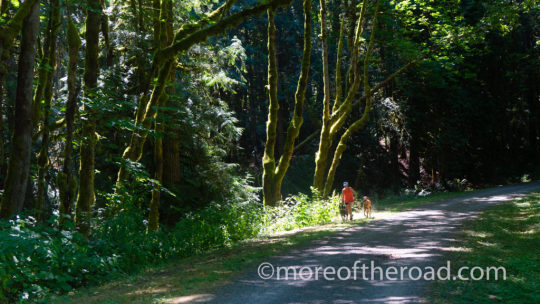
There is something to be said for the concept of “Forest Bathing” and the Snoqualmie Valley Trail draws in all of your senses. The air smelled clean and fresh and the trees offered protection from a hot mid-summer sun. From time time to time the trail crossed a deep ravine where the roar of mighty little brooks drifted up to path high above the tree tops.
I passed joggers out with their dogs, walkers out enjoying the day, and a cyclist or two as I walked along the dirt and gravel path. The further I went along the trail, the fewer people I saw. As I neared Tokul Creek, the sounds of gunfire from a nearby firing range replaced those of the birds.
Snoqualmie Valley Trail runs along the Everett Spur of the Milwaukee Road Railway
Eventually, a steep set of stairs at a tunnel carried me up to the narrow Tokul Road – the official trail detour around private property to the Reinig Bridge. My feet ached as I joined the Mill Pond Road. My mood dipped with every passing car. Only the magnificence of the Reinig Bridge could raise and the resumption of the Snoqualmie Valley Trail through North Bend could raise my spirits.
The Reinig Bridge on the Snoqualmie Valley Trail in North Bend Washington
There are only two hotels in North Bend Proper, neither of them allow dogs. So I was out of luck for a place to stay unless I wanted to walk an additional five miles to Edgewick Inn – adding an additional 2 miles to the following day’s trip as well.
Bonnie and I stopped to relax at the dog park in the Three Forks Natural Area. While there, I hit several locals up for information about places to stay. In the end I was taken home by Rolf and Uta who let me pitch a tent in their back yard and fed me steak and beer.
I ended the day feeling grateful for the generosity and enthusiasm of the people in Carnation and North Bend.
Day 2 – North Bend to Alice Creek
Distance: 18 miles
Wildlife: A magnificent Bald Eagle soaring over the south fork of the Snoqualmie River – and two very cheeky chipmunks investigating all of the bags at the rock climbing area.
Trails: Snoqualmie Valley Trail, John Wayne Pioneer Trail and Iron Horse State Park
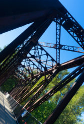
Trestles like this one over Change Creek characterize the western portion of the John Wayne Pioneer Trail
Bonnie and I walked away from Rolf and Ute’s shortly after 8:30 am and wound our way through the neighborhood streets of North Bend. The sun was already out in the force of every brilliant Pacific Northwest Summer ray when we joined the trail. To those who live in this often-gray region, a day like today is priceless. I was concerned, however, about the heat that the sunshine was sure to bring to an exposed trail.
I came upon a crowd just as the trail cut under the I-90 interstate highway. As I neared the crowd, I realized that this was the finish line for a Marathon/Half Marathon event. I lingered in the crowd for a while watching exhausted runners cross the line to cheers and applause before continuing along the side of the trail, well out of the way of any finishing runners.
As the day grew warmer we rested frequently along the eight mile stretch of trail that connects North Bend with Rattlesnake Lake. I paused to watch a bald eagle soar over the South Fork of the Snoqualmie River, and to cheer on the many marathoners still making their way down to the finish line.
The day was already hot when we reached Rattlesnake Lake. Bonnie grew tired of walking in the heat and often lay down to rest in any shade she could find. We rested for more than an hour in the shade at Rattlesnake Lake before joining the John Wayne Pioneer trail.
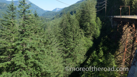
We had to rest often on our way to Alice Creek – the first of the primitive campsites along the trail.The trail often followed the cut of power lines – reducing the protection the forests on either side of the trail might have otherwise provided. Because of the heat, we stopped often to rest. The first time I walked this stretch of trail, the last mile to Alice Creek felt interminable. I was prepared for the mental challenge this time. Nevertheless I felt completely beat when I finally reached Alice Creek at 7pm.
With no energy for cooking, I ate a Cliff Bar for dinner as I set up camp and turned in early.
Please follow and like us:

A Stroll Along Seattle’s Snoqualmie Valley Trail was originally published on More of the Road
#Northwest#Pacific Northwest#Rail Trails#Slow Travel#Snoqualmie Valley Trail#The Long Walk#Traveling Slow#United States#Washington State#moreoftheroad#crosspost#travel
5 notes
·
View notes
Text
Connecting the Trails - A walk through Seattle's Suburban Neighborhoods
The Long Walk Connecting the Trails (A walk from Port Townsend to Carnation through Seattle’s suburban neighborhoods) When I planned my route through Washington State, there were sections of the walk that raised questions that seemed to have no answer. The logistics of connecting The Olympic Discovery Trail with The Snoqualmie Valley Trail was one of…
Connecting the Trails – A walk through Seattle’s Suburban Neighborhoods was originally published on More of the Road
#Pacific Northwest#Seattle#The Long Walk#Trails in Seattle#Walk Across Washington#Washington State#Whidbey Island#moreoftheroad#crosspost#travel
0 notes
Text
Tales from the Olympic Discovery Trail (Part 2)
The Long Walk Tales from the Olympic Discovery Trail (Part 2) The Olympic Discovery Trail runs along the coastal plain at the northern end of the Olympic Peninsula. With The Strait de San Juan de Fuca to the north, and the Olympic Mountains range to the south, the trail passes through old-growth forests, new-growth recovery…
Tales from the Olympic Discovery Trail (Part 2) was originally published on More of the Road
#More of the Road#North America#Olympic Discovery Trail#Olympic Peninsula#Pacific Northwest#Rail Trails#The Long Walk#The Olympic Discovery Trail#Trestles#Washington#Washington State#moreoftheroad#crosspost#travel
0 notes
Text
The Long Walk - A plan for a self-powered journey across the United States
The Long Walk A plan for a self-powered journey across The United States Beginning in July, 2017 my dog, Bonnie and I are beginning a self-powered trip across The United States. The journey stretches from the Pacific Ocean as far east as our legs, and money will carry us. The rules are that when possible…
The Long Walk – A plan for a self-powered journey across the United States was originally published on More of the Road
#Biking Holidays#Delaware#Idaho#Iowa#John Wayne Pioneer Trail#Maryland#Michigan#Montana#Ohio#Pennsylvania#Planning#Rail Trails#Route#Self Powered Travel#South Dakota#The Long Walk#Walking Across America#Walking Holidays#Washington#moreoftheroad#crosspost#travel
0 notes
Text
China: Water Towns of the Yangtze River Delta - Nanxun
China: Water Towns of the Yangtze River Delta – Nanxun
Time Out Shanghai lists Nanxun as their favorite water town – the least commercial and the most interesting. So I caught a bus from Suzhou to Nanxun.
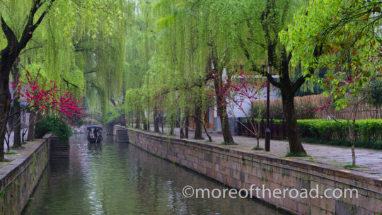
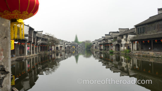
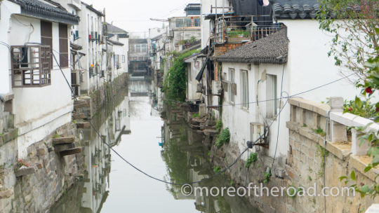
Many of the canals that run through the towns of the Yangtze River Delta were first constructed over 2000 years ago
During the Tang and Song Dynasties, Suzhou was at the heart of China’s Silk production. By the end of the Yuan Dynasty (1368), Nanxun had taken over the production of the finest raw silk. Silk made the town wealthy. According to some reports, the four wealthiest residents (The Four Elephants) were wealthier than the emperor. The four Elephants were the Liu, Zhang, Pang, and Hsing families. Some accounts add the Yueh family as a fifth “elephant” astronomically wealthy family.
With this wealth came large, ornate houses and gardens. The major attractions in Nanxun center around these grand houses of the famous figures of the Ming and Qing Dynasties.
Walking West Street…and East Street
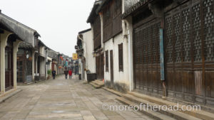
West Street, Nanxun
At 10 I am still mostly alone of the cobbled streets. The A huge student group arrived at the same time I did. They filled the otherwise quiet streets with the shouts and laughter of youthful enthusiasm. Thankfully, I haven’t seen them since they arrived, though.
I walk slowly taking in the sights of a village just waking up. An old man sits on the bench and gazes across the river. Several women squat on the steps that lead down to the water washing clothes. I pass several cafe’s hoping they are open. they are all closed. a couple of souvenir shops have their doors open and their wares displayed, but the shopkeepers lounge lazily on the steps, sometimes checking their phone, other times eating breakfast. It is clear that no one expects customers just yet.

A woman cleans her mop in the waters of the canal on West Street
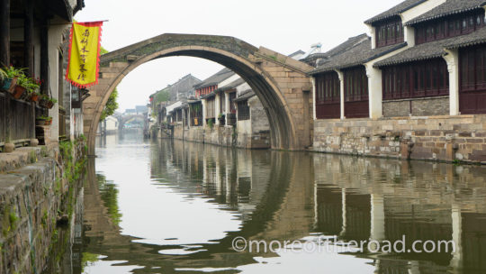
I cross the main road into the “East Street.” A sign informs me that this is the “Northern Scenic section. A man at a gate checks my ticket. If it didn’t cost 100 yuan per day to be here, I would stay a week! One website claims that you do not have to pay the 100 yuan if you are staying inside the historic quarter. Since I’m not staying in the historic quarter I have no idea if that if that is true.
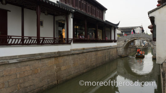
Here the bridges are taller. Their elegant arches form perfect circles with the reflection in the still canal water. The sound of construction drifts across the water of the canal. The sound of construction – the soundtrack to China.
The One Hundred Rooms of Baijian Luo
The tightly packed houses of the One Hundred Rooms Corridor extend for 400 meters along one of the smaller canals in Nanxun Ancient Town
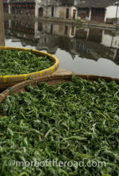
A herb commonly used in Tea set out to dry beside the canal along the 100 Rooms River
One of the most picturesque areas of Nanxun Ancient Town is the canal called the 100 Rooms River or 100 Rooms Corridor. This section of tightly packed houses was constructed around 400 years ago near the end of the Ming Dynasty.
The canal is called “100 Rooms” because of the small houses closely arranged one after the other on both sides of the canal. These were originally tenement rental properties.
Today tourists walk the narrow pathways on either side of the canal dodging the laundry hung to dry under the covered arcade and the tables put out by tiny restaurants hoping to sell breakfast.
I duck under some socks hung out to dry, and then pause to take a photo of some herbs placed in drying baskets on the canals edge. Nanxun is more than just a tourist town. ��It is still alive – her residents living very much as they always have.
Liu’s Former Residence

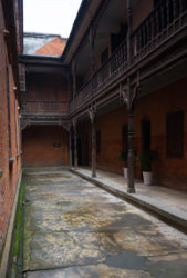
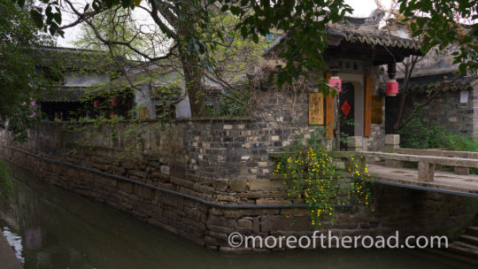
The red brick, columns, and rounded arches of the back face of Liu’s Former Residence are distinctly European
The Scarlet Wall and a Peaceful Pathway
The Qing era house of Liu Tiqing is one of the most photographed places in Nanxun. With a Chinese-style front facade and a European-style back facade, the house holds a unique mish-mash of eastern and western style architecture. This blend of eastern and western styles throughout the town is one of the things that makes Nanxun Unique among the water towns.
I wander through the light rooms with floors covered in tiles arranged in geometric patterns. Some of the rooms have western style furniture with large, ornate picture frames. Other rooms are more Chines in style. From the ornate wood latticework of the Sober house patio to the rounded arches and red brick of the “Scarlet wall and peaceful pathway” the west and the east merge beautifully. There are only a handful of tourists in the house and I don’t see them except for those times our paths cross as we move from room to room.
The Jiaye Hall Library

The Jiaye Hall Library is less than 100 years old and one of Nanxun’s newer buildings
One of the newest buildings in Nanxun,Liu Chenggan built the Jiaye Library between 1920-24. The building itself is less interesting than others in town. The building sports western facade, but more traditional interior hall.
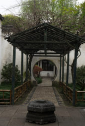
The garden outside the Jiaye Hall Library has a wild, untamed feel
A large garden borders one side of the library. While the library was impressive, the garden was untamed and magical. Trellises covered in pink blooms cover meandering pathways. Ornamental river rocks with holes large enough to walk through provide small, garden sized thrills.
Former Residence of Zhang Shiming
Zhang Shiming was the grandson of one of the Four Elements ( the four Richest men in Nanxun). In 1905 He used some of his inheritance to construct the large house. Like the former residence of Liu, this house blends Chinese and Western architectural styles creating a blended beauty. Some consider this house to be one of the finest in Nanxun.
Other Sights in Nanxun
You also won’t want to miss Former Residence of Zhang Jingjiang, the Guanghui Taoist Temple, and Nanxun’s most famous garden – the Little Lotus Villa.
Useful Links
China Travel has the ultimate guide to Nanxun. The article is a bit long, but it is accurate and informative and gives a detailed history of the town and its sights.
This article from Time Out Shanghai visits each of the water towns discussing their strengths and their weaknesses.
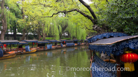
Covered junks await passengers in Nanxun, China
China: Water Towns of the Yangtze River Delta – Nanxun was originally published on More of the Road
#Ancient Cities#Ancient Towns#Canals#China#East Asia#Gardens#Nanxun#rivers#Shanghai#Water Towns#Yangtze River#moreoftheroad#crosspost#travel
0 notes
Text
China: A Weekend in Xi'an
What to do with a weekend in Xi’an Xi’an was once a great capital city that was home to the confluence of cultures that met at the end of the silk road. Today, Xi’an is China’s second most popular tourist destination. Like many travelers, I had only a short time to explore this great city. Here is what…
China: A Weekend in Xi’an was originally published on More of the Road
#Ancient buildings#Asia#China#Chinese Music#City Walls#East Asia#Music#Top Sights in China#moreoftheroad#crosspost#travel
0 notes
Text
Long Layover: 6 Hours in Shanghai
Long Layover: 6 Hours in Shanghai My bus pulled into the Shanghai South Long Distance Coach Terminal at 9 am. Since my flight wasn’t scheduled to depart from Dupong International Airport until 7:20, I wanted to make as much as I could of my six hours in Shanghai. I did a little research and opted for a circular…
Long Layover: 6 Hours in Shanghai was originally published on More of the Road
#Asia#buildings#China#cities#Cityscapes#East Asia#Long Layover#museums#Shanghai#Short Stops#moreoftheroad#crosspost#travel
0 notes
Text
China: Water Towns of the Yangtze River Delta - Suzhou
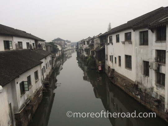
China: Water Towns of The Yangtze River Delta
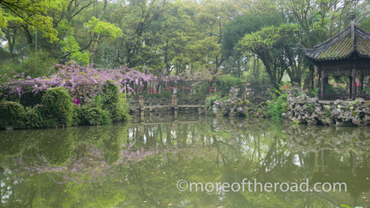
Visitors go to the water towns of the Yangtze River Delta to get away from the bustle of the nearby cities of Hangzhou and Shanghai. They come to absorb the beauty of the Classical Gardens and to bask in quiet of the tiny lanes along murky canals.
The famous city of Suzhou and the towns of Tongli, Luzhi, Zhujiajiao, Xitang, Wuzhen, Nanxun, and Zhouzhuang each draw thousands of tourists each day hoping to catch a glimpse of what is popularly called “the Venice of the East.”
Suzhou

For weeks advertisements on my Facebook page have been urging me to visit Suzhou. “10 Reasons to Visit the Venice of China” the advertisements taunted with pictures of flower draped canals lined with white buildings. The adds made me incredulous. Calling anything the Venice of anywhere strikes me as pretentious and misleading.
When I looked into the claim further I found that travel news was not much more helpful. The headline on a January 2017 article in the San Diego Union Tribune touts Suzhou as a “slice of Venice in China.” Even Trip Advisor had reviews for a place called “Venice of the East, Suzhou.”
In the end, my curiosity got the best of me and I arranged to pay a visit to Suzhou and nearby Nanxun to see what all of the hype was about.
So, you wonder, is Suzhou the Venice of China? No, (of course not). Venice is Venice and absolutely unique on this earth. In the same way, Suzhou is Suzhou and to compare it to Venice does both cities a disservice. Aside from the presence of sometime picturesque and sometimes stinky canals, the two cities have little in common. Nevertheless, Suzhou has some charm, plenty of history, and is well worth a visit.
Suzhou in A Day: What to See
Most of Suzhou has modernized and with a modern look the city lost a good deal of charm. The streets are wide and the buildings are tall, concrete blocks speckled with green tinted windows. Town planners have made a few attempts to undo some of the cultural damage done by modernization. They’ve added generic tile eaves in a classical Chinese style to the tops of the square blocks and paper lanterns to the city’s main shopping street. Unfortunately these efforts do little to restore what was lost.
So why should I visit Suzhou? People visit Suzhou for two reasons: Classical Gardens, and ambience. Of the two, the classical gardens is by far the better reason. Suzhou is home to 8 UNESCO World Heritage protected gardens – each with a unique beauty.
Pingjian Historic Quarter
Pingjian Historic District in Suzhou, China
The Pingjian Historic Quarter lies inside the moat that encircles the oldest part of town and runs North-South from Suzhou Museum down to the central East-West Ganjiang Street.
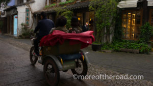
A moto-rickshaw rumbles down the cobbled Pingjian Pedestrian street
The narrow, cobbled street parallels a picturesque canal. Souvenir shops, cafes, and artisan’s boutiques line the little street. Silk scarves, flutes, and carved fans entice tourists into tiny shops. From time to time an army-green motor-cycle rickshaw rumbled by with a group of tourists squeezed into the seat under the bike’s red awning.

Suzhou is most famous for silk making and classical gardens, and even the canals take on a garden-like a appearance
If you are visiting Suzhou for glimpses of the canals lined with white houses and draped in flowers, there are two the Pingjian Historic Quarter will serve your purpose well.
The Humble Administrator’s Garden
At the intersection of Baijia Alley (the main canal-side alleyway of the Pingjian Historic Quarter) and Dongbei Street, turn left and you will find yourself at the gates of the Humble Administrator’s Garden.
Construction on the Humble Administrator’s Garden began in 1513 on the site of the ruined Dahong Temple
A small well in The Humble Administrator’s Garden
In spite of its name, this garden is anything but humble. The Humble Administrator’s Garden is the largest and most famous of Suzhou’s Classical gardens. It is also among the most crowded.
“Maximum flow of tourists: 9,031” a digital sign read at one of the entrances. “Real-Time flow of tourists: 1,801.” At around 1/5th capacity, the garden already felt crowded.
I wandered through the centuries-old pavilions dodging selfie-sticks ducking behind families posing for photos with a flower or a water feature or an ancient well. It is well worth getting to the garden early as many visitors come as a part of a day tour from Shanghai – arriving after 9am.
Admission: CNY75 (50 in the low Season)
Hours: 7:30-17:30
Silk Museum

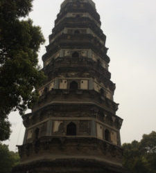
The North Temple Pagoda is the tallest pagoda south of the Yangtze River
Continue Westward on Dongbei street which becomes Xibei road until you reach the North Temple Pagoda. This nine-storey pagoda is the tallest south of the Yangtze River and offers hazy panoramas of a modern Suzhou for CNY 25 (open from 7:45-17:00). Turn right on the busy Renmin Road and you will find Suzhou’s Silk Museum.
In case you are unconvinced of the importance of silk in Chinese culture, the museum’s preface is quick to remind you: “silk is an epitome of ancient Chinese Culture…” it reads.
The region south of the Yellow River has been home to silk making for centuries. References to mulberry, silk worms and silk fabric appear as early as the Shang Dynasty (17th-11th century BC).
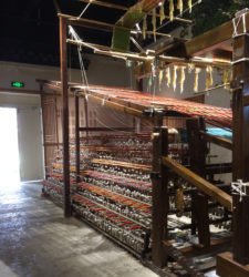
The Silk Museum offers a glimpse at the illustrious history of the silk industry in Suzhou
This is the best place in the region to learn about the region’s silk industry. The museum boasts re-creations as well as original swaths of exquisite ancient silk patterns. There are also informative displays demonstrations of the manufacturing processes for different kinds of silk.
Admission: Free
Hours: 9:00-17:00
Shantang Pedestrian Street
From the Silk museum, continue to work your way westward to Shantang Pedestrian Street.
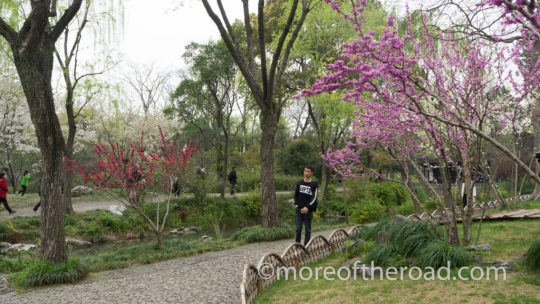
Suzhou’s Shan Tang Street is a remodeled ancient walkway that stretches 3.5km from Shi Lu up to Tiger Hill
Shan Tang Street is a place for a more local, more authentic experience in Suzhou
While most of Suzhou’s famous sights and museums lie near the Pingjian historic quarter, all of the city’s authenticity is to be found along the Shantang Pedestrian Street. Early in the morning school children made their way along the narrow street. The lucky ones rode on the back of a parent’s scooter.
As the morning wears on, the souvenir shops open. Unlike the more popular Pingjian Quarter, though. Long swaths of housing, as well as the occasional school punctuate the rows of knick knack sellers. This section of the city is old and beautiful, but still manages to hold it’s own identity very much apart from the tourist nature of the town around it.
Tiger Hill
Construction on the Yunyan pagoda began in 907 CE
Tiger Hill lies at the western end of the Shantang Pedestrian street. The burial site for the Wu king, Helu, the garden is named for the shape the burial mound takes At the top of the hill, the cloud rock pagoda leans precipitously – the top leaning almost 2 meters off of the the bass.
The grounds are beautiful. Meadows decorated with purple wildflowers fill the breaks in the quiet forests at the base of the hill. The place also oozes legends of the King. There is a sword testing rock that was said to be broken in two by an extraordinarily sharp weapon and the sword pool where legend says 3000 swords were buried with king Helu.
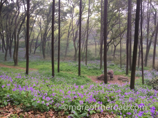
The forests and meadows of Tiger Hill provide an amazing escape from the city
More to do in Suzhou
More Canals – Explore Guantaiwei Lane
“The southern section of the lane was called Guantaiwei Bridge Xitutang’an, while the northern section of the lane was called Baixian Bridge originally. The two sections merged into one lane called Guantaiwei Lane with a length of 260 meters in 1980. There was Shadow of two towers, the former residence of the Qing Dynasty scholar Yuan Xuelan, in the lane, which is Wudu Hall now.”
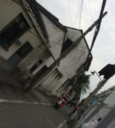
While most of Suzhou has modernized, historic pockets dot the otherwise modern city landscape.
I read the placard at the entrance to the alleyway next to the twin pagodas and tried to make sense of it. I’d gone for an afternoon explore and wandered the length of a tiny, residential canal for more than two Kilometers. There were no tourists and most of the residents looked genuinely surprised to see me. Here the white houses all could have used a coat of paint and wires drooped across the canal like robotic vines. Beautiful in its own way I wondered how long this tiny slice of a bygone time could hold on in the face of modernization.
More Gardens
Suzhou is a city of gardens. The Humble Administrator’s Garden might be the largest and most famous of the classical gardens, but it is a tiny sample of what Suzhou has to offer. The lion Forest Garden, the Couple’s Garden Retreat, and the Master of Nets Garden are are just three more of the dozens of classical gardens in the city and are all worth the time.
Traveling to Suzhou? See where I went next
China: Water Towns of the Yangtze River Delta – Suzhou was originally published on More of the Road
#Ancient Towns#Asia#Canals#Charm#China#East Asia#Gardens#Old buildings#Shanghai#Venice#Water Towns#Yangtze River#moreoftheroad#crosspost#travel
0 notes
Text
China: Hiking Hong Kong's Wilson Trail
Hiking in Hong Kong A Practical Guide to Hong Kong’s Wilson Trail Hong Kong’s Wilson Trail is one of the region’s three long distance trails. The 78 kilometer route is broken into 10 stages ranging from 5 to 15 kilometers each. I hiked the wilson trail two stages at a time over the course of 5…
China: Hiking Hong Kong’s Wilson Trail was originally published on More of the Road
#Asia#China#East Asia#Guide#Hiking#Hiking in Hong Kong#Hong Kong#Mountains#Trails#Walking Holidays#moreoftheroad#crosspost#travel
0 notes
Text
China: Fenghuang - a short guide to the Phoenix Ancient Town
Fenghuang, China A Short Guide to the Phoenix Ancient Town Fenghuang – the Phoenix Ancient Town is one of China’s most famous “Ancient Cities.” Stone streets meander under the peaked eves of the famous old houses that make up the core of the town. The broad Tuojiang River drifts placidly down the center of the…
China: Fenghuang – a short guide to the Phoenix Ancient Town was originally published on More of the Road
#Across China#Ancient Town#Asia#China#East Asia#Epic Journeys#Fenghuang#Hunan Province#More of the Road#Mountains#Myths#Old bridges#Old buildings#Phoenix#rivers#moreoftheroad#crosspost#travel
1 note
·
View note
Text
The Philippines: Exploring Subic Bay and the Bataan Peninsula
Exploring Subic Bay and the Bataan Peninsula
Subic Bay, The Philippines
We spent four days in Subic Bay and the Bataan Peninsula. During this time, we took a trip to Corregidor Island, explored the towns of Subic Bay and Olongapo, and visited as many of Bataan’s attractions as we could. Here’s what we found:
1. Subic Bay: the Town and the “Boardwalk”
Subic Bay is not a resort town. This part of town was all part of a large US navel operation until 1991 when the Philippine government decided not to renew the agreement. Now it is a mere echo of that time. The streets are wide, and have curbs and sidewalks that conform to US standards and the administrative style buildings each have large numbers painted on the side in large military script.
The streets of Subic Bay are wide, and have curbs and sidewalks that conform to US standards while the style of architecture is characteristic of a small town in America.
Subic Bay has no boardwalk and no bay-side entertainment. Aside from a small collection of hotels and restaurants at one end of Waterfront Road, the bayside area of town doesn’t actually have much at all. The Subic Bay “boardwalk” (at least that’s what my map calls that stretch of coast) is really just a dirty stretch of sandy beach at the center of the bay. While is a nice setting for a pretty dinner, it has little to offer beyond that.
For ocean swimming, one must go to the other side of the point where cleaner waters from the ocean break on the sandy beaches of All Hands Beach and Dungaree beach. Taxis will take you out there from town for about 200 pesos.
2. Olongapo and the Public Market
While the town of Subic Bay boasts quiet and wide tree-lined streets, her neighbor – Olongapo – is every bit as noisy, chaotic, and lively as Manila (except without the traffic). To get into Olongapo from Subic Bay one must pass through one of the two gates that once served to restrict access to the military base. Today, the gates stand open but still mark the boundary line between the towns of Subic Bay and Olongapo. They also serve to restrict certain kinds of vehicles. Jeepneys and Taxicle Trikes are forbidden in Subic bay but are everywhere in Olongapo.
Olongapo’s Public Market
The public market is the heart of Olongapo. This collection of vendors is surprisingly comprehensive. The narrow walkways are lined with shops selling shoes, clothes, cell phone accessories, fresh produce, jewelry, rice, souvenirs, meat, juice and just about anything else you can think of. I was expecting a small-town public market but instead I found an exciting Bazaar. The Olongapo Public market is well worth your time.
Location: At 20th and the Bataan-Olongapo road – about 2 Kilometers inland from the Main Gate to Subic Bay (map).
3. Three Forest Walks Near Subic Bay
Subic Bay is home to the International School of Sustainable Tourism, and the effects of that operation are becoming visible in the region. If nature is your thing, then you should definitely check out the forest trails open to visitors.
Apaliin Trail in Ilanin Forest West
The protected areas of the Bataan Peninsula are covered in virgin forests where centuries old trees tower above bamboo thickets
Past the airport and the All Hands beach resort, past the Red Cross Training and Operations Center, past the park checkpoint – un-manned and with the gates thrown upwards, a small sign marks the trail head of the Apaliin Trail – a 2 kilometer jungle walk that leads down to a tiny, isolated little sandy beach. Covered in leaves and shaded by towering trees, this forest trail is a delightful way to get away from the roar of the city. The trail is not difficult or steep. It is narrow and minimally maintained. I hiked it in sandals, but wished I had on my trainers. It took us two hours to hike the trail, round trip. We were moving at a very leisurely pace.
How to get there Unless you have your own car, your best bet is taxi – Our taxi driver charged us 350 for the drop off. He came back to get us and took us to another trail. The total cost for the morning was 1,100 Pesos.
The Apaliin Trail near Subic bay runs for about 2 Kilometers through the jungle from the road to the beach
Pamulaklakin Trail
The Pamulaklakin Trail is very different from the Apaliin Trail. located at the edge of the Subic Bay town, this trail is broad and well maintained. Visitors must pay for access to this trail, guided eco walks will cost 250 Pesos. This trail is widely visited by tourists and the eco tour is a great way to learn something about the native forests.
El Kabayo Falls
The El Kabayo Stables run trail rides up to these falls. If you don’t know how to ride a horse, don’t worry. The guides run along side leading the animals. All you need to do is sit and enjoy.
El Kabayo Falls near Subic Bay
Alternately, (if you don’t feel like sitting on a horse) you can hike the trail. A leisurely 10 minute stroll along a road-like trail will bring walkers from the trail head into the falls. The falls themselves are not that impressive. The forest is also aless interesting than the virgin forests on either the Pamulaklakin Trail or the Apaliin Trail.
4. Down the Bataan Peninusula: Corregidor
The mile long barracks of Fort Mills stand in ruins – a reminder of the fierce battles that once raged on this ground
Most tours to Corregidor leave from the Mall of Asia in Manila. it is also possible to get to the island from the Maritime Academy of Asia and the Pacific Port on Camaya Point near Mariveles at the tip of the Bataan Peninsula.
Corregidor Island is the sight of the Pacific memorial to lives lost during the second world war. There is also a Japanese Memorial to the thousands Japanese soldiers who lost their lives when the US re-took the island in 1945. During a visit to Corregidor Island you will ride through the park with a guide who will tell you story of the island from the time of Spanish colony until today. As you drive among the batteries and through the ruined remains of Fort Mills, the lives of those who lived and died to keep this ground becomes a little more real.
The Pacific Memorial at Corregidor Island in the Philippines was financed by the United States
The boat ride to Corregidor from Bataan costs about 3,500 Pesos for groups with fewer than 14 people. It must be booked in advance. The tourism.gov.ph website is your best bet for booking information. The bottom of the page has phone numbers and email addresses for booking tours to Corregidor from the Bataan Peninsula.
5. Mount Samat
Valor Cross on Mount Samat
Toward the top of the Bataan Peninsula, near the city of Balanga, a giant cross reaches to the sky from the top of a mountain. This is the Valor Cross on Mount Samat. The sight commemorates the brutal fighting on the front lines of the Bataan Peninsula and those who were subjected to the Bataan Death March.
Large words engraved in the marble walls of the memorial detail the battles won and lost on the ground the mountain overlooks. Relief maps in the museum show the assaults on the Philippines during the war. At the top of the mountain, the Valor Cross towers into the sky. A lift inside the cross carries visitors to the top, but it wasn’t operational when we visited in January, 2017.
The memorial and museum on Mount Samat outside of Balanga City on the Bataan Peninsula
6. Other Things to do on the Bataan Peninsula
Jungle Survival Training – JEST stands for Jungle Environment Survival Training and JEST camp offers just that. From day-long introduction courses to overnight adventures you will be better equipped for the Jungle, and more confident in your own skills after one of their courses. Their main camp is near the Subic Bay Airport. In addition to survival training courses, the camp offers a bird show, team building, and real life Angry Birds.
Hit the Beach – If you are looking for clean water, you should stick to the beaches that face the sea rather than Manila Bay. There are a few beach resorts outside of Subic bay, but there are more down by Morong.
Pawakan Sea Turtle Conservation Center If nature is your thing, then you might pay a visit to the Pawakan Conservation Center just south of Morong. The center helps ensure the hatch and release of baby sea turtles into the sea. The best time to visit is during the Pawakan Festival at the end of november, but the staff will show you the operation and help you understand the importance of what they do no matter when you visit.
If you prefer creatures that fly to creatures that swim, the Barangay Tortugas bird area near Balanga city is a good option. For public transit directions (and a heads up for what to expect) check out this post from Filipino Explorer.
Hiking and Mountain Biking If you are looking into a guided biking adventure Tourismo Pinoy’s “Brilliant Bataan” tour is a good place to begin. Alternately you can plan your own hiking and biking trip using the list of trails on bataan.gov.ph. The Bataan Peninsula has tons of other activities for the out-doors enthusiast. Visitors can hike, kayak, snorkel, and even dive some of the shipwrecks.
Where to Stay
My parents and I stayed at The Reef Hotel and Residences on one end of the Subic Bay. We had a room with a small kitchen, and a lovely view of the water. For the price, though, you can do much better (the Best Western, for example). Here are a few hotels that offer something a bit different than the ordinary hotel stay.
Las Casas Filipinas de Acuzar – Billed as a “heritage hotel” Las Casa Filipinas de Acuzar takes you back to 18th-century Philippines. Each building is a reconstruction of an 18th Century building from different places around the Philippines. They offer all of the luxury amenities of a major resort as well as heritage shows and tours of the facility.
Kamana Sanctuary Resort and Spa – Kamana Sactuary Resort is one of the nicest in the Subic Bay area. The real draw, though are the natural amenities the resort can offer. A private beach, kayak and snorkel rentals, along with the resort’s proximity to the Apaliin forest will give nature lovers a chance to explore the sea and the forests of the Bataan Peninsula.
Native House – If you are interested in a more local experience you might try one of these local huts. The complex boasts traditional rainforest huts in a forest environment with many of the amenities of a resort.
Notice: The links in this section take you to booking.com. I get paid a very little bit of money for each click. That money helps me pay the maintenance fees for this blog. Thanks for helping.
The Bataan National Park at a distance (as seen from Mount Samat)
The Philippines: Exploring Subic Bay and the Bataan Peninsula was originally published on More of the Road
#Asia#Bataan Peninsula#Historic Travel#History#Luzon#Markets#Philippines#Southeast Asia#Subic Bay#Towns#Travel#moreoftheroad#crosspost#travel
0 notes
Text
China: Yichang and the train to Zhangjiajie
Everest to Shenzhen
An overland journey from one side of China to the other
Part XI: Yichang and the Train to Zhangjiajie
An Afternoon in Yichang
The day was dull, miserable, and gray. A steady rain fell and turned the clean portions of the sidewalk into reflecting pools. The less-clean portions transformed into puss-pools filled with the grimy refuse of incontinent children and a hundred street food vendors. Pedestrians negotiated a mess of broken pavement, puddles, food-stands. Cars inched their way onto the sidewalk squeezing between trees and traffic posts to the wider area, usually reserved for pedestrians. Yellow lines showed that, yes, this impractical and impossible spot was indeed a parking place.
Yichang is a small, provincial town complete with small, provincial problems. While parts of the central area resemble a much larger city, it is clear that the town planners were cought unrepared by China’s recent boom.
I had one afternoon in Yichang before catching the train to Zhangjiajie and the final section of my trip across China. The day was so wet that I decided to spend it exploring the central part of town, instead of sight seeing. It isn’t like there’s much to do in Yichang anyways. Most people bypass the town altogether on their way to or from the Yangtze River Cruise.
The Train from Yichang to Zhangjiajie
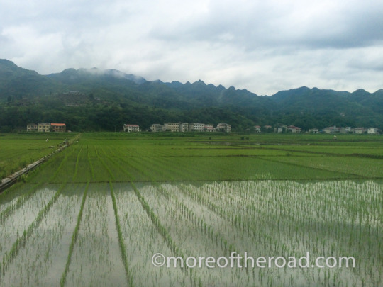
The road to Zhangjiajie
As we left Yichang and the three gorges behind us, the landscape flattened. Steep hills became low, crop-covered rises punctuated by the odd farmhouse. The rain dissolved into a changeless grey cloud cover blanketing everything with an ominous shadow.
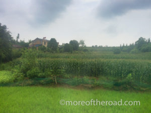
Mostly the landscape consisted of orange groves and corn fields. Every once in a while, though, a whole town floated by the window complete with a main thoroughfare and neat, pitched-roof houses.
The train car was crowded and noisy with conversation. From time to time I heard a lovely voice singing amidst the hubbub. Across the isle from me, a young woman used her boyfriend’s lap as a pillow while he watched TV on his phone. In China you live your life in a crowd.
The man pulling the fruit trolly through the isles of the train seemed determined to sell me something. He wanted to see my journal, to converse, to partake in the novelty of a white woman traveling alone in China. I wanted to be left alone. So I said “I don’t want,” shook my head ‘no,’ and stared hard out the window. He sat down in the seat opposite me and stared hard at me for a while. I tried not to notice.
The train passed crossed mountains and valleys through a long succession of tunnels and bridges. Tunnel, bridge, tunnel, bridge, tunnel, bridge. very little of the route was on a rail embankment. Even the highways cross the rugged parts of the country this way. The feat of engineering and labor required to complete these vast infrastructure projects is a bit incomprehensible to me.
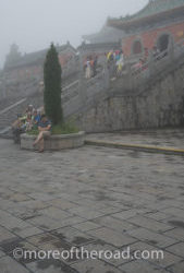
The train Journey from Yichang to Zhangjiajie took a little more than four hours. When I arrived in Zhangjiajie, I found my hostel and then took a short walk to get oriented in the town: Bus Station, Cable Car to Tianmen Mountain, Market…everything was within two or three blocks of the train station. I picked up dinner from a street noodles vendor and went to bed early. The next morning was going to be an early start up Tianmen Mountain.
Read more from Everest to Shenzhen An overland journey from one side of China to the other
Everest to Shenzhen Part 1: Welcome to Lhasa (Tibet)
Everest To Shenzhen Part 2: On the Road to Shigatse (Tibet)
Everest To Shenzhen Part 3: The Ancient Majesty of Gyantse (Tibet)
Everest to Shenzhen Part 4: The Road to Everest Chomolungma (Tibet)
Everest to Shenzhen Part 5: A night in Shigatse (Tibet)
Everest to Shenzhen Part 6: A Journey on the Qinghai-Tibet Railway
Everest to Shenzhen Part 7: Hotpot and hot springs 24 hours in Chongqing, China
Everest to Shenzhen Part 8: A Yangtze River Cruise
Everest to Shenzhen Part 9: Into the Three Gorges
Everest to Shenzhen Part 10: The Three Gorges dam
Everest to Shenzhen Part 11: Yichang and the train to Zhangjiajie (you are here)
Everest to Shenzhen Part 12: Zhangjiajie National Forest Park
Everest to Shenzhen Part 13: Epic Roads – the 99 Bends and Tianmen Mountain
Everest Shenzhen Part 14: Fenghuang
China: Yichang and the train to Zhangjiajie was originally published on More of the Road
#Across China#Asia#China#East Asia#Hunan Province#Overland Journeys#Three Gorges#Train Journeys#Train Travel#Yichang#moreoftheroad#crosspost#travel
0 notes
Text
China: Epic Roads - the 99 Bends and Tianmen Mountain
Everest to Shenzhen
An overland journey from one side of China to the other
Part XIII: Epic Roads – the 99 Bends and Tianmen Mountain
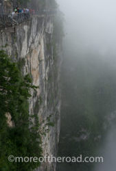
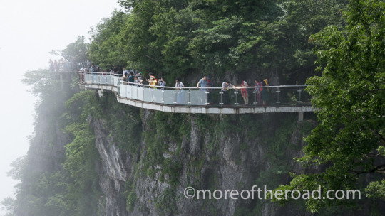
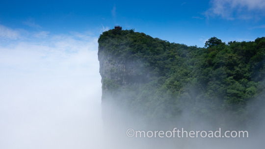
Tianmen Shan – Heaven’s Gate Mountain in Zhangjiajie is one of China’s tourism hotspots. A Cable Car takes you from town up to the mountain top and gives you a glimpse of the 99 Bends – one of China’s most spectacular roads. Cliffside walking trails crisscross the towering mesa giving visitors plenty to explore before taking the bus down the spectacular mountain road.
Cliff side trails of Tianmenshan are a kind of natural theme park. thrilling visitors with cliffside thrills
While the mountain intrigued me, the road is what most excited my imagination. The 99 Bends isn’t open to ordinary traffic. The only way to travel the road is by park bus, or on a bicycle. I couldn’t wait to experience one of the world’s most spectacular roads.
The Cable Car
Opening Hours: 7:30 am in Summer, 8:00 in the winter Closes at 4:00pm
Price: 258 Yuan for regular priced tickets. There are discounts during the low season (December-February) and for seniors and students with ID. The price includes one way on the cable way and one way down the escalators and bus.
I arrived at the cable car station shortly after 9 am to find the station already crowded. Blocks of covered seats outside the station were filled with tour groups waiting for their ticketed time.
As I left the ticket window I examined my ticket for the entry time. 9:45. I waited in the rain for a few moments, but since no one was policing the times, I joined the line at 9:30. We wound back and forth outside in the rain, then inside, then up some stairs, and then in the final waiting room for the cable car. The sound of the waiting hall was deafening as thousands of excited voices produced a muddled roar that never subsided. It wasn’t until 11 that I made it onto a cable car up the mountain.

The cable car ride from Zhangjiajie to Tianmenshan takes 30 minutes and travels 7 kilometers
The street, the market, the McDonalds and the train station drifted by beneath our feet. As we entered the park, I spotted a ribbon like road curling and winding and snaking up the steep mountain side. These are the 99 bends.
My fellow passengers and I all took turns taking pictures. This doesn’t usually happen in China. Usually it’s every man and women for themselves. I’d been helping their teenage son practice English, so I was treated better than usual. It took 30 minutes for our cable car to climb 1,400 meters (4,600 feet) to the upper station of Tianmen Mountain.
A Walk of Faith…
and a ride on Mother Nature’s Great Thrill Ride
When I got off of the cable car, I explored the somewhat confusing cable car complex. I rode the elevator to the tower to catch a view of the fog. Then I wandered through the station until I found the “west line” trail.
The most famous thrill on Tianmen Mountain, The Walk of Faith, lies along this trail. The Walk of Faith is a portion of the cliffside walkway constructed from glass, rather than cement. I bought my ticket (tickets for the glass walkway and chairlift are not included in the park entrance fee), pulled the maroon, fabric slippers over my hiking boots and stepped onto the glass.
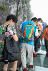
Nervous tourists press up against the cliff face on Tianmenshan’s oldest glass walkway
The cliff face stretched downward below my feet and disappeared into a fog of rainclouds. For a moment, I felt a tiny rush. Unable to see the ground through the fog, I could only imagine how high I stood. Around me, other visitors confronted their fears. The woman just in front of me took giant steps carefully stepping only on the places where cement supports stretched out from the cliff wall.
Another woman inched along sideways. She pressed her body tightly against the rock face that stretched upwards into the mist above us. Small groups of teenagers shrieked in delight as they leaned backwards to capture that selfie with the glass beneath their feet.
Tianmen Mountain has three glass walkways. While the Walk of Faith is the most famous of them, the other glass walkway (opened in early 2015) along the “east line”, is closer to the top of the cliff which makes it more appealing to those who prefer to see an “escape route.” The newest of the three glass walkways, the Coiled Dragon Cliff, opened in August 2016 and provides yet another opportunity for terror inducing thrills.
Tianmen Mountain’s three glass walkways provide terror inducing thrills to the mountain’s many visitors
A Forest and A Temple
The courtyard in front of the Tianmenshan Temple is a favorite spot for tourists to have a picnic lunch
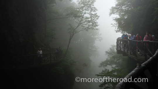
After dropping the maroon shoe-covers into the basket at the end of the glass walkway, I continued along the cliff-side walkway. Screams and shouts echoed through the white blanket of fog that enveloped the mountain. Slung from a tall cliff-face the narrow trail followed the cliff wall thousands of feet above hillsides below. Cement railings moulded to look like twisted tree branches stood between me and the fog shrouded abyss at my feet. For me, this was far more terrifying than the reinforced glass walkway.
The path wound up through the forest and away from the cliffs. Eventually it turned a corner into the courtyard by the Tianmenshan temple complex.
Tianmen shan Temple (originally the Lingquan Temple) was built during the Tang Dynasty but was destroyed by war in the 1940’s. The local government began rebuilding the temple in 1949 using the official architectural style of the Tang Dynasty.
Breaking through the Clouds
I found it difficult to get away from the crowds. Parks like this are like the Grand Canyon or Niagara Falls in North America – famous and crowded. Large tour groups, and families out for a day on the mountain all creeped along the narrow walkways creating long traffic jams. The shrieks and shouts of adrenaline as visitors partook in nature’s thrill ride echoed in the mist.
The Cloud Breaking mountain lives up to it’s name and divides the clouds that shroud the rest of the mountain in mist
I made a habit of following the path with fewest people. By this process, I eventually, found myself climbing a long series of steps. The steps led up a steep slope to the tower on top of the Cloud Breaking Mountain. There I found myself very nearly alone and the solitude felt glorious after the crowds of the cliff walkways.
Tianmen Cave and the 99 Bends
Most tourists follow a circular route of the mountain: You ride the cable car up, and the bus down. I was no exception. When I finished exploring the many reaches of Tianmen mountain, I got in line to ride the eternal sequence of escalators down into Tianmen cave.
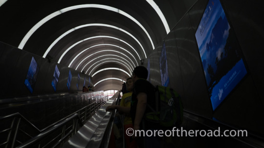
A long sequence of escalators descends from Tianmen Mountain into Heaven’s Gate Cave

The 99 Bends is one of China’s most famous roads
Tianmen Cave is a hole in the mountain that has inspired daredevils to thread the needle, and poets to write eloquent verses about a gateway to the heavens. Unfortunately, it was so foggy that I could barely see the cave around me let alone catch a glimpse of the steps. So I walked down the 999 steep steps that lead from the Tianmen cave to the bus pick-up point for my ride down the 99 bends.
The bus sped down the narrow, two lane highway. Inches separated us from a cliff face on one side, and a steep drop off on the other. The road turned and twisted, doubling back on its previous contortions as plummeted down the steep mountain. We turned, curved, twisted, turned, and then spiraled under an earlier bend. The short ride down lasted a mere 15 minutes – 15 thrilling minutes.

Read more from Everest to Shenzhen An overland journey from one side of China to the other
Everest to Shenzhen Part 1: Welcome to Lhasa (Tibet)
Everest To Shenzhen Part 2: On the Road to Shigatse (Tibet)
Everest To Shenzhen Part 3: The Ancient Majesty of Gyantse (Tibet)
Everest to Shenzhen Part 4: The Road to Everest Chomolungma (Tibet)
Everest to Shenzhen Part 5: A night in Shigatse (Tibet)
Everest to Shenzhen Part 6: A Journey on the Qinghai-Tibet Railway
Everest to Shenzhen Part 7: Hotpot and hot springs 24 hours in Chongqing, China
Everest to Shenzhen Part 8: A Yangtze River Cruise
Everest to Shenzhen Part 9: Into the Three Gorges
Everest to Shenzhen Part 10: The Three Gorges dam
Everest to Shenzhen Part 11: Yichang and the train to Zhangjiajie
Everest to Shenzhen Part 12: Zhangjiajie National Forest Park
Everest to Shenzhen Part 13: Epic Roads – the 99 Bends and Tianmen Mountain (you are here)
Everest Shenzhen Part 14: Fenghuang
China: Epic Roads – the 99 Bends and Tianmen Mountain was originally published on More of the Road
#Across China#Asia#China#East Asia#Epic Road Trips#Everest to Shenzhen#Famous Mountains#Famous Roads#fog#mist#Mountains#Spectacular Roads#Zhangjiajie#moreoftheroad#crosspost#travel
0 notes
Text
China: Zhangjiajie National Forest Park in Stories and Pictures
Everest to Shenzhen
An overland journey from one side of China to the other
Part XII: Zhangjiajie National Forest Park
…In stories and pictures
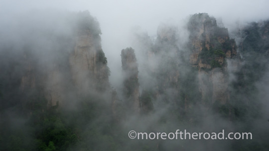
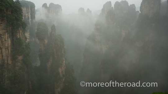
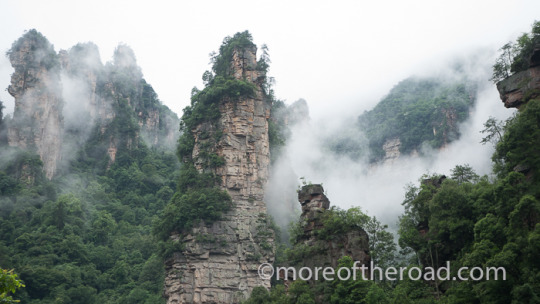
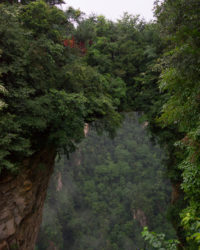
The month of June is rainy in Zhangjiajie, and the impressive rock pillars almost appear to float on the low clouds
The Story of The Buses (Day 1)
I arrived at the Wulingyuan entrance to the Zhangjiajie National Forest Park at 8:15 in the morning. I found the ticket window, purchased my ticket, and pushed through the gate. I was immediately confronted with a choice and none of the tools with which to make it: which bus do I take? Nothing was in English and I couldn’t find anything about a bus in my directions to the hostel.
I showed my map to the woman manning the bus line and pointed at the Golden Whip Stream.
“Bus 11 – 15!” The woman told me brusquely. She pointed frantically at one of the large purple buses in the line and indicated I should hurry.
the Trouble with Orientation
I strode over to the bus and found a seat. A few moments later the doors closed and we were off. We drove for more than 15 minutes before the bus made its first stop. I couldn’t read the signs through the window because the lettering was too small and the placement awkward. As the bus pulled away, I saw something that said “Bailong Elevator” and I panicked – I didn’t think I was supposed to be anywhere near the Bailong Elevator.
I jumped off at the next stop where I couldn’t make heads or tails of where I was. A handful of terrifying monkeys were busily fighting with tourist over her yellow plastic poncho. Signs pointed to some kind of geological museum across the stream. I saw a path and a stream and a few locals selling ponchos and umbrellas.
I checked the map on an information board. The information was largely rubbed out (and entirely in Chinese). It was no help at all.
At something of a loss, I jumped on the next bus going the same direction. I figured I may as well find out where it went. It took me to the Bailong elevator and a voice announced that this was the end of the line.
I knew I could ride to the top on the elevator and there catch a bus to my hostel, but the three hour hike through the park was something I’d been looking forward to. I wasn’t ready to let that go.
Riding in Circles
So I climbed onto the next bus determined to figure out how to get where I needed to be. It passed the mysterious stream and took me to a place called the 10 Mile Gallery. The 10 mile Gallery is nowhere near the Golden Whip Stream (at least according to my completely insufficient map). So I got on another bus going the other way and it took me back to the Bailong Elevator.
I decided all of this bus riding was rather useless (since all the busses seemed to make the same four stops) and that I should explore that trail by the stream. So I got on the next bus determined to get off at the stream. That bus skipped the stream stop and took me back to the 10 Mile Gallery.
I got off and got back on another bus having traveled the same section of road now five times. This bus let me off at the mysterious stream where I had a good look around before heading down the trail. About 200 meters down the trail I spotted a sign that read “Golden Whip Stream.”
After all of the back and forth, it turns out that the very first time I got off of the bus, I’d been in the right place after all!
Walking in the Rain (Day 1)
The views along the stream were outstanding. Mist-shrouded rock towers watched over the dense forest at their feet. A chocolate-brown river roared and surged through the narrow canyon spitting white froth at the lowhanging branches above it.
A heavy rain fell on trees, river, and tourists alike. Within half an hour my pants were damp to the knees. One hour into the walk and they were damp to the thigh. As I turned up the path toward the ridge, the damp reached up to my butt.
The stairs up the mountain were comfortably shallow and I only needed to pause once or twice in order to give a couple of shouters and one or two loud-talkers the space to make the hike more pleasant.
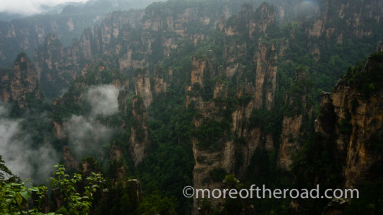
Zhangjiajie National Forest Park is famous inside China as one of the inspirations for the Hallelujah mountains in Avatar
After about fifteen minutes of climbing I reached the first concession stand. I walked through and continued along the trail. Fifteen minutes further up the trail, another concession stand sold processed meat and soda pop.

“First Bridge of the World” in Zhangjiajie National Forest Park
The steps led past dozens of stolen waterfalls roaring as they plunged off of rocky cliffs and into dark ravines. I climbed on and passed several lethargic toads along the base of a sheer cliff face that shone black and copper in the dense rain.
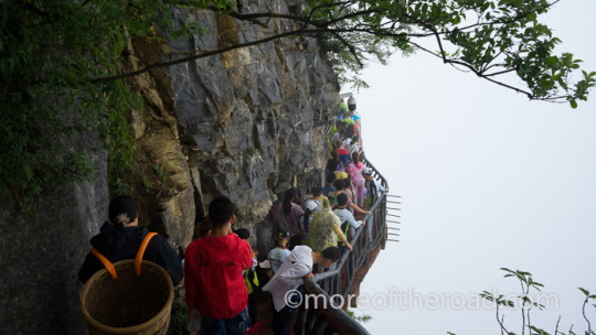
A few more steep sections of stairs brought me to an exit. I followed the signs to the “First Bridge of the World,” and soon found myself in a kind of hiker traffic jam. Hundreds of poncho-wearing, umbrella-wielding tourists inched their way along the cliffside path that connects some of Zhangjiajie’s most popular views: the Heavenly Mountain, and the World’s First Bridge.
It was nearly 1 pm when I made it to my hostel. I ordered a cup of tea from the staff (who spoke no English). Exhausted, I sat down to relax and dry off, and wait for my pack to arrive via currier.
The Story of the Flood (Day 2)
My second day at Zhangjiajie National Forest park proved no less an adventure than my first. I woke early and started out on the trail by 6:15. I hoped to beat the worst of the crowds. At first I stuck to the hostel worker’s suggestion: stay on top and see “the tops”. As I walked along the silent mountain-top road, a thick fog and heavy rain set in. I soon realized that I’d see nothing from the top through the thick blanket of white. So I walked back the way I came and set off down the trail for the golden whip stream.

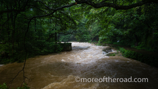
During the heavy rains of 2016 the Golden Whip Stream flooded the trail in some sections and was closed
When I reached the stream, I quickly realized I had a problem: a flood. The water of the Golden whip stream – yesterday a seething, frothy brown – was a franticly bucking wild force hurling debris down the narrow stream bed. A park sign floated face-up in the calmer waters near the river bank.
I raced along the path knowing that every passing moment brought the unloosed fury of the flooding river closer to the low lying parts of the trail. When I reached the place where a small dam controls the flow of water the trail dissappeared into a swirling mess of river water. All hope of dry feet slipped from my mind as I gingerly walked through the, calf-deep flood waters to safety. As I exited the trail to the bus stop, I looked back to see caution tape and a “trail closed” sign. That precaution would have been useful at the top.
10 Mile Gallery (Day 2)
I hopped on the bus (yes, the exact same bus as yesterday) and made the ten minute trip to the ten mile gallery trail head. It surprised me that the bus was running. Even yesterday, water from the river covered sections of the road near the ten mile gallery. Today that part of the road was riverbed and the bus plowed through the knee-deep water with determination.
The 10 Mile Gallery Trail is actually only 5.8 Kilometers long. The trail itself was a narrow boardwalk with barely enough space for two way traffic. My progress along the trail was frequently stopped by tourists stopping for selfies. Fortunately most people turned back after just two Kilometers limiting the worst of the human traffic jam to the lower part of the trail. As I walked along the wide riverbed admiring the towering spires of rock high above my head the chatter of tourists faded and the only sound was the percussive pounding of the rain hitting my poncho.
At at the top of the trail, I found some small concessions selling fried meat and cheap plastic toys, restrooms, and the entrance to the Tianzi Mountain Trail – the final, and most intense leg of my rainy hike.
Tianzai Mountain Trail (Day 2)
There is nothing to say about the Tianzi mountain trail except ‘steps’. The trail climbs over 2000 feet straight up the mountain. Whether the steps were steeper, or my legs wetter, the climb felt much harder than yesterday’s climb out of the Golden Whip Stream.
I slowed my pace and recited my mantra: “every step is important. Every step is important.” Slowly, step-by-step I made my way up the mountain. From time to time I heard a sharp crack and the rumbly roar of a rock slide on the other side of the 10 mile Gallery. I spotted a few large rocks on my trail as well so I took care not to linger beneath tall cliff faces.
The hike was lovely. The views on the upper reaches of the trail were indescribable. Seas of rock pinnacles emerged from the grey mist beneath me. The hike was made more beautiful by the solitude on the trail. I didn’t see anyone except bored porters on the trail until I was near the top.
Sucker!
I climbed steps for around and hour and a half until I came to a flattening of the path. The main path continued around a rise but a set of steep stairs in a state of general disrepair stretched upwards. A faded and worn sign next to the stairs read:
“Not climb to the platform namely you come in vain, up-run 186 steps.” I took it to mean – ‘why did you bother climbing all of those steps if you aren’t going to climb these?’
My legs ached, but I couldn’t pass up the possibility of a great view so I started up the 186 steps. After thousands of steps (one count puts the Tianzi trail at over 7000 steps), 186 doesn’t feel like much.
When I reached the top, I was painfully disappointed. Not only did the 186 steps reveal that I was still a good distance from the top, but the view from the platform was no where as good as the view from the trail. Laughing off the disappointment, I admitted that I was happier knowing than wondering. And so I returned to the trail and began the up and down that led to the top of the mountain.
Another half hour of climbing brought me to the McDonalds at the summit of the Tianzi Mountain Trail. I stopped in at the McDonalds for lunch. After all, how many hikes can you end with a mountain top lunch at McDonalds?
A Forest Walk (Day 3)
I woke the third day to clearer skies and a symphony of chirping birds. After some indecision about which way to leave the park, I decided to head over to Yangjiajie Cable Way and Wulingyuan Village. By the time I got there, I decided that I did not have time for both a hike down the mountain and an adventure in getting back to the forest park entrance on the incomprehensible bus system. So I paid the 76 Yuan fee for the cable car and walked to a gondola car with almost no wait. The steep ride to the bottom went along a steep channel lined with forested, rocky peaks.
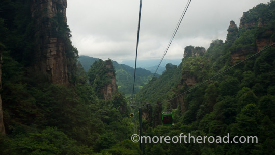
The Yangjiajie Cable way is one of the park’s newer cableways
When I reached the bottom I approached an employee with my park map and pointed at the forest park entrance. I didn’t feel like messing around with buses I did not understand. The employee looked at the map, said something to me and then walked me over to a small, brown bus.
The bus wound through the forested lower regions before climbing, once more, up the mountain. As we made our way up the mountains I began to question whether I was on the correct bus. Eventually the bus stopped and a wooden trail descending through the jungle. A sign (thank the heavens for a sign!) pointed toward the trail with the words “Forest Park Entrance.” so I began the walk through the dense rain forest.
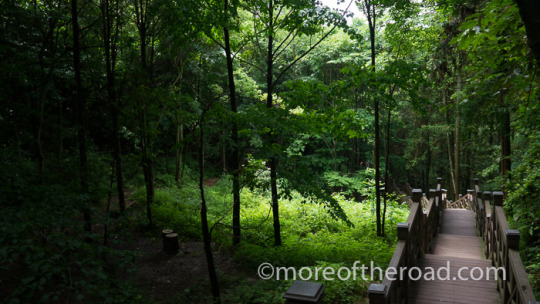
This forest path connects the lower station of the Yellow Stone Village with the Golden Whip Stream and the Forest Park Entrance
The new trail provided easy walking. Monkeys watched the tourists from high above our heads – occasionally dropping down onto the wood-deck trail to investigate the visitors to their home.
The trail wasn’t long, but the forest was beautiful and the trail was quiet and filled with wildlife. It ended at a bus turn-around with the entrance to the forest park was less than a kilometer away. I decided to walk down the road to the park’s entrance. That little forest stroll was the perfect way to end my visit to Zhangjiajie National Forest Park.
Some Useful Link
Need more practical planning information about the park? Here’s a link to my post with all of the information I needed (and learned) at China’s Zhangjiajie National Forest Park: Zhangjiajie National Forest Park – A Brief Guide.
Read more from Everest to Shenzhen An overland journey from one side of China to the other
Everest to Shenzhen Part 1: Welcome to Lhasa (Tibet)
Everest To Shenzhen Part 2: On the Road to Shigatse (Tibet)
Everest To Shenzhen Part 3: The Ancient Majesty of Gyantse (Tibet)
Everest to Shenzhen Part 4: The Road to Everest Chomolungma (Tibet)
Everest to Shenzhen Part 5: A night in Shigatse (Tibet)
Everest to Shenzhen Part 6: A Journey on the Qinghai-Tibet Railway
Everest to Shenzhen Part 7: Hotpot and hot springs 24 hours in Chongqing, China
Everest to Shenzhen Part 8: A Yangtze River Cruise
Everest to Shenzhen Part 9: Into the Three Gorges
Everest to Shenzhen Part 10: The Three Gorges dam
Everest to Shenzhen Part 11: Yichang and the train to Zhangjiajie
Everest to Shenzhen Part 12: Zhangjiajie National Forest Park
Everest to Shenzhen Part 13: Epic Roads – the 99 Bends and Tianmen Mountain
Everest Shenzhen Part 14: Fenghuang
China: Zhangjiajie National Forest Park in Stories and Pictures was originally published on More of the Road
#Across China#Asia#China#East Asia#Everest to Shenzhen#Hiking#Mountains#National Forest Park#Nature#rain#rivers#Travel#Zhangjiajie#moreoftheroad#crosspost#travel
0 notes
Text
China: Zhangjiajie National Forest Park - Guide
A practical Guide to Zhangjiajie National Forest Park
张家界国家森林公园

Zhangjiajie National Forest Park is famous inside China as one of the inspirations for the Hallelujah mountains in Avatar
Zhangjiajie National Forest Park is one of China’s most beautiful national parks. It is quite famous inside of China and draws large crowds during holidays. The astonishing natural beauty inside the park, however, makes braving the crowds worthwhile.
Getting to the park from the city of Zhangjiajie
The park entrances are between 30 and 50 kilometers from the town of Zhangjiajie. You can take a bus to any of the entrances from the town’s main bus terminal (by the McDonalds at the train station). The bus ride takes between 40 minutes and an hour. Double check that you are getting on the right bus. If you go to the Forest Park entrance, the bus should drop you off pretty close to the gate. The Wulinyuan is a bit different and you will need to take a taxi to the gate from the bus station (Zhāngjiājiè Guójiā Sēnlín Gōngyuán – 张家界国家森林公园).
Entrances…and fees
A Ticket to Zhangjiajie national forest park costs 245rmb and is good for three day. It takes about three days to see most of the 48sq/km park.
There are three entrances to Zhangjiajie National Forest Park: Wulingyuan Entrance, Forest Park entrance and the Tianzi Mountain Entrance. Most visitors staying outside the park use the Wulingyuan entrance because there are a number of hotels in the town nearby. This means that Wulingyuan entrance is the one most likely to have long lines. Visitors staying inside the park should consult with their hotel or hostel about which entrance to use.
Park Regions
Understanding the different park regions won’t really help you navigate – though it is worth reviewing after you’ve seen the park since the landscapes are somewhat different. There are six areas in the Zhangjiajie National Forest Park.
“First Bridge of the World” in Zhangjiajie National Forest Park
Yuanjiajie (袁家界) Many of of the pictures you will see of the park are from this area. It is popular, beautiful, and crowded even when it is pouring rain. You can reach this part of the park by way of the Bailong elevator. If you enjoy a good climb, you can take the Shadao Channel or the Luancuan Slope trail. Both branch from the Golden Whip Stream. A cliff-side trail connects Yuanjiajie’s major view points of “Greatest Natural Bridge” (Also called “the first bridge under heaven”), Heaven Pillar (Hallelujah Mountain), and Lost Souls Platform.
Tianzi Mountain (天子山) is beautiful. Particularly beautiful are the views at the “nodding General’s Platform (Dian Jiang Tai 点将台). There is a McDonalds on the top of the mountain here (if you find yourself needing lunch…or dinner). The Tianzi Mountain region of the park also includes the 10 Mile Gallery Trail.
Yangjiajie (杨家界) is steep and newly developed. This means it is a bit less crowded (for now) than other sections of the park. You should prepare for steep and narrow trails if you plan to hike here. The highlight of the Yangjiajie area is the Natural Great Wall – a great wall of natural rock.
Gold Whip Stream (Jinbian Stream – 金鞭溪) is a river and a trail and one of the best places for viewing the rock structures from below. Beware of flooding during the wet season. When this trail is closed it is difficult to get from one part of the park to another.
Yellow Stone (Yuangshi) Village is similar in feel to Yuanjiajie, but from the other side of the valley.
Laowuchang is the least developed part of the park – and therefore the least crowed. It is a bit difficult to access – mostly because of signage (or the lack of it). It is worth the effort if you have the time.

This forest path connects the lower station of the Yellow Stone Village with the Golden Whip Stream and the Forest Park Entrance
Bus Lines and Cable Ways – figuring it out…sort of
Bus
The network of bus routes and cable cars in the park mean that most of the park is accessible even to visitors with limited mobility. Figuring it all out, though, is a bit tricky. If you don’t speak Chinese it is especially complicated as none of the bus information is in English. I had a good deal of trouble with the buses when I first arrived. Even though I knew where I wanted to go, I couldn’t figure out where I was – mostly because of inconsistent signage. In the end, I ended up riding several of the buses back and forth until I got where I wanted to go. Here is some information that should help you avoid that.
“Mountain Down Bus”: is a lower (valley) route that runs from the Wulinyuan entrance to the Bailong Elevator. It makes stops at the lower station of the Tianzi Mountain Cable way, the Ten Mile Natural Gallery, “Water Winding Four Gates” – one terminus of the Golden Whip Stream, and the Bailong Elevator.
“Mountain Top Bus”: This one is slightly more confusing. Some buses run the whole length of the mountain top road connecting the Bilong Elevator with the Tianzi Mountain Cable Way and others just run between certain points. It doesn’t help that none of the bus stop signs or maps are in English. In the end I just pointed where I wanted to go and one of the many park workers would point me to the bus I needed.
Other Buses: There are two other bus routes. One connects the Yangjiajie Cable Way (near wulong village) with the Huangshi Village cable way (a short-ish, downhill path from the terminus of this bus line will take you to the Forest Park entrance). The other connects the Tianzi Mountain town with the “Mountaintop” bus.
Cable Ways, Trains, and Elevators
Access to the elevators and cable ways is not included in your park ticket, you will have to buy those tickets separately if you don’t want to hike the stairs up the mountains. Also – waits for the cable cars can be long if you are traveling during the busy season.

the Yangjiajie Cableway is one of the park’s newest features
The Bailong Elevator is an actual mountainside elevator. At the opposite end of the mesa, the
Tianzi Mountain Cable Way (72 rmb per person) is at the opposite end of the mountain from the Bailong Elevator. The mountain top Buses, and valley buses make a complete loop closed by the elevator and the Tianzi mountain cable way. Other parts of the park are not on this loop (this is an important navigational point).
The Yangjiajie Cable Car is a spectacular ride that connects the western side of the park with the top of the park (if you prefer to walk, there is a trail that more-or-less follows the cable car route.
There is also an electric monorail train (38 yuan one-way) that runs the length of the 5.8km “10 Mile Gallery.”
Some Popular Walking Routes
The Golden Whip Pock
The Golden Whip Pock trail connects the Forest Park Entrance with a bus stop on the “mountain down” bus line. It effectively joining two very different portions of the park. The Golden whip Pock follows the river through lush forest at the base of the karst rock formations. The trail is paved throughout and is an easy and beautiful walk. It takes about two hours to walk the length of the trail which might seem long to inexperience hikers. Be careful of the monkeys – they will attack you for food and toys – be especially careful if you are wearing a plastic poncho.
from the north side of the golden Whip pock, the Lancuan slope trail by “Getting Together Far Away” and the Shadao Channel trail both lead to the top of the Yuanjiajie area.
During the heavy rains of 2016 the Golden Whip Stream flooded the trail in some sections and was closed
Ten Mile Gallery and the Wolong Ridge Trail up Tianzi Mountain
The Ten Mile Gallery is actually less than 6km long. It is famous because the rock formations resemble different shapes and figures. You can ride a small electric train up the valley or walk on the narrow boardwalk with hundreds of other tourists. The walk isn’t bad (even in the crowd) and a lot of people turn back, so the further up the valley you go, the thinner the crowd.
At the end of the Ten Mile Gallery you will find the entrance to the path that leads up Wolong Ridge to the top of Tianzi Mountain. 8000 steps climb nearly 1000 meters up the mountainside. The top part of the trail offers some of the park’s most stunning views. Porters will carry you for part of the way (for a negotiated fee) and there are a couple of small concession stands on the way up.

The view from Tianzi mountain in Zhangjiajie National park
When to Visit
Avoid July and August because of crowds. Also avoid December to February because of bad weather and icy paths. The rainy season (March-June) isn’t bad because the clouds add atmosphere. If you do visit during the rainy season, bring your own rain gear if you plan to hike (the ponchos they sell in the park are awful).
Where to Stay
Where you want to stay depends a lot on your purpose in visiting and what you want to get out of your visit. If you are a leisure traveler who enjoys a certain level of comfort you will probably want to stay in Wulingyuan Village just outside the park.
If you are a photographer or hiker and want to stay for sunsets (and sunrises) you will need to stay inside the park. Accommodations inside the park are universally “basic.” They have hot water, but might not have towels or toilet paper. Pack accordingly.
I stayed at the Zhongtian International Youth Hostel inside the park. It was at the top of the Shadao Channel Trail and a short walk from the highlights of Yuanjiajie. The location which made it perfect for hiking and photography. I had to supply my own toilet paper and towel, but the rooms were comfortable and the food was reasonably priced and made to order.
Dealing with luggage when you stay in the park
If you plan to stay in Zhangjiajie city for a night or two before heading out to the park, you might consider having your luggage forwarded leaving you free to hike as soon as you arrive. Most hotels in Zhangjiajie city are able to forward your luggage to your hostel or hotel inside the park for a fee of about 20 rmb (as of the summer of 2016).
Some Useful Links
Zhangjiajie Tourism
China Highlights
A better tourist map of the park than most
China: Zhangjiajie National Forest Park – Guide was originally published on More of the Road
#Asia#China#East Asia#Guide#hikes#Hiking#Hunan Province#National Park#rivers#Zhangjiajie#moreoftheroad#crosspost#travel
0 notes
Text
Tigers and Ice - A Brief Guide to Harbin
Tigers and Ice A Brief Guide to Harbin’s Attractions (China) Harbin lies in China’s far northeastern province of Heilongjiang. The city has long had a distinctly international flavor. In the late 19th century, Russia based the administration of the recently constructed eastern section of the Trans-Siberian railroad in Harbin. This led to the influx of…
Tigers and Ice – A Brief Guide to Harbin was originally published on More of the Road
#Asia#China#East Asia#Ice#Northern China#Old buildings#Snow#Tigers#Winter#Winter Destinations#moreoftheroad#crosspost#travel
0 notes
Text
Austrian Advent: Glühwein, and Christmas Markets
An Austrian Advent
Glühwein and Christmas Markets
Christkindle (Christ Child) Markets, Advent Markets, and Weinachtsen (Christmas) Markets, have a long history in Germanic countries. The tradition of a market around Advent originated in Germany in the late middle ages. The Austrian incarnation of the Christmas market didn’t take root until well into the 17th century. Examples of earlier precursors – (December markets and such) exist, but there is little evidence of a proper market organized around the advent season until the 17th century.
I traveled to the most famous of Austria’s Christmas Markets in Vienna, Salzburg, and Villach.
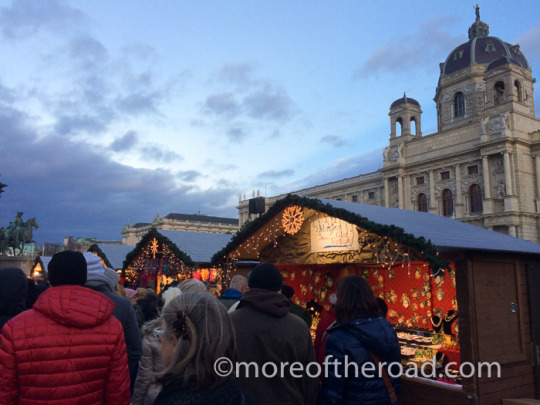
The market at Maria-Theresien-Platz, though picturesque, has little to set it apart from Vienna’s other markets
Stop 1: Vienna
The city of Vienna is filled with festive markets. Many of the city’s churches have a few stalls selling holiday theme knickknacks outside their doors.
Rathaus Market
The Rathaus Christkindlmarkt is perhaps the most famous of Vienna’s Christmas Markets. With the spires and towers of the 19th century neogothic city hall (Rathaus) as a picturesque back-stop, there is something of the magical about this market. The market was moved from its previous location at Messelpalast to the Rathausplatz in 1975. The Rathaus Christkindlmarkt boasts an Ice Skating trail, food stalls, Gluhwein and punsch and several booths selling snow globes, christmas tree ornaments, and other seasonal knick-knacks. It is usually crowded with tourists, which gives it a more of a vibrant (rather than frantic) atmosphere.
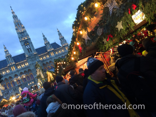
With 151 vendors, the Rathaus Market is the largest of Vienna’s Christmas Markets
Why go? For the ice skating, the crowds (if you like that sort of thing), and the festive atmosphere.
Location: (map) There is a Rathaus stop on the U2 metro line.
Karlsplatz Christmas Market
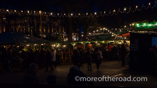
The Christmas market at Karlsplatz has the funkiest atmosphere of any of Vienna’s Markets
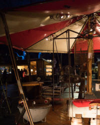
This junk Carousel is powered by bicycle
My personal favorite is the Karlsplatz Market. This market specializes in hand crafted knick-knacks and environmentally friendly treats. Children, as well as grown-up lovers of the absurd will love the bicycle powered junk carousel. The kids will have a great time playing in the hay field and on the bicycle powered train cars. Most of the hot beverage stations serve “bio” gluhwine – an organic alternative to the regular stuff and most of the booths are operated by artisans.
Why go? This market has all of the fun offered by the larger Rathaus market, but with smaller crowds, a funkier vibe, and higher quality items for purchase.
Location: (map) The Karlsplatz metro station is served by the U1, U2, and U4 metro lines.
Spittelberger Advent Market

Just a stone’s throw from the Volkstheatre metro stop, the Spittelberger Christmas market runs up and down the narrow, cobbled streets of what was once a country suburb of Vienna. This “village in the city” is Vienna’s second largest pedestrian zone. In these narrow streets and alleyways small, narrow houses with pastel facades and funky shops in on the ground floor have a much smaller, and more quaint feel than other places in Historic Vienna. The market also has a different flavor from the larger Rathaus market.
Why go? The Christmas Market in Spittelberg boasts numerous craft vendors along with a fascinating variety of permanent shops. You will find, lots of Gluhweine shops, some crowds, and an atmosphere that can’t be beat.
Location: (map) The nearest metro stop is the Volkstheater stop on the U2 and U3 lines (take the Burgasse/museumsplatz exit).
Other Christmas Markets in Vienna:
You will find small christmas markets just about anywhere tourists gather. The back side of St. Stephen’s Church has a small market, the area in front of Shonbrunn palace boasts a good sized market which focuses more on food and drink than on crafts and ornaments. There is also a market at the gardens at the Belvedere. Each of these markets is largely a copy of the others, but it is nice to enjoy some Gluhwein while awaiting your entrance time at one of the palaces, or as a break to exploring Vienna’s old town.
Stop 2: Salzburg

Although the roots of the Salzburg Christmas market go back to 1491 when it was known as the Tandlmarkt, today’s market in its present form only began in 1974.
The Salzburg Christmas market is filled with a traditional atmosphere. Draped pine garlands and fairy lights swoop across the 95 exhibitors in their pine-green booths. The market weaves through the courtyard of the cathedral and out into Mozartplatz where an ice rink rings with the shouts and squeals of thrilled youth. High above the town, the white walls of the Hohen fortress watch over the festive scene.
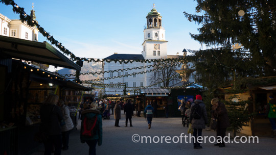
Salzburg, Austria
The scent of cinnamon and pine incense tempers that of the ubiquitous hot wine. Vendors sell hot wine, Christmas crafts, ornaments, chimney cake, apple strudel, and wurst. The sound of church bells ringing at dusk rides above the chatter of tourists who cluster around small round tables at the booths selling Gluhwein and Punsch.
Why go? of all the markets I visited in Austria, Salzburg had the most traditional atmosphere bringing a unique kind of magic through the more traditional approach to the market.
Location: The Salzburg market is located right at the center of the old town beginning in the Mozartplatz
Stop 3: Villach
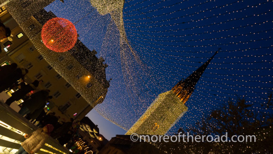
The canopy of lights over the ice rink in the Villach Christmas Market.
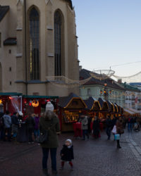
The Advent Market in Villach stretches through the center of the town’s historic district
Villach, in Austria’s southern Carinthia region, lies on a crossroads. Travelers traveling between Slovenia, Italy, Germany, and norther Austria all pass through Villach. The town is larger than it seems. Nearly 60,000 people call this town home, but the town feels more like a village than a city.
Quaint and atmospheric this small-town market has plenty to offer. Shops on the shopping street add to the festive feel by advertising items for sale on racks outside their stores. Villach’s Christmas market is a large draw for Italian tourists. The market winds through the town’s historic district. Fairy lights overhang craft stalls and Gluhwine cafes. The light-draped clock tower of the church of Saint Jacob watches over the festive scene from beneath its glittering mental. The central square has ice skating and a train ferries people from the market to the parking lots on the edge of the historic district.
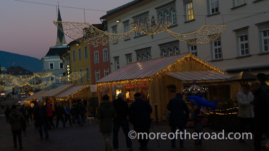
Villach, Austria
Why Go? The Villach market is a great place to stop if you are looking for something a bit quieter.
Location The Advent market is easy to find along the main street in historic Villach just a few short blocks from the main train station
Good to Know:
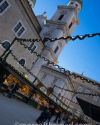
Salzburg, Austria
Gluhwein: Glühwein is hot wine with sugar and spices. In Austria it is served in both red and white varieties. It is significantly less potent than ordinary wine.
Punsch: Mostly juice with rum or schnapps and some spices added – this is also served warm.
Kaisespaitzle: A bit like Macaroni and cheese – except with a kind of dough dumpling instead of the macaroni.
Snow Globes: No, Snowglobes were not invented in Austria, but the story is an entertaining one (read it here).
Some Useful Links
The German Way and More offers a comprehensive guide to Europe’s Christmas markets along with some useful cultural commentary and historic context.
wien.at has the most historically accurate information about the history of Vienna’s Christmas Markets
wien.info has good information about Vienna’s most famous Christmas Markets
christmasmarkets.com is a great place to go if you are looking for a Christmas market in your country.
Austrian Advent: Glühwein, and Christmas Markets was originally published on More of the Road
#Austria#Christmas#Christmas Markets#Europe#European Christmas#Salzburg#Vienna#Western Europe#moreoftheroad#crosspost#travel
1 note
·
View note