
Last Seen Blogs

alioninacage
What have you done, my only friend?

organizationhimself
actively disintegrating excavator of ancient memes

texaseasymortgagellc
Untitled
i-wont-say-anything-blog
Fix Me
say-it-bae
Negative thinking just means I'm being realistic
Text
Wednesday
We had a number of things to do before we headed to Canmore today. We needed to run downtown to a camping store to buy bear spray and find a post office for stamps. Fortunately it was a nice day and traffic was light.

Packing was one of those things to do…
It’s always different wondering around a new city. Calgary has reasonable traffic patterns and easy in and out access to town. What was strange was that we had to pay for parking in a retail store parking lot. I can’t say I had seen that before.
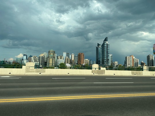
Calgary skyline.
Regardless, we found what we needed and headed straight out to Canmore to check into our Airbnb. Since we had time, we went down to the Canmore downtown and found a place for lunch. After, Diane shopped for jewelry from local artists. All good!

Downtown Canmore.
After we got settled in our Airbnb, I went to Banff to meet one of my cycling buddies. We were waiting on two others who had flight issues. In the meantime we built Jose”s bike then went downtown for dinner.
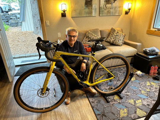
Jose working on his bike.
Banff was packed with tourists. The town’s Main Street runs about 4 blocks and is packed with retail and restaurants. We walked around checking things out then ate ramen at a sushi place. After checking in on the missing duo and knowing their ETA was 10:30pm, I decided to head back to Canmore to get some sleep.

Gotta love a mountain town!
While I was in Banff Diane took herself out for a delicious steak dinner in town. It gave her a chance to get to know the place a little better in anticipation of Jane and Sally’s arrival on Thursday.

And all I had was ramen.
Note that the blog will switch to my bike ride for the next couple week. We will pick this one up when I see Diane on July 12th.
1 note
·
View note
Text
Tuesday
Diane and I popped out of our sleeping bags around 6am so we could go back down the Cottonwood Trail to see a few birds that we couldn’t find on Monday. We spotted yellow warblers, a Baltimore Oriole, spotted towhee, eastern kingbird, and a ton of robins! We also saw a few mule deer and rabbits! Then the mosquitoes drove us back to camp.
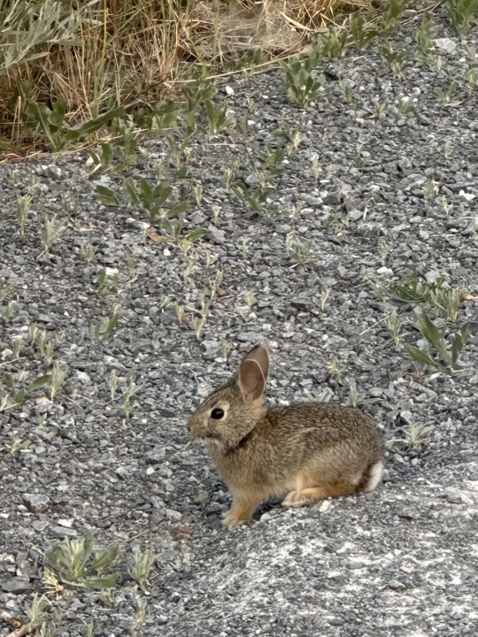
Bunny rabbit!
Once back, we quickly ate breakfast and packed our gear so that we would be on time for our Cretaceous Fossil Tour. The three hour walk took us into the restricted part of the park to see a fossil rich area. Along the way, the paleontologist who led the tour described the geology of the area and what made it so fossil rich. At our ultimate destination we were able to see fossils that were exposed to the elements thanks to erosion. 77 known Centrosaurus had been discovered in that area and it is believed that 10 times that number died in a single event and remain to be discovered.

Hot sun across the badlands.
Not only did we see an old dig site but but we were able to walk around and see and touch fossils that were just sitting on the ground. It almost looked like every stone we saw was a fossil!

Fossilized pine cone.
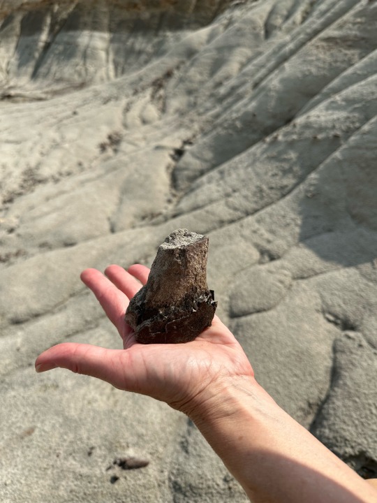
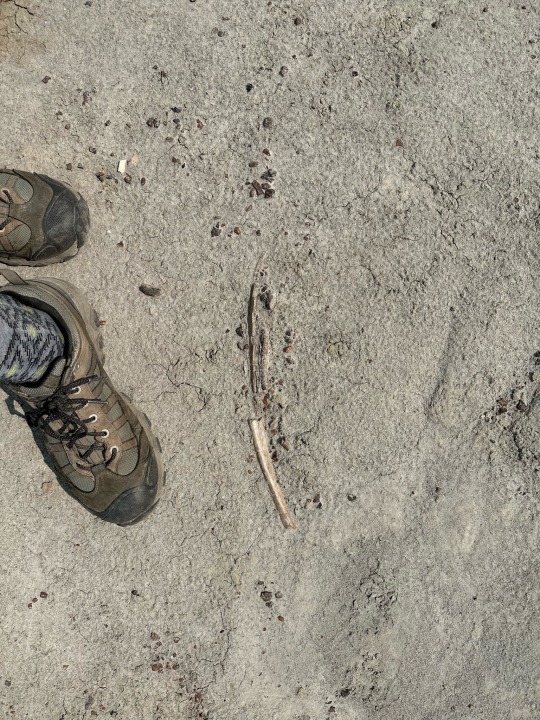
Leg bone that Diane picked up.
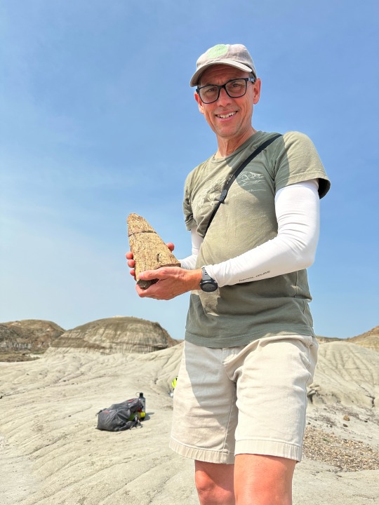
Centrosaurus horn.
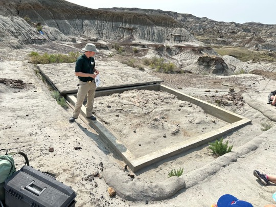
Dig site.
More fossils.

Everywhere fossils!!!
On the tour we also met a couple from the UK that was hitting all the dinosaur hotspots. He was a retired geologist and was checking off his bucket list of places to see. There was also a woman who was traveling with her wife, campervaning their way to the Yukon and the NW Territories from Phoenix. We had visited many of the same places as she had been over the years.
After we left the park we decided to hotel it rather than camp. I had a lot of prep work to do for the upcoming bike ride. It also gave us a chance to see Calgary. We ended up eating downtown in a touristy area near the business district. There were quite a few places to eat and drink although all the retail shops had closed by 6pm.

Stevens Street Mall.
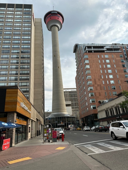
Space Needle downtown.
We ate at a placed called Barbarella. The food and drinks were quite good. The people watching was fun as well. There was quite a bit of strutting and preening going on.
All-in-all, a good day in Canada!
2 notes
·
View notes
Text
Monday
It felt good to lay in bed until 6am knowing that we didn’t have to drive anywhere today. As usual, it started getting light before 5am but we stayed in bed anyway. The birds were very active as well but we are getting used to it.
After breakfast we went out for an early hike. We learned about the geology that formed the badlands that we were visiting. At one time, the Park was on the shore of a great sea (prior to 75 million years ago). Later, it was a very wet area with multiple rivers converging here. They would leave their silt and occasionally flood to take out large quantities of local dinosaurs. Later, glaciers carved valleys and, even later, erosion and wind formed what we see today.

Hoodoo!

I’m in this pic for scale.

Top: claw
Bottom: claw
Along the way, we spoke to several friendly Canadians. Most were more than happy to share interesting facts about the area. Our next camp neighbor, an ER doctor with an interest in paleontology, even showed us a tooth, claw, and foot bone that he collected with the University of Alberta paleontology department earlier in the day (he would return them to be cataloged and registered. It made us excited for our tour in the “boneyard” on Tuesday.
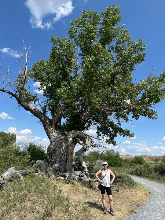
Ancient Cotton Wood
Later in the evening while visiting the washroom, I met a cyclist who just rolled in. He was one of the crazy cyclists on TransCanada 1 that we had seen earlier in the day. I was concerned about our ability to communicate when he greeted me with parlez-vous francais? Fortunately, he spoke very good yet accented English.
He was about 3600 km into his ride and still had more to go before he headed for home. We had a long conversation about bikes, and food, and packing, and more.
Well, all that was at 10:30pm so we cut the conversation short. It was well past all of our bedtimes!
2 notes
·
View notes
Text
Sunday
Really, really long drive today. Over 500 miles to Dinosaur Provincial Park in Alberta.
At 3:52am, I woke up to catch a glimpse of the sunrise. At 4:55am, I did Wordle and thought about getting out of bed. I don’t know how well I would do in the land of the midnight sun.

3:52am

4:55am
The Delta Hotel did well by us. We had a very nice suite, access to the concierge lounge, and complementary breakfast. All those days of business travel still pay off when traveling outside of the USA.
As we made our way out of town we passed Rothwell Street and saw a gray partridge running through a parking lot. How could the day get any better!

Need I say more…
We drove an hour down Trans-Canada Highway 1 and stopped in Moose Jaw to check out the town. Sunday mornings is not the best time to see how vibrant a town might be. Needless to say, it was dead. However, we could see that there was a lot going on in town. All the storefronts were full, there were plenty of bars and restaurants, just nothing was open on Sunday at 9am.

Quiet Sunday morning in Moose Jaw.
We rolled down the highway.
Next stop was Swift Current for lunch. Then we passed through Medicine Hat. Along the way, the flat farmland of Saskatchewan turned into rolling hills. Then it flattened a little as we came into Alberta. We saw mule deer, pronghorn, and the occasional suicidal rodent. We saw miles of rapeseed (canola), legumes, oats, and other crops. We saw major mining operations, miles of power transmission lines, pump jacks, solar panels, and windmills. And we saw cyclists miles from nowhere riding bikes that were fully loaded with gear. Those crazy cyclists!

The yellow crop is rapeseed (canola).

Pump jack.
We rolled into Dinosaur Provincial Park around 4:30pm. The Park is actually in a canyon which was a surprise to us. We were driving along and suddenly dropped a few hundred feet into the park entrance and visitors center.

Dinosaur PP behind us.
The park is wide open for exploration. The areas on the fringes the park are restricted to authorized persons due to the abundance of fossils. Before we leave, we have a tour within the restricted area!
The campground is quite active. The park as a variety of programs for visitors, especially kids. We sat in on the Dinosaur Trivia contest which was fun for all ages.
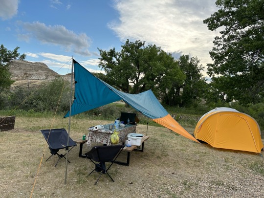
Our campsite.
Dino-trivia.
Another positive, the Canadians are really very friendly. We’ve spoken to several people, many noticed our NC tags (license plate). Our neighbor is a paleontologist who previously worked in the park, for example.
Asleep before sunset…
2 notes
·
View notes
Text
Saturday
Rain, rain. This has the potential to be a very long drive. We’ve got to go over 500 miles to Regina, Saskatchewan. That’s a quarter of the way across North Dakota (100+ miles), turn north, and cut a diagonal line to Canada. 350 miles in the USA. Another 150 in Canada. The first 100 miles or so were in the rain.

Our view for the first couple hours.
To give you an idea of how wide open the spaces are out here, we left the hotel without breakfast and thought we’d drive a few exits down the highway for food. We skipped the first 3 and the next thing we knew we were 40 miles west of Fargo before we found anything. With that, we gassed up the car every time we stopped today. We never really knew how far we’d have to drive before the next gas station.
Along the way in North Dakota we saw plenty of farmland, grassy prairies, rolling hills, and flat plains. Much of the ride was on 2 lane intrastate roads with no divider for oncoming traffic and with a 65 MPH speed limit (the divided interstate has a 75 MPH limit). There was quite a bit of construction along the way which slowed us down. At one point, they had scraped all the asphalt off the road leaving nothing but dirt for about 3 miles. Fortunately, it hadn’t rained there.

3 nasty construction miles.
Although this grassland was along the construction route.
There were many interesting sights along the way. At one point, we were in a valley for about 5 miles. Along the hills the graduating seniors from the local high school had laid out their graduation years in stones forming huge numbers. This started back in 1945 and only 2 years had yet to leave their mark.

You can’t tell from the pic but these numbers are 30 feet tall, at least.
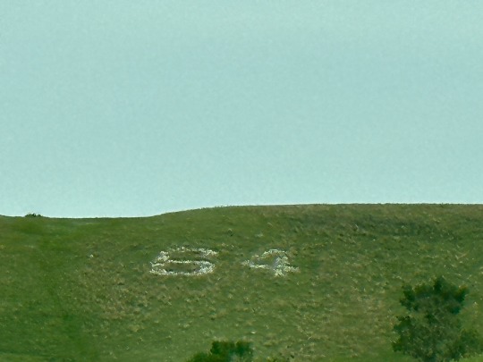
Earliest year we saw.
We entered Canada via a town named Portal, ND. The border agent asked us all the usual questions and let us pass. The first town on the Canadian side was North Portal. Makes sense!
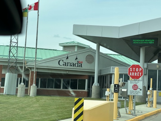
Oh Canada!
Saskatchewan, initially, wasn’t all that pretty. A mining company is surface mining a large area, 10s of square miles. What isn’t being mined was mined and what remains are mounds of vegetation-covered slag heaps. Once beyond the mining operation, things opened up into more farming. As well as crops, the farmers are exercising their mineral rights with fracking and pumping oil. There were more pump jacks than people.
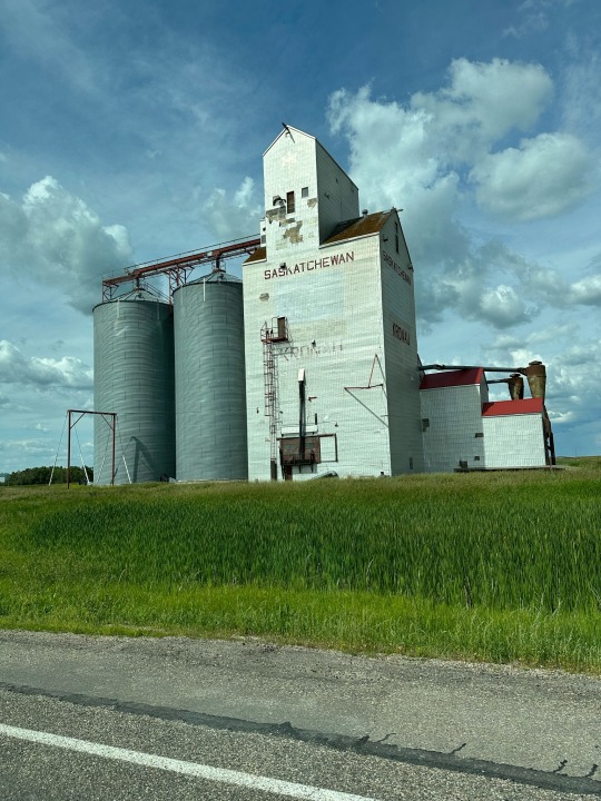
Some Saskatchewan industry.
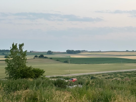
Regardless, the sky seemed to be endless. We also saw some wildlife… six pronghorns (3 adults, 3 children). A highway sign also warned us about moose but we never saw any.

Rapeseed, perhaps. To make Canola Oil.
Once in Regina, we quickly checked into our hotel and then scooted out to find food and drink. We walked into the Hotel Saskatchewan, a 100+ year old grand hotel that was build by railroad barons. We enjoyed the bar and they served excellent food. Our bartender was very attentive and educated me on Canadian whiskey.

The bar at the Hotel Saskatchewan.
After a few hours of relaxation in our high back chairs we decided to make our way back to our hotel. We hope to catch the sunset but don’t know if we will last until 9:14pm. You’ll have to find out if we did, tomorrow.

I watched it! Sunset beyond rail yard.
2 notes
·
View notes
Text
Friday
Listen to the riot of robins that woke me up at 4am.
Turn up the volume!!!
Diane was smart to wear earplugs. She slept until 5:30am, at least 45 minutes after it started getting light out. By 6:10 we were packed and headed out. By this time, the roosters were waking up.
A view from the farm.
Our first stop was to the auto shop to get a new battery. Ours was cranking at 1/2 the amps. We were concerned that it would die on us in the middle of nowhere so we replaced it. All is good now and we got a good recommendation on breakfast.
Next stop, the Hubbard Ave Diner in Middleton, WI. Designed to look like an old fashion diner with a menu to match. After some tasty hash we were ready to drive. Final stop… Fargo.
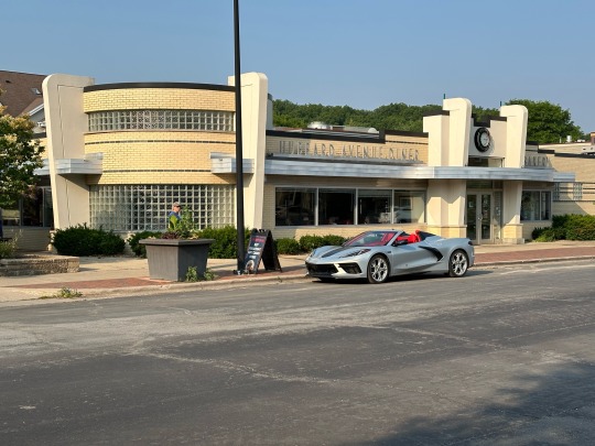
Hubbard Ave Diner. Middleton is quite a cute town.
Well almost. We dragged ourselves across Minnesota. We stopped in Minneapolis for fast food. Culver’s to be specific. Fried cod that was actually quite good. Not at all like a fillet-o-fish.

Fried cod fast food!
The next several hours involved driving the long, straight I-94 while we watched the sky grow darker. As we approached Fargo, the skies finally opened up.

Dark skies over Minnesota.
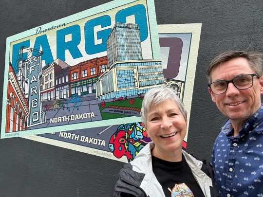
We rushed to check in to our hotel and find our way to downtown. Fargo proved to be a vibrant city with a young population and an active nightlife. We walked around checking out a few places and landed in, of all places, a seafood restaurant.
Guess where we are.
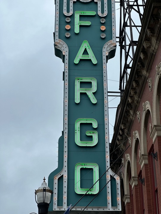
Here’s a hint.
We sat at the bar and ordered local fish. It was my first walleye and I thoroughly enjoyed it. Making things even better, we talked to a local couple who made us feel right at home. Elizabeth and Andrew made their way back to the area after living around the country including Petaluma CA, Florida, Savanna GA and other places. We had fun talking about all our kids, retirement, and travel.
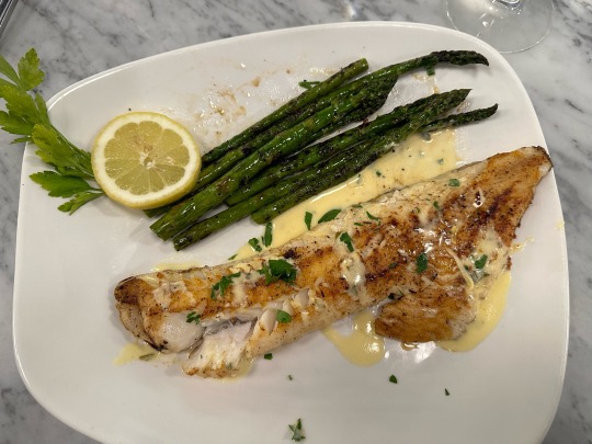
Delicious walleye.
No night caps for us. We fell asleep as soon as our heads hit the pillow.
2 notes
·
View notes
Text
Thursday
We had 6-7 hours of driving ahead of us so we got on the road by 8am. We really didn’t expect it to be a particularly interesting day. Indiana is flat with straight highways. We knew that Chicago would be busy with traffic. We rolled on.
One interesting sight in Indiana, we drove about a 10 mile stretch of I-65 where there were windmills for as far as the eye can see. There must have been 500 of them. They sat in the farmland among the crops. We’ve driven many places with windmills but none have had as many for as llong a stretch. Sorry, no pictures.
Once through Indiana, we drove through Chicago on the west side. The smog was thick with remnants of smoke from the Canadian fires. We made our way north and stopped in Evanston to check out the old neighborhood.
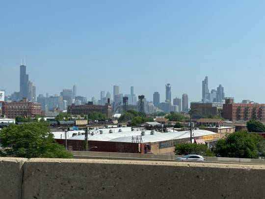
Smoggy Chicago.

The old street.
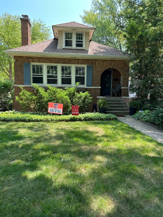
The old house looks the same!
First we had a bit to eat on Central Street. We wanted to see what shops are still there from 1996 when we moved away. Not surprising, there were several including Foodstuffs a gourmet deli. That’s where we ate lunch before heading back to the old street.
We walked up and down Lawndale Ave to see that the houses are all well kept, as always, and that several families with young kids were living on the block. It’s great to see the rotation of the older families to new ones!
Speaking of older families, we did ring the doorbell of some old friends. Unfortunately, no one was home. I guess that’s what happened at noon on a weekday. Regardless, we left a note and drove on.

Somewhere/anywhere in WI.
Next stop for us was Sun Prairie, WI. We wanted to drop in to the Midway Tavern to say hello to a friend of a friend. Unfortunately, she took the day off. We had a nice chat with the bartender who works full time as a 1st grade teacher. We learned that Sun Prairie has always been a vibrant town, somewhat of a suburb of Madison. She grew up in town and has watched it double in size.

Diane and me at the Midway Tavern.
From The Midway we dove 15 miles to our HipCamp for the evening. HipCamp is like AirBnB for campers. Our camp was a little more primitive than what we usually like (Diane is a champ!). The outhouse was about 300 yards from our tent. Our tent was 275 yards from our car. The chicken coop with 100+ birds was between our tent and the car. However, we had a nice level site in a grove of mulberry trees. We cooked a nice stir fry dinner, had a beer or two, and climbed into the tent before the mosquitoes got busy.

Camp for the night.
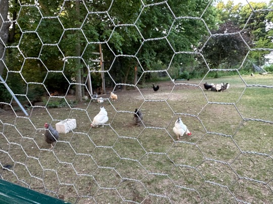
Some locals.
2 notes
·
View notes
Text
Wednesday
Driving day.
It rained a bit overnight and was still quite cloudy in the morning. We got up early, had breakfast, and packed up our wet tent and dining fly. After showering, we hit the road.
The first 50 miles or so were on windy country roads. Waze even had us on a gravel road at one point. Interestingly, we didn’t see a gas station until we got near the first highway. A mile earlier, our gas warning light went off. Good thing we had some options at that point.
Our route took us over Cincinnati and west to Indianapolis. At Indianapolis we turned south to Bloomington. We picked it just to see a different town.
Bloomington is a college town. It’s the home of Indiana University. Our first sights in town were of the downtown square and surrounding streets. There were a lot of older buildings but it was vibrant with thriving businesses. We ate at a nice cafe that had tables on a closed street right off the main square.
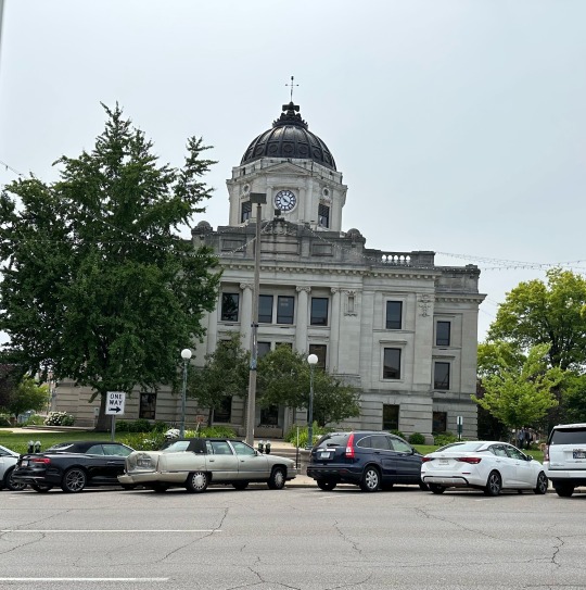
City Hall at the center of the main town square. Looks a lot like Morganton, NC.
While at lunch we spoke to a family from Phoenix that was working to see all 50 States. They just need West Virginia to meet their goal. We enjoyed talking to them about their favorite places and were pleased to hear that they put Charleston, SC and Savanna, GA on the top of their list of best places to visit.
Later in the day we drove onto the Indiana University campus. From what we could see, it’s immense. Many of the buildings are massive limestone structures. The facades are made of the same stone that was used to build the Empire State Building in NYC. It was quarried locally from the Empire Quarry. Unfortunately, the quarry is now owned by a private party so we couldn’t go see it.
One of the things I really wanted to see, and we did see it, was Armstrong Stadium. It’s the home of the Little 500. A bike race that has been put on by the IU Student Association for over 70 years. It’s also known for being the subject of one of the greatest cycling movies of all time… Breaking Away. Unfortunately, the gates to the stadium were locked so we had to admire it from a distance.

Lousy shot of the track at Armstrong Stadium.
After a cruise through a few more neighborhoods we made our way to a local brewery for dinner and a beer. Both the food and the beer were tasty. We certainly recommend Upland Brewing if you’re in Bloomington, IN.
After dinner we checked out some of the gentrification that’s taking place with old mill buildings near the brewery. It’s always great to see a town reusing the old buildings for new purposes.
That’s it for today. Tomorrow we will drive all day so we need a good night’s sleep.
1 note
·
View note
Text
Tuesday
We got rain overnight. Fortunately it wasn’t a drenching rain. It brought the temperature down a bit and we both slept comfortably.
Nature got us both up with sunrise. A variety of warblers sang us awake. Camp breakfast consisted of eggs and sausage in a tortilla, fresh fruit, and coffee/tea. Quick cleanup and we were off to see Old Man Cave.
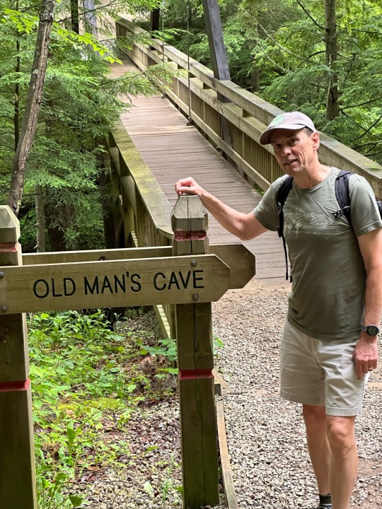
On our way to… you guessed it!
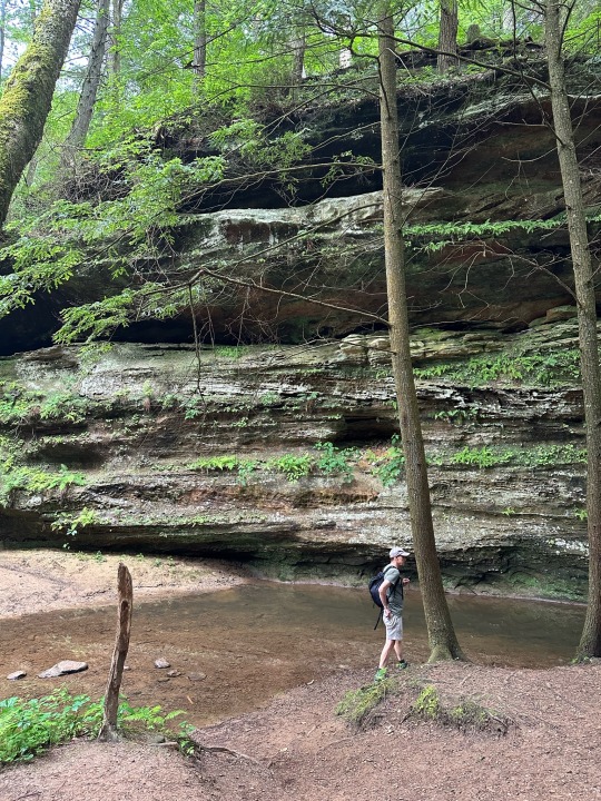
Hocking Hills State Park draws over 3 million visitors each year. On a summer Saturday, hiking the trails is more like waiting for a ride at Disney. On Diane’s suggestion, we were on the Old Man Cave trail by 8:30am this morning. We were virtually alone in the park. As a result, we got some nice pictures. You’ll see that it wad like being in a rainforest (in a good way).
The iconic Upper Falls.
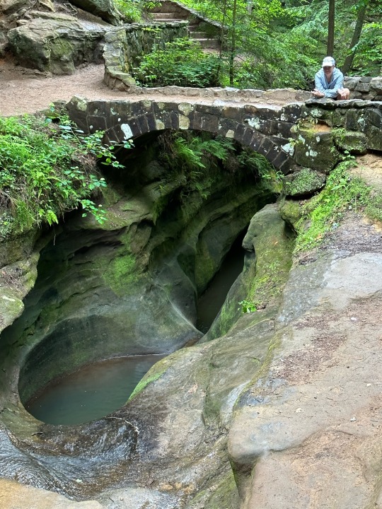
Devil’s Bathtub.
At 10am we joined a naturalist-led tour to lead more about what we just saw. The Park has two focuses when doing these tours, teach about the natural surroundings and teach about the positive impact of the CCC (Civilian Conservation Corps).
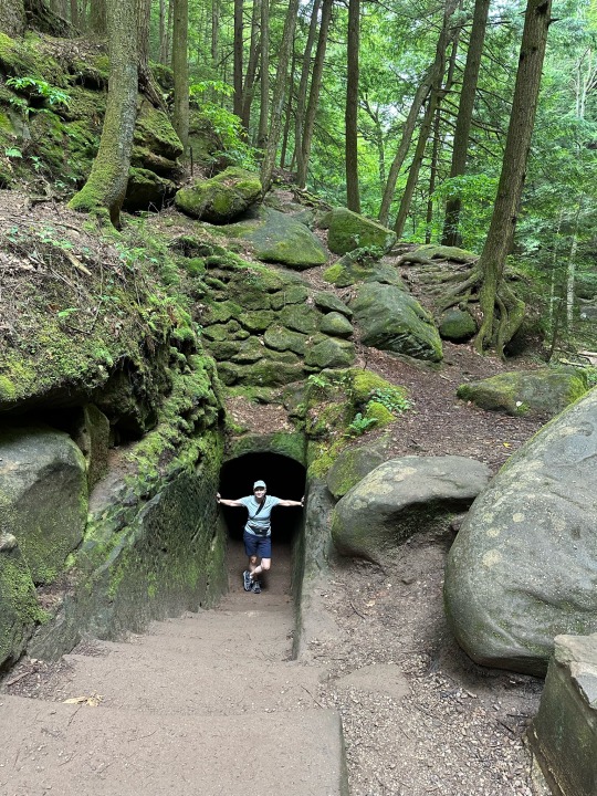
CCC carved tunnel to Old Man’s Cave.
From a geology perspective, Hocking Hills is built on layers of hard and soft sandstone. Wind and water have eroded the soft layers in between. The result is the caves and gorges that we see today.
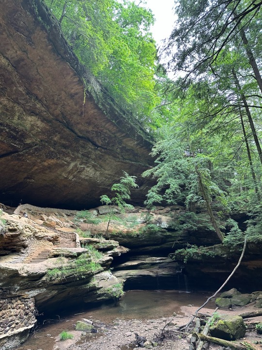
Old Man’s Cave.
The highlights of the park are its caves, gorges, waterfalls, and hundreds-years-old hemlock trees. We saw crews who are vaccinating the trees against a catastrophic blight.
Hemlocks & lichen.
Regarding the CCC, they built the trails, walks, rock bridges, and cut in the stairs throughout the Park.
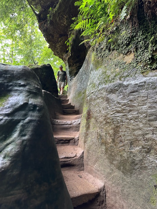
CCC work.
We found our way to the Hocking Hills Lodge just as the afternoon rain started. The lodge, which is relatively new and modern, was without power due to a modest wind storm. Regardless, we ate what was available from the kitchen (soup & salad) and waited out the rain.
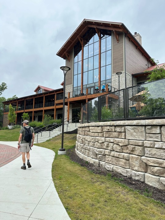
The new HH Lodge. The old one burned to the ground in the 90’s.
We walked the two miles back to camp just in time for the rain to pick up again. This gave us a reason to drive out of the park to a coffee shop for something warm to drink. By dinner, the rain had stopping and we able to eat back at camp.
Again, we were back in our tent before the sun went down and we read ourselves to sleep.
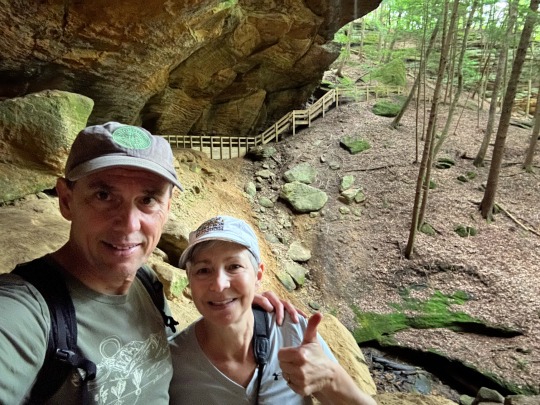
Diane and I in Whispering Cave…
2 notes
·
View notes
Text
Monday
And we are off…
We’ve got a six hour drive planned for our first day on the road. Weather and traffic might change that but we will see.
Our first stop was Wytheville VA, Virginia Heights Restaurant. We walked in to see a bunch of old guys sitting around talking about cars and other things. Typical small town local restaurant. Simple food. Tasty. A couple seventy-ish year old ladies were running the place. Friendly service! We walked had a fine lunch at a very reasonable price.

Virginia Heights Restaurant in Wytheville.
Wytheville’s historic downtown was quiet. On the positive side, 90% of the buildings are occupied with businesses. That’s always good to see when traveling through small towns around the country.
From VA we cut across West Virginia to Ohio. If you haven’t been there, WV is surprising remote and rugged. The highways go up, over and between steep forested mountains. Towns are few and far between. It’s easy to see why technology is slow to reach back into these hills.
The hills softened in Ohio but there were still deep ravines and twisting roadways. Hocking Hills State Park where we are camping was 8 miles down winding, roller coaster-like roads from the main highway. The highlights of the park are its caves, gorges, and waterfalls.

Home for a couple days.
After a nice camp dinner, we climbed into our tent and relaxed. As we read it grew darker and we were asleep by 11.
1 note
·
View note