#north columbia river
Text
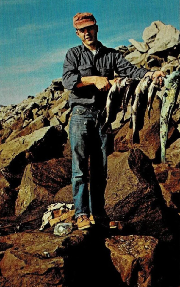
Excellent day of fishing in the North Columbia River Jetty
Washington
1965
#vintage camping#campfire light#washington#fishing#north columbia river#camping#hiking#history#vintage fashion#1960s
75 notes
·
View notes
Text
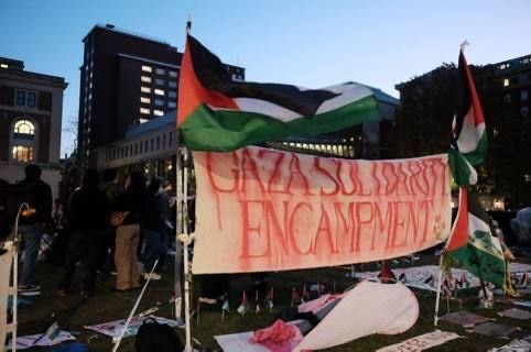
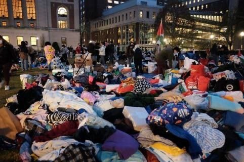


🚨 For the 5th consecutive night, students at Columbia University continue the Gaza Solidarity Encampment, undeterred by over 100 arrests, and returning with larger tents than before.
The students have declared that they will not stop until the University, with its $14 billion endowment, divests from zionism.
Despite a number of suspensions and censorship, students are not backing down. Tour guides for new students have resigned in protest of the repression. Support rallies continue outside the university.
The liberated zone at Columbia has inspired others: At Yale University in Connecticut, an encampment named Gaza Plaza with demands of divestment continues for the third consecutive night despite suspension threats. At Yale, a number of graduate students undertook an 8-day-long hunger strike to demand their university divest from zionism.
Students at the New School in New York also began an encampment, as did a number of students in Boston, creating three encampments at MIT, Emerson, and Tufts to demand divestment and cessation of attacks on students. Encampments are also taking place at the University of North Carolina, Washington University, and Miami University in Ohio.
#palestine#free palestine#gaza#free gaza#jerusalem#israel#tel aviv#gaza strip#from the river to the sea palestine will be free#joe biden#benjamin netanyahu#iof#idf#university#news#breaking news#gaza news#us news#yale university#new school#columbia university#tufts#washington university#university of north carolina#miami university#mit#emerson
270 notes
·
View notes
Text

TWO HOURS AGO: miami university students in oxford ohio have started their own gaza solidarity encampment! from new york, to north carolina, to ohio, let these three encampments be just the beginning! 🇵🇸🖤
#free palestine#end aid to israel#gaza genocide#save palestine#current events#let gaza live#end the genocide#end the occupation#columbia university#new york city#university of north carolina#miami university#students for justice in palestine#gaza solidarity encampment#from the river to the sea#free palestine in our lifetime#boycott divest sanction#no one is free until we are all free
12 notes
·
View notes
Photo
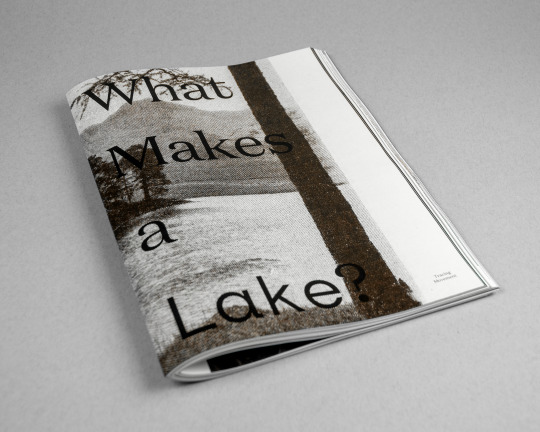
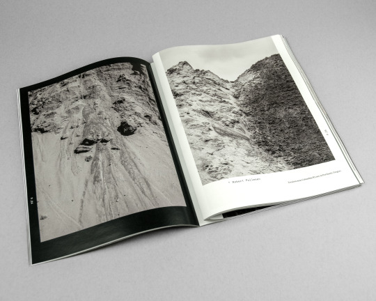
I want to let everyone know that work from my Land Studies series has been included in a new book by the talented folks at Another Earth.
What Makes a Lake? Tracing Movement brings together the work of more than 80 artists to create a portrait of Earth’ lakes, rivers, and oceans. This collection of images and text offers an intimate experience of places that we hope create a new connection to and commitment for caring for our most vulnerable ecosystems. In exploring an expanded scope of lakes around many different communities, we see how all these bodies of water are not isolated but rather flowing in and out of one another, reminding us how much our impact ripples out. What changes can be made with new awareness?
What Makes a Lake? Tracing Movement is beautifully designed and printed and is now available for pre-sale, so you can order on the Another Earth website: https://another-earth.com/books.
Curated and Edited by Abbey Meaker, Estefania Puerta and Cristian Ordóñez.
Book design by Cristian Ordóñez and Abbey Meaker.
This publication was supported by the Burlington City Arts Community Fund Grant.
#What Makes a Lake?#Photobooks#Photography Books#Publishing#Another Earth#Landscape Photography#Art Books#Ecology#Enviornmental#Lakes#Rivers#Slough#Columbia River#Columbia Slough#Pacific North West#PNW#PDX#Portland
73 notes
·
View notes
Text


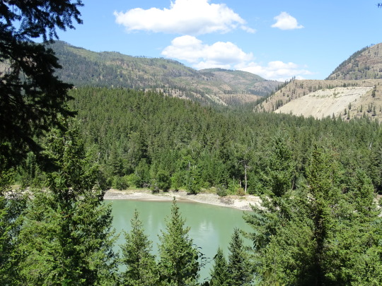
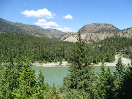


Clouds (No. 1198)
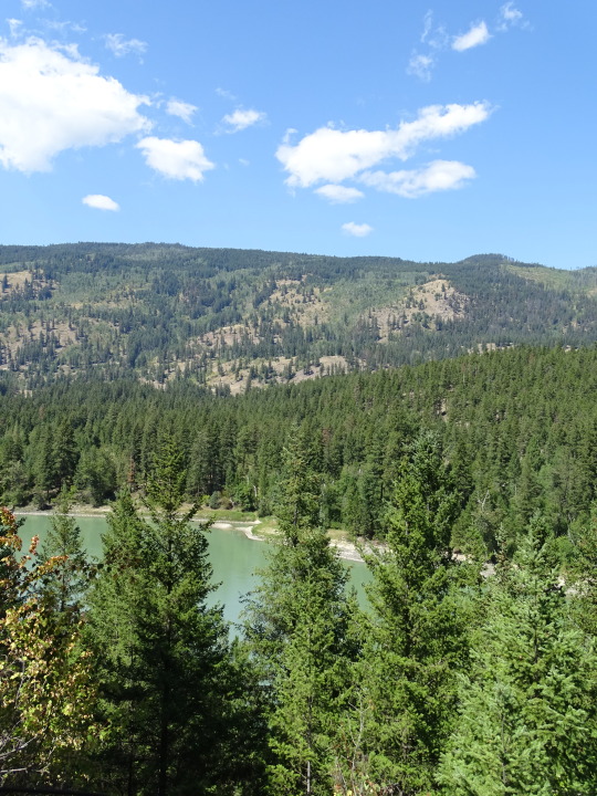
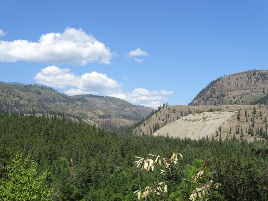
Exlou, BC (six pics)
Monte Lake, BC (two pics)
Summerland, BC (two pics)
#original photography#vacation#tourist attraction#landmark#clouds#nature#Canada#summer 2023#flora#travel#landscape#forest#woods#countryside#British Columbia#mountains#North Thompson River#Exlou#view#river bank#Monte Lake#Okanagan Lake#Summerland#Pyramid Picnic Ground#smoky air
11 notes
·
View notes
Text
Cheakamus River, Squamish, British Columbia, Canada
Ali Kazal
1 note
·
View note
Text

9 notes
·
View notes
Photo

Canon EOS Digital Rebel XTi + @vsco
#whistler#bc#british columbia#canada#winter#black and white#pine trees#gondola#peak to peak#frozen river#blackcomb#pacific north west#pnw#bwphotography#bw#canon#canon rebel xti#vsco film#vsco
1 note
·
View note
Text

Gathering clouds on the horizon.
#clouds#cloudy#North#forest#trees#mountains#british columbia#nature photography#river#nature#Spotify
1 note
·
View note
Text
It is a rocky, stormy, and wild coast, one that everywhere reveals nature at its most spectacular. There are the redwood groves of Northern California, the raging rivers of Southern Oregon, the Rogue Basin, and the Umpqua forest. There is the mouth of the Columbia River, with its huge waves and foaming breakers, where ocean currents and tides collide with the deadly bars. In Washington State, there are the breathtaking sea stacks of the Olympic National Park, the Hoh River, and Quinault River valleys. Also in the park are towering fir, cedar, and spruce trees draped in ghostly mosses. Then comes an inland sea, the Salish Sea, shared by Washington and British Columbia, where snow-laden mountains — the ten-thousand-foot Mt Baker and the eight-thousand-foot Mt Olympus — shelter idyllic islands whose waters are home to the last of the southern orcas.
#old growth forest#temperate rainforest#tongass national forest#redwoods#west coast#b.c.#california#oregon#alaska
328 notes
·
View notes
Text

Happy birthday, Paul Robeson! (April 9, 1898)
A celebrated actor and bass-baritone singer with a distinctive booming voice, Paul Robeson was born in Princeton, New Jersey to Reverend William Drew Robeson, a Presbyterian minister who had been born into slavery in North Carolina before escaping in his teens. The younger Robeson began acting in high school, and also excelled at sport. He won an academic scholarship to Rutgers University, which he graduated as class valedictorian in 1919. Robeson was socially conscious from a young age, and became especially concerned with inequality, both racial and economic, in American society. He attended Columbia Law School and worked for a time as a lawyer, but left the legal field behind due to its institutional racism. His talent for acting and singing allowed him to build a career in show business with the backdrop of the Harlem Renaissance, and he became especially known for his portrayal of Joe in Show Boat, with his rendition of "Ol' Man River" becoming iconic. He was also one of the first Black leads in American film history. In the 1930s, Robeson's social consciousness expanded, and he became interested in Africanism, anti-imperialism, and socialism, visiting the Soviet Union in 1934. Robeson would later reflect that his treatment in the Soviet Union was so starkly in contrast with the racism he experienced in America that he had felt like a full human being for the first time in his life. He became a left-wing political activist, supporting the Republicans in the Spanish Civil War and unionization in the United States. He was closely associated with a number of prominent socialists and members of the Communist Party, and supported Henry Wallace's 1948 Presidential campaign. He was also heavily involved in the early phase of the Civil Rights Movement. Robeson's political activities resulted in a backlash as the Cold War opened. He was blacklisted, forced to appear before the House UnAmerican Activities Committee, and his passport was revoked for several years, preventing him from touring. He retained popularity outside of the United States, and he was able to find some success touring in Europe and Australia, where he became the first person to perform at the site of the Sydney Opera House, singing the labor song "Joe Hill" for the workers building it. In poor health for much of his later life, Robeson died in 1976.
"My father was a slave, and my people died to build this country, and I'm going to stay right here and have a part of it, just like you. And no fascist-minded people like you will drive me from it. Is that clear?"
423 notes
·
View notes
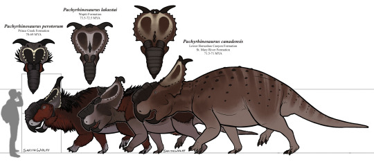
Text
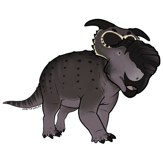
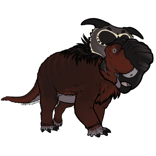
A Patreon request for rome.and.stuff (Instagram) - Pachyrhinosaurus perotorum… that I went a bit overboard with lol. I’ve been waiting for an excuse to draw my favorite ceratopsian, and to digitally adapt my old Pachy marker drawing design.
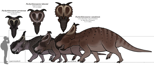
So! Pachyrhinosaurus! As seen above, there were three known species of Pachyrhinosaurus, living in different locations and eras in Late Cretaceous North America.
The oldest, P. lakustai, was native to the Wapiti Formation of Alberta and British Columbia, Canada. It’s known for the extra spikes it has at the center of its frill.
The slightly younger P. canadensis was native to the lower Horseshoe Canyon Formation and the St. Mary River Formation of Alberta and northwestern Montana. It was the largest of the three.
The youngest, P. perotorum, was native to the Prince Creek Formation of Alaska. As this ceratopsid seemingly stayed put during the long, dark, cold Alaskan Winters, it likely had adaptations for keeping warm.
The depiction of a “woolly” Pachyrhinosaurus was first popularized by Mark Witton as a speculative work, but the trope has prevailed. While many paleontologists find a heavy feather covering on a centrosaurine to be highly unlikely, and maintain that the animal’s size and homeothermy would have kept it warm enough, we still have no skin impressions to suggest that P. perotorum was fully scaly. So a feather coating is not completely out of the question (though it is unlikely). Still, I love the look of a woolly Pachyrhinosaurus and how it challenges our previous conceptions of non-avian dinosaurs. Stranger things exist in nature. I had to include a “woolly” option, especially since I already use the guy as my avatar on my paleo Instagram account, SaritaPaleo.
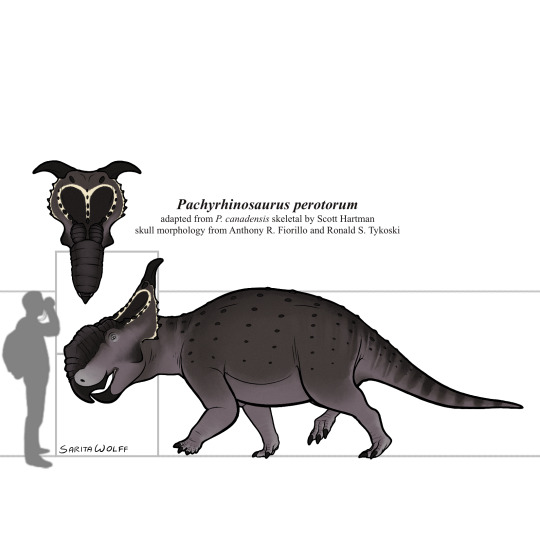
Pachyrhinosaurus was particularly unique in that it seemingly traded off something that had previously worked for other ceratopsians, horns, for a large nasal boss instead. For Pachyrhinosaurus, a battering ram worked better than a sword.
It was herbivorous, using its strong cheek teeth to chew tough, fibrous plants. Perhaps during the dark and cold Winters, P. perotorum would have also dug for roots or even scavenged carcasses. At any rate, from observations of their unusually conspicuous growth banding, it appears growth for P. perotorum would have been stunted during the harsh Winter, but was extremely rapid in the warmer months, an adaptation for the Alaskan climate.
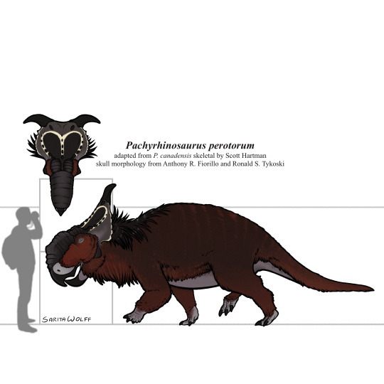
The tundra of the Prince Creek Formation housed a surprising amount of diversity. Pachyrhinosaurus perotorum would have lived alongside smaller ceratopsians like Leptoceratopsids, as well as other ornithischians like the pachycephalosaurine Alaskacephale and the hadrosaurid Edmontosaurus. Theropods such as Dromaeosaurus and Saurornitholestes, as well as a yet unidentified giant Troodontid, lived here as well. P. perotorum’s main predator would have been the tyrannosaur Nanuqsaurus. Small mammals were also somewhat common here, such as Cimolodon, Gypsonictops, Sikuomys, Unnuakomys, and an indeterminate marsupial.
(Btw, the request tier for Patreon starts at only $5 a month. 😉 Link is pinned at the top of my blog.)
#my art#SaritaDrawsPalaeo#Pachyrhinosaurus#Pachyrhinosaurus perotorum#Pachyrhinosaurus lakustai#Pachyrhinosaurus canadensis#Centrosaurines#ceratopsians#ceratopsids#ornithischians#dinosaurs#archosaurs#archosauromorphs#reptiles#Prince Creek Formation#Wapiti Formation#Horseshoe Canyon Formation#St. Mary River Formation#Late Cretaceous#Canada#United States of America
78 notes
·
View notes
Text
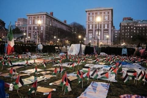
ONE HOUR AGO: our comrades at columbia's gaza solidarity encampment are strong in numbers and energy going into their third night! tonight as they go to sleep they will be joined in solidarity by our comrades at unc and yale. liberation is here, palestine will be free!
#free palestine#end aid to israel#bds movement#current events#gaza genocide#save palestine#let gaza live#free 🍉#end the occupation#end the genocide#columbia university#cu4palestine#students for justice in palestine#columbia university apartheid divest#university of north carolina#unc#yale university#yalies for palestine#from the river to the sea#free palestine in our lifetime#boycott divest sanction#palestine will be free#gaza solidarity encampment#happening now#dont stop talking about palestine
9 notes
·
View notes
Text
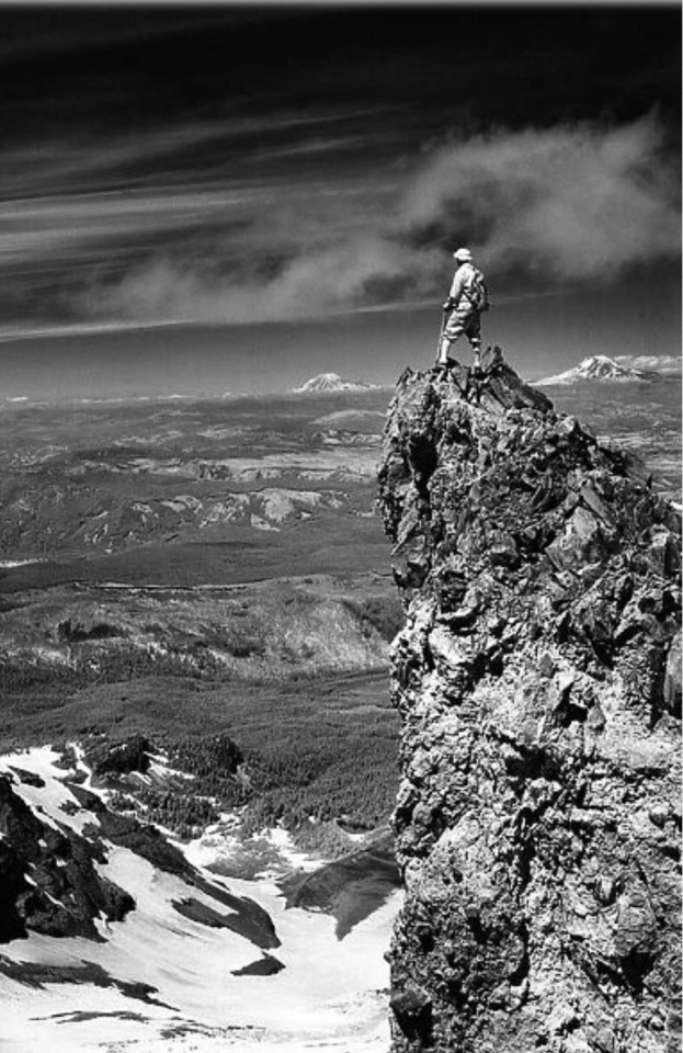
H. Armstrong Roberts (1883-1947)
A mountain climber on the north-east side of Mount Hood, looking north to Mount Rainier (left) and Mount Adams (right), Washington State. The Columbia River is in the background
USA 1970'S
74 notes
·
View notes
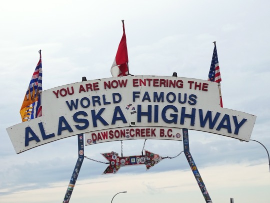
Text
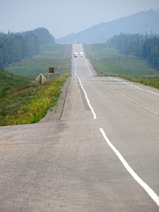


Alaska Highway, CDN (No. 5)
Rerouting continues, expected to continue in the Yukon through 2009, with the Haines Junction-Beaver Creek section covered by the Canada-U.S. Shakwak Agreement. The new Donjek River bridge was opened September 26, 2007, replacing a 1952 bridge. Under Shakwak, U.S. federal highway money is spent for work done by Canadian contractors who win tenders issued by the Yukon government. The Shakwak Project completed the Haines Highway upgrades in the 1980s between Haines Junction and the Alaska Panhandle, then funding was stalled by Congress for several years.
The Milepost shows the Canadian section of the highway now to be about 1,187 miles (1,910 km), but the first milepost inside Alaska is 1222. The actual length of the highway inside Alaska is no longer clear because rerouting, as in Canada, has shortened the route, but unlike Canada, mileposts in Alaska are not recalibrated. The BC and Yukon governments and Public Works Canada have recalibrated kilometre posts. The latest BC recalibration was carried out in 1990; using its end-point at the border at Historic Mile 630, the Yukon government has recalibrated in three stages: in 2002, from Mile 630 to the west end of the Champagne revision; in fall 2005, to a point just at the southeast shore of Kluane Lake, and in fall 2008, to the border with Alaska.
There are historical mileposts along the B.C. and Yukon sections of the highway, installed in 1992, that note specific locations, although the posts no longer represent accurate driving distance. There are 80 mileposts in B.C., 70 in Yukon and 16 in Alaska with a simple number marker of the original mile distance. There are 31 "historic signs" in B.C., 22 in Yukon and 5 in Alaska, identifying the significance of the location. There are 18 interpretive panels in B.C., 14 in Yukon and 5 in Alaska which give detailed text information at a turn-off parking area.
The portion of the Alaska Highway in Alaska is designated Alaska Route 2. In Yukon, it is Highway 1 (designated in 1968) and in British Columbia, Highway 97. The portion of the Alaska Highway in Alaska is also unsigned Interstate A-1 and unsigned Interstate A-2.
Source: Wikipedia
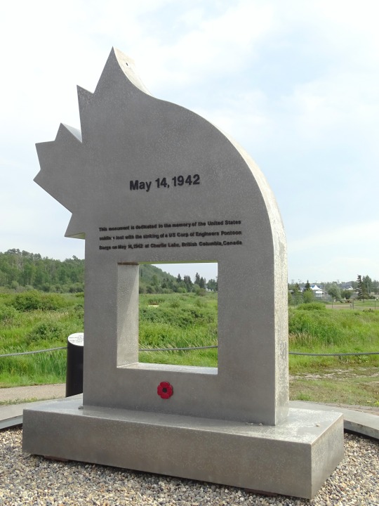
#Alaska Highway#street scene#travel#original photography#vacation#landmark#landscape#countryside#summer 2023#flora#nature#woods#forest#mountains#Canada#Alaska-Canadian Highway#ALCAN Highway#Alaskan Highway#the North#no traffic#tourist attraction#British Columbia#Racing River Bridge#river bank#Toad River#cityscape#Alaska Highway Memorial by Shala Dobson and Jim Dault#Charlie Lake#Dawson Creek#Mile 0 Cairn
11 notes
·
View notes
Text
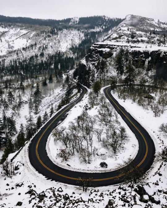
Rowena Crest Viewpoint, Historic Columbia River Highway, Mosier, Oregon, USA
Eric Muhr
#Rowena Crest Viewpoint#Historic Columbia River Highway#Mosier#Oregon#USA#US#United States of America#United States#North America#Road#Winter#ORNature
0 notes
Last Seen Blogs

hugemachines
Murray The Mummy

tumtumss
hehe hiii
panic-point-blank
PANIC___POINT


coreskunk-blog
ksereis oti tha se sko- twna