#milfordroad
Photo
Fiordland is better in the rain. . . . . . #Fiordland #milfordroad #milfordsound #roadtrip #southisland #southernalps #nzmustdo #purenz #hiddengem #newzealand #nz #newzealandguide #destinationnz #landscapesnz #beautifuldestinations #globeshotz #jaw_dropping_shots #depthsofearth #lifeofnewzealand #vegan #travel #outdoors #earthpix #wanderlust #earthofficial #newzealandnatural (at Milford Sound, Fiordland) https://www.instagram.com/p/ByQ32uEApOW/?igshid=1dvkk3306lkqi
#fiordland#milfordroad#milfordsound#roadtrip#southisland#southernalps#nzmustdo#purenz#hiddengem#newzealand#nz#newzealandguide#destinationnz#landscapesnz#beautifuldestinations#globeshotz#jaw_dropping_shots#depthsofearth#lifeofnewzealand#vegan#travel#outdoors#earthpix#wanderlust#earthofficial#newzealandnatural
0 notes
Photo
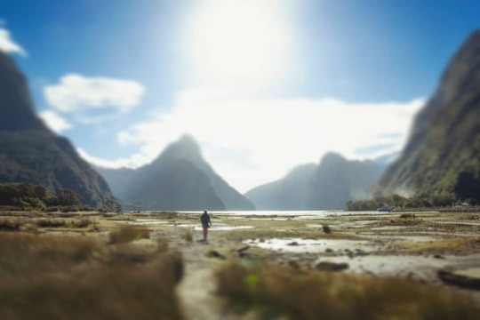
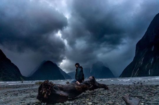
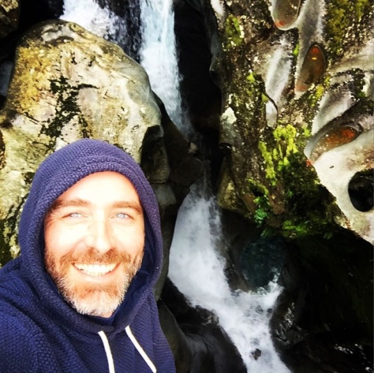
Le milf . . . . . #milfordroad #milfordsound #beach #sunset #naturelover #nature #tiltshift #jouet #natureporn #nature_shooters #walk #nz #amazingshot #instalike #instart (à Milford Sound, Fiordland) https://www.instagram.com/mathieudelacourt/p/Bvzpp7ZgJMc/?utm_source=ig_tumblr_share&igshid=x8qssqju8vmc
#milfordroad#milfordsound#beach#sunset#naturelover#nature#tiltshift#jouet#natureporn#nature_shooters#walk#nz#amazingshot#instalike#instart
0 notes
Photo
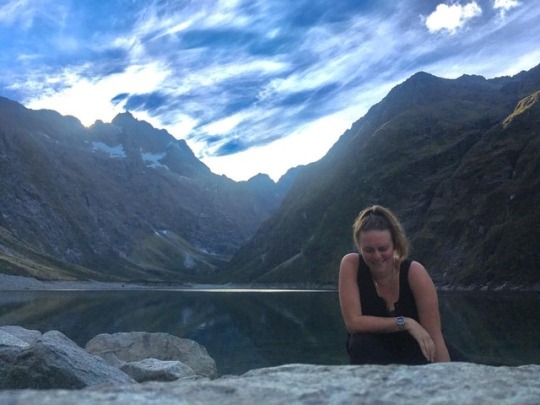
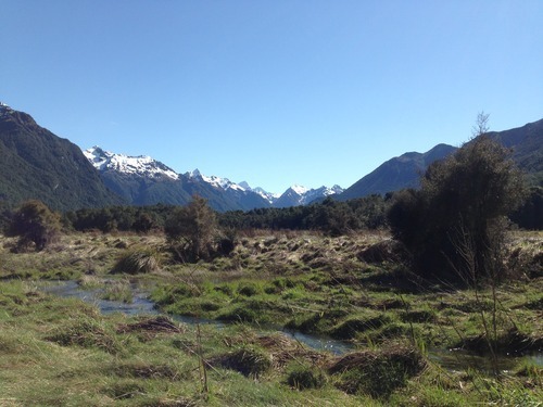
Here’s me at the shores of Lake Marian, an alpine lake set amongst tall, sloping mountains under a blue sky with wispy clouds. It’s the delicious reward at the end of 1.5 hour uphill hike over rocks, roots and muddy bogs. It is quite possibly one of the most stunning scenes I have ever set these eyes on.
This is also me, a WOMAN in NATURE. And it’s not April 22 and it’s not March 8 but this day, like every day, of every month, I celebrate myself and all women. Universally. Beyond internationally. And all that they’re capable of and all of the good energy that they produce. And I celebrate all of the men too. And everyone in between. And all of the children, who don’t know what they identify as yet, and shouldn’t have to. I’m sending love to everyone.
Most importantly, I’m celebrating the Earth. This planet sustains my every moment and my every movement and I’ll try all of my days to nurture it back. We’re at a precipice of just how much abuse this place can undergo but may also be at a turning point of our collective conscientiousness about the damage we are doing. We won’t have long without the rivers and oceans, the air, the trees and leaves and flowers, the bees and the bats and the rest of the animals that are left and all the rest of this natural world. So I’ll live my life to celebrate and conserve it. I’ll purify it all with my thoughts and my actions. And I’ll give thanks today and everyday that I get to live here and be amongst all of the glory.
#honor #cherish #thankyouuniverse #thankyouthankyouthankyou (at Lake Marian)
#thankyouuniverse#thankyouthankyouthankyou#honor#cherish#stillcelebrating#everyday#purifytheplanet#internationalwomensday#earthday#lakemarian#newzealand#NZ#southisland#milfordroad#milfordsound#hiking#trekking#tramping#wander#wandering#wanderlust#roadtrip#workingholiday
3 notes
·
View notes
Text
Neuseeland - Milford Sound
Ein Fotospot in Neuseeland ganz besonderer Art ist Milford Sound. Eine unvergessliche Landschaft mit atemberaubenden Wasserfällen wird man erleben. #MilfordSound #Neuseeland #Fotospot #sanflies #OvernightCruise #MilfordRoad #MilfordTrack #Bootstour
Der Milford Highway SH 94 ist die einzigste Verbindung mit dem Auto zum Milford Sound. Es ist eigentlich eine typische Straße, wie es sie in Neuseeland viele gibt. Doch eine Besonderheit möchte ich erwähnen. Auf der ganzen Strecke von ca. 120 km gibt es keine reguläre Tankstelle.
Bevor man also zum Milford Sound fährt, ist der Tank für das Auto voll! Die Fahrt dauert ungefähr zwei Stunden jeweils…
View On WordPress
#Boot#Fjord#Fotospot#Freizeitfoto#HomerTunnel#Lichtverschmutzung#Milford#MilfordRoad#MilfordTrack#Neuseeland#Schafe
0 notes
Photo
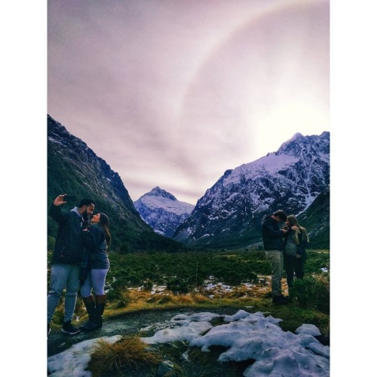
In the mood for love with this backdrop . . . #southisland #purenewzealand #NZmustdo #MilfordRoad #skyporn #beautiful #snowymountain #nationalpark #newzealandtourism #realjourneys (at Fiordland National Park)
#skyporn#newzealandtourism#realjourneys#nationalpark#snowymountain#beautiful#purenewzealand#milfordroad#nzmustdo#southisland
0 notes
Photo
Remembering my #NewZealand #roadtrip - this was me hanging over #TheChasm #MilfordRoad #FiordlandNationalPark 🇳🇿 #wanderlust 😊 (at The Chasm, Milford Sound)
0 notes
Photo
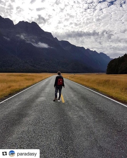
"All you need is the plan, the road map, and the courage to press on to your destination." - Earl Nightingale @paradasy #fjordlandnationalpark #mountains #hiking #stunning #nature #street #me #milfordroad #newzealand #travelling #wanderlust #travel #outdoors #photography #beautfiul #pretty (at Fjordland National Park)
#newzealand#street#travel#pretty#wanderlust#fjordlandnationalpark#mountains#outdoors#me#nature#stunning#milfordroad#travelling#beautfiul#photography#hiking
0 notes
Text
3./4. Mai Der Routeburn Track
Man soll es nicht glauben, aber ich habe in den vergangenen zwei Tagen doch tatsächlich meine erste Mehrtageswanderung in Angriff genommen. Der Routeburn Track ist einer von Neuseelands „Great Walks“ und führt über 32km von der Milfordroad-Seite der Alpen über den Harris Sattel bis zum Routeburn Shelter, etwas außerhalb von Glenorchy. Eigentlich wollten wir diese Tour zu dritt und in nur einem Tag kommenden Montag bewältigen, Zweifel an der Machbarkeit brachten eine Freundin jedoch zum Ausstieg aus unserem Unterfangen. Somit haben ein Kumpel und ich spontan um halb elf nachts umgeplant und entschieden bereits den nächsten Tag (für mich nach Arbeit) zu starten und in einer der Hütten auf dem Weg zu nächtigen.
Auf meine Frage hin, ob ich etwas eher, ggf. bereits gegen Mittag, von Arbeit verschwinden könnte wurde ich bereits deutlich zeitiger (9:30 Uhr) nach Hause geschickt und wir konnten die letzten Vorbereitungen treffen. Also Rucksack packen, die Hüttenpässe kaufen und Verpflegung organisieren. Auch der Transport zum „Devide“ dem Ausgangspunkt des Routeburn Tracks an der Milford Road war recht zügig organisiert (wir haben ja genug Mitbewohner).
Völlig motiviert und bei hervorragendem Wanderwetter machten wir uns auf den Weg. Die ersten Kilometer schlängelte sich der Weg steil bergauf, nur um dann sofort wieder ziemlich weit bergein zu führen. Nach etwa einer Stunde erreichten wir auch schon den Lake Howden mit der am See liegenden Lake Howden Hut, der ersten Hütte auf diesem Track. Wir gönnten uns eine kleine Verschnaufpause und genossen die unglaubliche Aussicht auf den See – dann ging es auch schon weiter...
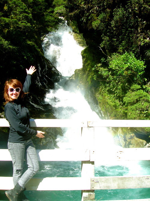
Hauptsächlich verlief der Weg im Wald, gelegentlich unterbrochen von buschigen Abschnitten und unglaublichen Aussichten über das Hollyford Valley. Die 174m hohen Earland Falls boten einen weiteren Höhepunkt, bevor wir uns auch schon ein weiteres Mal hinab in einen Talkessel begaben. Wir verließen den Wald und erreichten eine von Büschen und bemoosten Felsen besiedelte Ebene an deren anderem Ende ein gigantisches Gebäude mit Panoramafenstern und Sesseln hinter ebenjenen thronte. Wie wir kurz später herausfanden die Mackenzie Lodge – Unterkunft für diejenigen, die ein halbes Vermögen für eine geführte Wanderung auf dem Routeburn Track ausgeben. Hinter der nächsten Wegbiegung – und mit eindeutig besserer Lage und Aussicht als die Lodge – befand sich die Mackenzie Hut, unsere Unterkunft für die kommende Nacht.
Wir sicherten uns also Schlafplätze in einem der zwei Schlafräume und begaben uns anschließend die wenigen Meter bis ans Seeufer. Absolut atemberaubend. Der Lake Mackenzie lag spiegelglatt vor uns und wir genossen das wenige verbleibendede Tageslicht. Die ersten zwölf Kilometer hatten wir hinter uns gebracht.
Da wir uns hier unten auf den Winter zu bewegen sind die Tage entsprechend kurz und gegen sechs Uhr ist die Sonne verschwunden. Und es wird echt kalt. Nebenbei waren wir auch recht hungrig und so machten wir uns an die Zubereitung unseres Abendessens. Wir hatten uns mit Backcountry Tütenessen eingedeckt. Also nur Wasser kochen, in die Tüte kippen, diese verschließen und zehn Minuten stehen lassen – fertig! Blöderweise hatten wir in unserer überaus langfristigen Planung dieses Trips die Tassen vergessen (hatte ich eigentlich erwähnt, dass wir bereits wegen vergessenem Besteck zehn Minuten außerhalb Te Anaus noch einmal umkehren mussten?) und somit konnten wir die richtige Menge Wassers lediglich abschätzen. Das Ergebnis war jedoch absolut lecker (sollte man bei 12$ pro Tüte aber auch erwarten können!).
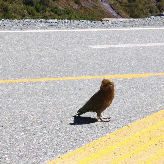
Am nächsten Morgen brauchten wir ein wenig Überwindung um unsere Schlafsäcke zu verlassen und starteten nach einem Tütenfrühstück um kurz nach 9Uhr. Im Tal war es noch schattig und entsprechend kalt, der beständige Aufstieg über die ersten Kilometer des Tages half uns aber darüber hinweg. Wunderschöne Ausblicke auf den Lake Mackenzie und später das Hollyford Valley waren die Belohnung für unsere Mühen. Beständig näherten wir uns dann Harris Saddle wo wir den Bergkamm überwinden wollten. Auf den letzten Metern vor dem Bergrücken sahen wir einige Keas die die Felsen umkreisten. Auf dem Sattel selbst befand sich eine kleine Schutzhütte an welcher wir kurz verweilten und uns zu unserem Glück mit dem Wetter gratulierten während sich die Schleierwolken im Hollyford Valley langsam zu einer dichter werdenden Wolkendecke verbanden.
Als wir unseren Weg fortsetzten wurden wir hinter einer Wegbiegung vom Lake Harris überrascht, welcher in beeindruckender Größe vor uns lag. Ein Stück oberhalb des Sees führte unser Weg am Hang entlang bevor er schließlich beständig taleinwärts zu führen begann. Immer entlang des Flusses Route Burn welcher in zahlreichen Stromschnellen und kleineren Wasserfällen dahin floss. An der Routeburn Falls Hut, welche sich (total überraschend) neben den Routeburn Falls befindet, machten wir eine letzte kleine Pause und genossen die Natur.
Die letzten Kilometer des Weges boten leider immer weniger der spektakulären Natur und zogen sich letztlich sehr in die Länge. Am Routeburn Shelter, dem Ende des Tracks (oder eben Start, wenn man ihn in entgegengesetzter Richtung läuft) angekommen, ließen wir uns auf einer Bank in der Sonne nieder. Zwar hatten wir die 32km des Tracks in einer ganz passablen Zeit bewältigt, allerdings lagen noch 244km Rückweg nach Te Anau vor uns – ein kleines unbedeutendes Detail welchem wir in unserer bereits erwähnten langfristigen Planung nicht zu viel Bedeutung zumaßen; es wird sich ja schon irgendwie ergeben.
Und tatsächlich hatte uns unser Glück noch nicht verlassen und keine zehn Minuten später kam ein älteres Ehepaar von einem Nachmittagsspaziergang zurück und war so freundlich uns bis nach Glenorchy mitzunehmen. Dort angekommen mussten wir erneut keine zehn Minuten warten um von zwei Urlaubern eine Mitfahrgelegenheit bis nach Queenstown zu bekommen. Die beiden waren sogar so freundlich uns direkt vor dem Fergburger rauszulassen – einen Burger hatten wir uns schließlich verdient. Wir genossen diesen und machten uns dann an die letzte kleine Hürde. Blöderweise hatte uns unser Glück ab diesem Zeitpunkt verlassen und mittels Mitfahrgelegenheit nach Te Anau (oder zumindest in die Richtung) mitgenommen zu werden gestaltete sich als nicht möglich. Nach einer dreiviertel Stunde Warten gaben wir auf (es war dann auch dunkel und etwas kalt) und liefen zum Flughafen um uns von einem unserer Mitbewohner dort abholen zu lassen.
Ein wunderschöner Track, dank Übernachtung in der Hütte eine eine ganz neue Erfahrung und ein etwas abenteuerlicher Rückweg – absolut überragend!!!
2 notes
·
View notes
Photo
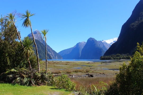

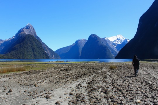
Milford Sound
#milford#milfordsound#milfordroad#sound#fiord#kea#keabird#weekendtrip#fiordland#southisland#newzealand
0 notes
Photo
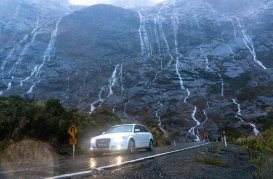
Took a drive into Milford Sound in the rain to check out the waterfalls. It’s pretty impressive in there. . . . #Fiordland #milfordroad #milfordsound #roadtrip #southisland #southernalps #nzmustdo #purenz #hiddengem #newzealand #nz #audinz #audi #audia4quattro #newzealandguide #destinationnz #landscapesnz #beautifuldestinations #globeshotz #jaw_dropping_shots #depthsofearth #lifeofnewzealand #vegan #travel #outdoors #earthpix #wanderlust #earthofficial #newzealandnatural (at Milford sound , Fiordland National Park, New Zealand) https://www.instagram.com/p/ByFrTllgJik/?igshid=47p1gwld9wj3
#fiordland#milfordroad#milfordsound#roadtrip#southisland#southernalps#nzmustdo#purenz#hiddengem#newzealand#nz#audinz#audi#audia4quattro#newzealandguide#destinationnz#landscapesnz#beautifuldestinations#globeshotz#jaw_dropping_shots#depthsofearth#lifeofnewzealand#vegan#travel#outdoors#earthpix#wanderlust#earthofficial#newzealandnatural
0 notes
Text
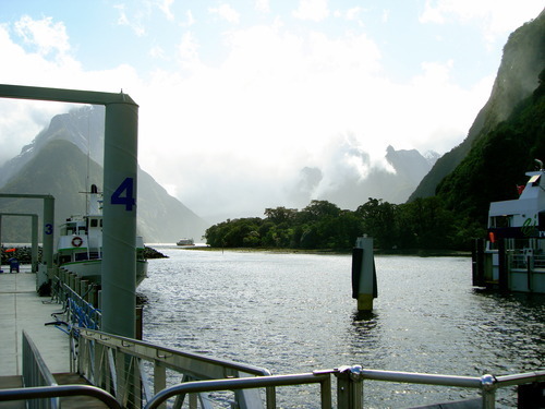
Depths in Fathoms (by T)
Hello everyone,
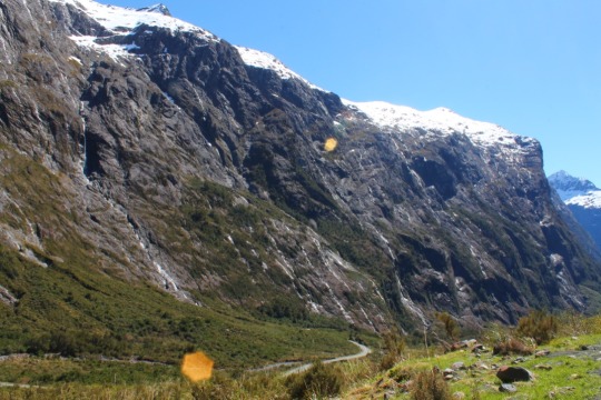
I'm here to pick up where Andrew left off..... In the morning of day 2 of our campervan trip, about to continue our journey along the Milford Road.
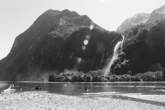
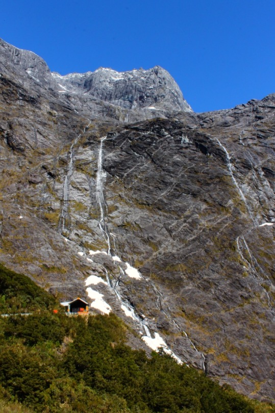
This day was a big day in our trip. Milford Sound, as Andrew mentioned previously, gets a lot of hype in the travel books. Often touted as the 8th wonder of the world, picaresque beyond belief, and the only sound (well, fjord technically) in Fiordland accessible by road, it's a place I've fantasized about visiting ever since we began planning this trip way back when we still lived in Lincoln.
To get to Milford, we had to drive a couple of hours from our campsite at Deer Flat. We woke up early enough to stop and see a few sights along the way.
As we made our way towards Milford, the roads grew more and more treacherous. We wound our way up carefully through the sheer cliffs, along sections of road known for rockslides. Andrew had volunteered to be the primary driver on this trip, and since he has a lot of experience driving a van, Steph and I gratefully agreed (although Steph especially was determined to get some experience driving on the left side of the road). Andrew admitted later that he was a bit terrified those first few days.....but you wouldn't have known it at the time. Thanks Andrew, you're a champ!
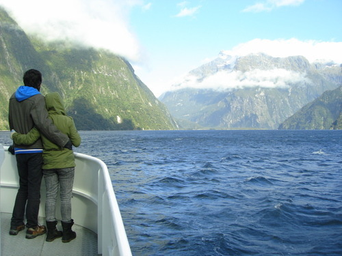
We arrived at the dock in plenty of time and relaxed a bit before boarding. The route is pretty basic, a single loop out to the Tasman Sea with a return along a slightly different path. We were lucky because the sun shone the day we took the tour, which allowed us to see a much farther distance into the sound than if it had been rainy.
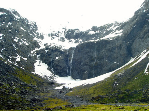
Much later that evening, when we had made our way back down the Milford Road to another DOC campsite called Cascade Creek, Steph told Andrew and me one of the Maori legends about the creation of Milford. The Maori name for the sound is Piopiotahi (a now extinct bird species). The creator of the region is named Tu-te-raki-whanoa, an atua (godly figure) who aspired to be a carver and was assigned to cut out the Fiordlands. For strength, he summoned a chant, and began to chop through the rocks, leaving in his wake a land of towering cliffs.

His skill improved as he worked his way from south to north, and by he time he reached his final destination (Piopiotahi), he was prepared to carve his masterpiece. The sound he created as his last work was so beautiful, the goddess Hinenui-te-Po grew concerned. To discourage humans from lingering too long in such a beautiful place, she released sandflies into the region, which pester visitors to this day.
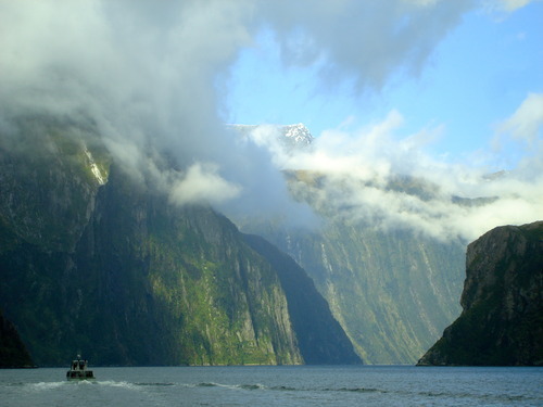
When you're in Milford, you can see why Hinenui-te-Po was concerned. The guidebooks and the blogs do not lie. Milford Sound is every bit as good as people say. Every last bit.
1 note
·
View note
Text
Beginning South Island Tour, One Night in Queenstown, Camping along the Milford Road
Andrew here.
During the first five months of our year-long stay in New Zealand, our approach to things was, in a word, conservative.
We hunkered down in a small city with a mostly student population, working jobs, saving money, and planning for our departure and tour of New Zealand's South Island. We purposefully started out in a city close to the southern tip, so that we could work our way north and eventually get to the North Island and, basically, rinse and repeat.
And so it was, the day after the finale of Breaking Bad, that we packed all of our earthly possessions (except for the stuff we left at our parents' houses and at Johnny and Nicole's place, plus all my comic books at Joe's house (HI JOE!)) into a few bags, climbed aboard a bus, and left Dunedin in our rear-view.
A mere four hours later, we arrived in the same city we originally arrived in from America, way back in April - - Queenstown. We showed surprisingly little interest in the city this time around, in spite of the fact that it's absolutely gorgeous and bustling with adventure 24/7. Instead, we went straight to the house where we planned on spending the night, where we were graciously hosted by the mother of one of Steph's coworkers from Etrusco. Her name is Diane, and she's from Florida originally (though it sounds like she's lived just about everywhere in the world since), so it was nice to speak to another American, which I hadn't had a chance to do in nearly the entire time we were in Dunedin.
We talked about everything you're probably not supposed to talk about in mixed company - - religion, politics, and just about everything in between. It was delightful and quite refreshing. I feel like I spent most of our time in Dunedin watching movies and eating takeaways by myself, so it was great being able to actually spend an evening like a normal person for a change.
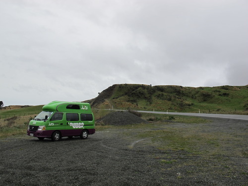
Anyway, the next morning, Diane drove us to the airport, where our month-long adventure was set to commence. We had many different options for how we were going to go about this trek, and we eventually decided that our best option, both for the freedom it provided and the affordability of it, was to rent a big van and spend the month camping out of it.
There are several different companies that provide relatively affordable accommodations, but we went with Jucy, which rents out giant camper vans (which they nauseatingly refer to as “campas”) that are two-toned green and purple (if you rent from Jucy, you will never have to wonder where you parked when leaving the supermarket) or smaller-sized camper van models or just regular cars, depending on your needs/budget/etc. Since we were going to be three people living in a van down by the river for a month, we opted for their largest model, which includes a stove and a refrigerator and a potable water tank.
The model we picked is also certified fully self-contained, which means all gray water storage is kept in a separate tank (dishwater and soapy water and toothpastey water and the like), plus it has an emergency toilet (which we never used), so you can camp pretty much anywhere in the entire country where it's permitted.
Now, a word on camping with a van in New Zealand: Like I said, if you're fully self-contained, you can camp just about anywhere, but it breaks down into, for the most part, three main options: 1) Freedom Camping - - Camping where, if you're fully self-contained, you basically pull over by the side of the road and park for the night, though there are designated Freedom Camping sites all over the place, which are a little more secluded and have a drop-toilet nearby (also worth noting, you can't Freedom Camp within five-ten kilometers of a township or where there are signs posted expressly forbidding it); 2) DOC Campsites - - Campsites that are maintained by the Department of Conservation, which usually cost around $6 per person per night for a site with a drop-toilet and some running water (these are also found in the most gorgeous parts of the country, so they're well worth the scratch); 3) Holiday Parks - - Campsites that are privately owned, usually closer to cities, where you basically pull in, drive to a patch of grass that's sectioned out in sizes similar to that of your van, with little to no privacy, and camp, but they have buildings with kitchens and showers and all the amenities you can't find elsewhere. These usually cost a bit more, around $10-15 per person per night.
Also, at Holiday Parks, you can shell out a few extra dollars per person per night for what's called a Powered Site, where you plug your van into a power socket so you can watch movies and run space heaters and toast bread and play solitaire on your laptop. We never used a Powered Site.
Naturally, we tried to Freedom Camp as much as possible, but it seems like it's getting harder to do so over the past few years, thanks to some campers abusing the system and leaving waste in their wake. It's not surprising, considering how lax the campsites are in America, for instance, where you basically can do whatever the hell you want and leave a mess behind because nobody cares. Here, the motto is, “Leave nothing but footprints, take nothing but photographs.” If you're caught dumping your gray water anywhere other than a designated Dump Station, for example, you can get a $300 fine. And if you're caught Freedom Camping where you're not supposed to, they also can hand out $200 fines per person, on the spot.
Now, we played it safe and didn't even come close to breaking any rules, were very respectful, etc, but I'm sure it's a lot more lax than it sounds. Kiwis seem to be all about giving you a list of rules with harsh punishments outlined for breaking them, but once you actually have a conversation with somebody about it, you quickly realize it's not as big of a deal as it sounds.
Still, I err on the side of caution, and I don't want to be disrespectful of nature (especially considering the sheer scope and awe of the environment in this country), and I dunno, it's just easier to follow the rules for me. I'm sure I annoyed the crap out of Steph and T at times, which I think is safe for me to assume, considering they flat-out told me I was annoying the crap out of them at times, but it's just the way I'm hardwired. My parents raised me up right, I suppose you could say.
Anyway, after a quick stop at the grocery store and some terrifying encounters with clockwise-turning roundabouts (everything is backwards when driving here!), we were out of Queenstown and snaking our way along the Southern Scenic Route.
Right away, and, spoiler alert, this is going to be a theme over the next few posts, we realized just how jaw-droppingly epic everything in this country is. Now let me explain: Epic is a word that is so grossly overused these days (“Oh, man, I had an epic sandwich yesterday!”) that it's nearly lost its meaning. But I mean it in the sense that everything here, all of the landscapes, are just so unbelievably massive that you cannot photograph them. They can't be captured. The size, the scale of things, there's just no way to measure it in any appreciable way. This is Planet Earth, front and centre, humbling you and making you realize just how small everything you've ever known truly is, and as that settles into your head, you can't help but feel a bit overwhelmed.
It was about ten minutes out of Queenstown when we pulled over at our first lookout and this feeling started to wash over us. It's a feeling that I still haven't been able to shake, and I don't know if I ever will.
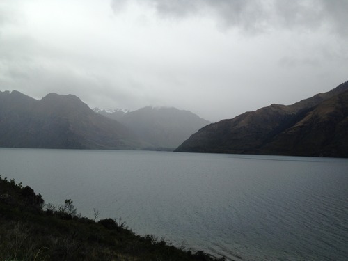
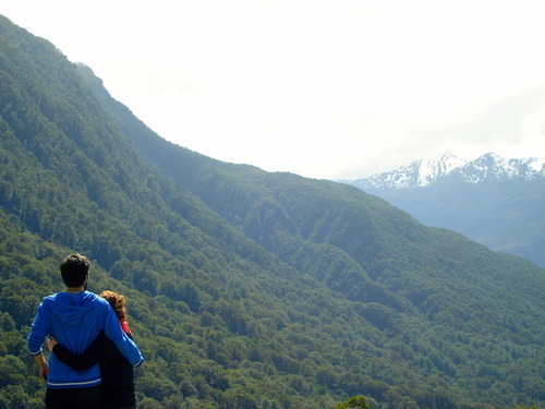
Anyway, within a couple of hours, we found ourselves in Te Anau, last stop before Milford Sound (the 8th Wonder of the World, according to Rudyard Kipling). We booked our boat tour for the following day and embarked north, along Milford Road. Before long, we were flanked on all sides by giant mountains with snow-capped peaks, though we were still driving through windswept fields at the bottom of a valley.
Our first night, we pulled into a DOC site called Deer Flat, slightly off the road, with spectacular views of what was to come the following day. Our brains reeling with that excitement that comes at the beginning of any big trip, we filled our bellies with subpar cold cuts and hit the hay.
The next morning, this was the view that greeted us out the back of our campervan:
To be continued.
3 notes
·
View notes
Last Seen Blogs

websiteoke
Tanpa judul

tommyguntunechi
Villa Ephrussi de Rothschild

dxntsaveher-blog
L.G

mbtidontevenknow
Mbti Don't Even Know

jesselang
Untitled