#iceagetrail
Photo
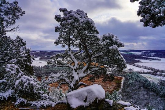
Gibraltar Rock • • #gibraltarrock #gibraltarrockstatenaturalarea #travelwi #naturalwisconsin #discoverwisconsin #nature #ig_brilliant #ig_captures #ig_countryside #rsa_folknature #tree_brilliance #nature_sultans #naturephotography #naturelovers #nb_nature_brilliance #wisconsin #midwest #nature_perfection #iceagetrail #hiking #hikingadventures #tree_magic #outwigo #igers #snowcovered #viewfromthetop #winter #igdaily #natureshots #nature_of_our_world (at Gibraltar Rock State Natural Area) https://www.instagram.com/p/CmzHILBrj0R/?igshid=NGJjMDIxMWI=
#gibraltarrock#gibraltarrockstatenaturalarea#travelwi#naturalwisconsin#discoverwisconsin#nature#ig_brilliant#ig_captures#ig_countryside#rsa_folknature#tree_brilliance#nature_sultans#naturephotography#naturelovers#nb_nature_brilliance#wisconsin#midwest#nature_perfection#iceagetrail#hiking#hikingadventures#tree_magic#outwigo#igers#snowcovered#viewfromthetop#winter#igdaily#natureshots#nature_of_our_world
0 notes
Photo

What you think about this color combo? Swipe it and drop a comment. Thank you @swaaby_08 I appreciate you . Wrap name: Merica @arcticfxgraphics . #usa #america #merica #leifalvarssonart #arcticfxgraphics #polaris #sledwrap #sledwraps #skoterdekal #dekal #decal #wrap #snowmobile #iceagetrail #polaris #backwoodbumpers #klim #foxshocks #sledusa #purple #stars #stripes #skinz https://www.instagram.com/p/ClMlGBgtyIY/?igshid=NGJjMDIxMWI=
#usa#america#merica#leifalvarssonart#arcticfxgraphics#polaris#sledwrap#sledwraps#skoterdekal#dekal#decal#wrap#snowmobile#iceagetrail#backwoodbumpers#klim#foxshocks#sledusa#purple#stars#stripes#skinz
0 notes
Photo
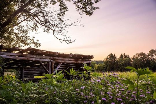
When places look eerie but there’s really nothing to them. 🖤 #paranormalinvestigation #highstrangeness #kettlemoraine #iceagetrail (at Loew Lake Unit, Kettle Moraine State Forest) https://www.instagram.com/p/CgwWJd6LisA/?igshid=NGJjMDIxMWI=
0 notes
Photo
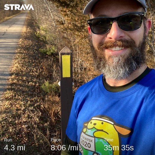
My official Worldwide WordPress 5k now that I have the shirt 🤣😂
2 notes
·
View notes
Video
We became buddies with this salamander on our hike today. New BFF. @odysseasx #hiking #hikingadventures #nature #naturelovers #salamander #lizardsofinstagram #nofilter #iceagetrail #danecounty #wisconsin https://www.instagram.com/p/B-LmOynDUgG/?igshid=9j01dsrvheqt
#hiking#hikingadventures#nature#naturelovers#salamander#lizardsofinstagram#nofilter#iceagetrail#danecounty#wisconsin
1 note
·
View note
Photo

My friend is hiking the Ice Age Trail. Follow her journey @steadywandering #iceagetrail #iceage #backpacking #thruhiker #wisconsin #ultralightbackpacking #scenictrail (at Ice Age Trail) https://www.instagram.com/p/CdGWtViFRAE/?igshid=NGJjMDIxMWI=
0 notes
Text


Ice Age Trail - Brooklyn
1 note
·
View note
Text

Experience Glacial Formations, Charming Trail Towns, And Breathtaking Scenery When You Join Wisconsin’s Mammoth Hike Challenge http://dlvr.it/SCB9nC
0 notes
Photo

Under a driftless sky, spring turns toward us. 03/15/2021 #driftlessworld #wisconsinriverway #iceagetrail #landscape #lenscratch #midwestphoto https://www.instagram.com/p/CM8iVMcpzyA/?igshid=1fx82lhbchv66
0 notes
Photo

Strolled through a winter wonderland today on the Ice Age Trail. #iceagetrail #winterwonderland #evergreen #wisconsin #hike #girlsweekend #mngirl #wanderlust #explore (at Saint Croix Falls, Wisconsin) https://www.instagram.com/p/CJ2hk_CgdzC/?igshid=v37fixb6wh1w
0 notes
Photo
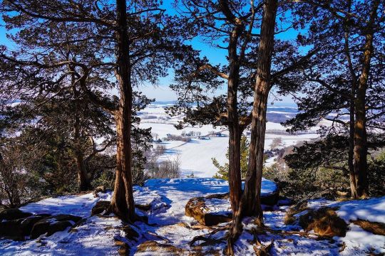
Gibraltar Rock - February • • #gibraltarrock #gibraltarrockstatenaturalarea #travelwi #naturalwisconsin #discoverwisconsin #nature #ig_brilliant #ig_captures #ig_countryside #rsa_folknature #tree_brilliance #nature_sultans #naturephotography #naturelovers #nature_brilliance #wisconsin #midwest #nature_perfection #iceagetrail #hiking #hikingadventures #tree_magic #outwigo #igers #snowcovered #viewfromthetop #winter #igdaily #natureshots #nature_of_our_world (at Gibraltar Rock State Natural Area) https://www.instagram.com/p/CfykBqvOrKO/?igshid=NGJjMDIxMWI=
#gibraltarrock#gibraltarrockstatenaturalarea#travelwi#naturalwisconsin#discoverwisconsin#nature#ig_brilliant#ig_captures#ig_countryside#rsa_folknature#tree_brilliance#nature_sultans#naturephotography#naturelovers#nature_brilliance#wisconsin#midwest#nature_perfection#iceagetrail#hiking#hikingadventures#tree_magic#outwigo#igers#snowcovered#viewfromthetop#winter#igdaily#natureshots#nature_of_our_world
0 notes
Photo
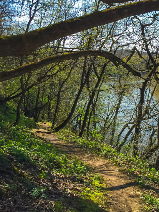
Ice Age Trail, Wisconsin
#hiking#trail#trails#longtrails#long trails#wisconsin#wi#wisconsin hiking#ice age trail#iat#iceagetrail#wisconsinhiking
8 notes
·
View notes
Photo

Sunset on the kame hill. 🌄 #outwigo #holyhill #iceagetrail #kettlemoraine #sunset #pastels (at Ice Age Trail at Holy Hill) https://www.instagram.com/p/CMQovGqjw4n/?igshid=1gl3wsrn8gcfo
0 notes
Text
Ice AgeTrail November 6 and 7, 2020
Last time we were here, we had the experience of “winter” hiking with 6” of snow and we were all pleasantly surprised with how much we enjoyed that, as long as it’s not too cold. During one of our dinners last time, Dan commented about someone’s post in the Facebook group about night hiking, and we thought we’d want to try that sometime. Well, as usual, we jumped right in and night hiked on Friday. But it’s a long story about how that happened.
As a group, we could only swing a two-day hike in November, so we agreed to do to 15+ mile days to still cover some good miles and make the trip there worthwhile. I booked a VRBO for two nights, on the Wisconsin River in the township of Irma, a little east of where we’d be but lucky to find that in this remote part of Wisconsin. Everyone but Gary came up on Thursday night and we all arrived around 4pm in time to enjoy the beautiful weather on the deck and the sunset over the river.
Independently, Dan and I both scouted the drop off and shuttle route so we confidently told Gary to drive directly to the starting point and we’d meet him there at 8am Friday morning. The rest of us left the cabin at 7am in two cars and drove into the New Wood State Wildlife Area with a plan to drop a car at the beginning of the Camp 27 segment and then travel to meet Gary. We ran into a snag when the gravel roads on Dan’s route were gated closed, and the roads on my map never materialized. Of course, no one had cell signal to pull up a map. Using the Guthook app I figured out that we were at the END of the Camp 27 segment so we decided to leave Lynn’s car there, even though it’d add 2.9 miles onto our 15+ mile day. Then we set out to drive to meet Gary, but with no detailed maps or cell service, we decided to drive the route that we knew would get us there, which was north to Tomahawk and around the way that became so familiar to us last month. Along the way, we got enough signal to let Gary know we’d be an hour late. If you’re doing the math, we now added nearly three miles, but lost an hour of daylight in our car shuttle. Plus, with going off daylight savings last week, we knew it’d be dark about 4:30pm.
The weather was spectacular. Two weeks ago when we started the Wood Lake segment, it was 17 degrees and the snow was crusty. Friday morning most people started in shorts and T-shirts and the temperature reached into the high sixties and most of the day felt HOT!
Both days of this hike took us through logging areas, some currently being logged, but mostly old camps and logging roads from the early 1900s. Our guide book said that parts of today’s trail would be on an old railroad right-of-way that was constructed in 1902 and ran between Rib Lake and Tomahawk.
There were some wonderful interpretive signs in the area around New Wood Lake - a beautiful area purchased by the state for $250,000 in the 1970s. We passed through Wood Lake County Park, and were delighted to find pit toilets open! There were three groups of people camped there, enjoying the unseasonable November weather. The lake was beautiful, and I was delighted to see that motors are prohibited – this would be a great place to come back to! The signs told of Hemlocks that were so big two people couldn’t stretch their arms around them – the kind they’d use those huge two person saws and axes to fell. The lumberjacks worked primarily in the winter, icing the roads to transport the logs by sleds. Besides the human logging activity, we saw lots of beaver activity and traversed quite a few beaver dams over these two days.
With the pressure of burning daylight on Friday, we kept our focus on moving and took limited breaks and photos during the day. We’d hiked over 4 miles before we took our first “packs off backs” break! I thought back to some of our guided trips and how the guides would get so frustrated with our dawdling ... they’d have been proud of how focused we can be when it’s necessary.
We finished off the beautiful Wood Lake segment, and promptly went into the Timberland Wilderness segment with lots of ups and downs and over eskers. In this segment, we crossed from Taylor into Lincoln county. Our guidebook describes Lincoln County as “some of the most isolated experiences on the Trail,” we found that to be true!
The Wood Lake segmet ended at Tower Road, which we were supposed to have driven along during this morning’s shuttle?! It also marked the Guthook app official 300 mile point. We walked the 1.9 mile CR to where we were should have ended the day, but we had 2.9 miles to get to the car and about 30 minutes of daylight. With breaks, we average 2 miles an hour typically but on Friday we were averaging a mile every 24 minutes.
The Camp 27 segment started with a large beaver dam and then a river crossing, lucky that we did those while we still had a bit of daylight! Most of the trail today was a thick pile of dry leaves. While they were soft and crunchy for walking through, they camouflaged rock and roots, so we all did a lot of stumbling, more so as we got tired. The sky through the trees turned pretty pink, and then it turned from dusk to dark. Many of us had headlamps or flashlights and we agreed to stay close as we picked our way through the woods. We had a pretty easy time of seeing the blazes, and enough people had been through ahead of us that you could usually count on crushed leaves as a way to ensure you’re on the trail. The creepiest part was when you stepped in soft mud without anticipating it. It was a little unsettling to have your feet just start sliding. We’re so noisy that I didn’t expect we’d see wildlife, but from time to time I did look into the woods to see if I’d see eyes shinning back at me. The only time I did see “eyes,” it was a large black spider right on the trail. Not a fan of spiders, but that was pretty cool.
We hiked about 2 miles in the dark. We’d left Lynn and Kent’s car at a trailhead, but there was a locked gate and we knew we’d have to walk about 1/4 mile down the road to get to their car. Dan was watching on the Guthook app as we neared the end of the Camp 27 segment so that directed us out to the road. When we got there though, it was so disorienting to me! It was a two-way road, and we could see the next segment New Wood beginning across the road. I also had a paper copy of the map which showed the gate and the parking area, but I just couldn’t reconcile this road going into two directions. Tam, who self-admittedly is bad with directions, had a feeling it’d be to the right so she and I marched off in the direction. After about 0.5 miles and no gate, I knew it wasn’t right. I stopped and looked at the paper map again, and realized the New Wood segment would be on our right, not our left. I turned the group around, and while I was feeling confident (finally) I was also feeling a lot of pressure from the whole group to lead them to out of here. This area is the New Wood conservation area and it has dozens of parking areas, I prayed I was leading us to the right one. I can’t describe the joy and relief when my headlamp picked up the reflective tape on the gate, and behind that, the reflectors on the car!
And while that was relief, there was still the matter that Gary and Dan’s cars were still an hour away, and then an hour back to the cabin! It wasn’t as late as it seemed, it was not quite 6pm when we got to the car. Kent drove us back to the cabin, dropped most of us there, Jeff and I showered, Lynn finished dinner prep and by 8pm they were back from the car shuttle and we all sat down to dinner: beef stew, salad and pumpkin bars for dessert. It was easy to say grace and thank God for getting us through the tough and trying day, and not just though it, but to have had such a glorious day in a beautiful wilderness.
Jeff confessed he’d been doing a mental inventory of what was in his pack in case we ended up spending the night out there, and most agreed they’d been doing the same thing. It was a mild night and we would have been just fine, but I’m glad we didn’t have to test it out!
Saturday morning, we were up at 6am with the goal of being out of the cabin around 7. The. group is good at the morning routine, although we were challenged by a smaller kitchen this time.
We headed out with all 4 cars packed, we were in the lead due to my retained status as chief navigator. However, even though Dan had just said to me that this morning would be our shortest drive to the drop site, I was messing with getting my boots on and completed missed it! We were halfway to the starting point before I realized it, bummer to have to turn around and go back. Nonetheless, we completed the drop, drove two cars to the start, and just a little after 8am, we were walking back through the gate and taking a left into the New Wood segment.
I was feeling really flat today and it was great to be able to hang back and not feel rushed. The leaves were heavy with dew, so the sound was more muted today. It was another amazing unseasonably warm November day!
A couple miles into the trail, we spotted a partially deflated balloon over in the woods. We can’t stand little pieces of trash on the trail, and that pink balloon was really harsh to see so Tam walked over to retrieve it. When she discovered it said ‘Happy Birthday,’ she tied it to my backpack, and my birthday week continued (plus by then I was wearing a black shirt and green pants to it added to my visibility)!
A lot of today’s hike followed old logging roads so we could easily walk side by side. The guidebook stated that the Timber Wolf have reestablished themselves here and are thriving, but all we saw today was scat (containing fur) on the trail which was probably from wolves.
The end of the segment walked along the New Wood River, which was beautiful and had several benches to sit and enjoy the view. Tam and Dad had a porcupine cross the trail in front of them and climb a pine tree – that was exciting!
We met a couple hiking towards us. They didn’t have much gear and Gary asked how long they were out for. They said they’d tried to do the next segment, but the river crossing was too deep so they turned back. We got to the parking area at the end of the segment and took a sit-down break. We ate snacks and started brainstorming silly ideas about how we’d get across the river. Someone recalled that the guidebook said if the river was too deep to cross, we’d have to road walk all the way around and bypass the whole segment.
We did a quick 0.6 miles road walk down the dusty County Highway E, then turned into the Averill-Kelly Creek Wilderness segment. It is mostly private land with an IAT easement, and we were grateful for that – it was so beautiful!! The first part was beautiful new growth of white birch trees with a few hemlocks mixed in, felt like walking through a Christmas decoration!
The trail walked along the New Wood River again for a bit – it looked tranquil, but too deep to ford for sure! Our map had the word “ford” twice, and we weren’t sure if that really meant two river crossings! The first was the New Wood River – Gary took off his socks, and walked through in just his boots, making it look easy and not quite knee high. Dan went next, in just socks! Jeff went third, in bare feet – about 2/3 of the way through, he started yelping from the cold. I went next and learned he wasn’t just being dramatic!! The first few steps the cold water feels fabulous, but your feet quickly go numb and you don’t want to hurry across the slightly slippery rocks! I got my socks and shoes on while I waited for the others to cross. Then we set off feeling wonderfully refreshed.
After about 300 feet, we got to Averill Creek, which the guidebook says we’d be able to “rock hop.” Gary again went first, making it look easy. I followed in my boots and made it without wet feet. Others took the time to walk across barefoot again.
After that excitement, we had about another 3 miles on mostly wide trails – detouring around a few low muddy spots. We’d known that the last mile of this segment was closed until after hunting season. We hit the detour sign, and continued on to where we’d parked two cars. We drove them both around to the start, then caravanned to nearby Merrill in search of burgers. There we failed to find an option, so we headed to Red Eye Brewing Company in Wausau, where Dan and Tam had previously stopped. Had great burgers and stouts in a funky bicycle-themed brew pub where they were adhering to mask and social distancing protocols, which made us happy. Along the way, I got enough signal to get a notification that Tuesday’s election had finally been called in favor of Joe Biden.
It was a great two days, and we felt awesome for having hiked 31+ miles over two days, hiked in the dark, and forded a river! Happy to be home before 8pm – unpacked and had a bubble bath!
0 notes
Photo

Snowshoeing in a winter wonderland. First one in the books this winter! #getoutside #snowshoeing #winter #wintersport #iceagetrail #nature (at Indian Lake County Park) https://www.instagram.com/p/CYDKp9_tVPB/?utm_medium=tumblr
0 notes
Photo

🤘🏼❤️🌳 nurturing nature & getting lost with scout master @terrygirl3 🌳❤️🤘🏼 #pikelake #hike #nurturenature #getoutdoors #getlost #thegreatoutdoors #poopinthewoods #iceagetrail #wisconsin #hikewisconsin #travelwisconsin #scoutmaster #shesthebest (at Pike Lake Unit, Kettle Moraine State Forest) https://www.instagram.com/p/CGNJLqrnd8G/?igshid=4lrvlhrlfirv
#pikelake#hike#nurturenature#getoutdoors#getlost#thegreatoutdoors#poopinthewoods#iceagetrail#wisconsin#hikewisconsin#travelwisconsin#scoutmaster#shesthebest
0 notes
Last Seen Blogs

lovingslimesludgecash
thisbitch

offaemagics
♡₊ ⊹『 F ❛ ING SURVIVING 』

urubuzada125
Sem título

seashellandpearls
Pearls (Max/Soyumil)

workingonwisdom
Working On Wisdom