roswellroamer
Roaming on Two Wheels
Musings, photos, blogging and videos of two wheeled adventures
218 posts
Don't wanna be here? Send us removal request.
Last Seen Blogs
erikiara80
Life finds a Way

meizthoughts
mei'z thoughts.
moving-jpop
J-PopのGIF
arugula2048
🍀🍀‼️

1escitoraqualquer
Textos aleatórios


Text
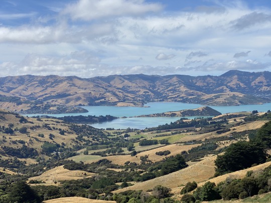
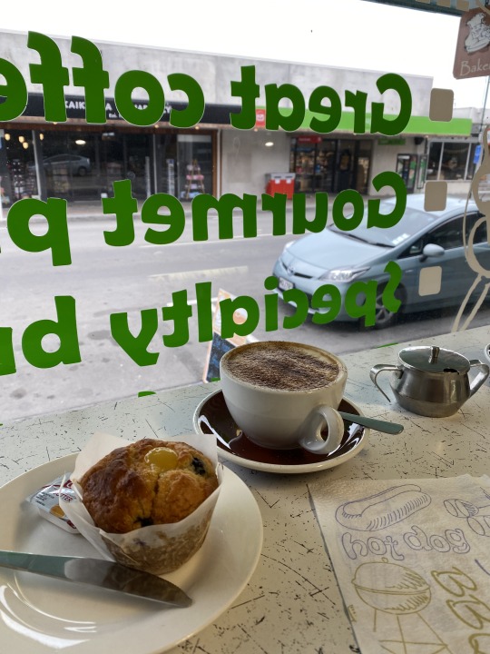
Day 22. February 20, 2020. Kaikōura to Akaroa to Leithfield. 410km. 4932km total = 3065 miles.
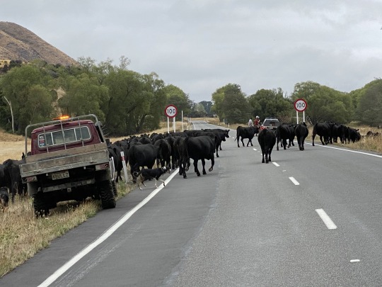
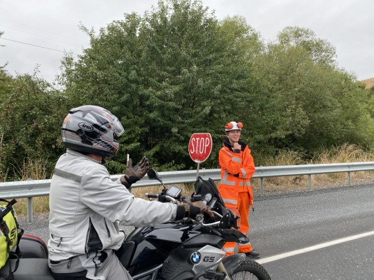
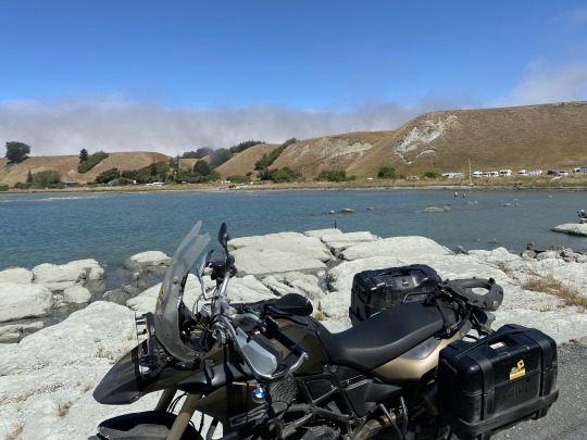
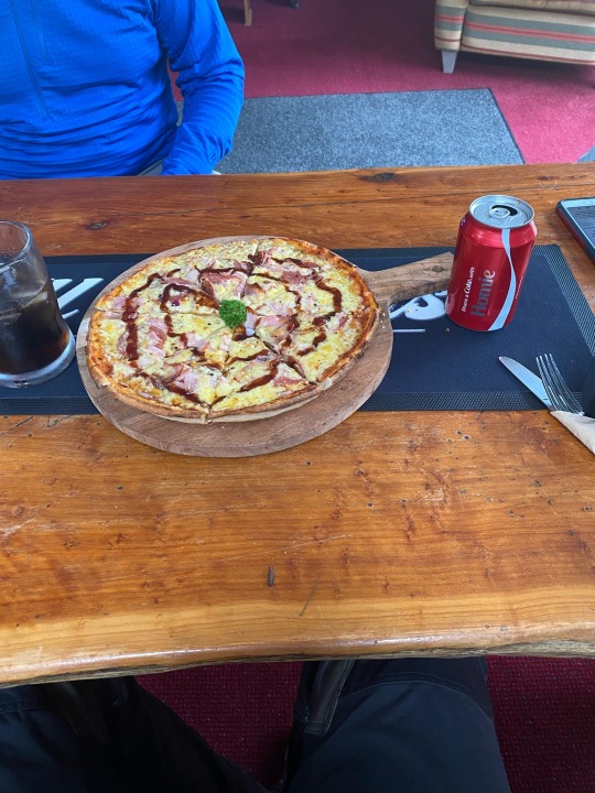
Today the clouds were back but no rain was in the forecast so we went down the hill into town and I ordered a cappuccino and a lemon blueberry muffin to start the day at Pot Belly bakery. We chatted a little back at the hotel with a crew of 6 Harley folks from Wellington on 3 bikes. They were planning a New Orleans to Vero ride in October so we made a few suggestions. Made friends with a gigantic tame rabbit at the hotel before riding out around 9. It was a straight shot down the coast about 4 hours on the main Hwy 1 (I-95 equivalent) but this main artery has lots of construction, flag men stops, cattle on the road! Even in Christchurch there are red lights and lots of traffic circles. We had heard about the beauty of the Akaroa peninsula just SE of CHC and though it made for a big day, we rode through wine country and lots of farmland to slip into moderate traffic through CHC. Hard to believe this is the last day! As we venture onto the peninsula the road empties and we are chasing the sunshine. Cloudy until arriving here, the sun and colors emboldened by its rays lit up our windy curves along the coast. Apparently cruise ships pull into Akaroa for the views and beauty. A couple more construction zones and a nice flag man who let us roar up the hillside to catch up with the recently dismissed line of waiting cars and trucks. The last 10kms toward Akaroa scales the scenic mountains as we intersected with the well known Summit Rd. Unfortunately this road took us to the eastern bays of the peninsula in the opposite direction from where we needed to return our bikes back in Leithfield. As it was, our expected return was around 3PM today and we didn't have time to explore Summit Rd. today. We were literally arrested by the view as we rounded the corner and saw the view at Hilltop Tavern. We pulled in as if ensnared and parked by another biker who was equally spellbound. Top pic above. We lounged and I enjoyed a salmon pizza (pic) and a Coke but mostly the view which is saying something because the pizza was excellent! A fairly tame sheep made laps along the fence line on 6" of flattened earth munching the numerous tufts of grass and enjoying the occasional scratching by diners. Opportunistic sparrows awaited your lack of attention to claim any unattended food. It was around 68° and just a great way to wrap up the ride.
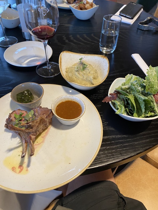
The cruise back to Leithfield was smooth, in and out of the traffic circles as the reality of the trip's end hits. What an adventure. What a beautiful country. Easy to enjoy, geared for tourism, US dollar is strong here but sort of a long ride to get here. Worth it if you can make it happen! No problems checking in the bike and Kiwi (Carrie) was kind enough to again ferry us back to town, this time to the brand new Novotel at the airport. It wasn't even open when I booked it 5 months ago. It is a primo Novotel. We drove past the US Antarctic center where most all flights to and from our base originate. Carrie said she thought it was actually considered US soil, a la Normandy. There were 4 USAF C-130 aircraft with their newfangled curves props on the tarmac and some other jet. We also enjoyed riding there with our new Norwegian friend Per, who returned his bike and was also booked at the appropriately named Novotel. My room was so nice. Soundproof glass in a corner with views on two sides and seriously less than 200 yards to both the control tower and the Emirates A380 loading up with passengers. I went to the airport to do a little shopping since I didn't think they would be open at 4AM the next morning (wrong). Went back and met Ted and Per at the bar to enjoy the view and watch the world's largest commercial aircraft lumber down the strip and lift off surprisingly quickly. Felt like a little kid. ✈️ 😳 A spectacular dinner for me included dumplings followed by rack of lamb, garlic mashed, Caesar salad. Really a great last dinner in this fine land weirdly punctuated by the unexplained disappearance of our server, Imogen. Halfway through the meal we noticed she wasn't around. After a bit we asked other servers to have her come by, only to be met with shrugs that they didn't know where she had gone. Never found while we were there! 🤷♂️ A relatively early night since alarms were set for 3:30. Wrapping this now at the airport all checked in waiting for first leg to Sydney. Then on to LA, somehow landing before I left due to the date line weirdness and then on home to ATL. Glad to be done writing, what a commitment from folks who do it daily but also glad to have followed through and captured just some of the events, feelings and silly things from this journey. Great place to ride! Peace, out. ✌️ 🏍 🇳🇿 🇺🇸
PS. Back in ATL now. Though 30 hours of traveling couldn't have gone smoother. If you are one of the folks reading this along the way. Thanks for making the time to share my NZ adventure with me as it unfolded. Comfort class with an extra seat made a nice difference on the 13 hour leg from SYD to LAX. Flew right over the harbor and got good shots of town and the opera house. Nice to be home, too. Until the next adventure. ... 🇳🇴
4 notes
·
View notes


Text
Day 21. February 19, 2020. Havelock to Kaikōura. 180km.
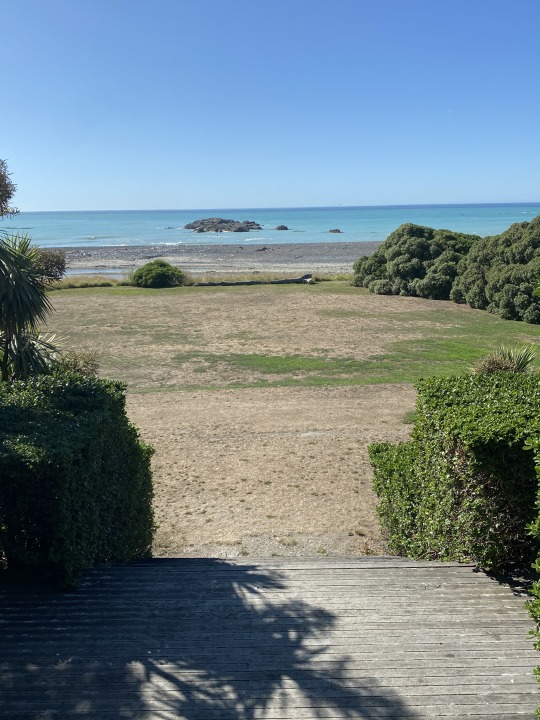
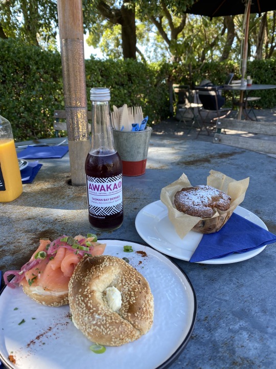
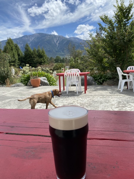
Yeah, it is really something how your whole psyche may be uplifted by a weather improvement. I mean I'm a pretty positive guy but after a few dreary days it really puts a spring in your step (well my step anyway) when you awaken to a sunny blue sky morning. Walked across the street to have a coffee. Well, a cappuccino that looked more like a chocolate pudding before I dipped my spoon through the froth. Headed out after packing around 9 and enjoyed the gold waving grasses on the hills that had mostly been cleared of timber. Stark contrast to the green pine trees on the few that weren't deforested. Up and over a ridge line and dropped into the Marlborough valley, which is as I mentioned yesterday lined with vineyard after vineyard. 🍇 Very scenic. Pic above. I also included a shot from my seafood pasta from Slip Inn last night as it was delicious. We wound down the highway and took a few side roads, one by accident to avoid some of Blenheim but it doesn't take long to get through this town. We aimed for The Store. It is a well situated and busy cafe on the beach just north of Clarence. My salmon bagel with pickled red onion, capers and cream cheese was perfect. The orange and chocolate muffin wasn't bad either. 😋 Washed down with an Awaka Tasman Bay Berries sparkling coconut water. Walked down a manicured lawn to the beach. Pic. The rest of the ride to Kaikõura was along a rocky coastline with mountains on the right and loads of construction zones with flag men and some slow traffic as a result. Seal colonies were scattered along the rocks to our left and we stopped at a couple overlooks to get them on "film". We turned right at a brown marker sign indicating an Irish hotel. The Donegal House is proud of their well documented Irish ancestry dating back 150 years. It was a beautiful setting and a Guinness nicely complemented the setting and we sat for a while.
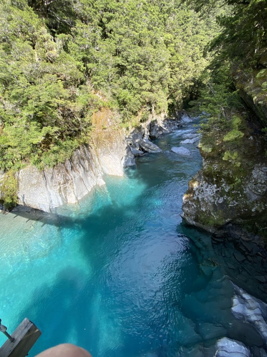
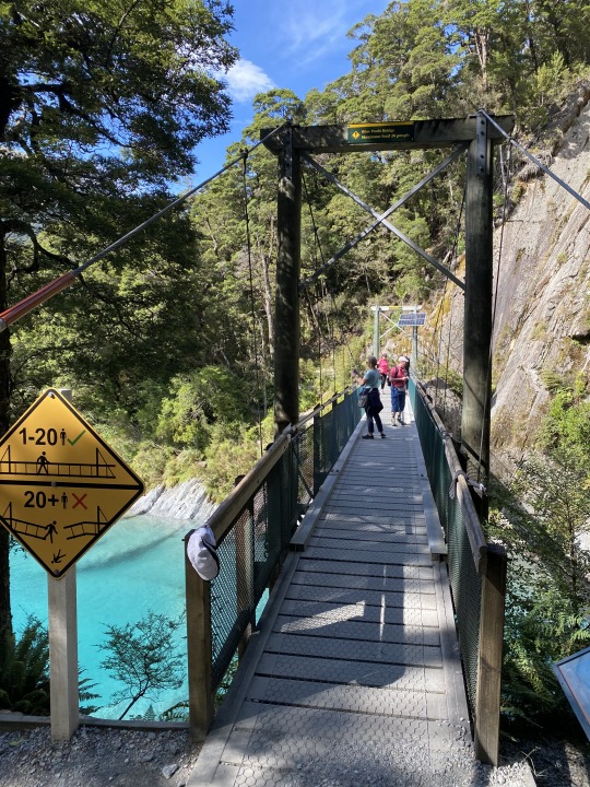
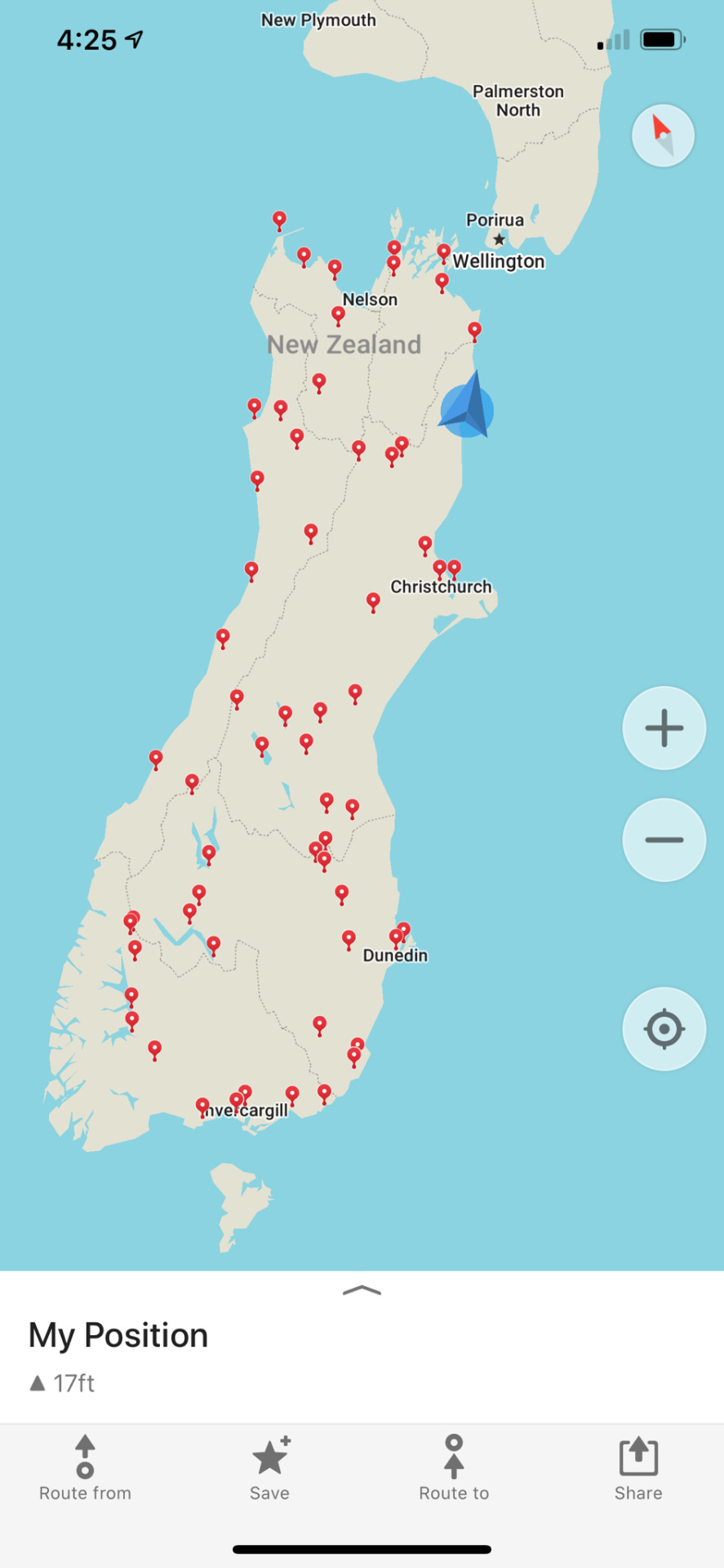
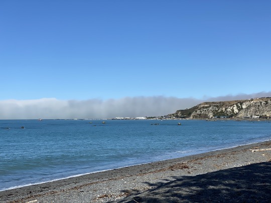
Kaikōura was less than 10' down the road and we rode to the town center to check it out. The water color today was really a nice turquoise hue and the setting here with white rocks, a peninsula and the surrounding mountains make it a hot spot for tourists. Whale watching by boat and air is popular here. Saw some surfers in the water a few bays north of town. Have definitely seen and heard more Americans in the last couple days in the NE quadrant of the South Island. We were able to check in to the motel even though we were slightly ahead of the official time. Bella Vista may have been a misnomer but it was clean and fine. Cleaned up and rode out along the shoreline to the peninsula. Food carts, campers, swimmers, people walking. It felt like a summer resort today for maybe the first time here. About 2-3PM real fog started to stream over the hills surrounding Kaikōura and toward the water. Mostly dissipating but visually cool to watch a la San Francisco. After a brief discussion we made reservations at the place the innkeeper recommended though the only available time was 5PM. A bit embarrassed to be eating this early but opting to go to the Pier Hotel anyway. Not like anyone is gonna read about my early bird ways, right?! 😉 Went into town after a number of stops for pics along the water and did a little shopping before getting a Panhead 🍺 at the Strawberry Tree. We then headed to join nobody but a few tables at the Pier. Right by the water about a mile down the road out onto the peninsula. Within a half hour or :45, all tables were full. Garlic bread was ordered to accompany the seafood platter. Whitebait (whole tiny fish), calamari, abalone, gurnard, salmon and a mini mussels pot with seaweed salad. 👍 Stuffed, we rode to Groper Garage to wind down the evening. This town has some nightlife it seems (not like Queenstown with discos until 4AM!) but we concluded the night in embarrassingly early fashion as we had started it just a few hours before. One pic above reflects the assortment of Maps.me location pins that I have been sporadically recording on this very useful app. I have found it is nearly as capable as any GPS app and once (before the trip) maps are downloaded there is no data requirement to use it. This is a nice way to not only navigate as needed without phone service but also to record a log of some stops along the way so I could go back on the app anytime and retrace my "steps". Most everywhere it is possible to ride on this island has been ridden these past 20 days. Great day. Easy day. Fun day. Only one more to go and the Kiwi 2020 adventure will draw to a close. It has been fantastic. 🇳🇿 🏍
2 notes
·
View notes


Text
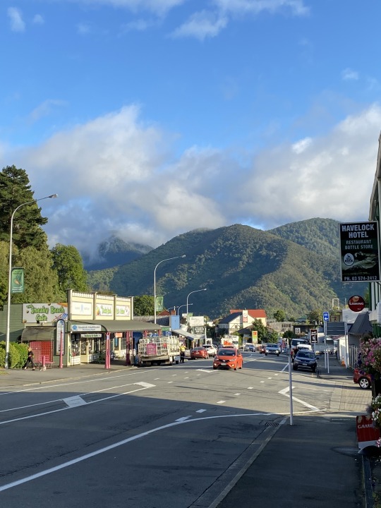
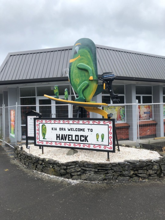
Day 20. February 18, 2020. Havelock day rides. 100km.
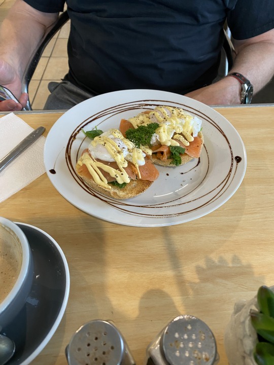
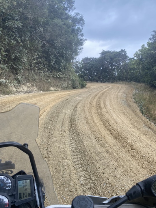
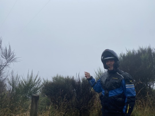
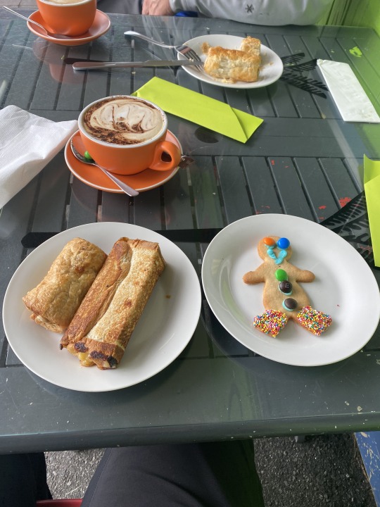
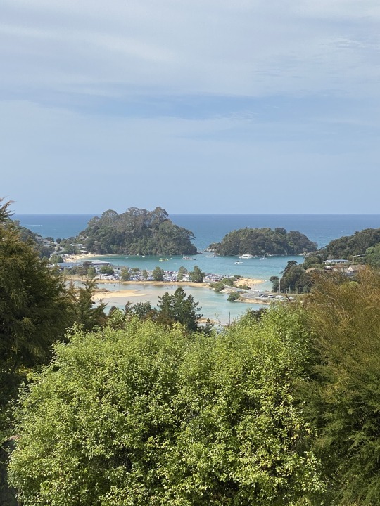
Woke up to a light drizzle. Eye swelling down to near normal. 👍 This is supposed to be the last of our recent series of wet days. The cider didn't have any ill effects and we strolled across the street to the Sneaky beach cafe. I had a steak & mushroom pie but was significantly out ordered by the eggs Benedict with salmon that were delivered across from me. 👀 No chance to ride in more comfortable gear due to rain and also projected gravel/dirt encounters today. We geared up and headed south. Somehow we missed the Queen Charlotte Road turnoff right in town and instead went nearly to Blenheim before we realized we had missed it. Oh well. We were in the very heart of the Marlborough wineries north of Blenheim. Perfectly manicured rows of grapevines spread out far and wide from both sides of the roads. The countless vineyard rows were broken up by picturesque wineries and inns. Looks like a great place to have a wine tour! 🍷 We detoured a few miles south to Blenheim outskirts and rejiggered our plan. We opted to take the twisty and notable coastal roads Port Underwood ( dirt/gravel and steep with hundreds of sharp turns) and the aforementioned Queen Charlotte which was paved with similar elevation changes and twistiness. The rain ensured that Port Underwood was taken mostly in first gear. The possibly more than a dozen bays of various sizes were reluctant to yield their full beauty due to the rain, some fog, dense foliage and some being entirely private. A few had only one to three people living there and any egress was gated. However there were a few spots that rewarded with tumbling bay views, nearby islands and even a pretty good look at the North Island (first pic above) in the distance. That's about 27 miles away!
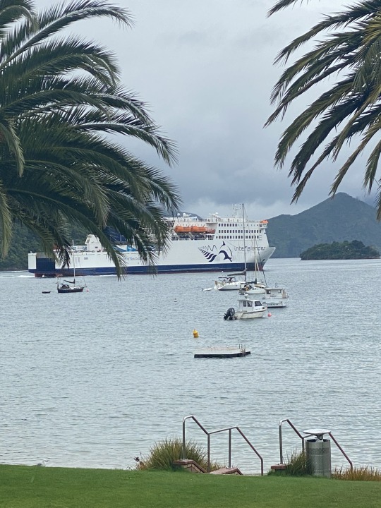
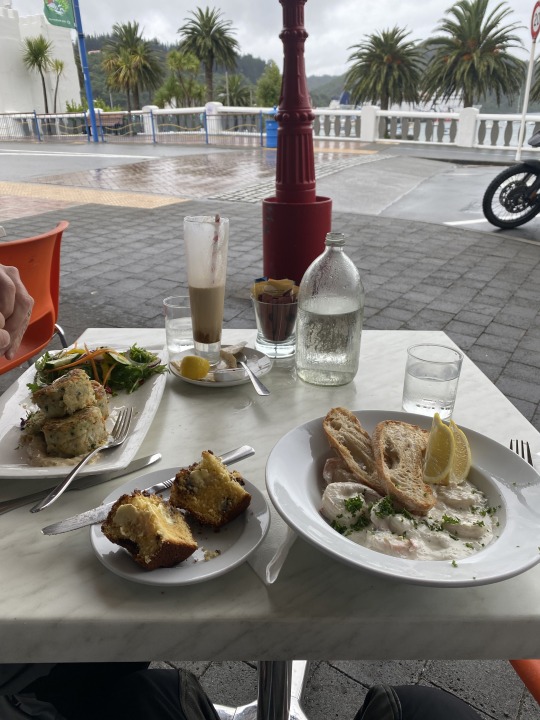
We saw one of the inter island ferries steaming towards Picton. Picton is the place on the S. Island where the ferries from Wellington (N. Island) dock. Every hour or so it seems a ferry is coming or going. Large ships loaded with trucks, buses, cars and people. Picton has a busy downtown and we parked our bikes right in front of some of the waterfront cafes. Decided to grab a table outside at the Seabreeze cafe on the corner of High St. & London Quay. We rode past four old British bikes (at least one Matchless) for the second time on our way to the water. I ordered lunch which was tiger prawns with garlic, coconut milk, chili and ginger along with toasted ciabatta. That was followed by a warmed orange and chocolate muffin. 😋 As I sat there before leaving the vintage British bikes rolled up toward the ferry. One, two, came on through the intersection. Number four had his engine die right in front of me! In fact he rolled it back to a spot right next to my bike as it was a slight uphill to the traffic circle and started checking all his wires. After a few minutes he rolled it back down the hill and onto a sidewalk with number 3 and they proceeded to try to figure out what was the problem. Love old bikes but this is why I don't ride them! Felt bad for him but he could've pushed it to the ferry if he had to from that position. We shopped a little and I bought an oilclioth supposedly crushable hat. Good for the rain as none of my baseball hats were very rain proof. From Picton we took the continuation of the dramatic road and views via Queen Charlotte counter clockwise up the coast then angled inland a bit to catch up with Havelock. Only a 100km day but the most death grips on the handlebars of the whole trip due to grade and slickness on Port Underwood. A little lie down was in order but turns out it was usurped by Boggle catch up and this very blog. That's OK, have been getting good sleep here. Still stumped by the lack of people here. We made a similar loop of the loca establishments to last night. I ordered the seafood pasta which was excellent at the Slip Inn. The Captain's Daughter was out of food due to a Lions Club meeting upstairs. The drizzle seemed to be ending by around 8. Hoping for some better light for views and pics tomorrow. Great day though! 😴
https://www.google.com/search?q=port%20underwood%20road
2 notes
·
View notes


Text
Day 19. February 17, 2020. Kaiteriteri to Havelock. 258km.
It seemed as if the weather had lifted a bit. My eye had however not gotten better. I was briefly concerned I wouldn't be able to use it as the swelling had increased, but other than looking down, the edema didn't interfere with anything critical and I was good to go. The bikes were a bit wet as was our deck furniture but we had planned a scenic side trip to French Pass and our early evaluation seemed to indicate that it was a go based on no rain. Let gravity do the work 🚶 on the way down to the lodge for the vegetarian brekkie. Then back up the hill (why didn't I ride down?) to pack up and roll. Careful to avoid the seriously slick yield sign at the junction, we aimed South past Motueka and into uncharted territory, at least as far as I was concerned. We cruised through farmland for a while then turned eastward along a ridge line. Clouds looked ominous ahead and also to our west and soon we were in the mist, then steady rain. We came through Mapua then hit traffic we hadn't seen in a while as we rode through surprisingly large Richmond and then into Nelson. We rode by a cruise ship and loads of businesses. We got away from the traffic circles and lights back to the country and were smack dab in the midst of NZ's most well known wine region, Marlborough. This encompasses a sizable area in the northeast corner of the South Island that has a good climate for grapes (& apparently hops and apples). The views and road to French Pass were a solid 2-3 hour detour that we were excited to take and we made the left turn off of Rt. 6 onto the notable Ronga Road. As we took hundreds of turns higher into the rain and fog in 2nd and sometimes 3rd gear, then descended into Okiwi Bay, we decided to look for a cafe and figure out if we would continue out to French Pass. Turns out there wasn't one there and as we admired the low clouds shrouding most of the surrounding mountains from view, we decided to turn back to the highway. Very tight road, some rocks had fallen on the roadway due to the rain and a small tree and it just wasn't that fun with the slick road, rain and no view. So, we found a roadside cafe and I had a Coke Zero and a couple pieces of fried chicken with a few tourists and farmers. Tasty. Came around a few more turns and descended to the river then the ocean.
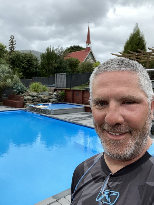
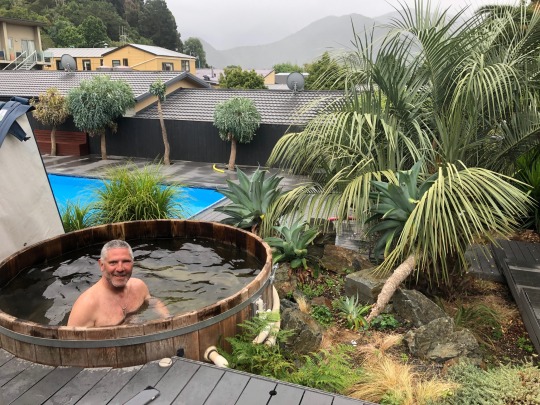
Came into Havelock, the self proclaimed green shell mussels capital of the world. Every restaurant we saw has mussels on the menu. We checked in to the motel and even though it was misting, took the cover off the iconic cedar barrel hot tub and soaked for a while. Cleaned up and refreshed, we found our way down to the water and the Slip Inn. An interesting and well apportioned smoked salmon bruschetta was washed down with some cider as we watched a few boaters taking their boats out on the ramp next to the cafe's deck. We then walked to the Captains Daughter where I may have had another cider. The Mussel Pot was closing so we finished the town tour at the pub next door, the Havelock Hotel. This town is pretty quiet and a bit surprising since this should be peak season. Quiet in town by 9 PM. At least I don't have to stay up past midnight writing tonight! 😴
2 notes
·
View notes


Text
Day 18. February 16, 2020. Kaiteriteri day rides. 275km
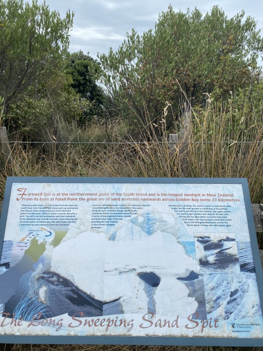
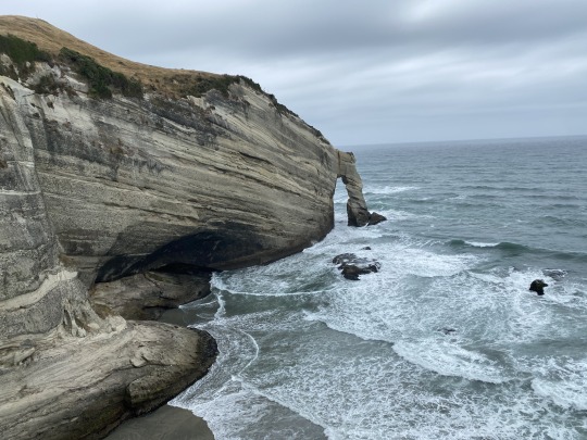
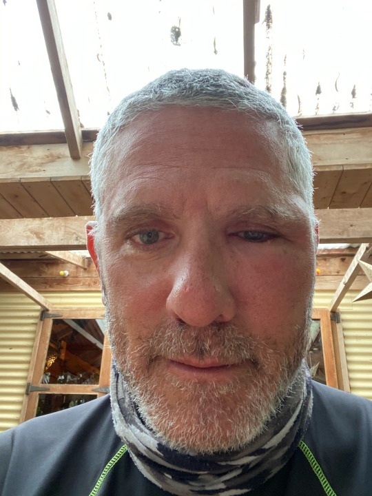
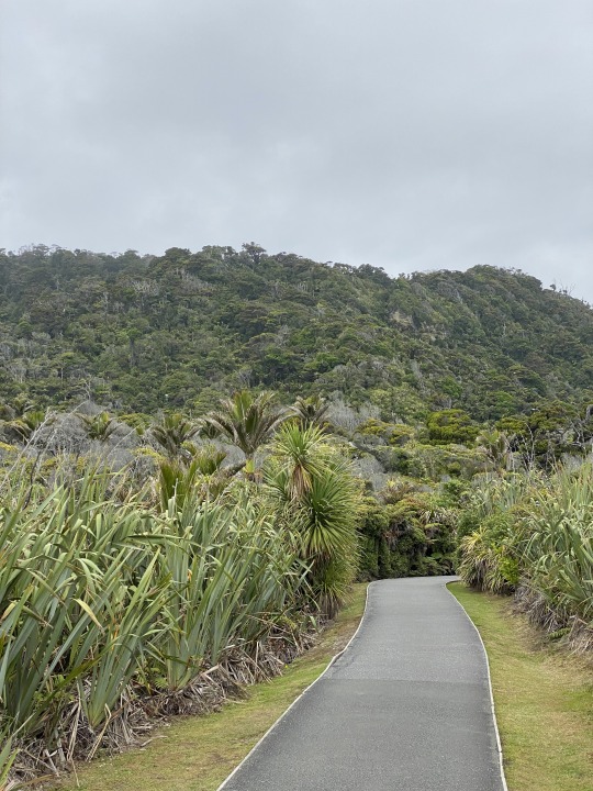
Glad I took some great shots yesterday from Kimi Ora resort since it was pretty gray in the AM. Still, really cool to wake up in the woods in a modern unit with a view of the water. I enjoyed my continued vegetarian diet through no choice of my own as the included breakfast was served at the main lodge (about 300 steps down the hill). Plenty of nice choices there and still pleased with the taste of the veggie dinner offerings from last night. One thing I also woke up to was a good amount of swelling and puffiness around my left eye, as the histaminic reaction had spread. Still able to use my eye, but feeling weird and half swollen shut, I felt like saying "Cut me, Mick". Actually got a bit worse for the first half of the day but as of now which is nighttime I will hope that the swelling reduces tomorrow. No real hindrance other than folks asking me if I had fallen from my bike! Heading north we managed to get Ted's debit card to be taken at the local unattended station then aimed up over the very tight and a bit scary hill just to get to the main road. We turned right on Takaka Hill Road and were immediately greeted with a sign that said we may have construction delays. after just a mile or so we ended up first at the traffic light. Theee indicator LED lights showed 6-12', 2-5' & 1'. We had just missed the green light as we saw the last car a few turns up the steep hill but waited it out. We joked about timing our return so that we wouldn't have to again wait another 12'. It wasn't construction but the recent heavy weather had actually washed away a few sections of road, dropping 4-6' of roadway down the hill and now cordoned off with construction barriers to be fixed who knows when. We aimed for the northernmost point on the South Island, Cape Farewell. There are some dramatic rock features that are worth the few hundred meters of tramping up to see them as the South Island abruptly ends into the see. Pics above. The "cave" is hard to see as it is under a very high and steep cliff with no safety measure but the water actually flows into and through this dramatic hole in the mountain's base. Also you can see the water flowing in but didn't want to have a "hold my beer" moment trying to capture the wave action inside the cave. The other spit of headland is marked by a flying buttress of stone and this was the last bit of land that Cook and his crew saw when returning to England in 1770. https://en.m.wikipedia.org/wiki/Cape_Farewell,_New_Zealand
We explored all 3 of the areas we could ride to and they encompassed maybe 10 or 12km of gravel roads around the top of the island. It felt pretty remote and it was beautiful even on a gray day. Next we retraced southward with a slight detour to cruise through Collingwood before opting to stop at the Mussel Inn. In addition to the bohemian vibe, we were treated to a culmination concert of African circle drums and dance provided by a group from around the country that had come together for a 4 day drum circle camp there. I got into the beat as they accompanied my tasty and quite large New Zealand green tipped mussels. Yes Jerry, I pulled the hair patches! 😉 In the toilet though I didn't need it, instead of toilet paper there was a bin of shredded cardboard. As the rain started up again we took our leave and the next brown sign turnoff took us to the Te Waikoropupu springs. This was a great stop as the size of the springs and especially the volume of water billowing from the ground was impressive. A sizable river basically emanated from there in just a couple springs. They are the largest freshwater springs in New Zealand, the largest cold water springs in the Southern Hemisphere and contain some of the clearest water ever measured! Took some pics but hard to grasp the clarity of the water and the volume. Spoke to a couple from Madison who were riding for a couple months on a BMW 1200GS they bought from the dealer in Dunedin we visited. McIver & Veitch. They bought it and have an agreement to sell it back when done which saves them a good third over renting. Good idea for longer rides/rentals. Heading back to the highly technical Takaka Hill, after crossing that Old Takaka River (insert Larry David joke here!), I had the uber geeky idea to count the turns since it had seemed twistier than the Dragon this morning. Of course with a 10' delay at the same one way light location due to bad timing or poor planning, I had to remember I was at 222 turns while at the light. I counted 250 turns in what Ted researched to be a 14.8 mile stretch of road. That is a turn per mile rate of 16.83 turns per mile. The Tail of the Dragon boasts 318 curves in 11 miles. That is a T.P.M. ratio of 28.9. So the Dragon wins. But I have never counted the Tail's twists myself. My impression was that this road is twistier but at this point I'll just accept that all the T-shirts are correct and Takaka Hill is just a bit less twisty. Still a fantastic road that wouldve been a lot more fun if not enveloped in fog at the top and wasn't raining/wet. We then headed past our resort to the closest sizable town of Motueka. Lots of restaurant choices there since the woman at reception yesterday seemed to indicate there wouldn't be much to choose from on Sunday in Kaiteriteri and our resort's kitchen is closed for Sunday dinner. If the weather held off we would try to head there for dinner. However the rain persisted and we also found that the nighttime and slick wet turns required to get back to Kaiteriteri were strong dissuaders. We explored Kaiteriteri a bit more and found the Beached Whale which said they'd be open for dinner later. It also said entertainment 7 nights a week so that sounded good. We rolled back up the hill to our jungle unit and I actually got a one hour nap which was sweet. 😴
We headed back on the bikes in our riding boots and Goretex jackets since it was still raining lightly. I wore jeans, for a mile trip you weren't gonna get very wet unless the weather opened up on us. Ted was far enough ahead of me that I didn't see him slide on the curve approaching the main road. He didn't go down but I also slid at the exact same spot, I'm guessing at least 3-4"". Closer inspection on the return ride revealed a white painted yield sign which must've had lines 6" to 12" wide painted right on the turn covering 2/3 of the width of the lane. We had been warned in the first couple days by a biker about the painted lines in NZ. They are slippery at home too but I think they use no grit here at all on some of them. When wet they can be especially dangerous. We both almost had a real problem at that same spot which we discovered during dinner discussions. A mushroom pizza and a Coke were then serenaded by possibly the owner on guitar and a computer and equipment to provide the accompanying rhythm and occasional synthesizer. He was very good. Again mostly American stuff. Eagles, Johnny Cash, Ike & Tina, Nancy Sinatra, Van Morrison (Irish I know) etc. Good day and going to head toward Havelock tomorrow with some great looking detours to French Pass if the weather cooperates. 😴
1 note
·
View note


Text
Day 17. Punakaiki to Kaiteriteri. 285km.
As the night went on, I wondered if it was storming. Regular intervals of low thunderous rumbles turned out to be just a rising tide and some waves crashing against the substantial sea wall erected just behind the Punakaiki beach motel where it appears there used to be a road closer to the water. I had closed the windows and gone on my own personal pest control missions in the nicely appointed apartment by the beach. Still I counted over a dozen bites on each ankle this day. 🦟 Welcome to the buggy west coast. The sun was trying to claim the day as we wheeled out at 9 and headed north from Punakaiki. The first overlook, not far past the Tavern where we had enjoyed a nightcap was a wow. Mist shrouded the further bays up the beach and the Hawaiian like forest cling to the cliffs etched out by a chip and seal snake winding in and out of the shoreline's wrinkles. Picture above. Further along the road was almost unbelievably windy. Ted said that he found online this section from Greymouth to Westport was one of the world's best motorcycle roads. I believe it. So twisty, with elevation changes, loops around bays and over rivers with ocean rocks with flowers planted to enhance the already speccy views. After gaining our breath, we detoured about 6 kms into Westport in search of fuel. We found it then on to Gibby's cafe for some coffee, sausage roll and a cheese roll (a la Invercargill) and why not, a gingerbread man! Pic above. Two nice older couples at the next table and a couple twenty something fellas with two cute dogs got to talking with us and they were very supportive of the current political situation in the US. Nice. 🇺🇸 We headed inland and through the lower and upper Buller gorges. Again no clear apex marked at a pass but the roads today were simply all a dreamy day for a biker. About a half hour of twisty roads brought us to Berlin's cafe. Four bikes parked out front were a good sign. Turns out one of the bikers was a gal who misjudged a passing maneuver on her BMW GS and busted a few parts off the handlebars including her front brakes which were pumping hydraulic fluid when pulled. Reservoir must've sheared off. She was fine but the bike wasn't rideable. A ginger beer was downed and a little Wi-Fi used. The next town of Murchison seemed to be super busy and couldn't figure it out. As we passed the cafe, that couldn't have been it. Cars parked on both sides of the street for 200m. Then, a festival of sorts on the right came into view. Carnival rides, food tents and farm machinery on display. Looked like fun but we kept riding. In fact I flipped open my visor and was promptly met by a fairly large bee who found himself jammed into my left temple and against the helmet. I would've thought that the 60-70kph impact would've killed him. Well, it did but not before giving me a good thorough stinging just to the left of my left eye. Oh well. I'm sure there will be repercussions tomorrrow. 🐝 More good roads and then heading downhill towards the east side of the island and past the Buller Gorge Swingbridge.
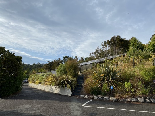
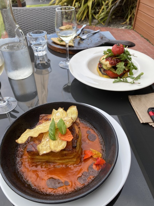
Finally descending into farmland again we turned north and followed a series of pretty rivers and canyons angling northward. Today would be our furthest north stop. Staying two nights we would have time to explore tomorrow, the extent of the Abel Tasman NP and the Golden Bay and Farewell Spit dunes extending to the very northern tip of the South Island. A couple of GPS generated bypass turns (due to adventurous setting) had us over a small bridge and tiny farm roads that wound along the river with good pavement underneath. We then had even more tight turns heading into Kaiteriteri and then up the hill to the Kimi Ora Eco resort. A bit of a splurge, this aptly named spot has its own garden for food, solar farm for power and is a bit fancy. Checking in to basically a two bedroom apartment up the hill with a view over the bay loaded with moored boats and people swimming on the beach. Very scenic setting. Had to go check out the hot tub(s) and the pool all with a view. Made an appointment at The Views, their vegetarian restaurant in the main lodge. The meal was excellent. Picture above but didn't show the chocolate mud cake with vanilla bean ice cream and raspberry drizzle. Walked back up the hill to the unit and now I can't believe I'm about to be done and current with the blog! I'm so glad to have this as a reference in the future but I sorta dread sitting down to spend 1 to 1 1/2 hours each day to put down the thoughts, do the homework, select the 10 pics. But as this is the final week of the ride the end is in sight and it is definitely worth the effort. Not sure when or how I will use it in the future but the volume of occurrences, sights, little things, meals, stories is tremendous. Even after a couple days let alone years the memories tend to if not fade at least blend a bit. Many of the above experiences would be lost to me if not captured here so, on we shall continue! Enjoying A/C again. Modern conveniences... 😴
1 note
·
View note


Text
Day 16. Rangiora to Punakaiki via Lewis Pass. 350 km.
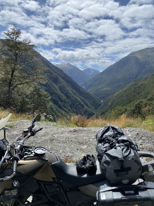
Woke up to a steady light rain. The forecast was better on the west (rainy) side and we were for the third time in three days going to cross the mountains again. Another failed attempt to use our American credit cards to pay for fuel at automated fuel island at Pak'n Save (like a Costco). After success the first week at these fully automated fuel stations, the last week has usually been met with failure. One attendant said that because the US cards require a signature (for who knows what ridiculous reason as that offers zero additional security) that they are declined at these automated pay stations. The tap and pay system is on the rise and most of my cards have the RFID chip to do so, has a name here. They call it Paywave. At least half the machines I've used at cafes and gas stations and motels are Paywave enabled. When tapping a card with Paywave no signature is required plus it's faster. We decided to roll a ways and got gas down the road with an attendant. Only self serve, by attendant I mean someone in the station to take payment. Mike had suggested the Culverden cafe for a stop so we cruised through the farmland and hedges with a long fairly strIght stretch while the rain was easing in fits. The cafe was barebones with just a few seats inside but the baked goods looked delicious. I opted for the butter chicken pie (surprising to find a light tomato sauce within) and a cream filled doughnut that was eclair shaped and drizzled with a raspberry sauce. 😋 All washed down with the dark chocolate milk which seemed to be in most shops. There was a paper sign with Uncle Sam on it. That dude was a long way from his origin in Troy, NY! 🇺🇸 He was being used to prompt interest in a "bowl" club since their numbers were dwindling and its survival was in question. I assume that's what we call bowling? After using the public toilet (they are very nice and high tech, many with electronic access and all have been super clean) we headed toward Lewis Pass and the landscape obliged our desires for more curves and mountain scenery. We had some beautiful views and made a couple photo stops but 2/3 passes over the Alps we've done lately didn't have a sign or marker and couldn't tell when the actual summit was reached. Weird. A few different areas where it was discussed if this was the apex or a false summit. I'll never know which but the road was superb. We even had some 15kph curves thrown in there for good measure! We pulled in to a very cute town of Reefton which had some motorcycles strewn about. Got gas at the Mobil as Ted attended to a scratched open mosquito bite with a band aid assist. The "healthy" breakfast had kept hunger from appearing at the appointed lunch hour, so instead of stopping to eat in Reefton we kept going. A couple of sport tourers (BMW) then appeared in our rear view. We are averaging about 110 kph most of the time. They tolerated our pace for a while then whined on by. We saw them edge slowly ahead as we enjoyed the roads and then after a turnoff to skirt Greymouth, they were stopped by a tractor on a one way bridge. The tractor barely fit! One wheel was on the curb. I stopped for a pic behind them and the tractor mid bridge. They then roared on ahead and the farmer held out his thumb and forefinger an inch apart to me, to emphasize the lack of room his machine had to navigate the bridge. I gave him a thumbs up and prodded my 800 into action in distant pursuit of the sport tourers.
We rode to Blackball and cut off the corner to Greymouth, finding the coast road and marveling at the Hawaii like jungle cascading down the sheer hills to the water. Occasional jagged rocks broke up the smooth expanse of beach as we revved northward. We saw a good looking motorcycle oriented cafe at Barrytown and decided to share a pizza there since we weren't that hungry. Cool place. From there it was only 15-20' up to Punakaiki (Poo'-na-kai-key) where we saw tons of cars and campers right in town which consists of the famous pancake rocks on the beach side of the road and a few businesses and cafes on the inland side.
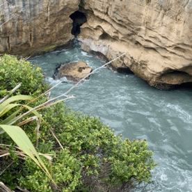
We then approached the coastal Punakaiki lodge and checked in, each having our own unit right by the beach. The ritual shower after riding was eschewed in favor of donning a swim suit and riding to the Punakaiki River where it joins the Tasman Sea, for an afternoon swim. But then realizing I didn't want to walk around Pancake rocks in a wet bathing suit, we turned around and buzzed the 1-2km back to Pancake rocks. Such a cool place! See the first pic above. There are blowhole pools where incoming waves make thunderous sounds and spray water. There are all sorts of connected caves and then there are the rocks! Limestone erosion and the ocean have created a wonder here. Strolled on the self guided tour for maybe 40 minutes and it is really worth a visit here. Then back to the river and I plunged into the river. Cool, but swimmable and super clear. Went into the ocean and nearly got swept out into the rocks by the surging current so managed to make it back to shore and stick to the river. 🏊♂️ 🌊 Soft sand lines the river and first dew feet are shallow, then one step and over your head it was. Back to the hacienda for a shower and then into "town" for dinner and entertainment at the not so inspired name "Pancake Rocks cafe". I ordered the manuka honey coated fried Halloumi cheese with an interesting Asian rice salad and polenta chips to accompany it. Halloumi is made from the local sheep and goats milk. At 7 the open mic night began. There were some regulars lined up and at least a couple were open about the fact that they were singing three songs to qualify for their free beer! One cool song I wished I had taped was about the longest place name in the world which due to it being on the North Island will escape a visit from me this trip. 85 characters long, I'll just paste a link to it here: https://www.google.com/search?q=longest%20maori%20place%20name We got chased away by one of the guys who just wasn't good and closed out the night at the very busy Tavern just north of our lodge. 🍺 😴
https://www.google.com/search?q=longest%20maori%20place%20name
1 note
·
View note


Text
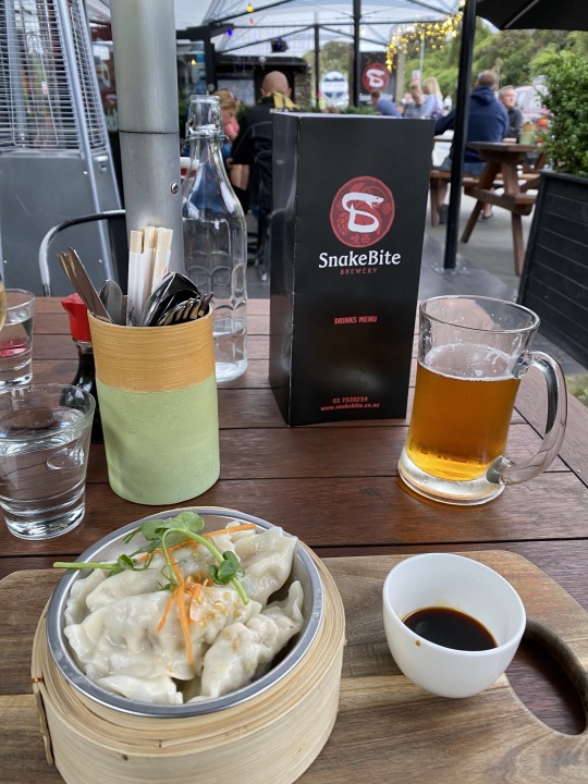
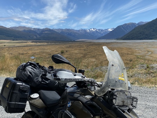
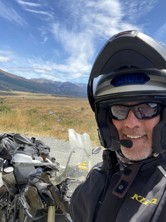
Day 15. February 13, 2020. Franz Josef to Rangiora via Arthur's Pass. 420km.
Woke up a little foggy. Oh yeah, the weather was too. The open mike singers at Snakebite brewery had one or two excellent voices I really enjoyed and I may have had too much beer... 🍻 But at least the motel was just around the corner and morning came too quickly. One item I am not sure I have mentioned regards the usage of the maps.me app. This app allows for an easy way to use your phone GPS anywhere. The phone always known where it is, but if in an area where there is no cell signal/data or if I am not using my cellular data due to cost/choice the phone is unable to draw/show maps on Waze, Google, etc. Maps.me allows you to download countries or regions so that you can always navigate and see where you are. I utilize the red pin drop and save features to create a track of the places I have ridden on longer journeys such as these. It is helpful to have this data to assist in retracing steps (combined with the metadata embedded in the iPhone pictures). Since I'm waxing technically, how about the freaky similarity in the land area of both Georgia and NZ's South Island. The state of Georgia exceeds the size of the South Island by about 1,000 sq. miles at over 59,000 but basically they're the same size. I couldn't really have imagined spending 3 weeks + exploring Georgia but the terrain here is almost nauseatingly scenic. Most of South and central GA isn't that exciting to ride. North Georgia would certainly provide a visitor interesting riding for a week or maybe a bit longer. Enough stuff unrelated to this day. The forecast had used the word dreary and there was a low shroud of clouds hugging the mountain ridges. A few stray drops dotted the visor as I aimed again northward toward Arthur's Pass. Shaking out the cobwebs I commented to Ted via our Sena Bluetooth communicators that even in the low shroud hiding most of the dramatic peaks, the riding has been pretty much nonstop scenic. Fern forests and sheer rocks where the road has been cut that are covered in ferns. Growing in everything crack and crevice. In fact, saw one of those mowers attached to a tractor on a hydraulic arm that was trimming the ferns today. When the scenery then changed as you wind in between scenic preserves (all named) the transition to farmland is met with seeded flowers creating a welcome mat to the berm of the road most places. Kind of like how North Carolina and zone places in Georgia plant areas of wildflowers in the median strips but this is done on both sides of the road creating a natural orange beauty line highlighting the roads. Came upon a Yamaha and a new Triumph Rocket 3 R at a construction stop light where we crammed our way to the front of the line. We followed them for a while as we wound up some tight turns. That R3 looks great! He had a nice looking Triumph bag strapped on the pillion. We actually passed them after a while. 🤷♂️ After meandering for a bit we opted to pull in to Ross (gold mining town) for some needed sustenance. A cappuccino and French toast garnished with grilled banana and bacon hit the spot. We were about 2' too late as a crowd of Aussie bikers from outside Brisbane was just loading in ahead of us. No spring chickens they, yet they were largely off road and headed on the fantastic network of NZ biking and hiking trails all the way to Greymouth. (Which was 66 km on the road so more for them). Good on you, bikers! 🇦🇺
Next we headed inland to cross the Southern Alps again as we had done yesterday this time back to the east via Arthur's Pass. First a 40km detour north to Greymouth since the GPS showed no fuel ahead on the pass. We headed up the pass and as is usual the windiness and elevation both increase significantly. This isn't a terribly high pass at just over 3,000 feet but snow fields and lots of runoff debris fields are revealed as we ascend. We see an unusual hotel and pull into "New Zealand's most interesting hotel", the Otira hotel. You can zoom in on the pic and see some of the depths the proprietors have gone to in order to make this place unique. There are so many curios and antiques strewn about the rooms, it oozes history. See Gollum dangling his "precious" perched on the roof's edge? Fed a couple leftover chips to the pig penned up down by Gandolph's garage. 🐖 Had the "famous" whitebait fish sandwich. Some sort of pressed pan fried whitefish on toasted bread. Pretty good! The Kiwi train rolls all along the pass somehow disappearing under the peak in a feat of underground tunneling. It came by configured for freight and stopped by the hotel for a while. Ted was supposed to ride the passenger version on the same line a year ago however the western highway we had just ridden was washed out so they couldn't make it. Imagine that! 🌧 🌧 After lunch we passed by an Italian style viaduct, open on the side away from the hill immediately followed by a waterfall which had been diverted to flow over the road on the concrete roof constructed as a water slide to launch the flow harmlessly away from the road. One last very long bridge brings you to a corner just shy of the peak which is scarily named Deaths Corner but offers a road up to a dramatic lookout. Seen there was a blacked out Road Glide with those angled mini apes that looks good. The guy is in full leathers, I think some sort of group (OK maybe gang) and he asked about my Klim gear. If I had brought it from home? He said it was good stuff and I agree! We came down the pass and there were plenty of sharp turns. 35 and 25kph suggested limits for hairpins and came by a number of ski resorts. Being on the Christchurch side of the pass these are more accessible to the population center of the South Island. As the descent continues we turn on the scenic inland route not far from where we started on our ride out of CHC two weeks ago. In fact our resting place this evening is really a suburb of CHC. We pass the now familiar trimmed hedge walls, checkered farmland and sheep. We zig zagged a couple of times thinking the GPS had it wrong but soon we pull into the well kept Riverstone Motel. First place the whole trip that had A/C (air con here) and oh my I sure enjoyed that. Mike the proprietor was helpful and off we went to town about 2.5 clicks away after a shower and change. Most of the restaurants were closed for some unknown reason. We opted for a Chinese place that was good and notable in that fried rice was ordered because no rice came with the dishes ordered, but the fried rice was so loaded with meat and chicken that there wasn't much rice! Back to the bar adjacent to the motel for a nightcap and then a much needed rest. Trip is going off without a hitch really, good fortune has smiled on us to date. 😴
1 note
·
View note