
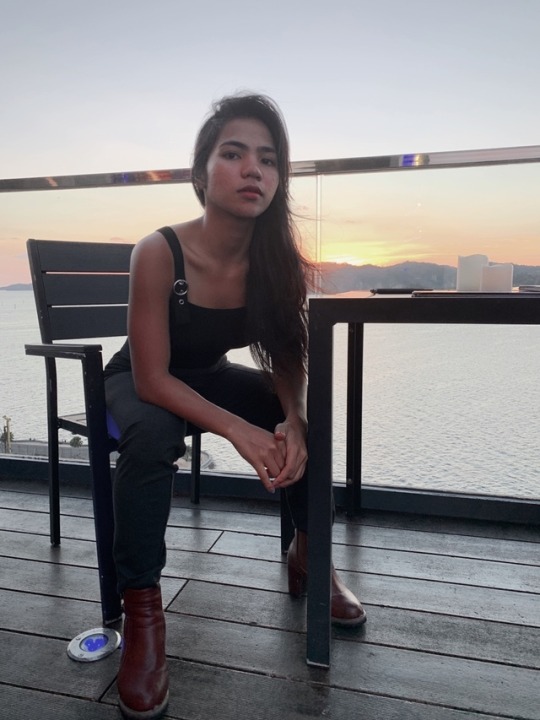
id-antonettereyes
This is Anrey.
Pursuing encounters with beautiful places and people, and probably getting sweaty, dirty, and hungry along the way.
20 posts
Don't wanna be here? Send us removal request.
Last Seen Blogs

piepress
Pie Press Publishing

eilifl
Picture feed

romigames19
romi games

ryanones
In Full Effect

hello-hikari
moomin-log
Text
For anyone trying to get over someone right now:
It’s possible for you to be happy without him because you were happy before him
Think about all the people you’ve felt this way about in the past and how little you care about them now
People make time for what they want to make time for and you don’t deserve anything less than first place
Remember when you had to convince yourself he was good enough for you?
Think about all the things you loved doing with him and ask yourself if you could be just as happy doing those same things with someone else (someone better)
Shift your energy to something else- everytime you start thinking about him open a book or start a yoga class or cook
Just because it was comfortable doesn’t mean it was meant to be
Write down all the things you hated about him- literally every little thing that annoyed you. Then burn it along with any pictures of him you have
Write down all the things you think he’s going to miss about you. Keep that list somewhere you’ll see it everyday
Finally- If he wanted to, he would have. And there’s someone out there who will.
930 notes
·
View notes
Text
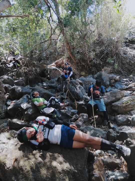
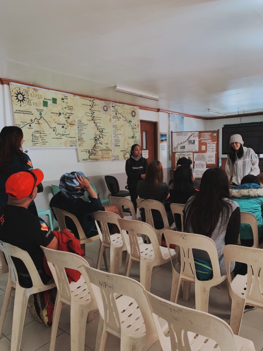
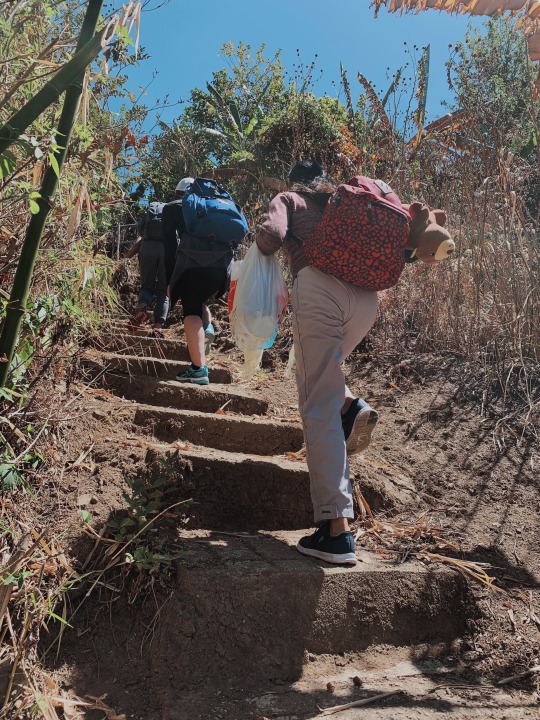
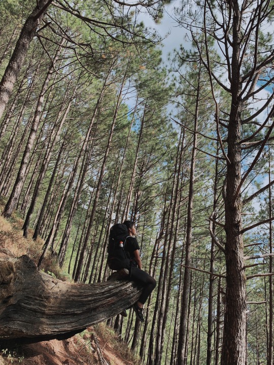
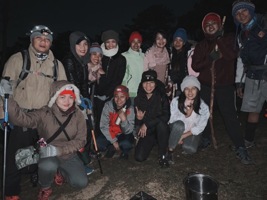
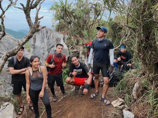
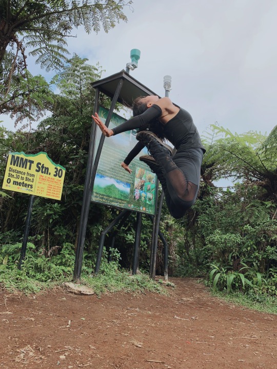
DASEMULAO is among the most challenging hikes in the Philippines, ascending three major mountains (Mt. Damas, Mt. Semilya, and Mt. Tapulao) plus several smaller mountains on the same route. It's a grueling 65km superloop starting at Papaac, Tarlac and finishing at Palauig, Zambales.
I joined Team Teka-Teka for a 35 straight-hours endurance hike, starting at 12PM on Saturday, January 18, 2020 and concluding at 11PM the next day. If you're an experienced ultra marathoner or trail runner, you may look forward to this trail but be aware that the endurance required for this route includes multiple steep climbs, so it can be more difficult than an equivalent distance on a flat terrain or a single mountain.
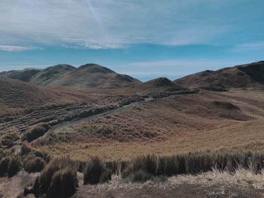
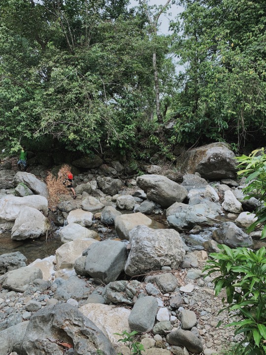
Hikers usually have their breakfast or lunch at the Zambales river. It's the last available water source before summiting Mt. Tapulao. After crossing Zambales River, you will put to test under the sun as you resume climbing up Mt. Marabinela. This reminded me of the Cawag Hexa trek of Zambales, but less difficult. It is very important to conserve your freshly-refilled water from Zambales River as you have approximately 30km to go. The next water source is 10 kilometer from the end point of the hike.
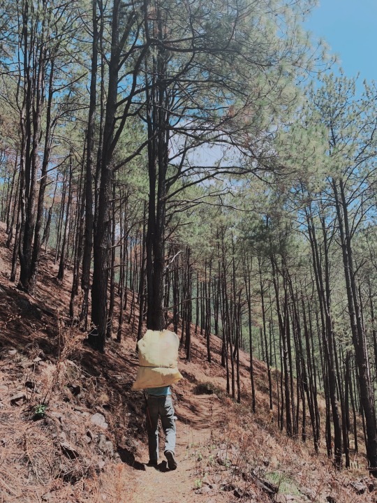
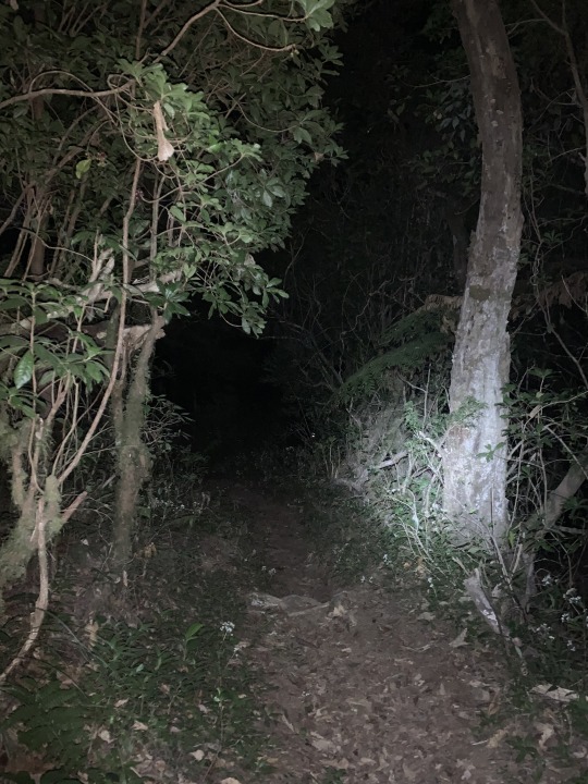
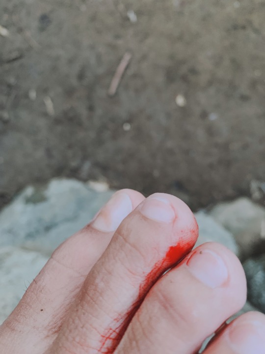
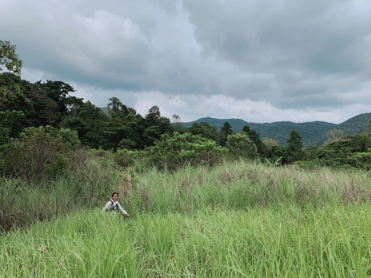
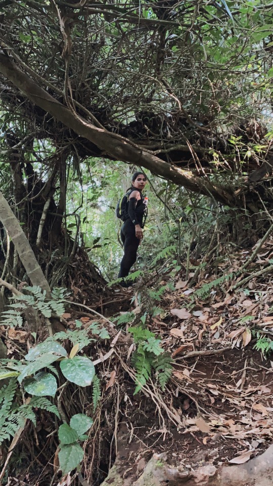
Climbing the mountains beyond Tarlac and into Zambales offers different kinds and level of challenges. Going to the summit of Mt. Tapulao, you'll encounter a mossy forest that seems to be never-ending. Aside from the presence of blood leeches or limatiks, the trail is very difficult to distinguish, and if you're by yourself it can be very creepy, if not dangerous.
It's important to be mindful of how your legs and knees feel, especially on the first mountains. The alternating steep assaults and descents aren't very friendly to our joints; so be wary of your muscle condition so you know when it is necessary to take a break and when it is smarter to keep going.
Long hours of trekking won't feel long if you're enjoying the experience. We climb mountains not to compete with anyone, or to brag. Let our presence be felt by the mountains so the latter will remember us.
WATCH IN HD: https://www.youtube.com/watch?v=Z5mC3pA66-I&t=12s
For more travel blogs please visit the following:
Youtube channel: https://www.youtube.com/channel/UCtYzd7I5Kpk6g8kpvvbQPIw
Facebook: https://www.facebook.com/anreypixelated/
Instagram: https://www.instagram.com/anreyxxvi
Personal Website: https://www.antonettereyes.com/
youtube
2 notes
·
View notes
Video
youtube
I brought my malaysian girlfriend in Alibijaban Island in the Philippines. We only spent USD120 for everything!
2 notes
·
View notes
Text
48 Hours in Brunei: Unexpected Treasures within the Sultanate
Brunei is the smallest ASEAN country by population, and the second wealthiest (next to Singapore by GDP per capita) thanks to oil wealth and a stable monarchy. Unlike Singapore, which is secular and diverse, Brunei is an Islamic state and civic society is centered on Islamic practice and values (no alcohol or cigarettes are sold in the country).

I traveled to Brunei from Kota Kinabalu by ferry with a stop at Malaysia’s Labuan Island, an offshore financial center and oil terminal. The ferry to Labuan leaves KK at 8AM and arrives in Labuan at 11:15am. Once in Labuan, you have the option to take the 1:30 pm ferry to Brunei. I visited the Labuan Museum, about ten minute's walk from the ferry terminal. This is really worth visiting and gives a good understanding of the history of Labuan, especially its time as a British Straits Settlement. There’s not much else in Labuan except small shops selling duty-free liquor and cigarettes. After two hours in Labuan, I was ready for the hourlong ferry trip to Brunei.

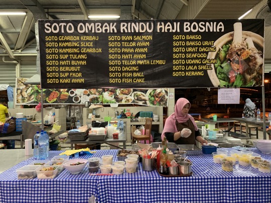
On the first night, I went to Gadong night market, which is a must-go to try local food.
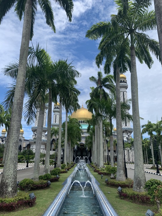
The next day, the first thing on my sightseeing checklist was Jame' Asr Hassanil Bolkiah MosqueI. I was stunned with the ambiance and the design. This ornately decorated mosque, built in 1994, is surrounded by landscaped gardens and fountains. This mosque is a fine example of Islamic architecture carried out with a devotion to details.

After roaming around the mosque, I took the Dart ride-hailing service to the waterfront where I got a boat tour of the River Village or Kampong Ayer. Known to some as the ‘Venice of the East’, Kampong Ayer is the world’s largest settlement on stilts.

From Kampung Ayer it’s just a 10-minute walk to the Royal Regalia Museum. The museum showcases the Sultan’s ceremonial belongings, as well as exhibits commemorating the Silver and Golden Jubilee celebrations of the present monarch’s reign.
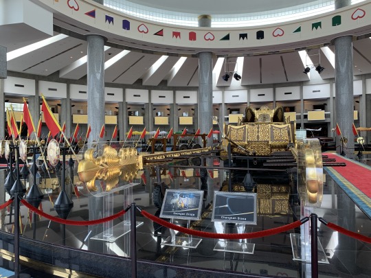
Visitors are greeted with the golden chariot used to take the Sultan through the city streets during the Silver Jubilee celebration. On the second floor is an exhibit of gifts for the Sultan from various countries and states.
After half-day of sightseeing, I rested at Yayasan mall. Yayasan Shopping Complex is close to popular sites such as Kampung Ayer and the Sultan Omar Ali Saifuddien Mosque. It’s a good hanging-out spot while waiting for the sunset. It’s Brunei’s earliest and longest-standing shopping malls.
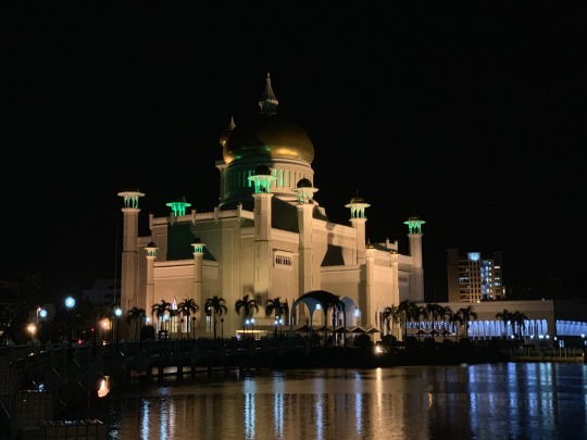
The last stop on my one-day itinerary was Sultan Omar Ali Saifuddien Mosque.The mosque is really beautiful. I chose to see this mosque during the night as it is surrounded by an artificial lake that acts as a reflective pool.
Some other observations:
Brunei has a wonderful mix of cultures. Bruneians are predominantly Malay, though many Chinese, Indian and indigenous Bornean populations add to the cultural makeup of Brunei.
Brunei is a wealthy country. During my bus ride to Bandar Seri Begawan, the capital city of Brunei, I immediately observed that the country is well-developed and properly governed. Those huge LNG tankers that I saw on my way to Brunei indicates the country exploits its abundant oil and gas reserves. Clearly the country enjoys a healthy economy and political stability.
Brunei isn’t popular with tourists. During most of my trip in Brunei, I was asking, “Where are the people?!” The city seemed deserted and even the busiest mall wasn’t very crowded. According to my Dart driver, Brunei isn’t attractive to tourists since bars aren’t allowed anywhere within the country, and drinking alcohol and smoking are strictly prohibited. Apparently, since I visited Brunei on weekends, many Bruneians were away in Miri, Malaysia, to drink, to go shopping, and other recreation.

Though the country isn’t popular with tourists, there’s lots of small local restaurants and a few good restaurants and a night market. Brunei is very clean, traffic was light, and good landscaping is everywhere. There were few billboards, very few chain stores or global brands, and malls are small and local.

Many people told me that Brunei was not worth visiting as it is conservative and boring with little to see. However, I felt it was interesting to see how the country differs from other Southeast Asian nations. A visit to Brunei can be a delightful weekend trip.
0 notes
Photo
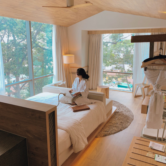
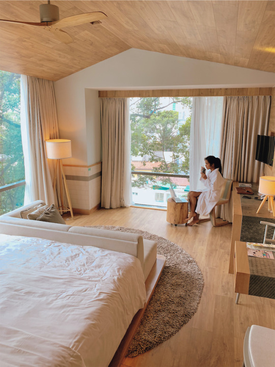
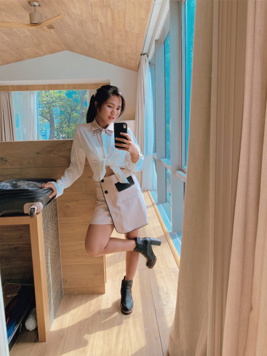


Located at the center of Ho Chi Minh City and close to all major tourist attractions, Fusion Suites Saigon boasts a minimalistic, modern design and cozy interior; the most instagrammable hotel I’ve ever been so far.
6 notes
·
View notes
Text
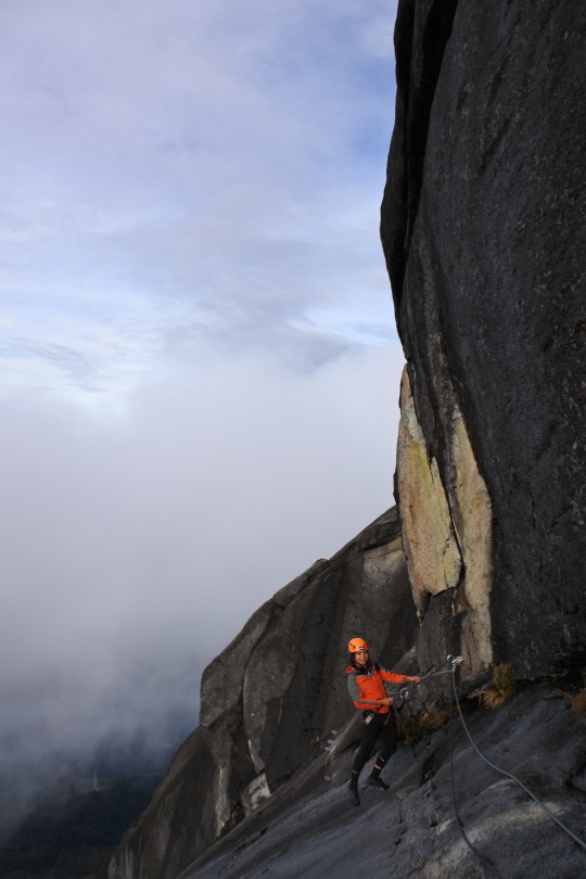
The Most Memorable Descent I Ever Had: Kinabalu Via Ferrata Low’s Peak Circuit - The World’s Highest Via Ferrata
Summiting Mt. Kinabalu is an achievement by itself but defying gravity in my highest altitude adventure is definitely the highlight of my Gunung Kinabalu climb experience.
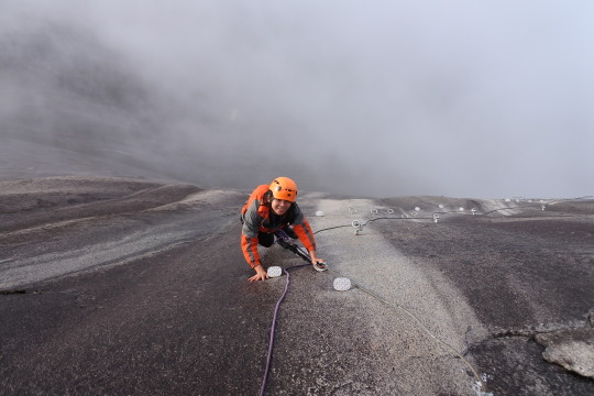
Last June 10, 2019 through the Mountain Torq organization, I got to experience the world’s highest via ferrata at 3,776 meters above sea level.

After reaching the summit Mt. Kinabalu, Low’s Peak, I gained access to such an exclusive route that offers exhilarating and scenic detour with the longest descent trail from the summit.
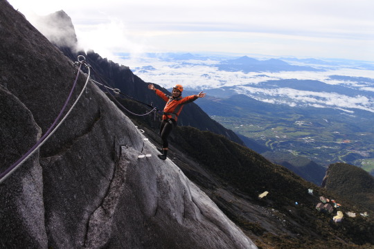
I was able to witness sections of the mountain that are inaccessible to hikers who are only on the summit trail.

To give a quick background, “Via ferrata” is a term little known outside of the European Alps. It means “iron path” in Italian and describes an engineered route of steel cables and iron rungs and sometimes ladders and bridges that provide access to dangerous routes with increased safety.
I don’t have a great fear of heights so I found the LPC to be exciting. Others might experience it as nerve-wrecking or frightening as the steel cable crosses sheer cliffs with thousand meter plunges to the valley below.
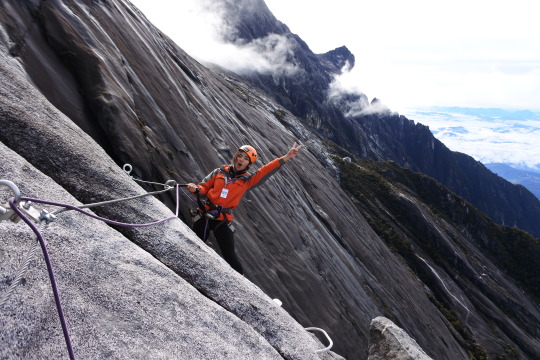
It was like walking through the clouds and having bird’s eye view of the valleys and villages bellow.

I started the LPC at 6:45AM and finished the 1.1kilometer via ferrata LPC route in two hours, at 8:50AM.
Come stand tall on the roof of Borneo on the world’s highest ferrata!
1 note
·
View note
Text
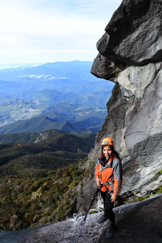
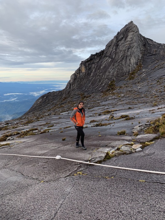
Greater Heights: Climbing Mount Kinabalu, The Roof of Malay Archipelago
Standing at Low’s Peak, Mount Kinabalu (Gunung Kinabalu), the most dramatic feature in Sabah and the tallest peak between the Himalayas & New Guinea.
Traveling to Borneo for a month obviously gave me the idea of climbing Mt. Kinabalu but due to logistical hindrances, I wasn’t sure that it would be possible. But as I saw the mountain from the plane, I was like, “I want to be there, I need to be there.”
Judging from the photos I saw online, it seems like Mt. Kinabalu would be a different experience for me compared to other mountains I’ve climbed before. Also, I haven’t had any experience being in an altitude more than 3,000 meters.

When I did my research, I found out that Sabah Parks only issue 185 climb permits per day so one has to book early to avoid disappointment. I’m glad that even with my late inquiry, at June 1, I was able to get a slot from River Junkie, a local travel agency who efficiently made all the arrangements for the entire Gunung Kinabalu trip.
DAY 1
River Junkie’s van picked me up at Jesselton Residences at 6:45AM, we started the two-hour ride going to Kinabalu National Park.

After checking our passports, completing registration, and picking up our packed lunch, we had a short ride to Timpohon Gate which is the starting and ending points for all climbers at 1,866masl. We started the 6-kilometer initial trek at 9:30 AM.
The trail is well defined and maintained and the assault consists of endless rough, uneven, staircase climbing.
At Layang Layang Shelter (at 2,702masl), many hikers will notice the effects of the decreased air pressure. Rapid heart rate and shortness of breath are signs of trekking in thin air.
Some of the hikers who accompanied me decided to go down due to altitude sickness before reaching the base camp.

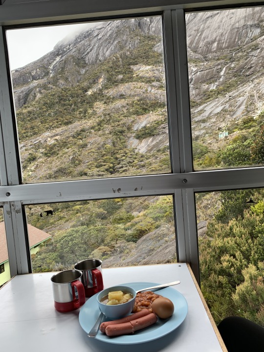
After six-kilometer assault through lowland rain forest to montane forest, and then cloud forest, I reached the Panalaban Base Kamp at 2:40PM in a sub-alpine meadow terrain.
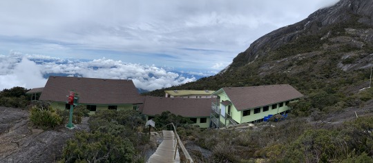
There are several dormitory buildings in the area with hot showers, toilets, cooked food and basic sharing rooms with bunk beds.
youtube
I stayed at Pendant Hut where Via Ferrata climbers have their seminar; while the others from our tour group stayed in Laban Rata.
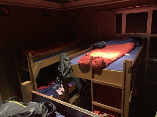
Knowing that we were expected to get up by 2AM, I tried my best to sleep right after the dinner but because of altitude insomnia, I was still up at 12:30AM and gave up on any idea of getting a good night’s sleep.
DAY 2
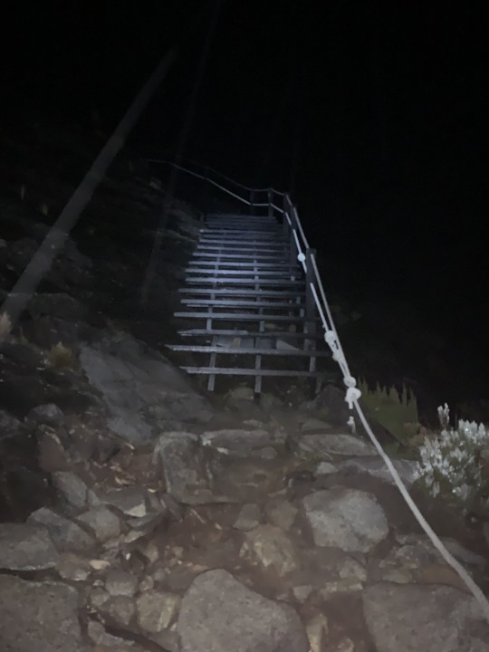
For the second part of this climb, we started our hike to summit at 2:45AM. It was raining as we started up endless flights of steps with some ladders and ropes. The organizers told us that we’d hike for an hour and attain a higher elevation to see if the rain might clear. They told us that if the rain continued, they would require us to turn back because attempting the summit in a storm was not safe. Needless to say, we were quite anxious about the possibility of continuing rain, as there was no possibility of refund of the tour fees even if we had to turn back because of weather.
youtube
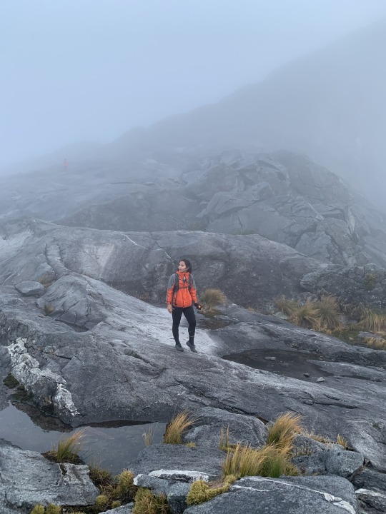
Above Laban Rata the vegetation disappears. The next stage of the climb is an open trail over a massive bare granite slab. Fortunately the rain stopped and was replaced by dense fog. As we ascended the granite, it became very cold with a strong wind on our way up to the summit. The fog obstructed visibility even with my head torch on.
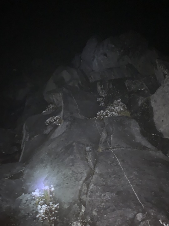
The final ascent was 100 meters of scrambling over loose rocks and large boulders before reaching Low's Peak.
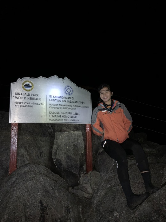
At 4:45am, after the 8.5 kilometre (5.25 miles) trek to the top, I was finally at the majestic 4,095m (13,435 feet above sea level) summit of Mount Kinabalu, the highest mountain between the Himalayas and New Guinea. Unfortunately, it was still night!
youtube
I reached the summit an hour earlier than the recommended time because of my fast pace.
As a result, I waited shivering in the cold for the sunrise. I only had a few moments to savor the sunrise on the summit since I had to arrive at the Low’s Peak Circuit’s meeting point before 6:30AM.
youtube
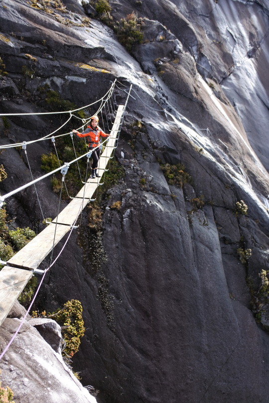
The stunning scenery along the summit trail from Low’s Peak.
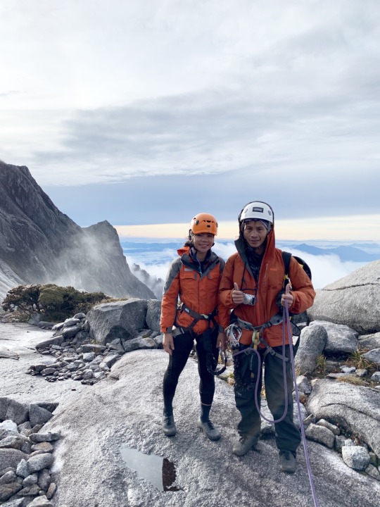
Through the Mountain Torq organization, I got to experience the world’s highest via ferrata at 3,776 meters above sea level.
youtube
“Via ferrata” is a term little known outside of the European Alps. It means “iron path” in Italian and describes an engineered route of steel cables and iron rungs and sometimes ladders and bridges that provide access to dangerous routes with increased safety. I started the LPC at 6:45AM and finished the 1.1kilometer via ferrata LPC route in two hours, at 8:50AM.

The end-point of Low’s Peak Circuit is Walk the Torq, so technically, I experienced both trail of via ferrata! To me, it was a vertical playground. The experience of crossing the mountain via ferrata will definitely provide memories for years to come.
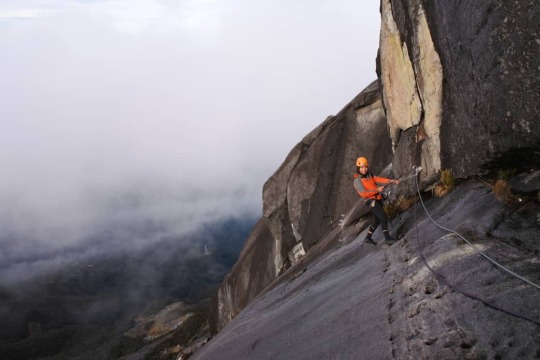
I don’t have a great fear of heights so I found the LPC to be exciting. Others might experience it as nerve-wrecking or frightening as the steel cable crosses sheer cliffs with thousand meter plunges to the valley below.
After traverse-descent from the summit via ferrata, II still had 700 meters to go before reaching the Pendant Hunt to get my well-deserved breakfast.
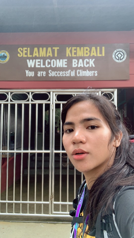
I checked-out at Pendant Hut at 11:00 AM and reached Timpohon Gate at 1:30. That concludes my Mt. Kinabalu journey! I will post a separate blog about Via Ferrata Low’s Peak Circuit soon.

The entire trip, from 6-km steep assault from Timpohon Gate to sumptuous dinner and cozy accommodation at Panalaban Base Camp, reaching Low’s Peak and the descent from the summit is simply breathtaking. The barren rock formations on a clear day above the clouds is magical. Defying gravity Via Ferrata Low’s Peak Circuit is indeed the highlight! and I’m glad I did it. Maraming salamat, Gunung Kinabalu!
0 notes


Text
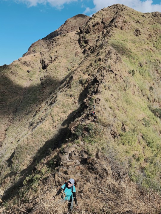
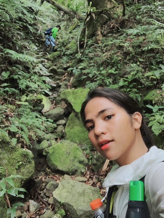
Cawag Hexa DayHike - The Ultimate Hell Hike
After having minor climb for the past two-months since I started hiking, I didn’t want to be called “beginner” again, so I tried to find some major hike that’s available on my chosen date. My first choice to be my major hike is Montablan Hexalogy but I can’t find any events since I only looked the day before the hike itself. Then I found Cawag Hexa event the next day. I immediately messaged the organizer that I’m interested to join without telling her that I’m a beginner and this will be my first major hike just to make sure that she would let me join. And she did.
The Cawag hexa consists of 6 peaks compressed into a dayhike, thus the “hexa” part. Mt. Balingkilat (1100 masl), Mt. Bira-bira (450 masl), Mt. Naulaw, Mt. Dayungan (935 masl), Mt. Cinco Picos (881 masl) and Mt. Redondo (660 masl).
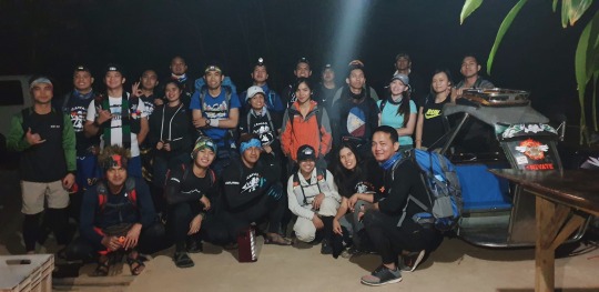
I met the event organizer and her team at Shaw Greenfields before riding a private van to Zambales. At the local police station, we had our group photo taken for security and safety purposes.

The local officer also gave us a short briefing. Then we had another few-minutes ride to Sitio Cawag to get our guides. Here, they gave us a short preview of how strenuous the climb’s gonna be, and we’ve also been informed of our options to cut the hexalogy to penta, quadra, or just trilogy if we feel like we can’t make the hexa hike considering time-constraint and other difficulties.
We started initial trek from the jump-off at 4:30AM.
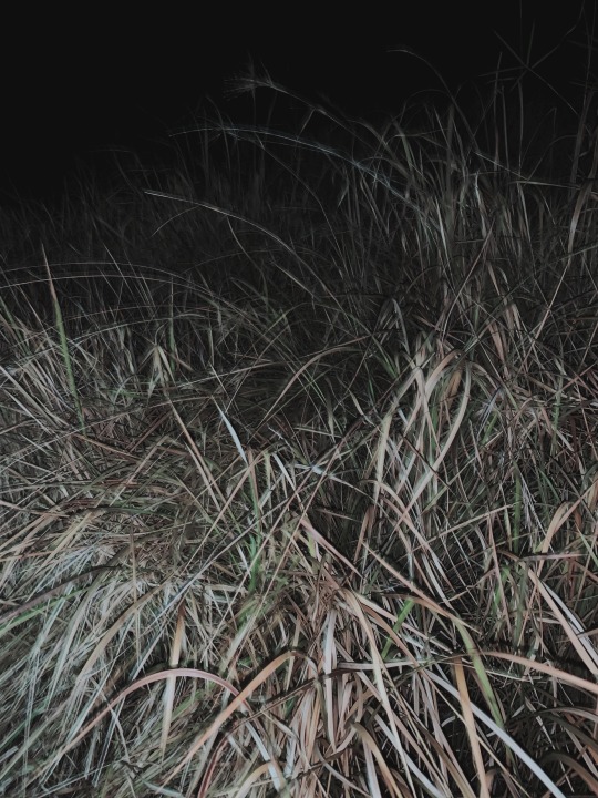
There were tall grasses with sharp edges that can give you itch or even cut your skin. In tagalog we call those plants "talahib".
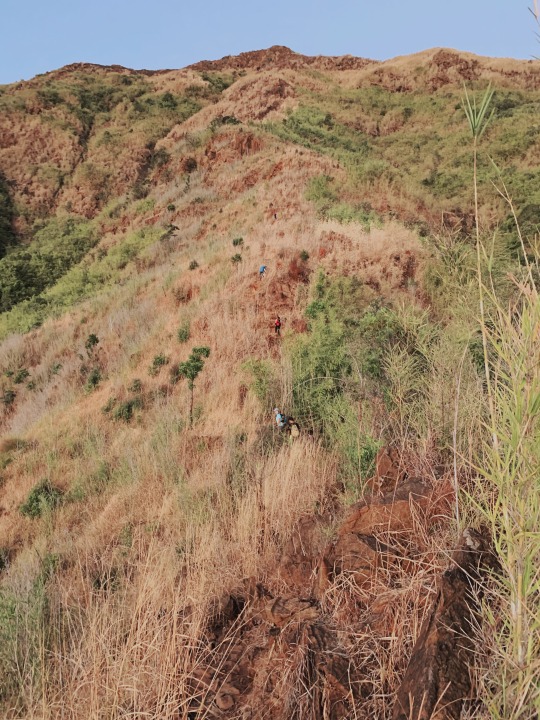
This is how our pacing looks like on our way to the summit. There’s great distance between us.

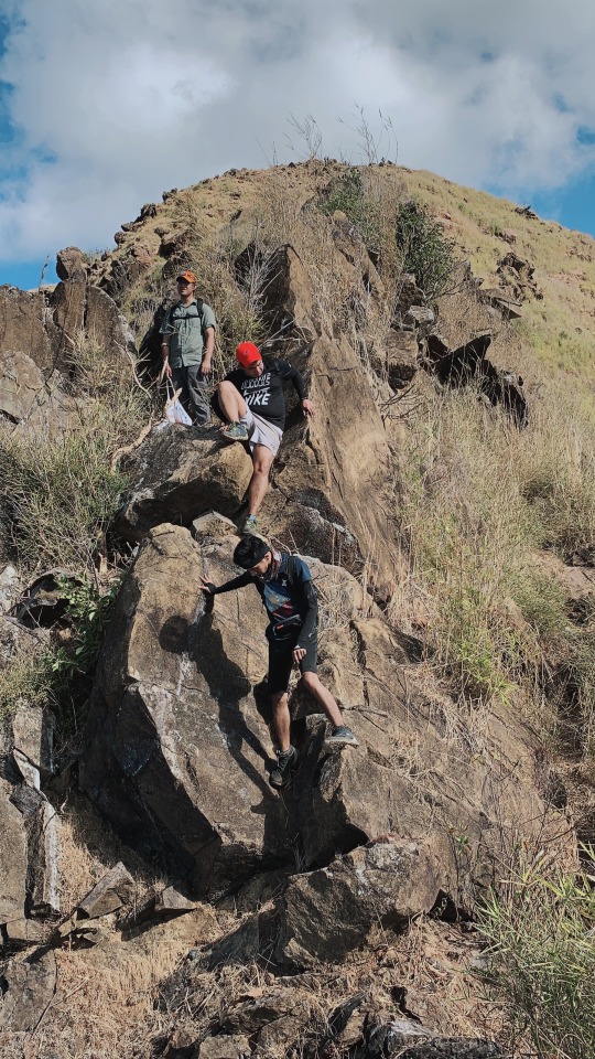
Slowly but surely we made our way up and as the sun starts to rise, I had a better view of Mt. Balingkilat knife-edge assault that surely intimidated me. Extra caution must be taken hiking that part of the trail.
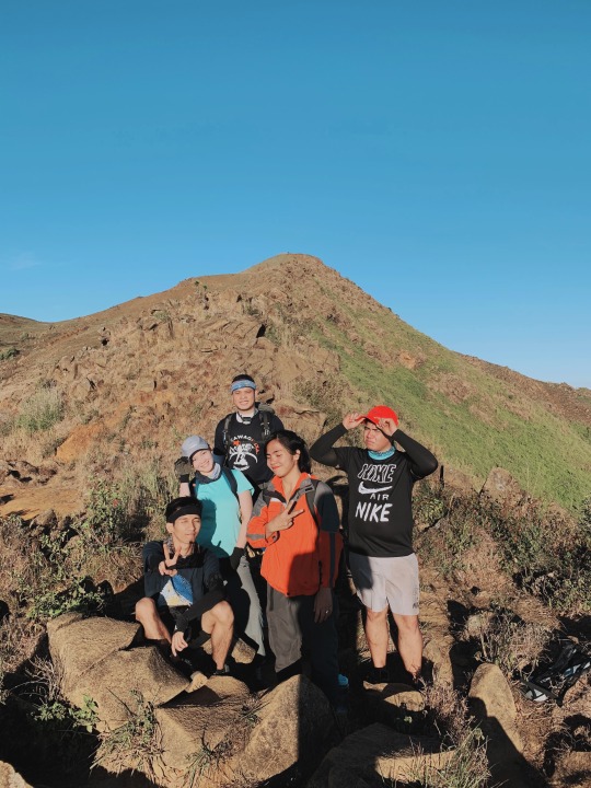
We took a group photo on the camp before doing the assault to the Mt. Balingkilat summit.

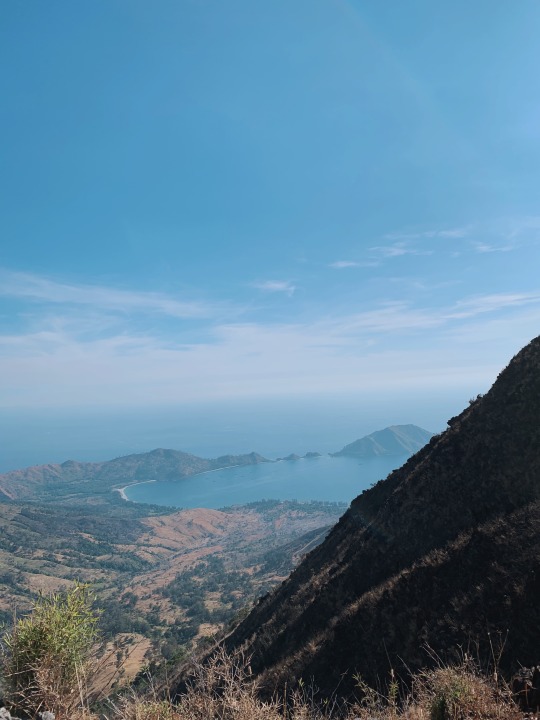
From the summit of Mt. Balingkilat we were rewarded with wonderful view of Nagsasa cove was stunning and we couldn’t resist getting pictures. We got a quick group picture before heading down the traverse trail to the next peaks.
Finally, after a long climb down a long rocky ridge, we got to the foot of Bira-bira peak.
We started to get really tired at navigating Bira-Bira and Naulaw peak. Having the nice views of the ocean tame us to start traverse-descent and just have a side-trip to the beach. But I don’t wanna disappoint myself in my first major hike. Some of us also decided not to finish hexalogy anymore and started traverse to Bira-Bira.

Here, I noticed that guideship here is not as good as in other mountains. Our guide would sometimes leave our group far behind and he wouldn’t really keep track of all the participants. All they would do is point you in the right direction and it’s up to you to follow.
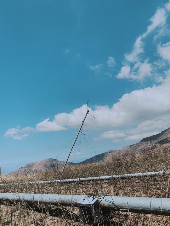
Mt. Bira-Bira has the lowest elevation among the mountains we scaled. Bira-bira peak and Naulaw peak marked by an antenna of some sort. To be honest I don’t think they’re really mountains as they look more like low ridges one had to traverse to get to Mt. Dayungan.
After some rolling trails, we reached the foot of Mt. Dayungan, the fourth peak. There’s river where the last water source is located so we also decided to have our lunch here. After a short nap, we woke up and continued the hike to the next major climb.
It was until that difficult moment when half of the team decided to stop and just go back because of the dehydrating weather condition There’s five people on the lead team who pushed thru with My. Dayungan, and four of us on the mid. While, the rest of our group decided to just skip Mt. Dayungan and go straight to the 5th and last mountain. Climbing Mt. Dayungan is quiet a big deal at this time because it is one of the three major ascents in this circuit, along with Mt. Balingkilat and Mt. Cinco Picos. It’s also the hottest part of the climb. With the perseverance of some of us despite the extreme heat we pushed forward to Mt. Dayungan.
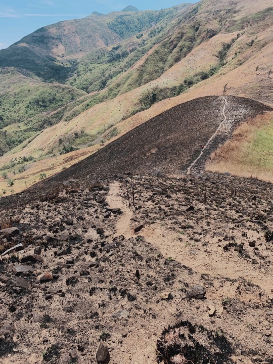
After escaping the trees of the water source, it was open trails all the way under the sun. The journey to Dayungan is indeed a hell-hike. The trail is burnt, no shades from trees, the air is dry, and I can really feel the heat reach underneath my skin.

We had no choice but to find little shade from small rocks for take 5′s.

We we’re moving so slow under the sweltering noontime heat. I had to stop for a moment with my eyes closed, just to tell myself to keep going and I can do it. As we kept going in spite of the intense heat, we climbed until we reached the top of the fourth peak.

The climb to Dayungan was steep, rocky, and dusty, but finally we reached the rocky summit. We enjoyed the amazing scenery of Silanguin and Anawangin coves while recovering energy. We descended carefully seeing the knife edges that we have to tackle as we head to the next mountain.

I told my friends that I will rush going down and try to catch up with the lead team so I went ahead and started trekking without any take-5′s. I said hi to them and just continued trekking so I can catch up with the lead team. Despite the heat, I managed to maintain a good pace and I still have energy.

I saw our sweep team on my way to Cinco Picos, but instead of resting, I continued to make my way down more ridges and valleys to catch up with the lead team, and gladly I did.
The sun set as we made our way through the last mountain, Mt. Redondo. I already ran out of water by the time we reached the 5th mountain. I realized that I don’t have a headlamp and I’m not sure if my powerbank flashlight could make it till we reach jump-off. So that means I need to stay close with the lead team to make sure I can share their lights.
I literally walked blind through the tall grasses but I still tried my best to walk faster, ignoring my scratches, in order to catch up with the lead team. My every step was only guided by shared lights from the headlamps of the hiker infront of me. We passed through several local houses until we reached the familiar jump-off.
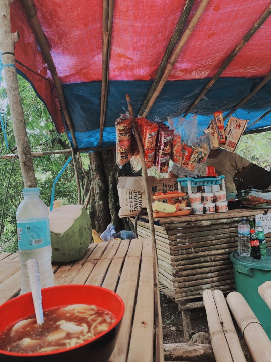
We were the first group to descend. While waiting for the rest of our team, I washed off and had some dinner with the rest of the lead. There’s only one carinderia that’s open and we’re lucky to be able to have dinner even with just few meals left. I need to advise anyone who wants to do Cawag Hexa to bring lots of food because there’s no stops or carinderias along the way. Once you leave the jumpoff, you have to be self-sufficient until you return.
I fell asleep all the way back to Manila. I didn’t have much energy left and the climb really drained me.
As my first major hike, this climb was really difficult for me. The endless descending and ascending ridges was tremendously long and draining. The lack of water sources was definitely an added challenge and it did help me get used to hiking with minimum hydration.
1 note
·
View note
Text
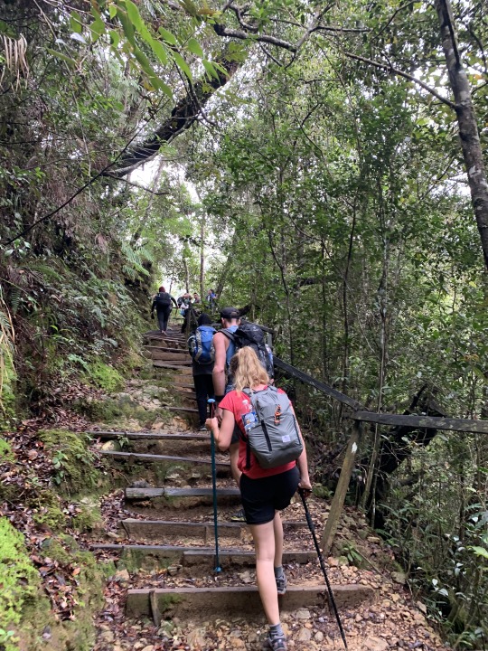
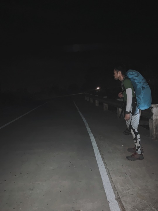
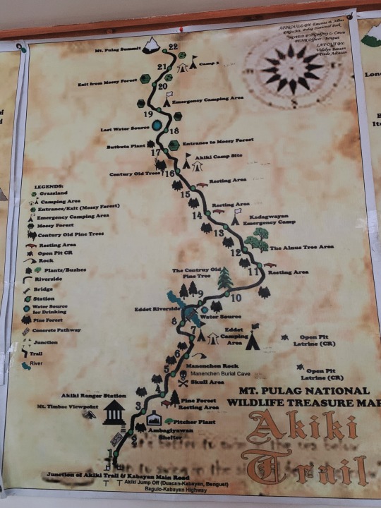
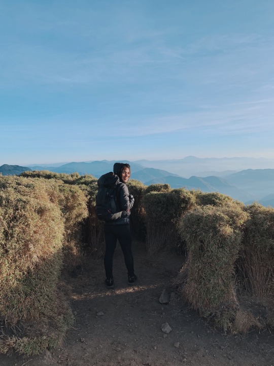
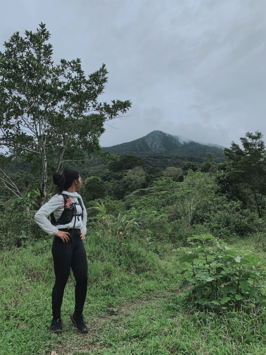
Climbing Luzon’s ceiling, Mt. Pulag via Akiki-Amba Trail
After my first major hike in Cawag Hexa, my friends invited me to finally go ahead and climb Luzon’s highest mountain, Mt. Pulag. More than that, they were so confident to advise to hike the mountain via the Akiki Trail.
It is known as the most difficult route to summit. Most tourists opt to climb Pulag through the Ambangeg Trail since it’s easier, and even considered as a minor climb. And as I wanted to challenge myself, I prepared myself to experience Luzon’s highest peak via the difficult route. The Akiki trail.
I went to Basekamp in Market! Market! to make sure that I have sufficient gears for this hike. Headlamp (because using just powerbank flashlight in Cawag was ridiculous), hiking bag, sleeping bag, water bladder, etc.

The store staff realized that I am a beginner since I’m just starting to collect necessary hiking gears. He asked me which Mt. Pulag trail am I gonna do, and he gave me such judgy look when I answered Akiki Trail. He said that the Akiki trail is composed mainly of steep ascents and painstaking assault. But that just made me more excited for my upcoming hike.
As usual, meet-up point is as Greenfields, Cubao. After long-drive from Manila, we took a topload jeepney from the local barangay where we had our physical examination and orientation.
From there, we road the monster jeepney again going to Akiki Ranger Station for the arrangement of guide assignment and optional porter designation.

Out of curiosity, I weighed my bag and it’s 10kilograms. Some of the other hikers hired a porter for PHP500/kilo. I was thinking of getting a porter as well but I felt like I need to experience greater challenge of hiking with heavy loads.
After all the final preparations, porter assignment and guide designation, we started initial trek at 11:30 AM.

We reached the dirt road after the strenuous and continuous assault. The group paused for a while on the waiting shed. This is where I asked our organizer if I can keep going and go on the same pacing with the porter ahead of us, and she allowed me to do so.

When I reached the Eddet River Campsite (Camp 1 - Akiki Trail), I took the opportunity to chat with the porter. He told me he’s carrying 30kilograms sack of baggage. There’s also water source at Eddet River Campsite but I still have enough so I didn’t have to refill. After resting for about 10 mins, I resumed trekking and crossed the bridge along Eddet River.
A steep ascent with sudden elevation gain follows after crossing the bridge along Eddet River. The trail is covered with pine-trees a.k.a twilight kind of scenery.
Akiki Trail Rhino Photo spot, in the midst of Twilight zone. This steep ascent to the Marlboro Campsite is also where fatigue usually starts to be a factor. It is not uncommon for hikers to suffer cramps in this part of the trail. I just slowed down a little bit and ate some of my trail food.

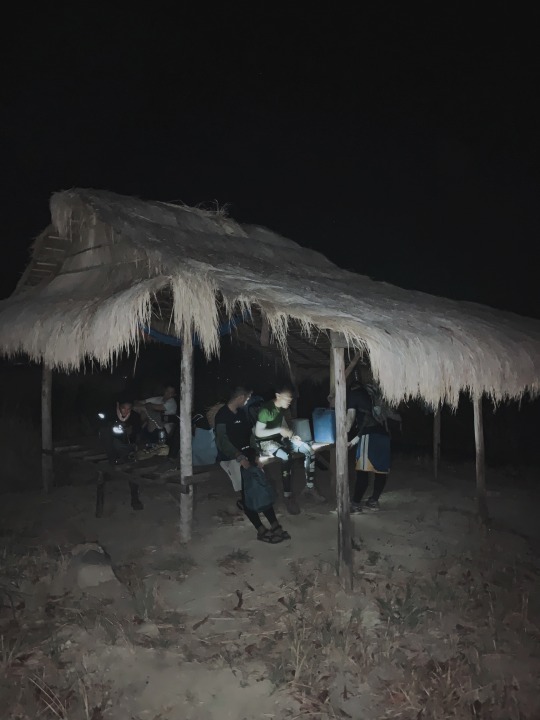
At 4:30 PM, I reached the Akiki Camp Site. That’s around three and a half hour of trekking from the Ranger Station. So good to have enough time to rest while waiting for the rest of our group but since I’m alone, I’m not very comfortable with the attention I’m getting from my friends here, lol cute cows. I took a nap while waiting, not minding the fog that just started to creep in around the surroundings.
Since we need to wake up around 2AM the next day, I already took a rest after dinner at 11:PM. The next day, we packed up around 2AM, had breakfast, and continued our journey towards the summit.
Since I was on the lead, I usually get confused which trail should I follow. I just continued despite of so much cold. I was basically navigating the steep trail amidst the cold mossy forest by myself.

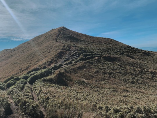
As I reach the grassland, I can already see the horizon ahead. Walking on thin air slowed me down but I pushed myself to walk and ran faster in the midst of dark mossy forest and frozen grassland. I thought that what I was looking at is already the summit but it’s just the junior pulag. And actually, I have barely scratched the distance that we aimed to cover being on an overnight hike.

After the final ascent, and trekking for more than three hours the day before, and another three hours from the camp, I finally reached Luzon’s highest mountain at 5:25 AM.

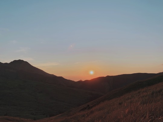
Since I arrived on the summit earlier than the rest of my team, I took my time to savor the beautiful sunrise and enjoy the scenery. I had to spent an extended time at the summit and took the opportunity to chat with other hikers and watch the sky change its color.

After waiting for two hours, my team arrived at 8:30AM.
Started descent from summit 8:10 AM and navigated the rolling hills of ambangeg trail. I’m glad the Ambangeg trail is relatively easy and I was able to hop and run along the trail.
I reached the Akiki Ranger Station at 10AM. The descent only took me approximately two hours as we took the easy route down.
T’was indeed a strenuous climb but I’m glad that my hexa hike prep me for this. Nonetheless, the chilling trail from the cold breeze, and freezing temperature gave me waaaay different experience than that of hell-hike cawag die-hike. I am thankful to see Mt. Pulag in different sceneries and level of difficulty by going up through the difficult route and descent via easy way down.
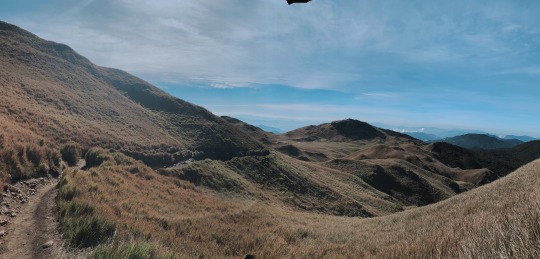
Mt. Pulag, you are truly the playground of Gods and it’s definitely magical to experience being with you.
2 notes
·
View notes
Text
Sta. Ines Trilogy, Time-Pressure DayHike
The hike where one’s hiking pacing is challenged. Hiking the mountains themselves is possible, but completing the trilogy in a day means minimal take-5′s and maximum perseverance.
Let me share my experience doing the Sta. Ines Trilogy, climbing Mt. Irid at 1467+MASL, Mt. Tukduang Banoi at 1258+MASL, and Mt. Masarat at 789+MASL.

From Cubao, we took a jeepney going to Antipolo, then we transferred to a monster jeepney (one that can pass through rivers and rocky roads) to Sta. Ines. We arrived at Sta. Ines around 3AM. The barangay officials told us that faster pacing is required if we really wanted to complete the trilogy, since we will not be allowed to hike Mt. Masarat (3rd mountain) later than 4:00PM.
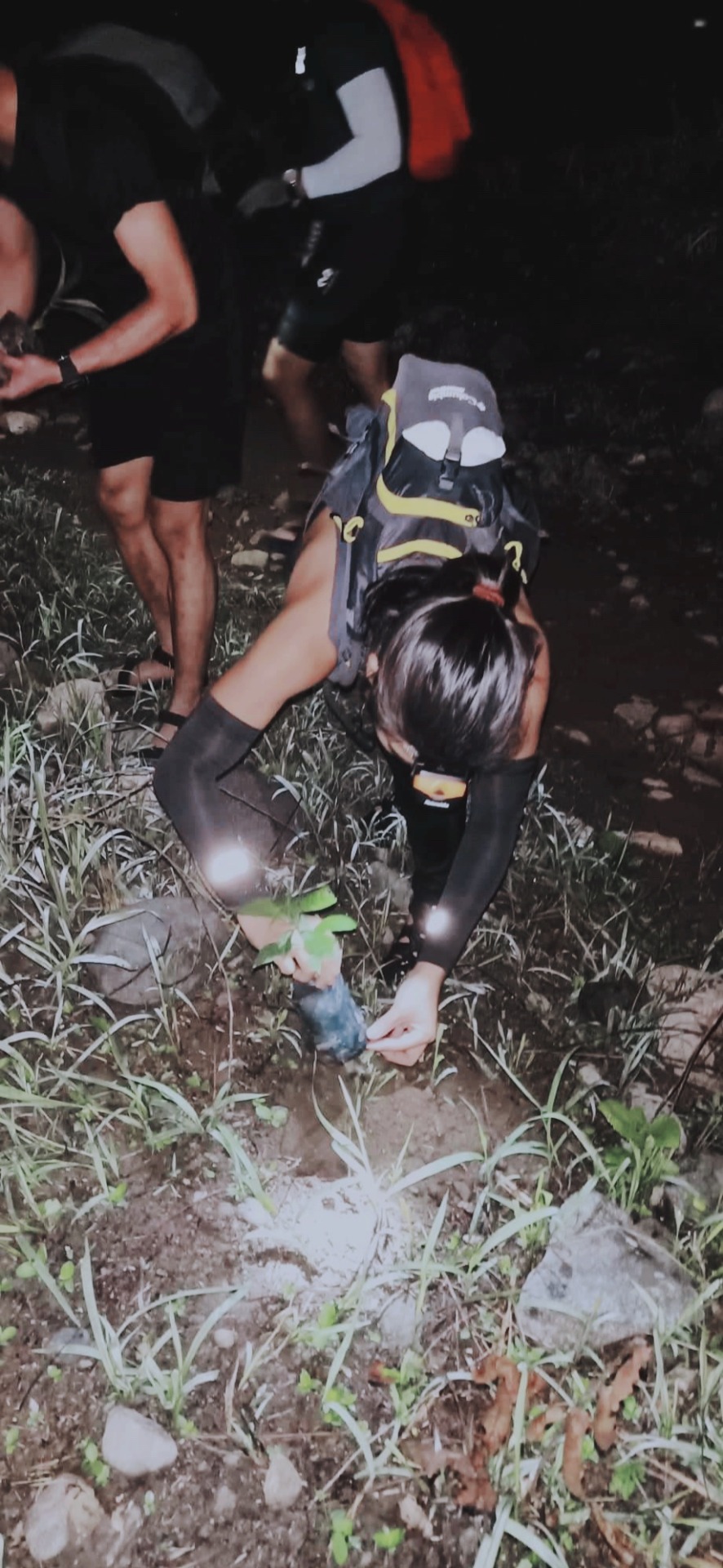
After registration and briefings, 12 hikers in our group started trekking. We had to bring one seedling each to plant along the trail.

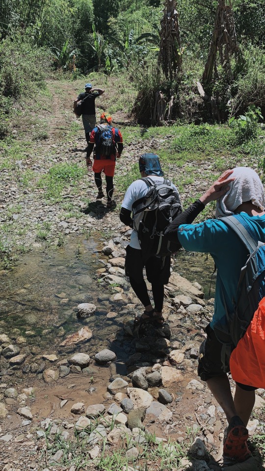
After 3 hours of mild ascent and 9 river crossings, we reached Sitio Sadlac at 6:00 AM, the foot of the first mountain, Mt. Irid. Past Sitio Sadlac is where the real hike begins.
Looking at Mt. Irid’s summit from the foot of the mountain.
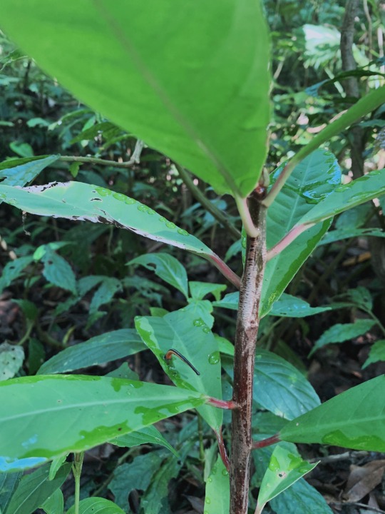
Nobody’s safe from these cutie limatiks (blood-sucking leeches) of Tanay mountains.

Some interesting wildlife we’ve found.

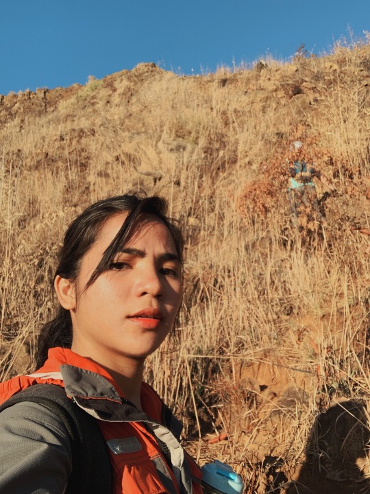
Reckless Reyes at the summit of Mt. Irid at 1467+MASL, the highest peak of Sierra Madre mountain range!
Us, the lead team, reached the summit at 9:08AM. We waited for the rest of the group but we insisted to start descent at 9:30 so we can successfully do the trilogy.
Reached Sitio Sadlac at 11:00AM. I had quick lunch and left with the guide 11:30 to start trekking onto the next mountain, Mt. Tukduang Banoi. Our coordinator gave us a head up that it’s more difficult than Irid: steep assault, straight-hours assault without any recovery trail. At this point, out of 12 Trilogy hikers, only three of us decided to push through.
After crossing one river, we reached the initial trail to Banoi, which is a grassland reminded of Mt. Pulag Akiki Trail. Due to dry air, extreme heat, and steep assault, the two hikers decided to just go back to Sitio Sadlac.

At this point, I am alone with our guide trekking to Banoi. We also found a snake along the trail and he explained to me the different snakes you can find in the mountains of Tanay Rizal and how to deal with them.
Indeed, Mt. Tukduang Banoi is a greater challenge given its forested, rocky, and mossy ascent. I was extremely cautious but I still slipped and fell a lot of times. For each step, I had to watch for large rocks that may not be stable. I had to be extra certain that the roots and branches I’m holding on to aren’t broken.

The entire trail is not properly maintained, no handrails made of bamboo/branches or anything similar that you can find on other well-known mountains.

Me at the summit of Mt. Tukduang Banoi, at 1:29PM. From the summit, I can see Mt. Irid, where I came from. Two mountains down, one more to go. The guide told me that we did it fast and reassured that with my pacing, I can complete the trilogy.
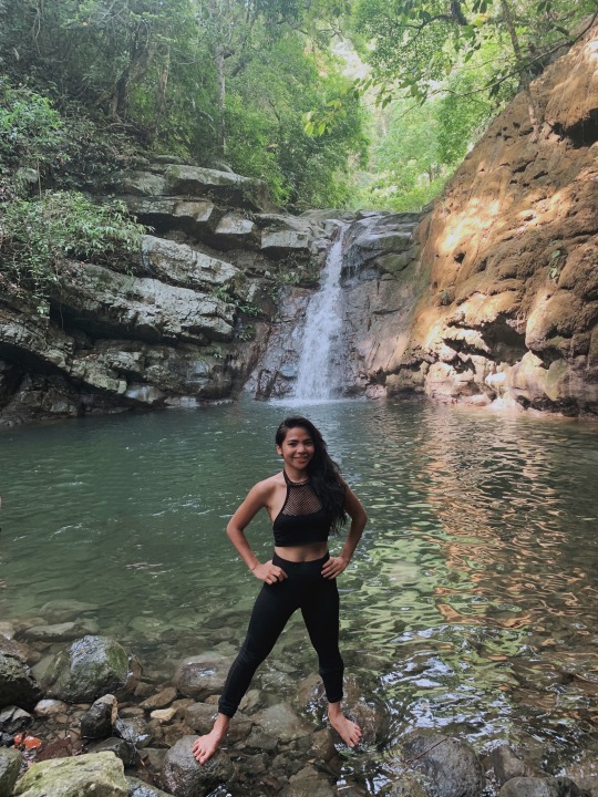
Before going to the last mountain of Sta. Ines Trilogy, I had a 15-minute break at Kinabuan falls.

Sir Aleks and Sir Jeric - the two gentlemen I was with on the initial trail to Tukduan Banoi, decided to go with me in climbing Mt. Masarat while the rest of our group are chilling on Kinabuan Falls. The mountain remains militarised, and other mountains nearby are also closed due to ‘encounters’.

It started raining few minutes on our way to the summit. We had to descent from Masarat quickly before it gets dark because the army in-charge of Masarat of other mountains nearby might mistaken us as NPA rebels and shoot us with a sniper or something when they see lights (from our headlamps).

Mt. Masarat at 5:08PM. And yes, I did it. I completed Sta. Ines Trilogy. Out of 12 participants of Trilogy, I am thankful to be able to climb Mt. Irid, Mt. Tukduan Banoi, and Mt. Masarat.
1 note
·
View note
Text
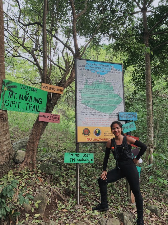
Mt. Makiling Traverse (MakTrav)
I experienced Mt. Makiling, more than just reading the legend of the beautiful maiden Makiling, but the mountain itself.


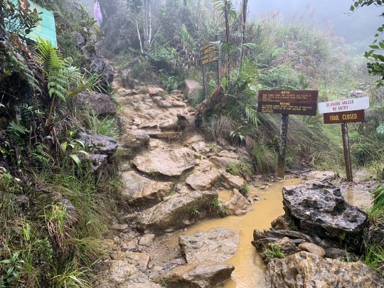
Mt. Makiling’s trail starts rom Sto. Tomas Batangas and ends in UPLB College of Forestry, Los Banos, Laguna. I learned that there were originally two trails – Palanggana and Sipit – but since Palanggana Trail is already closed, we opted for Sipit Trail.
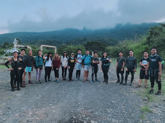
This is our group photo when we left the jump off at 5:30AM with foggy view of Mt. Makiling on the background.
I was also warned that the entire trail is plentiful of blood-sucking leeches called limatik. I had to put citronella lotion all over my body and sprayed citronella on my clothes to avoid them.
The initial trail was flat terrain. We reached the first and last water source at Station 2, this was early on in the hike so we didn’t really need to refill yet.
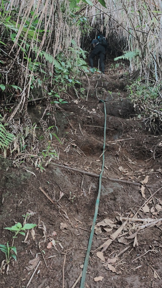
From Station 9, the trail turned into a strenuous assault.

Mt. Makiling’s rainforest is obviously well-preserved. t was very very green and the slopes looked like they were covered in broccoli.

The abrupt ascent along Melkas Ridge is prolly one of the most challenging part of the hike.

Beautiful mossy forest of Makiling.
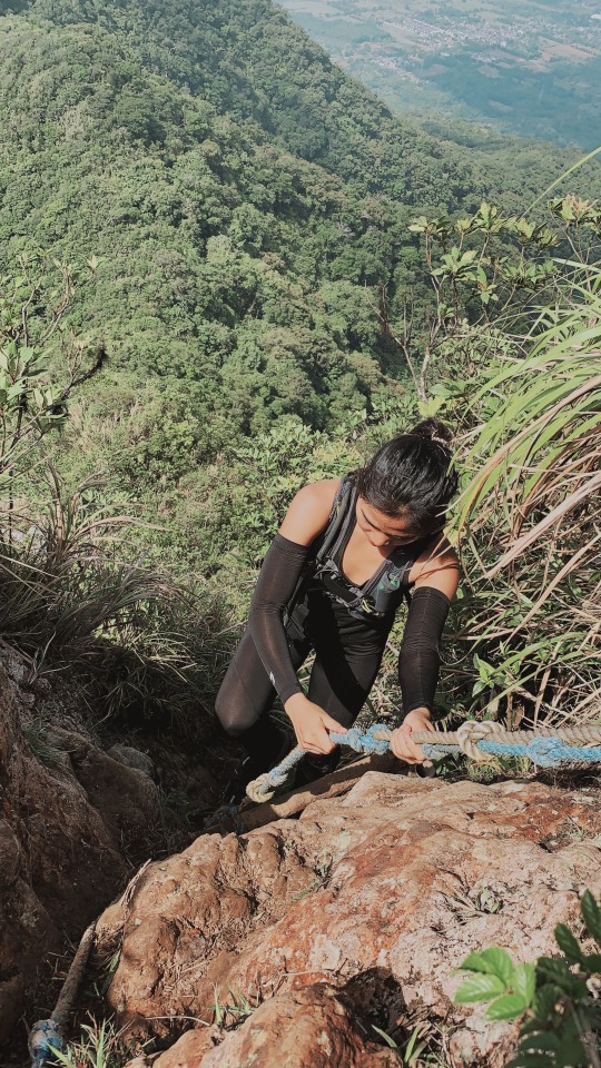
Rope sections. There were parts where rope-climbing was required. And sometimes, we’re left with no choice but to also hold on to pull ourselves up on the rocky surface. We did some body contortions and crawling under huge tree roots.
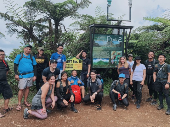
After the obstacle course kind of hike, we finally reached Peak 2 (1090 MASL) – the summit of Mt. Makiling at exactly 10:00 AM.
Reading about Mariang Makiling and seeing the mountain in books weren’t enough. I needed to be there, and I did.
I wanted to take a nap but it was too sunny on the summit. We waited for the sweep team while having our lunch and started descent at 11:30AM.

Descent was relatively faster even if it was muddy and slippery. I could still jump, run, and hop off between big rocks and huge branches of trees. We we’re lucky that it didn’t rain or else going down can be very difficult.
After an hour of descent from the summit, we reached Agila Base at 12:30 near the foot of the mountain. We had snacks and fresh buko juice from local sari-sari store.

You still have to walk on the cemented road from Station 11 to 1. Taking habal-habal/motorcyle is also an option for those who do not want to walk 7-km cemented road from Agila Base to UPLB registation point. We reached the latter at exactly 3PM.
I believe that every mountain is different. Mt. Makiling, for me, is neither easy nor difficult hike. Though I really got paranoid with the limatiks.

It was also my first time to bring a beginner to a major hike. I was hesitant at first because self-sustenance is a priority every major hike but I’m glad that this lad really took effort to get out of his comfort zone to see, and experience what’s behind nice photos every after hike.

With or without the legend of Maria Makiling, I hope that everyone, not just mountaineers, do their part in preservation of our forests.
0 notes
Text
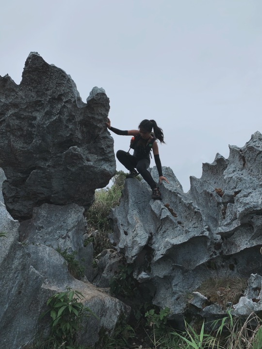
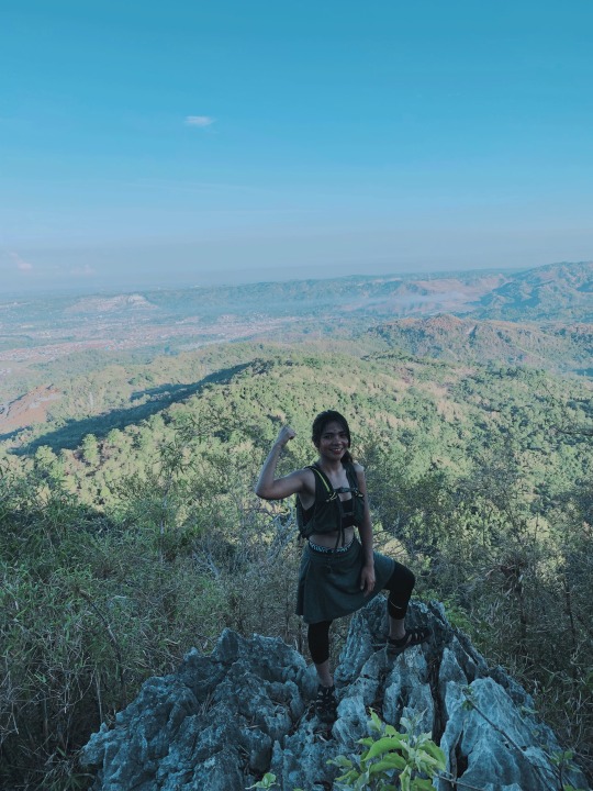
Reckless Reyes, Mascap Twin-hike edition
LOOK: This monolith is just two-hours away from Manila! The best part is, it’s just a minor hike!

I haven’t had minor hikes lately but to condition myself for my next major hike I decided to settle on a minor hike closer to home.
I opted to do a twin-hike this time since the trails in Montalban are relatively short and easy than ones I’ve already tried.

We left Brgy. Mascap jump-off around 5AM. The ascent started with a short trek on a cement road with a bit steep inclination. Muddy trail from yesterday’s rainfall welcomed us on the next stage of the hike.

Even though I was wearing Keen water shoes, three-inches of accumulated mud made each step heavier, and eliminated any traction.

Pointing to Espadang Bato as seen from the foot of the mountain.

We passed though a farm with ducks, native pigs, and dogs. There are also parts of the trail full of bamboos and banana trees.
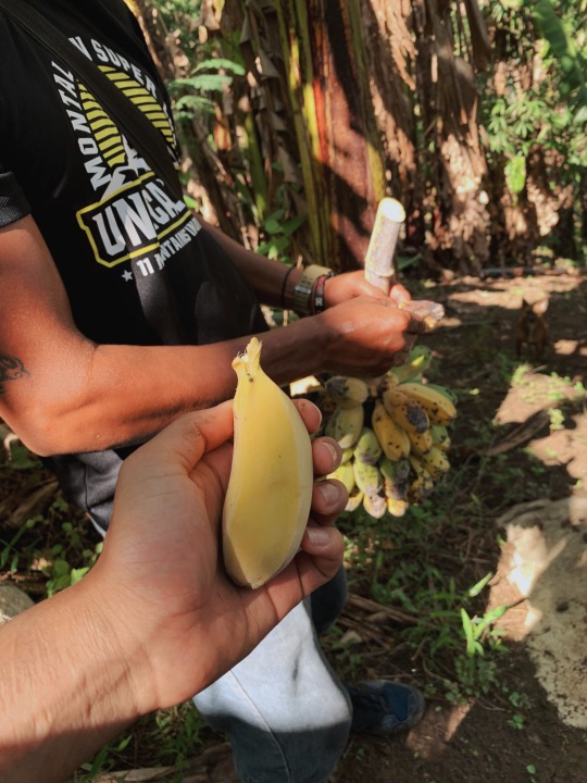
A local farmer even gave us a bunch of bananas for free.
Fun with animals and free bananas were not preparation for the difficult part of the trail; rock fragments with size greater than 25.6 centimetres.

I started to feel the fatigue on my knees as the trail became steeper. Boulders required me to take big steps, my knees almost hugging my chest. Surviving the trail is impossible without scrambling!
On the summit. The Espadang Bato summit’s rock formation is definitely not for someone who’s afraid of heights. It looks dangerous and it really is! There’s nothing to hold on to but small and sharp knife-edges of the rock. That makes it obvious why this mountain is called Espadang Bato, the rock formation on the summit looks like and is as sharp as a big sword.
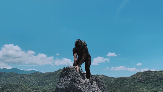
So how I did climb up there? Just my bare hands and sense-of-balance, making sure I don’t put weight on rock edges without making sure that the sharp outcrop is stable.
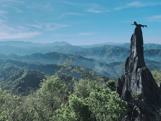
The guide snapped the photos, suggesting nerve-wracking poses. I even fell asleep as hikers did their photo-ops. A big salute to our guide for putting up with the sun!

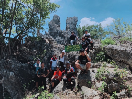
After photo-ops, we had to back trail to the farm house to rest before going to Mt. Sipit Ulang.

It only took us about an hour to reach the summit of Sipit Ulang. Like Espadang Bato, the trail and the summit itself are jampacked with numerous sharp rocks.

I recommend Mt. Espadang Bato and Mt. Sipit Ulang for those who are up for thrilling adventure without putting up with a 22-hours hike. It only took us two-hours to hike Mt. Espadang Bato from jump-off, and an hour from the farmhouse to Sipit-Ulang.
Right on the doorstep of Manila, the rocky mountains of Montalban Rizal can really challenge beginners and even experienced hikers to overcome their fear of heights.
I wanna thank all these amazing peeps I met during this hike. Thank for sharing your food and water with me haha since I’m only using my running bag! See you on my next hike.
0 notes
Text
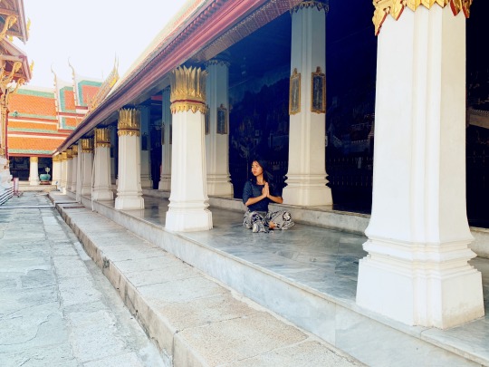
The Royal Grand Palace
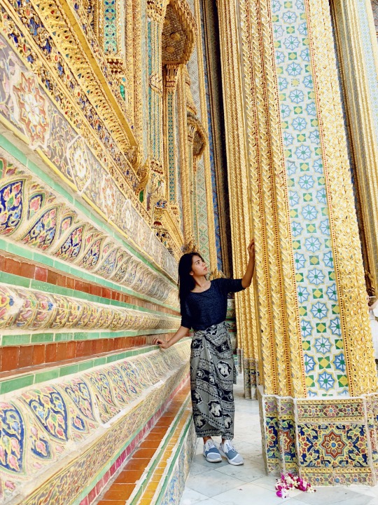
Roamed around the palace complex and saw several impressive buildings including Wat Phra Kaew (Temple of the Emerald Buddha), which contains the small, very famous and greatly revered Emerald Buddha from 14th century.
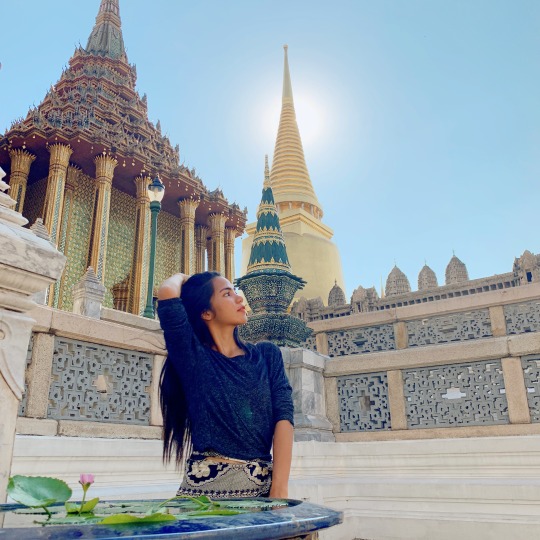
By the King's royal command, the palace was built to serve not only as his residence but also as the site of administrative offices.
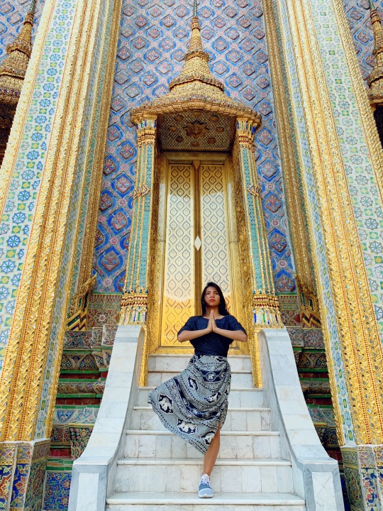
**I almost got a free admission (could've saved THB500) when the officer asked me to enter through the special lane for Thai people. Lol, I think should wear Philippine shirt bc everyone automatically assumes that I'm Thai.
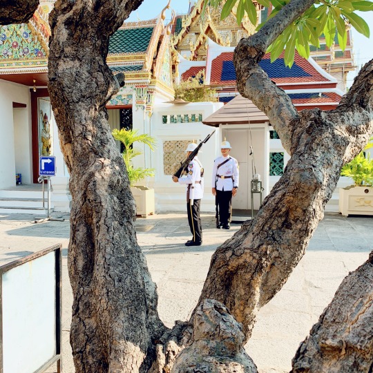
Royal Guards
0 notes
Text
Nalayag Monolith
Determination fueled by more than just photo-ops but adventure.
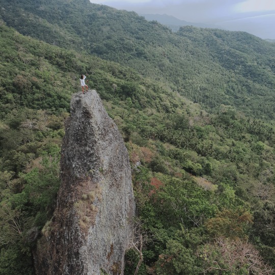
This photo was taken at Nalayag Monolith, at Sitio Punas Lobo, Batangas.
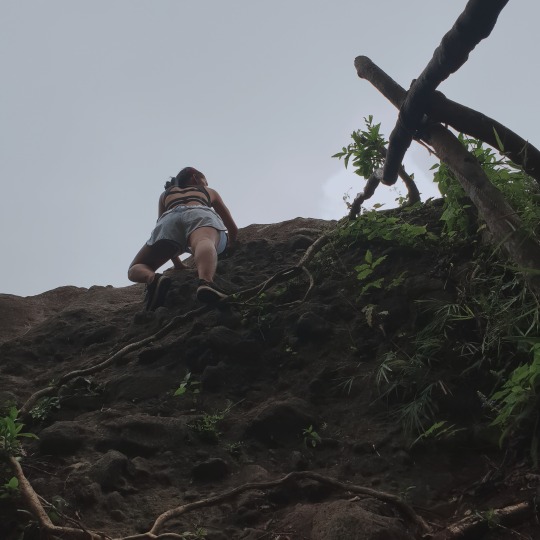
With an Elevation of 550+masl, and Salakot Peak at 650+masl, it took me around 5 hours to climb the peak. Though it’s just a minor climb, I still had to go through dangerous rock climbing.

Trail classes include rough rough road, river bank, woodland, farmland, and forest.
1 note
·
View note