
Last Seen Blogs

rihrihality
Rihology

hooked-on-fandom
Hooked on Fandom

eumesmacat
Uma Extraterrestre

l30blogs-blog
LOVE

tissueregeneration
Tissue Regeneration
Text
Part 2 of BDRRM Kwentuhan (Pictures)
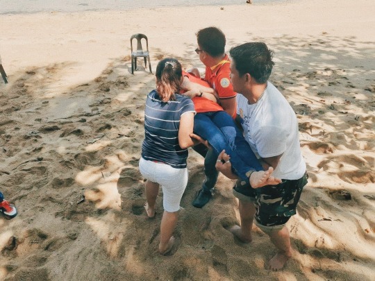
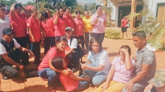


P.S These pictures are actually sent to me personaly by the Barangay Secretary. ☺️💖
0 notes
Text
How ready is your Barangay?
DRRM Kwentuhan
Hazard
A hazard is a process, phenomenon or human activity that may cause loss of life, injury or other health impacts, property damage, social and economic disruption or environmental degradation. Hazards may be natural, anthropogenic or socionatural in origin (UNISDR, 2016).
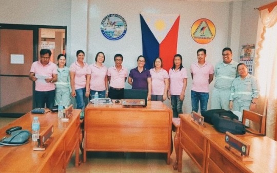
In a small barangay of Hayanggabon, Claver, Surigao Del Norte, where I conducted my interview with the Chairman of their BDRRM (Barangay Disaster Risk Reduction Management) which is also the Barangay Captain, Mrs. Tresa Placencia, I was able to learn the preparations and how ready the barangay is in times of calamities and disasters.
Barangay Hayanggabon is consist of 9 Puroks (wards), which are Purok 1 Seaside, Purok 1 Hillside, and Puroks 2-8 with the total population of 3,497. The Barangay is an area surrounded by oceans and Hills so therefore it is really at a high-risk when natural disaster occurs. The Barangay faces a lot of hazards or calamities such as typhoons that happens twice or trice a year, earthquakes that happens frequently, landslides during typhoons and heavy rains, floods and even forest fires, happened in years 2004 and 2009 as mentioned by the Barangay Captain.
During disasters such as typhoon, storm surge and tsunami, the most affected areas of the barangay is the coastal residence, especially puroks 1 seaside, 2, 3 and 4 because these puroks are near the ocean and the houses around these areas are made up of light materials, so the BDRRM really focuses around the mentioned areas for the safety of people. But the question is, how ready are they in times of calamities? According to Brgy. Capt. Tresa Placencia, the Barangay has 22 Million budget in a year and 5% of it is allocated for Calamity Funds or DRRM Funds. They used the budget to build an evacuation center with a complete DRR Emergency Supplies, Medical Supplies and evacuation center supplies and materials for the safety of everyone and also a capability building or training seminars on mainstreaming disaster risk reduction and mangament. The Barangay has a 5 year plan. They conducted a survey to identify the areas that is prone to typhoon, storm surge and tsunami for them to identify also the people that needs to evacuate in case of emergency, series of meetings to the BDRRM Council to make plans and preparations before, during and after the disaster, series of meetings for the officials of every purok such as the Information Education Campain (IEC) to implement preventive evacuation to avoid loss of lives, especially the elderlies, children and the disabled ones. They also have evacuation route map provided in every purok in case of calamities and programs such as Food For Work Program and Livelihood Programs.
Above all, how would they know if disaster is approaching them? Aside from watching the daily weather forecast for the weather, locals believed in the so called myths that a heavy rain, storm surge or typhoon is coming if the moon becomes brighter than usual or the halo is really visible and if there's only few stars at night. Another thing is that, whenever the animals are starting to act strange, there might be an earthquake coming. Whether it's true or not, locals are fully aware of their roles and the things that they must do or not to do in times of calamities, because the BDRRM Council with the help of Barangay Tanods and Barangay Health Center Workers are really hands-on towards the safety of everyone in Barangay.
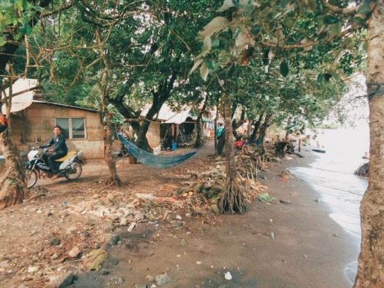
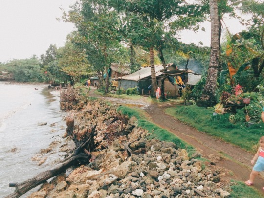
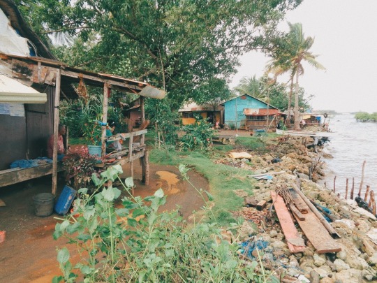
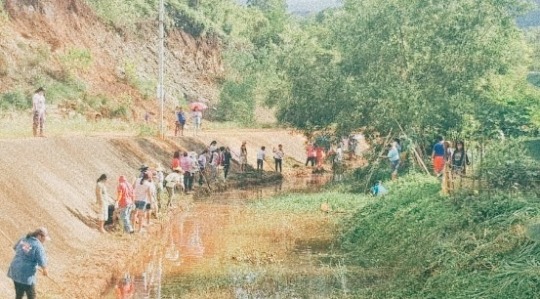
These pictures are the parts of barangay that experiences a huge damage in times of calamities since it is near the ocean, the waves sometimes reach the households and there's a possibility that it might get destroy since most of the houses are made up of light materials. The problem is, even though the people experiences such danger, the still continue to live in such places because of poverty.
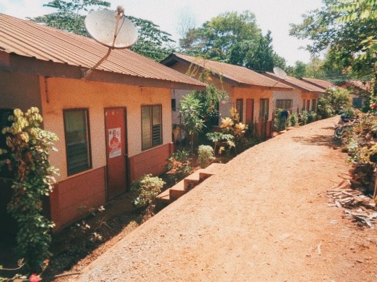
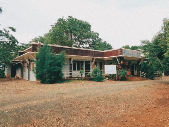
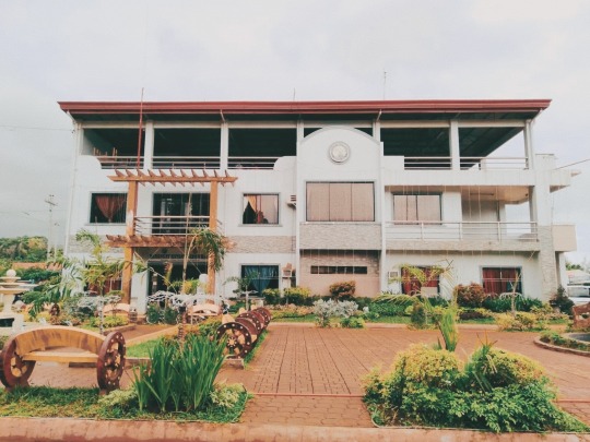
On the other side, these pictures are the safest part of the barangay, which is the Housing Project of the barangay council. It is located at the "PATAG" part of the barangay and the houses are build with strong materials. And aside from that, the evacuation center is also located around the area so it is more accessible and beneficial for the people that lives in this part of barangay.
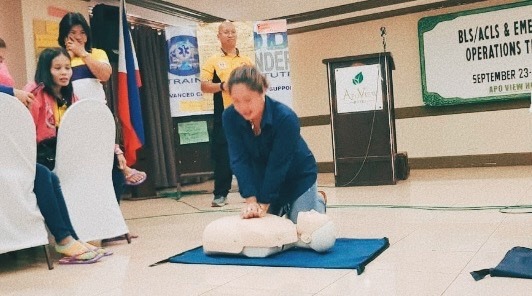
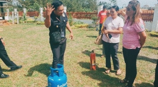
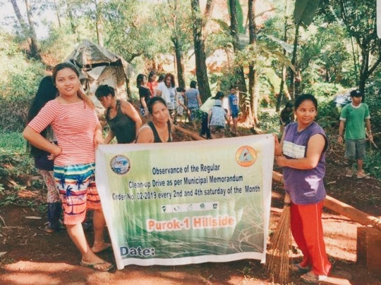
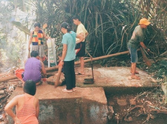
We can't stop the calamities and such danger from arising but we can prevent our self or someone from getting hurt. As for Baranggay Hayanggabon, they are confident that they can survive any calamities without getting hurt because they've great practices like; Clean-Up Drive every 2nd and 4th Saturday of the Month, they also provide DRRM Trainings like the Basic Life Support Training and seminars for the Barangay tanods, officials and purok officers in case of emergency, conducted an Earthquake and Fire drills and last but not the least they have the best medical team lead by Dr. Chrismar Mocorro, they provide health services such as Vaccines, regular check-ups for the senior citizens and providing people with medicines.
As a Filipino, we have experienced a lot of disasters, and by conducting my interview, I have realized that we should take very seriously the activities such as earthquake and fire drills because it is only for our safety. I believe that the government did its very best to protect us and we should also cooperate with them.
2 notes
·
View notes