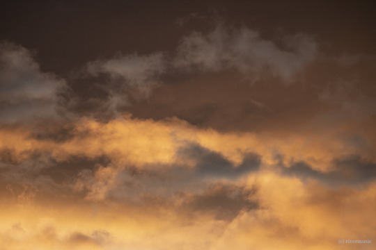
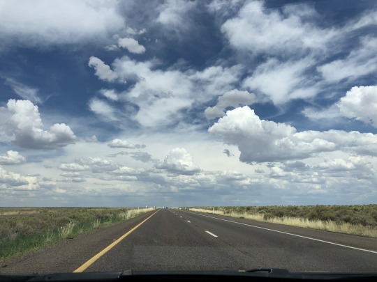
#cumulonimbus. altocumulus. hazy cirrus.
Text
Nephelomancy
or Nephomancy - Divination by Clouds
Telling the past, determining the present, and foretelling the future by reading the clouds. Shape, Color, Direction, Formation, and Location all go into a cloud reading.
First, let's learn a little bit about the history of Nephelomancy.
For ages, mankind has looked to something bigger than themselves for guidance. Beings they could not see, but only dream of. Aside from the Sun, the Moon, and the Stars; the clouds are another heavenly entity which seem to send messages. Dark, thick, angry clouds... white, fluffy, happy clouds.. free and fanciful wisps.. They flow and grow as though controlled by a higher being.
Early civilizations would pray, pour libations, and hold various kinds of sacrifices in hopes of calming or pleasing whatever gods may be watching over them. They would do this for rain to quench the fields, to keep meteorological disasters from happening, or for some kind of sign for guidance.
Closely related and a more broad term, Aeromancy (divination through atmospheric conditions), was first mentioned as a form of science, rather than as divination. It was mentioned in Deuteronomy 18 as being condemned by Moses. Albertus Manus also condemned it, as he believed it was related to necromancy. It was also one of the seven "Forbidden Arts" in Renaissance times (along with geomancy, hydromancy, necromancy, osteomancy, palmistry, and pyromancy.)
In the Greek commedy "The Clouds" by Aristophanes, Socrates declares to Strepsiades the clouds as the only true deities, that only they should be paid homage to. In this play, the clouds would change shape to reveal the true nature of those gazing upon them.
Next, we'll learn about the forms of clouds.
We have a lot to thank modern meteorology for, in understanding and classifying the varying shapes and forms of clouds. Here, however, we'll go over the ten basic types of clouds, as there are more than 100 classifications.. but they fit pretty neatly into ten basic types, which can be categorized by the various altitudes in which they lie.
Low-Level Clouds (below 6,500ft) - Cumulus, Stratus, Stratocumulus
Middle Clouds (between 6,500 and 20,000ft) - Altocumulus, Nimbostratus, Altostratus
High-Level Clouds (above 20,000ft) - Cirrus, Cirrocumulus, Cirrostratus
Cumulonimbus clouds go across all altitude levels.
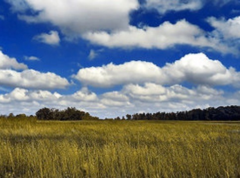
Cumulus clouds are flat and a little dark on the bottom, with light puffy tops. You see these from late morning to early evening when the day is clear and the sun warms the ground.
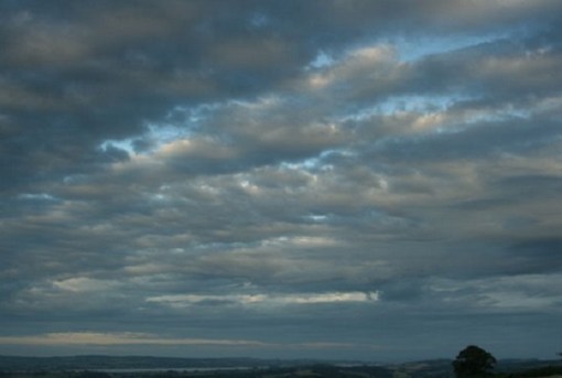
Stratus clouds are gray, hazy, and a uniform layer (think of fog, but in the sky.) You'll see these on overcast days, usually accompanied with a light rain.
Stratocumulus clouds are a nice mix of their namesake. They occur in big, honeycomb style patches on mostly cloudy days.
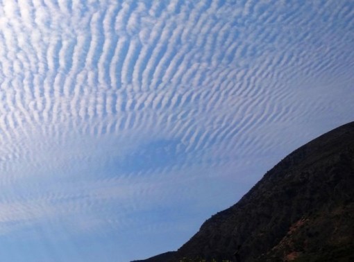
Altocumulus clouds are similar to Stratocumulus, but are higher altitude, smaller, and more round. You see these on warm, humid, summer mornings (signaling rain later in the day,) or ahead of cold fronts.
Nimbostratus clouds are -the- rain cloud. They're dark, thick, and extend from the lower to mid-level altitudes. You see these when it is going to, or when it is raining or snowing.
Altostratus clouds are gray, or bluish-gray hazy clouds which mostly cover the mid-levels. You can still see the sun through them, but there are no shadows. You'll see these ahead of any weather front coming through.
Cirrus clouds are light, wispy, curls of white, and made of ice crystals (high-altitude, cold, water vapor.. favorable for forming ice.) These occur on nice, fair-weather days, or ahead of warm front and large-scale storms. A sailor's provers states "Mares’ tails (cirrus) and mackerel scales (altocumulus) make lofty ships to carry low sails."
Cirrocumulus clouds are similar to altocumulus, but much smaller, organized into rows, made of ice crystals, and found at a much higher altitude. They're rare, have a short life, but can be seen on cold, fair weather days.
Cirrostratus clouds are nearly transparent and cover or veil almost the whole sky. A dead giveaway to identifying them would be when you see a halo around the sun. These are seen on warmer days when there is either a lot of moisture in the atmosphere, or ahead of a warm front.
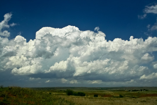
Cumulonimbus clouds are huge. These storm-producing clouds grow from cumulus and stretch across all altitudes. The tops of these clouds often flatten and plume out like an anvil.
Finally, let's learn the how.
Divining with clouds is truly more involved with intuition. It takes time and also requires more of an open mind. It's better when you're not out looking for specific shapes. It can either tell you more about yourself, or generalize occurances coming to you.
Some shapes to consider --
Angels or Felines - listen to your intuition.
Buildings - symbolize how you see yourself. Bigger buildings are confident, smaller buildings, not so much.
Crocodiles or Snakes - danger or deceit.
Circles - feeling complete or marriage ahead.
Deer, Moose, Reindeer - be more assertive. Take control.
There is by no means a definitive list of shapes. It truly is personal to you and your own history and beliefs. Signs that are personal to you. For example, a small bird shape could represent one person's family member watching over them, while to another, it means innocence or wishful thinking.
Back to the 10 Basic Shapes, they could symbolize the following..
Cumulus - naivety, childishness, innocence, joy
Stratus - secrets, hidden motives, a snake in the grass
Stratocumulus - strength, courage, wisdom, protection
Altocumulus - comfort, a safety blanket
Nimbostratus - power, abundance, influence
Altostratus - stability, prosperity, cohesiveness
Cirrus - freedom, adventure, loose ties, vacation
Cirrocumulus - dreams, sowing seeds for the future, intuition
Cirrostratus - beginnings, renewal, inner calling
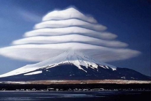
Cumulonimbus - turmoil, growing pains, change, difficult times
The Direction in which the clouds move can have meaning. Associate these with the characteristics of the elements we associate with each cardinal direction.
North - Air - Adaptability, Emotions, Charm, Fluidity, Creativity
East - Earth - Force, Inspiration, Trust, Love, Sincerity
South - Fire - Energy, Growth, Strength, Health, Loyalty
West - Water - Fertility, Solidity, Energy, Persistence, Confidence
How quickly or dramatically a shape forms and disappears can affect the meaning, such as something resolving or happening sooner or later. If a cloud splits, or example, it could mean more than one possible outcome. Alternatively, if shapes combine, cross paths, or are closer/farther apart, they can impact each other's meanings. The cloud's location in the atmosphere can be relative to the likelyhood of something happening (closer, lower altitude, more likely... farther, higher altitude, less likely.)
Keep in mind that meanings can alter, pending context, personal feelings and intuition.
image credit riverwindphotography.tumblr.com
114 notes
·
View notes
Text
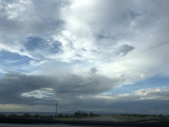
Master Class: Clouds and Storm Structure

This little master class came about as a reply to @jocarthage and the Roswell research methods tag. And because I fucking love weather. Give me any excuse to talk about weather, and this is what you end up with. So, let’s begin!
Clouds:
A very basic rundown of clouds are as follows:

(Source: Cloud Types | UCAR Center for Science Education)
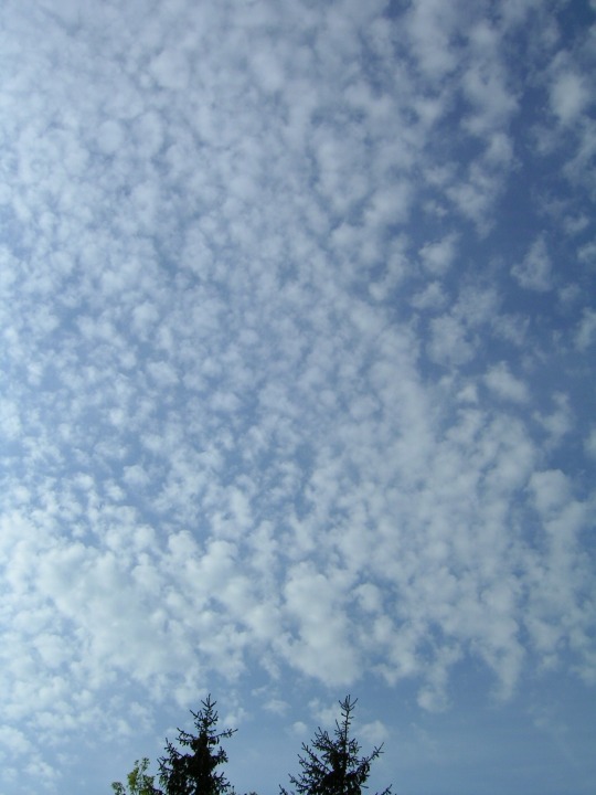
Stratus, cumulus, and stratocumulus are your low level clouds.
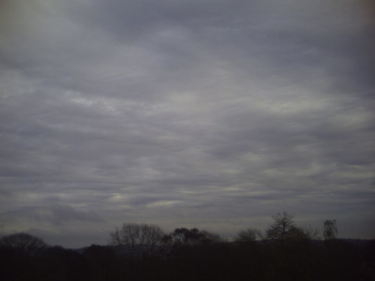
Stratus clouds are low-level clouds characterized by horizontal layering with a uniform base. More specifically, the term stratus is used to describe flat, hazy, featureless clouds of low altitude varying in color from dark gray to nearly white.

This is probably the best example of stratus clouds based on @jocarthage‘s photos.
Cumulus are cumuliform clouds with little vertical extent, common in the summer, that are often referred to as "fair weather cumulus".
A photo from my personal collection. This budding cumulus cloud went on to spawn a tornado about an hour later, but I’ll get to that when I start talking about storm structure.
A stratocumulus cloud belongs to a genus-type of clouds characterized by large dark, rounded masses, usually in groups, lines, or waves, the individual elements being larger than those in altocumulus, and the whole being at a lower height, usually below 2,000 metres (6,600 ft).
Another one of @jocarthage‘s photos. This one actually has some other cloud types in it, one’s that I’ll talk about soon.
Your mid-level clouds consist of altostratus and altocumulus.
Altostratus is a middle altitude cloud genus belonging to the stratiform physical category characterized by a generally uniform gray to bluish-green sheet or layer.
This one I found on Wikipedia because I don’t personally have a good one.
Altocumulus is a middle-altitude cloud genus that belongs mainly to the stratocumuliform physical category characterized by globular masses or rolls in layers or patches, the individual elements being larger and darker than those of cirrocumulus and smaller than those of stratocumulus.

One of my personal favorites because I took this after the Perseid meteor shower in 2012 around 5:30AM.
High-level clouds consist of cirrus and cirrocumulus. There are more, but I’m just going with what’s on the diagram.
Cirrus is a genus of atmospheric cloud generally characterized by thin, wispy strands, giving the type its name from the Latin word cirrus, meaning a ringlet or curling lock of hair.
A great photo from @jocarthage that’s not only got cirrus, but a bunch of other cloud types as well.
Cirrocumulus is a cloud of the stratocumuliform physical category that shows both stratiform and cumuliform characteristics and typically appears as white, patchy sheets with ripples or tufts without gray shading.
Another one from Wikipedia because even in my extensive library, I have yet to actually photograph these types of clouds.
And finally, cumulonimbus is a dense, towering vertical cloud, forming from water vapor carried by powerful upward air currents.
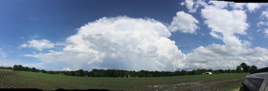
A pano of a developing cumulonimbus cloud taken from my iPhone.
Wikipedia has a list of cloud types that is far more detailed that what I’ve shown you, so if you’re really interested, go check it out. There are far more cloud types out there than what I described above.
Storm Structure:
Let’s start with a diagram, shall we?

And now for an actual photo:

It doesn’t exactly have all the elements from the diagram, but that’s because I’m about 40 miles away. BTW, this is a great example of an anvil cloud along with the flanking line.

I haven’t yet captured an overshooting top, but here’s a photo from NOAA (sourced from Wikipedia), where you see it clearly above the anvil.

One of my favorite photos of mammatus I’ve ever taken.

Some incredible cloud base striations along with lightning.

A very nice precipitation free base.

Just a single variation of a wall cloud. There are so many more, but this happens to be my favorite.

This is just an epic shelf cloud pano.
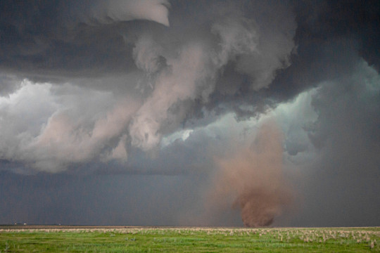
And, of course, a tornado, just because.
For more information, let me point you to Wikipedia’s articles about Thunderstorms and Supercells. Again, there’s a much more detailed explanation on each, along with more information about structure.
Or, if you’re really inclined to learn about thunderstorms, do a free spotter training class.
NWS SKYWARN Storm Spotter Program
Just click on the link, click on Find a class in your area, select your state on the map, then select your region. Each region is setup differently. If you have trouble finding a class in your area, call your regional NWS office, and they’ll be able to help you.
I hope this has been a nice little dive into clouds and storm structure. If you have anymore specific questions, please let me know! I always love talking about meteorology!
#Roswell research methods#clouds#storm structure#weather#storm chasing#photography#thunderstorm#supercell
16 notes
·
View notes
Text
New Post has been published on The top 10 of Anything and Everything!!!
New Post has been published on http://theverybesttop10.com/layers-of-clouds/
Top 10 Highest and Lowest Layers of Clouds

Top 10 Highest and Lowest Layers of Clouds
From the ground, it looks like all clouds are roughly the same height. But there are vast differences that amount to thousands of ft. But what are the highest and what are the lowest? This post has all the info you need to become a could expert…
Top 10 Highest and Lowest Layers of Clouds

Stratus Clouds
10 – Stratus (Average Level in ft: 1,000 – 1,456)
Wiki Info: Stratus clouds are low-level clouds characterised by horizontal layering with a uniform base, as opposed to convective or cumuliform clouds that are formed by rising thermals. More specifically, the term stratus is used to describe flat, hazy, featureless clouds of low altitude varying in colour from dark grey to nearly white.
Cumulus Clouds
9 – Cumulus (Average Level in ft: 1,476 – 6,562)
Wiki Info: Cumulo- means “heap” or “pile” in Latin. Cumulus clouds are often described as “puffy”, “cotton-like” or “fluffy” in appearance, and have flat bases. Cumulus clouds, being low-level clouds, are generally less than 3,300 ft in altitude unless they are the more vertical cumulus congestus form. Cumulus clouds may appear by themselves, in lines, or in clusters.
Stratocumulus Clouds
8 – Stratocumulus (Average Level in ft: 1,476 – 6,562)
Wiki Info: A stratocumulus cloud belongs to a genus-type of clouds characterised by large dark, rounded masses, usually in groups, lines, or waves, the individual elements being larger than those in altocumulus, and the whole being at a lower altitude, usually below 2,400 meters (8,000 ft). Weak convective currents create shallow cloud layers because of drier, stable air above preventing continued vertical development.

Cumulonimbus Clouds
7 – Cumulonimbus (Average Level in ft: 1,476 – 6,562)
Wiki Info: Cumulonimbus, from the Latin cumulus and nimbus, is a dense towering vertical cloud associated with thunderstorms and atmospheric instability, forming from water vapour carried by powerful upward air currents. If observed during a storm, these clouds may be referred to as thunderheads. Cumulonimbus can form alone, in clusters, or along cold front squall lines. These clouds are capable of producing lightning and other dangerous severe weather, such as tornadoes.
(adsbygoogle = window.adsbygoogle || []).push();

Nimbostratus Clouds
6 – Nimbostratus (Average Level in ft: 2,950 – 9,843)
Wiki Info: Nimbostratus usually produces precipitation over a wide area. Nimbo- is from the Latin word nimbus, which denotes precipitation. It has a diffuse cloud base generally found anywhere from near surface in the low levels and about 9,800 ft in the middle étage. Although usually dark at its base, it often appears illuminated from within to a surface observer.

Altostratus Clouds
5 – Altostratus (Average Level in ft: 6,562 – 22,966)
Wiki Info: Altostratus is a middle altitude cloud genus belonging to the stratiform physical category characterised by a generally uniform grey to bluish-green and sheet or layer. It is lighter in colour than nimbostratus and darker than high cirrostratus. The sun can be seen through thin altostratus, but thicker layers can be quite opaque.

Altocumulus Clouds
4 – Altocumulus (Average Level in ft: 6,562 – 22,966)
Wiki Info: Altocumulus is a middle-altitude cloud genus that belongs mainly to the stratocumuliform physical category characterised by globular masses or rolls in layers or patches, the individual elements being larger and darker than those of cirrocumulus and smaller than those of stratocumulus. However, if the layers become tufted in appearance due to increased airmass instability, then the altocumulus clouds become more purely cumuliform in structure.

Cirrus Clouds
3 – Cirrus (Average Level in ft: 16,404 – 44,291)
Wiki Info: Cirrus is a genus of atmospheric cloud generally characterised by thin, wispy strands, giving the type its name from the Latin word cirrus, meaning a ringlet or curling lock of hair. The strands of cloud sometimes appear in tufts of a distinctive form referred to by the common name of “mares’ tails”. On planet Earth, cirrus generally appears white or light grey in colour.
(adsbygoogle = window.adsbygoogle || []).push();
Cirrostratus Clouds
2 – Cirrostratus (Average Level in ft: 16,404 – 44,291)
Wiki Info: Cirrostratus is a high, very thin, generally uniform stratiform genus-type of cloud, composed of ice-crystals. It is difficult to detect and is capable of forming halos when the cloud takes the form of thin cirrostratus nebulosus. The cloud has a fibrous texture with no halos if it is thicker cirrostratus fibratus.

Cirrocumulus Clouds
1 – Cirrocumulus (Average Level in ft: 16,404 – 44,291)
Wiki Info: Cirrocumulus is one of the three main genus-types of high-altitude tropospheric clouds, the other two being cirrus and cirrostratus. Like lower altitude cumuliform and stratocumuliform clouds, cirrocumulus signifies convection. Unlike other high cirrus and cirrostratus, cirrocumulus includes a small amount of liquid water droplets, although these are in a supercooled state.
0 notes
Last Seen Blogs

fiery-assassin-archive-blog
Moved to Fiery-Assassin

chirpymusic
c h i r p y

phundle
Phundle's Phun

toysandtreasures
Toys and Treasures

artificialhearts
Artificial Hearts