#Pinnacles Campground Store
Video
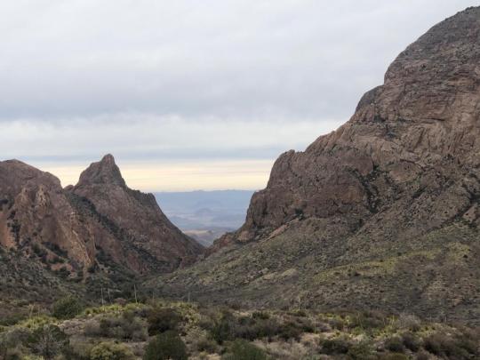
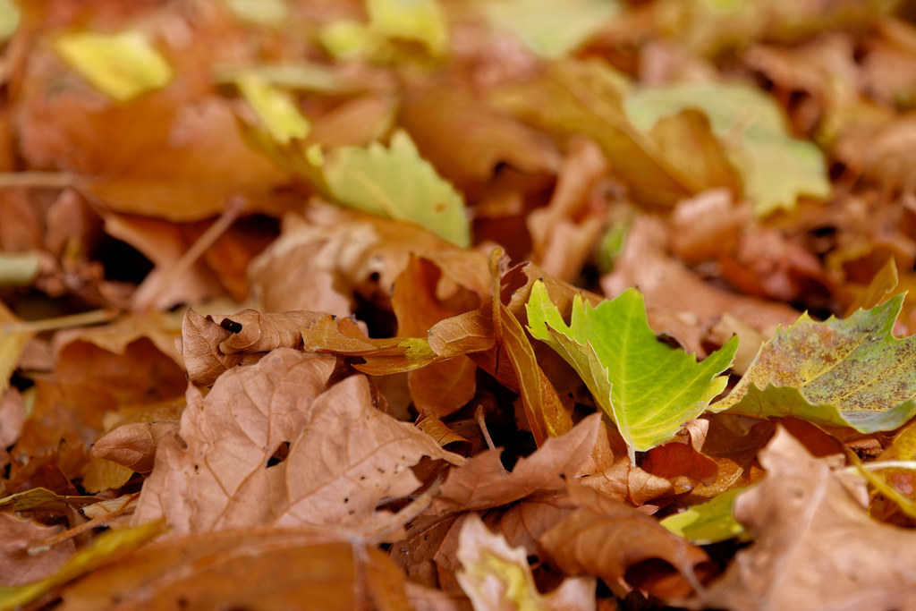
A Carpet of Autumn Leaves in Pinnacles National Park by Mark Stevens
Via Flickr:
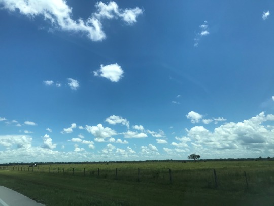
A setting looking to the northeast across a carpet of fallen leaves while at the Pinnacles Campground Store in Pinnacles National Park. My thought on composing this image was to get down low, swivel out the LiveView LCD screen on my Nikon D850 SLR camera, and then compose an image looking across these fallen leaves. Some of what I had in mind with this image was to capture a colorful pattern of the different leaves to my front.
#Autumn#Autumn Colors#Autumn Leaf Colors#Autumn Leaves#Azimuth 32#Carpet of Fallen Leaves#Carpet of Leaves#Central California Coast Ranges#Central and Southern California Ranges#Day 3#DxO PhotoLab 6 Edited#Fallen Leaves#Fallen Leaves Across Landscape#Forest Landscape#Gabilan Range#Landscape#Landscape - Scenery#Leaves#Looking NE#Nature#Neenach Volcano#Nikon D850#Outside#Pacific Ranges#Partly Sunny#Pinnacles#Pinnacles Campground Store#Pinnacles National Park#Pinnacles National Park and California#Project365
0 notes
Text
burgess battery factory ontario
woodland school ontario
abandoned zoo ontario
abandoned sewage plant ontario
downsview park
eglington line
gargantua toronto
schneider's courtland avenue kitchener
old linseed mill downtown toronto
tremain road burlington toronto abandoned
the hearn generating station toronto
symes toronto
the malt toronto
lower bay station toronto
the ttc tunnels toronto
king eddie toronto
cherry beach bridge toronto
hoe bowl hyde park new york
haunted hinsdale house
midway park chautauqua new york
fountain bowl abandoned western new york
vsk emporium frewsburg new york
salamanca antique mall
allen park jamestown ny
the arcade building (26 n. main st.) jamestown ny
rizzos pharmacy abandoned
crescent tool company abandoned
clay pond falconer ny
chadakoin river
cobleskill reservoir
times beach
buffalo light shines
buffalo harbor state park
caddy's strip club toronto
sheridan bay park
niagara county krull park
japanese garden
st francis park
tillman road wildlife management area
beaver meadow family campground
east otto state forest campground
creation walk nature trail
yates park
larkin woods
billy wilson park
minnewaska state park preserve
fishkill ridge trail
appalachian trail boardwalk
makamah nature preserve
central park
delaware water gap national recreation area
gwynns falls trail
hudson highlands state park
liberty loop trial
pinnacle trail head AT access
stairway to heaven trail
hidden valley animal adventure
winding waters trail
lake erie seaway trail center
adirondack park
seven tubs nature area
lehigh gorge state park
wonder bread factory
bannerman castle
silo city
pines hotel
albany cold storage
fort crown point
saratoga homestead asylum
masonic temple
missile silos
conklingville
great sacandaga lake
jackson sanatorium
beech nut factory
grossingers resort
lyon mountain mine
st joseph's church
charlestown USA outlet mall
craig e claire castle
NYS inebriate asylum
red apple rest
tahawus
worlds largest pair of pants homer
the only two story outhouse in new york state phelps
interstate 81 crows
worlds oldest trees gilboa
smallest church in the world oneida
copper john auburn
the worlds largest roll of life savers gouverneur
hoss's country store long lake
drain tile museum geneva
scythe tree waterloo
worlds largest garden gnome kerhonkson
catskill game farm
sterling forest state park
kaaterskill falls trail head
jamestown river walk
stony brook state park
wappinger creek greenway trail
pulpit rock and the pinnacle loop
three valley campground
pfeiffer nature center eshelman property
carlton hill multiple use area
richardson cottage
stohrer's lodge
pfeiffer nature center lillibridge property
kinzua bridge state park
luensman overview park
pop warner rail trail
midway state park
cat rocks hiking trail
gertrude's nose
minewasaka trail
pfeiffer nature center & foundation
minnewaska state park preserve
kissing bridge
mill road scenic overlook
old erie canal historic park poolsbrook
hudson highlands state park
anchor diamond park
old erie canal state historic park
master skill falls trail head
appalachian trail conservancy
ausable chasm
storm king state park
franny reese state park
high rock park
blue mountain resort
duffield camp & retreat center
old erie canal park
the woods at bear creek
bear creek
erie county restoration area
lime lake
cream ridge
boyce hill
erie county bureau of forestry
hampton brook woods wildlife management area
parkside park
hamburg beach town park
anna mae bacon bird sanctuary
hamburg dog park
hamburg park (there's a few)
yates park
hamburg beach
orchard acres park
taylor road park
allegheny mountain trail saddles
hunters creek county park
gooseneck hill waterfowl sanctuary
majors park
bureau of forestry visitors center
the owens falls sanctuary
beaver meadow family campground
beaver meadow audubon center
northampton park
stiegelmeier park
greece canal park
akron falls
cabic pond
patterson state park
goose creek valley greenway preserve
martin road park
bennett beach
forest lawn
beaver lake nature center
black rock mineral springs hiking trail
mossy bank park
gratwick riverside park
warsaw village park
stiglmeier park
greenway nature trail
reynolds gully
nestico field
moorman drive park
cheektowaga volunteer firemen's park
eiffel park
garrison park
sloan village park
lehigh valley railroad rail trail
walden park
nob hill park
cheektowaga town park
naples community park
stony brook state park
chapman state park
rattlesnake hill wildlife management area
indian fort nature preserve
losson nature trail
times beach
kashong conservation area
art park gorge trail
bishop nature preserve
churchville park
keuka lake outlet trail
eighteen mile creek
west lake road school park
rock city state forest
zoar valley
three sisters trail allegheny state park
deer lick conservation area
mccarty hill state forest
keuka lake state park
pat mcgee trail
turning point park
maplewood park
griffis sculpture park
allegheny national forest
ccc camp seneca
lucien morin park
nannen arboretum
dublin hollow
ellison park
colton state park
the grove public park
gargoyle park
little valley rural cemetery
faun lake
east otto state forest
penn dixie fossil park and nature reserve
mutual riverfront park
river fest park
elliott creek park
miller park
conklin's gully
seaway trail
skywalk allegheny park
lake erie
honeoye inlet wildlife management area
white brook nature area
RMSC cumming nature center
mill creek nature preserve
blue cut nature center
keuka lake outlet trail
ontario county park at gannet hill
gannet hill
gorham lodge park
bristol woodland campgrounds
isaac gordon nature park
high tor wildlife management area
ontario county pathway
italy hill state forest
rob's trail hemlock lake
hemlock lake
county park mt morris
canadaigua lake south end state boat launch
finger lakes trail
west hills nature preserve
dryer road park
honeoye falls
bowen park
boughton park
honeoye creek wildlife management area
sandy bottom park
hemlock lake park
west river fishing access site
papermill park
geneseo river access park
fishers park
wheat road trailhead
Honeoye Creek
japanese garden
rob's trail preserve
charlie c major nature trail
canadaigua/rochester KOA holiday
wesley hill nature preserve
hundred acres trail head
times beach bird part
knox farms
letchworth
black rock canal park
chestnut ridge
holiday hill campground
tamarack campground
burchfield nature
triphammer falls
roy h park reserve
4-h acres
tareyton park
jones park vestal
lick brook
sugar hill state forest
montezuma national wildlife refuge
morgan hill state forest
labrador hollow unique area
beaver lake nature center
seneca lake state park
beebe lake
north utica park
utica marsh wildlife management area
conewango swamp wildlife management area
bowman lake state park
hudson highlands state park
lake taghkanic state park
nannen arboretum
allen lake belfast
mccarthy hill state forest
island park wellsville
william w white american chestnut plantation
bear mountain state park
erie canal park
reinstein woods
joseph davis park
niagara historic trail
five senses nature park
william's st park
river road park
black creek park
cave springs conservation area
ontario county park at gannett hill
sprague brook
caz park
fort niagara
new york parks boat launch
kiosk marble bench stone beach
girl scout park
rapids high hiking trail
niagara gorge
stella niagara preserve
pioneer park
lower trail artpark
town of lockport nature trail
frontage park
2 notes
·
View notes
Text
Labelle 8/6/2020
Today we decided to head out to the small town of Labelle! We left my place around 11:30am and the drive was quick and easy. First, we stopped at Log Cabin BBQ for some lunch- it was INCREDIBLE! Savannah opted for some baby back ribs while I went for a fried chicken sandwich and they were both the pinnacle southern comfort food. We were making plans to return while we were still in the building!
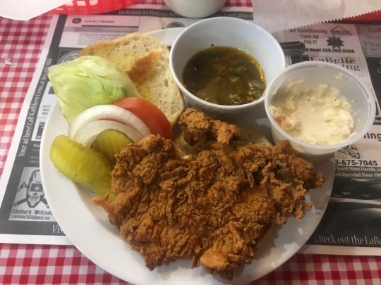
(I should’ve taken a picture BEFORE I started eating but look at it!! How could I resist?!)
After that, we headed down Bridge Street to check out the Harold P. Curtis Honey Store. Inside were walls lined with local honey, barbecue sauce, seasonings, and other unique items that represent Florida. We both bought 4 honey sticks and some homemade soap, awkwardly laughed at the cashier on the phone who was having “family problems,” and headed over to the antique store across the street called Me & My Girls.
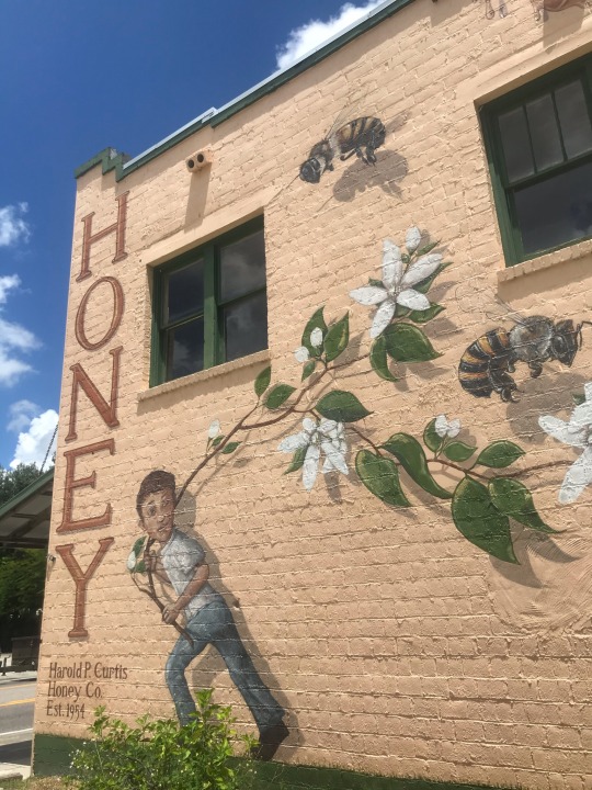
(The mural on the side of the honey store)
Unfortunately the antique store was closed and the other one we visited wasn’t our style so we were at a loss for what to do next... then we decided to go to the Labelle Nature Park to get a breath of fresh air! The outside of the park didn’t look inviting but the trail was an explosion of green- everywhere we looked had viridescent and earthy tones so decided to have a mini photoshoot about 100 feet up the path! But while we were enjoying the view we heard the sounds of a heavy animal (bear? panther? human? Swamp Ape?) thumping around in some palm fronds so we promptly decided to turn back.
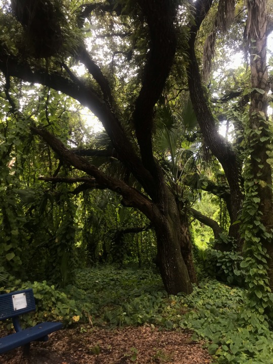

(Green as far as the eye can see)
Afterwards we checked Trip Advisor to see what else there is to do in the Labelle area and soon learned about a place called the Ortona Indian Mounds so we went back up Bridge Street, crossed the Caloosahatchee, and drove on over! As we were driving we noted at how “antique” everything looked- cars, tractors, houses, etc. and talked about our dreams of running a farmhouse with a burly outdoorsy husband... maybe one day..
(Not seen: groups of cows huddled under oak trees trying to take shelter against the oppressive Florida heat)
Eventually we headed up Achiaha St and made it to the Ortona Indian Mounds- which so happens to be the location for the local Sugar Cane Grinding Festival! We’ll have to come back on the first Friday of February to join in on the fun. This area isn’t too far from Clewiston, which is known for its sugar cane farming, so it makes sense that a festival would take place nearby.
(The park entrance- not very crowded)
We were the only people at the park and the grounds could be summed up in one word: eerie. It looked like an abandoned campground but we couldn’t ascertain as to when the last visitors were there. I likened it to the Walking Dead, Savannah likened it to the movie 1917, both of us had a sense that something was /off/. We wandered the area, taking pictures of the scenery, and meandered up the grassy trails. Some led to dead ends, some led to broken down boardwalks and as we were passing by flooded water faucets and oversized barbecue pits, both of us had the urge to text our mothers our locations in case the two of us went missing. It was definitely the highlight of our mini journey! The Ortona lived around 3000 BCE which is hard to wrap your mind around, and Savannah and I imagined aloud what it’d be like to be the first archaeologists (or “pot hunters” as they were known in the 1930s) to discover this previously forgotten civilization. Apparently the boardwalk leads to a lookout point to view where the Ortona carved out man made canoe canals, so we want to revisit with long pants and high boots and try to squeeze through the broken areas of the boardwalk.

(Lake Wobegon- I kept staring at the shrubbery across the water in hopes of seeing someone peeking back at me)
(Sugar cane grinder- we couldn’t help but give it a couple of whirls. To the east was the highest point in Glades County... a whopping 22 feet about sea level!)
(Apparently there’s a 10 picture limit so I cant post more but I feel like this specific photo captures the essence of abandonment emanating throughout the site)
Afterwards we headed back to Savannah’s car, blasted the AC, and worked our way back to town. We talked about a variety of things as we bounced between subjects like history, other places in Florida we want to visit, and ghost stories which made the drive go by quickly. We stopped for ice cream and milkshakes, said goodbye to Labelle (for now), and drove back home!
4 notes
·
View notes
Text
More on Greece, Part 2
We’ve been here almost a month now and there really is a lot to like about Greece. It reminds me of Italy in some ways but definitely has a flavor all its own. The olive oil is the best I have ever tasted and the white sandy beaches, mediterranean blue oceans, ancient ruins and history, as well as amazing landscapes and geographical structures, are incredible. For the most part the people are warm and welcoming, especially the women. From our experience, the women we have met of all ages and walks of life here we have connected with immediately and felt like we could become fast friends. They always left us with a good feeling and were a pleasure to be around. On the other hand, I had a couple encounters with men that left a bad taste in my mouth. I was in the post office and had a small package I wanted to mail to a friend back in the US. There were two counters servicing customers and I was next in line. An older man came in with a package and pushed in front of me as if I wasn’t there and jumped to the next counter open. I let it go thinking he was just rude, when another man came in and tried to do the same thing. Twice I could not abide by this behavior and threw up my hands in frustration. The young man working the counter spoke harshly to the man who pushed in front of me and motioned for me to go next. Something similar happened in the grocery store when we were checking out. It was always men who had this sense of entitlement and it made me realize how this culture has a lack of respect for women. Like any place in the world there are always down sides as well.
After exploring the Meteora region and the monasteries built into the rocky pinnacles that tower over the landscape, we moved on to Delphi. From our campground we took the bus into town and then a short walk with magnificent views brought us to the entrance of the ruins that are situated at the slopes of Mt Parnassos and its National Forest Park. The ruins date as far back as 7th century B.C. and climbing through the area really gives you a feel for what it must have been like to live there and be part of the community.
Next was the archaeological site of the city of Mystras which was one of the most important cities of the last centuries of the Byzantine Empire. Wandering through we saw several well preserved areas and the palaces of Mystras that are the only surviving example of a Byzantine palace complex in all of Greece. This Byzantine fortified city is situated on a steep slope with uneven stone paths and steps that were great for defense but difficult for setting up households, markets and social events. There are several churches, private houses and a monastery as part of the complex and it really was quite impressive and a good hike around the area.
Then there are the mighty ruins of Ancient Mycenae. For 400 years (1600-1200 BC) this kingdom was the most powerful in Greece. Without giving you too much history, the “well-built Mycenae, rich in gold”, that Homer wrote about in the 9th Century B.C. in his epic poems the Illiad and the Odyssey was regarded only as legend until discovered in 1870 by an amateur archeologist. In Mycenae, myth and history are intertwined as is often the case in Greek culture. This site also is quite imposing and for each of these I find myself feeling closer and closer to understanding the lengthy development of modern civilization.
For all the photos see John and Charlotte’s flickr sites. Just click on either of our names.
#Europe#Greece#Greek#world tour#peloponnese#Mycenae#mycenaean#byzantine#ruins#Mystras#Delphi#Mt. Parnassos#meteora#lack of respect#women#sense of entitlement#ancient#culture#Homer#Illiad#Odyssey#church#fortress#UNESCO
2 notes
·
View notes
Text
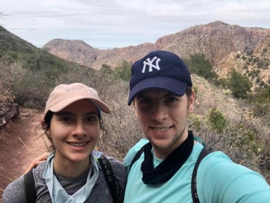
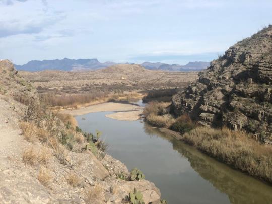
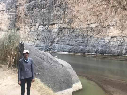
Big Bend National Park
The Verdict: We loved our trip to Big Bend! The scenery is stunning and otherworldly; we were just waiting for the dinosaurs to show up and reclaim their epic territory. We definitely recommend visiting.
WHAT TO DO (2 DAYS):
Ranked starting with our most favorite (though all were amazing):
Lost Mine Trail (5 miles out and back, moderate)
Santa Elena Canyon (2 miles out and back, easy/moderate)
Emory Peak (10 miles out and back, strenuous)
Windows Trail (5 miles out and back, moderate) & Window View (0.4 mile loop, easy)
Russ Maxwell Scenic Drive (22 miles each way)
Note: We did all of these in one (long-ish) day except Emory Peak, which we did on a second half-day.
Lost Mine Trail (5 miles out and back, moderate)
This is a pretty steep walk up a mountain with incredible panoramic views at the top. It really reminded us of Kauai. It was tiring, but absolutely worth it. Take a windbreaker – the summit is windy! There wasn’t much shade and it was very sunny on the way down; we drank about 2 liters of water each on this hike. It took us just over 2 hours.

Logistics:
Parking: Extremely constrained. Get here early or be prepared to wait for one of the 15-20 spots (when we were there the park had blocked off about 5 spots with traffic cones). The wait wasn’t terrible, though; we ate our lunch in the car while waiting about 25 minutes, during which time 4 cars left the parking lot. The upside of the constrained parking is the trail wasn’t very crowded.
Bathroom: None
Location: Trailhead very close to Chisos Basin Visitor Center, the central area of the park. Closest lodging is Chisos Basin Campground or Chisos Basin Mountain Lodge.
Other: There is a sign at the trailhead that picnicking is not allowed on the trail.
Santa Elena Canyon (2 miles out and back, easy/moderate)
A few miles past the end of Russ Maxwell Scenic Drive, this is one of the park’s most popular attractions. You’ll walk through a stunning high-walled canyon filled with water (at least it was when we went!). Some people even waded in. It’s absolutely worth visiting, but there is a surprising amount of stairs/elevation for a hike marked easy. It was unpleasantly hot (low 80s), sunny, and crowded when we went around 3:30 p.m. It’s worth noting the crowds here were different than the other hikes we did – largely unmasked tourists with poor trail etiquette -- perhaps a cost that comes with doing an “easy” hike. We spent around an hour here.
Logistics
Parking: Somewhat limited; we snagged the last available spot when we got there.
Bathroom: Disgusting. Two unisex hole-in-the-ground type structures that stank morbidly.
Location: Trailhead close to Castolon Visitor Center. Closest lodging is Cottonwood Campground. It was about an hour’s drive from Chisos Basin, the central area of the park.
Emory Peak (10.6 miles out and back, strenuous)
This hike is a seemingly unending uphill climb that ends in phenomenal 360 degree views. It starts out on the fairly well-shaded Pinnacles Trail (4 miles each way), which is like a forest of low trees and shrubs with increasingly impressive views of mountain canyons. Once you feel you can no longer move your legs, you take the Emory Peak Trail (1.5 miles each way), which starts out deceptively flat, becomes very steep and rocky, and ends as a rock-climbing-for-novices adventure.
I had read on earthtrekkers that the last 25 feet of the hike are a “rock scramble”, which evoked images of something harmlessly diverting, like a breakfast burrito. In reality, getting to the peak is a seemingly impossible straight-uphill climb; we saw an extremely fit-looking young couple do it with obvious trepidation, and a few people rock-scrambled onto a peak a few feet away that looked a couple of feet shorter. Having braved the insane stairmaster of a trail to get there, we couldn’t just leave; we found ourselves in the latter group, and the rock scramble wasn’t as difficult as it looked. The views were, indeed, epic – but if you’re not into rock scrambling, the Lost Mine Trail is a good substitute.
This took us 5 hours, 10 minutes. We were fortunate to have a relatively cloudy day, with some but not a lot of sun exposure. Between the two of us, we drank 7 liters of water.


Logistics:
Parking: Parking is at the Chisos Basin Visitor Center and is decently plentiful, though it does get crowded as it is shared with several other trails.
Bathroom: The bathroom at the parking lot had normal toilets and was pretty clean. There is also a compost toilet at the top of the Pinnacles Trail, but we didn’t check it out. There is a sign up there recommending peeing outdoors and saving the compost toilet for other uses :)
Location: Right by the Chisos Basin Visitor Center, a couple minute drive from the Lost Mine Trail trailhead.
Other: A lot of people brought walking sticks, which may be useful especially for the steep, rocky descent. The trail warns of bears and mountain lions, but all we saw were a few tiny cute mice at the peak.
Note: The South Rim is another popular hike, known for spectacular views of the Chihuahuan desert, and is also accessed via the Pinnacles Trail. Some people hike the South Rim trail instead of Emory Peak (approx. 12 miles roundtrip) or do both (approx. 15 miles total). We didn’t have enough water, time, or confidence to take on both of these strenuous hikes in one day, but this sounds like an interesting option if you are less into rock scrambling or want to do both.
Windows Trail & Window View
The Window View is a 0.4 mile loop to a scenic overlook. It’s very nice and there is a bench right at the overlook that is a nice place to enjoy a snack, if it’s not too crowded.
The Windows Trail is a descent into a canyon where you’ll get closer to “the window.” The scenery along the trail was mostly cacti and desert-looking shrubs, and since you start with a descent, you then have a pretty steep ascent on the way back up. The hike is decent until the last ~10 minutes, which is awesome. We found ourselves in a gorgeous canyon that was stunning to walk through. Finding your foothold can require some dexterity in certain areas, but it wasn’t too tough. The window is a really cool view and has some boulders that look perfect to sit on for a snack with a view, if it isn’t too crowded.


Logistics:
Parking: Same as Emory Peak, parking is at the Chisos Basin Visitor Center and is decently plentiful, though it does get crowded as it is shared with several other trails.
Bathroom: The bathroom at the parking lot had normal toilets and was pretty clean. I’m pretty sure there was also a bathroom just off the trail not long into the hike.
Location: Right by the Chisos Basin Visitor Center, a couple minute drive from the Lost Mine Trail trailhead. The trailhead starts right next to the Pinnacles trailhead for Emory Peak.
Russ Maxwell Scenic Drive (22 miles each way)
This is a breathtaking drive through a winding canyon that starts around 10 miles from Chisos Basin and extends south to Santa Elena Canyon. There are several hikes along the way; most look flat and unprotected from the sun, so we didn’t try them. This is on the way to Santa Elena Canyon, so if you go there you’ll drive it anyways.
WHERE TO STAY
Having gotten to know the park a bit, we’d recommend (in ranked order):
Chisos Mountain Lodge – the only non-camping accommodations available inside the park. We didn’t stay here because it was booked out, so can’t comment on how good it is. The location is great because it’s so central and right by several of the hikes that start at Chisos Basin. There is also a visitor center, convenience store, and gas station very closeby.
Chisos Basin Campground – the most centrally located camping accommodations. If you want to hit the trails early, this seems ideal. We weren’t able to get a spot here and can’t comment on how nice or not the campground is. We read that it can get pretty cold here at night because it’s in the mountains.
Cottonwood Campground – located by Santa Elena Canyon. If you can’t get a spot at Chisos Basin, this is conveniently closeby to another of the park’s major attractions. Again, we didn’t visit the campground ourselves.
Rio Grande Village Campground – the only other campground inside the park. We got lucky and managed to snag a spot here about 6 weeks before our trip, likely due to a cancellation. This is located at the remote east side of the park and isn’t close to any of the hikes we did; it was about a 45 minute drive one-way to Chisos Basin, and further to Russ Maxwell Scenic Drive/Santa Elena Canyon. There are some attractions here, such as the Boquillas Crossing to Mexico and the Hot Springs, but these were closed when we visited due to COVID-19. There is a gas station, convenience store, and RV campground with electrical hookups.
The campground is flat, and part of it has campsites located in clear view of one another. There are other campsites that are more secluded and border what looks like a forest. We had one of the latter, which was lovely due to the privacy from humans, but apparently was VERY well-trafficked by animals. Throughout the night we heard animals walking around, panting, and eating nearby, which we corroborated in the daylight when we found javelina droppings within a few feet of our tent and coyote or fox droppings right by our car! Our neighbors encountered a bobcat by the bathroom in the evening, and we encountered a javelina (which ran off immediately) when we took a late-night bathroom trip. It was quite an experience. Luckily, the bathroom was clean and had drinking water closeby (though it tasted weird).
Terlingua: This seems to be the closest town outside the park and when we checked Airbnb, had the most available accommodations. You can camp, glamp in a teepee, stay in an RV, and I think there were also possibly some homes and hotel accommodations. We drove by and it definitely didn’t look fancy.
Alpine: This was the next big town after Terlingua and was about 90 minutes outside of the park. There are lots of hotels here and we stayed at The Antelope Lodge on the night after we left the park. It was basically a one-room motel room with a fridge and microwave: spare, clean, and met our basic needs. There are plenty of chain restaurants – Pizza Hut, Subway, etc. It seems inconveniently far from Big Bend, so less than ideal to stay here unless on your way out. Alpine also happens to be about a 25 minute drive from the infamous Marfa, TX.
GETTING THERE
If you’re road-tripping, the closest major cities are El Paso or San Antonio/Austin, which are a couple hours away. We took I-20 through Dallas to Abilene and then Midland, which was extremely long, no real views, and the “textured pavement” on I-20 after Abilene was very loud and unpleasant to drive on. We turned south at Midland and the views became gorgeous. When we hit Marathon, TX, we stopped for dinner at Big Bend Pizza. We had about a 20 minute wait and the vegetarian pizza was loaded with veggies and tasted pretty good. We were surprised by how barren Marathon is – we didn’t even realize we were driving through it until we had passed it and had to turn back for pizza – and from there we had a (stunning) 2-hour drive to get to our campsite. We entered the park through Persimmon Gap Visitor Center and barely encountered any hikes until we hit the center of the park, Panther Junction Visitor Center, which is just 3 miles from Chisos Basin.
OTHER LOGISTICS
Wifi/cellular connectivity: We barely had any connectivity in the park. We got cell reception in the Chisos Basin parking lot, Marathon, and Alpine. In Terlingua, we couldn’t get any reception and had to stop and ask someone to direct us to the closest gas station.
Gas: Fortunately, there were two gas stations inside the park. It is a vast park, so helpful to have such easy access. We never filled up in the park, but assume the gas prices were pretty high, as they were when we filled up on our way out in Terlingua.
Food: The Chisos Basin Mountain Lodge sells food, but when we visited their cafeteria was only open until 4PM. The convenience stores also seemed to close early, and we never checked out the groceries available there. We carried all the food we ate; given the very long drive from our campsite to Terlingua, we never left the park to pick up a meal.
Animals: This seemed like a park where it might be beneficial to pick up bear spray. We didn’t have any, but our campground and many of the hikes warned of bears.
Getting oriented: We stopped by the central Panther Junction Visitor Center on our first morning in Big Bend and picked up a park map, which was perfect for navigating through the park.
0 notes
Text
Michigan: Latest updates on Coronavirus

Last updated March 27 at 11:50 pm E.D.T.
As of March 26, Michigan is reporting 3,657 confirmed cases of COVID-19 and 92 deaths associated with the virus, according to the Michigan Department of Health and Human Services. This makes it 5th in the list of states for the most US coronavirus cases. Confirmed cases have been reported in 58 out of 83 counties in the state. A total of 13,769 diagnostic tests have been completed in the state.
Democratic Gov. Gretchen Whitmer has signed the “Stay Home, Stay Safe” executive order that will be in effect through April 13. It directs all nonessential Michigan businesses and operations to temporarily suspend in-person operations. The order also directs Michiganders to stay in their homes unless they’re essential workers, doing an outdoor activity (while practicing safe social distancing), or aiding in the health and safety of themselves or their family, such as going to the hospital or grocery store, according to a government statement.
State park campgrounds, overnight lodging facilities and shelters are now closed through at least April 13, the government reported. State parks and recreation areas, however, will remain open for people practicing social distancing.
Michiganders who have become unemployed because of the COVID-19 outbreak can go here to see if they’re available for collections assistance.
Whitmer previously signed an executive order imposing temporary restrictions on nonessential medical and dental procedures, according to a news statement.
Action is being taken against price gougers. Call 877-765-8388 if you want to register a complaint, the state government reported.
On March 16, Whitmer issued an executive order that temporary closed all dine-in options for restaurants, theaters, bars, casinos and fitness centers. Delivery and walk-up services are still available.
On March 10, Michigan’s governor declared a state of emergency in response to cases of COVID-19. Large assemblages have been cancelled and all public K-12 schools will be closed from March 16 until April 5.
Michigan coronavirus hotline (7 days a week, 8 a.m. – 5 p.m.): 1-888-535-6136
Cases by county:
Allegan: 1
Barry: 1
Bay: 4
Berrien: 18
Calhoun: 9
Cass: 1
Charlevoix: 4
Clare: 1
Clinton: 8
Detroit City: 1,075 cases; 23 deaths
Dickinson: 1
Eaton: 8
Emmet: 3
Genesee: 91 cases; 4 death
Gladwin: 2
Gogebic: 1 case; 1 death
Grand Traverse: 3
Hillsdale: 6
Huron: 1
Ingham: 26
Ionia: 2
Iosco: 1
Isabella: 4
Jackson: 16
Kalamazoo: 11
Kalkaska: 4
Kent: 45 cases; 1 death
Lapeer: 4
Leelanau: 1
Lenawee: 8
Livingston: 31 cases; 1 death
Macomb: 404 cases; 14 deaths
Manistee: 1
Marquette: 1
Mecosta: 1 case; 1 death
Midland: 8
Missaukee: 1
Monroe: 28
Montcalm: 3
Muskegon: 6 cases; 2 deaths
Newaygo: 1
Oakland: 824 cases; 26 deaths
Oceana: 1
Ogemaw: 1
Otsego: 7
Ottawa: 21
Roscommon: 1
Saginaw: 14
Sanilac: 2
Shiawassee: 2
St. Clair: 15
Tuscola: 2 cases; 1 death
Van Buren: 3
Washtenaw: 150 cases; 3 deaths
Wayne: 735 cases; 14 deaths
Wexford: 1
Other: 23
Out of state: 8
Source: Fox 2 Detroit, Michigan.gov
Coronavirus in the US: Map, case counts and news
Originally published on Live Science.
OFFER: Save at least 53% with our latest magazine deal!
With impressive cutaway illustrations that show how things function, and mindblowing photography of the world’s most inspiring spectacles, How It Works represents the pinnacle of engaging, factual fun for a mainstream audience keen to keep up with the latest tech and the most impressive phenomena on the planet and beyond. Written and presented in a style that makes even the most complex subjects interesting and easy to understand, How It Works is enjoyed by readers of all ages.
New post published on: https://www.livescience.tech/2020/03/28/michigan-latest-updates-on-coronavirus/
0 notes
Text
What Everyone Is Saying About Mongolia Trekking and What You Should Do
Things You Won't Like About Mongolia Trekking and Things You Will
Mongolia is the world's most critical campground and to come here without doing a sort of trek, would display abandoning a tremendous measure of the nation's association with nature. On the off chance that it needs to gather the development business, they should make the nation continuously available to voyagers themselves. Climbing Mongolia is obviously perhaps the best procedure to watch the country, giving you the time and plans to really welcome the tremendousness and quietness of the scenes.
A pleasant arrangement of people go trekking in Mongolia, so you need the capacity to continue running over researching all around masterminded sustenances and mechanical get-together. Mongolia isn't the least problematic spot to get to a phenomenal thing some may state. It is making a shocking introduction to selling the nation. It is a stunning nation to go around in, because of its heavenly scenes and complete uncommon quality. Mongolia is stacked with awesome trekking openings, you simply need to pick a zone which best suits you. It's conceivable to encounter Western Mongolia without the use of an advancement help, yet it's unequivocally instructed that you utilize the assistance concerning an outing master for your very own comfort and success.
What's in store From Mongolia Trekking?
You can look for the associations of a zone regulate after you get to the district. Once more, you're need to interface with a territory manual for help with transportation and other key subtleties, and you will probably need to bring along various associates so you can part the expenses. You will likewise get proposition for how to prepare for a breakdown and what activities in an emergency. For visitors going to Mongolia, the data about the country is incredibly obliged. Distinctive dodgy people are giving inadequate Mongolia visits to endeavor to benefit on the development business center. There are a great deal of explicit occasions which happen over the class of the celebration, and if you're fortunate, you may even get a chance to hold one of the magnificent winged animals of prey yourselfwhich makes for a really cool picture to email your relatives and sidekicks!
On the off chance that you aren't a rider, yet a gutsy voyager who wishes to encounter Mongolia or Kazakhstan by pony, by then you're in like way in the best spot. LGBTQ2 travelers should cautiously think about the dangers of taking off to Mongolia. You find the opportunity to stay with the vagrants and appreciate a genuine wild trekking establishment. The term desert is amazingly a misnomer as, disregarding the route that there are sand rises, besides, there are mountains, springs and backcountry. Two thump camel is particularly serene creature which you'll comparatively feel it. It's central to not dismiss that what could be acceptable lead, dress and language in your country, may not be legitimate in another.
You have stunning grandness, culture, and a sensational farmland. Geographically straightforwardly over the inclination, and socially identified with the people of western Mongolia, it truly is a world away in relationship with the scene. In like way riding on a bull truck is among the fun approaches to manage development and see nature. Since Mongolia's exchange to the business economy in 1990, the development business area has molded into a colossal bit of the country's improvement. The Government starts a dynamically expansive pack of measures and vows to supply a tasteful help to propel the development business in Mongolia. Mexican Nationals Mexican nationals aren't visa-maintained a strategic distance from. You can check with near to development relationship for some more treks that you should try.
Transportation to the genuine start of the trek is EXPENSIVE. Mongolia travel tips you will get no spot else! In all actuality, even with the warm welcome, travel can be fierce a segment of the time, with fundamentally essential work environments in different spots. Our voyages are made to get under the skin of the country and to offer you a noteworthiness and wide degree of encounters. In any occasion you're in for an incomprehensible excursion. In the event that you'd like an experience with truly astonishing encounters, that is extraordinarily fitted accurately recognize how you need it, you found the sensible business.
There are a few inconceivable, light-weight tents in a split second accessible, tragically many are super costly. Outside near the base of Kang-Yutze pinnacle is among the features close by getting a look at Tibetan culture. The preoccupation center is a level out need see while on Kangaroo Island so cause sure to pass on time to go to and inspect. When arranging an unaffiliated trek in Mongolia, you ought to see how to get in and out of whichever area you're in and it's quick to have a crisis leave course engineered if fundamental. Confirmed spaces spread for all intents and purposes a fifth of the country and the association needs to develop that figure. Astounding maps and compasses can be found in Ulan Bator, yet you will pay somewhat more than if you got them in your nation of origin. Magnificent perspectives on Everest, an astounding trail, heavenly tea houses to stay in and in every way that really matters consistent perspectives on presumably the tallest crests on earth will keep keeping your idea during what's ordinarily a multi day trek.
0 notes
Video
flickr
Fallen Leaves in Pinnacles National Park by Mark Stevens
Via Flickr:
A view looking to the northeast at the Pinnacles Campground Store in Pinnacles National Park. My thought on composing this image was to get down low and then use the LiveWiew LCD screen to capture a look across these fallen leaves.
#Autumn#Autumn Colors#Autumn Leaf Colors#Autumn Leaves#Azimuth 32#Carpet of Fallen Leaves#Carpet of Leaves#Central California Coast Ranges#Central and Southern California Ranges#Day 3#DxO PhotoLab 6 Edited#Fallen Leaves#Fallen Leaves Across Landscape#Forest Landscape#Gabilan Range#Landscape#Landscape - Scenery#Leaves#Looking NE#Nature#Neenach Volcano#Nikon D850#Outside#Pacific Ranges#Partly Sunny#Pinnacles#Pinnacles Campground Store#Pinnacles National Park#Pinnacles National Park and California#Project365
0 notes
Text
Rv Campers Santa Monica
Contents
Reservation system improves service
System improves service
World famous “mother road” highway
Santa monica quackwatch home page
Fitness santa monica respondent
Make a Camping Reservation. Our new reservation system improves service delivery to our visitors online and in our park units. You’ll be able to explore California’s outdoor recreational opportunities in a more modern way via interactive maps and other online tools.
A list of the attributes bicycle tourists want in a route would likely include: great scenery, tailwinds, reasonably spaced towns, world-class cities, easy arrival and departure points, places to camp, and opportunities to meet other bike tourists.
Campground Overview: Lake Piru is located in Ventura County, California, in the Los Padres National Forest next to the Sespe Condor Sanctuary. You would never know it floating on our peaceful lake, but we are less than an hour away from Los Angeles.
Santa Monica Pier From Milwaukee Via Route 66 EagleRider’s Route 66 Self Drive Motorcycle Tour is a 15 day journey riding along the world famous “mother road” highway. You begin your tour in Chicago, IL and ride for 2400 exciting miles to Los Angeles, CA. Respondent Inc. santa monica quackwatch home page. Glenn Braswell’s Advisors Stephen Barrett, md. almon glenn Braswell, doing business
Printers Santa Monica La fitness santa monica respondent Inc. Santa Monica Quackwatch Home Page. Glenn Braswell’s Advisors Stephen Barrett, md. almon glenn Braswell, doing business primarily under the name gero vita international, markets pills and potions through the mail [1]. During the past 25 years, he has probably taken in more money and more people than any similar
Health Care Plans Santa Monica La Fitness Santa Monica Respondent Inc. santa monica quackwatch home page. Glenn Braswell’s Advisors Stephen Barrett, md. almon glenn Braswell, doing business primarily under the name gero vita international, markets pills and potions through the mail [1]. During the past 25 years, he has probably taken in more money and more people than any similar
Located on Pinnacles’ east side, the park’s sole campground has 134 sites, a swimming pool, showers and flush toilets, and a surprisingly well-stocked camp store that sells a lot of ice cream.
Camping Destinations in US, where you should head off for your camping trips in US. Here is a list of US campgrounds, Camping is one of the common American activities.
from The Insider's Guide to the Beautiful City of Santa Monica https://santamonicaday.com/rv-campers-santa-monica/
0 notes
Text
ARKANSAS
Arkadelphia
Ouachita Baptist University
Compton
Aux Arc Botanicals Lavender Farm and Event Venue
Conway
Conway Regional Medical Center
University of Central Arkansas
Deer
Magnolia Falls
Woods Boys Falls
Eureka Springs
Turpentine Creek Wildlife Refuge
Fayetteville
Springwoods Behavioral Health
Forrest City
Forrest City Medical Center
Harrison
Breast Center Harrison, A MANA Clinic
Buckets Sports Bar & Grill
DeVito's Restaurant
Harness Boots and Shoes
Jamie’s Creative Catering
Jamie’s Local Flavoring
Nature’s Wonders the natural living store
Shady Oaks Campground & RV Park
Townhouse Cafe
Jonesboro
St. Bernards HealthLine
Little Rock
Arkansas Heart Hospital
Ideal Staffing
Methodist Family Health
Pinnacle Pointe Behavorial Healthcare
The BridgeWay
UAMS College of Nursing
Morrilton
River Chase Rehabilitation and Care Center
Pine Bluff
Jefferson Regional Medical Center
Richland
Terry Keefe Falls Trail
Russellville
Arkansas Tech University
Saint Mary's Regional Medical Center
Sand Gap
Falling Water Falls
Richland Falls
Richland Creek Wilderness
Six Finger Falls
Upper Horsetail Falls
Searcy
Harding University - Carr College of Nursing
Witts Spring
Terry Keefe Falls Trail
0 notes
Text
Trekking In Amarnath Holy Cave - Lord Shiva
It was route back in the year 2002 when I originally found out about "Amarnath Yatra" from my maternal uncle, who previously visited the place of worship quite a while in the past at that point. I was captivated by his story making out of "day off", "chilly", "excellent mountains", "wonderful views" and some more. Not even in my teenagers at that point, I concluded that one day I will likewise scale the statures of that great home.
From that point forward, such a significant number of years passed. In 2018, I understand, I need to visit the sacred Amarnath cavern and consequently I went to my maternal uncle. This time for gathering specialized subtleties and prerequisite for the said trek. In any case, my uncle grinned at me and said with this constitution, I can't finish that course, which I thought was directly as I was 90 Kgs at that point. Be that as it may, uncle's words squeezed me parcel and now I accept this as a test to finish this trek.
So one fine morning of December-2018, myself with my two partners chose to visit Amarnath heavenly cavern. I was most eager as it was my first trek in the Himalayas around then. Yet, a hurried choice of trekking in the Himalayas without planning can be risky, So I began to take a shot at my wellness from the following morning and free very nearly 10 Kgs till July-2014 and furthermore adequately picking up stamina and perseverance, which prepares myself for the trek. I likewise purchased a couple of new trekking shoes for me from online store.
Presently the genuine procedure of coming to Amarnath cavern starts. We got ourselves enlisted for the yatra on the web, as it is a yearly occasion for explicit period and that too in a rough Himalayan territory. For one to take this journey, he had not exclusively to enroll himself for the yatra, yet he needed to acquire a medicinally fit declaration from assigned emergency clinics/specialists of "Shri Amarnath ji Shrine Board" and afterward need to get a license from Designated J&K Bank or Punjab National Bank. We done all these official works by our own costing around Rs. 300/ - per individual.
Day-1 "Beginning from Nagpur"
We three prepared for the outing, boarded a medium-term train at Nagpur (Maharashtra) on and arrived at New Delhi on sixth by 01:30 PM. From that point we go to our rest rooms at New Delhi railroad station, where we spruce up, had our lunch and take rest for the remainder of the time. We boarded our next train around evening time, which will take us to Jammu by next morning.
Day-2 "Coming to Jammu and drive to Pahalgam"
We reach Jammu at 06:00 AM. In the wake of having shower and spruce up we prepare ourselves for the lengthy drive to Pahalgam from Jammu, which is in excess of 250 Kms and which is all on National Highway 1A. The magnificence on the way is immaculate. Can't be portrayed except if visiting the area by and by. The rich green mountain valleys, wild mountain blossoms like a bright floor covering on mountain side and sparkling snow topped pinnacles of the Mighty "Pir Panjal" mountain ranges. Around then, that was my second visit to the lovely state. I recently visited J&K in 2018 with my family and after that too we had taken a similar course, however the magnificence of these scenes are worth numerous visits and I had just two around then. In the wake of intersection the Jawahar Tunnel (longest street burrow in India) we came to Pahalgam by 07:00 PM on that day. By then it was practically dim there and the climate there is chilling. We rapidly de-boarded our vehicle and get into our room and under those blankets as the temperature there is two low. After some time, when we become accustomed to the temperature, we haul out our comfortable garments from the rucksack and put them on to go for a stroll in the Pahalgam town. It was an excellent encounter. After a lengthy drive and meandering around walk, we feel extremely eager, so we return to our inn, had our supper and by putting our cell phones in charging, went under the blankets to have a sound rest, with the goal that we can get up right on time and begin our adventure towards Chandanwari from where we will begin our trek towards the "Heavenly Cave"
Day-3 "Pahalgam to Chandanwari and to Sheshnag"
Following day, we get up all around promptly toward the beginning of the day and after spruce up, we take our vehicle at 04:30 AM, which will drop us at Chandanwari. Here I simply needs to make reference to one thing that early wake up and flight for Chandanwari is exceptionally suggested as in light of the fact that as the day advances, heaping up of vehicles for the yatra makes congested road, which could postpone the arranged trekking program. Despite the fact that we get up ahead of schedule, there is a smidgen of jam at the check post. We reach Chandanwari at about 05:30 AM
In the wake of remaining in a line for almost 60 minutes, we at long last touched base at the check post, where we demonstrated our yatra license and subsequent to doing with the security check, we can really started our trek just at 07:00 AM.
(Day 1 of the trek):-
Day one of the trek should take us from Chandanwari to Sheshnag, the primary campground of our arranged trek. By the gift of ruler Shiva, the climate that day was pleasant. Splendid daylight welcomes us directly from the beginning check post, which was a superb thing as great climate during trekking in the Himalayas is a powerful shelter and furthermore the beautiful magnificence can be delighted in to its full.
For coming to Sheshnag from Chandanwari which is at 9500 Ft from MSL, we needed to trek for around 12 Kms. Be that as it may, the bend in the story is that, the initial 3 Kms from Chandanwari to Pissu Top is a precarious rise. There is a rough way which is tight and soak, to aggravate the issue increasingly, liquefying snow during that time makes heaps of mud and slop in the track. One should be exceptionally cautious in this segment as horse's and steeds are likewise employing on a similar track, many time we got hit by those too. Be that as it may, despite the fact that there are loads of challenges during this underlying 3 Kms, we at long last came to the "Pissu Top". We were depleted, however subsequent to coming to there and seeing the amazing perspective on snow clad mountain we feel restored once more.
Subsequent to taking 15 minutes rest there, we began once more. The trail from Pissu Top isn't intense, a continuous climb to Zojibal and an exceptionally slow slide to arrive at Nag Koti. The excellence of these spots can't be depicted on paper, simply look these snaps.
In the wake of resting for around 10 Mins, we began our trek once more. The trail upto "Sheshnag" is somewhat troublesome, however not an extremely intense one. Somebody with great wellness can without much of a stretch make it. There is no further ceasing point after one crosses Nag Koti and furthermore there is no authorization for outdoors in the middle of till Sheshnag. So we need to reach Sheshnag at the soonest with the goal that we can have a sound rest and set ourselves up for following day's intense trail.
At about 1:00 PM on that day, we had our first look on the sheshnag gathering of mountains and the Sheshnag lake in the middle of them. By encountering that see, we nearly strolling energetically on the mountain trail to reach there. We came to Sheshnag campground at stature of 11700 Ft at about 01:30 PM. Furthermore, after rapidly having our lunch in the free langars (which are abundant in numbers along the whole trek course, with menus including 4 to 5 course everything being equal (Breakfast, lunch and supper)) we rapidly get inside our tents and set down ourselves on the beds. Tents with beds can without much of a stretch be reserved by paying Rs.200/ - per head every night at the campground as it were.
Day-4 (Day 2 of the trek) "Sheshnag to Holy Cave by means of Panchatarani"
In the wake of encountering my longest rest (i.e from 2:30 PM to 04:00 AM ) I was especially prepared to trek further towards the Holy Cave. However, Alas ! adversity strikes ! One of our individuals has endured a medical problem and was not ready to trek without anyone else. So we chose to pass by horse till Panchatarani.
The trail from Sheshnag to Panchatarani should be a difficult one, as there is no water point and the whole trail was loaded with day off. So it is fitting o convey adequate water in rucksack.
Sitting on the back of horse, we initially rise steeply from 11700 Ft to 14500 Ft to reach Mahagunas top, on the way we crosses Warbal and the most delightful Mahagunas Pass.
In the wake of intersection Mahagunas top, while coming to Pabibal, my Pony's one of the leg got struck in day off the creature twists forward and the force of the ride puts me off the horse and I descended vigorously, fortunately for me I fall on a delicate day off, I didn't get injured. I rapidly get up and proceeds with our ride till Panchatarani (12700 Ft). at about 11:30 AM. Be that as it may, it is worth to make reference to that the trail from Sheshnag to Panchatarani is a significant intense one and riding a horse is a decent decision as the full cold trail and chilling breeze of Mahagunas pass could make life troublesome during the trek.
Leaving every one of those setbacks, hardships, tiredness behind, we immersed ourselves in those captivating perspectives on knolls and mountains. While tasting some espressos, are in all respects exorbitant, which is clear in this landscape, we investigate Panchatarani and we as a whole got astonished by the magnificence of that place. Panchatarani is directly at the base of "Bhairav Mount". The perspective on that spot is perfect, brilliant or whatever we can say is little for that place. So a few pictures are clicked to catch recollections of that.
The separation of Holy Cave from Panchatarani is 6 Kms. At about 11:30 AM, we begun from Panchatarani, this time individually. We first crosses a stream, which is extremely shallow, however a decent quality water verification trekking shoes are exceptionally prudent, in light of the fact that the chilling water can cause genuine consequences for feet. After that we ascended steeply for couple of hundred meters and in the wake of intersection a tough mountain landscape for just about an hour , we had our first look at the "Blessed Cave" "Amarnath Ji". I can't avoid myself to take a depiction.
The look at the Holy Cave and the Chants of "Har Mahadev" invigorates us to arrive at that spot considerably more rapidly. In any case, again the territory from here is the whole distance canvassed in snow till the "Sacred Cave". We proceeded with our voyage in all respects gradually and cautiously over the day off through the market to a point pretty much 500 Mtr from the Holy Cave, where on should left the entirety of his assets, for example, knapsack, water bottles, shoes, sticks and so on in an assigned asylum and get a token from that point free of cost, which can be stored at the season of reclaiming the effects after darshan of the Ice Lingam inside the Holy Cave.
We were presently couple of feet away of seeing something uncommon in our life, we went to the stairs that prompts the Holy Cave. At about 04:30 PM, we had our eyes stale of the Ice Lingam for few moments till a security me requested that we push ahead. Yet, those couple of moments are precious as anything, "Recollections of Lifetime". All our torment, weariness, tiredness disappears inside split seconds after the Darshan.
From the outset, we had intended to remain in a camp close to the Holy Cave, however when we had our darshan, it begins drizzling, So we chose to trek back to Baltal as downpour can be risky in Himalayas. So despite the fact that the downpour does not proceeds with further, following a couple of minutes of photograph shoot we began back. Baltal is on the opposite side of the Holy Cave, most pioneers take this course to return. However, this track does not go to Pahalgam, rather it goes to Sonmarg from where our taxi was reserved to drop us at Shrinagar.
The trail from Holy cavern to Baltal is limited and brimming with free rocks, while slight shortcoming in strolling can make genuine wounds legs (as going down is more testing than coming up as holding in stones is troublesome). At any rate the rock trail closes at "Domail" (09 Kms from Holy Cave). After that the trail is expansive, step by step slipping and simple.
At about 10:30 PM we arrive at our last campground at Baltal and afterward I make a call to my dearest spouse, and we both are on tears by the way that I have done it. We can't keep our tears down.
Furthermore, presently craving strikes we all. However, nothing to stress, Free Langars with numerous course of dinners are prepared to serve you. Today we went to our particular beds at about 11:30 PM.
Day-5 "Back to Shrinagar through Sonmarg Valley"
We wake up that day at about 07:00 AM, after spruce up with frigid water and subsequent to stimulating ourselves with sound breakfast and espresso, we boarded our vehicle at about 08:30 AM. By then I began feeling torment in my shoulder, which was because of that fall at Pabibal, which was deteriorating as the day advances. We at long last reach Shrinagar at about 12:00 Noon. I immediately hurried to my lodging and lay myself down. The chief of that lodging is useful. He rapidly gave me a gel and orchestrate me a warm pack which gives me some help till night.
After the night snacks, we simply meander in Shrinagar city and had our supper rapidly and got to our particular beds in all respects promptly in the night around at 09:30 PM
Day-6 "Returning to Nagpur Via Amritsar"
In the wake of completing a smidgen of sight scenes in Shrinagar, we head back to Jammu, leaving those powerful mountains, snow-topped pinnacles and rich green valleys behind and reclaiming long lasting recollections of what we accomplished and saw over the span of past 4-5 days.
We came to Jammu at about 05:00 PM and boarded our train at about 08:30 PM for Amritsar.
Day-7 "In Amritsar "
We came to Amritsar at about 2:30 AM and seen definite inverse climate. From the previous couple of days, we are in seriously chilly climate with loads of snow around us, however now we are here seeing extremely hot and moist conditions. Subsequent to drawing in ourselves for sight scenes enduring whole day and covering spots like Golden Temple, Jalianwala Bagh, Durgiana Temple and Wagha Border we take rest around evening time with an early supper and attempted to revive our recollections from the outing.
Day-8 "Going to Nagpur"
After Amritsar, we head back to our living spot/work place "Nagpur" by boarding an early train at Amritsar, we arrived at New Delhi by 03:00 PM. Later we get our train at about 06:00 PM to return to Nagpur which denoted the part of the arrangement the most lovely trek and voyage through my life.
It was a cherishable memory for a lifetime. Likewise who can overlook "Azam" the horse wala and our guide till Panchatarani and the lodging administrator, who helped me to dispose of my shoulder torment which without a doubt causes us to arrive at home securely and sufficiently.
0 notes
Text
Top 8 Portable AC for RV | Best RV Air Conditioner Reviews 2019/2020

It is nearly difficult to minimize the value of the best Portable AC for RV. Any individual who exists in a city with hot seasons can bear witness to a reality that rooftop air conditioners can be perfect lifesavers. Past keeping the atmosphere agreeable, Portable Air Conditioners protect inside temperatures for everybody, particularly kids and pets. Shockingly, they additionally have a trend to be expansive and hard to introduce or redesign.

Portable Air Conditioner
In the event that you need a more Portable AC for RV or portable solution to keeping cool, portable air conditioners are the ideal buy since they don't require the requirement for a window unit which isn't generally an option. In any case, since they are portable, doesn't mean they don't have to vent outside — regardless you'll have to hook them up to your window, more often than not with an included pack so you'll require outdoor access to utilize (which means despite everything you require a window). You can utilize them in a wide range of regions of the house, auto, RV, or even outside on the patio or campgrounds. When utilizing one to chill the outdoors you'll have to search for an evaporative cooler which works better in drier atmospheres.
Focus on BTU ratings to decide how powerful an air conditioner is since higher ratings will work better for bigger spaces, however greater isn't really in every case better so it is best to do your examination to perceive what works best for your space and needs.
To enable you to out, here are the Best Portable AC for RV to consider for a wide assortment of necessities.
Reviews: Top 8 Best Portable AC for RV

Best RV Air Conditioner Reviews
If you require a Portable Air Conditioner for traveling, there are various kinds of designs for you to think for your RV or several places where cool air conditioner may be required. Here, we at PowerBank-Online.com will take the private look at 8 Top Rating Portable AC Models from well-known AC makers & explain each of their excellent & not-so-great points. Then, we can decide which our best-recommended option for you is.
In order to determine the Best Portable AC for RVs, there are several factors to rate for each unit. You would desire an air conditioner that starts up instantly, comes with remote controls, has a Twenty-Four-hour timer, and also is light & easy to take, among other valuable features. You will see that every unit varies in Performance and price, but these are not the so essential features to see for when buying among the various air conditioners for RVs out there.
Editor’s Note: We will update this list as more devices hit the market.
Editor’s Recommendations ==>
Best USB Car Charger
BEST AUTOMOTIVE BATTERY CHARGER
Best 18650 Battery Charger Reviews
Best 16 Volt Battery charger Reviews
Best 6 Volt Battery Charger
36-Volt Battery Charger Reviews
24-Volt Battery Charger Reviews
Aibocn Power Bank Reviews
12v Battery Charger Reviews
12 Volt Solar Battery Charger
Best Battery for Car
AGM Battery Maintainer Reviews
Parmak Solar Fence Charger Reviews
Best Solar Car Battery Charger Reviews
36-Volt Golf Cart Battery Charger Reviews
GoPro Power Bank Reviews
Camping Power Generator Reviews
ChargeAll Battery Pack Reviews
AC vs DC Charger
DBPower Jump Starter Reviews
No. 1 Whynter FM-45G 45-Quart Portable Refrigerator/Freezer, Platinum

Whynter FM-45G 45-Quart Portable Refrigerator or Freezer, Platinum

PROS
Capacity: 45 Quarts or 60 Jars (12FL oz.)
Works as a cooler or cooler
8-feet AC power line and 5-feet DC power line and two removable wire bushels are incorporated
"Quick Stop" mode quickly cools to - 8°F
Voltage power AC (115V/60Hz – 65W/0.75A) or DC (12V/24V – 4.5A/2.5A Auto Lighter Attachment)
Wattage: 65 Watts. Net weight: 45 LB. Internal dimensions: 18.5inches W x 11inches L x 15inches H incorporating a compressor venture with 7.5inches W x 11.25inches L x 8inches H
ETL affirmed
CONS
No. 2 NOCO Genius Boost Pro GB150 4000 Amp 12V UltraSafe Lithium Jump Starter

NOCO Genius Boost Pro GB150 4000 Amp 12V UltraSafe Lithium Jump Starter
PROS
Compact, yet powerful lithium hop starter evaluated at 4,000 Amps (22,500 Joules3S) - up to 80 kicks off on a solitary charge.
An ultra-safe and slip-up evidence structure with start confirmation innovation and turn around extremity protection, which enables it to securely interface with any battery.
An ultra-splendid 100 lumen Drove electric lamp with 7 light modes, including SOS and Crisis Strobe.
Revive your own gadgets, like cell phones, tablets, in addition to power 12-volt gadgets, similar to tire pumps, inverters and that's just the beginning.
Intended for the two gas and diesel motors up to 10+ Liters for an auto, truck, vessel, diesel pickup, business vehicles, gear and that's just the beginning.
CONS
No. 3 SMETA Mini Fridge No Noise: Absorption Refrigerator 12V/110V Portable for Dorm Office Truck Camper, with Lock, DC AC, 1.0 cu ft., Black

SMETA Mini Fridge No Noise - Absorption Refrigerator 12V,110V Portable for Dorm Office Truck Camper
PROS
AC/DC single reversible entryway fridge/cooler without a cooler
Quiet absorption with no moving parts for calm operation, no commotion
Completely encased plan, lifetime use without including refrigerant
Indoor/outdoor cooler: Voltage election among AC and DC power - with AC need
Simple operation, best for home, dorm, garage, apartment, hotel, bar, camping, traveling, car, truck
CONS
No. 4 K-Box Electric Cooler and Warmer for Car and Home with Wheels - 48 Quart (45 Liter) - 6 FT. Extra Long Cables Dual 110V AC House and 12V DC Vehicle Plugs (Blue)
K-Box Electric Cooler and Warmer for Car and Home with Wheels
PROS
PORTABLE TRAVEL Cooler and Radiator: Regardless of whether you're going out and about or outdoors in an RV, camper or minivan, this substantial capacity stockpiling compartment to warm and warm or cool and chill sustenance and drink.
Attachments IN Anyplace: The cooler/hotter combo has 2 6 FT. Extra Long built-in strings - one for standard divider outlets and one for auto power connectors. Both have capacity compartments to be covered up when not being used.
Tremendous Storage room: This 48-quart cooler stores around 60 jars of soft drink or 6 two-liter jugs and 15 jars of soft drink or lager. A removable divider makes 2 compartments for less demanding sorting out and putting away.
CHILLS WITHOUT ICE: Overlook ice packs that need consistent refilling, consume up valuable room, and abandon you with a watery wreckage when they soften. This cooler keeps up a cool 40°F temp with no ice.
Twofold HANDLES AND WHEELED: Two handles and wheels make it simple to convey or pull. A double functioning handle enables you to convey your cooler close by or pull it on the ground utilizing the wheels.
CONS
No. 5 O2COOL FD10101ABE001000 10" Powered Portable Fan with AC Adapter (Batteries Included)

O2COOL FD10101ABE001000 10 inch Powered Portable Fan with AC Adapter
PROS
10" Smart Battery or the Electric Best Portable Fan (Batteries Included)
Best Dual power sources
A powerful 2-speed fan gives quiet cooling
CONS
No. 6 Jackery Portable Power Station Generator Explorer 440, 440Wh Solar Generator Lithium Backup Power Supply with 110V/300W (500W Peak) Pure Sine Wave AC Inverter for RV, Camping CPAP Fishing Emergency

Jackery Portable Power Station Generator Explorer 440, 440Wh Solar Generator
PROS
JACKERY PORTABLE POWER STATION, POWER OUTDOORS!
Across the board portable power station: Jackery Explorer 440 weighs just 12.57lbs with a simple convey handle, Furnished with an AC unadulterated sine wave inverter(110V 60Hz 300W), 3*USB-A ports 5V 2.1A (21W Max)), 2*DC 12V port(12V 10A) and a carport(12V 10A), Charge telephones, tablets, workstations, cameras, lights, CPAP machine, rambles, smaller than expected coolers, espresso machines and other little gadgets; A high capacity generator bears power while outdoors off-matrix, at celebrations, angling chasing and amid short blackouts
Sun-powered generator, charge all over: Jackery Explorer 440 is furnished with a lithium battery pack-no exhaust, no banging and no fuel required! To revive essentially plug the unit into a divider attachment or sun oriented board (sold independently). The full charge takes around 8 hours by a divider attachment, and 8-10 hours by sun oriented board contingent upon climate
Other cool highlights: (1)LCD screen with charge/release and battery life status; (2) Switch with marker light for on/off yield port charging; (3)powerful built-in Drove electric lamp, extremely accommodating when outdoor or at home
Wellbeing and guarantee: Explorer 440 mind-blowing security highlights including flood protection, impede, voltage control, temperature control, and battery administration system(BMS); We back our two-year item guarantee with every minute of every day agreeable client service
CONS
No. 7 All Power America APG3012, 3250W Watt Generator, Lightweight Gas Powered Portable Generator for Home Use Power Backup, RV Standby, EPA Certified

All Power America APG3012, 3250W Watt Generator, Lightweight Gas Powered Portable Generator
PROS
3250 Watt Pinnacle Power, 2500 Watt Evaluated Power
5 HP 196cc OHV air-cooled motor. Runs 8 hrs. @ 1/2 stack, Operating Commotion 68 dB
4 Gallon Fuel Capacity, Low Oil Level Close Down, Produces 20 amps at 120V
2x 120V AC Outlet, 1x 12V DC Output. Lightweight, compact size. Extraordinary for crisis power at home and employment site
EPA affirmed. Non-C.A.R.B. Agreeable, not accessible to ship to California
CONS
No. 8 Dometic CFX-35US Portable Electric Cooler Refrigerator/Freezer - 34 Quarts

Dometic CFX-35US Portable Electric Cooler Refrigerator-Freezer - 34 Quarts
PROS
The Capacity is 32 Liters
The 12 Ounce bottles capacity - 47
The Rated Current is about (12/24V DC/120V AC) 7.0 / 3.2 / 0.72 ampere
The Weight is 39 Pounds
Dimensions are (L x W x H) 25 Inch x 16 Inch x 16 Inch
CONS
Disclaimer
"All brand names and images are Registered Trademarks of their respective companies. All manufacturers names, numbers, symbols and descriptions are used for reference purposes only, and it is not implied that any part listed is the product of these manufacturers or approved by any of these manufacturers."
Read the full article
0 notes
Text
Days 48 to 51: It’s a Wild, Wild World!
Warning: this is a long read! :)
First of all, let me say that wool socks, toque, and down jacket are essentials to my preferred kind of camping! Before leaving Moab, Dan checked the weather and told me that the temperatures in Grand Teton and Yellowstone National Parks were between 1C at night and 24C during the day - that was music to my ears! As much as I have enjoyed the scenery in Moab, I could not wait to get out of the heat and go somewhere that requires bundling up!
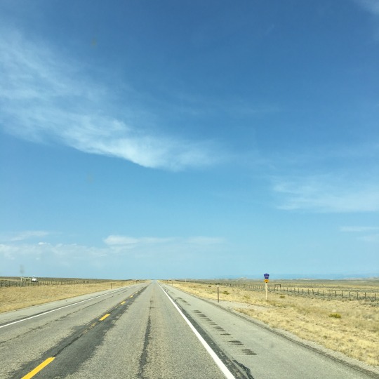
We had an early start during last morning in Utah and hit the road just after 7 AM. We ventured westward, further into the Colorado Plateau. We travelled through a matrix of arid landscapes - desert, grassland, scrub shrubs with sagebrush, and pigmy forests - which were relatively flat for the most part with table-top mountains in the distance and occasional mounds and small hills by the highway. We went for miles without seeing a single building and the colours were muted shades of straw and greyish green; even the skies were a bit hazy and overcast most of the morning.

The scenery got a bit more interesting as we entered Price Canyon, where the road travelled along the Price River. By now, the sky has also cleared up and everything has brightened up. Cliffs, towers, pinnacles, and fins of golden rocks towered over the highway most of the way, but at times they opened up to reveal spurs and valleys with sparse woodlands on the hillside.


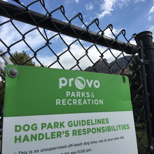
We travelled north and stopped in Provo to go to the off-leash area at Bicentennial Park for Gimli to have a bit of a stretch. Although it was a well-maintained space relatively large, they decided to use coarse sand for the ground, so it was essentially a giant litter box for dogs! It was a bit too dusty for our liking - even Gimli was a bit hesitant picking up his ball because it was covered with sand! Being home to Brigham Young University, I guess it was not surprising to see a Mormon temple on every block…. If you know us, needless to say, we did not linger beyond letting the pup out! Continuing northward, we passed Park City and saw the sprawling, developed area near the ski hills, but we did not check out this ski resort.

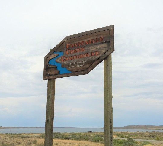
For the third time this trip, we entered Wyoming again and, by now, we were used to the endless grasslands and the remoteness. We did spot a coal mine and a couple of refineries this time though. We were originally going to stop at the campground at Fontenelle Recreation Area (by Fontenelle Reservoir), but because we started early and were feeling well-rested, we decided to just make a rest stop there and move on. When we arrived, the place appeared to be deserted except for one camper with an empty boat trailer at the boat launch. The campground was basic, but it had flush toilets and each site had its own sheltered picnic table (it was quite windy there!). It was kind of sad to see such public land/facilities (managed by US Department of Interior) not being utilized. We had a picnic lunch amongst the locals (birds and prairie dogs) and were back on the road again.


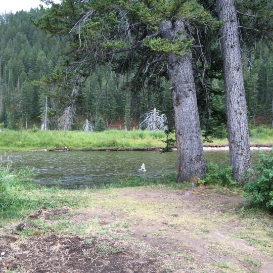
A couple of hours later, we arrived in Bridger Teton National Forest, a vast area surrounding the southern end of Grand Teton National Park. We were just about 30 minutes from Jackson and an hour from the entrance of Grand Teton, so this was a good place to stay for the night. We knew there are a few campgrounds within the Bridger Teton NF in this area, so we figured we would just drive to each one to see where we could find a spot. It turned out to be a lot easier than we thought to get a first-come-first-serve campsite close to a national park and tourist town in the middle of the summer!


We chose to stay at the Hoback Campground next to Hoback River. We found a site that backed up onto the river and decided that it was cool enough to get some firewood from our camp host for the first campfire of this trip! It was so nice being able to sit comfortably outside without any bugs! But no sooner have we settled into our camping chairs, we heard the familiar sound of distant thunder! We barely had a chance to put everything away before it starting raining! It proceeded to hail for a while before it settled into steady rain. Campfire will just have to wait.


We woke up to a chilly and refreshing morning with no rain! We met a couple, Ken and Tracy, from Florida who has a custom Class B built on a Mercedes Sprinter van. Dan spotted the brush bar on their van, so we stopped to chat with them and share van stories.

After a walk with Gimli along the river, we headed into Jackson in search of coffee and breakfast. We found parking just outside the town center and took a leisurely walk to the shops. Fortified by the great coffee and food at JH Coffee Roaster and Restaurant, we were ready to tackle the shops! We were pleasantly surprised by how many stores were dog-friendly! Gimli sure got his share of treats. praise and ear scratches!
While having coffee, I found the location of the one yarn store in town and we slowly made our way there. Knit on Pearl is in a cute little house and they have a very cozy set up inside. They have a great selection of yarn from local dyers as well as commercial brands. Since I have already got yarn from merino sheep raised in Wyoming at a different store, I decided to get a skein of blue-faced Leicester-nylon blend. The colour is tonal pale straw/beige with a greyish tinge that was very much like the grasslands that we have driven through. But the name of the colourway turned out to be Elk Horn, which was somewhat representative of the region, except that elks have antlers and not horns…. Minor details!


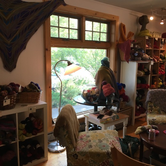

On our way back to the car, we stopped in a furniture/interior design store and had one of those weird and wonderful random encounters! The guy working there noticed the bag of yarn I was carrying and asked if I was a knitter, and if so, whether he could have my address. He proceeded to tell us that his great-aunt was a well-known knitter who used to tour the country to teach knitting and whose work was displayed at the Smithsonian. He has inherited her stash and had no idea what to do with it!! I told him that I would be happy to take the yarn off his hands and anything I can't use, I will share with my knitting friends. We exchanged contact info and that was when we found out that he lived in Hong Kong for a couple of years back in the 80's and is surprisngly fluent in Cantonese!
After spending the morning roaming around Jackson, we headed into Grand Teton National Park for an auto tour. We were disappointed that they do not have the driving tour narration for rent, but Ranger Neil gave us great advice on where to go and where to stop given our plan to be at a campground in Yellowstone that evening. He even told us where we would most likely see bears: Spoiler alert! He was bang on!
The smoke from the forest fires in the PNW has been a problem here as well and although we could still see the majestic peaks of the Tetons, everything was covered by the haze. We avoided the crowds at Jenny Lake Visitor Center and went to a viewing point recommended by the park ranger; we went up to Signal Mountain, the highest drivable point of the park and saw the expansive valley below. We were driving through the stretch of road Ranger Neil warned us about high likelihood of bear sighting when we noticed cars stopped in front of us and park rangers on both sides of the road directing traffic. We knew something was up! Sure enough, there was a black bear on a tree just like you would see on a wood carving! So that was where they got the idea!
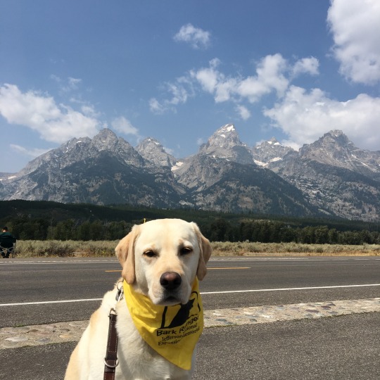

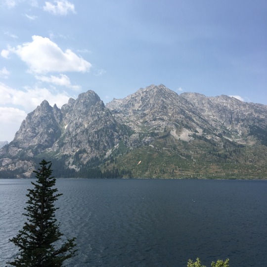

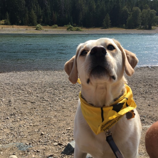
We were stopping at the park signs on the way out of Grand Teton when we met a couple from Kelowna, BC, who have just travelled through Glacier National Park. Since both places were on our "maybe list", we were interested in the fire and smoke conditions. Based on what they told us, we would be wise to avoid those areas; this also means we need to rethink our next step.
John D. Rockefeller Jr. Memorial Parkway took us from Grand Teton to Yellowstone; forest fires in the recent years were evident by the burnt dead wood as well as the new growth on both sides of the road. Once we entered Yellowstone, we travelled above the canyon through which the Lewis River flows. We caught glimpses of the river whenever there were openings between the trees. Grant Village Campground is the first campground from the south entrance and we felt quite lucky that we were able to find a spot there when we only called 3 or 4 days in advance. When we arrived at our assigned campsite, there was already someone parked there and they were not leaving until the day after. For a moment, we thought we got the dates wrong or we did not understand the labeling of the campsites! We went back to the office and they sorted things out and assigned us a different site instead.

While Dan set up camp, I took Gimli for a walk and to search for the showers because according to the map, they were further away than one would expect. I started walking further and further away from the campground and still couldn't find the showers, so I finally asked the park ranger who told me that the facilities were 1/4 mile away! Since we were planning to have a campfire tonight and would get smoky anyway, so we decided we could go without a shower for one more night.
Being in this busy campground in one of the most popular national parks, in the middle of summer, was quite a contrast after our peaceful night in the national forest campground. It was hard to enjoy the nice weather and our campfire when we had for neighbours Drummer Boy, Mr. Megaphone from California (there were about 10 guys in the group but apparently one of them was hoarding the Talking Stick), and Bob the Builder (was he chopping wood for the campfire or trying to build a freaking shed?!). We knew it would be busy, but there is a difference between a general louder ambient noise and specific people making more noise than anyone else for long periods of time. Fortunately, they all respected the quiet hours and we had a restful night.


On our first full day in Yellowstone, we got up early and got to the showers soon after they opened - yes, the showers were 1/4 miles away and available between 8 AM and 8:30 PM only. It would have been so much easier if they had been 24-hours and coin operated (1 shower per person per day was included in the camping fee and our tickets had to be marked off by an attendant with each use, and they had to buzz us into the locked shower rooms!). Although the location of the shower and the logistics involved in using them were a bit of a pain, the showers themselves were roomy and the water pressure was good, so as long as we planned ahead, it worked out just fine.
We learned the day before from the park ranger that they could only predict the next immediate eruption of the Old Faithful Geyser one at a time, so we went to the Visitor Center to check the eruption time. The timing turned out to be perfect: we had time to get coffee and breakfast at the café , walked around the store for a bit, learned about why Yellowstone NP celebrates Christmas in August (See photo), looked at the bull elk on the road, and still had time to get parking and find a good spot in front of the geyser to wait for the "show" to start. It was fascinating to watch the eruption: each time, 4000 to 8000 gallons of water (about 200F in temperature) is forced through a hole the size of a fist. The eruption we saw lasted for about 2 to 3 minutes, but it could last up to 5 minutes. We walked on the boardwalks around the geyser and saw Firehole River flow among hot springs that feed it; some of the hot springs around were of the most brilliant blues and aquamarine in colour. The water was so clear that you could see the contours of the wall a few feet into the pool.
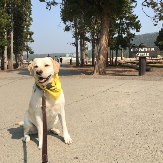
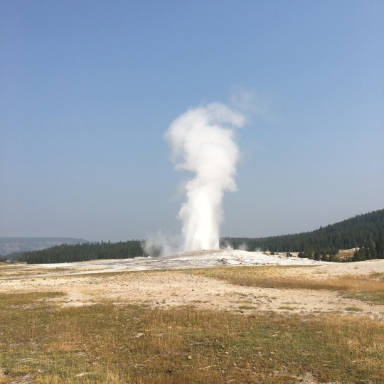
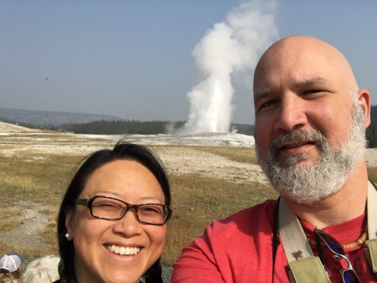

We visited Firehole Lake next and saw more hot, steaming, bubbling pools of water as well as a lone bison in the woods. We were expecting to see bison in herds, but it turned out this would not be the only lone bison we spot in the park… maybe that is what an introvert bison does when the herd becomes too much for them! We continued to drive through the park and when we arrived at Hayden Valley, the woods and mountains opened up to reveal an expansive grassland. Dan was just making a comment about this being prime bison territory and that I should get the binoculars ready when he spotted a dark spot in the distant. That spot turned out to be a bison that was standing among the herd. Once we stopped and climbed up the ladder at the back of the van, we could see the entire herd. It just put a big smile on my face and gave me the chills to see these majestic animals in their natural environment.
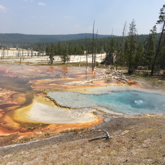

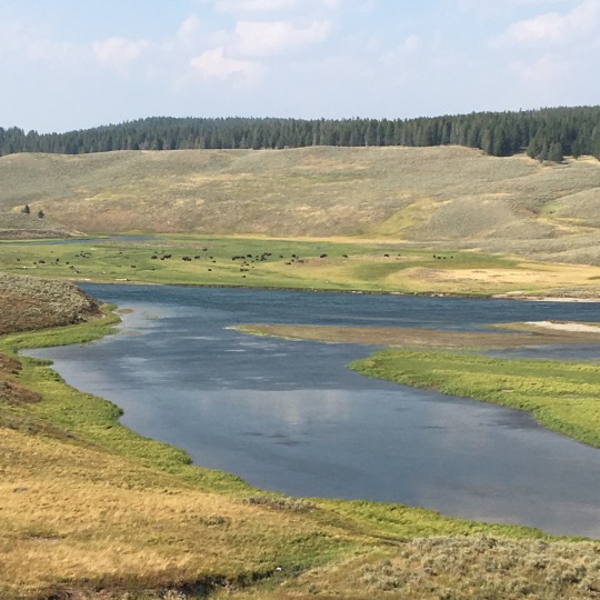
We were feeling really good about spotting that herd, but little did we know that there was a bigger herd on the other side of the valley when we drove a bit further, nor did we expect to have that "quintessential Yellowstone experience" of encountering the bison herd crossing the road this morning! We drove through Hayden Valley again on our way to tour the northern part of the park when we came across the "wildlife traffic jam". A number of park rangers were working on getting cars and bison moving along and we were lucky that a spot at the pullout opened up. We stayed there for a while to observe the herd up close and personal! When we started to leave, a couple of them decided to cross directly in front of us, but then the park ranger shooed them along and one of bison got spooked and almost ran into Bilbo!
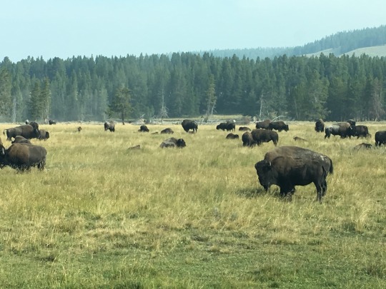


We stopped to check out the Upper Falls and the Grand Canyon of Yellowstone and ran into Ken and Tracy again. We had a good chat with them and offered them our driveway for boondocking when they are in Seattle. It was at the Upper Falls that we encountered the hoard of tourists that we were worried about… it was so crowded that I could not wait to get out of there. Having said that, it was the only time during our visit at Grand Teton and Yellowstone that we encountered that many people - Dan was worried that it was going to be crazy busy in the parks in mid-August.

Our last stop in Yellowstone was Mammoth Hot Springs where we drove through the hot springs on what was essentially a paved bike path. The constant flow of hot water and the minerals deposited created a unique environment - vegetation was sparse and the most prominent plant appeared to be junipers-- which was starkly different from the grassy rolling hills in the surrounding. While we ate lunch at Mammoth Village, we saw a herd of elk having their lunch on the hillside. But that these were not the last of our wildlife sighting: there was a small herd of mountain goats by the road causing minor wildlife traffic jam on our way out of the park as well as a lone elk near the park entrance bidding us farewell as we left.


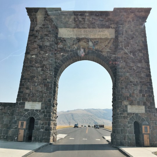
Not knowing where exactly where we would go from here, we decided to stop at the next town where there was better connectivity to plan the rest of our trip. After considering a few options while stopped at a gas station in Livingston, MT, we decided to aim for Bend, OR, and then to the Oregon Coast before heading home. Once that was settled, we got in touch with Dan's karate friend, Doug, in Spokane to see if we could stop by their place tomorrow evening. For tonight, we found a site at a KOA campground so that we could do laundry. Tomorrow, we will return to Washington State briefly before the last leg of our journey in Oregon. Until then, good night from Butte, MT.
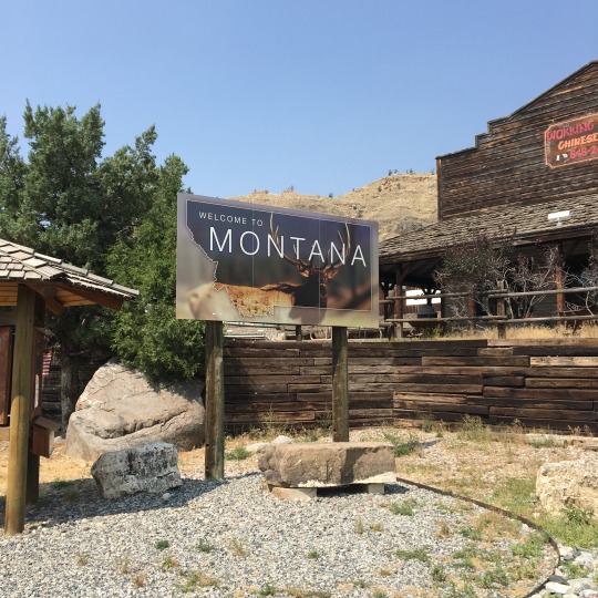
Check out our route on Roadtrippers!
#crosscontinentalroadtrip#roadtrip2018#bilbothevan#thereandbackagain#hymeraktiv#vanlife#campervan#bigsky#yellowstonenationalpark#grandtetonnationalpark#bridgertetonnationalforest
0 notes
Text
Outdoor Cooking Equipment You Need to know
Did you know you can come together two loves: of cooking and natural history, by investing in the most excellent, most hard-wearing and all-weather outside cooking equipment? Well, it's true; numerous people love the consideration of summer approaching purely because it gives them a probability to head out the doors and whip up some immense family meals because they have the just what the doctor ordered opening and tools to do so and outside cooking equipments make the job easier - and fun too!
Earlier times did not have the amenities and design options of today's highly developed and modified outdoor cooking apparatus types, but did all right for themselves; however, we have it well again today with the giant leaps made by man and knowledge in this field. You may bring a folding knife with you. So you can cut anything when cooking time.
There are numerous ways to enjoy the sumptuousness of being in nature's lap and cooking in the open air too, as the fresh air and scenery - even if it's backyard cooking and not the camping justification - provides a great, fun-filled chance for all to cook, spend quality time, chat and express amusement together. So pick the right outdoor cooking apparatus for your relations size and the kind of cooking you intend doing in the future; inconsequential, portable foodstuffs that are easy to clean are best, but if you are the recognizable backyard cook, you can opt for more enduring fixtures.
The basics of outside cooking equipment comprise the mandatory camp-stove that is budget-friendly and brightness (the backpack representation is lightweight and easy to use, ideal for hikers and anglers) and more often than not work on kerosene that one can store and carry without problems, besides using it to illumination camp-lanterns. Besides this, other pinnacle products for outdoor cooking take account of the char-grill, (some campgrounds have their own, on the other hand, avid campers may have a preference to carry their own), which cooks steaks and other meats well in a substance of minutes, giving it a lovely flavor; they are also reasonably priced and portable.
youtube
Thus, the most excellent of outdoor cooking equipment must be cost-effective, energy-efficient and durable above and beyond being uncomplicated to carry so that your backyard barbeque or campfire meal is cooked just right while making amusing less of a chore and less time-consuming too. Besides enabling you to cook for more populace in a short time, the use of specific and cheap outdoor cooking equipment like the charcoal grill also enables you to cut down on methods like frying, which use a lot of overweight and cut back on the lubricant by giving you the healthier alternative of cross-examination and roasting.
0 notes
Text
An 8 hour drive from Scottsdale, Lone Pine, California is the gateway to Mt. Whitney. My buddy TUBS and I started out on a Sunday after work and drove late into the night, eventually pulling off Highway 395 about an hour south of town. After a night in the car, we worked up the next morning and headed straight to the Inyo National Forest Office to retrieve our backcountry permit.
Heading west, a 12 mile drive takes you through the picturesque Alabama Hills with sweeping views of the Sierra Nevada mountains just behind. Some switchbacks and a few miles of steep grade brings you to Whitney Portal (elevation 8,000 ft). It was a bit hard to believe we still had another 6,000+ feet to ascend to the top. That’s more than climbing out of the Grand Canyon!
Whitney Portal consists of a campground, a store. and a small restaurant that cooks pancakes big enough to feed an army. It was hard to resist chowing down, considering the next two days would be filled with ramen, pretzels, and granola bars. We weighed our backpacks at the trailhead, around 30 pounds each, and set off to climb the highest mountain either of us had ever ascended.
To infinity and beyond!
…Or just the summit and back.
The Mt. Whitney Trail
From the trailhead, it’s about 3 miles of climbing to Lone Pine Lake. It is a beautiful alpine lake and the clearing provides some great views of the granite outcroppings and sparse pine forest that make up this landscape. We hung out at the lake for a while before pressing on.
Lone Pine Lake (CA)
Soon after the lake, the trail skirted a wonderful meadow. The lighter yellows of the grass made a wonderful contrast to the grays of the granite and bright blue sky. After the meadow came another beautiful lake called Mirror Lake.
Continuing our climb, we left the big Ponderosa pines behind as we ascended above tree line. From here on it, it was small grasses, moss, and scattered boulders to keep us company. Sometime in the late afternoon we reached the popular Trail Camp.
Trail Camp is around 5 miles from the summit, and makes the summit ascent much more manageable. For this reason it definitely fills up. There aren’t really any designated campsites… any flat spot amongst the boulders will do. At 12,000 feet, it is a desolate and cold place to camp for the night. Us Phoenix boys were downright freezing!
I threw on my long undies (look out ladies!) and we huddled around our stove cooking ramen. When the meal was consumed it was straight to the warmth of our sleeping bags. Sometime in the night a helicopter could be heard flying overhead. I didn’t think much of it and of course TUBS snored right through it!
The Push to 14,000 Feet
The next morning we headed up the toughest part of the trail: the “99 switchbacks” to trail crest. We managed alright and soon were hiking behind the famous pinnacles of Mt. Muir. It was here that we ran into a couple of search and rescue guys; the helicopter last night was part of their mission. Apparently, when the injured hiker learned the steep cost of the bill he suddenly decided he could make it down on his own!
Another hour or so and we were sitting on the summit. At 14,505 feet, Mt Whitney is the tallest mountain in the lower 48. Incredibly, the lowest point in North America, Badwater Basin (-280 feet), is only 85 miles away. The views from the summit were simply phenomenal. The Sierra Nevada Mountains to our west were gorgeous and glacial lakes were aplenty! To the east lie the deep Owens Valley and Lone Pine, far, far below.
We sat on top for awhile and took a sip or two of whiskey from a fellow hiker’s flask. Then it was time to turn around.
The Way Back Down
The way down was long and arduous as always, especially once we had the heavy backpacks over our tired shoulders. What kept me going were the people we met along the trail who had hiked the entire John Muir Trail. The trail runs 210 miles from Yosemite, ending at Mt. Whitney. Even after hiking for weeks straight, they were nothing but smiles.
We ended up grabbing some celebratory burgers and beers with an older couple who had just finished such a journey. I was blown away by their wilderness stories. I thought our trek to the summit of Mt. Whitney had been difficult, but for them it was simply the final few steps of an incredible trek. Maybe someday I will hike the John Muir Trail myself.
For more information on Mt. Whitney check out this website.
As well as the Inyo National Forest website.
Mt Whitney: A Summit Post
0 notes
Video
Autumn Escapes in Pinnacles National Park by Mark Stevens
Via Flickr:
A view looking to the northeast at the Pinnacles Campground Store in Pinnacles National Park. My thought on composing this image was to get down low and then use the LiveView LCD screen to capture a look across these fallen leaves.
#Autumn#Autumn Colors#Autumn Leaf Colors#Autumn Leaves#Azimuth 32#Carpet of Fallen Leaves#Carpet of Leaves#Central California Coast Ranges#Central and Southern California Ranges#Day 3#DxO PhotoLab 6 Edited#Fallen Leaves#Fallen Leaves Across Landscape#Forest Landscape#Gabilan Range#Landscape#Landscape - Scenery#Leaves#Looking NE#Nature#Neenach Volcano#Nikon D850#Outside#Pacific Ranges#Partly Sunny#Pinnacles#Pinnacles Campground Store#Pinnacles National Park#Pinnacles National Park and California#Project365
0 notes
Last Seen Blogs

tattoowitchmal
Mal.

bellechimes
Belle

sakuranonabi
sakura no nabi

vendeasart
My little world

etreacy
Erin Treacy: in the studio & things that inspire