
siberiablog
Siberia Blog
About life in a secret nuclear city in Russian Siberia
2 posts
Don't wanna be here? Send us removal request.
Last Seen Blogs
feelfreetotake
Templates of my own creation

life-is-a-movie
boring bitch

waterbabie55
Untitled
pensieri-vanno-e-vengono
scintille

jessnothard03
radiate love🌊
Text
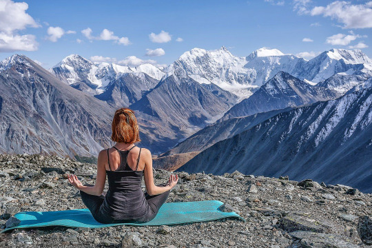
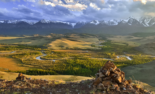
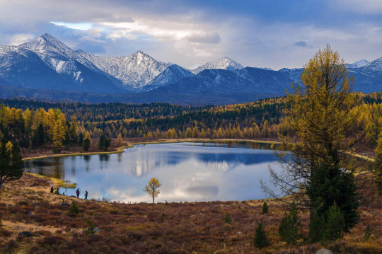
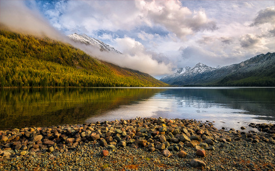
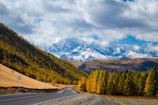
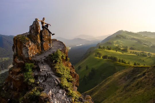
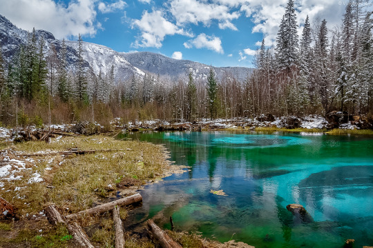
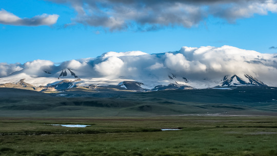
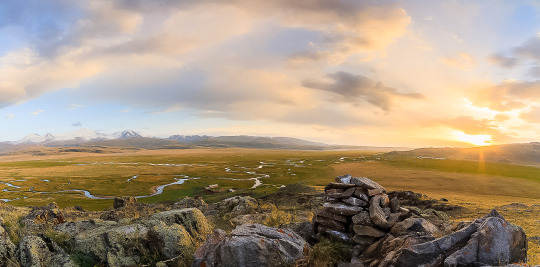
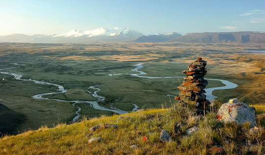
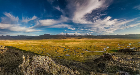
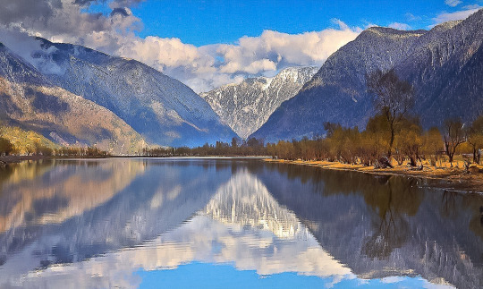
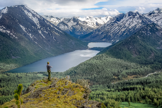
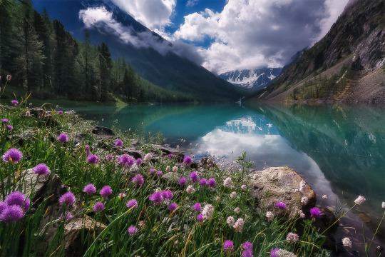
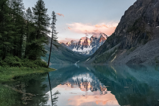
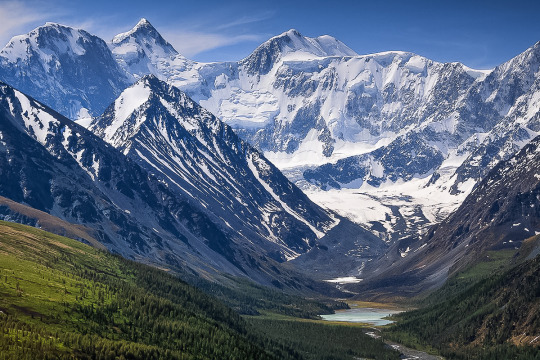
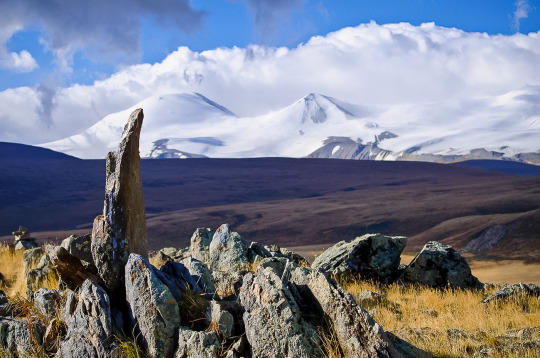
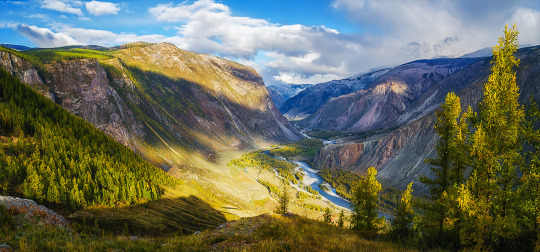
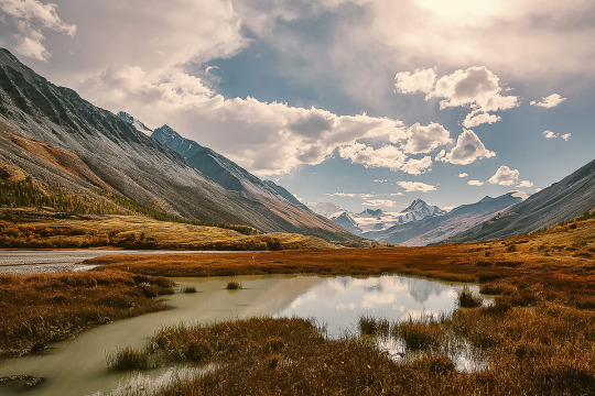
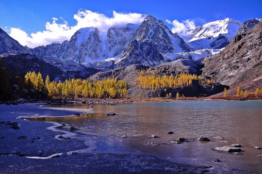
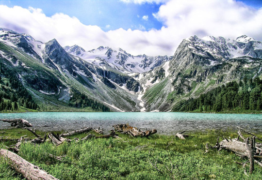
Mountain Altai, country of the spirits.
Greetings, my dear reader! Today I would like to tell you on my blog page about the region of the country that is popular in Russia and is loved by all Siberians — the Mountain Altai. Perhaps in this difficult time for the whole world, we need reasons to distract from sad thoughts, to dream about future trips, when the Covid-19 epidemic will finally be defeated by humanity and all roads and borders will be opened to us again.
So, this is a post about natural and tourist attractions. A kind and dreamy topic that I would like to write about in my blog first of all.
Everyone loves the Mountain Altai. Perhaps outside of Russia this area is not as well known as for example the same lake Baikal or other business cards of tourism in Russia. Or am I wrong, and this is a fairly well-known topic? My dear reader, feel free to write about it ;)
In any case, I hope you will be interested to learn something new. Or just look at photos of nature. This is a review post, it will not contain much specifics, if you want to find out more, write to me, and I will try to cover the topic that interests my reader in more detail.
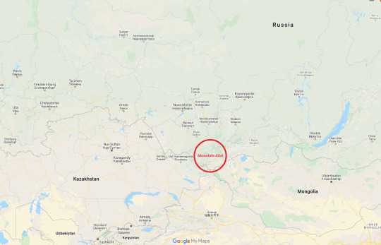
Mountain Altai is an amazing and very beautiful region, about which many enthusiastic words have been said and written. Golden mountains-this is how Altai is translated from the Turkic languages. Mountain Altai is located in Central Asia, Siberia and borders countries such as China, Mongolia and Kazakhstan. The capital of the province is Gorno-Altaysk. The most popular place to start a trip to Mountain Altai, where there is a major transport hub and an international airport — the city of Barnaul.

Residents of the European part of Russia sometimes confuse the Mountain Altai with the Altai country. These two regions border in the Siberian Federal district, but they are quite different: mountain landscapes are typical for the Mountain Altai, but the Altai country is green steppes and Terry hills.
Mountain Altai is probably one of the favorite vacation spots of my countrymen.. About 700–800 kilometers from my hometown is just a day’s drive away. You can have time to go to the Altai for some long weekend. It should be noted that Mountain Altai is one of the cleanest regions of Russia. There are no industrial enterprises or Railways. Only infinitely beautiful and fascinating nature. It seems impossible to remain indifferent to the natural beauty of the Altai mountains.
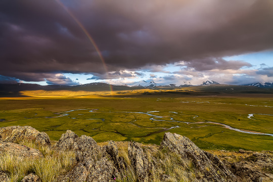
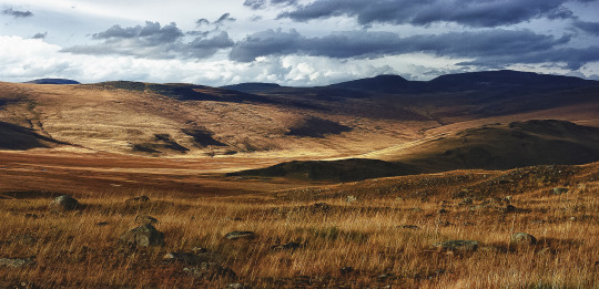
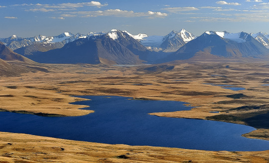
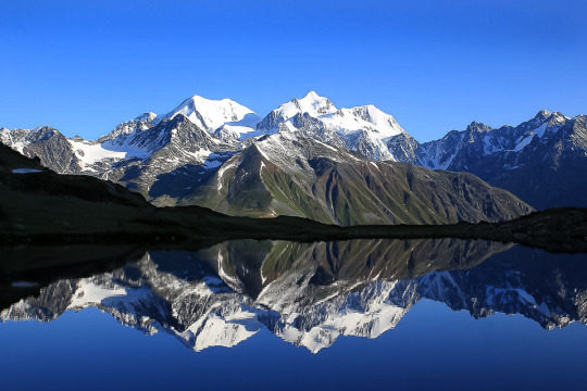
The nature of Altai is not just diverse, it is extremely contrasting. Taiga forests quickly give way to dry steppes, low mountains and hills change to snow-capped peaks, among other things the highest in Siberia, and rivers and lakes here change their color depending on the time of year. The weather and climate in the neighboring valleys can vary greatly — Altai is striking for its variety of nature and landscapes on a relatively compact area of the planet, which is of course extremely convenient for tourists.
At the same time, the tourist infrastructure is relatively well developed (in the whole Eastern part of Russia). First of all, of course, tourists should count on an inexpensive and unpretentious level of tourist bases, especially far from civilization. But there are also more expensive hotels for the demanding traveler. I am glad that here you can arrange a vacation at any level of available funds, while the prices IMHO are the most honest and balanced in Siberia.
It is worth noting that the Altai mountains with their natural attractions are included in the UNESCO world heritage list.
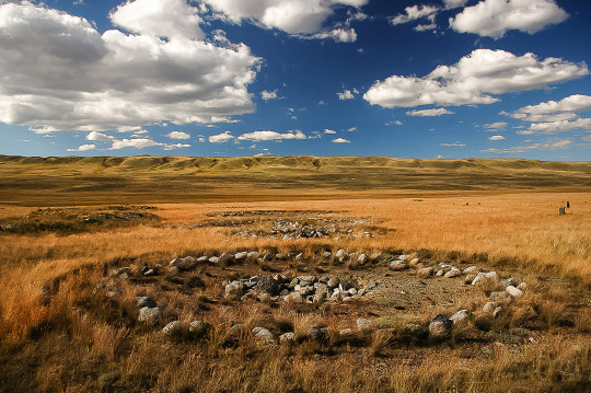
This is the Land of seven thousand lakes, turbulent rivers and silent landscapes. Here rises the largest mountain in Siberia, and passes one of the most picturesque roads in the world, archaeologists find ancient artifacts in mounds, and shamans conduct their mysterious rituals in places of power.

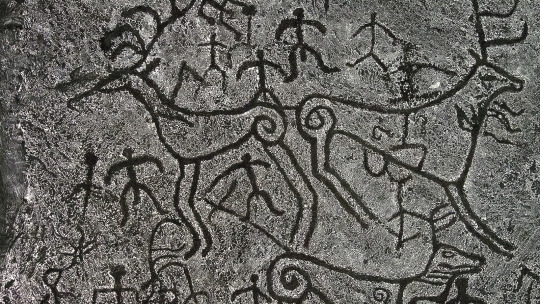
In ancient times, the paths of nomadic tribes crossed in the Altai mountains. Hundreds of thousands of years ago, people already lived in this area, and traces of them are found throughout the territory: unique rock petroglyphs, burials in places of power, and Parking lots.
For centuries, this harsh but picturesque region was part of the great Mongol Empire: the horses of Genghis Khan’s army trampled the delicate bowls of Edelweiss in the valleys and overcame steep mountain passes.
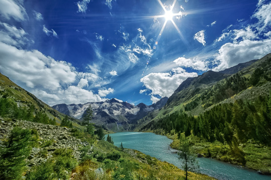
Altai is an ideal place for eco-tourism. The main value of the region is its nature, and the path to the most picturesque places is often thorny, but the effort is worth it. Here you can organize a week-long hike, swim in one of the crystal-clear lakes, go fishing or pick berries.
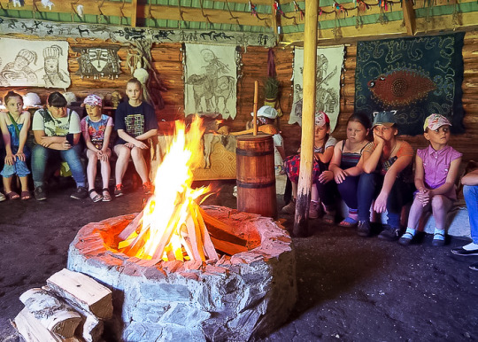
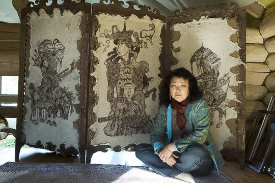
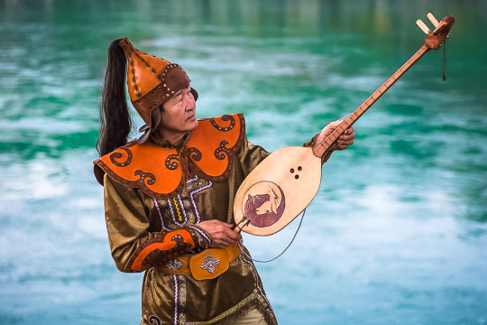
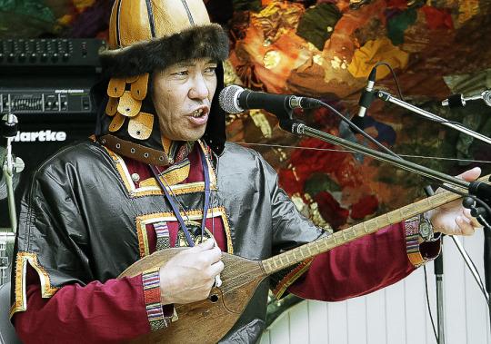
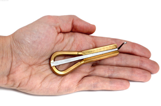
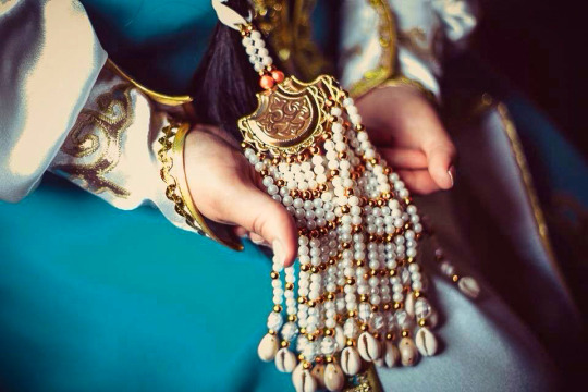
Another format of travel in the Altai is ethnographic excursions. For example, in the Yurt-gallery of Kalambina Zheltkovskaya, guests are introduced to traditional felt products, and in the ethnomaster “Aychus” they are told about Turkic patterns, learn to make amulet dolls and play national instruments: Komus and Topshuur.
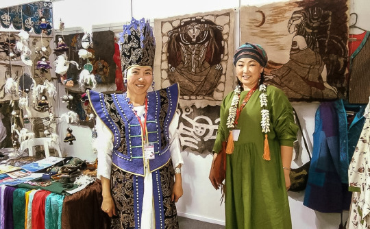
national musical instrument Komus:
national handmade guardian amulet Aichus:
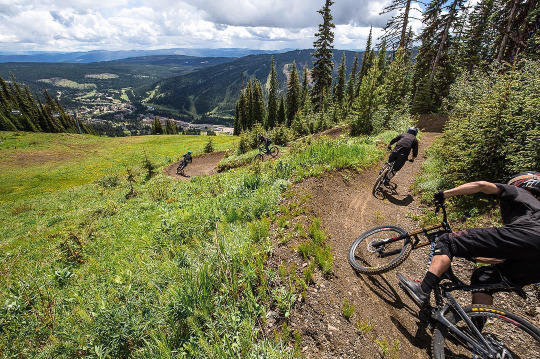
And, of course, extreme tourism! Ascents to the peaks, rafting of any level of complexity on rough rivers, skiing: there are good trails on the shore of lake Teletskoye, and the resort “Manzherok” is not only the slopes, but also the first professional Bike Park outside the Urals.

What to see in Altai? Cascades of rivers, mountain tops, crazy passes. What to do in Altai? Wake up with the sunrise, wash with cold water from the stream, admire the views from the car window, conquer the mountains, breathe deeply, listen to the legends about the eternal lands that the locals love to tell in the evenings.

Who is suitable for a holiday in the Altai mountains?
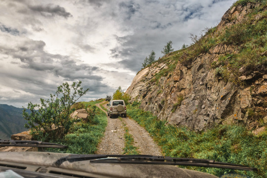
This region is for those who are willing to sacrifice comfort in order to see the incredible landscapes and pristine nature with their own eyes. There is often no net, you can only drive an SUV, and from the nearest village to the next lake or mountain you need to walk for several days. But it is in such places that you relax from the city, put your thoughts in order and get charged with energy!
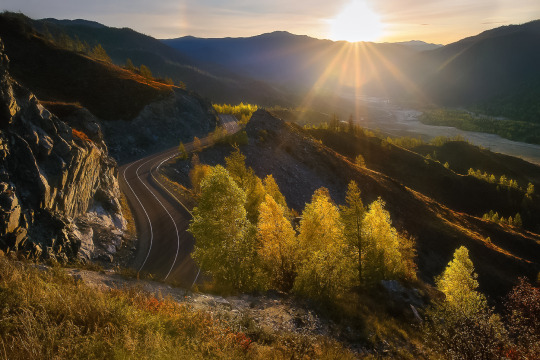
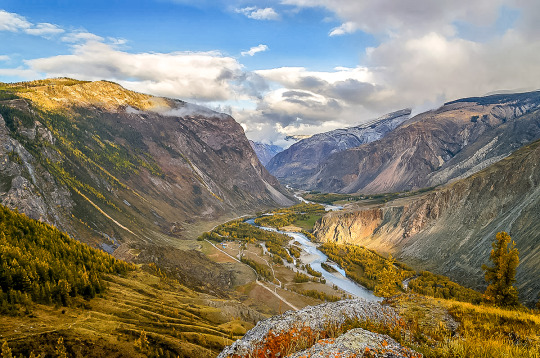
The best way to explore the Altai Mountains is to travel by car along the Chuysky tract. This is a Federal highway with a length of 968 kilometers that crosses the region from Novosibirsk to Mongolia, it is called the most picturesque road in Siberia, and the magazine National Geographic Russia even included the Chuysky tract in the top 10 most beautiful roads in the world!
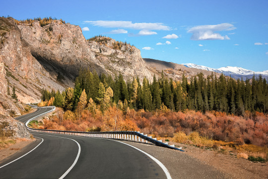
In places, the remains of the old road remain near the new highway. The Chuysky tract has existed for many centuries and in ancient times was part of the Great Silk Road from China to Europe!
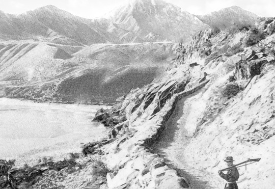
ancient and modern photos of the preserved section of the old Chuysky tract:
In the year of Gorny Altai is visited by about two million people! Today I’m talking about what is interesting in this region and where to look for the most-the most places.
The mountain Devil’s Finger
On the way from Biysk to the Seminsky pass, make a small stop and climb the Devil’s Finger. The ascent will not take much time, but you will get a stunning view — it is not for nothing that it is included in almost all the lists of “What to see in the Altai”.
There are many such “magic fingers” all over the world — a giant rock ledge on a mountain, pointing to the sky. But ours is also with a marigold, so they love to look at it in the Altai.
According to legend, this is the finger of a villain named the Devil. He came to these lands to capture them, but one of the brave Altaic warriors was able to fight back. The devil was trampled into the ground, and only his petrified finger remained on the surface. According to another version, the enemy was repulsed by the Moon itself — it descended to the Earth and drove our enemy so deep that only a finger and a nail remained.
The Devil’s Finger is really an amazing place — esotericists believe that a great power is stored in the rock, which can cure infertility and energize. Do not be lazy to go up and see what kind of view opens from the observation deck: the valley of the Katun river and the entire Altai at a glance.
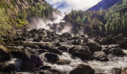
the rapids of a mountain river:

How to get there: from Biysk through the village of Souzga about 114 km. The reference point will be a telephone tower installed near the mountain.
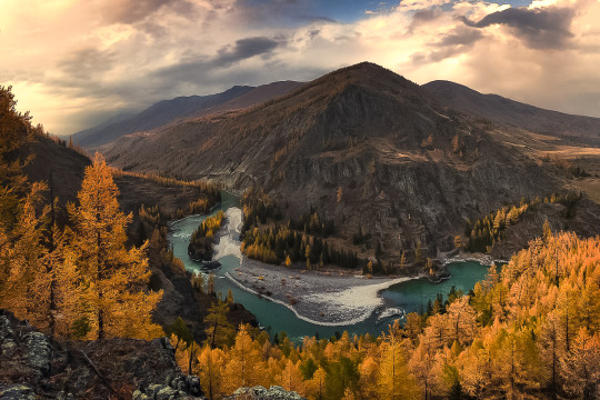
The Katun river — the hostess of Altai
“Mistress” — this is how its name is translated. The largest river of the Republic originates at the slope of Belukha and rushes away for 688 kilometers. On its way there are rapids and boulders, which then turn into flat areas, and the total height difference along the course of the current reaches two kilometers! This is due to the” restless nature “ of Katun: it flows softly, then rumbles between the stones. The river crosses all types of Altai landscape, so the animal and plant life along it is very diverse.
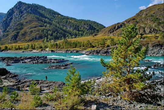
In the area of Biysk Katun meets Biya — the confluence of these rivers is considered one of the most picturesque in the Altai! Katun changes its color throughout the year, acquiring the famous turquoise hue in early autumn.
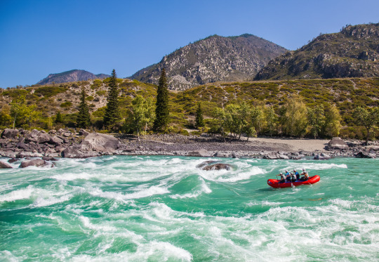
Hundreds of thousands of tourists flock to Katun every year: some-to relax on its banks in a tent or at a recreation center, others-to test their strength by rafting on the river. Most rafting routes start in the Katun nature reserve.
rafting on the Katun river:
Katunsky reserve is a border area, so you need to get a pass in advance before visiting it. To enter the reserve, you also need to get a permit — you can do this in its administration, which is located in the village of Ust-Koksa. Most of the river downstream has free access.
The coordinates of the source of the Katun: 49.779 318, 552 86.592.
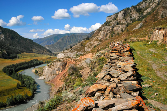
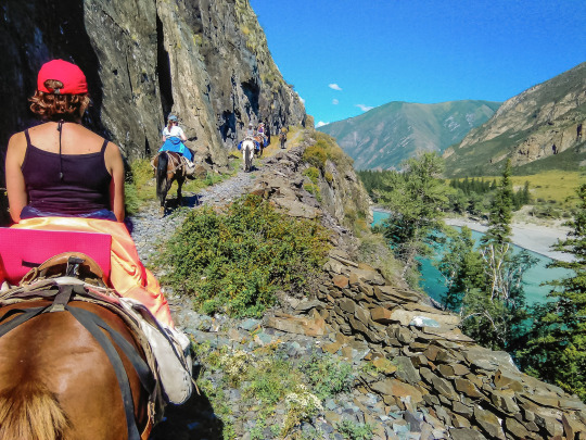
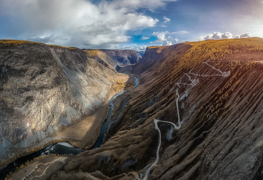
Chike-Taman Mountain Pass
Mountain pass… ract. Now a new, good road has been laid here. At the same time, the preserved old trail, which zigzags along the neighboring slope, almost overgrown, adds color to the already gorgeous view of the huge Terektinsky ridge, which opens from the observation deck.
the old road of the Chike-Taman mountain pass, it is still possible to drive along it. It is part of the ancient Great Silk Road:
How to get there: the Pass is located on 685 km of the Chuysky tract, 320 km from Biysk and 75 km from the Seminsky pass. The ascent, as well as the descent, is four km.
sightseeing tour of tourists on horseback along the preserved from ancient times section of the Great Silk Road from China to Europe in the area of the Chike-Taman pass:
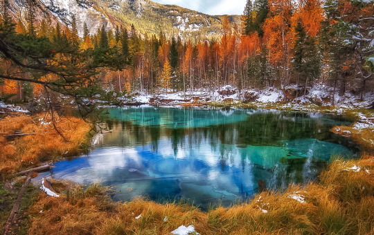
Geyser lake
This small lake, located near the village of Aktash, does not freeze even in winter. Its water has an unusual pattern formed by circles of blue clay-they are carefully “laid out” on the bottom of the underwater keys. The drawing is not static and changes throughout the day.
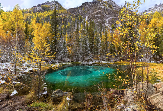
Now the lake is the property of the camp site “Little Paradise”, which recently leased it for 20 years. Every year this place becomes more and more popular with travelers, so you should come here early in the morning to catch up before the arrival of tourist groups. And it is best to stay for a day at this camp site, then you can easily choose a time period for viewing the Geyser lake more convenient. The camp site is not expensive, spending will not hit your pocket. Passage to the lake is paid: about 50 rubles (less than one Euro), guests of the camp are free of charge.
Coordinates: 50.290 140, 87.673 125.
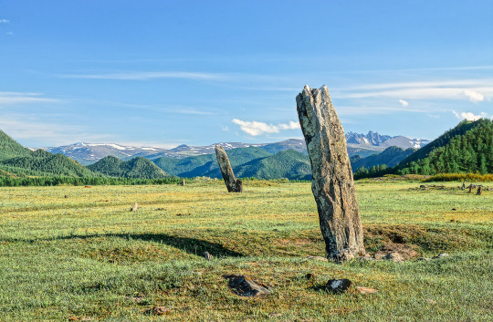
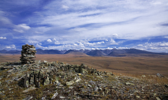
The Ukok high plateau — is a mysterious place of power
It is located in the very South of the Altai Mountains, near the border crossing of four countries: Russia, China, Mongolia and Kazakhstan. Here, at an altitude of more than 2200 meters above sea level, 150 archaeological monuments were discovered: prehistoric rock paintings-petroglyphs, deer stones, burial mounds of the Pazyryk culture, Scythian graves.
In 1993, archaeologists unearthed a mound that perfectly preserved the remains of a female mummy more than 2,500 years old. She was named the “Princess of Ukok” and taken to the soran Museum of archeology and Ethnography in Novosibirsk. In 2012, the “Princess” was returned to Altai, and since 2014, the local Council of elders has been seeking to re-bury the find: according to the elders, natural disasters have struck Altai because of the mummy being disturbed.
On the territory of the plateau there is a natural Park “Ukok”, which is divided into three zones: one of them prohibits any activity other than scientific, the other allows only limited and regulated access, and only the third is available to travelers. The fauna of the plateau untouched by civilization is very diverse: here you can easily see a wild horse, a wolf, a Fox and even a snow leopard! And in the sky above the silent landscapes soar eagles, Golden eagles and black storks.
Walking tours and yoga tours are organized on the plateau, esotericists often come to this place, and shamans conduct their rituals here.
Coordinates: 49.360 813, 88.76 642.
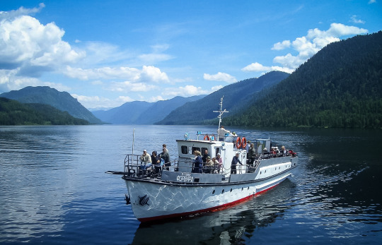
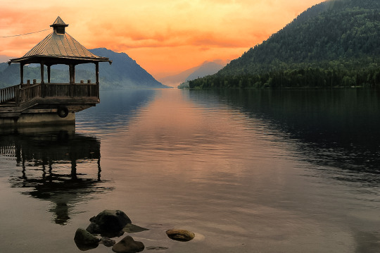
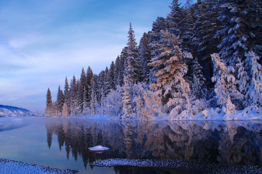
Lake Teletskoye
Perhaps the most popular attraction of the Altai mountains. It is the largest lake in the region and the second largest freshwater reservoir in the country after lake Baikal. The depth of the Teletskoye reaches 325 meters. Three small villages Nestle on its banks: Yaylu, Iogach and Artybash. To relax and swim, choose one of the hotels on the southern shore: in summer, the water temperature rises to +17°C — + 20°C, but in the North, in the area of Artybash, the lake remains cold even in hot weather-about +10 °C.
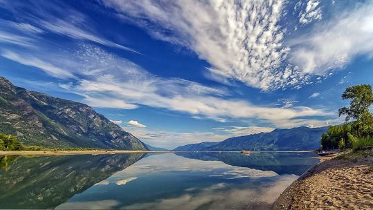
The water in Teletskoye is so clear that even at a depth of 15 meters you can see the stones lying on the bottom. You can set up a tent on the beach or enjoy the scenery of the lake by going for a ride on the ferry: it follows from Cape Kyrsay, which is on the southern coast, to the pier in Iogach — 78 kilometers of the way along the water surface will give you a pleasant experience and gorgeous photos!
Coordinates of Cape Kyrsay: 51.363 980, 87.760 251
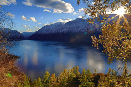
Teletskoye lake is famous for its cold water at any time of the year, its gigantic size, many types of fish and amazing landscapes. Here you can come to one of the camp sites or savage, you can fish, go on excursions to the nearest mountains, admire the cascades of waterfalls or even meditate-choose what you like, just do not forget to take warm clothes! Despite the fact that Teletskoye lake is one of the most popular places in Altai, many travelers are forced to avoid it if they choose attractions only along the Chuysky tract. Those who get to Teletskoye lake do not regret the time spent on the road. Even hotels and camp sites that have grown up like mushrooms on the coast do not violate the special atmosphere of this place — it is easy to let go of worries, forget about sorrows, and learn to recharge from nature.
The locals consider the lake Holy and call it the Golden lake-Altyn-Kel in the local dialect. Esotericists believe in its magic power, tourists come from all over the world to Altai, just to see Teletskoye lake and experience its magic for themselves. Do you want to see what this place does to you?
Golden lake-sunset on lake Teletskoye:
Most of the lake is included in the Altai State Natural Biosphere Reserve, so to visit it, do not forget to issue a pass — it is easy to get it in the village of Artybash or the village of Yaylu.
What to see in the surrounding area: Korbu and Chodor waterfalls, Karagay Bay, Chulyshman valley, zoo and ethnopark in Artybash village, Tilan-Tuu and Kokuya mountains (the latter can be reached by lift).
How to get there: the most convenient way to get to Teletskoye lake is from Gorno-Altaisk-it is 269 km to the nearest village to the lake, Artybash. regular buses run along the route. You can get to the South Bank by ferry, which runs from Artybash a couple of times a week, or by a beautiful circular road through the entire Chuisky tract and the terrible Katu-Yaryk pass. The last part of the path is accessible only to all-terrain vehicles.
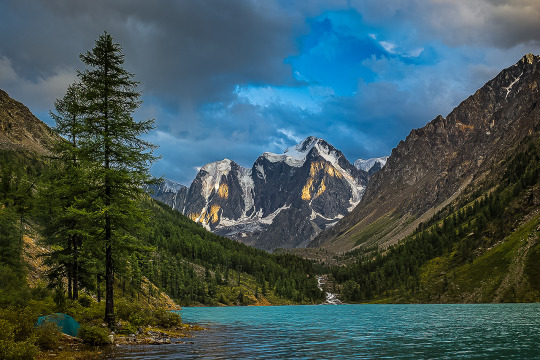
Multinskoe lake
So we got to the most popular place among tourists in the classic lists of “What to see in the Altai” — the Multin lakes. There are five of them: Lower, Middle, Upper, Transverse and Strong (very logical, Yes). Most often, tourists include the first three in the route. At the same time, the most popular is the Lower Multinskoe lake. It is the largest, it is easier to get to it, there are camp sites nearby and everything you need for a comfortable stay by the water.
The most beautiful thing is waiting for you between the Lower and Middle lakes — this is where the water cascade “Multinskiye shumy”is located. Then the road leads to the Upper lake. It is located on the territory of the Katunsky reserve, so you will need to pass through the cordon, coordinate the route with the Rangers and pay a small fee.

How to get there: from Biysk to the Multin lakes 535 km through the Seminsky pass.
Take care of your documents in advance! Don’t forget to take your passport — there is a Kazakh border near the lakes, they can check your documents. Citizens of the Russian Federation need only a passport, but guests of the country will also have to get a pass. It is issued on request in the Department of the Federal security service of Gorno-Altaisk.
The Petroglyphs Of Kalbak-Tash
A large complex of ancient rock paintings has more than 5 thousand images. According to scientists who have studied Kalbak-Tash, the drawings were created by people who lived here from the Neolithic era (IV-VI centuries BC) to the middle ages (VIII-X centuries ad). on the stones you can see figures of animals that inhabited the Altai several thousand years ago, hunting scenes and various, including solar, symbols. The people who carved them on the rocks used both stone and metal tools. Researchers refer well-preserved runic inscriptions to the ancient Turkic epoch. Some of the depicted stories can be easily correlated with the well-known Altaic myths.
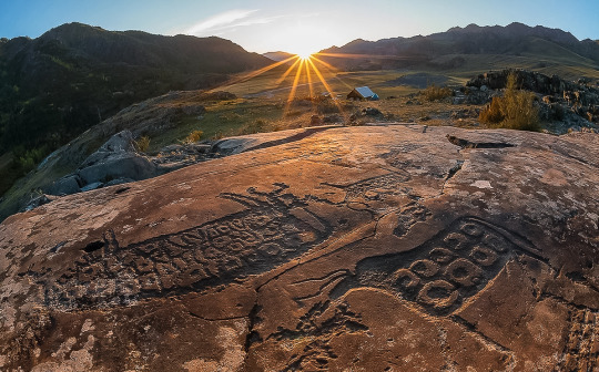
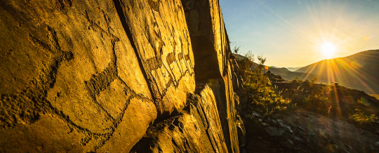

How to get there: the rock art complex is located on the right Bank of the Chui river near the Chuisky tract. After the “723 km” mark, turn left between the fourth and fifth poles of the power line and walk about 20 meters to the rocks.
Katu-Yaryk Mountain Pass
Ready for the most spectacular serpentine ride of your life? The pass is only thirty years old — until 1989, there was only a steep horse trail, now there is a dirt road. Climbing it is wildly scary, but all this will be forgotten as soon as you can look at what opens from above — the winding path of the road, colorful mountains, stormy mountain streams, waterfalls and the tops of centuries-old trees. It’s breathtaking!
Katu-Yaryk in numbers:
Height from the bottom — 892 m;
The average slope of 18% (10°);
Slope steepness-70% (35°);
Length-3.9 km;
The number of turns is 9.
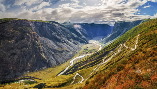
How to get there: by ferry across lake Teletskoye (the cost of crossing one car is 10,000 rubles). Then go along the Chulyshman valley for about 20 kilometers. The second option is from the village of Aktash, which is located 100 km from katu-Yaryk. Accordingly, this road leads to the southern shore of lake Teletskoye. It is desirable to go in high-traffic vehicles. Low cars often lose their bumpers on the road, and non-four-wheel-drive cars are not able to climb to the top of the katu-Yaryk mountain pass on their own due to too strong a slope and rocky obstacles on a narrow road cut through the rock. However, in the tourist season, a four-wheel-drive truck from the nearest tourist base is always on duty at the bottom of the pass,which for a small fee will drag the monoprivod car up.
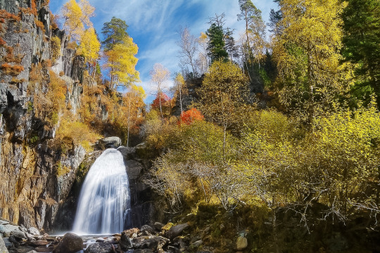
Big Chulchinsky waterfall or Uchar
The highest and most unusual waterfall in the Altai mountains! Its waters loudly and spectacularly cascade down from a height of 160 meters. It is located on the territory of the Altai State Reserve.
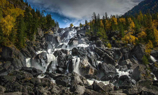
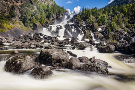

“Uchar” is translated as “unapproachable”, and the waterfall justifies this name: the way to it through the picturesque expanses of the reserve takes about four hours and requires good physical training — the trail is quite steep, some sections are duplicated by safety cables. However, you can often meet children and elderly people at Uchar. No special skills are required for visiting.
Coordinates: 51.118 079, 88.91 675.
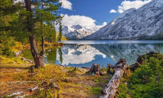
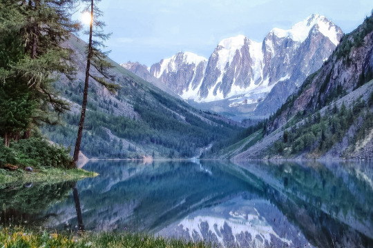
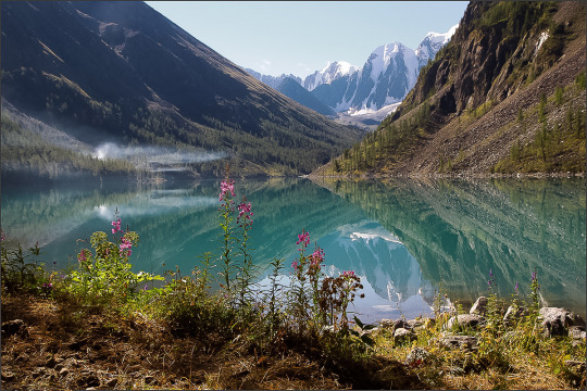
Shavlinskoe lake
They were formed as a result of the melting of ancient glaciers. The lakes are located in the heart of the North Chui Mountain Range and are considered the most picturesque in the entire Altai! Their water has a fantastic bright turquoise color, and from the banks there are incredible views of three Altai peaks at once, whose names are Dream, Beauty and Fairy Tale.

You can get here as part of walking tours organized by companies in Biysk and Gorno-Altaisk. The route starts from the village of Chibit and lasts about a week.
Coordinates: 50.106 689, 87.410 589.

Kek-Tash cave is one of the deepest in the country
Kek-Tash, translated from the Altai means “Blue stone.” This name was given to the cave because of the unusual gray-blue color of its limestone vaults. Bizarre stalactites and stalagmites, labyrinths of caves with dead ends, lakes-inside Kek-Tash a whole underground world with fantastic landscapes! There are several large halls that are connected by narrow passages. This is the deepest cave in Siberia, its length is 2.3 kilometers, and the tunnels go deep into the mountain for 350 meters.
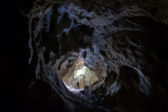

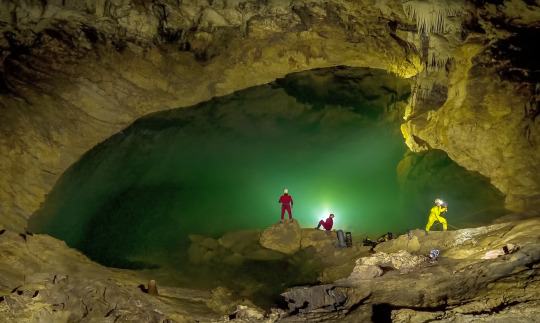
Kek-Tash is located in the North of the Shebali district, and you need good physical training and special equipment to visit it. Basically, come here if you like sports, tourism, diggers and explorers.
The coordinates of the entrance to the cave: 51.728 933, 85.656 417.
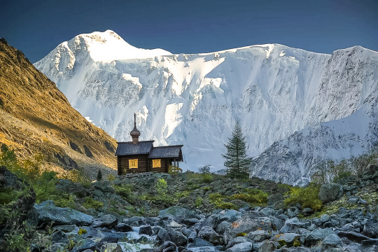
Belukha mountain is the main peak of the Altai
The highest peak in Siberia got its name because of the non-melting snow cap on the top. The locals also call it Uch-Sur — “Home of the Three Gods”. This mountain can be seen on the coat of arms of the Altai. The famous Russian traveler and esotericist Nicholas Roerich depicted its southern slope in one of his paintings. He was sure that the entrance to the mythical land of Shambhala was hidden here. “Lady of the Altai” — so the artist called his mighty snow-covered Muse.
the chapel under Belukha mountain:
The beauty of Beluga is best viewed from the Akkem lake. Climbing to the top with a guide costs about 30 thousand rubles per person. You can also see the mountain from a bird’s-eye view by participating in a group helicopter tour from Gorno-Altaisk. It lasts 7–8 hours, and the cost per person is about 28 thousand rubles.
Climbing Belukha will not be easy, but the tests will pay off with a vengeance — on the way to the top (height-4506 m) you will meet blue lakes with crystal-clear water, unique plants — at the foot of the mountain there are dense coniferous forests, birches, tundra lichens, berry bushes and flowers that are included in the Red book.

The best season to climb the mountain is summer, but even in July, be prepared to get caught in snow. The climb will be difficult and exhausting, and if you are not lucky with the weather, it will be delayed. Yes, it is better to go on such a trip with an experienced instructor or group.
Apart from the road to the bottom of the mountain and the time for acclimatization, the ascent takes about two days. On the first stage, pass the “Watermelon” glacier, Delaunay pass and Mensa glacier, and on the second day they already storm the top.
The coordinates of the vertices: 49.807 679, 023 86.590.
How to get to Altai?
From Moscow to Gorno-Altaisk. Almost all domestic airlines have direct flights to Gorno-Altaisk, and if you buy tickets in advance, you can snatch quite profitable tickets even for direct flights, and with a transfer so much the more. The flight duration is from four to five hours.
From Moscow to Biysk. An option for romantics and lovers of sleeping under the sound of wheels: by train to Biysk, the road will take almost three days, but when did this stop us? When you look at the ticket prices and calculate how much you will save in comparison with the plane, do not forget to add the expenses for food on the road. And in General, familiarity with Russian Railways will expand your horizons and prepare you for difficulties :)
From Saint Petersburg to Gorno-Altaisk. There are no direct flights to Gorno-Altaisk, so you will have to go with a transfer in the capital. If you can snatch cheap plane tickets (in the spring of 2020, there are many such offers), it will be both fast and profitable. If there are no successful plane tickets, then choose a train — one night, and you are there.
Via Novosibirsk to Gorno-Altaisk. This option is ideal for tourists who start their journey not from Moscow — flights fly to Novosibirsk from almost any city in Russia (and besides, they fly for cheap!), and then you can get by plane or bus to Gorno-Altaisk.
Especially worth noting is Barnaul — the largest transport hub relatively close to the Altai Mountains.
Going on a trip to the Altai is easier than it seems — in Biysk, Barnaul and Gorno-Altaisk, you can rent a car (with or without a driver), roads to the main tourist sites are paved, camp sites, hotels are built, and camping sites are equipped. This world is waiting for you!
1 note
·
View note
Text
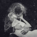
What does a “secret” closed city, classified during the USSR, hide?
…a common sight in my hometown of Seversk

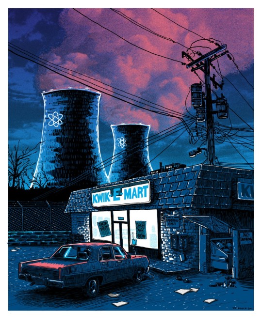
A slightly creepy illustration about a closed nuclear city will set the atmosphere for this article :)
In the era of socialism, the Soviet Union had many closed cities that were hidden not only from the prying eyes of enemies, but also from their own people. These cities weren’t even shown on the map until 1993, but they were home to thousands of people who didn’t actually exist. Most of these closed cities in Russia were excluded from train and bus routes, and were known only by their postal code, consisting of a name and number.
Tomsk 7- this is written in my birth certificate document in the column “ place of birth”.
Today, most of the former closed cities are open to the public, but there are some that are still hidden by the authorities. It is estimated that today there are about 40 closed cities in Russia, and more than 1.5 million people live here. If you want to visit a closed city, you need to get special permission from the security services, and it is not easy to get it. Permits are mostly reserved for relatives of people who live in these cities, or for those who are assigned there for work or service.

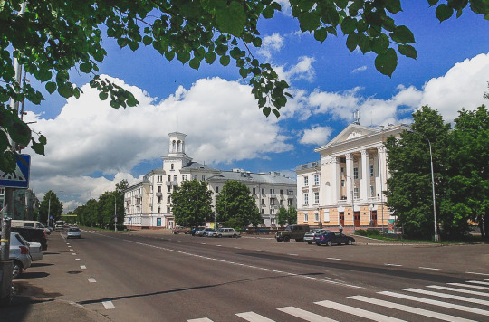
Seversk today: the main street of the city is called “Communists Avenue”
I was born in a closed city and lived in it for more than forty years — all my childhood and youth. Seversk is a closed locality, since its territory is home to a plant for the production of highly enriched uranium and plutonium. In General, the secret of the nuclear industry.
What is it like to live behind barbed wire, sew a respirator for yourself in BLS lessons (Basics of life Safety, in Soviet and now Russian schools there is such a thing) And why do I watch the TV series “Chernobyl” with completely different eyes?
So, my hometown is Seversk. One of these legendary “secret” cities of the USSR. This blog entry is dedicated to a brief description of it. I will tell you the history of the city and touch a little on current life. so that the reader has some minimal idea about this place.
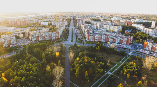
Seversk today: a bird’s-eye view of the city
Seversk is located in the geographical center of Russia, in Western Siberia, on the right Bank of the Tom river, a couple of dozen kilometers from the regional center — the large ancient Siberian city of Tomsk. This is away from the usual tourist routes, a provincial city on the plain, where of the natural attractions in the surrounding area, first of all comes to mind only the world’s largest swamp, it is difficult to compete with tourist centers in Moscow or St. Petersburg, the historical pearls of the “Golden ring” of Russia or the famous Baikal. But relatively close to us are the wonderful Altai mountains and Tomsk itself is known for its ancient wooden merchant buildings. For those interested in the history of Russia and the USSR, especially some dark pages of the past, we have something to see ;)
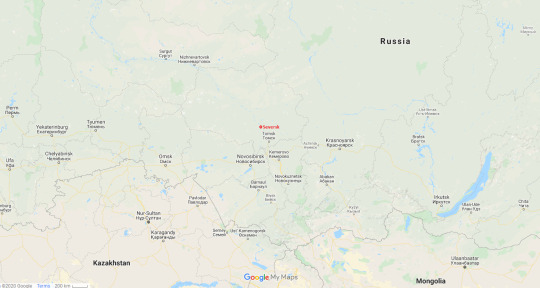
google maps, Seversk in red
A closed city is not just a name. It is really surrounded by a solid protective strip around the perimeter. The city is surrounded by a perimeter fence with 5 rows of barbed wire. This is not a saying, there are really 5 of them. For the unprepared, it looks creepy, for the residents of Seversk — a common thing. All roads to and from the city pass through special checkpoints (abbreviated as KPP).
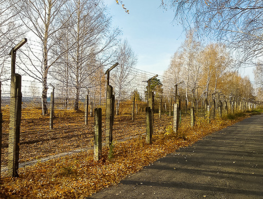
a wall of barbed wire on the border of the city
In this regard, the main document of the northerner is not the passport of the Russian Federation. The pass is our everything! You can only enter the city through a checkpoint with a special pass. “Without a piece of paper, you are a bug” (a Soviet folk saying) in our case works 100 %. If you forgot or (Oh my God!) lost your pass — you just can’t get into the city. What to do? Call relatives in the city and sit at the checkpoint, waiting for them to bring a pass. For such at the checkpoint there is a special bench, and people almost always sit on it. The city is located on the river, which means that a trip to the beach in the summer-also through the checkpoint. And that’s when the pass is easy to lose. And it can also be pulled out by thieves along with the wallet. Or you can leave it in another bag. In General, when you use a pass every day, it becomes commonplace.
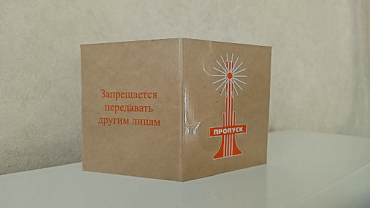
special pass to a closed city, the inscription on the left — “ it is forbidden to transfer to other persons”
Every time you drive into the city, you show your pass, open the trunk and all the doors in the car. Armed military personnel are searching you, your document, and your car.
Strangers are often shocked by this situation, but we are used to it, there are almost no people who are dissatisfied with the city’s regime among my friends, this is additional security in the city.

Stella at the entrance to the city
Stella at the entrance to the city, it is she who is depicted on the cover of the pass to the city. Stella is decorated with the image of the “peaceful atom” — a new concept of the city.
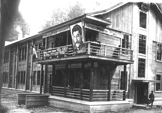
Seversk was founded in 1933 as an independent locality. It was then that the barracks were rebuilt and a youth labor commune was created (a normal phenomenon in the spirit of post-revolutionary Russia) with the proletarian name “Chekist”. In Russian, a Chekist is an employee of the “Cheka”(R.E.C.) or the all-Russian Emergency Commission by analogy with the current Russian name of an organization with similar functions — the FSB (Federal Security Service), probably known to you, dear reader, the Soviet secret service KGB (state Security Committee), or for example, a similar organization is the USSS. Maybe these linguistic explanations explained something to some of the readers :)

old photos of the area “security officer”. To the right, next to the new high — rise building, the oldest building in the district-a wooden hardware store-was preserved for a very long time, almost until the two thousandth years. I remember it well, a ramshackle old building with creaking floors and peeling green paint on the wood. Now in its place is a modern shopping center
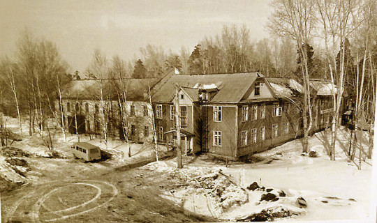
Under the commune, there was a labor camp for” re-education by labor “ of idlers, parasites and other members of society who were not conscious, according to the authorities.
old photo of the labor colony building
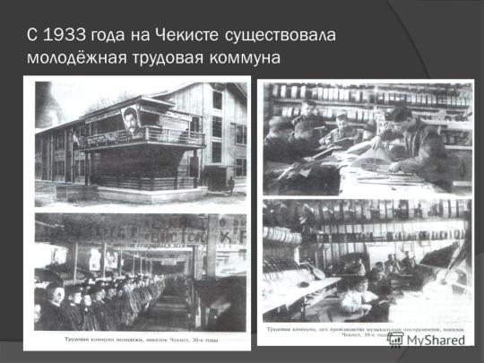
old photo — labor colony in the commune of “Chekist”
The commune gave its name to the village in which lived the first builders of the city. After this name passed to the area of the city located here today. Now this neighborhood is the South-Eastern border of the city. There is a stadium “Trud” and a sports school, a children’s health camp, the main medical center of the city and a dacha village that runs up to the mouth of the Kirghizka river.
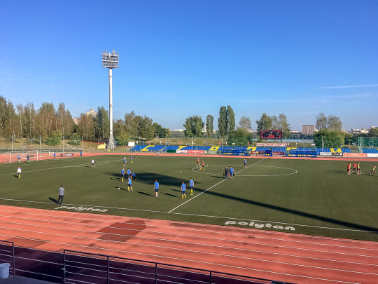
Seversk today: stadium “Trud” (translation - Work)
By the way, in the mouth of the Kirghizka river, which is considered the territory of Seversk, there was a monastery in about 1650, which can be considered the oldest building in the city. Alas, it lasted less than a century — as follows from the Chronicles, the monastery was destroyed and washed away by a flood in 1730. But I do not plan to go so far into history, otherwise I will have to mention the sites of primitive people and numerous finds in them found on the banks of the Tom river.
We will go back to Soviet times. In General, there were several villages on the site of Seversk. Some were transformed and became the outskirts of the city, some concrete jungles of the city just swallowed up, such as the village of Beloborodovo. It was located in the area of the current “new city” (relatively new multi-storey areas) and was formerly the outskirts of Seversk. I remember, as a child, we often rode bicycles with neighboring boys in Beloborodovo, drinking water from the pump — a stupid excuse to just roll somewhere :) The village, as such, finally disappeared in 1980.

Seversk today: Pobeda street is the widest street in the city, located in the new part of Seversk. 40 years ago there was a village Beloborodovo
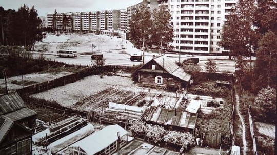
Old photo, high-rise buildings of the new district absorb the old wooden houses of the village of Beloborodovo
And for example the village Iglakovo exists to this day, only transformed it in a holiday cottage complex. Now this is the western border of the residential part of the city, then the industrial zone begins.
The future Seversk began to turn into a city in 1949, shortly after the end of the terrible and bloody Second World war. Then the Council of Ministers of the USSR decided to build a plant for the production of enriched uranium and plutonium near Tomsk.
The new industrial complex was originally called the “Zauralskaya office of Glavpromstroy” or Combine №816.
However, during my youth, the labor of prisoners was not used for a long time. But the construction of the young city actively involved the internal troops of the USSR — the so-called construction troops. Units of the army without high military qualifications, in which young people, soldiers of military age, mastered the peaceful construction profession. I think, during my childhood, this was the largest army category, something like reserve troops in case of an enemy attack. These soldiers-young people who served for two years after reaching the age of 18, had to learn the basics of military discipline and the basics of popular construction professions after school and College, being both a reserve of combat army units and a “free” labor force of the Soviet state. This is a tricky Soviet system, which had both negative and positive aspects… Of course, the internal troops were not the most prestigious category. All those who dreamed of military service, wanted to get into any other army. It was still completely incomprehensible and uninteresting to us boys from the eighties. For that it was interesting to get to the construction site and try to exchange for example for fried sunflower seeds or just beg for a shiny soldier’s button with a star or even better, a cockade. The king of wishes, I remember, was a soldier’s belt with a huge badge :)
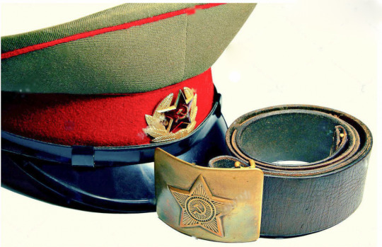
a military cap with a cockade and a belt with a shiny shirt — the dream of boys in the USSR :)
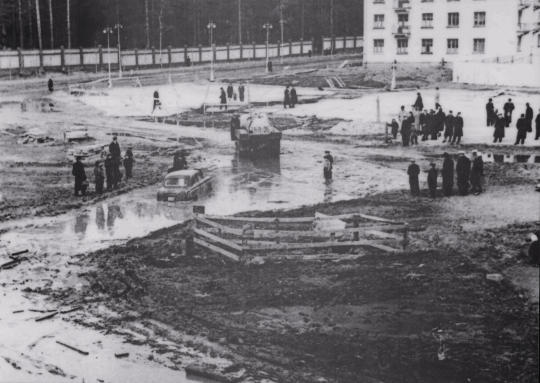
An old photo of construction of Seversk. A truck tries to pull out a car stuck in a large puddle
The original code name of the “Сity-Mailbox number 5”, because the construction of the city-forming plant was named: mailbox #5, in this regard, the city was colloquially called “the Fifth Postal” or simply “Postal”. Seversk is still often called “Postal” by locals for old times ‘ sake, most of them don’t even know where it came from.

“Postal”… The famous computer trash-FPS of the same name is just a funny coincidence ;)
In 1954, the closed settlement was given the name Seversk, but later documents began to refer to it as Tomsk-7 for reasons of secrecy. That’s the name on my official birth certificate. This is my homeland. A beautiful and cozy young city, whose residents bravely forged the atomic shield of the Motherland with their own hands for several years. (irony with a huge amount of truth)
The world’s second industrial nuclear power plant (NPP-1, also known as Sibirskaya) with a capacity of 100 megawatts was built in Seversk in 1958.
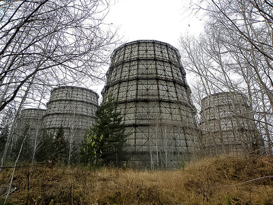
a cooling tower from Seversk nuclear power plant
The symbol of any nuclear power plant is a cooling tower. They cool the treated water that is fed from the reactor, then this water is discharged into the river.
The city’s secrecy status was lifted in 1989. At the same time, the city returned its name — Seversk. During the time of Gorbachev and Perestroika, secret production was reduced due to the disarmament program and ceased to be secret. Production was curtailed, and enterprises were repurposed for the production of peaceful products. The last reactor was shut down and mothballed in 2008. The production base and scientific potential of the former “military” industry is now engaged in peaceful research, primarily in the disposal of nuclear waste.
The city is still closed, although all the secrecy has long been removed. Every year, the regional administration discusses the issue of opening the city and removing the checkpoint, but so far everything is still the same. Residents see development prospects in the event of opening the city, but are aware of the possible loss of the current advantages of increased security, space and cleanliness of the city. There is no consensus among the people. This is how we live now. Yes, I forgot to mention that the city’s population is currently just over 100,000 people. In the neighboring regional center — Tomsk, which is 15 minutes away by car just over 600,000 residents. Seversk is considered the largest closed city in Russia. The city is cozy, clean, and self-sufficient. We live and work in the same way as residents of any other cities. All the infrastructure is there.
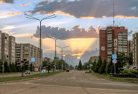
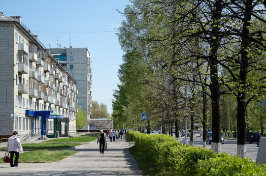
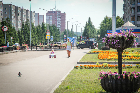
Seversk today: city streets
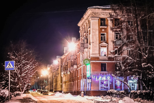

Seversk today: the old part of the city, winter
Seversk today: cinema “Russia”. In Soviet times, the city had three cinemas, but now with the development of television and the Internet, the interest of viewers has somewhat decreased.

Seversk today: The city is home to the largest monument to Vladimir Lenin in Siberia. It is installed on the square in front of the administration building
Perhaps it is worth noting that the people of Russia in general are calm about some historical buildings and monuments. There is no such thing that with the new trends of time something began to have a negative assessment in society and there was a need to immediately erase reminders of this from the face of the city. Even streets, as you may have noticed, are rarely renamed, although the Communist ideology has long ceased to be relevant. Well, is “Lenin” worth it and worth it to yourself, does it interfere? This is primarily a historical monument from the period of the city’s formation, we rather rethink and treat such monuments as architectural historical buildings. No, in the nineties, we also had a wave of reformers who wanted to demolish everything old for some reason, but thank God common sense still prevailed and now such objects can be safely recorded in the sights of our city, giving it its own identity.
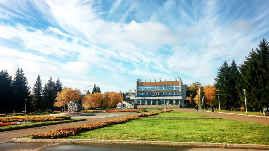
Seversk today: the building of the city administration
Seversk today: Nikolai Ostrovsky theater in the old part of the city
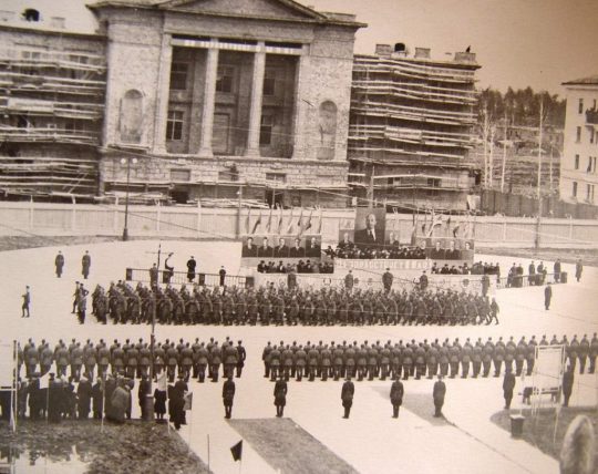

old photos: on the Left, the construction of this theater, 1958, the parade on the square of the same name. On the right is a theater in the late sixties

Seversk today: authentic old streets, classic “Stalinist” buildings

Seversk today: as the antipode of the previous photo, high-rise buildings in the newest district of the city, near the river Bank. By the way this place used to be a cargo dock
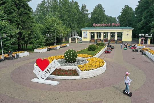
Seversk today: entrance to the nature Park in the city center

Seversk today: Museum, music school, “Khrushchevskaya” building in the center of the city… and on the horizon pipes of frozen regime nuclear facilities
Since childhood, we have understood what city we live in and what can happen at any moment. This was recalled by the inscriptions on the houses “Shelter-5 m”. They were in any part of the city, installed in the basements of apartment buildings.
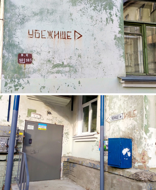
inscriptions on houses “Shelter-5 m”.
Such small concrete towers are found all over the city: on playgrounds, on city alleys, near the roadway. This is the ventilation system of urban shelters. When you stand next to one of these, you realize that under your feet is a network of underground corridors.
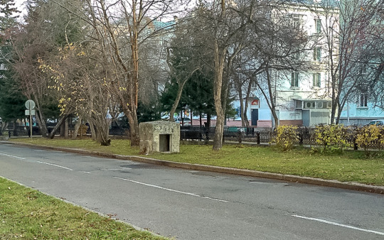
concrete ventilation towers in the city
In the lower grades of the school, training activities were also conducted on the organized issue of protective respirators and gas masks and rapid movement to the nearest shelter. Passed standards for the time of putting on a gas mask. I also remember how we were shown special posters and educational films. I can still see the “atomic shadows” from those posters. Imagine a person standing and casting a shadow on a wall. At the moment of radiation, a person evaporates, but his shadow remains. This is called the “atomic shadow”. That is, the person is no longer there, but his shadow is there.
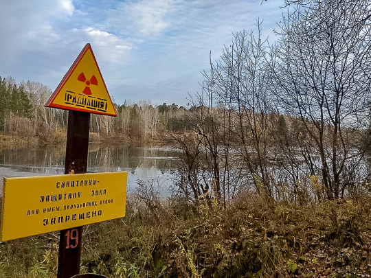
sign “radiation” on the Bank of a small river near the city
This sign stands on the Bank of a small river, which is popularly called the Daisy. By analogy with the sign of radiation. It was from here that water was taken to cool the nuclear reactor, which produced fuel for the nuclear power plant. The water was also returned there… In the river, fish are caught, unnaturally enlarged in size, which clearly should not be eaten.

a berry “Irga”
All residents had the idea of fix-products that remove radiation from the body. For example, everyone had honeysuckle and Irga berries growing in their gardens. Everyone ate these berries in buckets. Although outside the city, many do not even know that there is such a berry — Irga.
In addition to the time, date, and temperature, the main city clock also shows the radiation level. I’m sure most of the city’s residents have no idea what level is considered normal. But in fact, the norm is 15–20 microrentgen/hour. By the way, in some Russian cities the radiation level is much higher than in our country. But if you take a walk with a dosimeter in some places around the industrial zone, you can find bad places…
Here it is worth Recalling again the excellent TV series “Chernobyl”. No, it is not perfect, it is too” Western “ conveys the communication of people — in the USSR, people did not talk like this and did not behave like this, it has a lot of “cranberries”. This term is used by the Russian audience to describe the demonstration of unreliable Western cliches and images about Russia or the USSR in the cinema. But in terms of scenery and atmosphere, the film is certainly impressive. Personally, I liked it.
All closed cities are very similar-the architecture, the location of the streets. Especially the old part of the city, which was built during the Soviet era. That is why I watch the TV series “Chernobyl” with different eyes. I watch Chernobyl, but I see Seversk.
Of particular interest is the fact that an outstanding scientist Valery Legasov once lived and worked in Seversk. Yes, the same Legasov, the main character of the series “Chernobyl”.

On the nuclear topic, I would also recommend to you, my dear reader, the Russian film “Aurora”. A very emotionally moving film with a brilliant atmosphere. If you find somewhere this movie with a translation into your native language, I highly recommend watching it!
And why did I remember movies with atomic catastrophes after a note about city clocks? Of course, because this crown is close to the residents of Seversk. In 1993, an accident occurred at the Siberian chemical combine. The explosion resulted in the release of radioactive substances into the atmosphere, and 1946 people were exposed to radiation. Index on the international scale of nuclear events INES-4.
I remember the atmosphere of suppressed fear in the city during this event, even though I was still a young boy who only had girls on his mind. And I remember how three months later, at the end of August this year, a group of schoolchildren went for a walk “around the objects”. Well, such a self-entertainment event on school holidays, a twenty-kilometer hike along the “wild” route around the regime objects. Walk, hot summer, the birds are singing. Boys flirt with girls — in General, the usual walk of youth. We have already gone quite far, almost half of the route. The path makes a sharp turn and behind the dense foliage of acacia, a group of youngsters in open summer clothes suddenly face to face with a group of adults in white protective suits, fully closed “spacesuits”, with dosimeters similar to mine detectors, which these “cosmonauts” were leading in a line along the road and roadside. We stood up, our mouths open and our eyes wide. “Spacesuits” , too, I think were taken aback, perhaps they wanted to tell us something, but because of the glass they did not hear anything. Perhaps the senior one waved his hand at us intensely, saying get out of here immediately. They ran as fast as they could. Such a funny childhood memory.
In the end, I would be happy if some of my readers, inspired by this article, wanted to visit my native Seversk for tourist purposes. Moreover, despite the status of a closed city, the administration of the Siberian Chemical plant regularly conducts excursions to the territory as part of organized tourist groups. You only need to have a group or the help of a local travel Agency in the organization. And of course extra time, the documents of all willing participants are carefully checked by the FSB :)
However, it seems to me that with the latest photos and information, I drove away any desire to come to us :)
And now you see Seversk as something like this:
Seversk is not really like that!
Please remember it better this way:
This is a full-length statue of a Mother and child near a children’s clinic in the city center. the monument is very old, I remember it from my childhood and I always liked it very much.
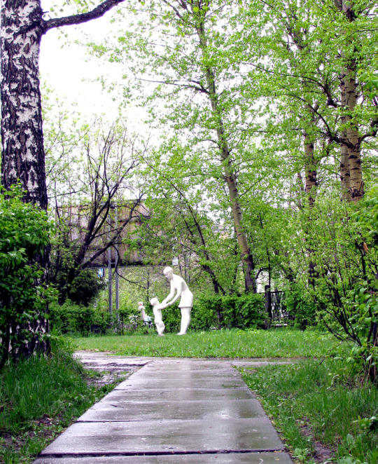
statue of a Mother and child near a children’s clinic
3 notes
·
View notes