
Last Seen Blogs

jamluisa
things i like.

dulcedolorroma-blog
RomaSinDolor

vinegarcrisps
tudja hol szeret a cápa

papaslittlekitten
Папина маленький котенок

khalmoha120-blog
Kholood.
Text
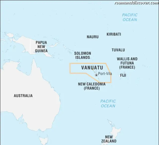
Vanuatu

If you're looking for an off-the-beaten-path destination that's both breathtakingly gorgeous and culturally rich, Vanuatu is the place for you. Located in the Pacific Ocean, Vanuatu is a group of 80 islands with stunning beaches, lush rainforests, and a unique blend of traditional and modern culture.
The name 'Vanuatu' is derived from the word 'vanua,' which means 'land' or 'home' in many Melanesian languages. The 'tu' ending is simply a plural marker, so Vanuatu could be translated as 'many lands' or 'many homes.'
The history of Vanuatu is as diverse as its landscapes. The islands were first settled around 3,000 years ago by indigenous Melanesian people. In the 1600s, Europeans began exploring the area, and by the late 1800s, both French and British colonizers had established a presence in Vanuatu.
Today, Vanuatu is a mix of traditional Melanesian customs and practices and contemporary influences. The country boasts a rich biodiversity and unique geology, making it a haven for nature lovers. Visitors can also enjoy cultural experiences, such as witnessing traditional ceremonies, tasting local cuisine, and exploring local markets.
- Geography: Vanuatu is an archipelago of 80 islands, stretching over 1,300 kilometers in the South Pacific Ocean. The islands are volcanic in origin and have stunning coral reefs, white sand beaches, and lush rainforests.
- Ecology: Vanuatu is home to a variety of ecosystems, including tropical forest, mangroves, and coral reefs. The islands are also home to unique plants and animals, many of which are found only in Vanuatu.
- Biodiversity: Vanuatu has a high level of biodiversity, with many unique plant and animal species, including the world's smallest mammal, the bumblebee bat.
- Climate: Vanuatu has a tropical climate, with high temperatures and humidity throughout the year. The islands are prone to cyclones and other severe weather events.
Vanuatu faces a number of environmental challenges, including deforestation, soil erosion, and marine pollution. The country has taken steps to address these challenges, including creating protected areas and implementing sustainable tourism practices.
The political system of Vanuatu is a parliamentary democracy, with the president as the head of state. The country has a diverse economy, with agriculture, tourism, and fisheries as the main industries. The infrastructure in Vanuatu is limited, particularly on the outer islands.
If you're interested in science and technology, you'll find plenty to discover in Vanuatu. The country has made significant advancements in areas like renewable energy and disaster management.
Vanuatu is also home to a number of notable people, including the former Secretary-General of the United Nations, Kofi Annan, and the Olympic medalist, Margaret Gatty.
The population of Vanuatu is predominantly Melanesian, with smaller populations of Europeans, Asians, and other Pacific Islanders. There are over 100 different languages spoken in Vanuatu, making it one of the most linguistically diverse countries in the world.
The culture of Vanuatu is rich and diverse, with traditional customs and practices still observed alongside contemporary influences. Visitors can witness traditional ceremonies, sample local cuisine, and explore local markets.
Vanuatu offers plenty of exciting activities for visitors, whether you're looking for adventure or relaxation. From hiking to water sports to simply lounging on the beach, there's something for everyone.
The major cities in Vanuatu include the capital, Port Vila, and Luganville. Both cities offer a mix of cultural experiences and modern amenities.
Vanuatu has some truly stunning cities, including Port Vila and Luganville. However, if you're looking for the most beautiful cities in Vanuatu, be sure to check out Efate and Espiritu Santo, which are home to some of the country's most pristine beaches and crystal-clear waters.
Some of the top places to visit in Vanuatu include the Yasur Volcano, Champagne Beach, and the Chief Roi Mata's Domain World Heritage Site.
Vanuatu's cuisine is a mix of traditional Melanesian dishes and contemporary influences. Some popular foods include lap lap, a dish made from grated yams or taro, and coconut cream; and island-style curries.
Traveling to Vanuatu is easy, with international flights arriving at the country's main airport, Bauerfield International Airport in Port Vila.
Accommodations in Vanuatu range from budget-friendly guesthouses to luxury resorts, so there's something to suit every budget and style.
Whether you're a nature lover, culture buff, or simply looking for an unforgettable getaway, Vanuatu has something to offer. With its unique geography, diverse culture, and stunning natural beauty, it's no wonder that Vanuatu is becoming an increasingly popular destination for travelers from all over the world.
So why not pack your bags and head off to Vanuatu today? You won't be disappointed!
Etymology
The name 'Vanuatu' has an interesting etymology. It was derived from the words 'Vanua' and 'Tu', which are both indigenous words from different parts of the archipelago. 'Vanua' in some of the northern dialects of Vanuatu means land or home, while 'Tu' means stand or rise. When combined, the word 'Vanuatu' means 'Our Land Rises'
Before the adoption of the name Vanuatu in 1980, the country was formerly known as the New Hebrides. The name was given by Captain James Cook when he sighted the islands in 1774. The islands were referred to as the New Hebrides because they reminded him of the Hebrides, a group of islands off the coast of Scotland.
The name 'Vanuatu' was officially adopted in 1980 when the country gained independence from both France and the United Kingdom. It was chosen to reflect the unique Melanesian culture and geography of the islands.
It's interesting to note that the name 'Vanuatu' is not the same in all of the country's languages. Bislama, the national language, spells it as 'Vanuatu', while in French it's 'République de Vanuatu'. In other indigenous languages, the pronunciation and spelling may differ slightly.
the name 'Vanuatu' embodies the country's rich culture, history, and geography – a fitting and meaningful name for this beautiful Pacific island nation.
History
Vanuatu is a beautiful archipelago of 83 coral and volcanic islands located in the South Pacific Ocean. The rich historical background of the country dates back thousands of years, and each island has its unique traditions and customs. The original inhabitants of Vanuatu were the Melanesians who arrived around 3,000 years ago. These people were skilled in navigation and were able to colonize the islands despite the long distances between them.
Over time, Vanuatu became known as a trading hotspot due to its strategic location. During the 16th century, European explorers arrived, and many of these islands were colonized by European powers. The French and British colonial powers shared control of the islands for decades until Vanuatu gained independence in 1980.
The colonial period greatly affected the development of Vanuatu. The missionaries from Europe brought Christianity to Vanuatu, and it became the dominant religion among the population. They also introduced the Western education system, which led to a higher literacy rate among the Vanuatu people.
During World War II, the United States built military bases on the island of Efate. This led to an influx of American goods, culture and values into Vanuatu which still exist to some degree today. These days, the economy is mostly based on agriculture, fishing, and tourism.
Despite several challenges along the way, including natural disasters such as earthquakes and cyclones, Vanuatu has persevered and maintained its unique culture and identity. The country's government and people have worked together to maintain their sovereignty while welcoming the world to explore their beautiful islands.
Today, the history of Vanuatu is celebrated through various cultural festivals, museums, and tours of historical sites. Tourists can walk through ancient ceremonial grounds, view traditional woodcarvings or witness custom dances during their visits. The history of Vanuatu is ever-present in all aspects of their culture and daily life.
the history of Vanuatu is an essential part of its identity. It has helped shape the country's unique culture and customs and has played a crucial role in shaping the way that the island nation looks today.
Geology
Vanuatu, located in the South Pacific Ocean, is a fascinating island nation known for its beautiful scenery, friendly people, and rich culture. One of the most intriguing aspects of Vanuatu is its geology. The islands that make up Vanuatu were formed through volcanic activity, which has left a lasting impact on the landscape.
The islands of Vanuatu are part of the Pacific Ring of Fire, a region where numerous volcanic eruptions and earthquakes occur. As a result of these geological processes, Vanuatu has a diverse range of geological features, including active volcanoes, hot springs, and volcanic craters.
The most famous volcano in Vanuatu is Mt. Yasur, located on the island of Tanna. Mt. Yasur is one of the most accessible active volcanoes in the world and attracts visitors from all over the globe. The volcano has been erupting continuously for over 800 years, with regular explosions that send lava bombs flying through the air.
Another interesting geological feature in Vanuatu is the Millennium Cave, located on the island of Espiritu Santo. The cave was formed over 10,000 years ago and is one of the largest caves in Vanuatu. It is named after the fact that it was discovered in the year 2000.
Vanuatu also has a number of hot springs that are popular with tourists. The most famous of these is the Nanda Blue Hole, located on the island of Efate. The blue hole is a natural swimming pool that is fed by an underground hot spring. The water has a unique turquoise color, making it a picturesque spot for swimming and relaxing.
The geological diversity of Vanuatu has also created some unique rock formations, such as the Champagne Beach, located on the island of Espiritu Santo. The beach is named after the bubbles that are formed by volcanic gas seeping out of the rocks beneath the sand.
In addition to these natural wonders, Vanuatu is also known for its rich mineral resources. The country has significant deposits of minerals such as manganese, nickel, and copper, which are essential to the global economy. These resources present opportunities for investment and development in the country.
the geology of Vanuatu is a fascinating topic that offers much to explore and discover. Whether you are interested in volcanoes, hot springs, or mineral resources, Vanuatu has something to offer for everyone.
Geography
Vanuatu is a country located in the South Pacific Ocean and it comprises 83 islands that are spread over 1,300 km (810 miles) of ocean. The archipelago covers an area of 12,279 km² (4,739 mi²) and makes it one of the smallest countries in the world. The geography of Vanuatu is diverse and fascinating, with volcanic islands, coral reefs, white sandy beaches, and dense forests.
The country's landscape is dominated by active volcanoes, with three major ones located on the islands of Tanna, Ambrym, and Lopevi. The highest peak is Mt. Tabwemasana, standing at 1,879 meters (6,165 feet) tall. This mountain offers incredible views of Vanuatu's volcanic ranges and lush rainforests. The country is also famous for its unique geological features, including hot springs, mud pools, and geysers.
The coastline of Vanuatu is equally stunning with a mixture of rugged cliffs and sandy beaches. Port Vila is the capital of Vanuatu, and it is considered the most beautiful port in the world. There are several ports and harbors in Vanuatu, including Luganville, which is the second-largest city in Vanuatu located on the island of Espiritu Santo. This city has a deepwater port that can accommodate large ships and is known for its excellent fishing and diving spots.
The islands of Vanuatu are incredibly diverse, with each having their unique features. Some islands are rich in foliage and are densely forested, while others have vast savannahs and grasslands. A significant portion of Vanuatu's landscape is covered with rainforests with a diverse mix of tree species like mahogany, sandalwood, and eucalyptus.
The country also boasts of numerous rivers and streams that flow down from the mountains through the country's dense rainforests. The highest volume river is the Hope River, which flows into Papua New Guinea. Several other rivers like the Sarakata, Creeks, and Charlot flow through the lowlands of Vanuatu.
The country is blessed with an abundance of natural resources, ranging from timber, minerals to fish, and water resources. Vanuatu is also known for its coral reefs, which attract both recreational and professional divers from around the world. The largest reef in Vanuatu is the Espiritu Santo reef, which runs from Cape Cumberland to the northern tip of the island.
Vanuatu's geography and landscape are incredibly diverse and fascinating. From the rugged cliffs and sandy beaches to the dense rainforests and active volcanoes, Vanuatu has something for everyone. Its unique features are a testament to the country's natural beauty, and it is one of the reasons why the country is increasingly becoming a popular travel destination for tourists and adventurers alike.
Ecology
Vanuatu is a stunningly beautiful archipelago located in the South Pacific. This country is rich in biodiversity and has a unique ecology that is worth exploring. The ecology of Vanuatu comprises both terrestrial and marine ecosystems that are home to a wide variety of flora and fauna, many of which are endemic to the region.
The terrestrial ecology of Vanuatu ranges from lowland rainforests to montane forest ecosystems. These forests are home to a diverse range of plants such as orchids, ferns, palms, and other tropical trees. there are also unique species of birds and animals found in these ecosystems such as fruit bats, flying foxes, and the endemic Vanuatu megapode.
The marine ecology of Vanuatu is equally diverse and fascinating. The country is surrounded by coral reefs that host a variety of fish species, marine mammals, and invertebrates. These coral reefs also protect the coastline from erosion and provide a habitat for many marine species. The Vanuatu coral reefs are home to more than 4,000 fish species which emphasize the biodiversity of Vanuatu's coral reefs.
The mangrove forests of Vanuatu are yet another fascinating ecosystem that is rich in biodiversity. These forests grow in brackish water and are often found near estuaries and lagoons. They provide a habitat for many species of birds and other animals, and also protect the coastline from erosion.
The grasslands and savannas in Vanuatu are also home to a variety of animals, including several species of snakes. These ecosystems are characterized by their sparse tree cover and are often found in drier areas of Vanuatu.
Moreover, there are various efforts made by the government to preserve the unique ecology of Vanuatu. Several national parks and conservation areas have been established in Vanuatu to conserve the country's unique flora and fauna. Eco-tourism is also a growing industry in Vanuatu that provides visitors with an opportunity to explore the country's ecology while supporting conservation efforts.
if you are a nature lover, Vanuatu's diverse ecology will certainly leave you spellbound. The unique terrestrial and marine ecosystems of the country are home to a wide variety of flora and fauna, making it an exceptional place to visit and explore.
Biodiversity
Vanuatu is famous for its unique biodiversity, given its isolation from other landmasses. It boasts an impressive range of plants and animals, including several that are endemic to the region. A recent study showed that Vanuatu's biodiversity is declining at an alarming rate due to various factors such as climate change, habitat destruction, and the introduction of invasive species.
There are approximately 3,000 plant species found in Vanuatu, with a third of them being indigenous to the islands. Notable species include the widely grown kava plant, which is used to make a traditional drink, and the sandalwood tree, which has been used for centuries to make perfumes and soaps. Vanuatu is also home to several unique orchid and fern species.
When it comes to animal species, Vanuatu has its fair share of fascinating creatures. One of the most famous is the coconut crab, the largest land-based arthropod in the world. There are also several species of birds and reptiles on the islands, such as the Vanuatu megapode and the Pacific boa. The waters around Vanuatu are teeming with marine life, including over 4,000 fish species and various marine mammals such as dolphins, whales, and dugongs.
Unfortunately, Vanuatu's biodiversity is under threat from human activity. For instance, the logging industry has led to the destruction of large tracts of forests, which has seen several endangered species lose their natural habitats. climate change has resulted in rising sea levels, which has led to the erosion of coastal areas and the destruction of coral reefs.
Despite these challenges, efforts are underway to conserve Vanuatu's unique biodiversity. Conservation groups are working with local communities to establish protected areas and to raise awareness about the importance of preserving natural habitats. Through eco-tourism initiatives, visitors can experience Vanuatu's incredible biodiversity in a sustainable and responsible way.
Vanuatu's biodiversity is an essential aspect of its cultural heritage and identity. It is vital that we take action to protect and conserve this unique resource so that future generations can enjoy the same rich and diverse natural world.
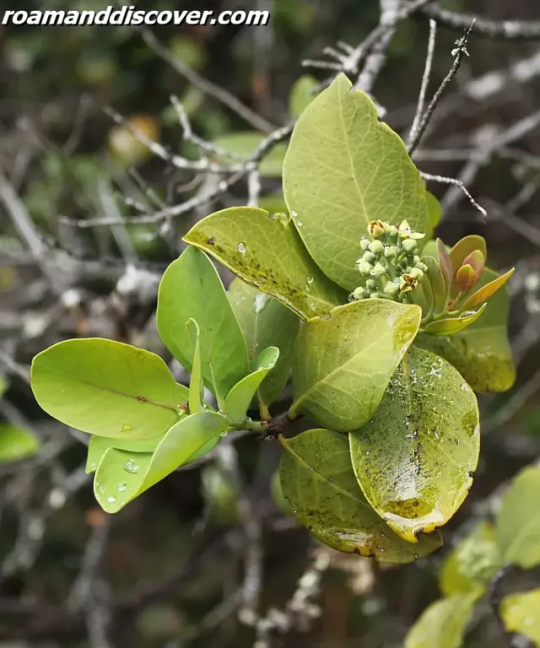
Sandalwood tree
Climate
Climate plays an important role in determining the best time to visit Vanuatu. The climate of Vanuatu is tropical, which means it is warm and humid all year round. The average temperature is around 26°C (79°F), with slight variations depending on the location and the time of year.
Vanuatu experiences two distinct seasons: wet and dry. The wet season usually lasts from November to April, while the dry season is from May to October. During the wet season, Vanuatu receives heavy rainfall and there is a higher risk of tropical storms and cyclones. While the dry season is typically sunny with cooler temperatures and less rainfall.
The temperature and humidity are higher during the wet season, making it less comfortable to spend extended periods outdoors. However, the wet season also brings lush greenery and beautiful waterfalls to life, which are worth exploring. On the other hand, the dry season with its mild and sunny weather is perfect for outdoor activities like hiking, snorkeling, and diving.
Read the full article
0 notes
Text
New Zealand
New Zealand is a stunning country situated in the southwestern Pacific Ocean that comprises of two main islands, North and South. The North Island is known for its geothermal attractions, including hot springs, geysers, and mud pools, while the South Island is characterized by its mountain ranges, fjords, and glaciers. In total, New Zealand has 600 smaller islands that form part of the country.
This country's geography is diverse, featuring plenty of immaculate beaches, forests, mountains, waterfalls, and lakes. Known for its natural beauty and spectacular scenery, New Zealand provides a myriad of opportunities for adventure lovers, nature enthusiasts, and wildlife watchers. Whether you opt to go hiking, skiing, surfing, or simply strolling along the beach, New Zealand caters to the diverse needs and interests of travelers from around the world.
The culture of New Zealand is a unique blend of Maori and Western traditions. The indigenous Maori people are an essential part of New Zealand's identity and have played a significant role in shaping the country's culture and history. European settlers arrived in the late 18th century and brought with them a wide range of customs, cuisines, and practices that have made New Zealand the cosmopolitan country it is today.
If you want to experience the natural beauty and unique culture of New Zealand, it's essential to plan your visit well in advance. International flights are available from many major cities globally, and once you're in the country, you'll have plenty of accommodation options, ranging from budget-friendly hostels to luxury resorts.
Whether you're traveling solo or with friends, New Zealand is a destination that promises to surprise and captivate you with its stunning landscapes, friendly people, and rich cultural heritage.

Etymology
'New Zealand' originates from the Dutch explorer Abel Tasman who named it 'Nieuw Zeeland', meaning 'new sea land' in Dutch. Tasman was the first European explorer to sight New Zealand in 1642. However, it was not until the arrival of British explorer James Cook in 1769 that the country was extensively explored and claimed for Britain. The name 'New Zealand' became official when the Treaty of Waitangi was signed between the British Crown and Maori chiefs in 1840, establishing British sovereignty over New Zealand. The treaty was signed in both Maori and English, with the Maori version referring to the country as 'Aotearoa', meaning 'land of the long white cloud'. Today, 'New Zealand' is internationally recognized as the official name of the country. The country is also known as 'Aotearoa' in Maori, and this name is widely used by both Maori and non-Maori New Zealanders.
History
New Zealand has a rich history, with the first settlers being the indigenous Maori people around 800 CE. Their arrival from Polynesia marked the beginning of a distinct cultural heritage that still features prominently in New Zealand's society today. They developed their own language, customs, and beliefs, which were strongly connected with the natural environment.
The next significant event in New Zealand's history was the arrival of Europeans in the late 18th century. They were explorers and traders, who introduced new materials, technology, and crops to the Maori people. Although the initial interactions were peaceful, tensions rose over time as more and more Europeans arrived in search of land and resources.
The Treaty of Waitangi, signed in 1840, formalized the relationship between the British Crown and the Maori people. It recognized Maori ownership of their land and guaranteed them the same rights as British subjects. However, the interpretation and implementation of the treaty were far from straightforward, and conflicts between the two cultures continued for many years.
Over time, New Zealand became a British colony, and this led to further changes in the social, political, and economic landscape. New immigrants from Europe and other parts of the world arrived, establishing their own communities and traditions. The country became a dominion in 1907 and gained full independence in 1947.
New Zealand's history is long and varied, and the legacy of its different cultures can be seen in everything from its architecture and cuisine to its music and art. It is a fascinating destination for anyone interested in the history of the Pacific islands, and there are many museums, galleries, and historic sites that offer a fascinating insight into the country's past.
Geology
New Zealand is an incredibly unique country with an equally unique geological landscape. The country is situated on the boundary of two tectonic plates, which has resulted in a great deal of volcanic and geothermal activity. The volcanic activity has created many impressive mountains, including Mount Cook, New Zealand's tallest peak.
There are over 50 volcanoes in New Zealand, many of which are still active. The most famous is Mount Ruapehu, which is also home to the largest ski resort in the country. New Zealand's volcanic activity also causes hot springs to form in certain areas, such as Rotorua, where the geothermal activity is so pronounced that steam visibly rises from the ground.
New Zealand's glaciers are also a unique feature of its geography. In addition to Mount Cook, which is surrounded by glaciers, there are also the Franz Josef and Fox glaciers, which are popular tourist attractions. Visitors can take guided tours or hike to these icy wonders.
The Coromandel Peninsula on the North Island is known for its unique geological formations, including the famous Hot Water Beach, where visitors can dig their own hot spring in the sand. The Waitomo Caves on the North Island are also a popular attraction, with their unique limestone formations and glowworm displays.
New Zealand's geology is a fascinating and integral part of its identity, with so much to explore and discover.
Geography
New Zealand is a land with a rich and diverse geography, ranging from sandy beaches to dense forests, towering mountains to tranquil fjords. The country has a total land area of approximately 268,000 square kilometres, and is located in the southwestern Pacific Ocean.
The North Island of New Zealand is known for its active volcanoes, such as Mount Ruapehu and White Island. The Central Plateau is dominated by the volcanic peaks of Tongariro National Park, which was the country's first national park and is now a UNESCO World Heritage Site. The North Island is also known for its beaches, including the famous Mount Maunganui Beach and Ninety Mile Beach.
The South Island of New Zealand is characterized by the Southern Alps, which run the length of the island and include New Zealand's highest peak, Aoraki/Mount Cook. The Southern Alps are home to numerous glaciers, including the Franz Josef and Fox glaciers, and offer world-class skiing and hiking opportunities. The South Island is also known for its fjords, particularly Milford Sound, which is one of the country's most popular tourist destinations.
New Zealand's geography is also shaped by its location on the Pacific Ring of Fire, a region of high volcanic and seismic activity. As a result, the country experiences frequent earthquakes, and is home to a number of hot springs and geothermal pools, including the famous Rotorua geothermal area on the North Island.
In addition to its natural wonders, New Zealand also has a number of man-made landmarks, such as the Sky Tower in Auckland, the Beehive in Wellington, and the Christchurch Arts Centre. With so much to explore, it's no wonder that New Zealand is a popular destination for adventurers, nature lovers, and culture enthusiasts alike.
Ecology
New Zealand is known for its unique ecology, which is characterized by a mix of endemic and introduced species of flora and fauna. The country's isolation and variable climate have led to the evolution of a diverse range of species, many of which are not found anywhere else in the world.One of the most iconic endemic species in New Zealand is the kiwi bird, which is a flightless bird and is considered a national symbol. Other endemic species include the kakapo, the takahe, and the tuatara, a reptile that dates back to the time of the dinosaurs.New Zealand's marine ecology is also unique, with a range of endemic species of fish, crustaceans, and other marine life. The Hectors dolphin, for example, is only found in the waters around New Zealand.However, New Zealand's ecology is facing a number of threats, including habitat loss, introduced pests, and climate change. The country has taken steps to protect its native flora and fauna, including establishing national parks and wildlife reserves.In recent years, there has been a growing movement towards conservation and sustainable practices in New Zealand, with many organizations and individuals working to protect the country's unique ecology. One such initiative is the Predator Free New Zealand project, which aims to eliminate introduced predators such as rats and stoats that threaten the country's native species.
Biodiversity
New Zealand has a unique and diverse range of ecosystems, including forests, grasslands, wetlands, and alpine regions. The country's isolation from other landmasses has enabled the evolution of many endemic species of flora and fauna that cannot be found anywhere else in the world.
The native forest of New Zealand, known as the 'bush', is home to many species of trees, including the iconic kauri and totara. The country's aquatic ecosystems are also incredibly diverse, with many different species of fish, shellfish, and crustaceans.
The protection of New Zealand's native flora and fauna is a top priority for conservation efforts in the country. The Department of Conservation (DOC) is responsible for managing the country's natural resources and is dedicated to protecting and preserving New Zealand's unique biodiversity.
One of the most important ways in which New Zealand protects its biodiversity is through the establishment of national parks and reserves, which aim to protect and restore natural ecosystems. Some of the most significant of these protected areas include the Tongariro National Park, Fiordland National Park, and the Abel Tasman National Park.
New Zealand's marine biodiversity is also a crucial aspect of the country's ecology. The country's marine environment is home to a diverse range of ecosystems, from rocky reefs to sandy beaches. The protection of these ecosystems is vital not only for the preservation of native species but also for the country's fishing and tourism industries.
the protection of biodiversity is an essential aspect of New Zealand's environmental management, and the country has made efforts to ensure the preservation of its unique ecosystems for future generations.
Climate
New Zealand's climate is largely influenced by its location in the southwestern Pacific Ocean and the prevailing westerly winds. The country experiences a temperate maritime climate with warm summers and mild winters. The North Island tends to be warmer and more humid than the South Island, which can experience cooler temperatures and more frequent snowfall.
The average temperature in New Zealand ranges from 10°C (50°F) in winter to 20°C (68°F) in summer. The warmest months are December to February, while the coolest months are June to August. Rainfall is spread evenly throughout the year, although some parts of the country can experience rainfall for up to 200 days a year.
The country's diverse geography, which includes mountains, plains, and coastal regions, means that there is a variation in climate between regions. The west coast of the South Island, for instance, receives a higher amount of rainfall than the east coast.
New Zealand is also prone to extreme weather events, such as hurricanes and tornadoes, particularly during the summer months. However, these events are relatively rare and generally only affect small parts of the country.
New Zealand's mild climate makes it a popular destination for tourists from around the world who are looking to explore the country's natural beauty and enjoy outdoor activities such as hiking and swimming.
Environmental issues
New Zealand has a unique and fragile environment, and as such, it faces a range of environmental issues. Deforestation is one such issue. Despite efforts to protect native forests, many areas have been cleared for farming, logging, and development. As a result, many native species have lost their habitats, and erosion and soil degradation are becoming more common.
Pollution is another major environmental issue in New Zealand. Industrial, agricultural, and urban sources all contribute to air pollution, water pollution, and soil contamination. For example, high levels of nitrates in waterways are a concern for both public health and the health of freshwater ecosystems.
Perhaps the most pressing environmental issue facing New Zealand is the impact of climate change. Rising temperatures, changing rainfall patterns, and more frequent extreme weather events are all expected to have significant impacts on the country's ecosystems, agriculture, and infrastructure. New Zealand has committed to reducing its greenhouse gas emissions, but much work remains to be done to mitigate the impacts of climate change.
Efforts to address these environmental issues are underway in New Zealand. The government has set targets for reducing emissions and protecting biodiversity, and there are a range of voluntary initiatives and programs aimed at encouraging sustainability. However, much work remains to be done to ensure that New Zealand's unique environment is protected for future generations.
Politics
New Zealand is widely known for its progressive and stable political system. It is a parliamentary democracy with a constitutional monarchy. The Head of State is the British monarch, currently Queen Elizabeth II, represented in New Zealand by the Governor-General. However, the monarch's role in New Zealand is largely ceremonial, and the country is effectively governed by the elected Prime Minister and Parliament.
The Parliament of New Zealand is unicameral, meaning it has only one chamber, the House of Representatives. Members of Parliament are elected every three years by a form of proportional representation. This often results in coalition governments, where multiple political parties work together to form a majority. New Zealand's current Prime Minister is Jacinda Ardern, who heads the Labour Party. Her coalition government includes the Greens and New Zealand First parties.
New Zealand has a strong tradition of social welfare, with a comprehensive healthcare system, free education, and a range of other social services. The country also has a focus on environmental protection and sustainability, with a target of becoming carbon neutral by 2050. The government has implemented a number of measures to reduce emissions and promote renewable energy.
As a member of the Commonwealth, New Zealand maintains close ties with other countries that share the same political system, including Australia, Canada, and the United Kingdom. The country is also a member of the United Nations and a range of other international organizations.
Economy
New Zealand has a diverse and dynamic economy, with a strong emphasis on agriculture and tourism. These two sectors make up a significant portion of the country's GDP and provide employment opportunities for many New Zealanders.
Agriculture has traditionally been the backbone of the New Zealand economy, with the country exporting a wide range of agricultural products such as dairy, meat, and wool. The dairy industry, in particular, is a major contributor to the economy, with New Zealand being the world's largest exporter of dairy products. The wine industry has also grown in recent years, with New Zealand wines earning a strong reputation worldwide.
Tourism has also emerged as a major contributor to the economy, with the country's stunning natural beauty and outdoor activities attracting millions of visitors each year. The industry is supported by a wide range of tourism infrastructure, such as hotels, restaurants, and transportation.
New Zealand also has a thriving manufacturing sector, with significant production in food processing, wood and paper products, and machinery. The country has a well-developed financial sector, with strong banking and insurance industries.
Trade is an important part of the New Zealand economy, with the country exporting goods to a wide range of destinations around the world. The country has several free trade agreements in place, including with China, Australia, and the European Union.
New Zealand's economy has shown resilience and adaptability, with a diverse range of sectors contributing to the country's prosperity. The government has a strong focus on supporting businesses and promoting innovation, ensuring that the country remains competitive on the global stage.

Infrastructure
New Zealand has a robust infrastructure system that makes it easy for both locals and tourists to navigate the country with ease. The country has a well-connected transportation system that includes options such as buses, trains, ferries, and flights that operate regularly to different parts of the country. The transportation system is efficient, safe, and cost-effective, making it one of the best in the world.
The country's roads are well-maintained, and travelers can rent cars, campervans or motorbikes to explore the country's scenic routes. New Zealand's world-class airports make it easy for tourists to arrive and depart from different cities and towns. Its seaports are modern, full-fledged, and efficient, making it convenient for goods to be transported within the country or to different parts of the world.
New Zealand's communication systems are equally well developed, with the country having a relatively high internet penetration rate. Most places in the country offer free Wi-Fi, including most of the airports, cafes, libraries, malls and even some public parks. This makes it easy for visitors to stay connected with their loved ones or even work while they are on holiday.
The country also has a well-established postal system that offers courier and mailing services to businesses and individuals, both domestically and internationally. The postal service is reliable, with an efficient delivery system, and it can be accessed through several post offices located in different parts of the country.
the country's first-rate infrastructure ensures that visitors can move around with ease, and it is a vital factor in making New Zealand one of the top tourist destinations in the world.
Science and technology
New Zealand's strong focus on science and technology has led to the development of several world-class research institutions in the country.
Read the full article
0 notes
Text
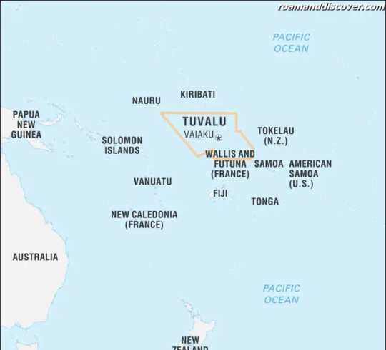
Tuvalu
Tuvalu is a small Polynesian island nation located in the Pacific Ocean. It is made up of nine coral atolls and islands, which are spread over a vast area of water. Despite its size, Tuvalu has a rich history, unique biodiversity, and a vibrant culture that has attracted visitors from around the world.
Many people are unaware of Tuvalu's existence, but this tiny nation has a lot to offer. Its remote location and low-lying geography make it a unique and fascinating destination. Tuvalu's coral atolls are fragile ecosystems that are home to a variety of stunning marine life, while its lush vegetation and pristine beaches provide visitors with a glimpse of paradise.
Historically, Tuvalu was settled by Polynesian voyagers around 2,000 years ago. These original settlers lived off the land and sea, and developed a vibrant culture that is still celebrated today. Over time, Tuvalu came under colonial rule by various nations, including Great Britain, until it eventually gained its independence in 1978.
Today, Tuvalu is facing many challenges, including climate change and rising sea levels. Despite these challenges, the country's people are resilient and proud of their unique culture and way of life.
If you're planning a trip to Tuvalu, there are many things to see and do. You can explore the islands and atolls on foot or by boat, visit historical sites and museums, or simply relax on the pristine beaches. Tuvalu's friendly people will welcome you with open arms and can provide you with a unique insight into their way of life.
Tuvalu is a must-visit destination for any traveler looking for something a little different. Its rich history, unique geography, and diverse biodiversity make it a truly remarkable place to visit. So why not pack your bags and experience the beauty of Tuvalu for yourself?
Etymology
Tuvalu, a Polynesian island nation located in the Pacific Ocean, has an interesting etymology that reflects its history and culture. The name "Tuvalu" means "eight standing together" in Tuvaluan, the country's official language. This refers to the eight main islands that make up the nation: Nanumea, Nanumanga, Niutao, Nui, Funafuti, Vaitupu, Nukufetau, and Nukulaelae.
According to Tuvaluan mythology, the islands were formed by the god Tefolaha, who created them from a single piece of rock. The god then named each island after his children and gave them to his sons to govern. Over time, the islands fell under different influences, including those of Samoa, Tonga, and Fiji, which led to the development of a unique Tuvaluan culture.
The name Tuvalu was first recorded by European explorers in the 16th century, who mistook the islands for part of the Ellice Islands, an archipelago that is now part of Tuvalu. The name Ellice was given by the British explorer Edward Ellice, who visited the islands in 1819. In 1978, Tuvalu gained independence from the British, and the name Tuvalu was officially adopted as the country's name.
the name Tuvalu reflects the country's deep connection to its geography and history, as well as its unique cultural identity. To this day, Tuvaluans continue to cherish their traditional customs and values, alongside their modern aspirations.
History
Tuvalu has a rich and fascinating history that dates back to its earliest settlers, the Polynesian voyagers. It is believed that the first settlers arrived on the islands around 3,000 years ago, bringing with them their traditional customs, beliefs, and skills. The people of Tuvalu were skilled navigators and seafarers, using the stars and the ocean currents to travel between the islands.
During the 16th and 17th centuries, European explorers began to visit the islands, with the first recorded European contact taking place in 1568 when Spanish explorer Álvaro de Mendaña de Neira stumbled upon the islands. Over the next few centuries, Tuvalu became a frequent stopover point for European and American sailors who were traveling between Australia, New Zealand, and the Pacific Islands.
In the late 19th century, Tuvalu was colonized by the British, who established a protectorate over the islands in 1892. Under British rule, the islands were incorporated into the Gilbert and Ellice Islands Colony, which also included the nearby Gilbert Islands (now known as Kiribati). The British administration brought significant changes to the islands, including the introduction of Christianity, the establishment of schools, and the construction of modern infrastructure.
During World War II, the islands were occupied by the Japanese, who used them as a base for their military operations in the Pacific. After the war, Tuvalu remained part of the Gilbert and Ellice Islands Colony until 1975, when it became a separate British dependency. In 1978, Tuvalu gained self-governance, and in 2000, it became a fully independent nation.
Tuvalu's history is characterized by centuries of self-sufficiency and resilience in the face of numerous challenges, including colonialism and environmental threats. Today, the people of Tuvalu are proud of their unique cultural heritage and traditions, which continue to be celebrated and preserved through music, dance, art, and storytelling.
Geology
Tuvalu's geology is unique due to its low-lying coral atolls. The country is composed of nine atolls and islands, each consisting of coral reefs and sandbars that have slowly risen from the ocean floor over thousands of years.
The coral atolls of Tuvalu are formed by the process of reef building, where coral polyps secrete calcium carbonate to form a hard skeleton that builds up over time, eventually creating a barrier reef. As the coral grows and the reef builds up, sand and debris accumulate on top to form a sandbar. Over time, plants and trees take root in the sand and debris, forming an island. The process is slow and takes many thousands of years.
Despite their beauty and ecological importance, Tuvalu's coral atolls face many challenges. Due to their low-lying nature, they are highly vulnerable to flooding from storm surges and rising sea levels caused by climate change. This poses a serious threat to the country's infrastructure, economy, and way of life.
In addition, Tuvalu's coral reefs are under threat from human activity. Overfishing, pollution, and climate change all contribute to the degradation of the country's marine environment. Tuvalu has taken action to protect its reefs, implementing marine conservation programs and working with international organizations to promote sustainable fishing practices and reduce pollution.
Despite these challenges, Tuvalu's unique geology remains a point of fascination for scientists and visitors alike. The country's coral atolls and islands are home to a rich array of marine life, including colorful fish, sea turtles, and coral gardens. Visitors to Tuvalu can explore the country's reefs through guided snorkeling and diving tours, observing the diverse ecosystems that thrive beneath the waves.
Geography
Tuvalu is a Polynesian island nation located in the Pacific Ocean. The country comprises of 9 small islands, out of which only 4 are inhabited. The total land area of Tuvalu is about 26 square kilometers with a population of approximately 11,000 people. The country is famous for its stunning natural beauty, white sandy beaches, and turquoise lagoons.
The nine islands of Tuvalu are arranged in an east-to-west line. They are Nanumea, Nanumaga, Niutao, Funafuti, Nukufetau, Nukulaelae, Vaitupu, Nui, and Niulakita. The capital city, Funafuti, is located on the Funafuti atoll, which is the largest atoll and also serves as the administrative center of the country.
The geography of Tuvalu is quite unique as the majority of the islands are coral atolls that sit atop volcanic islands that have sunk into the ocean. The highest point in Tuvalu is only 4.6 meters above sea level, making it one of the lowest-lying countries in the world. Tuvalu is also home to some of the most beautiful lagoons and marine environments in the world, with coral reefs, sea grass beds, and a wide range of marine life.
Island Name
Area(sq.km)
Funafuti
2.4
Nui
3.4
Nukufetau
2.6
Nukulaelae
1.82
Nanumea
4.6
Nanumaga
1.37
Vaitupu
5.6
Niulakita
0.48
Niutao
3.87
The islands of Tuvalu are divided into three groups, known as the Northern, Central, and Southern groups. The Northern group is comprised of Nanumea, Nanumaga, and Niutao. The Central group includes Funafuti, Nukufetau, and Nukulaelae. The Southern group consist of Vaitupu, Nui, and Niulakita.
Tuvalu is surrounded by vast expanses of ocean and is located in the tropical cyclone belt, which makes it prone to natural disasters such as tropical storms, tsunamis, and cyclones.
The marine environment in Tuvalu is one of the most pristine and biodiverse in the world. It is home to a wide range of marine species, including sea turtles, sharks, and colorful fish. The coral reefs in Tuvalu are also important habitats for a variety of marine life and are vital for the country's sustainable tourism industry.
- The total coastline of Tuvalu is about 24 kilometers.
- The country has a warm and humid climate throughout the year, with temperatures ranging from 28°C to 31°C.
Tuvalu's geography is unique and fascinating. The country's coral atolls, stunning lagoons, and marine environment make it a popular destination for tourists and nature lovers around the world.
Ecology and Biodiversity
Tuvalu's unique geography and climate have given rise to a fascinating array of plant and animal life. The small size of the islands and their isolation from the rest of the world have also made the species found here incredibly diverse and often found nowhere else on the planet.
The waters around Tuvalu are home to a diverse range of coral, fish and other marine creatures. The coral reefs are among the most diverse in the world, with over 150 species of hard coral, 450 species of reef fish and numerous species of sharks, rays, and turtles.
The islands themselves are covered in lush vegetation, including coconut palms, pandanus, breadfruit and banana trees. These plants provide food, shelter and livelihoods for the people of Tuvalu, as well as habitats for a range of animals, including birds, bats and insects.
Despite its natural riches, Tuvalu is facing a number of challenges due to human activity and climate change. Habitat destruction, overfishing and pollution are putting pressure on the delicate ecosystems of the islands, while rising sea levels and more frequent storms are causing erosion and damaging buildings and infrastructure.
In response, the government of Tuvalu is taking steps to protect its biodiversity and reduce its carbon footprint. It has established a network of marine protected areas to conserve its coral reefs and fish stocks, and is promoting sustainable agriculture and tourism practices. It has also been active in international efforts to curb greenhouse gas emissions and raise awareness of the impacts of climate change on small island states like Tuvalu.
Unfortunately, much of the damage done to Tuvalu's ecosystems is beyond its control. The country is heavily reliant on external aid and support to adapt to the effects of climate change and protect its natural heritage. It is a vivid example of the complex environmental and social challenges facing small island states in the 21st century.
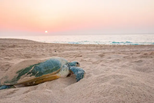
turtles
Climate
Tuvalu's climate is classified as tropical, with high humidity and temperatures ranging from 27-32°C throughout the year. The country experiences two distinct seasons: a dry season from May to October and a wet season from November to April.
The most significant threat to Tuvalu's climate is rising sea levels caused by global warming. As one of the world's lowest-lying countries, with an average elevation of just 2 meters above sea level, Tuvalu is extremely vulnerable to flooding and coastal erosion. In recent years, the country has experienced exceptionally high tides and storm surges, leading to the destruction of homes, infrastructure, and freshwater supplies.
Tuvalu also faces the threat of more frequent natural disasters, including cyclones and tsunamis, which can cause significant damage to the country's already fragile infrastructure. The most severe natural disaster in Tuvalu's recent history was Cyclone Pam, which hit the country in 2015 and caused widespread flooding and destruction.
The effects of climate change are not limited to Tuvalu's physical environment. The country's economy, which relies heavily on coastal fisheries and tourism, is also at risk. Changes in ocean temperatures and acidity levels can harm marine life, while extreme weather events can discourage visitors from traveling to the country.
Tuvalu has made significant efforts to address the challenges posed by climate change, both domestically and through international cooperation. The country has implemented measures to reduce its reliance on fossil fuels, including promoting the use of solar power and reducing energy consumption through public awareness campaigns. Tuvalu is also an active participant in international climate change negotiations, working with other small island developing states to advocate for greater action from developed countries.
Despite these efforts, Tuvalu's future remains uncertain in the face of rising sea levels and increasingly severe weather events. The country's leaders have called on the international community to take urgent action to combat climate change and protect the world's most vulnerable nations, including Tuvalu.
Environmental issues
Tuvalu, a small island nation in the Pacific Ocean, faces several environmental issues that pose a threat to its sustainability. One of the most significant issues is pollution, particularly plastic pollution, which affects the country's marine ecosystem. Waste management is also a pressing concern in Tuvalu, as the country has limited facilities to manage its waste properly.
Climate change is another environmental issue that Tuvalu is facing, as rising sea levels caused by global warming could submerge the country in the future. The country also experiences more frequent natural disasters, such as cyclones and storms, which threaten its infrastructure and economy.
Tuvalu is highly vulnerable to the impact of climate change, as the majority of its land area consists of low-lying coral atolls that are highly susceptible to coastal erosion and flooding. The country's dependence on subsistence agriculture and fisheries also makes it vulnerable to the effects of climate change on these sectors.
In addition to these issues, Tuvalu faces challenges in managing its natural resources sustainably, such as the exploitation of its marine resources and overfishing. The country's small land area is also under pressure due to population growth and urbanization, resulting in deforestation, habitat loss, and soil erosion.
To address these environmental challenges, Tuvalu has implemented various measures to promote sustainable development, such as promoting clean energy, conservation of marine resources, and waste reduction. The country is also part of various international agreements and initiatives that aim to address climate change and biodiversity conservation.
Environmental Issues in Tuvalu
Causes
Effects
Solutions
Pollution
Plastic waste, industrial waste, and sewage
Marine ecosystem degradation, threats to public health
Improved waste management, reduce plastic usage
Climate Change
Greenhouse gas emissions, rising sea levels
Coastal erosion, flooding, damage to infrastructure and economy
Promote clean energy, conservation, and climate adaptation measures
Resource Exploitation
Overfishing, unsustainable land use practices
Degradation of marine and land resources, loss of biodiversity
Sustainable management of resources, conservation measures
- Tuvalu has implemented a national policy of reducing plastic waste, including a ban on single-use plastic bags and straws.
- The country also aims to increase the use of renewable energy sources, such as solar and wind, to reduce its reliance on fossil fuels.
- Efforts to promote sustainable land use and conservation of biodiversity are also underway, including the creation of protected areas and sustainable farming practices.
Despite these efforts, Tuvalu remains vulnerable to the impacts of environmental issues caused by human activities, and ongoing efforts are needed to support the country's sustainable development.
Politics
Tuvalu is a parliamentary democracy with a unique political system. Its head of state is the Queen of the United Kingdom, represented by a Governor-General. The government is led by a Prime Minister, who is appointed by the Governor-General and is responsible for the day-to-day administration of the country.
The Parliament of Tuvalu is unicameral, with 15 members elected for a four-year term. Members of Parliament are elected from eight constituencies, which correspond to the eight islands of Tuvalu.
Despite its small size, Tuvalu has been an active member of the international community since gaining independence in 1978. It is a member of the United Nations, the Commonwealth of Nations, and the Pacific Islands Forum, among other organizations.
Tuvalu's relationship with other countries has been shaped by its unique geographic and economic situation. The country's reliance on international aid has led to close ties with donor countries such as Australia and New Zealand. Tuvalu has also developed relationships with other Pacific Island nations, including Fiji and Kiribati.
One of Tuvalu's most well-known international issues is its stance on climate change. The country has been outspoken about the threat posed by rising sea levels and has played a prominent role in international climate negotiations. In recent years, Tuvalu has called on developed countries to take stronger action to reduce greenhouse gas emissions and support vulnerable countries in adapting to the impacts of climate change.
Tuvalu's efforts to raise awareness about climate change have received international attention and support. In 2009, the country hosted the Pacific Islands Forum, where it called for urgent action on climate change. Tuvalu has also been the focus of coverage by international media and environmental organizations.
Economy
Tuvalu is a small and isolated island nation with a limited economy that heavily relies on international aid. The majority of Tuvalu's revenue comes from foreign aid, which is used to finance infrastructure development, social programs and other public services. The country's small and limited economy is mainly based on subsistence agriculture and fishing, with coconut, taro, and pandanus being the main crops.
Read the full article
0 notes
Text
Marshall Islands

Name of Marshall Islands
The Marshall Islands, officially known as the Republic of the Marshall Islands, is an island country located in the Pacific Ocean. It consists of 29 atolls and 5 individual islands, with a total of 1,156 islands spread across 1,990,530 square kilometers of ocean. The name "Marshall Islands" is derived from British explorer John Marshall, who visited the islands in 1788.
The Marshall Islands have a rich history and culture, with a strong connection to the ocean and their ancestral heritage. The people of the Marshall Islands have inhabited these islands for thousands of years and have developed a unique way of life that revolves around the sea. They have a deep respect for nature and the resources it provides, and their traditions and customs reflect their close relationship with the environment.
Despite their small size and remote location, the Marshall Islands have made significant contributions to the world. The country is known for its active participation in international affairs, particularly in the areas of climate change and nuclear disarmament. The Marshall Islands have been vocal advocates for action on climate change, as they are one of the nations most vulnerable to the effects of global warming.
- Key Points:
- The Marshall Islands is an island country in the Pacific Ocean.
- The name "Marshall Islands" is derived from British explorer John Marshall.
- The people of the Marshall Islands have a deep connection to the ocean and nature.
Population
Capital
Official Language
58,413 (2020 estimate)
Majuro
Marshallese and English
Etymology in Marshall Islands
The etymology of the Marshall Islands is rooted in its rich history and diverse cultural heritage. The name "Marshall Islands" itself is believed to have originated from British Captain John Marshall, who explored the region in the late 18th century. However, the islands have a deeper connection to their indigenous roots, with the local name for the islands being "Aelōñin Ṃajeḷ" in the Marshallese language.
The Marshallese language holds great significance in understanding the etymology of the islands. Marshallese is a Malayo-Polynesian language and is part of the Austronesian language family. It bears resemblance to other languages spoken in the Pacific. The language itself reflects the values, traditions, and cultural aspects of the Marshallese people, providing valuable insights into the origins of the names given to the islands, local customs, and ancient practices.
Exploring the etymology of the Marshall Islands further reveals the influence of European explorers, traders, and missionaries who interacted with the indigenous communities throughout history. The islands were part of Spain's colonial empire in the 16th century before coming under the control of Germany in the late 19th century. The German era brought a noticeable German influence, resulting in the adoption of German terminology and place names. The subsequent Japanese occupation during World War II also left its mark on the islands' etymology.
- In summary, the etymology of the Marshall Islands is a fascinating blend of indigenous Marshallese language, European influence, and cultural adaptations over time. The names of the islands and local terminologies reflect the intertwined history and diverse origins of the people who have inhabited this beautiful archipelago for centuries.
Key Points
1. The name "Marshall Islands" may have originated from Captain John Marshall, a British explorer.
2. The local name for the islands is "Aelōñin Ṃajeḷ" in the Marshallese language.
3. The Marshallese language holds cultural significance and provides insights into the origins of names and local customs.
4. European explorers, traders, and missionaries have influenced the etymology of the islands.
5. German and Japanese occupations have also left their mark on the islands' etymology.
History in Marshall Islands
The history of the Marshall Islands is a fascinating tale of resilience, bravery, and cultural preservation. Spanning thousands of years, the islands have been inhabited since at least 2,000 BCE by Micronesian seafarers. The indigenous people of the Marshall Islands, known as the Marshallese, developed a unique seafaring culture, using their expert navigational skills to explore and settle the vast expanse of the Pacific Ocean.
One of the most significant events in the history of the Marshall Islands was the arrival of European explorers in the 16th century. Spanish navigators, led by Álvaro de Saavedra Cerón, were among the first Europeans to set foot on the islands. However, it was not until the late 19th century that the islands came under colonial rule, first by Germany, then Japan during World War I.
The impact of colonization on the Marshall Islands was profound. The islands became a major battleground during World War II, as the United States and Japan fought for control of the Pacific. The fierce battles and subsequent nuclear testing conducted on the islands left a lasting impact on the environment and the lives of the Marshallese people.
- Despite the challenges faced by the Marshall Islands throughout its history, the Marshallese people have shown remarkable resilience and a deep commitment to preserving their culture and heritage. Today, they continue to pass down traditional knowledge and practices to future generations, ensuring the survival of their unique way of life.
Key events in the history of the Marshall Islands
The arrival of Spanish explorers in the 16th century
Colonial rule by Germany and Japan
World War II and the impact of nuclear testing
Independence from the United States in 1986
Geology in Marshall Islands
The Marshall Islands, located in the central Pacific Ocean, are a group of islands and atolls that are known for their stunning natural beauty. The geology of this remote island nation is unique and fascinating, with a rich history that spans millions of years. From volcanic activity to coral reefs, the geology of the Marshall Islands has played a significant role in shaping the landscape and creating the diverse ecosystems that exist today.
One of the most prominent features of the geology in the Marshall Islands is the presence of coral reefs. These reefs are the result of thousands of years of coral growth, as well as the sinking and rising of the ocean floor. The coral reefs not only provide a habitat for a wide variety of marine life, but they also protect the islands from erosion and act as a natural barrier against storm surges.
In addition to coral reefs, the Marshall Islands also have a number of volcanic formations. These volcanic features are remnants of past volcanic activity, which occurred millions of years ago. The islands themselves are the tips of ancient undersea volcanoes, which have gradually risen above the surface of the ocean over time. While there is no active volcanic activity in the Marshall Islands today, the remnants of past eruptions can still be seen in the form of volcanic craters and lava flows.
- The geology of the Marshall Islands is not only important for understanding the history of the islands, but it also has practical implications for the people who live there. The unique geology of the islands has resulted in limited freshwater resources, as well as a vulnerability to rising sea levels and coastal erosion. As a result, the people of the Marshall Islands have had to adapt and find innovative solutions to these challenges. They have implemented conservation measures to protect the fragile coral reefs and have explored alternative sources of freshwater, such as rainwater catchment systems.
- Overall, the geology of the Marshall Islands is a testament to the power of nature and the resilience of the people who call these islands home. It serves as a reminder of the importance of protecting and preserving our natural resources, and the need to adapt and find sustainable solutions in the face of environmental challenges. Whether through the stunning coral reefs or the ancient volcanic formations, the geology of the Marshall Islands continues to inspire awe and appreciation for the wonders of our natural world.
Key Takeaways:
1. Coral reefs: The Marshall Islands are home to beautiful coral reefs, which provide a habitat for marine life and protect the islands from erosion.
2. Volcanic formations: The islands are the remnants of ancient undersea volcanoes, with visible volcanic craters and lava flows.
3. Adaptation and conservation: The unique geology of the islands has led to limited freshwater resources and vulnerability to rising sea levels, prompting the need for conservation measures and innovative solutions.
Geography in Marshall Islands
The Marshall Islands, located in the central Pacific Ocean, is a mesmerizing archipelago consisting of 29 coral atolls and 5 low-lying islands. It is a place where natural beauty thrives, and its geography plays a significant role in shaping the unique characteristics of this nation.
The islands, scattered over 750,000 square miles of ocean, are a sight to behold. Lush green landscapes, crystal clear turquoise waters, and white sandy beaches stretching as far as the eye can see, make the Marshall Islands a haven for visitors from around the world. Nature has truly blessed these islands with breathtaking beauty that captivates the soul and ignites a sense of wonder.
The geography of the Marshall Islands consists of two main groups: the Ratak Chain in the east and the Ralik Chain in the west. The atolls and islands are spread across these chains, creating a diverse and captivating landscape. From the low-lying coral atolls, such as Majuro and Kwajalein Atoll, to the higher volcanic islands, like Likiep and Wotje, each offers its own unique charm and allure.

Ecology in Marshall Islands
The Marshall Islands, a stunning archipelago in the Pacific Ocean, is not just a tropical paradise; it is also home to a rich and diverse ecological system. The ecology of the Marshall Islands is a testament to the wonders of nature and the resilience of the environment. From its vibrant coral reefs to its lush forests, the Marshall Islands boast a unique and fragile ecosystem that deserves our admiration and protection.
One of the most remarkable features of the Marshall Islands' ecology is its extensive coral reef system. The pristine reefs are teeming with an abundance of marine life, serving as a sanctuary for a myriad of colorful fish, exciting sea turtles, and countless other fascinating creatures. These reefs not only provide a breathtaking underwater spectacle but also play a crucial role in maintaining the balance of the marine ecosystem. Sadly, like many coral reefs around the world, those in the Marshall Islands face the threats of climate change, pollution, and unsustainable fishing practices. It is imperative that we take action to preserve and restore these fragile underwater wonders.
Not only does the Marshall Islands offer magnificent marine life, but it is also home to a diverse range of terrestrial ecosystems. The lush forests that cover the islands are host to a variety of plant and animal species, some of which are found nowhere else on Earth. However, these forests are under constant pressure from deforestation, invasive species, and habitat destruction. It is crucial that we recognize the significance of these ecosystems and work together to protect and restore them for future generations.
- Aside from the coral reefs and forests, the Marshallese ecology is also characterized by its mangrove forests. These unique coastal ecosystems play a crucial role in supporting marine life, protecting shorelines from erosion, and serving as nurseries for various species. Unfortunately, these vital habitats are also facing significant threats, including coastal development and climate change impacts such as sea-level rise and increased storm intensity. Preserving these mangrove forests is not only essential for the ecological balance but also for the protection of the islands' communities and infrastructure.
Biodiversity
Climate Change
Pollution
The Marshall Islands are known for their rich biodiversity, with numerous endemic species found across the islands. By preserving and protecting their unique natural habitats, we can ensure the survival of these remarkable plants and animals.
As the world grapples with the challenges of climate change, the Marshall Islands are particularly vulnerable to its impacts. Rising sea levels and more frequent and intense storms threaten both the coral reefs and the coastal ecosystems, putting the delicate balance of the environment at risk.
Pollution, whether it be from plastic waste or chemical contaminants, poses a significant threat to the ecology of the Marshall Islands. It is crucial to raise awareness and implement policies to reduce pollution and protect the environment from further degradation.
Preserving and promoting the ecological well-being of the Marshall Islands is not just a responsibility of the Marshallese people; it is a global imperative. We must recognize the interconnectedness of our planet's ecosystems and work together to protect and restore them. Each individual can make a difference by reducing their ecological footprint, advocating for sustainable practices, and supporting conservation efforts. Together, we can ensure that the natural wonders of the Marshall Islands thrive for generations to come.
Biodiversity in Marshall Islands
Biodiversity in Marshall Islands is a topic of great importance, as this small island nation is home to a rich variety of flora and fauna. The unique geographical location and diverse ecosystems of the Marshall Islands have contributed to the remarkable biodiversity found within its borders. From pristine coral reefs teeming with marine life to lush tropical rainforests hosting a multitude of plant species, this country is a treasure trove of natural wonders.
One aspect that makes the biodiversity in Marshall Islands truly fascinating is the presence of endemic species. These are plants and animals that are found nowhere else in the world. The isolation of the islands has allowed for the evolution of unique species that have adapted to the specific conditions of their environment. For example, the Marshall Islands tree snail (Papustyla pulcherrima) is a beautiful and rare mollusk that can only be found in this archipelago.
The conservation of biodiversity in Marshall Islands is a critical task that requires concerted efforts from both the government and the local communities. With the increasing threats posed by climate change, overfishing, and pollution, it is crucial to protect and preserve the fragile ecosystems that support this rich diversity of life. Initiatives such as establishing marine protected areas and implementing sustainable fishing practices are key to ensuring the long-term survival of the unique species that call the Marshall Islands home.

Coral reefs
Climate in Marshall Islands
The climate in the Marshall Islands is characterized by a tropical rainforest climate, with high temperatures and abundant rainfall throughout the year. The islands are located in the Pacific Ocean and are part of the Micronesia region. The climate is influenced by the trade winds and the proximity to the Equator.
The Marshall Islands experience a hot and humid climate, with average temperatures ranging from 80°F (27°C) to 90°F (32°C) all year round. The high levels of humidity, combined with the warm temperatures, create a tropical environment that is ideal for the growth of lush vegetation and diverse wildlife.
One of the main features of the climate in the Marshall Islands is the abundant rainfall. The islands receive an annual average rainfall of around 100 inches (2,500 mm), with the wettest months occurring between July and October. This rainfall contributes to the lush green landscapes and supports the rich biodiversity found on the islands.
Environmental issues in Marshall Islands
The Marshall Islands, located in the Pacific Ocean, is a small island nation with a rich cultural heritage and stunning natural beauty. However, like many other places around the world, it faces several environmental issues that threaten its delicate ecosystem and the well-being of its people.
One of the major environmental issues in the Marshall Islands is the rising sea levels caused by climate change. The islands are particularly vulnerable to the effects of global warming, as most of the land is no more than a few meters above sea level. As a result, the islands are experiencing increased coastal erosion, flooding, and salinization of freshwater resources.
Another pressing environmental issue in the Marshall Islands is plastic pollution. With limited disposal and recycling facilities, plastic waste often ends up in the ocean, causing harm to marine life and ecosystems. The government and local communities are taking steps to promote plastic reduction and improve waste management systems, but more needs to be done to address this issue effectively.
- Deforestation
- Pollution from mining activities
- Coral bleaching
- Loss of biodiversity
Environmental Issues
Impact
Sea-level rise
Coastal erosion, flooding, and freshwater salinization
Plastic pollution
Harm to marine life and ecosystems
Deforestation
Habitat loss and soil erosion
Pollution from mining activities
Contamination of soil and water resources
Coral bleaching
Destruction of coral reefs and marine biodiversity
Loss of biodiversity
Disruption of ecological balance and habitat destruction
Politics in Marshall Islands
The politics of Marshall Islands is a fascinating subject that showcases the country's journey towards self-governance and democracy. The rich history and unique cultural heritage of the Marshallese people have influenced the political landscape of the nation. The political system in Marshall Islands is based on a democratic framework with a parliamentary system of government.
History of Politics in Marshall Islands
The political history of Marshall Islands can be traced back to its colonial past. It was once a part of the German Empire and later came under Japanese control during World War I. After World War II, the United States became the administering authority under the Trust Territory of the Pacific Islands. The country gained independence in 1986 and adopted a constitution, establishing itself as a sovereign and democratic nation.
Political Structure and Institutions
The political structure of Marshall Islands is characterized by a mixed system of governance, with both traditional leadership and democratic institutions coexisting.
Read the full article
0 notes
Text
Tahiti
Name of Tahiti
The name "Tahiti" invokes images of pristine white-sand beaches, crystal-clear turquoise waters, and swaying palm trees. It is a name that carries an air of mystery and allure, capturing the imagination of travelers from all around the world. But have you ever wondered about the origin and significance of this enchanting name?
The Etymology of Tahiti can be traced back to the ancient Polynesian language. In Polynesian mythology, it is believed that Tahiti was named after Tahiti-ki-te-rangi, the legendary chief who discovered the island. The word "Tahiti" itself means "rising sun" or "bright sky," symbolizing the beauty and radiance that this island paradise holds.
As you delve deeper into the rich History of Tahiti, you will uncover a tapestry of captivating stories and events that have shaped the island's past. Tahiti has a long and storied history, having been inhabited by the Polynesians for over a thousand years. The island has witnessed the arrival of European explorers, the establishment of a French protectorate, and the influences of various cultures that have left their indelible marks.
Etymology in Tahiti
The fascinating study of etymology takes us on a journey through the origins of words and how they have evolved over time. In the case of Tahiti, a mesmerizing island in French Polynesia, delving into its etymology unravels a captivating tale of its rich linguistic heritage and cultural significance. The name "Tahiti" itself bears a profound meaning that embodies the essence of this tropical paradise.
Derived from the ancient Polynesian language, the word "Tahiti" is said to have originated from two distinct roots. The first root, "ta," translates to "light," symbolizing the radiant glow that emanates from this idyllic destination. The second root, "hiti," refers to "red," embodying the vibrant hues of the island's sunsets that paint the sky with breathtaking beauty. Together, "Tahiti" evokes an image of a place bathed in a warm and golden light, inviting visitors to embrace its enchanting allure.
The etymology of Tahiti is not only a linguistic exploration but also a reflection of the island's cultural significance. The name itself serves as a reminder of the Polynesian heritage deeply rooted in the island's identity. It embodies the connection between the people of Tahiti and their land, emphasizing the profound bond they share with their natural surroundings.
History in Tahiti
The history of Tahiti is a rich tapestry of culture, exploration, and resilience. From ancient Polynesian settlers to European colonization, the islands have seen their fair share of triumphs and challenges. The story of Tahiti's history is one of indigenous traditions merging with outside influences, creating a unique and diverse society.
The first known settlers of Tahiti arrived around 1,500 years ago, navigating the vast Pacific Ocean in impressive sea-faring canoes. These Polynesians brought with them a deep connection to the land and a complex social structure. For centuries, they thrived in harmony with nature, developing an intricate system of agriculture and trade. Their oral traditions, legends, and rituals formed the foundation of Tahitian culture.
In 1767, European explorers led by Samuel Wallis discovered Tahiti, forever changing the course of its history. European powers, including France and England, sought to exploit the resources and strategic location of the islands. This colonization brought both progress and hardship. Western influence transformed aspects of Tahitian society, introducing new technologies and religious teachings. However, it also disrupted traditional ways of life and led to disease outbreaks that decimated the population.
Geology in Tahiti
Tahiti, the largest island in French Polynesia, is known for its stunning natural beauty and breathtaking landscapes. One of the key factors that contribute to the unique charm of this island paradise is its fascinating geology. The geology of Tahiti is a testament to the powerful forces of nature that have shaped the land over millions of years.
The island of Tahiti is actually made up of two volcanic mountain ranges, known as Tahiti Nui and Tahiti Iti. These majestic peaks were formed as a result of volcanic activity that occurred millions of years ago. The volcanic eruptions gave rise to the rugged terrain and dramatic cliffs that characterize the island's landscape.
One of the most remarkable geological features of Tahiti is its iconic black sand beaches. These beaches get their distinctive color from the erosion of volcanic rocks, which gradually break down into fine particles over time. The contrast between the ebony sand and the crystal-clear turquoise waters creates a mesmerizing sight that is truly unforgettable.
Geography in Tahiti
When it comes to the geography of Tahiti, one can only marvel at the breathtaking beauty that surrounds this island paradise in the South Pacific. From pristine beaches with crystal clear waters to lush tropical rainforests and majestic mountains, Tahiti offers a diverse and stunning landscape that captivates the imagination.
The geography of Tahiti is characterized by its volcanic origin. The island is actually part of a larger group of islands known as French Polynesia, which is made up of 118 islands and atolls. Tahiti itself is divided into two main parts - Tahiti Nui (Big Tahiti) and Tahiti Iti (Small Tahiti), with the capital city, Papeete, located on the northwest coast of Tahiti Nui.
In terms of its physical features, Tahiti is dominated by two volcanic mountain ranges - the Tahiti Nui and the Tahiti Iti. The highest peak, Mount Orohena, stands at an impressive 2,241 meters (7,352 feet) and offers breathtaking panoramic views of the island. These majestic mountains are covered in lush vegetation and are a haven for hikers and nature enthusiasts.
Another remarkable aspect of Tahiti's geography is its stunning coastline. The island is surrounded by turquoise lagoons, coral reefs, and white sandy beaches that are the stuff of dreams. The lagoons are teeming with vibrant marine life, making it a paradise for snorkeling and diving enthusiasts. The picturesque beaches provide the perfect setting for relaxation and soaking up the sun.

Ecology in Tahiti
Ecology in Tahiti is a subject that highlights the vibrant and diverse natural environment of the region. Tahiti, known for its lush landscapes and pristine beaches, is teeming with unique flora and fauna. The ecological balance of this tropical paradise is crucial to its sustainability and the well-being of its inhabitants.
The biodiversity in Tahiti is truly remarkable. With its remote location and isolation from mainland continents, Tahiti has evolved into a hotspot of endemic species. The lush rainforests are home to an array of exotic plants and trees, including the iconic Tahitian gardenia and hibiscus. The diverse marine life surrounding the islands is equally impressive, with colorful coral reefs and a vast array of tropical fish species.
Preserving the ecological balance in Tahiti is of utmost importance. The local government and environmental organizations have taken significant steps to protect the natural habitats and maintain the delicate balance between human activity and the environment. Efforts are made to educate both residents and visitors about the importance of sustainable practices, such as responsible tourism, waste management, and conservation of natural resources.
Climate change poses a significant threat to the ecology of Tahiti. Rising sea levels, increased temperatures, and extreme weather events have the potential to disrupt the delicate ecosystems that exist in the region. The inhabitants of Tahiti are increasingly aware of the need to address climate change and take steps towards mitigating its impact on the environment. Efforts such as promoting renewable energy sources, reducing carbon emissions, and implementing sustainable agriculture practices are being undertaken to combat these challenges.
Biodiversity in Tahiti
Tahiti, known for its breathtaking beauty and mesmerizing landscapes, is also home to a rich and diverse ecosystem. The biodiversity in Tahiti is truly remarkable, with its lush rainforests, vibrant coral reefs, and unique flora and fauna. This tropical paradise holds a wealth of natural wonders, making it a haven for nature enthusiasts and researchers alike.
One of the key factors contributing to the exceptional biodiversity in Tahiti is its geographical location. Situated in the heart of the South Pacific, Tahiti benefits from a warm and stable climate that fosters the growth of a wide range of plant and animal species. The island's isolation from other land masses has also played a crucial role in preserving its distinct biodiversity and preventing the introduction of invasive species.
The diverse ecosystem of Tahiti can be observed in its tall and dense rainforests, which are teeming with life. From colorful birds and insects to an abundance of plant species, these forests provide a sanctuary for a myriad of living organisms. The endemic flora, such as the Tahitian chestnut and Tahitian gardenia, add to the unique charm of the island and are often found nowhere else in the world.
- Moreover, the waters surrounding Tahiti are home to a stunning array of marine life. The coral reefs, with their vibrant colors and intricate structures, are a sight to behold. These reefs support a diverse range of fish species, sea turtles, and other marine creatures, making it a paradise for snorkelers and scuba divers. The crystal-clear lagoons are also home to magnificent whales and dolphins, captivating visitors with their majestic presence.
Tahitian Chestnut
Tahitian Gardenia
The Tahitian chestnut, known as the "Fei" in Tahitian, is a majestic tree that can reach heights of up to 50 meters. Its large, dark green leaves provide shade and shelter for a variety of animals. The tree produces edible fruits that are an important food source for birds and small mammals, contributing to the island's biodiversity.
The Tahitian gardenia, or "Tiare Tahiti," is an iconic flower native to the island. Known for its intoxicating fragrance, the Tiare Tahiti holds a special place in Tahitian culture and traditions. The flower is often used in leis and is considered a symbol of love and friendship. Its presence adds elegance and beauty to Tahiti's biodiversity.
Preserving and protecting the biodiversity in Tahiti is of utmost importance. With the increasing threats of climate change and human activities, it is crucial to raise awareness about the significance of biodiversity conservation. Sustainable tourism practices, responsible waste management, and efforts to preserve natural habitats play a vital role in safeguarding the unique ecosystem of Tahiti for future generations to enjoy.
Visiting Tahiti not only offers an opportunity to immerse oneself in its stunning natural beauty but also to witness the incredible biodiversity that thrives in this paradise. The experience of exploring the lush rainforests, diving into the crystal-clear waters, and marveling at the endemic species will leave a lasting impression and deepen one's appreciation for the wonders of nature.
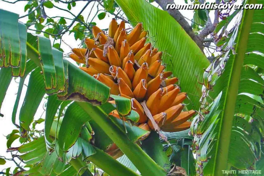
Fei
Climate in Tahiti
Tahiti, the largest island in French Polynesia, is well-known for its stunning natural beauty and tropical paradise-like environment. One of the reasons that make this island so captivating is its unique and diverse climate. The climate in Tahiti is classified as tropical rainforest climate, characterized by high temperatures, high humidity, and abundant rainfall throughout the year.
Tropical Rainforest Climate
In Tahiti, the tropical rainforest climate creates a perfect setting for lush vegetation, vibrant flora, and diverse fauna. The island experiences consistently warm temperatures, with an average annual high of around 85°F (29°C) and an average low of around 73°F (23°C). The warm climate in Tahiti allows for a wide variety of plants and trees to thrive, including the iconic palm trees, hibiscus flowers, and vibrant tropical fruits.
Abundant Rainfall
The abundant rainfall in Tahiti is another defining characteristic of its climate. The island receives an average annual rainfall of about 79 inches (2,000 mm). This consistent precipitation contributes to the lush greenery and vibrant landscapes that Tahiti is known for. The rainy season typically occurs between November and April, with the wettest months being January and February. During this time, tropical storms and occasional cyclones can bring heavy downpours and strong winds to the island.
Environmental issues in Tahiti
Tahiti, known for its breathtaking natural beauty, is facing a number of environmental challenges. As the world becomes more aware of the importance of preserving our planet, it is crucial to take a closer look at the issues affecting this paradise. From coral reef degradation to waste management problems, the people of Tahiti are working tirelessly to find sustainable solutions to these pressing problems.
One of the major environmental issues in Tahiti is the degradation of its coral reefs. Coral reefs are not just a stunning sight to behold but are also crucial ecosystems that provide habitat for a wide range of marine life. Unfortunately, factors such as climate change, pollution, and overfishing have taken a toll on these delicate structures. The government and local communities are implementing measures to protect and restore the coral reefs, including creating marine protected areas and promoting sustainable fishing practices.
Another pressing concern in Tahiti is the management of waste. With the increase in tourism and population, the amount of waste generated has also risen significantly. Improper waste disposal has led to pollution of the land, water bodies, and even the majestic lagoons of Tahiti. Efforts are being made to tackle this issue through waste reduction campaigns, recycling initiatives, and the development of proper waste management infrastructure.
Deforestation is another environmental issue that deserves attention in Tahiti. The lush forests of the island are not only home to unique plant and animal species but also play a vital role in maintaining the island's water cycle and preventing soil erosion. However, illegal logging and the expansion of agriculture have resulted in significant deforestation. Conservation organizations and local communities are actively reforesting areas, promoting sustainable agriculture practices, and raising awareness about the importance of preserving the island's forests.
Addressing these environmental issues requires not only the efforts of the government and organizations but also the active participation of residents and visitors. By choosing sustainable tourism practices, such as supporting eco-friendly accommodations and responsible tour operators, individuals can contribute to the preservation of Tahiti's natural wonders. Together, we can ensure that future generations can continue to marvel at the beauty of Tahiti while living in harmony with nature.
Politics in Tahiti
Politics in Tahiti plays a crucial role in shaping the destiny of this beautiful island. With a rich history of colonization and struggle for independence, the political landscape of Tahiti reflects the resilience and determination of its people. The political system in Tahiti is characterized by a democratic framework, with a parliamentary system of government.
At the heart of Tahiti's political structure lies the Assembly of French Polynesia, which is responsible for enacting laws and regulations that govern the daily lives of the Tahitian people. The Assembly consists of 57 members, elected through a system of proportional representation. The President of French Polynesia, who is elected by the members of the Assembly, acts as the head of state and oversees the executive functions of the government.
The political landscape in Tahiti is dominated by a few key parties, each representing different ideologies and advocating for various issues. The Tahoeraa Huiraatira party, founded by former President Gaston Flosse, has been a prominent force in Tahitian politics for many years. Their focus is primarily on economic development and preserving Tahitian culture and identity. Another influential party is the Tapura Huiraatira, led by President Édouard Fritch, which emphasizes social welfare and environmental sustainability.
- One of the key challenges in Tahitian politics is striking a balance between economic development and environmental conservation. As a tourist destination, Tahiti has experienced significant growth in its economy. However, sustainable development and protecting the pristine beauty of the island remain important concerns for policymakers.
- Another critical issue is the pursuit of greater autonomy and self-governance for Tahiti. While the island enjoys a certain degree of autonomy within the French Republic, there is an ongoing discussion and debate regarding the extent of this autonomy and the desire for full independence.
- Tahitian politics also grapple with the issue of cultural preservation. With a unique cultural heritage, including the Tahitian language, traditional practices, and indigenous knowledge, there is a constant need to protect and promote these aspects in the face of globalization and modernization.
Pros
Cons
Opportunity for economic growth
Risk of overexploitation of natural resources
Efforts towards cultural preservation
Political divisions and tensions among parties
Potential for greater autonomy and self-governance
Challenges of maintaining a balance between development and conservation
The political landscape in Tahiti is a dynamic and ever-evolving one. As the Tahitian people continue to assert their identity and strive for a sustainable future, politics will remain at the forefront of their journey towards self-determination and prosperity.
Economy in Tahiti
Tahiti, the largest island in French Polynesia, is known not only for its breathtaking natural beauty but also for its thriving economy. The economy in Tahiti is diverse and dynamic, with a range of industries contributing to its growth and development. From tourism to agriculture, Tahiti has a diverse economic landscape that fuels its prosperity.
One of the key drivers of the economy in Tahiti is the tourism industry. With its idyllic beaches, crystal-clear waters, and lush landscapes, Tahiti attracts visitors from all over the world. The tourism sector provides opportunities for employment and entrepreneurship, as well as generating revenue for the local economy. From luxury resorts to eco-tourism activities, Tahiti offers a wide range of experiences for tourists seeking an unforgettable getaway.
Another important sector in Tahiti's economy is agriculture. The fertile soil and favorable climate of the island make it conducive for the cultivation of various crops.
Read the full article
#TahitiandherIslandsOverview#TahitiandherIslandstours#TahitiandherIslandsTravel#TravelTheWorld#visitTahitiandherIslands
0 notes
Text
New South Wales
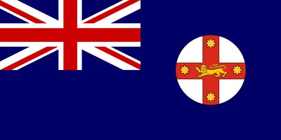
New South Wales is the oldest and most populous state in Australia, located in the southeastern part of the country. It covers an area of more than 800,000 square kilometers and is home to over 8 million people. The capital city is Sydney, which is also the largest city in the state and the most populous city in Australia. New South Wales is a beautiful and captivating state with a rich cultural heritage, diverse ecosystems, and a booming economy.
The state has a fascinating history that dates back to the arrival of British settlers in 1788. It was named 'New South Wales' by Captain James Cook who was inspired by the similarity between the coastline of the state and that of Wales in the United Kingdom. Throughout the years, New South Wales has gone through numerous transformations and has emerged as a powerful force in the region.
Geologically, New South Wales is located on the Australian Plate and consists mostly of sedimentary rocks. The state is divided into four main regions, namely the eastern highlands, the central west, the Murray-Darling Basin, and the coastal plains. It is also home to a number of stunning natural landmarks such as the Blue Mountains, the Jenolan Caves, and the Snowy Mountains.
With a population of over 8 million people, New South Wales is a diverse state with a rich multicultural heritage. The state is home to numerous ethnic groups, and the most common languages spoken are English, Mandarin, Arabic, Cantonese, and Vietnamese. Christianity is the dominant religion in the state, followed by Buddhism, Islam, and Hinduism.
The state's economy is diverse, with services, manufacturing, and agriculture being the main sectors. It is a major contributor to the national economy, generating a gross state product of over $500 billion. Sydney is the country's financial and economic capital, with a thriving business community and a bustling retail sector.
There is a lot to discover and explore in New South Wales, from its vibrant cities to its untouched wilderness areas. Visitors to the state can enjoy a variety of activities, such as bushwalking, surfing, skiing, and winery tours. The state has some of the country's most beautiful cities, including Sydney, Newcastle, and Wollongong.
New South Wales is a state like no other, with a unique blend of history, culture, and natural beauty. Whether you're a visitor or a resident, there's always something new and exciting to discover in this incredible part of Australia.
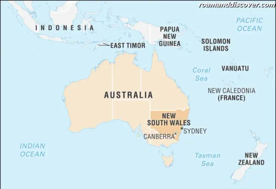
Etymology
New South Wales, one of the six Australian states, is situated on the country's south-east coast, bordered by Queensland to the north, South Australia to the west, and Victoria to the south. The state's name, New South Wales, reflects its connection to the United Kingdom. Captain James Cook, who mapped out Australia's east coast in 1770 during the first of his three voyages of discovery, named the territory 'New South Wales' after the Welsh principality at the time. The name also honored King George III of England, who was from the House of Hanover's German royal family.
After the British Crown claimed the land in 1788 and established a penal colony on the land, New South Wales became an official British colony. The state has a history of being a place where convicts were brought, and many of Australia's most notorious criminals were incarcerated there.
The name declared by the Government of New South Wales is efficient in giving an image of the state's primary place, and it stands out among the relatively imaginative names for the Australian states. The land territory of New South Wales was initially marked by a further term, "South Wales," which represents the state's rough similarity to the South Wales district of the Kingdom of England, which combines coal mining and an offshore coast.
Another goal in connecting the name to Wales was to capitalize on the cultural image given off by Wales with its black coal and green valleys, a picture readily linked with the British Isles' western regions. Captain Cook was under the belief that this new land had equivalent traits. The lands were alike in that they possessed mines and clear coastlines. The 'new' was added because the state was fresh to European explorers.
Today, New South Wales is the country's most populous state, and it remains a popular tourist destination for both locals and international visitors alike. Its capital city, Sydney, is one of the most famous cities in the world, globally recognized for its iconic landmarks such as the Sydney Opera House and Harbour Bridge.
The origin story of New South Wales' name represents the state's rich history and the continuous influence that the United Kingdom has on its culture and identity.
History
The history of New South Wales began with the arrival of the British in 1788 when Captain Arthur Phillip led the First Fleet to Australia. Convicts were sent to the colony as punishment for their crimes, and the settlement quickly grew in size. In 1810, Lachlan Macquarie became the governor of the colony and initiated significant reforms, including the construction of public buildings and infrastructure.
In the mid-19th century, New South Wales experienced a gold rush that led to a population boom. The discovery of gold in places like Bathurst and the city of Orange led to the rapid development of mining towns and cities, increasing the state's wealth.
Throughout the 20th century, New South Wales faced numerous challenges, including two world wars and the Great Depression. The state played a crucial role in the allied effort during both world wars, with many soldiers, sailors, and airmen coming from New South Wales.
The state also experienced significant social and political changes during the 20th century. In the 1960s and 1970s, there was a surge of activism around issues such as women's rights and Aboriginal land rights. The Whitlam Labor government, which came to power in 1972, implemented a range of progressive policies, including free university education and national health insurance.
In recent years, New South Wales has experienced rapid population growth and economic development. The state's capital, Sydney, has become a global financial center and a hub of technology and innovation. In 2000, Sydney hosted the Summer Olympics, which provided a massive boost to the state's infrastructure and tourism industries.
The state's history is shaped not only by its European colonizers but also by the Indigenous peoples who have lived in the area for thousands of years. The state has a rich Aboriginal heritage, and there are numerous sites across the state that are of cultural and spiritual significance to Aboriginal communities.
The New South Wales State Archives and Records Authority is responsible for preserving the state's historical documents and artifacts, including photographs, diaries, and government records. There are also numerous museums and historical sites throughout the state that offer insights into New South Wales' rich cultural heritage. the history of New South Wales is complex and diverse and reflects the many different influences that have shaped the state over the years.
Geology
New South Wales is a state in southeastern Australia that boasts diverse and breathtaking landscapes. The state has a rich geological history, with geological formations that date back millions of years.
Most of New South Wales is made up of the Australian Shield, which is a large section of the continent's basement rock that was formed over 2.5 billion years ago. The Shield is largely composed of granite and gneiss, and it extends across the eastern part of the state.
The eastern coast of New South Wales is characterized by the Great Dividing Range, which is a series of mountain ranges that extend for over 3,500 kilometers. The range is made up of sedimentary and metamorphic rocks, including sandstone, shale, and limestone.
One of the most distinctive geological features of New South Wales is the Sydney Basin, which is a large sedimentary basin that contains the city of Sydney. The basin was formed over 250 million years ago and contains rocks that range in age from around 300 million to 180 million years old. The basin is also home to coal deposits that have been mined for over 200 years.
In addition to the Sydney Basin, there are several other sedimentary basins in New South Wales, including the Gunnedah Basin, the Murray Basin, and the Clarence-Moreton Basin. These basins contain a wide variety of sedimentary rocks, including sandstone, shale, and coal.
New South Wales is also home to several volcanic rocks, including basalt and rhyolite. The state has a number of extinct volcanoes and volcanic plugs, such as Mount Kaputar and the Warrumbungles. These volcanic features offer some of the most stunning landscapes in the state.
The state's mineral resources include coal, gold, copper, silver, lead, and zinc. The mining industry is an important part of the state's economy and has played a significant role in its history.
- Coal - the state is the largest producer of coal in Australia, with most of it coming from the Hunter Valley and Illawarra regions
- Gold - is mined in several regions of the state, including the Central West and the New England regions
- Copper - is mined in the Cobar region, which is also a significant producer of silver and lead
New South Wales's geological features have played a significant role in shaping the state's history and economy. The diverse landscapes and mineral resources continue to provide opportunities for tourism and development.
Geography
New South Wales is the most populous state in Australia and is located in the southeastern region of the country. It has a diverse geography that ranges from stunning coastlines to rugged mountain ranges, arid deserts, and fertile river valleys. The state encompasses a total area of 800,642 square kilometers and has a total coastline that stretches for over 2000 km.
The state's physical geography is divided into four clearly defined regions, namely the eastern highlands, the coastal plain, the western slopes, and the western plains. The eastern highlands consist of the Great Dividing Range, a series of mountain ranges that run parallel to the eastern coast. It is Australia's most extensive mountain range and stretches for over 3,500 kilometers.
The coastal plain is a narrow strip of land that runs along the state's eastern coast and encompasses sandy beaches, inlets, and bays. The plain is low-lying and is home to several significant urban centers such as Sydney, Newcastle, and Wollongong.
The western slopes of New South Wales comprise the region between the Blue Mountains and the western plains. This region has several well-known wine-growing areas and is home to the farming communities that cultivate wheat, barley, and other crops.
The western plains are the state's most arid region and comprise most of the state's interior. The region is characterized by flat plains, rivers, and creeks, and is ideal for grazing cattle and sheep.
In terms of human geography, New South Wales is divided into several regions, each with its own unique attributes and characteristics. For instance, the Sydney metropolitan area is the most populous city in the state and is home to over 5 million people. Newcastle, the state's second-largest city, is also a significant industrial center located on the coast.
The state's southeastern region is home to the Snowy Mountains, which is a popular recreational destination for ski enthusiasts. The south coast of the state is known for its pristine beaches, while the north coast has an abundance of natural parks and reserves.
New South Wales is also home to several national parks, including the Blue Mountains National Park, the Kosciuszko National Park, and the Wollemi National Park. These parks are important wildlife sanctuaries and provide vital habitats for several species of flora and fauna.
New South Wales' geography is incredibly diverse and offers several unique experiences to any visitor. Whether you're looking to explore the state's majestic mountain ranges or relax on its stunning beaches, the state's geography has something for everyone.
Ecology
New South Wales is home to a diverse range of ecosystems, including rainforests, woodlands, grasslands, and coastal environments. These ecosystems support a vast array of flora and fauna, many of which are endemic to the region.
The state's rainforests are particularly notable, with World Heritage-listed areas such as the Gondwana Rainforests of Australia spanning over 50 national parks and reserves. These ancient ecosystems date back over 100 million years and are home to a vast array of plant and animal species, including the iconic lyrebird and platypus.
The woodlands and grasslands of New South Wales are also vital ecosystems, home to a range of iconic species such as kangaroos and koalas. However, many of these ecosystems have been severely impacted by land use changes and climate change, with large areas being cleared for agriculture and urbanization.
The state's coastal ecosystems are also under threat, with pollution and erosion impacting the health of marine environments and threatening important fish species. Actions are being taken to protect these ecosystems, including the implementation of marine protected areas and the restoration of shorelines through the planting of native vegetation.
The importance of New South Wales' ecosystems cannot be overstated, as they provide vital services such as carbon storage, soil stabilization, and water filtration, in addition to supporting a vast array of biodiversity. The state's natural environments also play a significant role in the tourism industry, attracting millions of visitors each year who come to experience the unique beauty and wildlife of the region.
Efforts are currently underway to protect and restore New South Wales' ecosystems, with conservation programs and initiatives aimed at preserving these vital environments for future generations.
New South Wales is also home to several important biodiversity hotspots, including the Cumberland Plain, which supports over 300 plant species that are found nowhere else on Earth. The Brigalow Belt South and Nandewar bioregions in the west of the state are also critical biodiversity hotspots, with unique assemblages of plant and animal species.
These hotspots are vitally important for conservation efforts, as they contain high levels of endemic species and are under significant threat from habitat loss and fragmentation. Measures are being taken to protect these areas, including the establishment of protected areas and the implementation of habitat restoration programs.
Biodiversity
New South Wales is home to a diverse range of flora and fauna, including many unique and endangered species. The state is blessed with varied landscapes, from the rugged Blue Mountains to the fertile plains of the Riverina, and each region is characterized by different ecosystems.
In the east of the state, the Great Dividing Range and its foothills are covered in eucalyptus forests that provide habitat for a variety of marsupials, including kangaroos, wallabies, and possums. The coastal areas are home to sandy beaches, rocky cliffs, and estuaries, which support a rich marine ecosystem with dolphins, seals, and numerous species of fish.
The state's western plains are dominated by grasslands and shrublands, which are adapted to the arid climate. Here, red kangaroos, emus, and other desert-adapted animals roam freely. The freshwater wetlands of the Murray-Darling Basin, which stretches across much of southern Australia, provide habitat for many bird species, including waterfowl, cranes, and herons.
New South Wales also has a wealth of plant species, with around 13,000 species recorded, representing over 20% of Australia's total flora. The state's vegetation ranges from rainforest and wet sclerophyll forests to grasslands and heathlands.
One unique feature of New South Wales' biodiversity is its high number of endemic species, meaning species that occur naturally only in that area. This includes the Wollemi Pine, a prehistoric conifer that was thought to be extinct until it was discovered in the Wollemi National Park in 1994.
However, despite its rich biodiversity, New South Wales is facing many threats to its ecosystems. Habitat loss and fragmentation, climate change, and introduced species are some of the major environmental challenges faced by the state. Conservation efforts are underway to protect endangered species and their habitats, but more action will be needed to ensure their continued survival.
New South Wales boasts a wide range of unique and diverse flora and fauna. Its varied landscapes and ecosystems provide a home for many species, some of which are found nowhere else in the world. While there are challenges to conserving this biodiversity, it remains an important part of the state's natural heritage that must be protected for future generations.

Herons
Climate
Climate plays a significant role in the ecological and geographical landscape of New South Wales. The state experiences varied climatic conditions due to its diverse geography. New South Wales has a temperate climate along the coast, subtropical in the north, and arid in the interior regions.
In general, the state experiences warm summers and mild winters. The coastal areas receive rainfall throughout the year, while the interior regions have low precipitation. The mountainous regions in the southeast receive occasional snowfall during the winter season.
New South Wales is also susceptible to natural disasters such as floods, bushfires, and droughts. The state faces drought conditions frequently, and the government has implemented various measures to handle these situations effectively.
The table below highlights the average temperature and rainfall in some of the major cities of New South Wales:
City
Summer Average Temperature (°C)
Winter Average Temperature (°C)
Annual Precipitation (mm)
Sydney
26
8
1,213
Newcastle
27
9
1,175
Wollongong
25
7
1,217
Apart from these, New South Wales also experiences a phenomenon called "Southerly Buster," which is a sudden drop in temperature due to a cold front from the south. It brings strong winds, heavy rain, and thunderstorms.
However, the state's climate patterns are changing due to global warming, and New South Wales has been experiencing more frequent heatwaves and extreme weather conditions. The state's future climate is expected to become drier and hotter, leading to more devastating bushfires and droughts.
New South Wales has various climate-related initiatives focusing on reducing carbon emissions and promoting renewable energy. The government's aim is to create a more sustainable future for its residents while preserving its unique ecology and biodiversity.
Read the full article
0 notes
Text
Tonga

Welcome to our guide to Tonga, a beautiful island nation located in the South Pacific. Tonga offers visitors a unique blend of natural beauty, rich culture, and exciting activities to enjoy. It consists of 169 islands, 36 of which are inhabited, and is divided into three main island groups: Tongatapu in the south, Ha'apai in the central region and Vava'u in the north.
One of the unique aspects of Tonga is its name, which means "south" in the local language. The country is also known as the "Friendly Islands," a name given to it by Captain Cook, thanks to the amicable and welcoming nature of the Tongan people.
Tonga is an archipelago created by millions of years of volcanic activity. The islands' geology varies, with some made of volcanic rock and others consisting of coral formations. The active volcanic island of Tofua is one of the main geologic attractions in the country, offering visitors the chance to witness an active volcano up close.
When it comes to geography, Tonga is a stunning destination. Its location in the South Pacific means that it's surrounded by crystal-clear waters with abundant marine life, making it an excellent place for diving and snorkeling. The beaches offer white sand and turquoise seas, and the vegetation is lush and verdant.
In addition to its natural beauty, Tonga boasts unique ecosystems and a rich biodiversity. The country is home to numerous endemic species, including birds, plants, and reptiles. The surrounding waters are equally diverse and are home to many marine mammals, including humpback whales, which migrate to Tonga's waters every year.
The climate in Tonga is tropical with two distinct seasons: the wet season, which runs from November to April, and the dry season, which runs from May to October. Despite being a tropical country, Tonga is not frequently affected by natural disasters such as hurricanes and typhoons.
Like many countries, Tonga faces environmental challenges, such as overfishing and deforestation. However, efforts are being made to address these issues, including implementing sustainable development practices that protect the environment.
Tonga is a constitutional monarchy with a parliamentary system of government, and it is also one of the last remaining Polynesian monarchies. The King of Tonga serves as the head of state, while the elected Prime Minister holds executive power.
The economy is reliant on fishing, agriculture, and tourism. The tourism industry has been growing in recent years, with many visitors attracted to the natural beauty, unique culture, and exciting activities Tonga offers.
Infrastructure in Tonga is relatively undeveloped, with limited transportation and communication options, but efforts are being made to improve this. Tonga has a developing science and technology sector, which is helping to advance the country's infrastructure.
Tonga boasts a rich culture influenced by Polynesian and Melanesian traditions. Music and art are an integral part of Tongan culture, with traditional dances and crafts still practiced today. Religion is also an essential aspect of Tongan society, with Christianity being the dominant religion.
Visitors to Tonga can enjoy a range of exciting activities, including diving, snorkeling, hiking, and cultural experiences such as traditional dancing and weaving. There are also several beautiful cities to explore, such as the capital, Nuku'alofa, and many stunning attractions to visit, such as Ha'amonga 'a Maui Trilithon, which is thought to be over 1,000 years old.
Tonga's food and drink are unique, with a focus on fresh seafood, taro, and coconuts. Visitors should try traditional dishes such as 'ota ika, a raw fish salad with coconut milk, and lu pulu, taro leaves cooked in coconut cream and meat.
If you're planning a trip to Tonga, it's helpful to know that there are several flights to and from Tonga every week, and a range of accommodation options from luxury resorts to budget-friendly guesthouses.
Tonga's global image is one that celebrates its natural beauty and friendly people. It has been featured in several films and TV shows, including 'Moana,' the 2016 Disney animated movie.
We hope this comprehensive guide has given you an idea of what makes Tonga such a remarkable destination. From its unique geology to its rich culture and stunning scenery, Tonga is a tropical paradise that is not to be missed.
Etymology
Tonga, officially known as the Kingdom of Tonga, is a Polynesian country located in the South Pacific. The name "Tonga" is believed to have originated from the word "tongiaki," which means "southwards." The name may have come from the direction in which the country was discovered or the direction of the trade winds that brought early settlers to the country.
The name "Tonga" has also been attributed to the legendary founder of the country, the demigod Maui. According to legend, Maui fished up the islands from the ocean and named the largest island Tonga-iti, which means "little south." This island was later renamed Tonga-tapu, which means "sacred south," becoming the site of the country's capital city Nuku'alofa.
In Tongan culture, the name of a person or place carries great importance and significance. The meaning and history behind a name is often passed down through generations, providing a connection to the past and a sense of identity within the community.
History
Tonga has a rich and fascinating history that dates back more than 3,000 years. According to legend, the first settlers arrived on the islands from Samoa in the 4th century BC. Tonga is the only Pacific island nation that has never been colonized, and it has a long tradition of self-rule.
The first European visitor to Tonga was Dutch explorer Abel Tasman, who arrived in 1643. In the late 1700s and early 1800s, Tonga was ruled by a powerful king, Taufa'ahau, who united the islands and established a monarchy that continues to this day.
During the 19th century, Tonga became an important center of trade and commerce in the Pacific. The islands were visited by whalers, traders, and missionaries, and in 1875, Tonga became a British protectorate. Tonga maintained its independence and continued to rule itself internally, but it was obligated to conduct its foreign relations through the British government.
In 1900, Tonga became a British protectorate, but it was not until 1970 that it gained full independence and became the Kingdom of Tonga. The country has experienced significant social and economic development in recent years, but it has also faced a number of challenges, including political unrest and natural disasters.
Tonga has a fascinating cultural heritage that is reflected in its traditional arts, music, and dance. The country is particularly famous for its Tongan wooden carvings, which are highly prized by collectors around the world. Traditional Tongan ceremonies, such as the tapa cloth-making ceremony, are also an important part of the country's cultural heritage.
Today, Tonga is a thriving and dynamic country with a unique history and culture. In recent years, the government has made significant investments in infrastructure and education, and the country is considered a leader in the Pacific in terms of social and economic development. Tonga's rich history and cultural heritage continue to attract visitors from around the world, who come to explore the country's ancient ruins, beautiful beaches, and vibrant culture.
Geology
Tonga is a volcanic archipelago with a unique and complex geological history. The country is located in the Pacific Ring of Fire, which means that it is situated in an area prone to volcanic eruptions, earthquakes, and tectonic activity. Tonga consists of approximately 170 islands, of which only 36 are inhabited, and these islands are located on the Tonga Ridge, which is a volcanic arc formed by subduction processes.
The geology of Tonga is characterized by volcanic activity, which has shaped the islands over millions of years. Many of the islands are formed from a mixture of volcanic ash and coral, which has resulted in the creation of limestone formations. The coral reefs are a significant geological feature of Tonga, and they are the foundation for much of the country's biodiversity. The reefs are home to a vast array of marine life, including sharks, rays, and tropical fish.
Tonga also has a number of extinct and active volcanoes. The most prominent of these are the islands of Tofua and Kao, which are both active stratovolcanoes. The country also has a number of underwater volcanoes, which contribute to the geological complexity of the region.
In addition to volcanic activity, Tonga has a number of other geological features, including caves and sinkholes. The 'Anahulu Cave System' is the most well-known of the country's caves, and it is a popular tourist attraction. The cave system consists of two limestone caves that are connected by an underground river. Another notable geological feature is the 'Marble Arch', which is a natural arch formed from limestone and located on the island of Tongatapu.
the geology of Tonga is incredibly diverse and complex, shaped by millions of years of tectonic activity, volcanic eruptions, and erosive processes. The islands' geological features contribute significantly to its unique natural environment, which is home to many rare and endemic species. Visitors to Tonga can explore these geological formations through activities such as hiking, cave exploration, and diving, allowing them to experience the country's ancient and fascinating geological history firsthand.
Geography
Tonga is a Polynesian country in the South Pacific Ocean. It consists of 169 islands, of which 36 are inhabited. The islands are divided into three main groups: Tongatapu, Ha'apai, and Vava'u. Tongatapu is the largest and most populated island, and it is also where the capital, Nuku'alofa, is located.
The islands of Tonga are volcanic in origin, and most are elevated with steep cliffs and surrounded by coral reefs. The highest point is on Kao Island, which rises 1,030 meters above sea level. The country's total land area is just over 747 square kilometers, and it extends over an ocean area of approximately 700,000 square kilometers.
The waters around Tonga are some of the clearest in the world, with visibility reaching up to 40 meters. The country is known for its rich marine life, including whales, dolphins, turtles, and a variety of fish species. The waters also contain several deep-sea trenches, including the Tonga Trench, which is the second-deepest trench in the world.
The islands of Tonga are located in the Pacific Ring of Fire, which is an area where many earthquakes and volcanic eruptions occur. As a result, Tonga experiences occasional earthquakes and volcanic activity, and visitors to the islands are advised to be aware of this.
The climate of Tonga is tropical with warm temperatures throughout the year. The rainy season is from November to April, and the dry season is from May to October. Cyclones are a common occurrence during the wet season, and visitors are advised to keep an eye on weather reports during this time.
The islands of Tonga are a popular tourist destination, and their beauty is renowned worldwide. With their pristine beaches, clear waters, and unique geological features, they are a must-visit for any avid traveler.
Ecology
Tonga is a beautiful country, located in the South Pacific Ocean. The country has a diverse ecology and natural environment, largely due to its unique geological features. Tonga is composed of over 170 islands, most of which are coral atolls or volcanic islands. The country's geography is characterized by stunning beaches, lagoons, and reefs, which are home to a multitude of marine species.
The ecology of Tonga is diverse and ranges from subtropical rainforests to coral reefs and coastal mangroves. The country has a range of ecosystems that support numerous plant and animal species. The coral reefs, in particular, are rich in biodiversity, making them popular dive sites. The reefs serve as habitats for an array of marine life such as tropical fish, sea turtles, sharks, and dolphins.
The Tongan government has implemented measures aimed at preserving the country's environment and ecosystems. One such initiative is the creation of national parks and protected areas, which safeguard the country's rare and endangered species. The marine protected areas are especially important as they help to conserve Tonga's coral reefs and their associated marine life.
The country's flora and fauna are also noteworthy. The tropical rainforest is home to a broad range of plant species such as banyan trees, coconut palms, and pandanus shrubs. The rainforest is an essential ecological system that supports an array of birds, insects, and smaller mammals. Some of the notable animal species found in Tonga include the Tongan fruit bat, flying fox, and native birds like the white-tailed tropicbird and the Tongan whistler.
Tonga's natural environment is susceptible to various environmental challenges that threaten its ecosystems. These challenges include deforestation, coastal degradation, coral bleaching, and pollution. The country has taken steps to address these issues by implementing regulations aimed at reducing greenhouse gas emissions, promoting sustainable farming practices, and reducing pollution in rivers and coastal areas.
Tonga's ecology and natural environment are breathtakingly beautiful and are crucial to the country's identity. Tonga's government has implemented measures to conserve and protect the country's flora, fauna, and unique ecosystems. Visitors to Tonga can enjoy the country's natural wonders while also contributing to the efforts to preserve them.
Biodiversity
Tonga is a treasure trove of biodiversity. The region's oceanic location and geological history have given rise to countless unique species that can only be found in this part of the world. The country is home to over 300 species of reef-building corals, 18 species of land mammals, and over 200 species of birds, including the critically endangered Tongan megapode. Tonga's isolation from other land masses has allowed a range of endemic plants and animals to evolve, making the country an important site for conservation.
One of the most notable marine creatures found in Tonga is the humpback whale. The warm, shallow waters around the islands provide the perfect breeding and calving grounds for humpback whales, and Tonga is one of the few places in the world where they can be seen up close. The country is also a hub for deep-sea fish, and visitors can spot a variety of unique fish species while diving or snorkeling.
On land, Tonga is home to a diverse range of flora and fauna. The forests of the islands are home to many endemic bird species, including the Tongan whistler and the Tongan ground dove. In addition, Tonga is known for its fruit bats, which play a key role in pollination and seed dispersal for many plant species.
Despite the country's small size and low population, Tonga faces a number of conservation challenges. Overfishing and habitat destruction threaten many marine and terrestrial species, and invasive species such as feral cats and rats pose a major threat to native populations. Fortunately, the government and various non-governmental organizations are working to protect Tonga's rich biodiversity through various conservation initiatives and education programs.
Tonga's unique biodiversity is part of what makes it such a special destination for travelers and nature lovers. From swimming with humpback whales to exploring the forests and reefs, visitors have the opportunity to witness a rare and remarkable ecosystem that is unlike any other in the world.

Humpback whale
Climate
Tonga's climate is characterized by tropical weather patterns and seasonal variations. The country enjoys a warm and humid climate year-round, with temperatures ranging from 25°C to 30°C (77°F to 86°F) on average. The climate can be divided into two main seasons, the wet season and the dry season.
The wet season runs from November to April and is characterized by heavy rainfall and high humidity. During this time, tropical cyclones and storms can occur, bringing strong winds and torrential downpours. The wet season is also the hottest time of the year, with temperatures reaching their peak in February and March.
The dry season runs from May to October and is characterized by cooler temperatures and lower humidity levels. The dry season is the most popular time for tourists to visit as the weather is generally sunny and pleasant. Temperatures during this time average around 25°C (77°F).
It is important to note that Tonga is located in the South Pacific Cyclone Belt, making it susceptible to tropical cyclones and storms during the wet season. Visitors should pay attention to weather warnings and take necessary precautions during this time.
The ocean currents around Tonga have a significant impact on the climate. The warm South Equatorial Current flows through the country, keeping the water warm and supporting a diverse marine ecosystem. The cooler Tonga Trench Current flows along the eastern coast of the country, bringing cooler water and contributing to the seasonal variations.
In addition to its warm and humid climate, Tonga is also known for its clear blue skies and stunning sunsets. Visitors can enjoy many water-based activities year-round, such as swimming, diving, and sailing.
Tonga's climate is characterized by tropical weather patterns, with a wet season from November to April and a dry season from May to October. Visitors should be aware of the risk of tropical cyclones and storms during the wet season and take necessary precautions. The warm ocean currents surrounding Tonga support a diverse marine ecosystem and provide excellent opportunities for water-based activities year-round.
Environmental issues
Tonga, like many other countries, faces environmental challenges that threaten the well-being of its people and its natural resources. Some of the key environmental issues facing Tonga include deforestation, soil erosion, and the overexploitation of marine resources.
Deforestation is a major issue in Tonga, as it is in many other countries in the Pacific region. The practice of logging has led to the loss of much of Tonga's native forest, which has negatively impacted the country's agrarian society. Deforestation has also led to soil erosion, which is a serious problem in Tonga. Soil erosion has decreased the fertility of Tonga's soil, making it harder for farmers to grow crops.
Overfishing is another environmental issue facing Tonga. The waters around the country are home to a diverse array of marine life, including tuna, marlin, and shrimp. However, overfishing has led to a decline in many of these species, which has had negative economic and ecological impacts. In addition, the use of unsustainable fishing practices, such as dynamite and cyanide fishing, has further exacerbated the problem.
Read the full article
0 notes
Text
New Caledonia
New Caledonia is a breathtaking archipelago situated in the South Pacific Ocean, to the east of Australia. The primary island, Grande Terre, is the main attraction of New Caledonia, famous for its incredible natural beauty and an abundance of diverse cultures.
The country has long been a favorite among travelers searching for the perfect blend of adventure and relaxation. From its rugged mountain ranges to its extensive coral reefs, there's something here for everyone.
One of the most popular destinations in New Caledonia is the Grande Terre Island, known for its stunning natural beauty. Travelers flock here to explore the many hiking trails that wind through lush tropical vegetation and climb to the peak of the towering mountains.
For those seeking a more relaxed vacation, the island’s stunning beaches are a must-visit. The clear turquoise waters of the South Pacific provide the perfect backdrop for sunbathing, swimming, and snorkeling.
But New Caledonia isn't all about natural wonders – it's also home to an array of fascinating cultures. The country boasts a unique blend of French and Pacific Island influences, as well as the rich heritage of the native Kanak people.
The country's diverse cultural offerings are evident in its vibrant arts and crafts scene, colorful festivals, and delicious cuisine. Visitors are encouraged to explore the traditional villages to get firsthand experience of the Kanak way of life.
New Caledonia is one of the most beautiful and culturally diverse destinations in the world. Whether you're an adventurer or a beach bum, this archipelago has something to offer you. Come and experience the magic of New Caledonia for yourself!
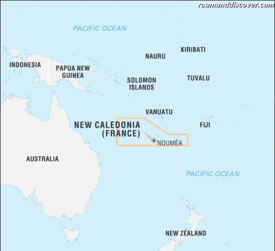
Etymology
'New Caledonia' has an interesting linguistic origin. The name 'Caledonia' is derived from the Latin word for Scotland, and British navigator James Cook named the island after its resemblance to Scotland's Highlands. Therefore, New Caledonia translates to 'New Scotland' in English. The territory has also been referred to as 'Kanaky' by the indigenous Melanesian population, which refers to the ancestors who first populated the islands. Today, 'Kanaky' is often used by Kanak activists advocating for independence from France. The name 'New Caledonia' continues to be used officially, and it remains a significant part of the territory's history and identity.
History
New Caledonia has a complex and intriguing history, marked by a blend of indigenous cultures and European colonialism. The island was originally settled around 3,000 years ago by the Lapita people, who originated in Southeast Asia and Oceania.
During the 18th century, the island was visited by various European explorers, including James Cook, who claimed the island for Britain in 1774. The island was later visited by French explorers, who established a presence on the island during the 19th century.
New Caledonia officially became a French colony in 1853, and the French took over the island's economy, politics, and society for the next century. Tensions between the French settlers and the indigenous Kanak people began to rise during this time, due to the French policy of assimilation and forced labor.
Indigenous uprisings against French rule erupted throughout the late 19th and early 20th centuries, culminating in the Kanak Uprising of 1984-1988. This conflict resulted in the Matignon Accords, which granted greater autonomy to the indigenous population and paved the way for a referendum on independence in 2018.
Today, New Caledonia remains an overseas territory of France with a unique political status. The island's history is a complex and fascinating blend of cultures and conflicts, which continue to shape the island's identity and society.
Geology
New Caledonia is a collection of islands located in the South Pacific Ocean, with the largest being Grande Terre. This island is the sixth largest in the Pacific and is characterized by rugged mountain ranges and pristine beaches. The island's geology is complex and includes both volcanic and sedimentary rocks.
The central mountain range dominates the island's topography and includes the highest peak, Mount Panié, which rises to 1,628 meters. The range is surrounded by rolling hills and coastal plains, and in some areas, the hills form steep cliffs meeting the coastline.
New Caledonia's most famous geological landmark is the world-famous lagoon. The lagoon is listed as a UNESCO World Heritage site and is the largest in the world. It covers over 24,000 square kilometers and is dotted with hundreds of small islands and coral reefs. Visitors can experience the lagoon's crystal clear waters by snorkeling or diving, or they can take a boat tour to explore its many islands and atolls.
The island's geology has been shaped by millions of years of tectonic activity. The island is located in the heart of the Pacific Ring of Fire, where the Earth's tectonic plates meet, causing volcanic and seismic activity. The island's volcanic rocks date back to the late Cretaceous period.
New Caledonia's geology is diverse and impressive. Its rugged mountain ranges, pristine beaches, and incredible lagoon make it a unique destination for tourists seeking adventure and natural beauty.
Geography
New Caledonia is a beautiful archipelago located in the South Pacific Ocean, approximately 1,200 kilometers east of Australia. The island group is made up of a main island, Grande Terre, which covers an area of 16,372 square kilometers and is the sixth largest island in the Pacific.
In addition to Grande Terre, there are several smaller islands and atolls that make up the islands of New Caledonia. The Loyalty Islands are located east of Grande Terre, and include Lifou, Ouvea, and Mare. There are also smaller islands, such as the Isle of Pines, and numerous coral atolls.
The geography of New Caledonia is characterized by rugged mountain ranges that run the length of the main island. The highest peak is Mount Panié, which rises to an elevation of 1,628 meters. The island is also surrounded by a lagoon which is one of the largest in the world, with a total area of around 24,000 square kilometers.
The islands of New Caledonia have a diverse range of landscapes and habitats, from forests and mountains to pristine beaches and coral reefs. Visitors can explore the lush rainforests, hike through rugged mountain ranges, or relax on the stunning beaches and swim in the pristine waters of the lagoon.
New Caledonia's unique geography has led to the evolution of many endemic plant and animal species, making it a biodiversity hotspot. The island's natural beauty and cultural diversity make it a popular destination for travelers seeking adventure, relaxation, and cultural immersion.
Ecology
New Caledonia's unique ecology is a result of its isolation, diverse habitats, and ancient geological origins. The island has never been part of a larger landmass, so its flora and fauna have evolved in isolation for millions of years. As a result, the island has a high level of endemism, with many species found nowhere else on Earth.
New Caledonia is home to more than 3,500 plant species, many of which are endemic. The island is particularly known for its conifer forests, which are the world's most diverse. New Caledonia also has a wealth of other vegetation types, including mangroves, rainforests, and savannas.
The island's fauna is equally impressive, with numerous endemic bird, reptile, and insect species. Several endemic bird species, including the Kagu and Crow Honeyeater, are classified as endangered or vulnerable due to habitat destruction and hunting. Other endemic animals, such as the Crested Gecko and Barrier Reef Anemonefish, are popular attractions for ecotourists.
New Caledonia's marine ecology is also rich and diverse. The island has one of the largest lagoons in the world, which is protected as a UNESCO World Heritage site. The lagoon is home to numerous coral species, sponges, and fish. Visitors can snorkel or dive in the lagoon to experience the incredible biodiversity firsthand.
The unique ecology of New Caledonia is not without its challenges. The island's endemic species are under threat from habitat destruction, hunting, invasive species, and climate change. Efforts are being made to protect and conserve the island's ecosystem through national parks, marine reserves, and sustainable tourism practices.
Biodiversity
New Caledonia is one of the world's most important biodiversity hotspots, with an incredible range of unique flora and fauna. The island's geographic isolation and varied habitats have led to the evolution of numerous endemic species, making it a critical center of biodiversity in the world.
One of the most remarkable features of New Caledonia's biodiversity is its conifers. The island is home to the world's largest diversity of conifers, with over 40 species found only in New Caledonia. Among these are the cypress pine, the Norfolk pine, and the bunya pine, which can grow up to 50 meters tall and live for over 1,000 years. The various species of conifers found in New Caledonia are thought to have evolved in the island's diverse environments, and today they play a critical role in maintaining the health of the island's ecosystems.
In addition to its conifers, New Caledonia is also home to a wide variety of endemic bird and insect species, many of which are found nowhere else in the world. The island is particularly known for its parrots, with nine endemic species including the New Caledonian parakeet, the horned parakeet, and the kagu. These unique birds have adapted to the island's forests, feeding on fruits, flowers, and insects. Other important bird species include the New Caledonian crow, the red-fronted parakeet, and the Crow Honeyeater.
Another important group of species found in New Caledonia are the reptiles, which have evolved to occupy a variety of habitats, from forest floors to forest canopies. Among the iconic species found on the island are the giant gecko, the New Caledonian pine tree gecko, and the New Caledonian crested gecko. These species have adapted to the island's unique environment, developing specialized traits to thrive in their particular habitats.
New Caledonia's endemic insects are also incredibly diverse, with numerous species found only on the island. Among these are the New Caledonian longhorn beetle, the New Caledonian moth, and the New Caledonian shield bug. Each of these species plays a critical role in the island's complex ecosystems, and their loss would have a devastating impact on the island's biodiversity.
New Caledonia is a unique and important center of biodiversity, with an amazing range of endemic species. The island's conifers, birds, reptiles, and insects have evolved over millions of years to become perfectly adapted to their environments, and their survival is crucial for the continued health of the island's ecosystems. It is important for us to recognize the value of New Caledonia's biodiversity, and to work to protect these species for future generations.
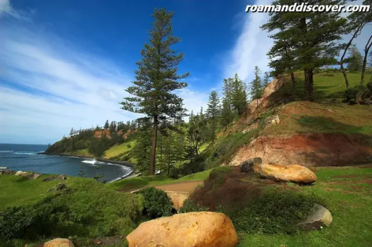
The Norfolk pine
Climate
New Caledonia is blessed with a tropical climate that is both warm and pleasant year-round. There are two main seasons that are experienced, a dry season from May to October and a wet season from November to April. During the dry season, the temperature remains comfortable, with averages between 20°C to 27°C (68°F to 81°F) in the south, while in the north, it ranges from 22°C to 28°C (72°F to 82°F).
During the wet season, the temperature remains warm, with averages between 24°C to 30°C (75°F to 86°F) in the south, while in the north, it ranges from 26°C to 32°C (79°F - 89°F). The rainfall varies throughout the island, with the east coast being drier than the west coast. The northern parts of the island typically receive more rainfall than the southern parts.
Visitors to New Caledonia should be aware of the possibility of cyclones during the wet season, which can occur between November and April. Cyclones can bring heavy winds, rainfall, and storm surges, causing damage to infrastructure and affecting tourism activities. Visitors should monitor local weather reports during the wet season and follow the advice of local authorities.
Environmental Issues
New Caledonia is facing several environmental challenges, including deforestation and mining activities which have caused damage to the island's ecosystems. These issues are of particular concern to indigenous Kanak communities.
Deforestation is a major environmental issue in New Caledonia. The island has a high level of biodiversity and a significant portion of its forests are home to endangered species such as the Kagu, a ground-dwelling bird that is native to the island.
Mining activities are also a significant threat to the island's environment. The mining of nickel and cobalt, which are essential for producing stainless steel, has caused significant damage to the island's ecosystems. The mining process involves the clearing of forests, which leads to the loss of habitat for many endemic species.
The mining operations also produce large amounts of waste material, which is often dumped into river systems and coastal waters, causing further damage to the island's fragile ecosystems. The pollution caused by mining activities is a major concern for the indigenous Kanak communities, who rely on the land and sea for their livelihoods.
The government of New Caledonia has implemented several measures to address these environmental issues. The territory has set aside land for conservation and is working to implement sustainable management practices in the forestry and mining sectors.
Efforts are also being made to reduce the impact of mining activities on the island's environment. Regulations have been put in place to limit the amount of waste material that can be dumped into rivers and coastal areas. The mining industry is also required to rehabilitate mined areas and restore them to their original state.
However, more needs to be done to address these environmental issues, particularly in relation to the impact of mining activities. The indigenous Kanak communities have called for greater protection of their traditional lands and for their voices to be heard in decision-making processes that affect their environment and livelihoods.
environmental issues are a major concern for New Caledonia, and it is important that the government and industry work together to address these challenges and ensure that the island's unique ecosystems and biodiversity are protected for future generations.
Politics
New Caledonia is an overseas territory of France and is governed by the French system of government. The territory has a unique political status and is in the process of decolonization, which began in the late 1980s. The Noumea Accord, signed in 1998, established the pathway for New Caledonia's decolonization process and created a government system that includes both French and Kanak members.
The territory is currently in the final stages of the decolonization process, and as part of this process, a referendum on independence was held in 2018. The result of the referendum was a rejection of independence, with 56.7% of voters choosing to remain part of France.
However, another referendum is expected to be held in the future, as the Noumea Accord allows for up to three referendums to be held on the issue of independence. The final decision on independence will be based on a simple majority vote.
- The process of decolonization has been a long one for New Caledonia, and has involved significant political and social tensions.
- As part of the transition to independence, the territory has established a new flag and national anthem.
- There are concerns about the economic impact of independence, as the territory is heavily dependent on France for financial support.
Despite these challenges, many New Caledonians are optimistic about the future of their territory and the potential for greater self-determination. The territory's unique cultural and environmental heritage, along with its strategic location in the South Pacific, make it an important player in the region's political landscape.
Economy
New Caledonia has a mixed economy that is heavily dependent on mining, particularly nickel and cobalt. In fact, New Caledonia is one of the world's largest producers of nickel, providing almost a quarter of the global supply. Nickel and cobalt exports currently account for around 80% of the territory's exports.
The mining industry has been a major driver of the New Caledonian economy, contributing significantly to the territory's GDP. However, there have been concerns about the environmental impact of mining activities, particularly on indigenous Kanak lands.
In recent years, there has been a push to diversify the New Caledonian economy, with a focus on developing the tourism industry. The territory has a rich and diverse cultural heritage, and ecotourism is a growing sector, attracting visitors from around the world.
New Caledonia's natural beauty, including stunning beaches, lagoons, and coral reefs, makes it an ideal destination for tourists looking for sun, sand, and adventure. The territory is also home to several cultural attractions, such as museums and traditional Kanak villages, which provide visitors with a unique glimpse into New Caledonia's rich and varied history.
The government has implemented several initiatives to boost the tourism industry, including promoting eco-tourism and cultural activities, as well as investing in infrastructure such as hotels and transport. These efforts have already begun to pay off, with tourist numbers increasing steadily over the past few years.
Despite the focus on tourism, mining remains a crucial sector of the New Caledonian economy, and efforts are being made to ensure that it is conducted in a responsible and sustainable manner. The government has introduced strict environmental regulations, and mining companies are required to adhere to these regulations and operate in an environmentally-friendly way.
New Caledonia's mixed economy and focus on both mining and tourism present unique opportunities for growth and development. With careful planning and investment, the territory has the potential to become a major player in the Asia-Pacific region.
Infrastructure
New Caledonia boasts a well-developed infrastructure that makes it easy for visitors to explore the island and its many attractions. The territory has an extensive road network that connects major cities and towns, making it easy to travel by car or bus. there are several small airports on the island that provide easy access to the more remote parts of the territory. The main international airport is La Tontouta International Airport, which is located in Nouméa and is served by several airlines.
New Caledonia's deep-water port is one of the largest in the South Pacific, and it serves as a major hub for shipping in the region.
Read the full article
0 notes
Text
Tasmania

Tasmania is an island state located south of the Australian continent. It is one of the states of Australia and has a unique history, geography, and culture. Tasmania's name is derived from the Dutch explorer Abel Tasman, who was the first European to navigate the island in 1642.
The island's history dates back over 40,000 years, with the Aboriginal people being the first inhabitants. Tasmania has a rich and complex history, including European settlement and colonialism, which impacted the Aboriginal population.
Tasmania's geography includes high mountains, deep valleys, and forests, with a diverse and delicate ecology that includes ancient forests, alpine areas, and marine ecosystems.
The climate in Tasmania is cool and temperate, with four distinct seasons that contribute to its unique flora and fauna. The island state faces environmental challenges such as logging, mining, and climate change, which affect its delicate ecosystems.
Tasmania's economy is diversified and includes tourism, agriculture, forestry, and mining, with a particular focus on high-value products. The infrastructure in Tasmania is modern, including highways, airports, and telecommunication networks, supporting its economy and communities.
Tasmania has a strong tradition of scientific research, with a particular emphasis on sustainable resource management and renewable energy. Famous individuals from Tasmania include actors, musicians, authors, and sportspeople.
The population of Tasmania is relatively small and concentrated mostly in urban areas, with a mix of ethnicities and religions. Tasmania's cultural scene is vibrant, including festivals, museums, galleries, and music venues, showcasing the island's unique heritage.
Visitors to Tasmania can enjoy activities such as hiking, camping, surfing, and wildlife watching. The state has a few major cities, including Hobart, which is the state capital, and Launceston, the second-largest city.
Tasmania is a popular tourist destination, with many popular destinations such as Cradle Mountain, Port Arthur, Wineglass Bay, and the Tarkine Wilderness. The state is known for its high-quality food and drink, including seafood, wine, cheese, and craft beer, all produced locally.
Tasmania has several airports, including Hobart and Launceston, with regular flights from major Australian cities. Accommodation options in Tasmania cater to different budgets and preferences, including hotels, motels, guesthouses, cottages, and campgrounds.
Tasmania offers a unique experience for visitors to Australia, with its rich history, diverse ecology, vibrant culture, and breathtaking scenery.
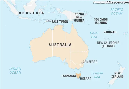
Etymology
Tasmania's name has a fascinating origin and is attributed to Abel Tasman, a Dutch explorer who is believed to be the first European to navigate the island in the year 1642. The name "Tasmania" was given by Tasman in honor of the Dutch East India Company's Governor-General, Anthony van Diemen, who had funded his exploration mission. Initially, the island was called "Van Diemen's Land" in honor of the Governor-General, but it was renamed Tasmania in 1856.
The name Tasmania has an interesting Dutch origin. The suffix "-ia" is a common Latin ending for territory names, while "Tasman" is Dutch in origin, meaning "son of Tas." When Tasman first landed on the island, he named it "Antony Van Diemen's Land" after his patron. However, by 1856, the government had realized the negative connotations of the name for the Australian colonies and decided to change it to Tasmania.
The name change was significant for Tasmania, as it meant a break from the convict past and marking the beginning of a new era. It also marked the island's growing autonomy from the other Australian states. Today, Tasmania's name is a proud reminder of its rich history and unique cultural heritage, and it's a name that resonates with people all over the world.
History
Tasmania has a history that dates back over thousands of years and is rich and complex. Aboriginal people inhabited Tasmania for more than 40,000 years before the arrival of Europeans. The Aboriginal people of Tasmania had a deep connection to the land and had intricate knowledge of the island's natural resources.
When European explorers arrived in Tasmania, they reported finding a thriving Aboriginal population. However, the Europeans brought with them diseases that the Aboriginal people had not encountered before, leading to significant population decline. European settlements and the ensuing land disputes also caused conflict and violence between the Aboriginal people and the settlers.
During the 19th century, Tasmania was used as a penal colony by the British Empire. Thousands of convicts were sent to Tasmania, and their labor was used to build infrastructure and develop the economy. However, the treatment of convicts was often harsh, and many suffered greatly during their time in Tasmania.
The 20th century saw Tasmania transform into a modern state with a diverse economy and a growing population. However, issues such as environmental degradation and social inequality also emerged. The state experienced a significant period of turmoil during the 1980s, with disputes over the establishment of a proposed dam on the Franklin River leading to protests and civil disobedience.
Today, Tasmania is a thriving state with a vibrant culture and an ecologically conscious population. The state's complex history has shaped its identity and continues to inform its decisions as it moves forward towards a sustainable and equitable future.
Geology
Tasmania, located on the southeastern edge of the Australian continent, has a unique geology that is diverse and fascinating. The island is made up of ancient rocks that date back to the Precambrian era, which makes it one of the oldest landforms in the world. These rocks were formed more than 500 million years ago and consist of ancient sandstone, quartzite, and dolerite.
Tasmania boasts a range of mountains, including the Western Tiers, which are part of the Central Highlands, and the Cradle Mountain-Lake St. Clair National Park. These mountains provide breathtaking scenery and attract hikers and climbers from all over the world.
Another notable feature of Tasmania's geology is its stunning coastline, which spans more than 5,000 kilometers and includes towering cliffs, secluded bays, and sandy beaches. The coastline is formed by a combination of ancient rocks, including sandstone, granite, and limestone, and provides a home for many unique marine ecosystems.
Tasmania is also home to several active geological processes, including volcanic activity and plate tectonics. The island's location on the Australian plate means that it is constantly subject to seismic activity, with occasional earthquakes being felt by residents.
Tasmania's geology is an important part of its history and culture and provides a rich resource for scientific study and tourism.
Geography
Tasmania, located on the southeastern edge of Australia, is a stunning island state with a diverse geography that offers something for everyone. With a total land area of 68,401 square kilometers, Tasmania is Australia's smallest state, but it packs a big punch when it comes to its topography.
The island is surrounded by the Southern Ocean, Tasman Sea, and Bass Strait, and has a coastline that stretches for over 5,000 kilometers. Along this coastline, visitors can discover pristine beaches, secluded coves, and towering sea cliffs that offer breathtaking views.
Tasmania's interior is made up of rugged mountain ranges, deep valleys, and vast forests. The highest peak in Tasmania, Mount Ossa, rises to a height of 1,617 meters above sea level. These mountains provide an excellent opportunity for hiking, and visitors can explore a variety of trails that cater to all levels of fitness.
The Tasmanian Wilderness World Heritage area, covering nearly 20% of the state, is a true gem of the island's geography. It includes ancient forests, alpine plateaus, and wild rivers that are home to unique animal and plant species.
The island also has numerous national parks and reserves that protect the fragile ecosystem, such as Freycinet National Park, where visitors can see iconic landmarks such as Wineglass Bay that is acclaimed to be one of the top 10 beaches in the world. At the same time, Cradle Mountain-Lake St Clair National Park is known for its rugged mountains and stunning glacial lakes.
The Tarkine Wilderness in Tasmania's northwest is another area of great ecological value. It is home to temperate rainforests, buttongrass moorlands, and wild rivers that are remote and pristine.
In addition to its natural wonders, Tasmania has a rich cultural heritage, with many historic sites and landmarks that tell the story of the island's early days. Lake Pedder, a natural lake located in a remote and undeveloped part of southwest Tasmania, provides an excellent opportunity for wilderness walks surrounded by mountains and forests. Hence Tasmania provides a great chance for visitors to experience its diverse geography and appreciate its natural beauty.
Ecology
Tasmania is a nature lover's paradise, offering visitors a unique and delicate ecology that is unlike anywhere else in the world. The island state is famous for its ancient forests, alpine areas, and marine ecosystems, which support a wide range of plant and animal species that are found nowhere else on earth.
One of Tasmania's most well-known ecological features is its ancient forests, which include old-growth forests that have been largely undisturbed for centuries. These forests are home to a variety of endemic plant and animal species, such as the Tasmanian devil, the wedge-tailed eagle, and the giant freshwater crayfish. Visitors can explore these forests by walking along the many hiking trails that criss-cross the state, providing a unique opportunity to experience the untouched beauty of ancient Tasmania.
Tasmania's alpine areas are also home to many unique plant and animal species, with high-altitude vegetation that is adapted to the harsh alpine environment. These areas offer visitors a chance to see a completely different side of Tasmania, with stunning views of rugged mountains, clear alpine lakes, and snow-covered peaks.
The state's marine ecosystems are equally as unique, with some of the most pristine coastal waters in the world. Tasmania's coastline is home to a wide range of marine life, including seals, whales, dolphins, and a variety of fish and shellfish species. Visitors can explore these habitats by taking a boat tour or by snorkeling or diving in the crystal-clear waters, experiencing the awe-inspiring beauty of Tasmania's marine environment.
Tasmania's ecology is delicate and precious, and the state is committed to preserving its natural wonders for future generations to enjoy. The government and many local organizations work tirelessly to protect Tasmania's unique flora and fauna, including planting and maintaining native species, managing invasive species, and reducing the impact of human activities on the state's delicate ecosystems. It is vital that visitors to Tasmania also do their part in protecting these fragile environments, by following responsible tourism practices and ensuring that they leave no trace behind.
Biodiversity
Tasmania is home to a unique biodiversity that attracts scientists and nature enthusiasts from all over the world. The island’s isolation and diverse landscape have created a perfect environment for many endemic species to thrive. Tasmania has more than 25,000 species of plants and animals, many of which are found only on the island.
Some of the remarkable species of animals found in Tasmania include the Tasmanian devil, Bennett’s wallabies, eastern quolls, and echidnas. Tasmania is also home to many species of birds, including eagles, parrots, and owls that are found only on the island. the island is home to numerous marine mammals such as dolphins, seals, and whales.
There are more than 3,000 species of vascular plants in Tasmania, including the native Huon pine, king billy pine, and Tasmanian blue gum. The island is also known for its fern forests, which are ancient and have been in existence for over 400 million years.
The island's biodiversity is under significant threat from habitat destruction, invasive species and climate change. In response, Tasmania has implemented policies and measures to protect its unique ecosystems. Many of Tasmania's national parks and reserves are protected areas and are home to some of the island's rare and endangered species.
Inspired by Tasmania's unique biodiversity, many people are taking steps to protect and preserve the island's flora and fauna. One of the ways this is being done is through ecotourism. Tasmania's wilderness area and national parks have become popular destinations for tourists looking to explore the island's unique ecosystems while learning about conservation efforts.
Tasmania has an impressive biodiversity that is found nowhere else in the world. Its unique environment and rich history have created a perfect place for many endemic species of animals and plants to flourish. Although environmental threats pose a significant challenge to Tasmania's ecosystem, the island’s government and people are committed to sustainable and environmentally responsible practices that will help protect its natural wonders for generations to come.
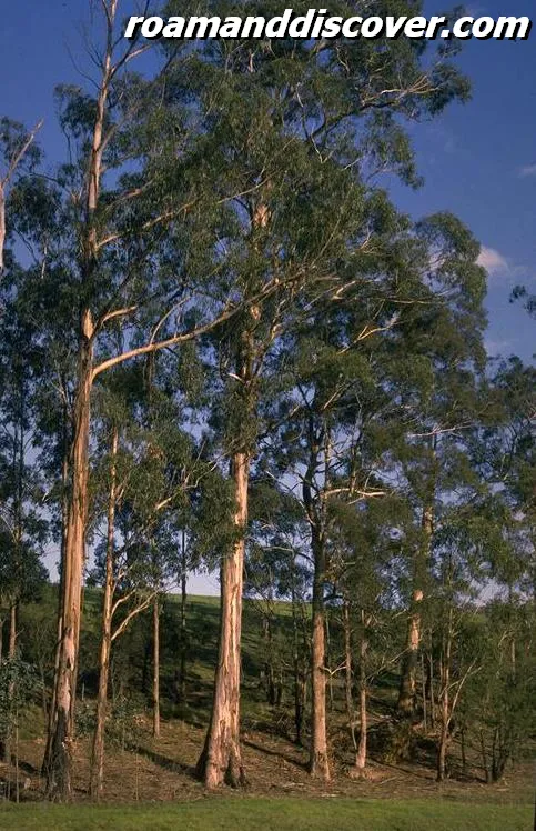
Tasmanian blue gum
Climate
Tasmania's climate is cool and temperate, with four distinct seasons that contribute to its unique flora and fauna. The island's location in the Southern Hemisphere means that its summer months are from December to February, while its winter months are from June to August.
The average temperature in summer is around 21°C (70°F), while the average temperature in winter is around 12°C (54°F). However, temperatures can vary depending on the region, with the mountainous areas being cooler than the coastal areas.
Tasmania receives a high amount of rainfall, with the western region being the wettest part of the island. The rainforests in the west receive over 2,400 millimeters (94 inches) of rainfall per year, which creates a lush and verdant landscape.
The distinct seasons of Tasmania have an impact on its flora and fauna. In spring, wildflowers bloom across the island, including the iconic Tasmanian blue gum, which is the state's floral emblem. Summer is a popular time for outdoor activities, including hiking and camping, while autumn brings about a stunning display of colorful foliage.
Winter in Tasmania can be cold, particularly in the mountainous areas, but it also provides an opportunity to witness the island's unique winter landscapes. The snow-capped mountains and frozen waterfalls create a magical winter wonderland.
The cool and temperate climate also contributes to the island's food and drink culture, with Tasmania producing high-quality seafood, wine, and craft beer. The abundant rainfall and sunshine provide ideal conditions for growing grapes, and Tasmania is quickly becoming renowned for its cool-climate wines.
Tasmania's cool and temperate climate with four distinct seasons is a significant factor in the island's unique flora and fauna, as well as its food and drink culture. Visitors to Tasmania can experience the beauty of each season and the abundance of natural riches that the island has to offer.
Environmental issues
Tasmania, like many other regions globally, is facing significant environmental issues that pose a threat to its delicate ecosystems. The state has a rich biodiversity and unique ecology, which makes it vulnerable to a range of environmental challenges such as logging, mining, and climate change.
Logging is a major concern in Tasmania, with large areas of native forests being cleared for wood production. This activity affects the habitat of many endangered species, including the Tasmanian devil, and disrupts natural ecosystems. The Tasmanian Government has implemented policies to reduce the impact of logging on the environment by promoting sustainable forestry.
Mining in Tasmania has also been a significant source of environmental concern. Mining activities have the potential to release harmful chemicals and pollutants, which can contaminate waterways, soil, and air. The Mount Lyell mine disaster in 2014 resulted in a significant environmental impact, with over 100,000 cubic metres of acidic waste escaping into nearby waterways, leaving an ecosystem devastated.
Climate change is another significant environmental issue that impacts Tasmania. The state's location in the Southern Ocean makes it particularly vulnerable to the effects of climate change, leading to increased frequency and intensity of extreme weather events such as droughts, heatwaves, and bushfires.
The Tasmanian Government is working to mitigate the effects of climate change through measures such as supporting renewable energy and reducing greenhouse gas emissions. However, the state's reliance on industries such as mining and agriculture makes it challenging to transition fully to a low-carbon economy.
Tasmania is facing a range of environmental challenges that require a coordinated effort from government and industry to mitigate. Only through working together, can Tasmania hope to protect its unique and diverse ecosystems, which are essential to its cultural and economic well-being.
Politics
Tasmania has a parliamentary system of government, which is headed by a Premier and a bicameral Parliament. The Tasmanian Legislative Council and the House of Assembly make up the Parliament, which is responsible for making laws based on the needs of the people.
The Premier of Tasmania is the head of the government, who is appointed by the Governor and leads the state government's cabinet. The role of the Premier is to oversee the state's overall governance and make important decisions for the betterment of Tasmania.
Tasmania is a progressive state that has a reputation for creating innovative policies. It is known for being a leader in environmental issues, particularly its efforts to reduce reliance on fossil fuels and promote renewable energy. Many forward-thinking policies have been implemented, such as the introduction of the Anti-Discrimination Act and the establishment of the first-ever Public Interest Disclosures Commissioner.
The Tasmanian government is also committed to social equality and has made significant efforts to improve the lives of the LGBTQ+ community, including legalizing same-sex marriage, anti-discrimination protections, and providing access to gender-affirming healthcare and legal gender recognition.
The state government has also introduced initiatives to support small businesses and entrepreneurs, including financial grants and programs to help with business planning and marketing. Tasmania has also gained a reputation for supporting the arts, with various funding programs available to support Tasmanian artists and cultural events.
Read the full article
0 notes
Text
South Australia
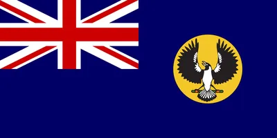
South Australia, known as the “Gateway to the Outback”, is the heart of Australia and a must-visit destination. This diverse state is the perfect destination for explorers, nature enthusiasts, and history buffs who want to experience a unique blend of culture and adventure.
With its rich history, diverse landscapes, and breathtaking natural wonders, South Australia offers something for everyone. Visitors can explore the rugged landscapes of the Outback, hike through the lush forests of the Adelaide Hills, or swim with dolphins in the crystal-clear waters of Kangaroo Island.
The state’s capital, Adelaide, is a vibrant and cosmopolitan city, known for its festivals, wine, and food. It is surrounded by picturesque coastal towns and beach resorts that are ideal for surfing and swimming. Adelaide is also home to a vast network of cycle paths, the perfect way to explore the city and its surrounds.
South Australia is home to some of the most unique and diverse wildlife in the world. Visitors can see endangered species, such as the southern hairy-nosed wombat, or get up close and personal with a variety of marine animals, including the famous Great White Shark.
South Australia is a food and drink lover’s paradise, with an abundance of fresh and local produce on offer. Visitors can sample some of the world’s finest wines in the Barossa Valley or indulge in some of the state’s famous seafood, including prawns, oysters, and tuna. The state’s food scene celebrates its multicultural heritage, with restaurants offering everything from Italian to Vietnamese cuisine.
Whether you are looking for cultural experiences or outdoor adventures, South Australia welcomes you to explore this beautiful and unique state.
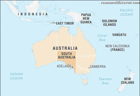
Etymology
The name South Australia was given by the British colonial government when the territory was established as a province of Australia in 1836. The name was inspired by the region's location in the southern part of the continent, bordering the Southern Ocean. The original proposal was to name the region Australasia, but it was considered too broad and eventually rejected.
The name South Australia is also believed to have been influenced by the Greek word "australis," which means "of the south." It's worth noting that the indigenous Kaurna people, who have inhabited the region for thousands of years, had their own names for the land and its features. The Kaurna name for the Adelaide Plains, where the capital city is located, is Tarndanyangga, which means "place of the red kangaroo."
History
South Australia is a land of rich history that dates back thousands of years. The earliest known inhabitants of the region were Aboriginal people who had occupied the land for at least 40,000 years before European settlers arrived. The Aboriginal culture in South Australia is diverse and includes many distinct groups, such as the Ngarrindjeri, Adnyamathanha, and Kaurna peoples, each with their own language, customs, and traditions.
European explorers were the first to officially document the land in 1802 when a British explorer named Matthew Flinders charted the coastline of South Australia. In 1836, the first British settlement was established by a group led by John Hindmarsh, who became the first governor of the region, and established the city of Adelaide. South Australia gained self-government in 1856, becoming the first Australian state to do so.
During the late 19th century, South Australia experienced a boom in the mining industry with the discovery of rich copper deposits in areas such as Moonta and Kapunda. This led to an influx of immigrants from all over the world, including Germany, Ireland, and China. In the early 20th century, South Australia became a major producer of wheat and wool, with the opening of new railway lines and infrastructure to support the industry.
South Australia played a significant role in both World War I and II, with many of its men and women serving in the military. The state also suffered greatly during the Great Depression of the 1930s, with high unemployment and poverty rates.
Today, South Australia is a hub for wine production, tourism, and renewable energy. It is known for its thriving arts scene and cultural offerings, and is home to world-class museums and galleries. The state has a rich history and cultural heritage that is celebrated and preserved for future generations to appreciate.
Table: Significant Events in South Australia's History
Year
Event
1802
Matthew Flinders maps the South Australian coastline
1836
South Australian colony is established
1856
South Australia gains self-government
1870s
South Australia experiences a boom in the mining industry for copper and silver
1914-1918
South Australia heavily involved in World War I
1929-1939
South Australia suffers during the Great Depression
1939-1945
South Australia heavily involved in World War II
2016
South Australia experiences a statewide blackout due to severe storms
Geology
South Australia is home to diverse and breathtaking landscapes, making it a geological wonder. From the rugged Gawler Ranges to the stunning Flinders Ranges, the state is full of interesting geological formations that are waiting to be explored.
The Flinders Ranges are undoubtedly South Australia's most famous geological formation. The mountain range stretches for over 400 km and is characterized by jagged ridges, deep gorges, and breathtaking scenery. The Wilpena Pound is a natural amphitheater that is one of the most popular attractions in the area. The area is also home to a stunning array of wildlife, including kangaroos, emus, and koalas.
The Gawler Ranges are another must-see destination for geology enthusiasts. The region is characterized by volcanic rock formations, including the incredible The Organ Pipes. The Organ Pipes are formed from basalt columns that have been exposed over time, creating a unique and stunning geological feature.
South Australia is also home to several ancient rock formations, including the Nullarbor Plain, a vast expanse of flat, limestone rock. The region is home to several caves, including the world-famous Nullarbor caves, where visitors can explore incredible cave formations and see ancient fossils.
The state's coastline is also a geological wonder. The Great Australian Bight is a vast stretch of coastline that is characterized by towering cliffs and rugged coastline. The limestone formations of the Bunda Cliffs are a popular attraction, and visitors can often see humpback whales migrating along the coast.
For those interested in minerals, South Australia is home to several mines. The Olympic Dam mine, located in the state's north, is one of the largest mines in the world and produces copper, gold, silver, and uranium.
South Australia is a geological wonderland full of diverse and breathtaking landscapes. From the rugged mountains of the Flinders Ranges to the ancient limestone formations of the Nullarbor Plain, the state is a must-see destination for anyone interested in geology.
Geography
South Australia is one of the six states in Australia and is located in the southern central part of the country. It lies between Western Australia to the west and Queensland to the east. The state also borders the Northern Territory to the north and Victoria to the southeast. It covers an area of 984,377 square kilometers, which makes it the fourth largest state in Australia.
South Australia has a diverse geography, with different regions offering breathtaking landscapes and features. The state has three main geographic regions - the Eyre Peninsula, the Mount Lofty Ranges, and the Murray Basin. The Eyre Peninsula is located in the western part of the state and has a rugged coastline with spectacular cliffs, serene beaches, sheltered bays, and natural harbors. The Mount Lofty Ranges are a series of hills that run parallel to the coast within Adelaide. It has many vineyards, forests, and parks, and is known for its diverse wildlife. The Murray Basin occupies the eastern part of the state and is a flat and fertile plain that is drained by the Murray River.
South Australia's topography is characterized by a combination of rolling hills, mountains, plains, and plateaus. The highest point in the state is Mount Woodroffe in the Musgrave Ranges, which rises to 1,456 meters. The Flinders Ranges is also an important mountain range in the state that stretches over 450 kilometers from the Gulf of St. Vincent in the east to Lake Torrens in the west. It has many picturesque gorges, valleys, and creeks that are home to a variety of plant and animal species.
The state's coastline is nearly 4,700 kilometers long and includes the Great Australian Bight in the south that has one of the longest uninterrupted stretches of coastline in the world. It also has several islands, including Kangaroo Island, which is the third largest island in Australia.
South Australia's geography and topography have a significant impact on the local climate. The state has a Mediterranean climate, characterized by hot, dry summers and cool, wet winters. The temperature can vary significantly across different regions of the state due to differences in topography and proximity to the coast.
South Australia's geography and topography are diverse and spectacular. Its rugged coastline, rolling hills, majestic mountains, and fertile plains make it a unique and special place. The state's geographic features not only shape its climate and weather patterns but also provide opportunities for outdoor activities and sightseeing.
Ecology
South Australia is home to some of the most unique flora and fauna in the world. The landscape of South Australia varies from coastal regions to arid deserts, and each ecosystem is home to its own distinct species. The flora of South Australia is diverse and includes plants such as banksias, wattles, and eucalyptus trees. The sandy deserts of South Australia are home to spinifex grass and the iconic red kangaroo paw.
The vegetation of South Australia is a mix of both native and introduced species. The native vegetation includes plants that have adapted to the harsh conditions of the region over thousands of years. The introduced species, such as olive trees and grapevines, have been introduced for commercial purposes.
South Australia is home to a diverse range of wildlife, including many species that are not found anywhere else in the world. The kangaroo is perhaps the most iconic animal of Australia, and the red kangaroo is the largest marsupial in the world. Other notable wildlife in South Australia includes koalas, echidnas, wallabies, and emus. The coastal waters of South Australia are also home to a diverse range of marine life, including sharks, seals, and dolphins.
One of the most unique and fascinating animals in South Australia is the platypus. The platypus is a semi-aquatic mammal that is endemic to Australia. It is known for its unique appearance, with a bill like a duck, webbed feet like an otter, and a tail like a beaver. The platypus is an important part of the ecosystem in South Australia, and it plays a vital role in keeping the freshwater systems healthy.
The Murray-Darling Basin is the largest river system in Australia, and it runs through several states, including South Australia. The basin is home to many important wetlands that provide essential habitat for a wide range of bird species. The Coorong and Lakes Alexandrina and Albert are internationally recognized wetlands that support migratory bird species from around the world.
The ecology of South Australia is also affected by human activity. Land clearing and habitat destruction have led to the decline of many native species. The introduction of invasive species, such as rabbits and foxes, has also had a negative impact on the ecosystem. However, there are many conservation efforts underway to protect and restore the unique flora and fauna of South Australia.
the ecology of South Australia is diverse and unique. From the sandy deserts to the coastal wetlands, each ecosystem is home to its own distinct species. The flora and fauna of South Australia are a vital part of its cultural heritage, and there are ongoing efforts to protect and preserve these important ecosystems for future generations to enjoy.
Biodiversity
South Australia is home to a diverse range of flora and fauna, spanning from the coastal region to the outback. The state is known for its unique and rich biodiversity that attracts nature enthusiasts from all over the world. The area boasts an extensive range of ecosystems, from marine life to arid zones and everything in between, making it a biodiversity hotspot.
The marine life biodiversity of South Australia is exceptionally diverse, with a vast range of species living in the Southern Ocean off the state's coastline. The Great Australian Bight, located off the coast of South Australia, is home to over 800 known species of fish, including many endemic species. The area is renowned for its unique marine life, including southern bluefin tuna, blue whales, and Australian sea lions.
In addition to marine life, South Australia is also home to a wide range of plant and animal species. Coastal vegetation is unique to South Australia, with saltbushes and bluebushes growing in the region's arid zones. Further inland, arid regions are home to a variety of reptiles, including bearded dragons and geckos. The outback also serves as a refuge for marsupials, such as the bilby and the bettong.
The state's wetlands, such as the Coorong and the Riverland, are home to migratory and endemic bird species. These wetlands provide critical habitat for waterfowl species, including pelicans and spoonbills. The Coorong, which is also a Ramsar site of international importance, boasts a diverse range of birdlife, including the vulnerable fairy tern and hooded plover.
South Australia is also home to some of the world's rarest plant species, with over 3,000 plant species, including several that are found only in the state. The state's arid regions boast a unique landscape, with red sand dunes and sparse vegetation that shelters a variety of plant species, including the desert pea and sturt desert pea. The state's conservation parks, such as Ikara-Flinders Ranges National Park, are home to rare and endangered plant species such as the black oak and the kanku-breakaways wattles.
Protected areas throughout South Australia make up more than 20% of the state's total land area. The state government, along with local and national organizations, is committed to preserving the state's unique biodiversity through conservation projects, sustainable use, and effective management strategies.
So, whether you're a nature enthusiast or a curious explorer, South Australia is the place to be for an up-close and personal experience with Australia's unique biodiversity.

reptiles
Climate
South Australia is a state that experiences a variety of climatic conditions throughout the year. It has a Mediterranean climate with hot and dry summers and mild wet winters. The state has diverse climatic regions, ranging from temperate climate in the southeast to arid climate in the northwest.
The coastal regions of South Australia have a relatively mild climate, with average temperatures ranging from 22°C in summer to 12°C in winter. The interior regions of the state experience hotter and drier conditions, with temperatures often exceeding 40°C during summer. The northern part of the state is particularly arid with little rainfall.
The rainfall patterns in the state vary significantly from region to region, with the south and west receiving more rainfall than the north and east. The rainy season in the south and west usually occurs during winter, with the occasional rainfall in autumn and spring. The northern and eastern regions are mainly influenced by tropical weather systems and are characterized by erratic rainfall patterns.
South Australia is subject to various weather phenomena, such as tropical cyclones, thunderstorms, and heatwaves. During summer, heatwaves are common, and they can last for days or even weeks, with temperatures often exceeding 40°C. Thunderstorms occur mainly during summer and can result in heavy rainfall, strong winds, and occasional hail.
In terms of climate change and global warming, South Australia is experiencing an increase in temperatures, particularly during summer. This has resulted in the state experiencing more frequent and severe heatwaves, water shortages, and bushfires. The government has implemented various measures to combat climate change, including increasing the use of renewable energy and reducing greenhouse gas emissions.
South Australia is a state with diverse climatic conditions, ranging from mild to arid. The state experiences various climatic events throughout the year, and it is essential to plan accordingly when traveling to the state. Whether visiting during the hot summer or the mild winter, there are always beautiful landscapes and attractions to explore.
Environmental Issues
South Australia hosts many unique and diverse ecosystems, including the Great Barrier Reef, the Flinders Ranges, and the Murray-Darling Basin. Unfortunately, like the rest of the world, South Australia is facing environmental issues that threaten these habitats and their inhabitants.
One of the biggest problems South Australia faces is climate change. Rising temperatures and changes in weather patterns are affecting the state's agriculture, wildlife, and water systems. The Murray-Darling Basin, which is Australia's largest river system, is also facing issues with excessive water extraction, degradation of water quality, and declining biodiversity due to drought and climate change.
Another issue in South Australia is deforestation. The state has lost a significant amount of habitat due to land-clearing practices, making it difficult for native wildlife to thrive. This has had a severe impact on the state's flora and fauna, including many endangered species such as the southern hairy-nosed wombat and the black-flanked rock wallaby.
South Australia is also facing challenges with managing waste and pollution levels. Plastic pollution is a significant problem, affecting both marine life and public health. The government has implemented programs to reduce plastic waste and promote recycling, but more work is still needed.
Despite these environmental challenges, South Australia is making efforts to conserve their unique natural resources. Conservation efforts are concentrated on protecting endangered species and restoring degraded ecosystems. The government has also implemented policies to promote sustainable practices and reduce greenhouse gas emissions.
South Australia is also home to many national parks and conservation areas that offer opportunities for the public to engage in conservation efforts.
Read the full article
0 notes
Text
Nauru

Nauru, also known as the Republic of Nauru, is a small island nation located in Micronesia, in the Pacific Ocean. It is the third smallest country in the world with an area of only 21 square kilometers, and the second smallest in Oceania. The island has a population of approximately 10,000 people, with most residing in the capital city of Yaren.
Nauru is a unique destination that offers a variety of exciting experiences. Despite its small size, the island is rich in history, culture, and natural wonders. Visitors can enjoy the sunny beaches, explore the lush tropical forests, and savor the local cuisine. the friendly locals and colorful festivals make Nauru a tourist hot spot.
The island is dotted with ancient ruins, museums, and monuments, which tell fascinating stories about its past. The Nauruan people have a rich cultural heritage, which is celebrated through music, dance, and art. On the island, visitors can also witness unique traditions like canoe racing, which is a symbol of Nauru's seafaring history.
For those interested in outdoor activities, Nauru offers numerous options like snorkeling, diving, and fishing. The island's clear waters are home to a variety of colorful marine life, including tropical fish and giant clams. In addition, the island is blessed with plentiful fishing grounds, which attracts fishing enthusiasts from all over the world.
When visiting Nauru, tourists can choose from a variety of accommodation options including hotels, resorts, guest houses, and camping grounds. The island is well-connected, with daily flights to Australia and Fiji, making it a convenient destination for international travelers.
Nauru is a hidden gem that offers something for everyone. Its natural beauty, rich history, and warm hospitality are sure to make your trip unforgettable. Whether you are seeking a relaxing getaway, an adventurous vacation, or an educational experience, Nauru has it all.

Etymology
Nauru is a small island nation located in the Pacific Ocean. The name Nauru is believed to have originated from the Nauruan language, one of the few spoken languages in the country. The Nauruan language itself is part of the Micronesian branch of the Austronesian language family.
The literal translation of Nauru means "I go to the beach."
According to legend, the name Nauru is said to have come from two women who were fetching water from a well. When they reached the well, they saw that the water was being disturbed as if someone was swimming in it. As they looked closer, they saw that it was actually a young maiden, who they invited to come out of the water and play with them on the beach. After playing and having fun together, the young maiden declared that she was going to live on the island, and thus the name Nauru was born.
However, this is just a legend and the true history behind the name may never be fully known. It is also possible that the name may have been influenced by neighbouring languages or cultures, such as the Polynesian, Melanesian or Asian cultures that have had an impact on the islands of the Pacific region.
Despite the uncertainty surrounding its origins, the name Nauru has become synonymous with the unique history, culture and natural beauty of the island nation. It may have a simple translation, but it carries with it a deeper meaning for those who call the island home.
History
Nauru, a small island nation located in the Pacific Ocean, has a rich and interesting history. The island was originally inhabited by Micronesian and Polynesian settlers around 1000 BCE, who created a unique culture and way of life.
In the late 18th century, Nauru was visited by European explorers, who introduced Christianity and began exploiting the island's rich phosphate deposits. The island was subsequently annexed by Germany in 1888, and then passed to Australia, New Zealand, and the United Kingdom during World War I.
After the war ended, Nauru was once again governed by Australia, which continued to exploit the island's phosphate reserves for decades. However, in 1968, Nauru gained its independence and established its own government.
Throughout the 20th century, Nauru's economy relied heavily on phosphate mining, which led to environmental degradation and economic fluctuations. In the 1990s, the government implemented economic reforms and diversified the economy, introducing new sectors such as offshore banking and fishing.
However, despite these changes, Nauru still faces numerous challenges, including poverty, high unemployment rates, and health issues. The government has sought to address these issues through various initiatives, such as investing in education and healthcare, and diversifying the economy even further.
Nauru's history reflects the challenges and opportunities faced by many small island nations in the Pacific. Despite its tumultuous past, Nauru remains a resilient and unique country with a rich culture and proud history.
Geology
Nauru, a small island nation located in the Pacific Ocean, has a unique geological structure that sets it apart from other land masses in the region. The island itself is actually a raised coral atoll, which means that it was formed from coral reefs that were lifted up out of the sea by tectonic forces.
The limestone substrate of Nauru is not only responsible for the island's rocky terrain and jagged coastline but also for the island's most significant export, phosphate. Phosphate mining has been a crucial economic sector in Nauru since the early 20th century, and the excavation of this mineral has led to extensive damage to the island's natural landscape.
In addition to the phosphate deposits, Nauru's geology also boasts several notable caves and sinkholes, including the famed Anibare Bay Cave and Buada Lagoon. Anibare Bay Cave is an extensive limestone cave network located on the eastern coast of the island and is home to unique species of bats and endemic insects. Buada Lagoon, on the other hand, is a former coral atoll that has been flooded to create a freshwater lake in the center of the island.
The geological makeup of Nauru has also contributed to the island's limited access to fresh water. Due to the porous limestone substrate, rainfall rapidly drains away from the surface, leaving Nauru with no permanent lakes or rivers. The island relies heavily on underground reservoirs of freshwater, which are replenished by rainfall and require careful management to prevent overuse and contamination.
the geology of Nauru provides a fascinating glimpse into the unique natural formations and resources that make this island nation so distinct. While the human impact on the island's landscape has been significant, efforts are underway to restore damaged areas and protect the remaining natural features for generations to come.
Geography
Nauru is a small island nation located in the Pacific Ocean. With an area of just over 21 square kilometers, it is one of the smallest countries in the world. Nauru is also the third smallest state by population, with a little over 10,000 inhabitants. Despite its small size, Nauru is a fascinating place, with a unique geography that sets it apart from other Pacific islands.
Nauru is a raised coral atoll, which means that it is a ring-shaped island that was formed from the remnants of an ancient coral reef that was uplifted from the sea-floor. Unlike most atolls, however, Nauru has a relatively flat and elevated central plateau that rises to a height of around 70 meters above sea level. This plateau is surrounded by steep cliffs that drop off into the sea on all sides, forming a natural barrier that protects the island from the elements.
The geology of Nauru is characterized by a mix of limestone, phosphate, and coral, which has been mined extensively over the past century. This has resulted in considerable environmental damage, including the loss of significant areas of rainforest and the depletion of groundwater resources. Despite this, however, Nauru remains a place of outstanding natural beauty, with clear blue waters, sandy beaches, and lush green vegetation.
The climate of Nauru is warm and tropical, with temperatures averaging around 30 degrees Celsius throughout the year. The island is located close to the equator, which means that it experiences two distinct seasons: a wet season from November to February, and a dry season from March to October. During the wet season, Nauru receives heavy rainfall and occasional cyclones, which can cause flooding and landslides. Despite this, however, the island remains relatively safe from most natural disasters.
In terms of flora and fauna, Nauru is home to a wide range of plant and animal species that are endemic to the island. These include several species of birds, reptiles, and rodents, as well as a variety of trees, shrubs, and flowers. Some of the most iconic species of Nauru include the Nauru boa (a type of snake), the Nauru starling (a bird), and the screw pine tree (a flowering plant).
the geography of Nauru is one of the most interesting and distinctive features of this tiny island nation. From its raised coral atoll to its steep cliffs, lush rainforest, and diverse range of flora and fauna, Nauru is a place that is both rich in natural beauty and unique in its geological characteristics. Whether you are interested in exploring the island's stunning coastline, hiking through its rainforests, or simply enjoying the peaceful, laid-back atmosphere of this remote Pacific paradise, Nauru is a destination that is sure to surprise and amaze you.
Ecology
Nauru may be a small island, but it is rich in biodiversity and unique ecosystems. The island's coral reef, lagoon, and surrounding waters provide a variety of habitats for marine life, including sharks, turtles, and a variety of fish species. The island's forests, grasslands, and wetlands support a diverse array of plant and animal life, including several endemic species.
Despite its small size, Nauru is home to several protected areas, including the Nauru Conservation Area and the Wildlife Sanctuary. These areas have been established to protect the island's unique ecosystems and biodiversity from further damage and degradation.
One of the most significant environmental challenges facing Nauru is the impact of mining operations on its land and water resources. The island was once the world's largest exporter of phosphate, and the mining industry has left a lasting impact on the island's landscape and ecosystems. Efforts are being made to rehabilitate damaged areas and restore the island's natural systems.
In recent years, the government of Nauru has also made strides in renewable energy, including solar power, to reduce its carbon footprint and lessen its impact on the environment. Education and awareness campaigns about environmental issues are also taking place to encourage sustainable living practices and protect Nauru's precious ecosystems for generations to come.
Nauru's ecology plays a vital role in the island's culture, economy, and way of life. Protecting and preserving these systems is essential to ensuring the sustainability of Nauru's people and its natural resources.
Biodiversity
Nauru's biodiversity is not very well-known due to its small size and isolated location. However, the island boasts a number of unique plant and animal species that are found nowhere else in the world. One notable species is the Nauru reed warbler, a small bird that is only found on the island. Its habitat is threatened by the loss of the island's natural vegetation, which has been largely cleared for phosphate mining.
Other endemic species include the Nauru boobook, a type of owl, and the Nauru flying fox, a bat that feeds on the island's fruit trees. There are also several species of lizards and frogs that are found only on Nauru, including the Nauru green tree skink and the Nauru cave frog.
The island's plant life is also diverse, with several endemic species of trees, shrubs and herbs. One of the most famous is the Nauru screw pine, which has spiral-looking branches and is a symbol of the island's culture. Unfortunately, many of these plants are also threatened by deforestation and habitat loss.
Nauru's biodiversity is fragile and vulnerable to external threats. It is important for both the government and individual citizens to take steps to protect the island's unique flora and fauna. Educational programs and conservation efforts can help to preserve Nauru's biodiversity for future generations.

flying fox
Climate
Nauru has a tropical climate, with warm temperatures and high humidity throughout the year. The island experiences two distinct seasons: the wet season and the dry season.
The wet season typically starts in November and lasts until April, with February being the wettest month. During this time, Nauru experiences heavy rainfall and occasional thunderstorms. Temperatures during the wet season average around 28°C (82°F) during the day and 25°C (77°F) at night.
The dry season, which runs from May to October, is characterized by clear skies and lower humidity. Temperatures during this time average around 32°C (90°F) during the day and 28°C (82°F) at night. While the dry season is generally pleasant, occasional heat waves and dust storms are known to occur.
Despite its location near the equator, Nauru does not experience tropical cyclones (typhoons) due to its location outside the usual typhoon zone. However, the island is susceptible to El Niño events, which can cause prolonged dry periods and droughts.
If you are planning a trip to Nauru, the best time to visit is during the dry season when weather conditions are most favorable for outdoor activities. Be sure to pack light, cool clothing and plenty of sunscreen to protect yourself from the intense tropical sun.
Environmental Issues
Nauru has faced various environmental challenges that have affected its ecology, economy, and overall sustainability. One of the primary environmental issues faced by the island nation is the severe depletion of its natural resources, particularly phosphate reserves. Nauru was once one of the world's largest exporters of phosphate, but the extensive mining of this resource has resulted in depleted reserves and an altered landscape.
The decline in phosphate reserves has affected the island's ecosystem, including its soil fertility and water quality. The extraction of phosphate has resulted in significant soil erosion and the removal of vegetation, which has led to ongoing desertification. The island's lack of agricultural land and freshwater resources has also been aggravated by this process.
Another environmental issue faced by Nauru is its vulnerability to extreme weather events, such as cyclones, typhoons, and droughts. These natural disasters have the potential to cause severe damage to the island's infrastructure, housing, and agriculture, which are critical components of its economy.
Climate change has also impacted Nauru, with rising sea levels posing a significant threat to the island's low-lying areas. Rising sea levels not only increase the risk of flooding and soil erosion but also threaten the island's groundwater supplies. The occurrence of tsunami is also of great concern to the island nation, with the potential to inflict massive damage to the infrastructure and livelihoods of the coastal communities.
waste management presents a significant environmental challenge to Nauru. The island nation has limited facilities for waste disposal, leading to uncontrolled dumping of waste in public areas and illegal dumping of hazardous waste. Proper waste management practices are essential for enhancing the island's environmental sustainability, protect its natural resources, and protect the health of its residents.
To mitigate these environmental challenges, Nauru has taken several steps to promote environmental sustainability. It is one of the few countries in the world to have established a protected marine conservation area that serves to preserve local marine life and promote sustainable fisheries. The government has also implemented policies to reduce greenhouse gas emissions and encourage the use of renewable energy, such as wind and solar power.
Despite the efforts to address environmental challenges, more needs to be done to protect Nauru's natural resources and enhance its environmental sustainability. By addressing the critical environmental issues, the island nation can ensure the long-term viability of its economy, infrastructure, and society.
Politics
Nauru is a republic with a parliamentary system of government. The President is the head of state and government, and is elected by Parliament for a three-year term. The unicameral Parliament of Nauru consists of 19 members, with the Speaker of the House presiding over its meetings.
The judiciary system of Nauru consists of a Supreme Court and a Court of Appeal. The Supreme Court is the final court of appeal and has the power of judicial review over the decisions of lower courts. There is also a Family Court that deals with family matters such as child custody, guardianship and adoption.
Nauru's constitution guarantees the rights of its citizens, including the freedom of speech, religion, and assembly. The constitution also establishes an independent Electoral Commissioner to oversee free and fair elections.
In terms of foreign relations, Nauru maintains diplomatic relations with a number of countries and is a member of various international organizations such as the United Nations, the Commonwealth of Nations, and the Pacific Islands Forum. Nauru also participates in regional organizations such as the Pacific Islands Development Forum and the Pacific Islands Telecommunications Association.
Nauru's economy is heavily reliant on the revenue generated from phosphate mining, which has caused environmental damage to the island. The government has implemented policies to diversify the economy and reduce dependence on phosphate mining. In recent years, Nauru has also become a destination for asylum seekers, resulting in controversial policies such as the detention of refugees in offshore processing centers.
Nauru's political system is based on a parliamentary system of government, with the President as the head of state and government. The judiciary system consists of a Supreme Court and a Court of Appeal. The government has implemented policies to diversify the economy and reduce dependence on phosphate mining, and has faced controversy over its handling of asylum seekers.
Economy
Nauru's economy is primarily based on phosphate mining. The small island nation has large deposits of phosphate, which is used as a fertilizer in agriculture. The mining industry accounted for the majority of Nauru's GDP in the past, but due to a decline in reserves, the nation has had to diversify its economy.
Aside from mining, Nauru's economy also relies on fishing and agriculture. The country has a small fishing industry and relies on its domestic agriculture sector to produce crops such as coconuts, bananas, and pandanus fruits.
Read the full article
1 note
·
View note
Text
Kiribati

Kiribati, pronounced as "Ki-ri-bas," is an island nation located in the central Pacific Ocean. It consists of 33 atolls and reef islands spread across an area of 3.5 million square kilometers. The country's capital, Tarawa, is located on the southernmost atoll, which is the most densely populated area in the country.
Kiribati is a former British colony, gaining independence in 1979, and comprises three island groups: Gilbert Islands, Line Islands, and Phoenix Islands. With a population of over 120,000 people, Kiribati is one of the smallest countries in the world and is known for its pristine beaches, diverse marine life, and unique culture.
The country's location in the Pacific Ocean gives Kiribati a unique position in the world. It straddles both the equator and the International Date Line, meaning that it is the first country to see the sunrise of a new day, as well as the last to see the sunset of the day that has passed.
Kiribati has a tropical climate with temperatures ranging from 26 to 32 degrees Celsius throughout the year. The country is known for its beautiful beaches, crystal-clear waters, and abundant marine life, making it a popular destination for tourists and divers from all over the world.
The official language of Kiribati is English, and the indigenous Kiribati language, also known as Gilbertese, is widely spoken. The country's culture is deeply rooted in its history and religion, with a blend of Christianity and traditional beliefs. The people of Kiribati are known for their warm hospitality, unique dance and music, and love for sports, such as football and rugby.
Kiribati is a small nation facing significant challenges related to climate change. The country is highly vulnerable to sea-level rise and extreme weather events, which threaten to displace its population and harm its economy. The government of Kiribati is making efforts to promote sustainability and reduce carbon emissions, but much more needs to be done to address the looming environmental crisis.
Kiribati is a small yet unique island nation with a fascinating culture, rich history, and stunning natural beauty that has captivated the world. Despite the many challenges it faces, Kiribati remains a resilient country with a proud heritage and a bright future ahead.

Etymology
Kiribati is an island nation located in the central Pacific. The country's name is a unique and interesting one, derived from the local pronunciation of "Gilberts," which refers to the Gilbert Islands, one of the country's island groups.
During the colonial era, Kiribati was known as the Gilbert Islands, named after the British explorer Thomas Gilbert, who was the first European to discover the islands in 1788. However, when the country gained independence in 1979, it adopted the name "Kiribati," not only to recognize the unique pronunciation of the islands but also to represent the cultural diversity of the country's people.
The name "Kiribati" has a special meaning in the local language, which is Gilbertese. It is said to be derived from two words: "kiribati" (meaning "Gilberts") and "gi" (meaning "to turn towards"). This interpretation reflects the local belief that the islands turned towards the rising sun, which is seen as a symbol of hope and new beginnings.
In recent years, the name "Kiribati" has gained greater attention due to its links to climate change issues. The country is one of the most vulnerable nations in the world to the impacts of climate change, with rising sea levels threatening its low-lying islands. The name "Kiribati" is seen by some as a poignant reminder of the country's struggle to adapt to these environmental challenges and the need for global action to address climate change.
the name "Kiribati" is a reflection of the country's unique culture, history, and geography. It highlights the importance of language and how it shapes our understanding of the world around us. As a visitor to Kiribati, exploring the origins of the country's name can provide valuable insights into its identity and the challenges it faces today.
History
Kiribati, formerly known as the Gilbert Islands, has a rich and complex history dating back thousands of years. The earliest evidence of human settlement in Kiribati dates back to around 3000 BCE, and the islands have been inhabited by Micronesian peoples ever since.
Despite its isolation, Kiribati has had contact with outside cultures for centuries. Spanish explorer Álvaro de Mendaña was the first European to encounter the islands in 1568, but it wasn't until the late 18th century that British explorers began to establish contact with the Gilbertese people.
In 1892, the Gilbert Islands became a British protectorate, and were later joined by the Phoenix and Line Islands. This colonization brought significant changes to Kiribati, including the introduction of Christianity and the establishment of a British colonial government.
During World War II, Kiribati was occupied by Japanese forces, causing significant damage to the islands and resulting in the deaths of hundreds of Gilbertese civilians.
Following the war, Kiribati became a colonial possession of New Zealand before finally gaining independence in 1979. Today, Kiribati maintains close ties with both the United Kingdom and Australia, and is a member of the Commonwealth of Nations.
The history of Kiribati is complex and multifaceted, shaped by the influences of ancient Micronesian culture, European colonization, and the effects of war and globalization. While the islands have faced many challenges throughout their history, Kiribati remains a proud and resilient nation with a rich cultural heritage and a bright future ahead.
Geology
Kiribati's unique geology is characterized by its atolls, which are coral islands that encircle lagoons. Atolls are formed through a complex process that takes place over thousands of years.
The formation of an atoll begins with the growth of a fringing reef around a volcanic island. Over time, the island subsides and the reef continues to grow upward, eventually forming a barrier reef. As the central island continues to sink, the lagoon within the barrier reef is formed.
In Kiribati, there are more than 30 atolls, each with its own distinct geology and formation history. Some of the largest atolls include Kiritimati, Aranuka, Abaiang, and Tarawa.
Kiribati's atolls are not just unique in their formation process but also in their topography. The atolls are generally flat and barely above sea level, with the highest point on many atolls not exceeding 3 meters. This makes Kiribati one of the lowest-lying countries in the world.
The unique geology and low-lying nature of Kiribati make it particularly vulnerable to the effects of climate change, including sea-level rise and increased occurrences of severe weather events. Efforts are being made to protect the atolls through coastal management strategies and other adaptation measures.
In addition to atolls, Kiribati also has several raised coral islands. These islands were once atolls that have since been uplifted due to tectonic activity. Some of the notable raised coral islands in Kiribati include Banaba and Makin.
Kiribati's geology is not only fascinating but also has significant implications for the people and environment of the country. As one of the world's most vulnerable nations to the effects of climate change, understanding and protecting Kiribati's unique geology is more important than ever.
Geography
Kiribati, a beautiful island nation situated in the central Pacific, is comprised of over 30 atolls and one raised coral island. The country covers a vast area of the Pacific Ocean, approximately 1.3 million square miles, with its islands scattered over 3.5 million square kilometers of the Pacific Ocean. The nation is the world's largest atoll nation in terms of land area.
Kiribati's geography is characterized by its low-lying atolls and coral reefs that sit just meters above sea level. The atolls are circular in shape and composed of coral. They encircle a central lagoon, which in many cases, is deeper than the surrounding oceans. The atolls also have narrow strips of land that are home to the country's population.
The islands of Kiribati are divided into three groups: the Gilbert Islands, Phoenix Islands, and Line Islands. The Gilbert Islands are the most populated and include the capital city, Tarawa. The Phoenix Islands, located in the eastern part of Kiribati, are home to one of the world's largest marine conservation areas. And the Line Islands, the furthest from Tarawa, have the earliest time zone in the world, making them the first to see the New Year.
Kiribati's position makes it vulnerable to natural disasters such as cyclones, storm surges, and sea-level rise. The nation is also exposed to the effects of climate change, with rising sea levels posing a significant threat to the country's existence. It is estimated that by 2050, a large portion of Kiribati's land will be underwater.
Kiribati is home to a rich and diverse marine ecosystem that includes a variety of fish species, sharks, dolphins, and turtles. The country also boasts a significant population of seabirds and migratory birds that flock to the islands each year. The nation's unique geography and landscape have also contributed to the development of its culture and way of life, something that is celebrated and appreciated by the people of Kiribati.
Kiribati's unique geography and landscape have contributed significantly to the country's identity and way of life. From its low-lying atolls and coral reefs to the diversity of its marine ecosystem, Kiribati is undoubtedly one of the most beautiful island nations in the world. However, with climate change posing a serious challenge to the country's existence, it is essential that efforts are made to preserve the nation's unique geography and cultural heritage.
Ecology
Kiribati's ecology and marine ecosystems are of vital importance, not only for the local communities but also for the wider world. The island nation's remote location and unique geology have created a diverse range of flora and fauna, both on land and in the surrounding oceans.
At the heart of Kiribati's ecology is its marine ecosystem, which covers over 3.5 million square kilometers and supports a vast array of marine life, including sharks, dolphins, turtles, and over 500 species of fish. These waters are also home to the world's largest coral atoll, the Phoenix Islands Protected Area, which was established in 2006 to protect this unique ecosystem from overfishing and other human activities.
However, like many marine ecosystems around the world, Kiribati's is facing a range of threats, including climate change, overfishing, and pollution. Rising sea levels, caused by global warming, are already causing increased flooding and erosion on many of the islands, which in turn is affecting both terrestrial and marine ecosystems.
Overfishing is also a significant issue, and many of the region's fish stocks are already under threat from over-exploitation. To address this, the Kiribati government has introduced a range of measures, including licensing and quota systems, to manage and conserve its marine resources.
Meanwhile, pollution, particularly from plastic waste, is also a growing problem in the region. The Kiribati government is working with international partners to combat this through initiatives such as beach clean-ups and awareness-raising campaigns.
Despite these challenges, however, there is hope for Kiribati's ecology and marine ecosystems. The country has set itself ambitious environmental targets, including its commitment to the Paris Agreement on climate change, and is working to protect and conserve its unique natural heritage for future generations.
Biodiversity
Kiribati is home to a rich and diverse range of flora and fauna, owing to its isolated location in the central Pacific Ocean. Its ecosystem includes a diverse range of marine life, coral reefs, coconut groves, mangroves, and indigenous plants.
The coral reefs surrounding Kiribati are a crucial part of its ecosystem, providing habitat for a vast array of marine species. The reefs also serve as a vital food source for the people of Kiribati, with fish forming a significant part of their diet. Sadly, these reefs are under threat from a range of factors, including coastal erosion, overfishing, and climate change.
Kiribati's coconut groves are another important natural resource, with the coconut palm playing a crucial role in the islands' economy and culture. The tree's leaves and wood find use in construction, while the nuts provide food and oil. Kiribati is also home to the Kiribati Pisonia, an indigenous tree found only on the islands of Kiribati and the Line Islands.
The islands' mangrove forests provide significant ecological value, serving as breeding grounds and nurseries for several marine species, including fish and sea turtles. Mangroves also help control coastal erosion and purify water, making them essential to the overall health of the ecosystem.
Kiribati's terrestrial wildlife is less diverse than its marine life, with only a handful of land mammals found on the islands, including pigs and rats. However, the islands are home to several indigenous bird species, including the Kiribati sandpiper and the Tabiteuea warbler. These species are threatened by habitat loss and invasive species, highlighting the need for conservation efforts.
Kiribati's diverse flora and fauna are essential to the islands' economy, culture, and ecosystem. Protecting these resources is crucial for sustainable development and the preservation of the unique ecosystem.
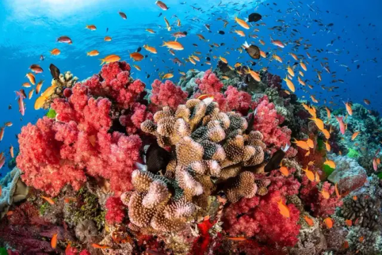
Coral reefs
Climate
Kiribati's climate is characterized by warm temperatures, high humidity, and a consistent sea breeze. The country experiences two distinct seasons: a wet season from November to April and a dry season from May to October. The wet season is often accompanied by tropical storms and cyclones, which can cause significant damage to the islands.
Despite the idyllic climate, Kiribati is highly vulnerable to the impacts of climate change, including rising sea levels, ocean acidification, and coral bleaching. This vulnerability is due in part to the country's low-lying atolls, which average just two meters above sea level. Even a small increase in sea level could submerge much of the country's land area, displacing entire communities and causing widespread damage to infrastructure and ecosystems.
The effects of climate change are already being felt in Kiribati. Coastal erosion is a growing problem, and saltwater intrusion is contaminating freshwater sources, making them unfit for consumption. The country's sensitive marine ecosystems are also being impacted, with coral reefs suffering from mass bleaching events and fish populations declining due to the loss of habitat.
In response to these challenges, Kiribati has taken a proactive approach to climate change adaptation and mitigation. The country has developed a national climate change policy and action plan and has established a Climate Change Unit within the Ministry of Environment, Lands, and Agricultural Development. These efforts aim to build resilience to the impacts of climate change, reduce greenhouse gas emissions, and promote sustainable development.
Kiribati has also been an active participant in international climate change negotiations, advocating for the needs and concerns of small island developing states (SIDS). The country has called for urgent action to address climate change and has emphasized the importance of global cooperation in tackling this complex and pressing issue.
Despite these efforts, the future of Kiribati remains uncertain in the face of climate change. As the world continues to warm, the country will face increasingly severe and frequent climate-related hazards that could threaten the very existence of its people and culture. While adaptation and mitigation measures can help to lessen the impacts of climate change, the need for global action and support remains paramount.
Environmental Issues
Kiribati, like many other low-lying island nations, is facing a range of environmental threats due to climate change and human activity. Rising sea levels caused by global warming pose a significant risk to Kiribati's coastal communities, with some projecting that the nation could be uninhabitable by the end of the century. This threat is amplified by the fact that much of Kiribati's land mass is barely above sea level, meaning that even small rises in sea level could have devastating consequences.
Kiribati is also grappling with challenges linked to water security, pollution, and overfishing. With a growing population and limited freshwater resources, Kiribati is having to find innovative ways to manage its water supply and ensure that it remains safe and accessible for all. At the same time, pollution from plastic waste and other pollutants is harming Kiribati's marine ecosystems and the communities that depend on them. overfishing is putting immense pressure on fish stocks, threatening the livelihoods of local fishermen and the food security of the wider population.
Despite these challenges, Kiribati is taking proactive steps to address them. For example, the country has pledged to transition to 100% renewable energy by 2025 and is already making significant progress in this regard. Kiribati has also invested in infrastructure projects, such as seawalls and water storage facilities, to help mitigate the impact of rising sea levels. the government is working to establish marine protected areas and ensure that fishing is sustainable and environmentally responsible.
Efforts to address environmental issues in Kiribati are also being led by local communities and NGOs. These groups are advocating for sustainable land-use practices, promoting recycling and composting, and raising awareness about the importance of protecting the country's unique ecosystems. Such initiatives are essential in the face of rising pressures from climate change and human activity. Collaboration between government, civil society, and private sector stakeholders will be crucial in ensuring a sustainable future for Kiribati and preserving its natural beauty for generations to come.
Politics
Kiribati is a parliamentary representative democratic republic, with the president serving as the head of state and government. The government is divided into three branches: executive, legislative, and judicial. The president is elected by parliament from its members, while the cabinet is appointed by the president. The legislative branch is a unicameral parliament, known as the Maneaba ni Maungatabu, which consists of 46 members representing 23 constituencies.
Kiribati's political system is notable for its emphasis on traditional leadership alongside modern governance structures.
Read the full article
0 notes
Text
Solomon Islands

The Solomon Islands is a beautiful island country situated in the South Pacific. It is a place that is famous for its scenic beauty and its role in World War II. The Solomon Islands is composed of six major islands and over 900 smaller islands, making it a paradise for adventurous travelers.
It is a place that is highly recommended for nature lovers as it offers an incredible range of outdoor activities. From diving and snorkeling to rainforest hiking, kayaking, and surfing, there is something for everyone.
Furthermore, the Solomon Islands boast an exquisite selection of flora and fauna. It is home to fascinating animals such as the dugong, flying fox, and the Solomon Island skink, found nowhere else in the world.
The Solomon Islands also possess historical significance, hosting the famous Guadalcanal campaign of World War II. Visitors can explore the war relics and exhibits that pay tribute to the brave men who fought and died on the island.
If you are looking for an off-the-beaten-track destination, the Solomon Islands is the perfect place for you. You can experience the authentic local culture, enjoy the delicious food, and explore the stunning landscapes all while immersing yourself in a unique and unforgettable adventure.

Etymology
The name "Solomon Islands" is believed to have originated from the biblical King Solomon, known for his wisdom and wealth. According to legend, during his reign, he sent ships to a land called "Ophir" to collect gold, ivory, and other valuable resources. Some historians believe that the Solomon Islands may have been one of the locations identified as Ophir, making it a possible source of the wealth and luxury of King Solomon's kingdom.
Another theory suggests that the name "Solomon" may have been given to the islands by Spanish explorers in the 16th century, who were reminded of King Solomon's riches when they encountered the local population's gold jewelry and ornaments.
The indigenous population of the Solomon Islands has their own name for the country, "Ysabel." This name is believed to have been given by the Spanish explorer Álvaro de Mendaña de Neira, who named the island after his wife, Ysabel Barreto de Mendaña.
Regardless of its origin, the name "Solomon Islands" has become synonymous with the natural beauty, rich cultural heritage, and unique biodiversity of this Pacific island nation.
History
The history of the Solomon Islands is rich and complex, marked by centuries of indigenous cultures and the impacts of European colonialism and World War II. The island chain was first settled by Austronesian-speaking peoples around 30,000 years ago, who created unique societies and languages across the archipelago.
In the 16th century, the Spanish explorer Álvaro de Mendaña became the first European to sight the islands. The archipelago was later named after King Solomon by a Portuguese explorer in the 16th century, who believed that the islands were the source of the biblical king's legendary wealth.
In the late 19th century, the Solomons became a British protectorate, with extensive logging and mining occurring throughout the colonial period. During World War II, the islands were the site of intense fighting between Allied forces and the Japanese, with the Battle of Guadalcanal being one of the most significant conflicts of the Pacific theater.
After the war, the Solomon Islands became a self-governing territory within the British Empire, with full independence achieved in 1978. However, the nation has faced numerous socio-economic and political challenges since then, including ethnic tensions and economic instability.
Today, the Solomon Islands is a sovereign nation with a rich cultural heritage and a rapidly growing tourism industry. However, the events of the past continue to shape its present and future.
Geology
The Solomon Islands are part of an archipelago made up of around 990 individual islands and coral atolls, situated in the South Pacific Ocean. The islands are known for their stunning natural beauty, with lush rainforests, pristine beaches, and clear turquoise waters.
The geology of the Solomon Islands is largely volcanic, with many of the islands being formed by volcanic activity millions of years ago. The islands are situated in the Pacific Ring of Fire, an area of intense volcanic and seismic activity, caused by the movement of tectonic plates deep beneath the earth's surface. This geographical location has meant that the Solomon Islands have been subjected to a long history of volcanic activity and earthquakes, which have played a significant role in shaping the landscape.
The islands are also characterized by their rugged terrain, with steep hills and mountains forming a dramatic backdrop to the tropical forests and coral reefs. These formations have been sculpted by powerful tectonic forces, which have pushed and lifted the land, creating deep valleys and soaring peaks.
The volcanic activity has also generated a network of hot springs and geothermal vents, which can be found scattered across the islands. These hot springs are popular with both tourists and locals, who use them for bathing and therapeutic purposes.
In addition to volcanic activity and tectonic forces, the Solomon Islands have also been subjected to significant erosion and weathering. The islands are located in a tropical climate, which is characterized by heavy rainfall and high humidity. This has led to the formation of extensive networks of rivers and streams, which have carved deep gorges and valleys into the landscape over millions of years.
the geology of the Solomon Islands is complex and diverse, shaped by a wide range of geological processes over millions of years. Visitors to the islands can explore this rich geological history by hiking through rainforest-clad valleys, climbing towering peaks, or swimming in the warm waters of the geothermal springs.
Geography
The Solomon Islands is an archipelago of more than 900 islands that covers over 28,000 square kilometres of land. The islands are situated in the South Pacific Ocean, northeast of Australia and east of Papua New Guinea. The majority of the islands are mountainous and volcanic in origin.
The topography of the Solomon Islands is highly diverse, with different landscapes on each island, such as forests, coastal plains, lagoons, and coral reefs. The highest peak in the Solomon Islands is Mount Popomanaseu, which stands at 2,335 metres above sea level.
The islands are surrounded by rich marine life and an abundant coral reef system. The Solomon Islands are home to more than 1,000 species of fish and 230 species of coral. The natural environment of the Solomon Islands is one of the main attractions for nature lovers and adventure seekers.
The climate of the Solomon Islands is tropical, with high temperatures and humidity all year round. The islands are also prone to cyclones and earthquakes due to their location in the Pacific Ring of Fire.
The largest island of the Solomon Islands is Guadalcanal, where the capital city, Honiara, is located. Other notable islands include Malaita, Choiseul, and Santa Isabel. Each island has its unique culture and history, making the Solomon Islands an exciting destination for cultural tourism.
The Solomon Islands is also home to many rivers and waterways, including the Matanikau River, which flows through Honiara. The country has a mountainous terrain, making it challenging to construct roads and bridges. Nevertheless, there has been significant infrastructure development in recent years to improve connectivity within and between different islands.
the unique geography and diverse landscapes make the Solomon Islands a fascinating destination for travellers looking to explore nature and discover new cultures. Whether it's trekking through rainforests, diving in the coral reefs, or visiting traditional communities, the Solomon Islands offers an unforgettable travel experience.
Ecology
The Solomon Islands is a land of diverse and unique ecosystems that support a plethora of plant and animal species. The archipelago consists of over 900 islands, each with its own distinct ecological makeup. The islands' ecosystems range from rainforests and mangrove swamps to coral reefs and deep-sea trenches.
The Solomon Islands' coral reefs are breathtakingly beautiful and home to an incredible variety of marine life. The waters around the Solomon Islands are also known for their abundance of fish, including tuna, mahi-mahi, and barracuda. The coastline and beaches are home to numerous species of sea turtles, including the critically endangered hawksbill sea turtle.
The Solomon Islands also have a vast rainforest ecosystem that is home to a variety of plants and animals. The rainforests are teeming with life, including tree kangaroos, possums, and numerous species of birds. Some of the endemic bird species found in the rainforests include the Solomon Island pigeon, the Solomon Islands cuckoo-shrike, and the white-capped monarch.
The mangrove swamps in the Solomon Islands are also ecologically important as they provide habitats for numerous fish, crustaceans, and birds. The mangrove swamps act as breeding grounds for fish, and the trees also play a crucial role in stabilizing the shorelines and protecting the islands from erosion.
Another unique aspect of the Solomon Islands' ecology is the presence of volcanic activities. The islands are located along the Pacific Ring of Fire, which is responsible for the creation of the volcanic island chains that make up the Solomon Islands. The volcanic activity has resulted in the formation of deep-sea trenches, which have created unique ecosystems that are home to a variety of deep-sea creatures.
The Solomon Islands' biodiversity is also noteworthy, with numerous endemic species found on the islands. The islands are home to dozens of unique plant and animal species that cannot be found anywhere else on earth. Some of the endemic species found in the Solomon Islands include the Guadalcanal monkey-faced bat, the Choiseul crested pigeon, and the Solomon Island flying fox.
The Solomon Islands' ecology and biodiversity are truly remarkable, and their protection and preservation are of crucial importance. The Solomon Islands' government has implemented several initiatives to preserve the archipelago's unique ecosystems, including creating marine protected areas and enforcing stricter regulations on hunting and fishing activities.
the Solomon Islands' diverse and unique ecosystems and the species that call it home are an integral part of the archipelago's natural beauty and cultural heritage. Visitors to the Solomon Islands can witness these ecological wonders firsthand by exploring the rainforests, snorkeling or diving in the coral reefs, or observing the endless array of wildlife that can be found throughout the islands.
Biodiversity
The Solomon Islands is a paradise for nature lovers, and one of the reasons is its exceptional biodiversity. The islands are home to a plethora of exotic and unique plant and animal species that can only be found here. In fact, the Solomon Islands have one of the highest rates of endemism in the world, with over 85% of its species being unique to the region.
The islands’ forests are diverse and range from mangroves to lowland rainforests, with some areas having been unexplored and uncharted. The diverse habitats and climate zones have resulted in a remarkable range of flora and fauna. The coral reefs are home to an impressive variety of marine life, including colorful fish, sponges, crustaceans and more.
One of the iconic species of the Solomon Islands is the Solomon Island flying fox, one of the world's largest bats with a wingspan of up to 2 meters. It is a vital species for the islanders' hunting culture and plays a significant role in maintaining the forest ecosystem.
Another renowned animal is the Guadalcanal marmoset, a small primate found only on the Guadalcanal Island. Besides these two, other rare and exotic animal species unique to the Solomon Islands include the Solomon Sea eagle, the Bougainville monkey-faced flying fox, and many different types of bird species endemic to the region.
The plant life on these islands is equally fascinating. With over 4,500 different plant species, the diversity in flora is incredible. The lush forests have many medicinal plants that remain undiscovered and unexploited by modern medicines.
Many of these species are found nowhere else in the world, and the Solomon Islands have been declared one of the world's biodiversity hotspots. Efforts are being made to protect and conserve the species through various programs. The islands have established national parks to ensure the sustainable use of these valuable resources.
With such a diverse array of unique flora and fauna, the Solomon Islands are truly a paradise for nature lovers and an unmissable destination for those interested in biodiversity.

Coral reefs
Climate
Solomon Islands has a tropical climate with consistent temperatures ranging between 26-32°C throughout the year. The islands have a distinct wet and dry season with the wet season running from November to April while the dry season runs from May to October. During the wet season, the islands experience heavy to moderate rainfall, high humidity, and strong winds, while the dry season is characterized by dry and sunny weather.
The eastern islands of the Solomon Islands experience more rainfall than the western islands. During the wet season, the islands may experience tropical cyclones and typhoons. In extreme situations, these can cause severe damage to the islands. It is important to check the local weather and advisories before traveling to the Solomon Islands.
The sea temperatures remain warm throughout the year, making the islands a great destination for water-based activities such as diving and snorkeling. Due to its location on the equator, the Solomon Islands have consistent daylight hours, with the sun rising at 06:00 am and setting at 6:00 pm all year round.
It's important to bring appropriate clothing for the climate. Lightweight clothing made from breathable fabrics such as cotton or linen is advisable. Visitors should bring waterproof items during the wet season, including waterproof jackets, pants, and shoes. Sunscreen and sunglasses are also essential due to the strong UV rays and bright sunlight. Try to avoid exposing yourself to the sun during its peak hours, from 10:00 am to 4:00 pm.
the tropical climate in the Solomon Islands guarantees sun, sand, and sea all year round. However, visitors should be aware of the wet and dry season and take appropriate protective measures from the sun and rain. it is worth noting that the Solomon Islands can be affected by tropical storms from time to time, making it essential to keep an eye on local weather advisories when traveling.
Environmental Issues
The Solomon Islands face a number of environmental challenges, including deforestation, mining, and climate change. The country is home to vast expanses of tropical rainforest, but these are being destroyed at an alarming rate. In some cases, this is due to logging, but it is also driven by the expanding population, who need land for agriculture and settlements. Deforestation has led to soil erosion, reduced water quality and increased flood risk.
Mining is another major environmental issue in the Solomon Islands. In particular, the extraction of gold and other minerals has a significant impact on the environment. Chemicals used in the mining process can lead to soil and water pollution, as well as serious health problems for those working in or living near mines. There are also concerns about the long-term sustainability of mining in the country, given the limited resources and the finite nature of mineral deposits.
Climate change is yet another major environmental challenge facing the Solomon Islands. Rising sea levels are a particular concern, as they threaten to displace thousands of people living in low-lying coastal areas. The warmer waters around the islands also increase the likelihood of coral bleaching, which can have devastating consequences for marine ecosystems. The country is taking steps to address these challenges, including developing plans to relocate affected communities, promoting sustainable agriculture, and investing in renewable energy.
Efforts to protect the environment in the Solomon Islands are generally led by a range of stakeholders, including the government, NGOs, and local communities. One notable initiative is the Pacific Islands Greenhouse Gas Abatement through Renewable Energy Project (PIGGAREP), which aims to reduce greenhouse gas emissions and promote clean energy in the region. The country is also involved in regional initiatives to address climate change, such as the Pacific Island Forum Leaders’ Declaration on Climate Change Action.
Despite these efforts, much remains to be done to address the environmental challenges facing the Solomon Islands. This will require a sustained commitment from government, civil society, and the private sector to protect the natural resources that sustain the country’s people, economy, and cultural heritage.
Politics
The Solomon Islands operates as a parliamentary democracy and is a member of the Commonwealth of Nations. The executive branch is headed by a prime minister who is elected by the Members of Parliament. The legislative branch is a unicameral Parliament with 50 seats, and members are elected for a four-year term. The judicial branch consists of a High Court, a Court of Appeals, and a Magistrates' Court.
One of the main political issues confronting the Solomon Islands is the challenge of maintaining stability and peace in a country that has experienced political unrest and civil conflict. The Solomon Islands experienced a period of conflict between 1998 and 2003 that saw the intervention of regional forces. Since then, the country has undergone processes of national reconciliation and community building, and has worked towards ensuring peace and stability.
In recent years, the Solomon Islands has been experiencing political developments that are shaping the country's future. In 2019, Manasseh Sogavare was elected as the country's new Prime Minister. His election is expected to have a significant impact on the country's politics, as he takes over at a time when there is growing concern about China's increasing presence in the Pacific region. The Solomon Islands is also considering the possibility of changing its diplomatic recognition from Taiwan to China, a move that has raised concerns among some members of the international community.
Aside from its political challenges, the Solomon Islands is also experiencing other issues that impact its governance and political stability. Corruption remains a major concern, and its effects on political institutions have been far-reaching. The government has taken measures to address the issue, including the establishment of an Independent Commission Against Corruption.
Read the full article
1 note
·
View note
Text
California

California, the most populous state in the United States of America, is known for its beaches, Hollywood, and Silicon Valley. However, there is so much more to this state than just those three things. California is a state that is diverse in every aspect, from its geography to its culture. In this article, we will take a detailed look into California and explore everything that it has to offer.
Let's start by tracing the origins of California's name. The name California is said to have been derived from the 16th-century Spanish novel Las Sergas de Esplandián. The novel describes a fictional island called California, located on the western coast of North America. The name caught on, and the Spanish began to use it to describe the land they were exploring. Today, California is known as the Golden State.
California has a rich history that spans centuries. The Spanish were the first to establish a colony in California in the late 1700s. They built many missions, and the state slowly developed. However, it was not until the mid-1800s, during the California Gold Rush, that California really took off. Thousands of people flocked to the state to try their luck at finding gold, and California grew rapidly. Over the years, California has become the most populous state in the US, with a population of over 39 million people.
One of the unique aspects of California is its geography. California is home to the Sierra Nevada Mountains, the Mojave Desert, and the Pacific Ocean coastline. With such diverse landscapes, it's no surprise that California has a variety of ecosystems. From towering redwoods to barren deserts, and from rocky beaches to lush vineyards, California has it all.
California also has a unique climate. In the northern part of the state, the climate is Mediterranean, while in the southern parts, it is desert-like. The state also sees a range of natural disasters, including earthquakes, wildfires, and floods.
Despite its fame and fortune, California also has its share of environmental issues. Droughts are a recurring problem, and the state has been hit hard by climate change in recent years. Air pollution is another issue, particularly in the major cities.
But California isn't all work and no play. The state is home to an incredibly diverse population, with people from all over the world living here. California has a vibrant culture, with art galleries and museums, music festivals, and sporting events.
California's major cities, including Los Angeles, San Francisco, and San Diego, offer a range of activities for tourists and locals alike. From trying the famous In-N-Out Burger to exploring Alcatraz Island, there's something for everyone. The state is also home to some of the most beautiful cities in the world, including San Francisco and Santa Barbara.
With so much to offer, it's no wonder California attracts visitors from all over the world. So, whether you're a history buff, an outdoor enthusiast, or simply looking for a good time, California has something for you.

Etymology
The name California has an intriguing history that dates back to the 16th century. It was Spanish explorers who first arrived on the shores of what is now California and named the land ‘California’ after a mythical land described in a popular Spanish novel called Las Sergas de Esplandián.
The novel described California as a place rich in gold and ruled by a powerful queen named Calafia. When the Spanish explorers came across similarly lush and abundant land, they immediately thought it was the land of the novel, thus naming it California.
However, there is some debate over the origin of the name. Some argue that the name California was derived from the Latin phrase ‘calida fornax’ meaning ‘hot furnace’ or ‘hot oven’. This is due to the state’s reputation for having particularly hot summers.
Language Origin
Meaning
Spanish
Based on the name of a mythical land in Spanish literature whose queen was Calafia and was filled with gold and precious gems.
Latin
Derived from the Latin phrase ‘calida fornax’ meaning ‘hot furnace’ or ‘hot oven’ because of the state’s hot summers.
The actual origin of California’s name, therefore, remains something of a mystery. But one thing is for sure – the state of California has established itself as a land of beauty, abundance, and opportunity, whatever its name may mean.
History
California has a rich and fascinating history that spans centuries. The state was originally inhabited by various Native American tribes until the arrival of Spanish explorers and missionaries in the late 18th century. The Spanish established numerous missions throughout the state, which led to the conversion of many California Indians to Christianity.
By the mid-1800s, California had become a part of Mexico, until it was ceded to the United States in 1848 after the Mexican-American War. The discovery of gold in 1849 drew massive numbers of people to California in search of fortune, sparking what is now known as the California Gold Rush.
The state's population continued to grow rapidly in the subsequent years, driven in part by the completion of the first transcontinental railroad in 1869, which linked California to the eastern United States. In addition, the development of the oil industry in the early 20th century and the rise of Hollywood transformed California into a major economic and cultural center.
Throughout the 20th century, California played an important role in numerous historical events, including the internment of Japanese Americans during World War II and the rise of the hippie counterculture in the 1960s. Today, California remains one of the most populous and influential states in the nation, with a rich cultural and historical legacy that continues to inspire and captivate visitors from around the world.
Geology
When studying California's geology, one comes to appreciate the variety of landforms that make up the state's landscapes. Primarily known for its coastline and rugged mountains, California also boasts vast deserts and fertile valleys. The state's bedrock dates back to the Pre-Cambrian era, and its diversity is credited to the many tectonic plates that meet in California. The state is separated into three primary regions: the Coast Ranges, the Sierra Nevada, and the Basin and Range province.
The Coast Ranges represent the state's western edge and are largely composed of sedimentary and metamorphic rocks. The Sierra Nevada range is a dramatic and awe-inspiring mountain range with some peaks rising above 14,000 feet. It's composed primarily of granite and was formed when the Farallon Plate subducted beneath the North American Plate. Californians have always been proud of their mountain ranges, with Hollywood films often featuring their majestic peaks.
Covering much of the eastern part of California is the Basin and Range Province. The towering peaks of the Sierra Nevada shield the province and act as a barrier. The basin and range province is an arid land of striking contrasts, with some areas only a few hundred meters above sea level while others exceed 11,000 feet. The landscape is primarily composed of sedimentary and igneous rocks.
California's geology has given rise to many unique features, including its hot springs and geysers. Lassen Volcanic National Park is a popular destination for visitors looking to explore California's volcanic history. The park features the now-dormant Lassen Peak as well as various hydrothermal features.
California's geology is vast and diverse, resulting in a diverse range of landscapes, from mountains to deserts to fertile valleys. Understanding the state's geology is essential for appreciating its natural beauty, and exploring its unique features is a highlight of any visit.
Geography
California’s geography is as diverse as it is captivating. From towering mountains to pristine beaches, this Golden State has it all. With a land area of nearly 163,696 square miles, it is the third-largest state by land area in the United States.
The state of California shares its borders with Oregon to the north, Nevada to the east, and Arizona to the southeast. To the south, it is bordered by Mexico, while the Pacific Ocean lies to the west.
The state can be divided into four main regions - the Central Valley, the Coastal Range, the Sierra Nevada, and the Mojave Desert. The Central Valley is a vast expanse that runs north to south between the Coastal Range and the Sierra Nevada. This region is primarily agricultural, providing much of the nation's fresh produce.
The Coastal Range runs along the western edge of California and forms a natural barrier between the Pacific Ocean and the Central Valley. The rugged terrain, coupled with the state's Mediterranean climate, makes it an ideal destination for hikers and outdoor enthusiasts.
The Sierra Nevada mountain range lies to the east of the Central Valley and spans over 400 miles. The highest peak in the contiguous United States, Mount Whitney, is located in this range, standing at an impressive 14,505 feet.
The Mojave Desert is located in the southeastern portion of the state and covers an area of over 25,000 square miles. Despite being labeled as a desert, the region has a diverse landscape that includes sand dunes, volcanic cinder cones, and Joshua tree woodlands.
California is also home to a number of popular national parks, including Yosemite, Joshua Tree, and Death Valley. These parks offer breathtaking scenery and provide visitors with a glimpse of California's unique natural beauty.
In terms of bodies of water, California is home to Lake Tahoe, a popular recreation spot in the Sierra Nevada mountains, as well as the Salton Sea, the largest lake in California. The state also boasts an extensive coastline that spans over 840 miles, with cities like San Diego, Los Angeles, and San Francisco serving as major coastal hubs.
California's geography is one of the most varied and stunning in the United States. Whether you prefer mountains, beaches, or deserts, this state has something for everyone.
Ecology
Ecology is a field that deals with the study of the interactions between living organisms and their environment. California is home to some unique ecosystems, each with its distinctive flora and fauna. Understanding and preserving these ecosystems is vital for the state's environmental sustainability.
One such ecosystem is the California chaparral and woodlands, which consists of shrubs, small trees, and grasses. These vegetation types have adapted to survive in the Mediterranean climate of California, characterized by hot summers and mild winters. They provide habitat for a wide range of animals, including the California condor, mountain lions, and bobcats.
Another ecosystem unique to California is the coastal sage scrub, found in the coastal regions of the state. It is composed of low-growing evergreen shrubs, characteristic of a Mediterranean climate. Many animal species, such as the California gnatcatcher and the coastal cactus wren, rely on this ecosystem for their survival.
The Central Valley of California is home to agricultural ecosystems, which provide a significant chunk of the state's revenue. Farmers grow a variety of crops, including almonds, pistachios, grapes, and oranges, among others. These systems rely heavily on irrigation and are threatened by water scarcity and pollution.
The Sierra Nevada mountains, with their snow-capped peaks and coniferous forests, are among the most visually stunning landscapes in California. These forest ecosystems support a wide range of wildlife, including black bears, mountain lions, and bald eagles. The forests also play a crucial role in the state's water cycle, serving as a source of freshwater for rivers and other bodies of water.
In addition to these, California is also home to other unique ecosystems such as deserts, wetlands, and alpine tundra. Each of these ecosystems provides habitat for unique species, highlighting the rich biodiversity of California.
The unique ecosystems of California are under threat from climate change and other human activities. The state must take proactive measures to preserve and protect these ecosystems while ensuring that they remain sustainable for future generations. It is also crucial to educate people on the importance of biodiversity conservation and the role that they can play in preserving these ecosystems.
Biodiversity
California is renowned for its breathtaking scenery, stunning landscapes, and diverse ecosystems. One of the key pillars of California's ecology is its rich biodiversity. Home to a variety of species, California has a marvelous array of flora and fauna.
The abundance of vegetation in California is a sight to behold. The state has over 6,500 species of plants - more than half of which cannot be found anywhere else. From towering redwood trees to the vibrant blooms of desert wildflowers, California's plant life is simply astounding.
But it's not just about the plants. California is also home to an incredibly diverse and fascinating range of animals. The state boasts over 660 species of birds, over 200 species of mammals, and nearly 90 species of reptiles and amphibians. From the majestic California condor, the largest land bird in North America, to the adorable sea otter, California's wildlife is truly unique.
California's marine ecosystem is also teeming with life. The state's coastal waters are home to a wide range of marine organisms - from sea stars and octopuses to whales and dolphins. The coast is also dotted with kelp forests, which provide habitat and food for many species of fish and other marine life.
In addition to the wealth of species that can be found in California's natural habitats, the state is also home to a number of important wildlife sanctuaries and parks - including Yosemite National Park, Joshua Tree National Park, and the Golden Gate National Recreation Area, among many others. These protected areas help to conserve and protect California's unique biodiversity.
Despite this wealth of biodiversity, however, California is not immune to the impacts of human activity. Habitat loss, climate change, pollution, and overexploitation of natural resources are all posing major threats to the state's flora and fauna. It is critical that we take action to protect and conserve California's natural heritage for generations to come.
amphibians
Climate
California has a highly diverse climate due to its expansive geography. The state's southern region usually experiences a Mediterranean climate, which features mild, wet winters, and hot, dry summers. Meanwhile, the northern part of the state tends to have a wetter climate, with cool, damp winters and warm, dry summers. The state also has an arid desert climate in some areas. The coastal regions of California are cooled by the Pacific Ocean, resulting in a temperate climate and an average of about 300 days of sunshine per year. The state's central valley is hot and dry during the summer months but experiences colder winters, whereas mountainous regions have a predominantly alpine climate, with colder temperatures and significant snowfall in winter. Southern California, particularly the area around Los Angeles, is infamous for its smog problem, which is the result of its location in a basin surrounded by mountains that trap pollutants from traffic and industry. droughts are not uncommon in California, as the state experiences long dry spells that are exacerbated by climate change. Apart from smog and drought, wildfires are also a significant issue in California, especially in wooded and mountainous areas. According to CAL Fire, the state agency responsible for fire protection, California experienced its largest-ever wildfire season in 2020, with over 4.2 million acres burned. Climate change is exacerbating these problems, and California is taking a proactive approach towards addressing environmental issues. Actions such as implementing renewable energy sources, investing in electric vehicle infrastructure, and encouraging sustainable farming practices are among the measures the state is putting in place to combat the effects of climate change. California's varying climates make it a desirable location for a range of outdoor activities, from skiing in the Sierra Nevada Mountains to lounging on the beaches in Los Angeles - all within the same state. Visitors and residents alike must keep an eye on the weather, which can change quickly, particularly in mountainous areas, where heavy snowfalls can cause road closures. California's climate is incredibly diverse, with varying temperatures, degrees of humidity, and rainfall amounts. While visitors are advised to be aware of the weather, there is a wide range of outdoor activities to enjoy across the state's many different climates.
Environmental issues
California is facing significant environmental issues that are affecting the state. One of the biggest problems is air pollution, which results in chronic respiratory diseases and contributes to climate change. The state is also experiencing a water scarcity crisis, which is becoming more and more severe. The drought problem is exacerbated by the rising demand for water from a growing population, and it is affecting agriculture, wildlife, and even the quality of life of residents. Wildfire incidents have increased in recent years due to prolonged droughts and hotter temperatures, causing severe damage to natural habitats, homes, and infrastructure.
Another significant environmental issue facing California is the rapid depletion of natural resources, such as forests, fisheries, and minerals. Overuse of these resources threatens the delicate ecosystems and their inhabitants, including endangered species and fish populations. The state is also facing ocean pollution, largely caused by the dumping of plastics and industrial waste into the ocean, which is affecting marine life and contributing to the degradation of the natural ecosystem.
Climate change is one of the biggest threats to California's environment, and it is already causing a myriad of problems. The state is experiencing more frequent heat waves, which lead to dehydration and heat strokes. It also causes more intense storms, leading to floods, landslides, and soil erosion. The rising sea level is also causing damage to infrastructure and the displacement of people living in coastal communities.
To tackle these environmental issues, California has implemented numerous regulations and programs. The state has invested in green technology, including renewable energy and electric cars, to reduce the carbon footprint and dependence on fossil fuels. The state is also actively engaged in recycling programs and has banned single-use plastics, which have contributed to ocean pollution. California has enacted laws to protect endangered species, preserve natural habitats and forests, and reduce water wastage.
California is facing significant environmental issues that threaten the diverse ecosystems and the quality of life of its inhabitants.
Read the full article
0 notes
Text
Utah

Utah, situated in the western United States, is a state famous for its awe-inspiring national parks, world-class skiing destinations, and unique landscape that draws visitors from around the globe. The state is known for its diverse and vibrant geography that includes mountains, canyons, deserts, and forests, making it an ideal destination for outdoor enthusiasts.
Utah's natural beauty is showcased in its five national parks, including Zion National Park, Bryce Canyon National Park, and Arches National Park, each with its unique scenery and geological formations. Visitors can enjoy a range of activities, from hiking and rock climbing to horseback riding and rafting, all surrounded by Utah's stunning natural surroundings.
Aside from its national parks, Utah is also known for its world-class skiing destinations, attracting visitors from around the world to experience the state's legendary powder snow. Ski resorts such as Park City, Deer Valley, and Alta offer a range of terrain for skiers and snowboarders of all levels, along with luxurious accommodations and après-ski activities.
Utah's landscape is also unique, with features such as the Great Salt Lake, the largest saltwater lake in the western hemisphere, and the Wasatch Mountains, which offer breathtaking views of the surrounding areas. Utah boasts stunning rock formations, including the iconic Delicate Arch and the sweeping landscape of Monument Valley.
For those looking to experience Utah's culture and history, the state features several museums that chronicle the region's past, including the Natural History Museum of Utah and the Utah Museum of Fine Arts, showcasing the state's art and culture scene.
- Utah's unique landscape, abundant outdoor activities, and vibrant culture make it a must-visit destination for travelers of all types.
Etymology
'people of the mountains'.
Utah's name is steeped in history, with its origins rooted in the Ute Indian tribe who were the first inhabitants of the area. The Ute tribe, who resided in the Rocky Mountains and surrounding areas, were known for their resilience, bravery, and deep connection to nature.
The name Utah itself comes from the Ute language, where it was pronounced as "Yuta" meaning "people of the mountains". This name was given to the region by early explorers and eventually became the official name of the state in 1896 when it gained statehood.
The Ute people were not the only Native American tribe to inhabit Utah, as the state was also home to various other tribes like the Paiute, Shoshone, and Navajo, each with their unique history and culture.
In addition to its Native American roots, Utah's name also has ties to the Spanish explorers who first traveled through the area in the 16th century. Spanish explorers referred to the area as "Sierra de Utah" or "the mountains of Utah", cementing the connection between the state and its mountainous terrain.
The name Utah has since become synonymous with the state's unique landscape and natural beauty, which continues to attract millions of visitors every year. From towering mountain peaks to stunning canyons, Utah is a true testament to the power and wonder of nature.
History
Utah's history is a fascinating tale of exploration, conquest, and settlement. The first inhabitants of the area were Native American tribes, including the Ute, Paiute, and Shoshone, who lived off the land for thousands of years.
In the 16th century, Spanish explorers led by Francisco Vásquez de Coronado traveled through Utah in search of the fabled Seven Cities of Gold. They established no permanent settlements in the area, but their stories sparked an interest in the region for future explorers and settlers.
In the 1820s and 1830s, fur trappers and traders ventured into Utah, establishing trading posts and opening up new routes for travel. In 1846, the United States fought a war with Mexico and gained control of the Utah region, which was then under Mexican rule.
The mid-1800s saw a more significant influx of settlers into Utah, with members of The Church of Jesus Christ of Latter-day Saints (Mormons) making their way to the area in search of a new home. Led by Brigham Young, the Mormons founded Salt Lake City in 1847 and began to establish settlements throughout the region.
The settlement of Utah by Mormons was a pivotal moment in its history, as it led to conflicts with the US government and other settlers. The Mormon pioneers were self-sufficient and industrious, building successful communities and developing a unique culture that still influences the state today.
Utah's history was not without controversy, however, as conflicts between settlers and Native Americans, as well as disputes with the federal government, led to bloodshed and unrest. The infamous Mountain Meadows Massacre of 1857, in which a group of Mormons and Native Americans killed over 120 emigrants passing through the area, remains a dark chapter in Utah's history.
Despite its difficult past, Utah has grown and prospered in the years since its settlement. Today, it boasts a vibrant and diverse population, a strong economy, and a rich cultural heritage that is celebrated by its residents.
Geology
Utah's geology is as diverse as it is stunning. The state's dramatic rock formations, sweeping canyons, and soaring mountain ranges were shaped over millions of years by ancient seas, volcanoes, and erosion.
The Wasatch Range, a mountain range that runs through the state's center, is a prime example of the state's diverse geology. The range is composed of several distinct layers of rock that were lifted up over time due to seismic activity. The lower layers are older and made up of sedimentary rock, while the top layers are younger and formed from volcanic rock.
Another famous geological feature of Utah is Bryce Canyon National Park, located in the southern part of the state. The park's stunning red rock formations, known as hoodoos, were formed over millions of years from erosion caused by water and freezing temperatures. The park also features numerous natural amphitheaters, formed from the erosion of softer rock layers over time.
The state is also home to several ancient volcano sites, including one in the southwestern part of the state that erupted millions of years ago, leaving behind a caldera that is now a popular site for hiking and camping.
In addition to its towering mountain ranges and unique rock formations, Utah is also home to several significant geological sites, such as the Bonneville Salt Flats, a vast area of barren salt flats that stretches for miles, and the Great Salt Lake, the largest saltwater lake in the Western Hemisphere.
Utah's diverse geology is a testament to the state's unique and ancient origins, and offers visitors a glimpse into the incredible natural forces that have shaped the American West for millions of years.
Geography
Utah's geography is truly unique, with diverse landscapes that include the stunning Great Salt Lake, the towering Wasatch Range, and numerous national parks and monuments that showcase the state's natural beauty.
The Great Salt Lake, located in the northern part of the state, is a massive inland sea that covers over 1,700 square miles. It is the largest saltwater lake in the Western Hemisphere and is famous for its otherworldly beauty, with pink sunsets and dazzling white salt flats.
The Wasatch Range, which runs parallel to the eastern border of the state, is a series of mountains that rise over 11,000 feet in elevation. The range is home to several world-class ski resorts, including Park City and Snowbird, as well as countless opportunities for hiking, mountain biking, and rock climbing.
Utah's national parks and monuments are some of the most beautiful and iconic in the country, including Zion National Park with its towering red cliffs, Bryce Canyon National Park with its unique hoodoos, and Arches National Park with its incredible natural arches.
Other notable geographic features in Utah include the Uinta Mountains in the northeast part of the state, which are the highest range in the country that runs east to west, and the stunning Monument Valley on the southern border.
With such a diverse and beautiful landscape, it's no wonder that Utah is a popular destination for outdoor enthusiasts and nature lovers from around the world. Whether you're interested in skiing, hiking, camping, or just soaking up the stunning scenery, Utah's geography has something for everyone.
Ecology
Utah's ecology is truly fascinating and diverse, with a wide range of plant and animal species found in various habitats throughout the state. The unique ecology of Utah can be attributed to its varied geography and climate, including deserts, forests, mountain ranges, and wetlands.
In Utah's deserts, succulent plants such as cacti, yucca, and agave thrive alongside hardy shrubs and grasses. Sagebrush, a signature plant of the Great Basin region, is also abundant in Utah's arid landscapes.
Utah's forests are a mix of coniferous and deciduous trees, ranging from towering pines and firs to quaking aspens and cottonwoods. These forests provide habitat for a variety of birds, mammals, and insects, including moose, elk, bears, and mountain lions.
The mountain ranges of Utah also host an array of plant and animal life, from alpine tundra species at higher elevations to majestic forests of Douglas fir, spruce, and pine. The state's highest peak, Kings Peak, towers above the Uinta Mountains and is home to unique species such as the Uinta chipmunk and bighorn sheep.
Utah's wetlands are critical ecosystems that provide habitat for a variety of bird species, including the iconic American white pelican and endangered species such as the California condor. Wetlands are also home to unique plant species such as cattails, bulrushes, and sedges.
Utah's ecology faces several threats, including habitat loss due to human development and climate change. It's crucial to protect these unique habitats and the plant and animal species that call them home.
- Unique species: Utah is home to several unique animal species, such as the Utah prairie dog, Bonneville Cutthroat Trout, and Mojave Desert tortoise.
- Diverse habitats: The diverse geography of Utah provides habitats for a wide range of species, from deserts to forests and wetlands.
- Threats: Habitat loss and climate change are major threats to Utah's ecology, making conservation efforts essential.
Utah's ecology is a testament to the state's natural beauty and unique characteristics. It's important to appreciate and protect these habitats and their inhabitants for future generations to enjoy.
Biodiversity
Utah's diverse ecology is home to a wide range of plant and animal species, making it an important region for biodiversity in the United States. The state is home to several rare and endangered species, including the Bonneville Cutthroat Trout and the Utah Prairie Dog. Conservation efforts aim to protect these species and their habitats from threats such as habitat destruction and invasive species.
Besides rare species, Utah also has abundant wildlife, including elk, deer, and coyotes. These animals can be found throughout the state, from the forests of the High Uintas to the deserts in southern Utah. Wildlife watching and hunting are popular activities in many parts of the state, with many dedicated wildlife management areas and hunting units.
Utah's diverse landscape, including its forests, deserts, and wetlands, provides a home for many different types of plant life. Some unique and rare species include the Fremont Cottonwood, the Great Basin Sagebrush, and the Zion Milkvetch.
Utah's rich biodiversity is an important part of its natural heritage, and efforts to protect these species and their habitats are a critical part of ensuring the state's natural beauty and ecological health for generations to come.

Utah Prairie Dog
Climate
Utah is known for its varied geography, which contributes to its range of climates. Summers in much of the state are hot, with temperatures averaging between 85-100 degrees Fahrenheit. In contrast, winters can be extremely cold, with temperatures dropping below freezing in many areas. In January, the coldest month, the average temperature in Salt Lake City is 29 degrees Fahrenheit.
Utah's mountainous regions experience the most significant temperature variations, with temperatures dropping at higher elevations. Utah's higher elevations also see frequent snowfall, with some areas receiving up to 500 inches of snow each year, making it one of the best states for skiing and snowboarding in the United States.
Utah's desert regions experience much less snowfall and have a drier climate, which contributes to high temperatures in the summer. These regions also experience significant temperature fluctuations, with nighttime temperatures sometimes falling below freezing.
If you're planning to visit Utah, it's essential to pack accordingly for the weather. Summers call for light clothing, whereas winters require heavy jackets and snow gear. it's a good idea to check the weather forecast for the area you'll be visiting before you go - Utah's climate can vary significantly even within different parts of the state.
Environmental Issues
Despite its natural wonders, Utah is not immune to environmental challenges. One of the major concerns is air pollution, particularly in the Salt Lake Valley region, where vehicle and industrial emissions get trapped by surrounding mountains and create a thick smog. This poses health risks to residents, especially those with respiratory conditions.
Another issue is water scarcity, with Utah being one of the driest states in the country. Many communities rely on limited water resources, and with a growing population, the demand for water is increasing. Climate change and drought conditions exacerbate this problem.
Human activity also impacts fragile ecosystems and endangered species. Development and urbanization encroach on wildlife habitats, disrupt migratory patterns, and threaten the survival of species such as the desert tortoise and the Gunnison Sage-Grouse.
Efforts are underway to address these environmental challenges. The state government has implemented regulations and programs to reduce vehicle emissions and promote clean energy. In addition, individuals, businesses, and organizations have taken steps to conserve water, reduce waste, and protect natural habitats.
Utah also has numerous national parks and monuments that showcase the state's extraordinary natural beauty and ecological diversity. These protected areas offer opportunities for visitors to experience the wonders of nature and learn about the importance of preserving our environment for future generations.
Politics
Utah has a reputation for being a politically conservative state, with a dominant Republican Party. However, there are also Democratic and third-party factions in the state.
The Republican Party has held a majority in the Utah state legislature since the 1950s, and currently holds a supermajority in both the House and Senate. Republican politicians in the state often prioritize issues such as limited government, lower taxes, and traditional family values.
Despite the Republican Party's dominance, there are progressive and liberal groups in the state pushing for change. The Democratic Party has been making gains in recent years, with Salt Lake County, the most populous county in the state, being reliably Democratic. Utah also has a strong third-party presence, including the Libertarian Party and the Utah Independent Party.
Utah's political landscape is also influenced by the dominant religion in the state, The Church of Jesus Christ of Latter-day Saints. The church's teachings on issues such as marriage, abortion, and LGBTQ rights often line up with conservative political views, and many members of the church are active in Republican politics.
In recent years, Utah has also seen a rise in political activism and engagement, with grassroots organizations and community-led movements pushing for change on issues such as climate change, racial justice, and healthcare. Regardless of political ideology, Utahns are known for their civility and willingness to engage in respectful dialogue with those they disagree with.
Economy
Utah's economy is driven by a diverse range of industries. Tourism is one of the most significant contributors, with millions of visitors flocking to the state each year to explore its natural wonders and outdoor activities. In 2019, the tourism industry generated over $9 billion in revenue and supported over 140,000 jobs.
Technology is another crucial sector in Utah's economy, with companies such as Adobe, Intel, and eBay having a significant presence in the state. The industry employs over 100,000 people and accounts for more than $25 billion in economic output.
Mining has a long history in Utah and remains a vital industry today. The state is known for its abundant natural resources, including coal, copper, and gold, and is a leading producer of magnesium and beryllium. The mining sector directly employs over 19,000 people and generates $3.3 billion in revenue annually.
Agriculture is also an essential industry in Utah, with the state's fertile valleys and high-altitude climate supporting a range of crops such as fruits, vegetables, and grains. The industry generates over $20 billion in economic output and provides thousands of jobs.
Utah has also emerged as a significant player in the aerospace and defense industry, with companies such as Northrop Grumman, Boeing, and Lockheed Martin having operations in the state. The industry contributes over $1.5 billion to the state's economy and employs over 30,000 people.
Utah's economy is diverse and growing, with a range of thriving industries and opportunities for business growth.
Infrastructure
Utah's infrastructure is well-developed, making it easy to travel within the state and connect with other regions. The state is home to numerous highways that provide easy access to cities and towns, including Interstate 15, which passes through the center of the state and connects to major cities such as Salt Lake City, Provo, and St. George.
In addition to highways, Utah also has a public transportation system that includes buses, light rail and commuter rail services. The Utah Transit Authority (UTA) operates these services, which are available in the Salt Lake City metropolitan area, as well as in other cities such as Ogden and Provo.
For those traveling to or from other parts of the country, Utah has several airports, including Salt Lake City International Airport, which is the state's largest and busiest airport. It offers flights to domestic and international destinations, connecting the state to the rest of the world. Other airports in the state include Ogden-Hinckley Airport, Provo Municipal Airport, and Saint George Regional Airport.
Read the full article
0 notes
Text
Ohio
Located in the Midwest region of the United States, Ohio is a state rich in history, diverse in culture, and full of surprises. From its breathtaking natural landscapes to its vibrant cities, Ohio has something to offer for every type of traveler.
Ohio's history spans back to prehistoric times, with the area once home to Native American tribes such as the Shawnee and Delaware. Fast forward to the 18th century, Ohio became a territory of the United States and was admitted as the 17th state in 1803. Ohio played a major role in the Civil War, with many Ohioans fighting in both the Union and Confederate armies. Today, Ohio is known for being a battleground state during presidential elections, as it has helped decide the outcome of many elections in the past.
Ohio's geology and geography are quite unique. The state was formed from glaciers during the last Ice Age and is characterized by its rolling hills, fertile plains, and glacial lakes. The Ohio River, one of the largest rivers in the United States, runs through the state, providing both recreational opportunities and an important trade route. Ohio is also home to a diverse range of ecosystems, from deciduous forests to wetlands, supporting a rich array of flora and fauna.
The state's economy is driven by its major industries, including manufacturing, healthcare, and technology. Some of the world's largest corporations, such as Procter & Gamble, General Electric, and Goodyear Tire & Rubber Company are headquartered in Ohio. The state also boasts a thriving startup scene, particularly in the cities of Columbus and Cincinnati.
The arts, literature, and sports culture of Ohio are deeply intertwined, with a rich history of producing some of the world's most famous athletes and artists. The Rock and Roll Hall of Fame, located in Cleveland, celebrates the legacy of musicians and bands who have had a major impact on the industry. Ohio is also home to the Pro Football Hall of Fame and the National Museum of the United States Air Force.
In addition to its urban offerings, Ohio has a wide range of natural wonders and attractions. Hocking Hills State Park, for example, offers some of the most stunning hiking trails in the country, with cascading waterfalls and soaring cliffs. Cedar Point, an amusement park located on the shores of Lake Erie, is known for its thrilling roller coasters and family-friendly attractions. Ohio is also home to many charming small towns and villages, such as Yellow Springs and Marietta.
Travelers to Ohio will find a diverse range of cuisine, from classic Midwestern comfort food to international cuisines. Ohio is also known for its craft beer and wine scene, with dozens of breweries and wineries scattered throughout the state.
Ohio is a state full of surprises and is a must-visit for any traveler interested in history, culture, and nature.

Etymology
Ohio's name is derived from the Iroquois tribe's word 'ohi:yó', which means 'large creek' or 'great river'. This is in reference to the Ohio River that runs through the state. The French colonizers who explored the region in the 17th century, referred to the Ohio River as 'La Belle Riviere,' which means 'the beautiful river.'
Ohio's name was officially adopted in 1861 and is known as 'the Buckeye State'. This moniker is in reference to the state tree, the Ohio buckeye, which is a type of chestnut tree. The buckeye tree is also a symbol of Ohio State University, one of the state's largest public universities. The legend goes that Ohioans carry buckeyes with them for good luck, and it's believed that the nut brings good luck, warding off sickness and headaches.
Ohio's native tribes had unique names for the region that is now Ohio. The Shawnee tribe who lived in the region, called it 'Owikhgenhale' which means 'place of the good river.' Although the origins of Ohio's name have different interpretations, the name has become synonymous with the state's rich history, diverse culture, and breathtaking scenery.
History
Ohio's history can be traced back to prehistoric times when the state was inhabited by indigenous people like the Adena and the Hopewell culture. These Native American tribes were known for their impressive earthworks and mounds that can still be seen today in places like Chillicothe and Newark.
European exploration of Ohio began in 1669 when a Frenchman named Robert Cavelier, Sieur de La Salle, explored the area along the Ohio River. The French and British struggled for control of Ohio in the 18th century, with the French ultimately being defeated in the French and Indian War in 1763. After the American Revolution, Ohio became part of the Northwest Territory in 1787.
During the 19th century, Ohio played a critical role in the Underground Railroad, a network of secret routes and safe houses used by slaves to escape to freedom in the North. Famous Ohioans like Harriet Beecher Stowe, who wrote Uncle Tom's Cabin, and John Brown, who led a raid on the federal arsenal at Harper's Ferry, were pivotal in the fight against slavery.
Ohio was a key player in both the Civil War and World War II. During the Civil War, Ohio raised more soldiers per capita than any other state and played a significant role in the Union's victory. During World War II, Ohio's industrial economy played a critical role in the war effort, producing everything from airplanes to tanks to rubber products.
Today, Ohio is a thriving state with a diverse economy and a vibrant culture. It is known for its pro sports teams, including the Cleveland Cavaliers and the Cincinnati Bengals, as well as its world-class museums, stunning natural beauty, and vibrant cities. Whether you're a history buff or just looking for a fun and exciting place to visit, Ohio has something for everyone.
Geology
Ohio has a diverse geological makeup, with varied rock formations, mineral resources, and water systems. The state's landscape was formed by a combination of natural forces, including glaciation, tectonic activity, and erosion.
During the last ice age, Ohio was covered by a massive sheet of ice, which formed the Great Lakes and reshaped the state's topography. Glaciers also left behind moraines, drumlins, and other features, some of which can still be seen today.
The state is also rich in mineral resources, including coal, limestone, and shale. Mining has been a major industry in Ohio for centuries, providing raw materials for construction and energy production.
Ohio's water systems, including the Ohio River and Lake Erie, have played a crucial role in shaping the state's landscape and economy. The Ohio River, which forms the state's southern border, is one of the most important waterways in North America, connecting the Midwest to the Gulf of Mexico.
Lake Erie, meanwhile, is the fourth largest of the Great Lakes and a major source of freshwater for the region. Its shallow depth and warm waters make it a popular destination for fishing and boating.
The state's unique geology is also evident in its many parks and natural areas. The Hocking Hills region, for example, is known for its rugged cliffs, deep gorges, and waterfalls. The Cuyahoga Valley National Park, located near Cleveland, features scenic hiking trails and historic canal locks.
Ohio's geology has played a critical role in the state's history and culture, shaping everything from its economy to its natural beauty.
Geography
Ohio is situated in the Midwestern region of the United States. It is the 34th largest state in the country and is bordered by Michigan to the north, Pennsylvania to the east, Kentucky to the south, and Indiana to the west. The state's total area covers 44,825 square miles, with a length of 220 miles from north to south and 220 miles from east to west.
Ohio is divided into five regions: the Allegheny Plateau in the east, the Bluegrass region in the south, the central Till Plains, the Lake Erie shore, and the Appalachian Plateau. The state is known for its diverse landscape, which includes rolling hills, forests, lakes, rivers, and valleys.
Ohio has 88 counties and is further divided into 12 congressional districts. Columbus is the state capital and the largest city in Ohio. Other major cities include Cleveland, Cincinnati, Toledo, and Akron.
Ohio has a humid continental climate, characterized by hot and humid summers and cold winters. During the summer, temperatures can reach the mid-to-upper 80s (°F), while wintertime temperatures have been known to dip below zero. Precipitation is fairly evenly spread throughout the year, with an annual average of 39.1 inches of rainfall and 26.1 inches of snowfall.
Lake Erie borders the northern edge of Ohio, providing access to the St. Lawrence Seaway and the Atlantic Ocean via the Great Lakes. Major rivers in Ohio include the Ohio River, the Maumee River, and the Muskingum River.
Throughout Ohio's history, transportation has been crucial to its economy. The state has a well-developed highway system, with interstate highways serving all major cities. The Ohio Turnpike, a toll road stretching across northern Ohio, is a major thoroughfare for travelers. The state also has several major airports, including John Glenn Columbus International Airport, Cleveland Hopkins International Airport, and Cincinnati/Northern Kentucky International Airport.
Furthermore, Ohio is known for its strong manufacturing industry, fueled by its key position as a hub for transportation. Several Fortune 500 companies, including Procter & Gamble, Goodyear, and Nationwide Mutual Insurance Company, are headquartered in Ohio.
In terms of agriculture, Ohio's top crops include soybeans, corn, and wheat. Livestock contributes significantly to the state's agricultural economy, with cattle, pigs, and chickens being the most commonly raised animals.
Ohio's geography has played a significant role in its growth, development, and economy. From its diverse landscape to its well-developed infrastructure, the state has much to offer both its residents and visitors alike.
Ecology
Ohio boasts a rich and diverse array of ecosystems, ranging from vast forests to winding rivers and serene lakes. The state's geography is characterized by fertile plains and rolling hills, which have helped shape its unique ecology.
Forests make up a large portion of Ohio's land cover, with the majority consisting of oak-hickory forests. These forests are home to a vast array of plant and animal species, including white-tailed deer, wild turkeys, and black bears. In addition, Ohio's forests provide important ecosystem services such as carbon sequestration, water filtration, and recreation.
Ohio's rivers and lakes are also a vital part of the state's ecology. The state is home to a number of major watersheds, including the Ohio River and Lake Erie. These water bodies support a rich diversity of plant and animal life, including walleye, yellow perch, and smallmouth bass. However, pollution and other environmental threats pose significant challenges to the health of Ohio's aquatic ecosystems.
Ohio's wildlife is incredibly diverse, with over 400 species of birds, mammals, reptiles, and amphibians. The state's wildlife is protected through a variety of conservation efforts, including habitat restoration and management, hunting and fishing regulations, and endangered species protection. Some of the most iconic wildlife species found in Ohio include the bald eagle, the American black bear, and the eastern massasauga rattlesnake.
Ohio's ecology is incredibly diverse and complex, with a wide range of ecosystems and species that contribute to the state's natural beauty and ecosystem services.
Biodiversity
Ohio boasts a diverse range of ecosystems, including wetlands, forests, prairies, and glacial lakes, which support a wide variety of plant and animal species. The state's unique geography and climate have contributed to its rich biodiversity, making it an important region for conservation efforts.
Ohio is home to over 350 species of birds, including the Ohio state bird, the cardinal, and several threatened species such as the Kirtland's warbler and the cerulean warbler. The state also contains more than 70 species of mammals, including white-tailed deer, black bear, and beaver.
There are over 150 species of fishes in Ohio, including the state fish, the walleye, which is popular among recreational fishermen. The state's freshwater habitats also support important species such as the lake sturgeon and the eastern hellbender, a type of salamander.
The biodiversity of Ohio is threatened by several factors, including habitat loss and fragmentation, invasive species, pollution, and climate change. Several conservation organizations, such as the Ohio Biodiversity Conservation Partnership, are working to protect and restore the state's ecosystems and wildlife through research, education, and on-the-ground conservation projects.
Ohio also has several protected areas, including national parks, state parks, and nature preserves, which provide important habitat for rare and endangered species. The state is home to the Cuyahoga Valley National Park, one of the only national parks in the country located near an urban area. The park is home to a diverse array of flora and fauna, as well as several historic sites and recreational opportunities.
In addition to conservation efforts, Ohio has several laws and regulations in place to protect its biodiversity. The state's Endangered Species Act protects rare and endangered species from harm and prohibits their capture or sale. The state also has regulations in place to regulate hunting and fishing, protect wetlands, and prevent the spread of invasive species.
Ohio's unique natural heritage and rich biodiversity make it an important region for conservation efforts and a valuable resource for future generations to enjoy.

white-tailed deer
Climate
Ohio has a humid continental climate, with warm summers and cold winters. The state is located in a transition zone between the humid subtropical climate of the southern United States and the cooler and drier climate of the northern states. The average temperature in Ohio during summer is around 80 degrees Fahrenheit, while winter temperatures can often drop below freezing.
During the summer months, Ohio experiences frequent thunderstorms and tornadoes. The state lies in the path of major storm systems that track across the United States, making it particularly vulnerable to severe weather events. Winter weather in Ohio can be severe, with heavy snows and freezing rain causing transportation problems and power outages.
Ohio is also prone to flooding, particularly in areas near major rivers like the Ohio River and the Muskingum River. The state has experienced major flooding events in recent years, including in 2011 when the Ohio River reached its highest level in more than 20 years.
Ohio's climate has also been impacted by human activities, including pollution and climate change. The state has experienced an increase in both the frequency and severity of extreme weather events in recent years, including heat waves, droughts, and major storms. These events have had a significant impact on the state's infrastructure, including transportation systems, power grids, and water supplies.
Despite these challenges, Ohio has made progress in addressing its environmental issues and promoting sustainability. The state has implemented a number of programs and initiatives aimed at reducing pollution and promoting clean energy, including the Ohio Green Fleets Program and the Ohio Clean Energy Standard. Ohio also has a strong research and development sector focused on developing new sustainable technologies and practices.
Ohio's climate and weather patterns are complex and varied, with unique challenges and opportunities. While the state faces environmental challenges, it also has a strong tradition of innovation and progress in addressing these issues and promoting sustainability. Visitors to Ohio should be prepared for the state's changing weather patterns, but also appreciate the state's natural beauty and commitment to a sustainable future.
Environmental Issues
Ohio is not immune to environmental challenges. One of the most pressing issues facing Ohio is pollution, which threatens both human health and the natural environment. The state is home to a number of industrial facilities, including factories and power plants, which are significant sources of pollution. transportation is a major contributor to air pollution, particularly in urban areas.
Another major environmental issue in Ohio is climate change. The state has already experienced warmer temperatures and more frequent and severe weather events like floods and droughts. These changes have serious implications for the state's ecosystems, including its forests, rivers, and lakes, as well as its agricultural industry.
To address these challenges, Ohio has implemented a number of environmental regulations and initiatives. The Environmental Protection Agency (EPA) has set standards for air and water quality, and the state has also established emissions standards for industrial facilities and vehicles. Ohio has invested in renewable energy, including wind and solar power, and has implemented energy efficiency programs to reduce energy consumption.
Despite these efforts, Ohio still faces significant environmental challenges. Climate change, in particular, will require continued and sustained action to mitigate its impacts. By promoting sustainable practices, investing in renewable energy, and working to reduce pollution, Ohio can help protect its environment and build a more sustainable future.
Politics
The political history of Ohio is rich and varied, with the state playing a key role in many of the country's political struggles. Ohio was originally part of the Northwest Territory, which was governed under the Articles of Confederation. In 1803, Ohio became the 17th state to join the Union, and since then it has been an important battleground in many presidential elections.
The state's government structure includes a governor, lieutenant governor, secretary of state, treasurer, auditor, and attorney general. The state legislature consists of a House of Representatives and a Senate, with 99 and 33 members respectively. Ohio's federal representatives consist of two senators and 16 members of Congress.
Ohio has long been a battleground state in presidential elections, with a finely balanced electorate that can swing either way. In recent years, the state has leaned towards the Republican party, but it has also voted for Democrats in the past. In the 2008 presidential election, Ohio played a key role in Barack Obama's victory, and in 2016 it helped Donald Trump secure his historic upset victory.
Ohio has been home to many prominent politicians throughout its history. For example, William Henry Harrison, the ninth president of the United States, was born in Virginia but spent much of his life in Ohio. Another famous Ohioan was Rutherford B. Hayes, the 19th president of the United States.
Read the full article
0 notes
Text
Montana

Montana, also known as Big Sky Country, is a state located in the western region of the United States. It is the fourth largest state in the country and has a population of over a million people. Montana is famous for its stunning landscapes, including the Rocky Mountains, Glacier National Park, and Yellowstone National Park.
The state boasts a rich history and culture. It was first inhabited by various Native American tribes, including the Blackfeet, Crow, and Sioux. In 1805, Lewis and Clark traveled through Montana during their famous expedition. It wasn't until the mid-1800s that European-Americans began to settle and establish towns in the area.
The geography of Montana is diverse and breathtaking. The western part of the state is mountainous and includes parts of the Rocky Mountains. The eastern part of the state is mostly plains and has areas of badlands. Montana is home to several rivers, including the Missouri River and Yellowstone River, as well as numerous national forests and grasslands.
Montana's economy is primarily driven by agriculture, mining, and tourism. The state is one of the leading producers of wheat and cattle in the United States. Montana is also rich in mineral resources, including gold, silver, and copper.
The culture of Montana is influenced by its rich history and natural beauty. The state is home to various museums, galleries, and cultural centers showcasing local art and history. Montana's cowboy culture is also prevalent, with rodeos and horseback riding activities being popular pastimes.
Montana offers a unique mix of stunning landscapes, rich history and culture, and a thriving economy. Whether you're looking to explore the great outdoors, learn about the state's history and culture, or start a new business venture, Montana has something for everyone.

Etymology
Montana's name comes from the Spanish word montaña, which translates to "mountain" in English. The name was first used by Spanish explorers in the 18th century to describe the mountainous region that is now Montana. Prior to this, the area was inhabited by various Native American tribes, who had their own names for the land.
Other names that Montana has been known by include "Land of the Shining Mountains" and "Treasure State". The former was coined by Montana's first U.S. senator, Thomas J. Walsh, while the latter is a reference to the state's abundant mineral resources.
Interestingly, Montana was briefly known as "Absaroka" in the mid-19th century, after a proposed territory of the same name was established in the area. However, the name was never officially adopted and was largely forgotten after the territory was dissolved a few years later.
Montana's name reflects the state's rugged, mountainous terrain and its importance as a source of natural resources throughout its history.
History
Montana has a rich and diverse history, with evidence of human habitation dating back thousands of years. The indigenous peoples of Montana, including the Crow, Blackfeet, and Sioux, lived off the land and developed their own unique cultures.
In 1804, explorers Meriwether Lewis and William Clark led an expedition through Montana, exploring the Missouri River and establishing relations with local tribes. Their journey marked the first official presence of the US government in Montana.
The fur trade soon followed, as trappers and traders established posts throughout Montana. In the mid-1800s, Montana became a destination for gold miners and prospectors, leading to the establishment of boomtowns such as Virginia City and Helena.
The 1860s saw the outbreak of conflict between settlers and Native Americans, as territorial boundaries and resource disputes arose. This culminated in the Battle of the Little Bighorn in 1876, where the Sioux and Cheyenne defeated the US army led by General George Armstrong Custer.
By the late 1800s, Montana had become a state and was experiencing rapid growth and development. The state's economy was driven by mining, agriculture, and logging, with major corporations such as Anaconda Copper Company dominating the industry.
In the early 20th century, Montana's political landscape was heavily influenced by the rise of the Progressive movement, which sought to limit the power of corporations and promote social justice. Montana saw a series of labor strikes and protests, including the infamous Anaconda Road Massacre in 1920.
During World War II, Montana played a significant role in the war effort, serving as a training ground for thousands of soldiers and hosting prisoners of war. The post-war era saw the rise of industrialization and tourism, with major developments such as the construction of the Hungry Horse Dam and the establishment of Glacier National Park.
Today, Montana's history and heritage are celebrated throughout the state, with museums, historic sites, and cultural festivals showcasing the diverse and fascinating stories of Montana's past.
Geology
Montana's geology is diverse and stunning, offering visitors and residents alike a glimpse into the natural world. The state is home to the Rocky Mountains, which run north and south through the western half of the state, and the Great Plains, which stretch across the eastern half of the state.
The mountains in Montana offer fantastic skiing, hiking, and scenic vistas, with peaks such as Granite Peak and the Beartooth Mountains rising to over 12,000 feet. In addition to the rugged peaks, the state's mountain geology includes cliffs, canyons, and valleys carved by glacial activity and erosion.
Montana's rivers are also an integral part of its geology, with the Missouri River running the entire length of the state. The Clark Fork River, which flows through western Montana, is one of the largest rivers in the state and provides ample recreational opportunities for fishing, boating, and camping.
The Great Plains are a vast expanse of rolling grasslands and prairies, dotted with buttes and badlands, and offer visitors a unique contrast to the mountains and rivers. The geology of the plains is characterized by long, sweeping plains of grasses and grains, with several notable escarpments and coulees.
Montana's geology is rich and diverse, offering a unique blend of mountainous and prairie landscapes. Whether exploring the peaks of the Rockies or the vast expanses of the plains, visitors to Montana are sure to be awed by the state's natural beauty.
Geography
Montana is located in the western region of the United States and shares its borders with North Dakota, South Dakota, Wyoming, Idaho, and Canada. The state covers an area of 147,040 square miles, making it the fourth largest state in the country. Montana can be divided into two distinct regions: the Rocky Mountains to the west and the Great Plains to the east.
The Rocky Mountains dominate Montana's western region, including the famous Glacier National Park. The mountain ranges provide breathtaking views and are home to some of the state's most popular tourist attractions. The Continental Divide runs through Montana's western region, dividing the state's drainage system into two, with water from the western side flowing into the Pacific Ocean and the eastern side flowing into the Gulf of Mexico.
The Great Plains region in Montana is located to the east of the mountains and covers about two-thirds of the state's area. The plains are characterized by rolling hills, grasslands, and wide-open spaces that are home to large, grazing animals, including bison and pronghorn. The eastern region includes many rivers and streams, including the Missouri River, Yellowstone River, and Milk River.
Montana has a diverse topography, and its highest point is Granite Peak in the Beartooth Range, which rises to 12,807 feet above sea level. The lowest point is the Kootenai River, which is at an elevation of 1,800 feet. Montana's topography is also influenced by geological features such as canyons, ridges, and valleys.
In addition to its natural features, Montana also has well-defined political and town boundaries. The state is composed of 56 counties, with each county having its own unique features and characteristics. The largest cities in Montana include Billings, Missoula, Bozeman, and Great Falls.
Montana's scenic beauty and diverse topography make it one of the most popular tourist destinations in the United States. From skiing in the winter to hiking in the summer, Montana has something for everyone. Whether you're interested in exploring the mountains or taking a scenic drive through the plains, you're sure to find something that will capture your heart and leave you wanting more.
Ecology
Montana is a state rich in ecological diversity, with a wide variety of flora, fauna, and ecosystems thriving within its borders. From the towering peaks of the Rocky Mountains to the sprawling plains of the east, Montana's natural beauty is something to behold.
One of the most famous areas of ecological significance in Montana is Yellowstone National Park. This vast wilderness area is home to an incredible range of wildlife, including bison, wolves, grizzly bears, and elk. Visitors can explore the park's many hiking trails, take a scenic drive through its picturesque landscapes, or even go camping in one of its many designated campsites.
Another important ecological area in Montana is Glacier National Park, which is home to a stunning range of plant and animal life. Hikers can take in spectacular views of its mountain peaks and glaciers, and wildlife enthusiasts can keep an eye out for mountain goats, moose, and bears.
Montana is also home to a variety of other natural areas that are important for their ecological significance. The Flathead Valley, for example, is a vital habitat for many bird species, including bald eagles and ospreys. Meanwhile, the Bighorn Canyon National Recreation Area is home to a fascinating array of wildlife, including bighorn sheep, mountain lions, and bobcats.
In addition to its parks and preserves, Montana is home to a wide range of ecosystems, each with its own unique species and characteristics. The western part of the state is dominated by mountainous terrain, characterized by forests of Douglas fir, spruce, and lodgepole pine. Meanwhile, the eastern part of the state is dominated by rolling prairies, covered in grasses and dotted with sagebrush and juniper trees.
Montana's ecology is truly remarkable, offering a one-of-a-kind experience for nature enthusiasts and wildlife lovers alike. Whether you come for the national parks, the wildlife reserves, or simply to explore the state's rich ecological diversity, Montana is sure to leave a lasting impression.
Biodiversity
Montana boasts a rich and diverse wildlife, with a vast array of habitats ranging from the heights of the Rockies to the depths of the prairies. The state is home to some of North America's most iconic species, including grizzly bears, wolves, elk, and bison, as well as numerous rare and endangered species.
Montana's diverse ecosystems, from forests and grasslands to wetlands and alpine tundra, have sustained a unique set of plants and animals. For example, Glacier National Park alone boasts over 70 mammal species and 270 bird species. The state also has a rich aquatic fauna, with ample fish species such as the native westslope cutthroat trout and the Arctic grayling.
Despite being home to such a vast array of life, many species in Montana face significant threats. Endangered species such as the grizzly bear and lynx must deal with habitat fragmentation and human encroachment on their habitats. Meanwhile, the swift fox and black-footed ferret are just two of Montana's many threatened species, struggling against habitat loss and disease.
The state has a long and proud history of natural resource management and conservation. Montana has dozens of federally protected wilderness areas, refuges, national parks, and state parks dedicated to preserving Montana's unique outdoors.
The state also has several plant and animal life sanctuaries, including the Montana Natural Heritage Program, which is committed to monitoring, conserving, and restoring endangered species in the state.
Furthermore, the state's Department of Fish, Wildlife, and Parks actively manages huntable and non-huntable populations, creating a balance between the conservation of ecosystems and the recreation and economical value of hunting and fishing. This makes Montana a top destination for hunting enthusiasts.
Montana's rich biodiversity and unique ecosystems not only make for awe-inspiring natural beauty but also provide invaluable resources for the state's people and economy. However, Montana's wildlife faces significant threats from climate change, human encroachment, and habitat loss, making the need for conservation and management increasingly essential.

Alpine tundra
Climate
Montana has a varied climate due to its diverse topography, with some areas experiencing harsh winters and hot summers while others enjoy mild temperatures year-round. Generally, the state has a semi-arid climate with long, cold winters and short, hot summers. However, the weather patterns can differ significantly between the western and eastern parts of the state.
The western region, which includes cities like Missoula and Kalispell, experiences a more moderate climate due to its proximity to the Pacific Ocean. This translates to milder winters and cooler summers with more precipitation than the eastern side of Montana. The western region also has a more varied terrain with mountains and forests, which can affect local weather patterns.
On the eastern side of the state, which includes cities like Billings and Miles City, the climate is more extreme. Winters are longer, colder, and snowier, while summers are shorter and hotter than the western region. The higher altitude of this region also affects the weather, with nighttime temperatures regularly dropping below freezing.
The state's mountainous regions, including the Rocky Mountains and the Bitterroot Range, experience colder temperatures and more precipitation than the rest of the state. The top of the mountains can remain snow-covered for much of the year, while the valleys below experience more moderate temperatures and less snow.
Montana is also prone to weather extremes such as thunderstorms, tornadoes, and wildfires. Thunderstorms are common during the summer months, often leading to high winds and hail. The state also has a high incidence of tornadoes in the eastern regions, with an average of six per year. Wildfires are also a significant concern, especially during the hot and dry summer months.
Montana's climate varies significantly depending on the region and season, making it important to check weather forecasts and pack appropriately for any outdoor activities. Whether you are planning to visit the mountains or explore the plains, Montana's climate offers something unique and exciting for everyone.
Environmental issues
Montana, with its diverse and beautiful landscape, faces numerous environmental challenges. Wildfires are one of the biggest threats, with the state experiencing more than 1,500 fires per year. These fires can have devastating effects on the natural environment, destroy homes and infrastructure, and endanger lives. The state also faces problems with mining activities, as the disposal of waste from mines can contaminate water sources and harm wildlife.
Oil and gas development is another major environmental issue in Montana. The extraction and transportation of oil and gas can cause significant damage to the land, water, and air quality, and have negative impacts on local communities. This is especially true in the eastern part of the state, where the Bakken shale formation is located.
Climate change is also a growing concern in Montana. The state has experienced warmer temperatures and longer droughts in recent years, which have led to more frequent and intense wildfires. The state is also seeing changes in the frequency and severity of storms, and changes in precipitation patterns that impact agricultural production. Glacier National Park, a symbol of Montana's natural beauty, has seen a drastic reduction in the number of glaciers due to rising temperatures.
To combat these environmental challenges, Montana has implemented policies and regulations to protect the natural environment. The state has invested in fire suppression technology, forest management, and emergency response teams. Regulations require mines to remediate and restore impacted sites. The state also has renewable energy growth goals, and encourages the development of solar and wind energy.
However, these efforts have not been without controversy. There is often a tension between environmental conservation and economic development, particularly in resource-dependent communities. Some argue that energy extraction activities bring jobs and economic growth to the state, while others stress the importance of preserving Montana's natural beauty and protecting the health of its residents.
Montana's environmental issues reflect the challenges that many states face in balancing economic development with conservation efforts. As climate change and other environmental concerns continue to escalate, it is important for individuals and communities to engage in discussions around how best to protect the health and well-being of both people and the planet.
Politics
Montana's political history dates back to the early 19th century when it was still part of the Louisiana Territory. It became a US Territory in 1864 and was admitted to the Union as the 41st state in 1889. During its early history, Montana was a Democratic stronghold with little Republican influence. However, this trend began to shift in the early 20th century with the rise of progressive politics and the emergence of the Republican Party.
Currently, Montana is known for its moderate and libertarian streaks in politics, often electing politicians who are independent-minded and willing to cross party lines. Montana's current governor is Greg Gianforte, a Republican who was elected in 2020. The state has one House representative, Matt Rosendale, who is also a Republican.
Montana has been known to produce notable politicians such as former governor Steve Bullock and Max Baucus, one of the longest-serving Democrats in the US Senate. Other famous politicians from Montana include Jeannette Rankin, the first woman to be elected to Congress, and Mike Mansfield, a Senate Majority Leader who served for over 30 years.
The state's political climate is heavily influenced by its rural and conservative nature, although this is changing with the arrival of new residents from more liberal states. Montana is known for its strong support for land rights, gun rights, and limited government, but also for its willingness to embrace progressive causes, such as environmental protection and LGBTQ+ rights.
Montana has a unicameral legislature, meaning it only has a House of Representatives, which has 100 members.
Read the full article
2 notes
·
View notes