Last Seen Blogs

jajka-bonple
The Queen of Tankathalon

chodzacaparodia
I must be more than just machine

venixnoraz-blog
copripiumino matrimoniale

firenative
Untitled

xolomariduenabr
XOLO MARIDUEÑA BRASIL
Text

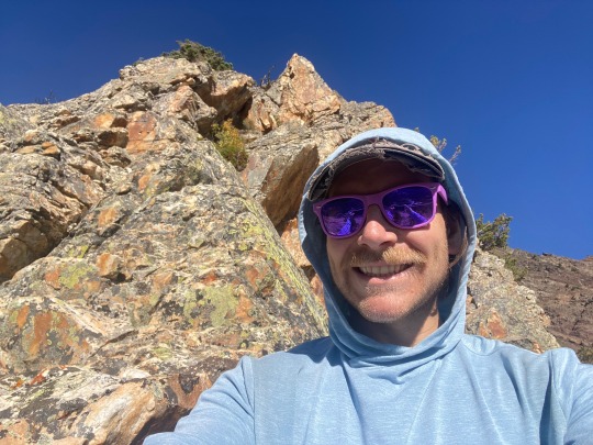

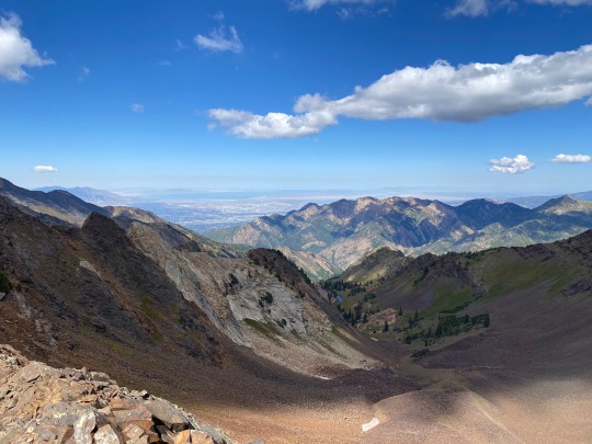
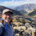
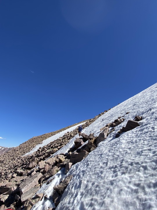
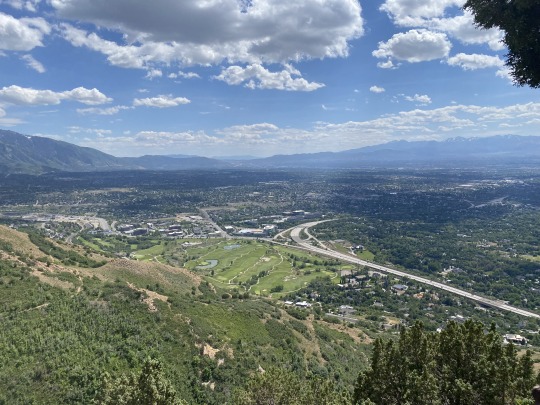
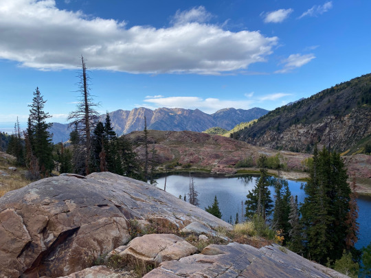
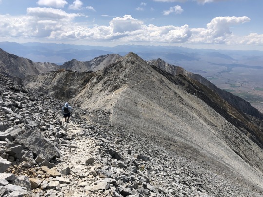
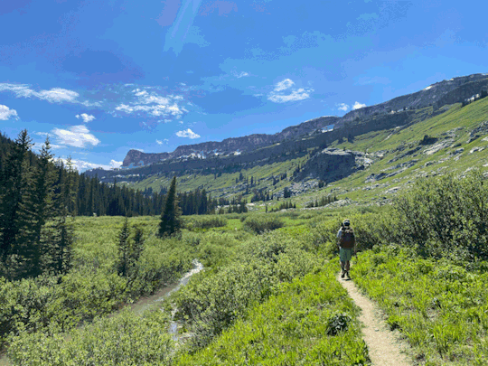
South Ridge of Mt. Superior
4.5 mile roundtrip
4,260 feet elevation gain
Link: https://www.mountainproject.com/route/105984407/south-ridge
Less of a hike and more of a scramble, I’ve had my eye on this one for a while and decided it would be a fun one to do solo on a day off of work for me.
It started off with a pretty steep and rocky approach before finally getting up on to the ridge and starting the real scrambling. The “official” route was directly up the knife’s edge of the ridge, but I decided that, since I was going solo, I would do whatever looked the most fun while still keeping me safe. As long as I was gaining elevation in the right direction, I could treat it as a choose-my-own-adventure.
And what an adventure it turned out to be! I had terrific views, challenging movements, peaceful solitude, and got to touch some really dope rocks. What an experience. I’d say the only negative of this trip was how frequently I got tricked by the false summits. No joke, it must have happened 5+ times.
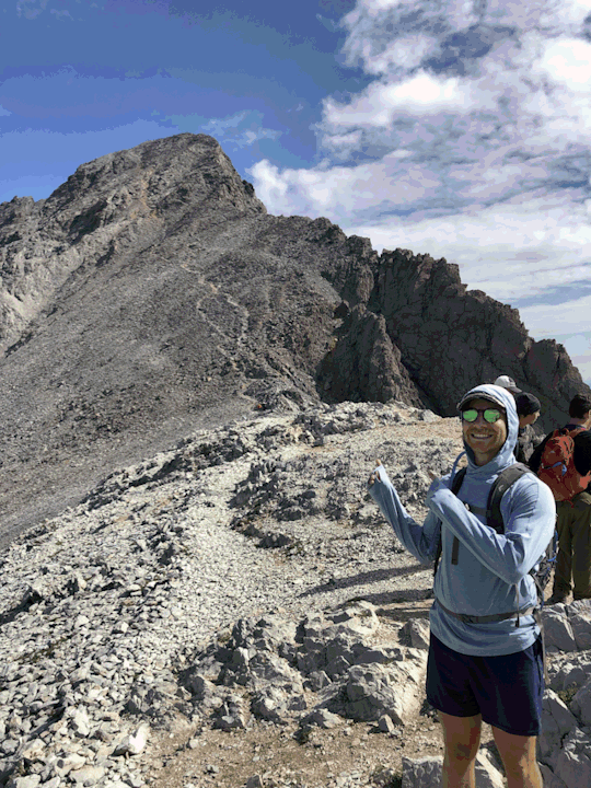
I ended up with the summit completely to myself and, and the 360o view made me feel like I was on top of the world. I could even see the Great Salt Lake! Hopefully it’s still there in a few years.
After chilling at the top for about 30 mins to eat, I hiked back down one of the trails. It was a bit hard to follow so I was glad to have my phone with the map, but it became much more defined after losing some elevation. It eventually popped me back out to the road about a half mile up from my car, and I was able to wrap the whole ordeal up in less than 5 hours.
I had been pretty nervous before this scramble because it looked scary and I had seen online that some people rope up for it, but I felt totally confident at every point along the ridge. It’s definitely something that I know I’ll end up doing again.
1 note
·
View note
Text
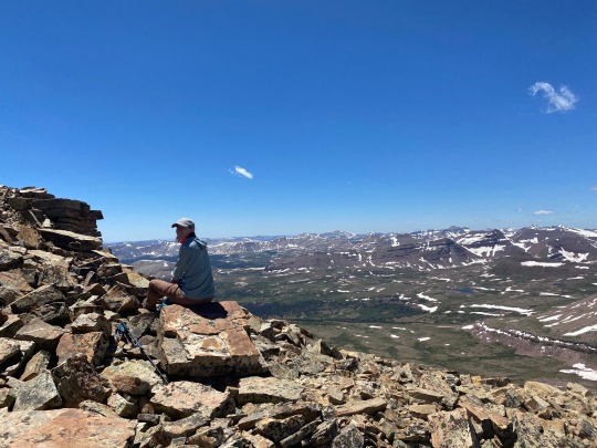


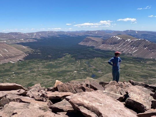

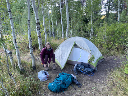
King’s Peak (again)
25.0 mile roundtrip
4,202 feet elevation gain
Link: https://www.alltrails.com/trail/us/utah/kings-peak-utah-highpoint-trail
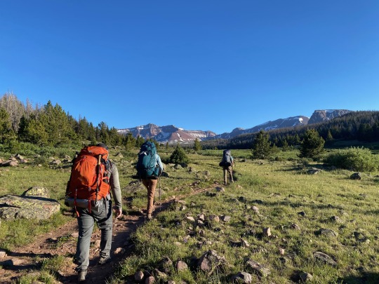
Back again in the High Uintas, but this time with friends! I was joined on this trip by Emily, Kenny, and Chris, with Nick, Eliza, and Brady meeting us on our second day.
We got to the trailhead in the early afternoon with the goal of setting up camp at Dollar Lake, roughly 7 miles in. The hike in was, of course, absolutely gorgeous. We saw so few people on the trail and had a great time playing Contact to keep morale up. 7 miles with a heavy pack is no joke, but everyone in our party absolutely killed it. We also talked to some people who said they saw a bear, so I was pretty happy with my choice to keep bear spray clipped to my pack. It’s surprising to hear of a bear sighting at this high of an altitude, though.
At one point we came upon a trail sign with somebody’s phone and backpack just sitting there. I thought it would be funny to take a couple selfies on the phone and leave it there, and we learned on the way off the trail that the phone belonged to someone who had broken their leg and gotten evacuated. WHOOPS! Gotta wonder why they didn’t take the person’s stuff with them too, but at least now they can look at our beautiful faces while they’re in bed recovering.
We made it to Dollar Lak just as the sun was setting and the bugs were coming out. We quickly ate dinner, pumped water at the lake, hung our food in a tree, and hit the hay for an early morning.
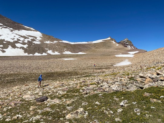
Chris decided to sit out the summit push because his back was hurting, so Emily, Kenny, and I set out just the three of us. The hike turned into a slog and a bit of a game of map interpretation – I know we wanted to hit Gunsight Pass as a shortcut, but we were having some trouble physically locating it. Luckily we were able to get some directions by another guy on the trail, because where I thought Gunsight Pass was located was not even close to where it actually was.
The pass, when we found it finally, was a tough uphill through the snow with lots of postholing. Then it opens up into this HUGE basin to cross before the final uphill to the summit. We pretty much just put our heads down and hiked, crossing the enormous rocks in the basin and aiming generally for the saddle that indicated the start of the final climb, official trail be damned (because we literally couldn’t find it).
With a final scramble up the ridge, we eventually made it to the summit, and suddenly every ache and pain was worth it. We had the whole summit to ourselves for about 30 minutes. Stupendous. We hung out, snapped some pics, ate some Snickers, and then started our long haul back down.
Fueled by Nuun to prevent the bonk, we really only ran into trouble when we got back to Gunsight Pass. From above, it looked like a totally alien world from what we saw earlier. The snow had softened a ton, the path looked even steeper, and we were tired. After some deliberation, we chose the “safest” path and pretty much had to downclimb the whole way. It was definitely spooky and exposed, and I’m really proud of how the three of us maintained our composure the whole way. The joy of adventure, the butt-puckering of navigating a steep snowfield with crazy exposure… what a combo.
After the pass it was just a straight shot back to camp. Being back in the valley with sweeping views of the surrounding mountains and alpine lakes, there are so few words to describe it. I was filled with such a sense of peace and awareness that I can really only achieve when in remote wilderness. And chasing those feelings is what keeps me coming back to places like this. What a world we live in.
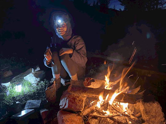
Back at camp, we met back up with Chris and were delighted to see that Nick, Eliza, and Brady were able to find us. After a long day of hiking, it was so nice to chill out by a campfire for the evening and kick it with our homies.
The next morning we had a quick breakfast and packed up camp to hike out. Before leaving, though, we decided to finally see for ourselves what it’s like to spray bear spray. We all took turns with it, and I have to say I was surprised by how short the range was… It only goes about 5ish yards, so you’re not hitting the bear until it’s up in your grill. Pretty scary to imagine the situation I’m in when I need to use the spray.
The hike out was a bit of a grind, especially after how exhausting the summit push was the day before. I’ve said it before and I’ll say it again, there’s almost nothing better than that first sight of the car after a long, long hike. Those hunks of metal are the equivalent to angels in those moments.
And that was that! We got up and down safely, and that’s all that really matters. I’m hoping next year we can do more of these trips with friends, and I’m thankful to have the homies that get just as excited as I do to suffer in the backcountry.
0 notes
Text


Humphreys Peak
10.1 mile roundtrip
3,380 feet elevation gain
Link: https://www.alltrails.com/trail/us/arizona/humphreys-peak
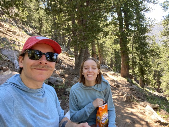
Emily and I made the trip down to Flagstaff to knock out another state highpoint, Humphreys Peak in Arizona.
We got a mildly early start to the day and started at the trailhead a little before 8am. The hike itself was pretty tame and only had a mild incline. We started off with some switchbacks through a lush forest, which was beautifully quiet when we weren't being joined by other hikers. The trail was pretty crowded, so we ended up playing leapfrog with a few different groups.
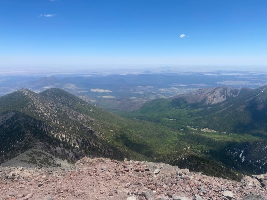
After the saddle we hit a bunch of false summits before we finally laid our eyes on the prize and made our final push for the summit. What's crazy is that the whole hike had been pretty bug-free, and as we got closer to the summit they suddenly started swarming. We were swatting non-stop, and we were thinking we'd finally be free at the summit based on how many people we could see hanging out there. WRONG! The summit was unbearable from the bugs! And people were still all hanging out, eating lunch, and snapping pictures like they weren't being eaten alive. I couldn't believe it.
We spent only about 3 minutes at the summit to take some pictures before hauling out of there to escape the bugs. Maybe we're bug magnets, maybe those other people had a way higher tolerance for being bit, or maybe the altitude was causing us to hallucinate. Who's to say.
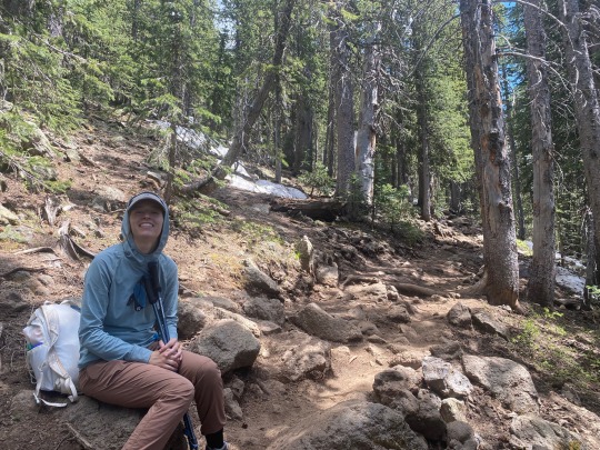
The way down was pretty chill and uneventful. My favorite part of the descent was when we decided to take a break back in the forested area. We took a few minutes to sit in total silence and listen to the wind through the trees. Bliss. I love the way the wind can make the trees look like they're shimmering.
Car to car it took us about 8.5 hrs to check off this highpoint, but I'd definitely consider it one of the easier ones I've done so far. Can't wait for the next one!
#hiking#nature#outdoors#summit#summitting#highpointing#highpoint#arizona#humphreys peak#mountain#mountains
0 notes
Text


Mt. Olympus Trail
7.1 mile roundtrip
4,133 feet elevation gain
Link: https://www.alltrails.com/trail/us/utah/mount-olympus-trail
I have few words to describe this hike. In fact, I only have one word: bugs. Holy moly the bugs were unreal on this one.
We got to the trailhead a little later than we had intended and started our attempt for the summit. The first half or so of the uphill was actually pretty nice. We were able to find plenty of shady spots to take breaks, and we even ended up running into some people we knew on the trail.
But then it started. The bugs came out. Huge, biting flies. It started out with just a few, and then more came. And then even more came. And our bugspray did nothing. And we were walking with our hands constantly waving around our face. And still they persisted. We each must have had 30-40 flying around our face at any given time.
We hiked in suffering silence, and luckily they relented by the time we got to the scramble near the top. Our summit was not a joyous one because we knew we'd be returning to the bugs on the way down.
I think the hike back is repressed from my memory due to the suffering. We tried to outrun the flies but they somehow kept up. We made it to where there were no bugs on the way up, but they kept on coming.
I think we finally escaped the bugs for only the last mile of the hike. What a sight the car was. Yeesh.
I've never regretted a hike, as I think time spent outside enjoying the sights and sounds of nature is such a special experience. Even bad time outside can be better than good time inside. But this hike was different, and the bugs alone made it a bottom 5 outdoor experience of my entire life. I even left my first ever Alltrails review to warn people that it wasn't worth it.
If you want to read about this hike from a more positive perspective, here's a link to when I did it last and didn't want to yeet myself off a cliff midway through.
1 note
·
View note
Text


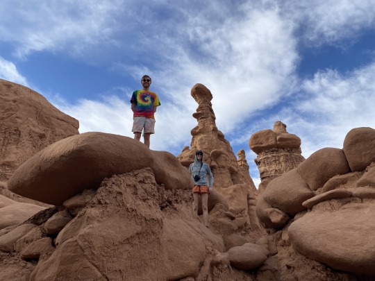
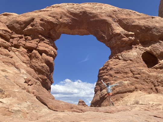
Goblin Valley and Arches National Park
Hike - Little Wild Horse Bell Canyon Trail
6.0 miles roundtrip (as we did it)
Link: https://www.alltrails.com/trail/us/utah/little-wild-horse-bell-canyon-trail
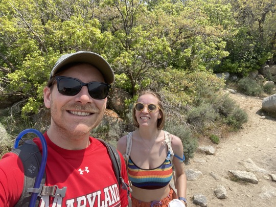
Emily's friend Harry was in town visting from Australia, so we decided to take him on a trip down to Southern Utah.
We started with a slot canyon just outside of Goblin Valley State Park. This was the first slot canyon I'd ever hiked, and what a unique experience! Squeezing through tight passageways, going under and over rocks blocking the path, and just being able to see and touch all the curved rock layers made me feel so connected to nature.
After the slot canyon, we ventured into Gobling Valley to explore the valleys and their many goblins. Walking around here made me feel like we were on a different planet. The goblins were towering and beautiful, and we also found this cave with a flat area in the back that was big enough to fit a king sized bed! Made me want to get into spelunking before I remembered that tight spaces aren't really my jam.
After Goblin Valley we did a speed run of Arches National Park. We did some of the easy arches that were mostly accessible by car since we didn't have a ton of time. You can check out my previous report here from the last time I was at Arches.
Southern Utah is such a special place, but the heat's already kicking up so it sounds like our next few camping trips will involve heading north. Stoked!
#utah#hiking#camping#slot canyon#canyon#red rocks#goblin valley state park#arches national park#nature
0 notes
Text
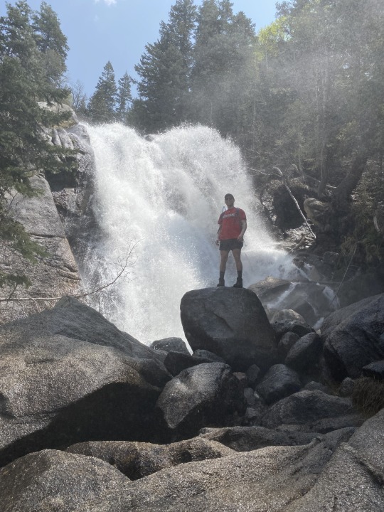
Bells Canyon Trail to Lower Falls
4.6 miles roundtrip
1,496 feet elevation gain
Link: https://www.alltrails.com/trail/us/utah/bell-canyon-trail-to-lower-falls
First hike of the season after a truly epic winter! We heard the falls were raging in Bells Canyon, so we set out to check them out and enjoy some recharge time outside.
The first half of this hike was pretty mellow. We saw tons of families with little kids, and what a joy it is to see the outdoors shared by people of all ages. We ascended a dry trail past the reservoir and continued our trip up to the lower falls.
Once we got to about 1.5 miles away from the falls, the trail turned minto ore of a ravine! I've recently joined team anti-boot as I think hiking boots are too heavy for my extended hikes, but luckily I had done some research ahead of time and wore my waterproof boots knowing that this section would be super wet. That's called preparation.
We stepped from slippery rock to slippery rock before finally reaching the falls, and boy were they flowing. It was loud and beautiful and COLD! We found a sunny spot to chill out and have lunch before snapping some pictures back under the falls. There was a huge rock at the base that I thought would make for a good photo to stand on, and I felt like I was standing in the arctic tundra while Emily snapped some pics. Good thing I'm tough as nails.
The hike down was quicker but still required some high precision in our steps due to the wetness. Towards the halfway point of the trail we actually saw the end of the water as it slowly crept downhill which was pretty cool. We also saw a couple hikers coming through with skis on their packs - they were probably heading to the upper falls where there would still be snow.
All in all, an amazing hike to kick off what should be an excellent outdoor season!
0 notes
Photo

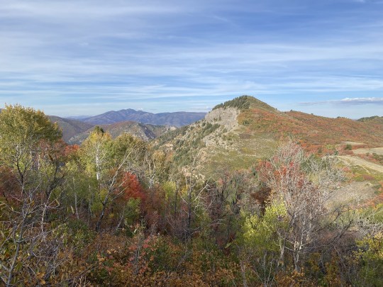
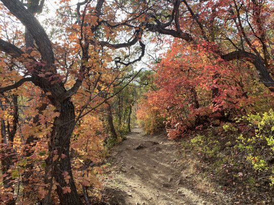
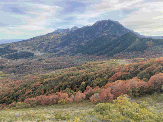
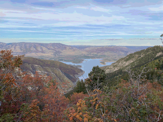
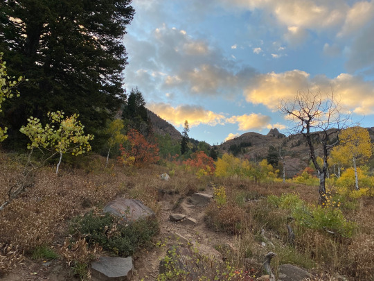
Sardine Peak Ogden Outlook Trail
8.6 miles roundtrip
1,528 feet elevation gain
Link: https://www.alltrails.com/trail/us/utah/sardine-peak-ogden-outlook-trail
A short and sweet hike to get some time with the homies and enjoy the fall colors before they’re covered in snow for the next few months. I don’t have much to report here except that the overlooks were fantastic, the inclines were very manageable, and the planning could have been a lot better (we may have finished the last mile with headlamps on).
Beautiful hike, great company, and delicious beer in Ogden to cap it all off.
5 notes
·
View notes
Photo


Sundial Peak - lake Blanche
10.1 miles roundtrip
4,186 feet elevation gain
Link: https://www.alltrails.com/trail/us/utah/sundial-peak-via-lake-blanche-trail
It had been a while since I’d done some solo adventuring, so I decided to spend the night at Lake Blanche and scratch my explorer’s itch. I’d been there a few times and wanted to check out Sundial Peak, the eye-catching mountain that overlooks the lake. I had done some research beforehand about paths to the top, and I my interest was piqued by the fact that there wasn’t actually a trail to get up there. I’d have the freedom to pick my own path to the top, and hopefully the wisdom and ability to do it safely.
I headed out in the afternoon and hauled ass up the mountain. Fun fact: this was my first time ever using my hiking poles after having owned them for about 2 years. I can confirm that they may have helped a bit.
After quickly setting up camp on the quiet side of the lake, I set my eyes on Sundial Peak and set out. Now, the real reason I was doing this hike was to film my Survivor application on the way up, but this is a hiking blog so I won’t talk much about that…
The climb up to Sundial Peak was a true adventure and everything I hoped it would be. I navigated, I climbed steep faces, I made a few reckless decisions but vetoed far more of them. I felt like a true mountain man calling on all of my skills and experience to get to the top. And you know what? It was fucking awesome. I got to the summit and got to look down at the lake and see my tiny campsite, and I just took some time to drink it all in. My itch was scratched.
The descent from the summit was a story of impeccable risk management, where I ended up taking a ton of detours from my ascent. A younger version of me would have chosen the quickest route down, but the current version of me (with a fully formed frontal lobe) was worried about getting home safely to my girlfriend.
After a surprisingly short amount of time, I finally made it back to my campsite. The sun was starting to set so I quickly heated up some water for dinner, wolfed down my MRE, and cozied up in my sleeping bag to finish my book.
My night wasn’t as restful as I anticipated, as I spent a large majority of the night growling at animals outside of my tent. At one point I made the bold move to open my tent and finally face the beasts that had been terrorizing me all night, only to find nothing there. Mother nature sure has a way of messing with you.
I woke up before the sun for a cold hike back to the car, and enjoyed some more of the peace and quiet before returning to civilization. What a trip.
If you haven’t gone solo camping before, I can’t recommend it enough. It’s hard and it’s scary and it’s certainly dangerous, but man is it rewarding.
#hiking#backpacking#camping#utah#wilderness#lake blanche#sundial peak#big cottonwood canyon#wasatch mountains#wasatch
4 notes
·
View notes
Photo
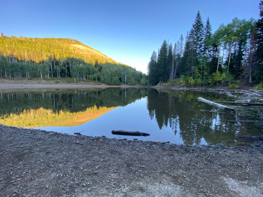


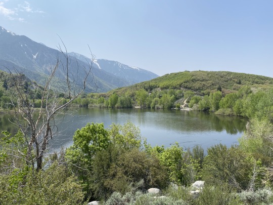
Dog Lake
5.6 miles roundtrip
1,476 feet elevation gain
Link: https://www.alltrails.com/trail/us/utah/dog-lake-mill-d-north-fork-trail
Emily and I were hankering for an overnight backpacking trip, so we packed our bags and headed out for Dog Lake, a hike we found on AllTrails that seemed like a decently light effort.
We hit the trailhead and were met with a pretty peaceful uphill climb to the lake. Honestly, it was one of the more relaxing hikes of my life. We went slow, and really the only thing that happened to us was almost running into a moose! Talk about exciting.
I was walking behind Emily and I saw some movement out of the corner of my eye behind me. I turn around and am met with the pleasant surprise of being roughly 10 feet away from a full grown female moose! It was 2 feet from the trail! And behind us! That means we walked right past it without even noticing! Holy moly!
Anyways, we made it to Dog Lake and set up camp shortly after our moose encounter. Let me tell you, whoever called it Dog Lake has clearly never seen a lake in their life. I might have suggested Dog Puddle. Or Dog Oops I Spilled My Glass of Water. Whatever. I don’t get to name things.
Some other hikers were there with dogs who they let off the leash to jump into the “Lake”, which seemed pretty harmless except for the coyote we also saw hanging around by the lake. I don’t think the tiny chihuahua we saw running around without a leash would stand much of a chance…
We made our camp, had a very delightful mac n’ cheese dinner with laffy taffy for dessert, and snuggled up in our sleeping bags for an early night. We probably would have stayed up for some stargazing if it weren’t so dang cold.
The next day we hiked down without seeing much of any people or wildlife. Bliss.
We did however receive some news when we got back home. Apparently there was a mountain lion attack on a trail pretty close to the one we were on! Two women were hiking when they got attacked; it bit one of them and the other women fought off the cat with a rock! Props to them for being badasses, but mostly I’m glad we weren’t them.
39 notes
·
View notes
Photo
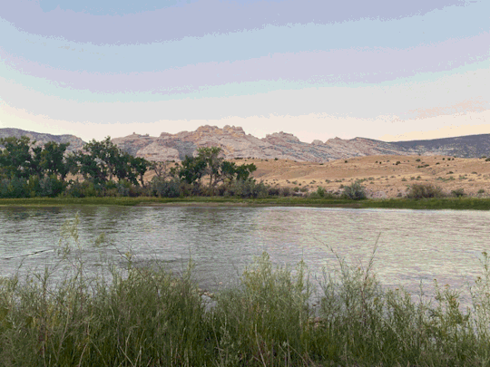
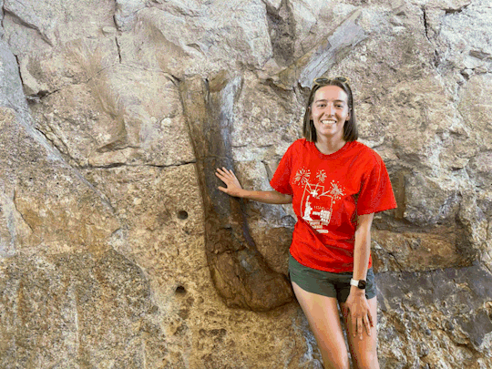

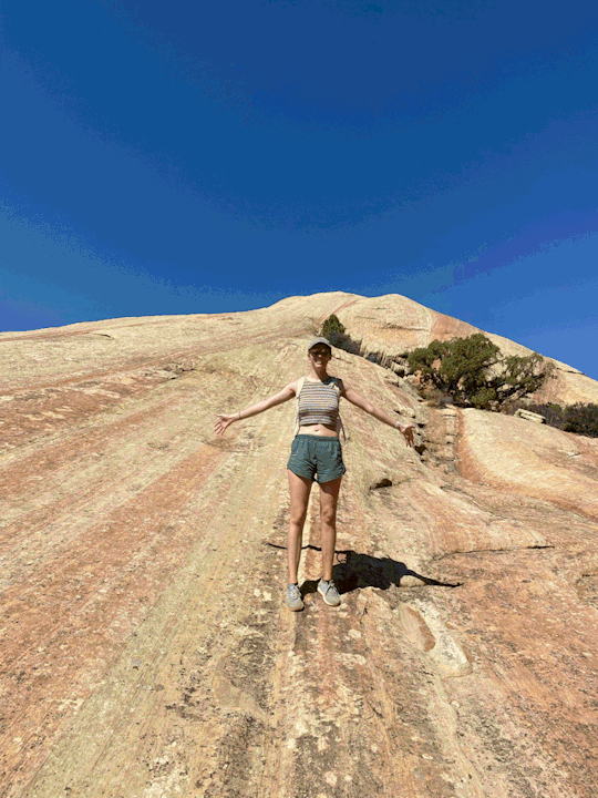
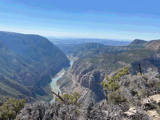
Dinosaur National Monument
Sound of Silence Trail: https://www.alltrails.com/trail/us/utah/sound-of-silence-trail
Harper’s Corner Trail: https://www.alltrails.com/trail/us/colorado/harpers-corner-trail
Took an overnight trip out to Dinosaur National Monument for Emily’s birthday because she wanted to see the dinosaur bones, and they were so cool! They had a crazy display of legit dino bones that had been washed downstream and were embedded in the rocks. They had an exhibit hall that you could walk through with a huge array of over 1,500 fossils exposed in the cliff face. We even got to touch one! Did not get the chance to lick one unfortunately.
We ended up paying for a campsite after our BLM campsite we picked out left us feeling a little uneasy, and then we spent all of day 2 hiking and driving around:
· Sound of Silence Trail: probably made worse by how hot and dry it was, but this trail was only ok. It was indeed silent as we were literally the only people (dumb enough to be) on the trail
· Harper’s Corner Trail: epic views of the Green River followed by an incredible overlook with sweeping views of the river canyons. A perfect trail in terms of amazing landscapes per miles hiked
· The many, many overlooks: per Emily’s request, we stopped at every single one. Can confirm - they all overlooked some things
A very cool trip! The dinosaur bones and petroglyphs we saw were definitely the highlights, but I saw this more of a “go once and then never again” kind of place.
1 note
·
View note
Photo
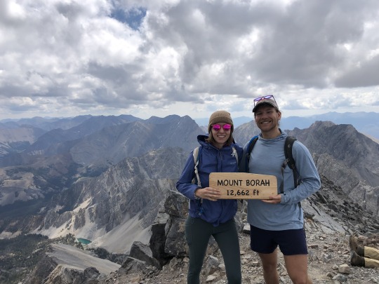


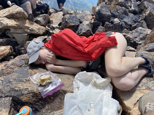
Borah Peak
8.2 miles roundtrip
5,301 feet elevation gain
Link: https://www.alltrails.com/trail/us/idaho/mount-borah-trail--2
And just like that, it’s time for another state high point! This time it’s Borah Peak, the highest point in Idaho, with an elevation of 12,662 ft.
We decided to do this an overnighter since it was nearly 5 hours away. The drive itself wasn’t too bad, but we went through some patches of really, really heavy rain. It got a bit scary in some parts, but we made it there no problem.
The parking lot at the trailhead was PACKED with other people who must have had the same idea as us. There were only 5 official campsites there, and I estimated over 70 people camped out. We just pulled into an open spot and pitched the tent right by the car. With plans to wake up at 6:30am, we hit the sack.
At 5:30am, Emily woke me up because she was having trouble sleeping. We decided to start a bit earlier than expected, which turned out to be a blessing in disguise. We had a quick bite to eat and hit the trail just as the sun was starting to creep up.
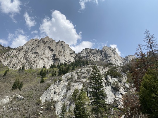
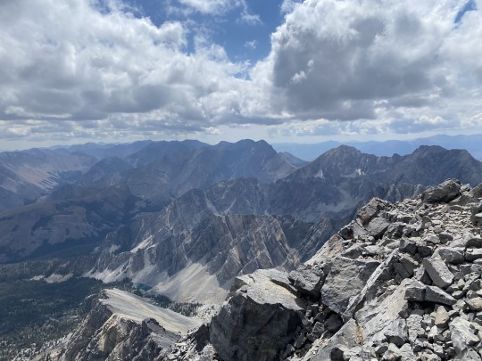
This trail was STEEP! We started out winding our way through some trees and taking frequent breaks to stay fresh. The switchbacks seemed to never end, but then we finally made it above the treeline and got our first view of the summit. Still a long way to go.
The next part of the trail was a super long stretch along the ridge line over some loose rocks. This was the calm before the storm, and also where we got passed by a ton of kids. It turns out the entire cross country team of the local high school was here to do the hike with us. They blew past us wearing jeans and string bags with no water, leaving me feeling older than I’ve ever felt before.
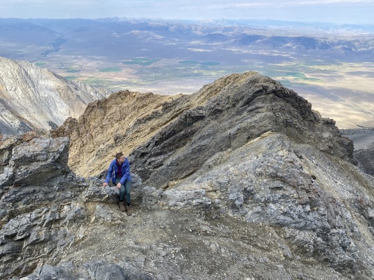
After the ridge line, we reached the crux of the hike: Chicken Out Ridge. I had been nervous planning this trip because of how many people got freaked out by this part and turned around, but it turned out to be not that bad and actually really fun. It was just a lengthy scramble up some rocks with some decent exposure, but there weren’t any parts where I felt unsafe. I’m sure that feeling comes from my years of experience rock climbing, but I think an average hiker would have no problem here. Emily also really impressed me with how confidently she moved through this section – I was struggling to keep up with her. We even got to see some fossils in this part!
Chicken Out Ridge ends with a 30ish foot downclimb with a fixed rope to help people. We saw the line of about 40 people to use the rope and decided to have a little adventure of our own to avoid the bottleneck. We climbed down the side instead and did some scrambling around the sides to bypass everyone. This was definitely not the safest option, and I may have put myself into a couple stupid/dangerous positions, but it all turned out ok. I felt like Alex Honnold free soloing out there.
The final push was an uber steep section right before the summit. At this elevation and this level of incline, we were struggling! We could only go a few minutes before having to stop to take a break. We also got lumped in with some decent crowds, and I ended up ditching the trail to scramble up the rocks to the right instead. I’d say it saved me a grand total of 2 minutes for about 3 times as much effort. That’s efficiency, baby.
The view from the top was unbelievable. We posed for some pictures, took a nice, long rest, ate our food, and began our descent.
The descent was almost as bad as the ascent. With the steepness and all the loose rock, you had to be incredibly deliberate with every step. Chicken Out Ridge was also a lot more difficult going down than up, but I still thought it was the most fun section of the trail.
The “mellow” parts left of the trail were done at a slow pace, which was good for both of us. We were both super tired and had run out of water, so we did what we could to conserve energy. This also meant that we were passed by literally everyone, and that is not an exaggeration! Hard to believe we started at sunrise and ended up being the last people on the trail.
The last few miles were quiet for us as were both exhausted and hangry, but some energy was injected into me at first sight of the car. We threw everything into the backseat and immediately headed home, feeling accomplished and on the lookout for the nearest Burger King.
Let me say that this trail was VERY challenging. Despite only being 8.2 miles roundtrip, it took us nearly 11 hours to finish. We gained over a mile of vert over 4.1 miles! That’s bananas!
I also want to say how incredibly proud and impressed by Emily. She got an IUD inserted the day before this, got zero sleep because of the cramps she was feeling, and still absolutely knocked it out of the park. She’s a beast and I love her so much.
0 notes
Photo


Sunset Peak via Brighton Lakes Trail
5.8 Miles Roundtrip
1,975 feet elevation gain
Link: https://www.alltrails.com/trail/us/utah/sunset-peak-via-brighton-lakes-trail
I think the Cirque Series trailrunning race may have gotten me to actually like trailrunning? Either that or I have Stockholm Syndrome. I think the biggest appeal for me is the amount of time it saves, especially with destination hikes to a summit or a lake.
This was a quick one I did up at Brighton ski resort. There’s a trail that goes by all of the lakes at the resort, so I popped over for a quick run there after work one day. Naturally, I did not check the weather and spent the first 30 minutes of this hiding underneath a tree while some torrential downpour came
down. But other than that, it was awesome! Next to nobody on the trail and I was rewarded with an epic view from the top. I even made it back down in time for my kickball game.
Now I might have to invest in some trailrunning shoes and make it become my whole personality.
1 note
·
View note
Photo

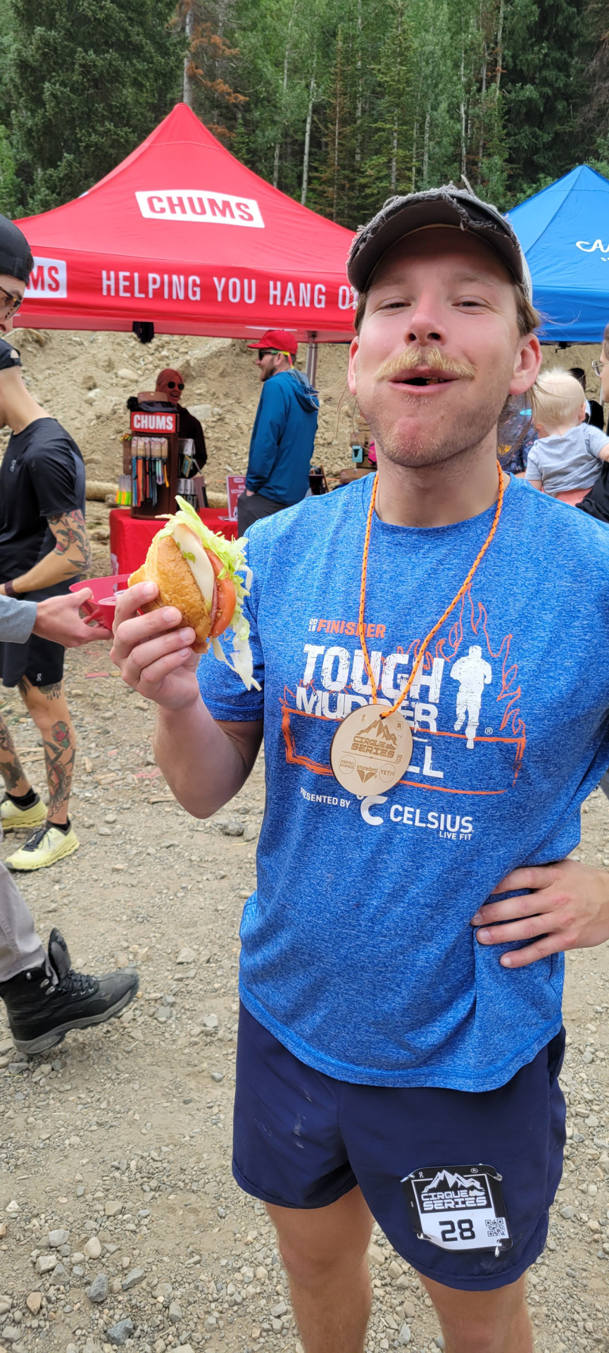


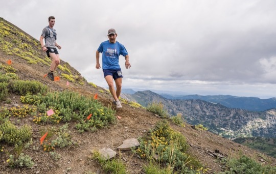

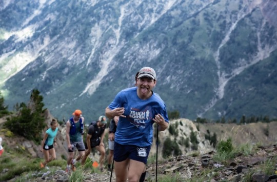
Cirque Series - Snowbird
8.7 miles, 3,566 ft elevation gain
Link: https://www.cirqueseries.com/snowbird
My first trail running race! I was peer pressured into signing up only a few days before the race, which gave me no time to train. All I did to prepare was a 6 mile run on a road near my house. Not exactly any indicator to my body of what I’d be doing, but I figured I could rely on my base athleticism to carry me to the finish.
I had never done any trail running before and figured that everyone was running the whole time – luckily I was wrong (except for the couple of elite runners who led the pack). Nearly all of the uphill was just power walking with some short runs sprinkled in when it occasionally leveled out. I found my pack of people running the same pace as me and made it a goal to pass them anytime I decided to run.
Man, those uphills were GRUELING. What made it worse was that all of the volunteers telling us “you’re halfway there!” were lying, and I fell for it every time. It was also hard because you had to run with your head down to keep an eye on all the rocks, so there were no really good chances to enjoy the epic views.
I was chugging along as best I could and really only struggled with some really steep downhill portions on loose dirt. I was wearing regular running shoes instead of trail running shoes, and I’d owned them long enough that the bottoms were worn almost completely smooth. I spent that portion carefully sidestepping down the mountain as everyone with better footwear shot around me. It felt like a miracle that I didn’t fall face-first and tumble down the mountain.
Once the downhill leveled out a bit I was able to start hauling ass and making up ground. I must have passed 15 people during the last mile, just lengthening my stride and letting gravity do all the work.
I ended up finishing in 2:08 (my goal was 2:30) and coming in 70th overall! Pretty great results for not having trained. Now maybe I’ll have to pick up some trailrunning shoes and start doing this as a legit hobby. It’s like hiking but faster and more painful the next day!
1 note
·
View note
Photo
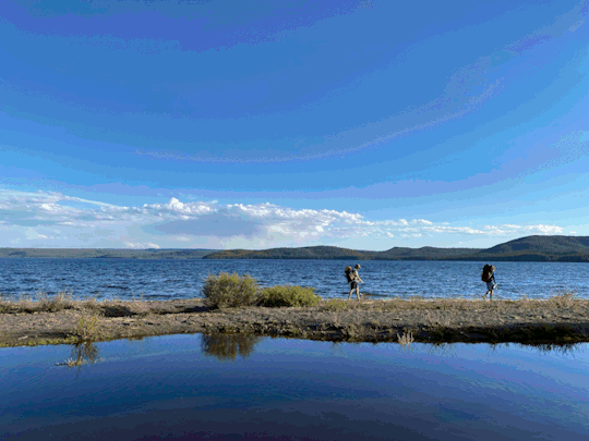


Yellowstone National Park
Shoshone Lake: https://www.alltrails.com/explore/trail/us/wyoming/shoshone-lake-via-delacy-creek-trail
Lone Star Geyser: https://www.alltrails.com/explore/trail/us/wyoming/lone-star-geyser-trail
Yellowstone – the first national park and probably the one I’d heard the most people talk about it. And what did I think of it? I thought it kind of sucked…
We started by trying to access an off-the-beaten path entrance since we didn’t have a camping reservation and didn’t have the proper license plate to get into the park due to their limited entry policy. Before heading off down this dirt road, we took a very short hike to a hot spring that we saw on the map.
We started off by hitting a brief hike to a hot spring just outside the park. Unbelievably, this mini hike and mini spring was probably better than anything we actually did inside the park. We had a beautiful river to cross, and the hot water felt amazing on our worn-out feet. Couple this with the beer we brought along, and we had a delightful afternoon.
After that hike, we decided to try to access the park via an off-the-beaten path entrance since we didn’t have a camping reservation and didn’t have the proper license plate to get into the park due to their limited entry policy. This proved to be a mistake, as my civic isn’t exactly an all-terrain vehicle. After about 30 minutes of bumps that shook my fillings, we decided to turn back and try our luck at the main entrance.
We told the ranger at the check-in that we were just going to the ranger station to get a backcountry reservation, and she reluctantly let us in even though we technically were not permitted to visit the park. What a lady.
At the ranger station, we got set up for a backcountry permit that night at Shoshone Lake. Somehow, we weren’t suspicious that there was still a permit available at 4 pm, and the ranger didn’t give us any sort of warning about the condition. Sweet, sweet naivety.
Our hike to our campsite at Shoshone Lake was peaceful and beautiful at first, then quickly turned awful. The mosquitos got worse and worse as we got closer to the lake, despite copious bug spray usage. An orb of mosquitos surrounded us at all times, and Aaron was the only one who brought any sort of netting.
We passed a bunch of open fields but saw no wildlife, which was incredibly disappointing. The lake itself was also pretty beautiful, but you couldn’t even take a moment to enjoy it lest you got swarmed by bugs. We had to eat our dinner while walking because we couldn’t sit still for a moment without being attacked. We ended up retreating to an early evening in our respective tents where Cole and I played a game of chess by calling out our moves to each other.
We woke early the next day and made a beeline out of there. Again, we saw no wildlife. What a shit hike.
Back at the car, we made the decision to spend the next night front country camping, so we headed straight over to Grant Village to get a spot before it filled up. We made a quick breakfast and planned another hike for the day - Lone Star Geyser since the map indicated a slew of hot spring on the trail
The geyser itself was pretty cool, and we hung out and fished on the Firehole River while we waited for it to go. The eruption was stunning, and I’ll give Yellowstone some credit for its natural beauty there. But the rest of the hike… it was so BORING! We were just walking through dense trees with nothing to see and another orb of mosquitos surrounding us. I felt like I was back at Patapsco State Park. And those hot springs on the map turned out to not exist. Pure and utter disappointment.
Resigned and tired, we finally returned to the car and decided to drive around the Southern Loop and hit all the major touristy parts. We sprinted to catch an eruption of Old Faithful (crowded), took a stroll to see the Grand Prismatic (crowded), pulled over to watch some “wolves” in the distance “stalking” some antelope (they weren’t), saw a bison running along the road (probably the coolest part of the drive), saw some waterfalls (meh), and then finally arrived at the pièce de resistance that Aaron had been raving about for our entire drive: the Mud Volcano.
The Mud Volcano, it turns out, was just a stinky, bubbling pile of mud. But Aaron loved it, and I admire him for trying to keep our spirits high when his favorite national park was being met with disappointment from Cole and me. I guess it was cool to see (or smell).
It started raining as we got closer back to our campsite which further soured our mood. We ended up paying to take a shower at the campsite, which might have been the highlight of my entire time there. Luckily the rain stopped by the time we got back to our tents, so we were able to make dinner, have some beer, and enjoy a campfire.
Fittingly, we decided to spend the next day back in the Tetons instead of doing anything else in Yellowstone. I figured we weren’t going to miss anything else in the park.
Obviously, our experience wasn’t great due to half the park being closed. Because of the flooding, the entire north half of the park was closed, and my understanding is that that’s where most of the wildlife viewing is. Maybe I’ll go back one day when the whole park is open to get the full Yellowstone experience, but for now I’m content with my 2 nights there.
Sorry Aaron! I wish we had liked it as much as you did.
0 notes
Photo


Grand Teton National Park
Death Canyon Trail: 18.7 mile, 3,792ft elevation gain, https://www.alltrails.com/trail/us/wyoming/death-canyon-trail--4
Hidden Falls via Jenny Lake Trail: 4.9 mile, 590ft elevation gain, https://www.alltrails.com/trail/us/wyoming/hidden-falls-trail
This trip was a long time coming, and I couldn’t have been more stoked. Aaron and Cole, my buddies from college who I had previously backpacked Banff and Jasper with, were flying out from New Jersey for a week long trip to the Tetons and Yellowstone.
The drive up to Jackson, WY was pretty chill with some great rolling hills to look at – we spent a lot of time playing our own version of Wordle with 6 letter words. I thought “bazaar” was a fantastic word but they ended up getting it almost immediately. Sad.
Eventually we ended up in the Tetons and set up our first night’s camp in a frontcountry spot right by Lower Slide Lake, a lake with remnants of a MASSIVE rockslide that happened in the early 1900s. We has some tuna mac n’ cheese and a couple beers before calling it an early night.
The next morning, we went to the ranger station to see what backcountry camping permits were still available. We ended up getting there about 30 mins after the station opened due to a slower start, which turned out to be hugely serendipitous – the group two people in front of us were there to cancel their reservation at Phelps Lake, and we were able to hop right onto that.
After a quick detour back to Jackson to get fishing gear and breakfast, we set off for Phelps Lake. The hike in was tranquil and offered some epic views of the lakes, and we quickly dropped our stuff off at the campsite to set off on a day-hike with lighter packs.
Our plan was to go up Death Canyon until we reached the pass, which we knew would be steep and covered in snow. We figured we’d turn around once it got too treacherous to go on.
Let me tell you, Death Canyon is steep. Luckily we had tons of tree coverage and were walking next to some beautiful rapids most of the time, but I also made the mistake of forgetting to bring my water filter. Luckily we were able to borrow one from another pair of hikers.
The views of the canyon were incredible, and it was great to be able to look back on Phelps Lake, which itself was huge. As we kept climbing up, we passed through some dense forest that was a little spooky to walk through. We were expecting to find a bear around every corner, so we stay closed and yelled out periodically so we wouldn’t surprise any.
Our climb up the canyon rewarded us with a jaw-dropping clearing once we emerged from the trees. We were surrounded by ethereal peaks and traipsing through some of the lushest greens I’d ever seen. Cole was hiking as fast as he could to try to get to the pass before having to turn back for sundown, but I was (selfishly) moving a bit slower so I could enjoy all the views.
Ultimately, we figured we wouldn’t have enough time to make it to the pass and make it back down before sundown. With about a mile and a half still to go, we ended up turning around with a new goal: reach the rock jumping area back at Phelps Lake before nightfall.
The hike down was excellent and full of good conversation. We hustled all the way down and did end up making it back to camp with about 30 minutes of light to spare. We quickly changed into swimtrunks and pretty much ran to the rock, about a half mile from our campsite.
There was already a group there to offer us some choice words of encouragement, and the three of us took the icy plunge. It was so cold that it felt like my body was going into shock, but it was also the perfect feeling of a grand reset that we all needed after a long day of hiking.
We went back to camp, made a quick dinner, and all went straight to bed. I awoke to thunderstorms at about 7 am the next morning, but Aaron and Cole had awoken about an hour earlier to something large walking around our campsite. They thought it was a bear, but who’s to say.
We packed up our soggy tents and started our hike back out to the car. On the way out, we talked with a couple at the Phelps Lake Overlook who said they saw a bear right by where around where we were camping. Maybe that bear theory actually held some weight…
After this hike, we ended up driving up to Yellowstone for a few days and then came BACK to the Tetons because Yellowstone sucked, but I’ll save that for another post.
For our second trip, Cole and I dropped Aaron off to do some fishing while we did a more touristy hike. We chose to do Hidden Falls via Jenny Lake Trail, which had the option for you to take the ferry across Jenny Lake and skip the first couple miles of the hike. Cole and I, fiscally savvy and fit as hell, decided to skip the ferry and just enjoy the hike. We were pretty much the only people on the trail and got to enjoy it all to ourselves.
Then we got to the ferry drop-off point, and we joined a group of roughly 200 people for the last bit of the hike. It was nuts – I’ve never seen so many people on one trail. It certainly took a bit away from the experience, but the Hidden Falls were gorgeous and the Jenny Lake Overlook was pretty inspirational.
We quickly made our way down to meet up with Aaron at our pre-specified time, and the return hike was much better once we got back out past the ferry drop-off/pickup point. My only program was accidentally peeing on myself and nearly exposing myself to another hiker when I stopped to take a pee break on the trail. In my defense, Cole didn’t do a very good of serving as a lookout.
We made it back to the car and picked up Aaron only 10 minutes after our pre-arranged meetup time, which I’d say shows pretty good hiking estimation skills. After that, we piled into my filthy car and started our drive back to Salt Lake – Aaron and Cole had to get back for a redeye flight home that night.
The first time we got a good look at the Tetons was one of the most magical experiences of my life. I wish I could better describe the way that big mountains like that make me feel. It’s almost like there’s a magnetic pull in my bones towards them, like they’re calling out to me, like there’s a physical force drawing me closer.
Experiences like this make me so glad to live in Utah where I have such easy access to so many national parks. I know I’ll be back here one day, and hopefully next time it will be to climb the Grand Teton itself!
4 notes
·
View notes
Photo


Amethyst Lake
13.0 Mile Roundtrip
2,326 feet elevation game
Link: https://www.alltrails.com/trail/us/utah/amethyst-lake-trail
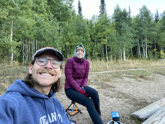
Emily’s first backpacking trip! Chris ended up having to back out last second due to his wife, Amber, being sick, so it was just Emily, Jake, and me.
We set off into the High Uintas through a good mix of highways and backroads, and ended up at the trailhead with no service and no downloaded maps. Now that’s a great start.
The trail was pretty tame, and we knew that we would be looking for a “rock pile” and that we would have to turn left at it. This was pretty much our only knowledge of the trail, and we spent the entirety of the first 2ish miles saying “is that the rockpile?”
At one point, I ended up leaving my pack to run ahead on a scouting mission, because we were unsure if a “rockpile” and something that kind of looked like a fork in the trail was our turning point. I ended up finding the rockpile only about 300 yards ahead, which was a huge relief.
We made our left turn and continued our trek up a brutally steep and long trail with lots of slabby rocks to slip on. All we could do was press on, being sure to take frequent breaks. It was a bit of a slog, but we had a beautiful river that ran parallel to the trail, so we never had to worry about not having enough water.
After finally cresting the apex of this segment, we found a serene little meadow with a firepit already made, so we decided to call it a night and set up camp. We built a nice fire, enjoyed our “flavorful” and “delicious” freeze-dried meals, and headed off to bed for an early start in the morning.
After an uneventful morning (besides waking up to Jake having already made a fire… what a guy!), we packed up our day packs and headed off to Amethyst Lake. We passed stunning alpine meadows, crossed over freezing streams via rickety bridges, and happened upon a stunning, emerald-green lake. Eventually, we finally made it to Amethyst Lake and set up to make some lunch and hang out for a bit.
I tried my hand at fishing using beef jerky and apple bits as bait, but ended up with no bites. I did, however, discover that the reel on my fishing rod was broken, and the spinning handle would fly off anytime I tried to cast it. The first time it happened, I had to go about shin deep into the coldest water I’ve ever experienced. After that, I was sure to put the handle in my pocket when casting and then re-attach it when it was time to reel in. Of course, I managed to forget to do to this on my last cast and dropped it into the lake AGAIN, this time even farther out. I had to go about knee-deep and managed to drench my shirt reaching down to grab it. Sometimes it feels like I never learn…
After hanging for a bit, we had a calm trek back to camp to pack out. I always know it’s going to suck, but I still never feel prepared for the transition from a day pack to a full backpacking pack.
The hike back from camp to the car felt somehow longer than we had hiked the day before. The now downhill portion we had conquered on the way in was absolutely brutal on the knees. And you know when you’re getting kind of close to the car, and you keep mistaking something you see through the trees as being the car? Yeah, we did that for about a MILE before we finally caught sight of the beautiful orange hue of Jake’s car. Yeesh. The Arby’s on the way back was hard earned.
I think Amethyst Lake was absolutely worth the effort, though! And it’s really cool that Emily has decided to get into backpacking – now it’s a hobby that we can share together 😊
0 notes
Photo

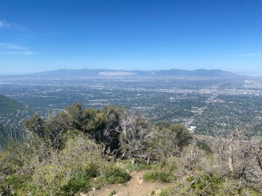

Grandeur Peak (West Face)
4.4 Miles Roundtrip
3,238 feet elevation gain
Link: https://www.alltrails.com/trail/us/utah/grandeur-peak-trail-west-face
I had an off Friday that I wanted to take advantage of and I hadn’t been on a solo hike in a while, so I decided to head on out to a local hike in Grandeur Peak.
Let me describe this hike as simply as I can: hot, exposed, and steep! I started early but not early enough, as the sun was already beating down on me by the time I got to the trailhead at around 830 am. It started out pretty mild, then quickly turned into a killer calf-burner of a hike. I almost wish I had brought my climbing shoes…
The shade was very, very limited, so I had to take advantage of what little there was for my breaks. I actually ended up leap-frogging with this one dude the whole way up. Outside of him, the only other people I saw were one dude SPRINTING up the mountain (Utah fitness freaks are freaks indeed) and another dude who was on a work conference call on speakerphone. That’s the way to do remote work.
When I finally got to the top, I was rewarded with some pretty stellar views of the valley. I also got the chance to talk with the guy I was leap-frogging. He’s a neurosurgeon resident at the University of Utah hospital and grew up near Indianapolis (where Emily is from) and went to school in Baltimore (where I’m from). He had just moved to Salt Lake only 4 days prior! I regrettably didn’t get his number, but I have been checking the UofU hospital page trying to find his info. I’ve been new to Salt Lake too, and I know how valuable it is finding a friend when you’re trying to build up a new social life.
At the top, I ended up discovering that I had drank all my water (3 liters!!! Just for the uphill!!!) and used all my sunscreen. Solution? Run down to the car to save time.
It certainly saved time, but came at the cost of my foot health. I had blisters in places that I didn’t even know I could get blisters, and my legs felt like total jello.
Grandeur Peak was a dope hike, but I don’t think it’s meant to be done in the Utah summer. Still, any time outside is time well spent.
0 notes