
christine-d-beatty
Creative Transwoman
By day I'm a software engineer. I'm also a writer, filmmaker and a musician. I love my cats, music, guitar, singing, hiking, movies, photography, exploring, and lots of other things. I survived the 80s and lived to tell the tale. Oh yeah, and I was born into a male body, tried the military (USAF), macho jobs and marriage, then transitioned at 27. All better—eventually!
11 posts
Don't wanna be here? Send us removal request.
Last Seen Blogs

crocoroyalties07
🐊𝑪𝒓𝒐𝒄𝒐𝒓𝒐𝒚𝒂𝒍𝒕𝒊𝒆𝒔07

auscape
Auscape Exterior Transformations

fiberpunk027
Unhinged And Over 30

freedomintheend
Eromara
freedomintheend
Eromara
Text
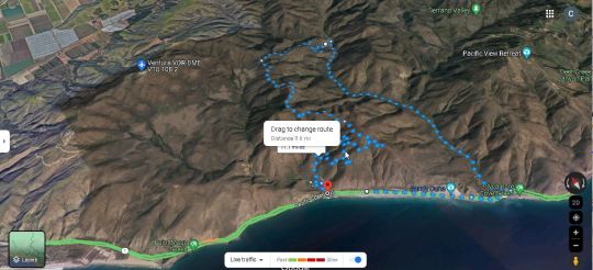
Even on the hottest day of summer, coastal mountains like the western Santa Monicas offer a cool alternative. I recently hiked the west end of the Backbone Trail, 11.7 miles round trip.
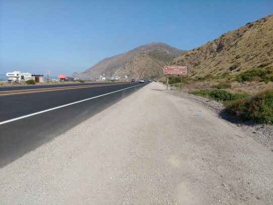
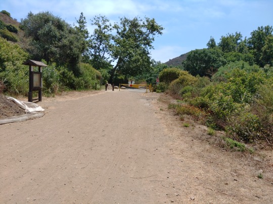
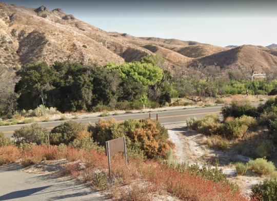
I parked of the PCH (Pacific Coast Highway) halfway between the exit point from Sycamore Cyn and the trailhead at La Jolla Cyn. Not only did I save the $8 parking fee at the Ray Miller trailhead, I was so ready to climb into my car when I got back to PCH I didn't want to walk the additional 2 miles back to the lot.
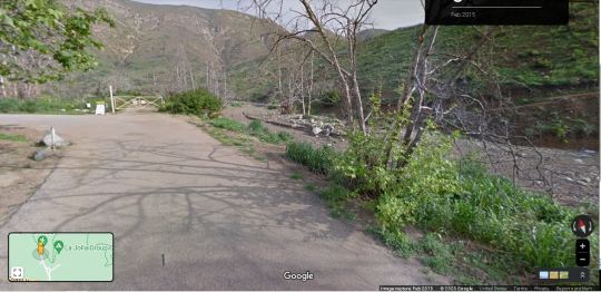
I was so eager to start the climb I didn't stop to shoot a photo here, so thanks Google. The paid lot is to the left of the closed gate and the trailhead is to the right. You can see the Backbone Trail climbing all the way to the right.
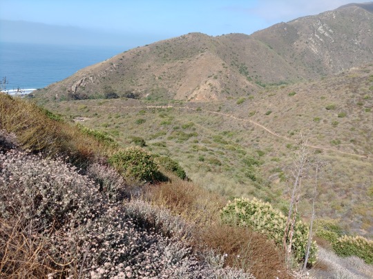
About 0.75 miles from the trailhead and 400 feet up. Walking a mile from my car to the trailhead was a great warmup. Barely breathing hard at this point and the cool breeze from the Pacific was lovely.
1.5 miles in now and nearly 800' up. What a glorious day!
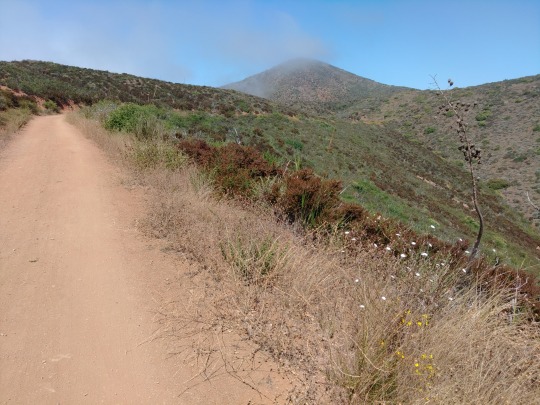
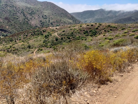
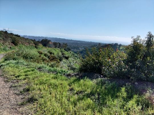
At 2.7 miles the Backbone Trail merges with the Overlook Fire Road. Much of it is pretty level with gentle rises like this one and dips. Looking toward the high point of the Overlook Rd. for this trip at 1100'. As you can see it's not a very steep climb. The cool ocean breezes kept it very pleasant.
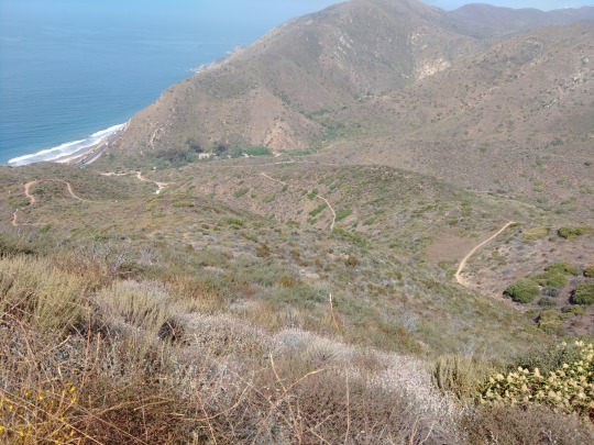
Looking toward the Pacific from 3.4 miles in and 1100' up. This the last we'll see of the ocean until we exit at Sycamore Canyon.
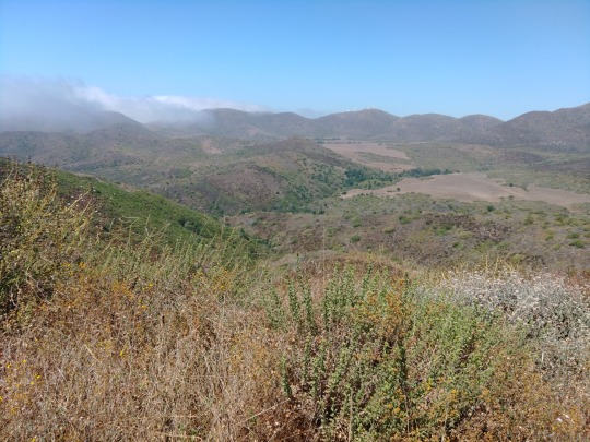
The coastal mountain plains of Point Mugu state park. The cooling effect of the fog stayed most of the way down to Wood Canyon.
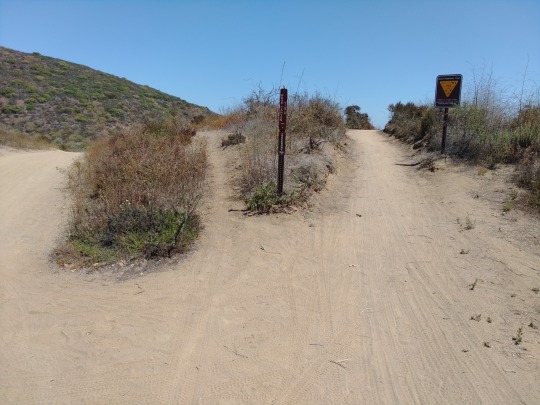
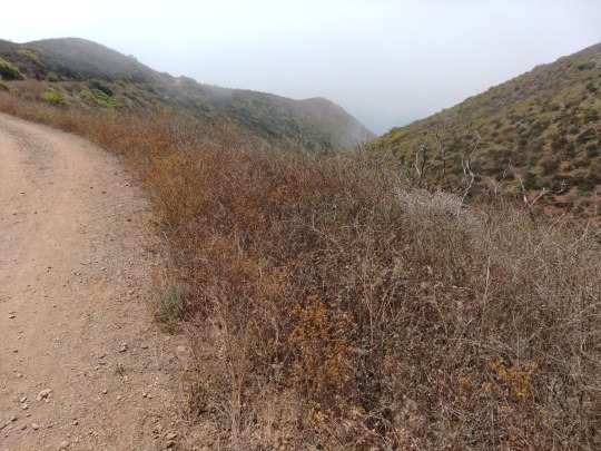
About 4.6 miles in the Backbone Trail veers off the fire road and heads down to Wood Canyon for the next leg of the trip. I should point out there were a number of bicyclists and joggers, especially bikers, so be on the lookout for them. Fortunately all the ones I encountered were polite and responsible about passing me.
The Backbone down to Wood Canyon is fairly gentle and even, a gradual descent over 1.8 miles from 910' down to 210' above sea level. Probably twenty cyclists passed me during this leg but the trail was wide enough to give them plenty of room.
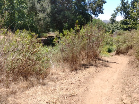
The final switchback down into Wood Canyon. That picnic table was a welcome sight. I was pleasantly surprise by what was around the next corner, though.
Here we are at 6.4 miles in and meeting Big Sycamore Creek. I hope you like it because you're going to cross it nine times as you head west down Sycamore Canyon Rd. back to PCH.
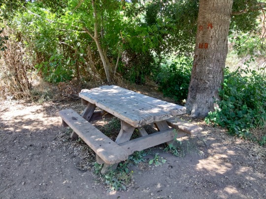
Had a nice little rest here. Of course I took notice of the poison oak growing around the tree. There's a fair amount of it: low elevation plus shade plus water equals poison oak. Be mindful!
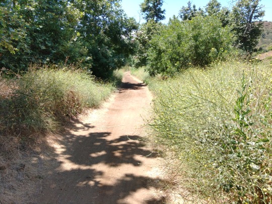
Sycamore Canyon lives up to its name, 'cause there's lots of them providing welcome patches of shade most of the way back to PCH. Gradually we descend this road—there are a few mild rises—from 109' to 10' above sea level at PCH.
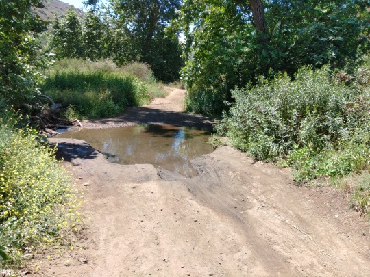
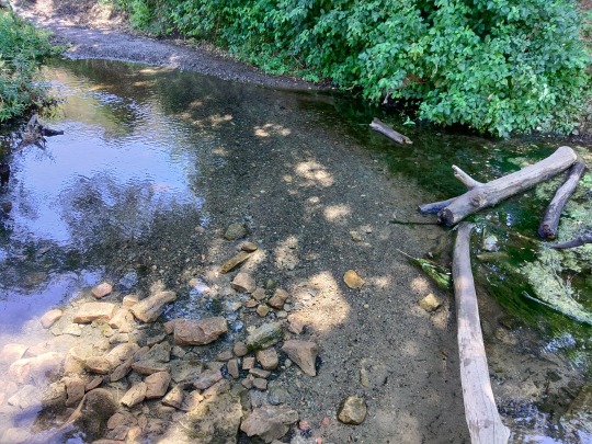
This is one of the prettiest creek crossings: about the fourth one after that first crossing. After a certain point I stopped hopping across rocks and logs and just waded through the shallowest parts. What's the point of having good boots if you don't trust them to keep your feet dry? Mine did! Asolo boots—love them!
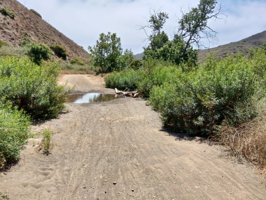
About 9 miles in and there's the 8th crossing. The cyclists really go flying through these things so take care you don't get splashed. We're getting close to the PCH now!
Big Sycamore trailhead and campground at 9.2 miles in. PCH is only 0.4 miles away and only about one more mile to my car. Feeling very good about how well this hike went, save for a few aches and pains in my back. Small price to pay...
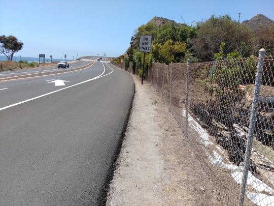
Fortunately there's a very wide shoulder on PCH to accommodate cyclists, runners and hikers. Yeah, it's a drag hiking on asphalt and breathing exhaust fumes but the beauty of the ocean makes up for it.
Thanks for coming on this trip with me, virtually speaking.
0 notes
Text
Brentwood Heights Hike
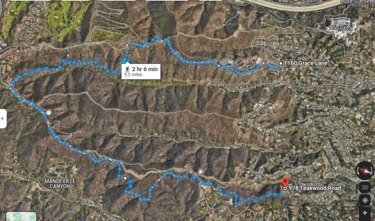
In the Santa Monica Mountains just the west of the 405 (I-405) and over the neighborhood of Brentwood Heights are Mandeville and Bundy canyons, both with trails. By combining the Casa Viejo, Lower Canyonback, Riordan and other roads and trails you get moderate 5.2 mile workout with some lovely views of the Pacific and the west side of LA county.
CAUTION: after all of the rain there will be more animals, including rattlesnakes. Generally they try to avoid people and will shake their rattle to warn you away. If you listen to music/etc. when hiking—especially if using earbuds or headphones—you probably won't hear them warn you, and you could get bitten. Hike Smart!
Starting at the end of Teakwood Road the trail goes up a hillside past a house and then you are soon surrounded by plants and a gradual climb up into the mountain.
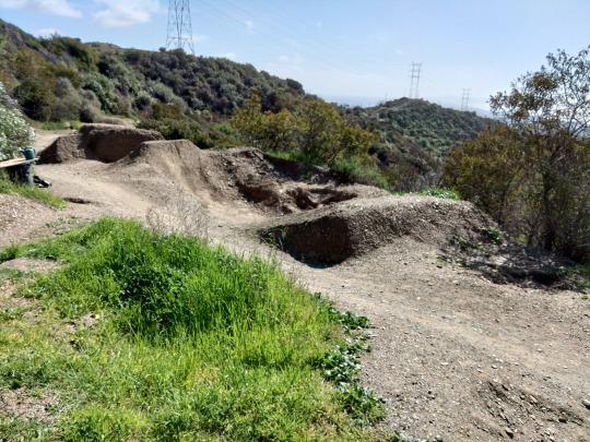
The Casa Viejo Trail joins the Kenter "Ave" fire road and then you get an opportunity to take a side route—the "Whoops!" Trail used by mountain bikers with a dirt jump ramps built in. I've never seen a lot of cyclists but be alert. I prefer it to the wide dirt Kenter Road that is usually heavily traveled.
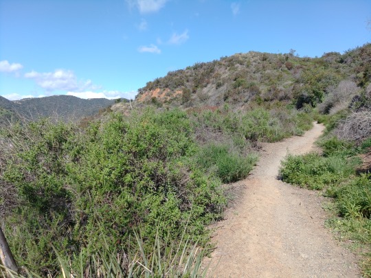
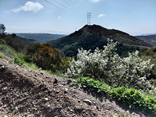
The Whoops Trail eventually rejoins Kenter and the Lower Canyonback trail into a nice, steady workout climb. This is looking back toward the coast.
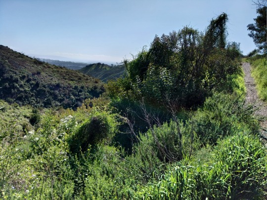
Right near the top befor Lower Canyonback deadends at the Mountaingate gated community and country club, the Riordan trail veers off to the right and zigzags down into Bundy Canyon for the trail back south to neighborhood streets.
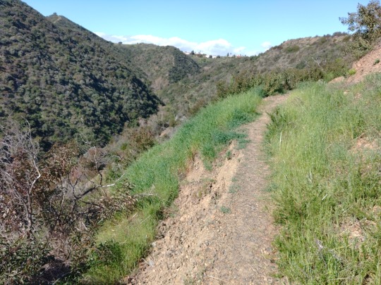
Eventually the Riordan Trail switchbacks up to a fire road that goes downhill to Mount St. Mary's College. It's four miles over city streets back to the starting point from St. Mary's, so it's best to do this hike with a friend and leave one car parked on Chalon Road next to the college. Or expect to pay $20+ for a rideshare back!
0 notes
Text
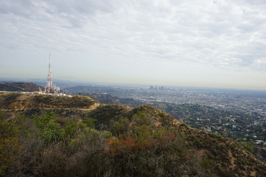
This six-mile trip is a scenic workout, especially the steady climb up the backside of Mount Burbank up to Cahuenga Peak, over to Mount Lee (Hollywood sign), down to Mulholland Highway and back. It starts in the the parking area along Lake Hollywood Dr., climbs up somewhat steep Wonderview Dr. to a trail junction.
Up the front side (green route) follows a rough trail up to the Wisdom Tree and is the path taken by hundreds of hikers a month up to just behind the Hollywood sign on the adjacent Mount Lee.
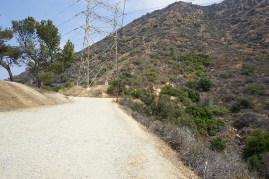
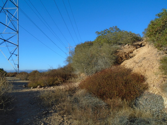
Or you can take the dirt service road for the HV towers to the Tree of Life trail (steady climb), the over a ridge to Mt. Lee, then down to Mulholland Highway and then surface streets back to your car.
Either route there is limited shade and it can get very hot. There also may be rattlesnakes, though I've never seen one in over a dozen trips up there. If you take the steep back route--bring a hiking pole!
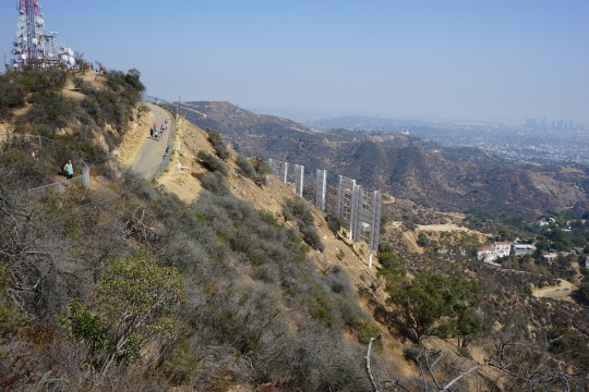
Trail junction and tourists going up the front route to the right.
If you're a hardy hiker and take the left fork, there's a gate against vehicle traffic. This service road lies just beyond it. It goes up a bit and then down, down past Universal and Warner lots. taking you past some very old drainage structures.
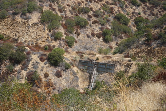
400 beyond this is the bottom of the Tree of Life trail.
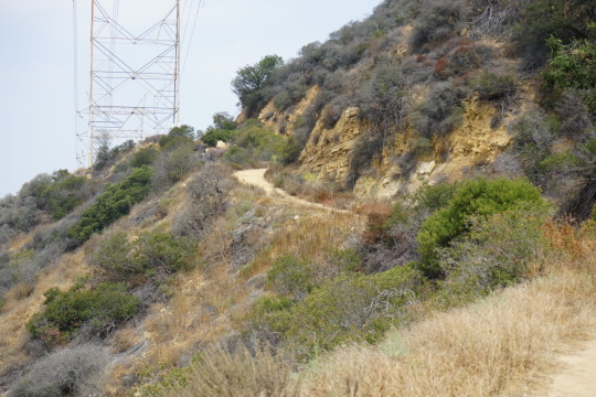
The trailhead is so rough and steep it looks like a wash from the service road. After the rains of early 2023 it's even more rugged.
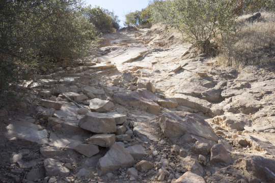
It's steep and rocky but after a hundred feet or so it gets better.
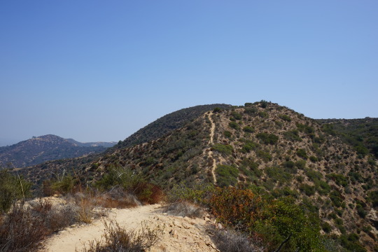
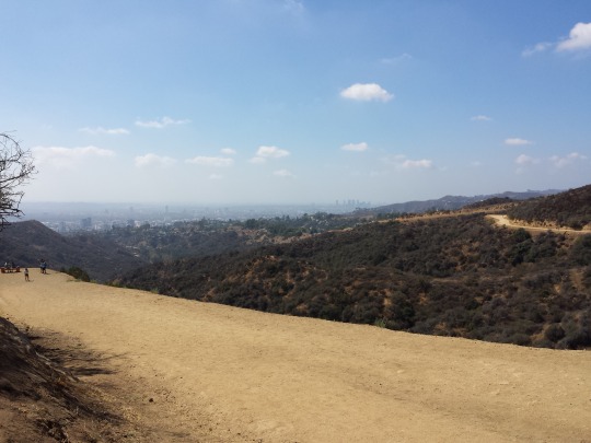
Then it's mostly a steady uphill 3/4 mile to the top. Each time you top a ridge you think you're almost there... then another ridge!
From the very top (Cahuenga Peak) you can see from DTLA to Catalina Island on a clear day. That's Mt. Lee with the Hollywood sign to the left. To get there you follow a rugged ridge over to Mt. Lee.
From the ridge going over to Mt. Lee. From then on it's a paved road down to the dirt track of Mulholland Highway, which eventually leads to the neighborhood of Hollywoodland and Lake Hollywood Dr.
Mulholland Highway around here is dirt road , frequented by horseback tours from a nearby tourist ranch.
0 notes
Text
More UCLA class photo assignments from 2018. Taken with a Sony Alpha and consumer-grade lenses. These are mostly photos from my website slideshow.

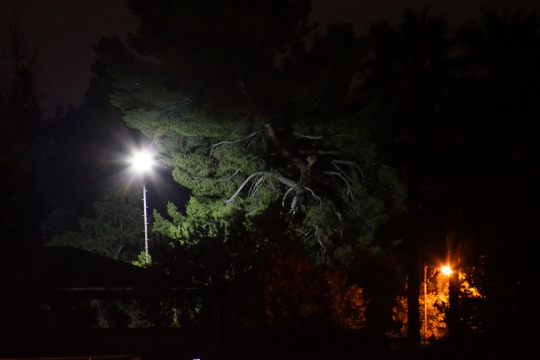
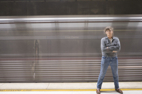
"Ghost Train" was taken at Los Angeles' Grand Park MTA station with a five-second, remote-control exposure, shot just as the train entered the station from my left. We see the bare, water-stained concrete wall behind everything and then a pseudo-double-exposure of the train racing past into the station.

This last one is a real machete and a rubber hand shot with compact fluorescent backlighting and an overhead spotlight with a "snoot" aimed at the hand and the edge of the blade.
IT'S FAKE! DON'T REPORT IT AS "VIOLENCE" OR ANYTHING ELSE!
0 notes
Text
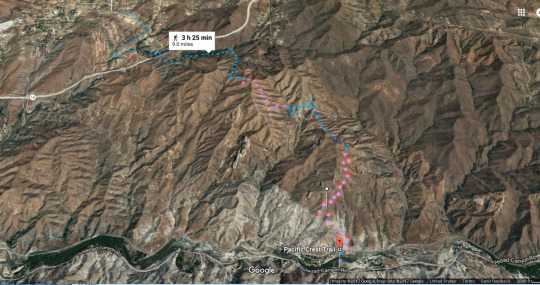
Want to say you've hiked on the PCT without doing the full 2650 miles or even a 100+ miles segment? This nine-mile stretch is a good workout—you'll climb, oh yes!—and it gets very hot in summer—but it's got some beautiful parts to it. You'll need a car at each end unless you want to backtrack all three hours!
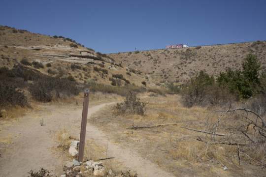
It starts here at Indian Canyon trailhead on Soledad Canyon Rd. There's a parking lot right across from the Santa Clara River (usually dry) which is the first crossing.
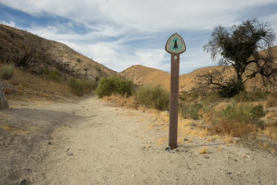
After you cross the riverbed and Metrolink railroad track you head north. And up and up and up for two miles.
And up and up...
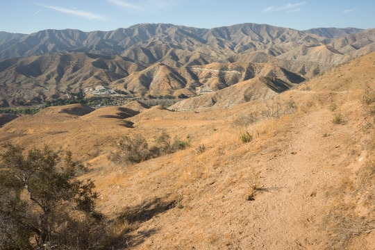
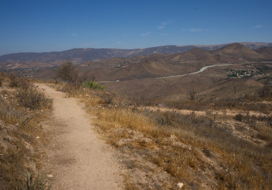
Looking back toward Soledad Canyon. There's a few level parts.

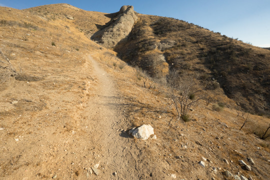
But still you keep going up. And as you can see, very little shade.
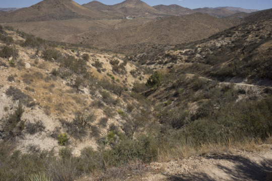
Looking back at about three miles in. After the two mile climb it's level or down for a little bit... and then it starts climbing again! Here we're looking at the little down section before the second climb.
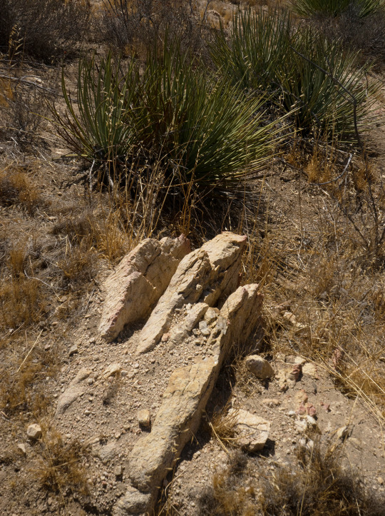
I liked the composition so I shot it. Just so it's understood, these are desert mountains with heat and rocks and lizards and little shade and the occasional rattlesnake. Have fun!
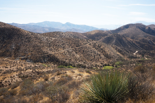
When you crest the second climb, there's the Hwy 14 headed up to the Antelope Valley, Palmdale, Lancaster, and Death Valley. This is about 4.2 miles in, roughly halfway.
Descending toward the Hwy 14 corridor. Streams cross the trail down there after a good rain!
At the bottom of the 14 corridor. Now all we have to do is cross that freeway to the last leg of our hike! 6.7 miles in.
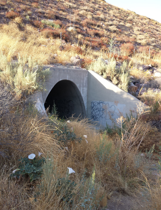
We don't cross over the 14: we go under it. I have yet to take this during or right after a storm and would prefer not to. Notice the Datura flowering here. Do NOT eat this plant!
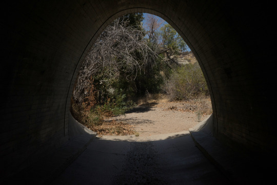
The light at the end of the tunnel is Vasquez Canyon, which runs alongside the freeway down to where we climb up into the park.
Were it not for the whooshing sounds of the freeway it feels like the middle of nowhere here around the 7 mile mark.
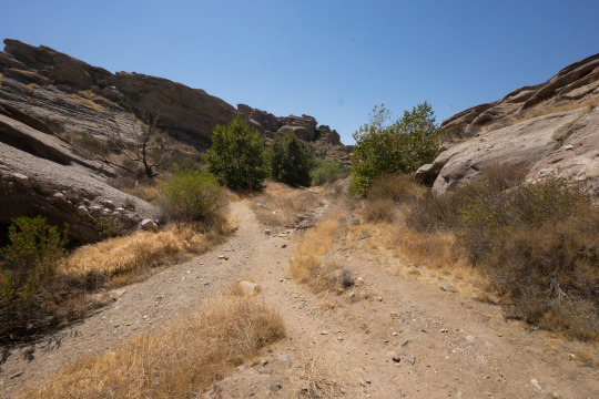
If you're thinking this looks like movie country that's exactly what it is, in addition to being a state park. Vasquez Rocks park is famous. Many original Star Trek episodes were partly shot in this park. If you just want to see that and skip the hike, take the Agua Dulce exit and road and you'll find the park.
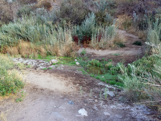
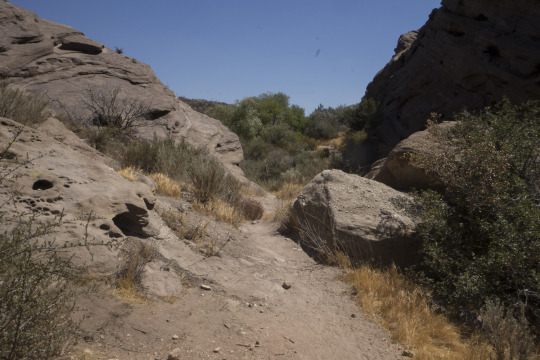
There's a creek that runs through the canyon. Sometimes it has water.
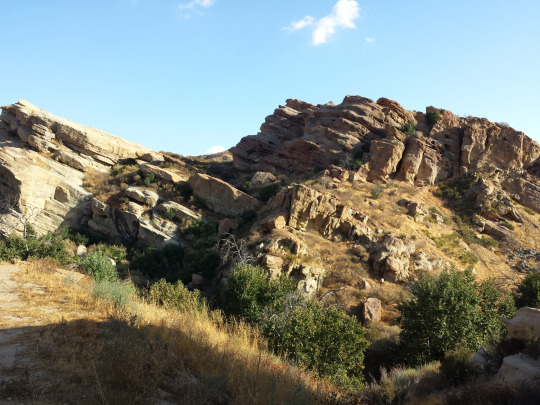
Part of Vasquez Rocks.
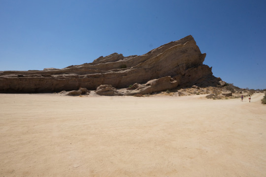
The famous part of Vasquez rocks. The end of this hike is the park entrance about 0.4 miles beyond this.
0 notes
Text
Now that rain is again transforming our California trails—and I have a little time—I'm finally getting around to posting this.
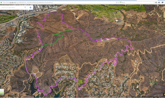
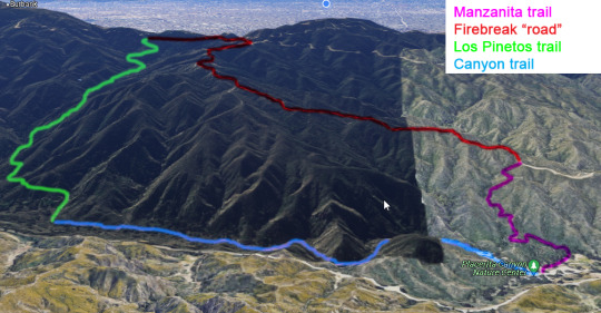
I went hiking on a rainy day last month, finally getting around to posting. This is a Google Satellite photo of the entire 7-mile route in Placerita Canyon just north of LA. The loop is formed by four trail, each hi-lit with a different color.
The Manzanita is a bit of a workout and dicey in places; the firebreak "road" is a relentless uphill slog with steep, terribly uneven sections. It's daunting in places. The downhill on Los Pinetos was the prize: an easy, beautiful descent, and the last part was a cool-down stroll.
Sorry for the phone photos but the weight of a real camera would have too much. I have a lot of getting into shape to do!
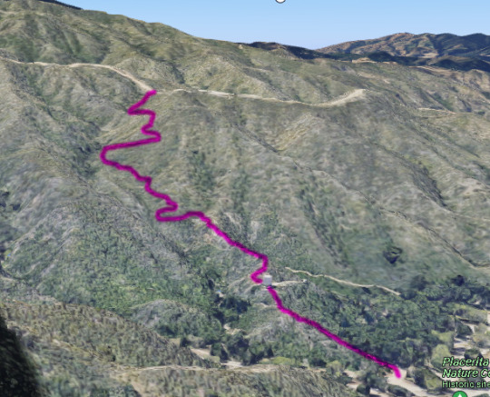
(Google photo)
Manzanita (also the name of a small tree/shrub) is a steady climb with a few rough, precarious patches but it's a pretty hike. It got me ready to tackle the real challenge.
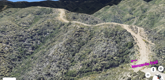
(another Google photo)
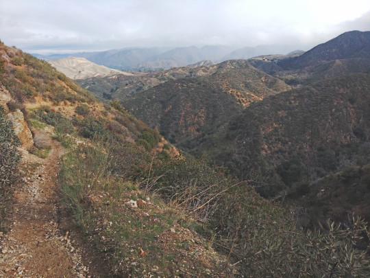
At the top of Manzanita the real effort begins. There's no way this picture can convey just how steep the first rise looks from the bottom.
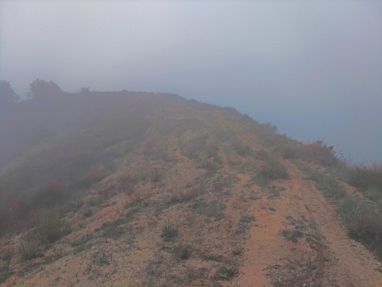
When I got up to the 3000 level the peaks of the mountains were literally up in the rain clouds. I got so cloudy—NOT fog!—that in places you couldn't see more than 30 meters in any direction. I got pretty damp from being inside the clouds! You get a better idea of steep it gets from this picture.
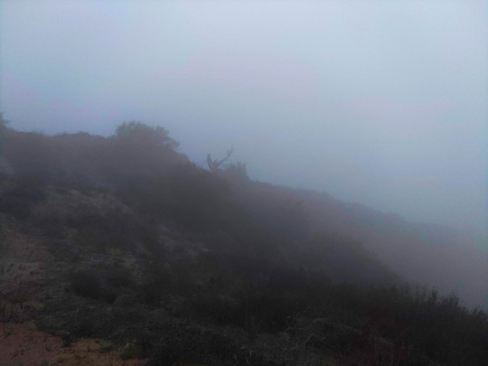
This was at about 3200 feet above sea level. I love the ghostly-looking tree on the ridge line. Well into the clouds by now!
Finally easy hiking! All the way downhill on the Los Pinetos trail. Lots of lovely tree cover near the top. This is about 1/3 of the way down. Los Pinetos means "the pine trees."
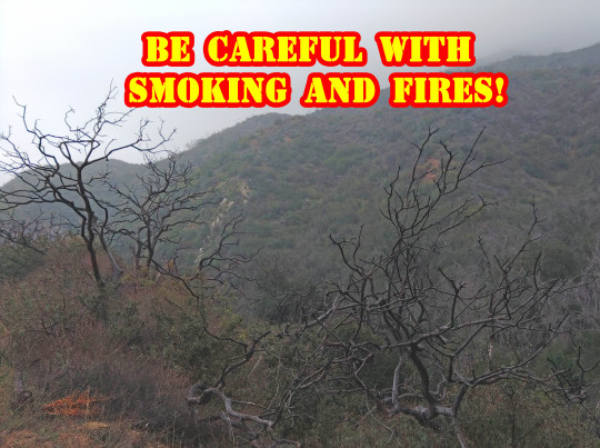
Sadly, there aren't as many pine trees as there used to be. A huge fire (30,000+ acres), the Sand Fire, burned through here in 2016. Please be careful with smoking and fires outdoors!
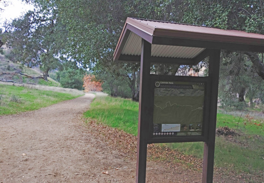
Finally back down to the Canyon trail, less than two miles from the starting point in the parking and mostly flat. A nice cool-down.
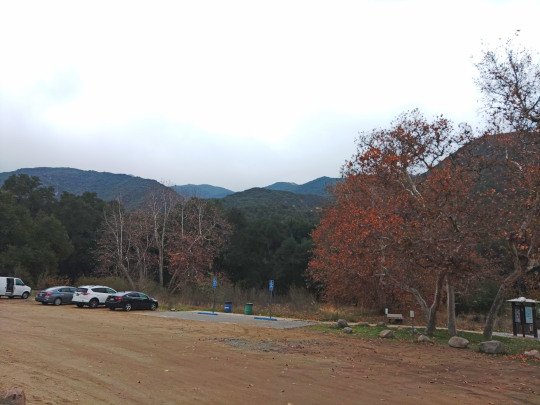
A final view of the park and perspective on the trip. I was on the distant mountain top only ninety minutes earlier.
1 note
·
View note
Text
Reminds me of my furry kids!
Reblog to headbonk your mutuals like a cat full of love
159K notes
·
View notes
Text
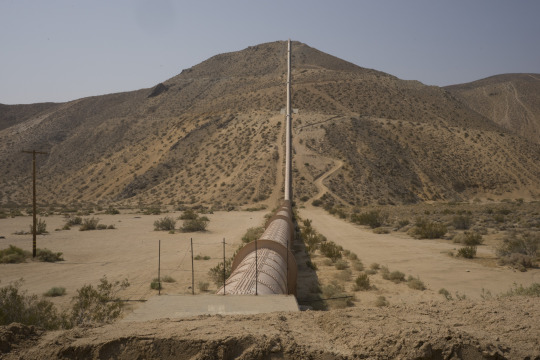
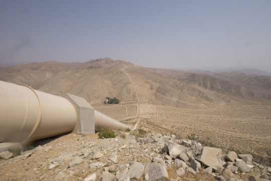
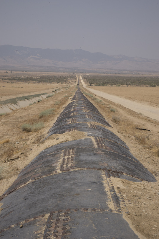
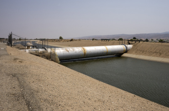
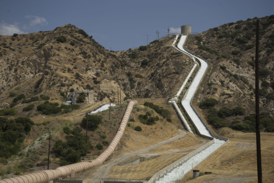
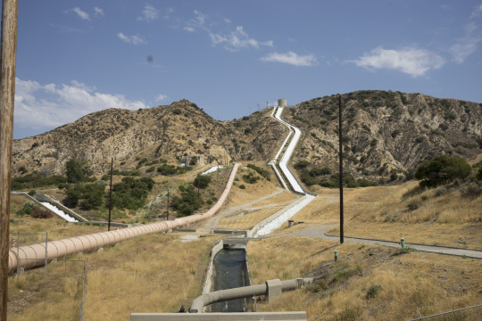
For one of my UCLA assignments I did a partial survey of the Los Angeles aqueduct, starting in Jawbone Canyon, 110 miles NE of LA in the high desert. This shoot took half of the day. These are the best of the lot. Someday I'll hike all 300 miles of the aqueduct and photograph the whole thing!
1 note
·
View note
Text
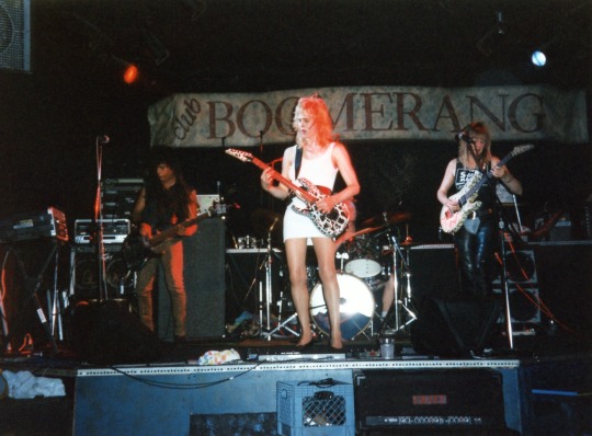
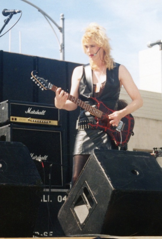
Lead singer/rhythm guitarist me, back in the day in San Francisco. I miss playing live but not all the BS and business side of being an unsigned recording artist. Also, glad to not bleach my hair anymore!
1 note
·
View note
Text

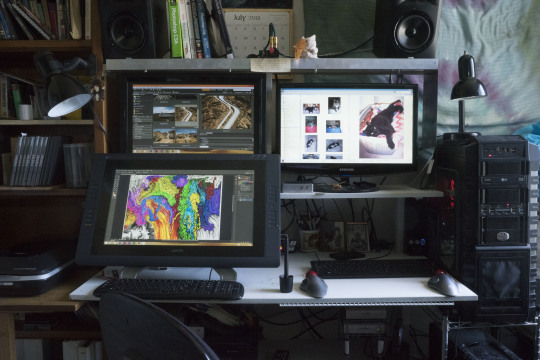
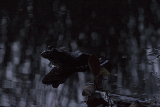
Miscellaneous photos from various UCLA assignments. I'm especially proud of getting that frog in crystal clear focus with an inexpensive lens in post-sunset light in Franklin Canyon in LA (one of my many hiking spots). There's also my movie and photo post production desk and one of my guitars. All photos are from 2018.
0 notes
Text
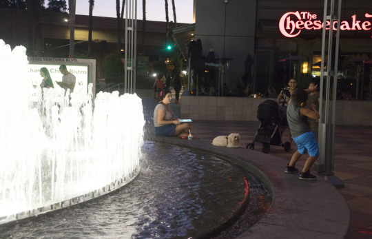
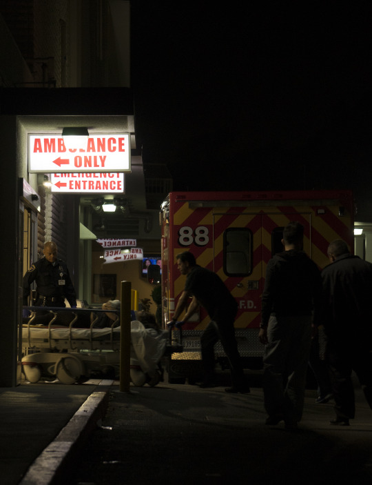
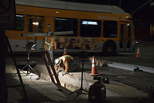
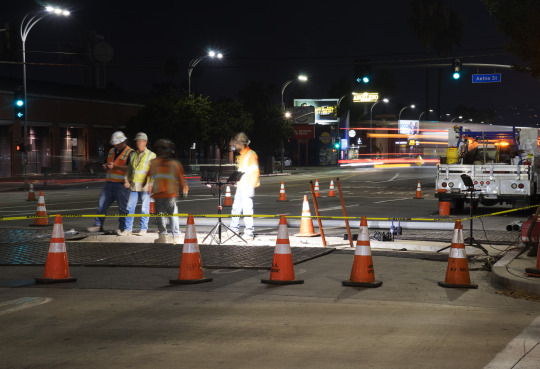
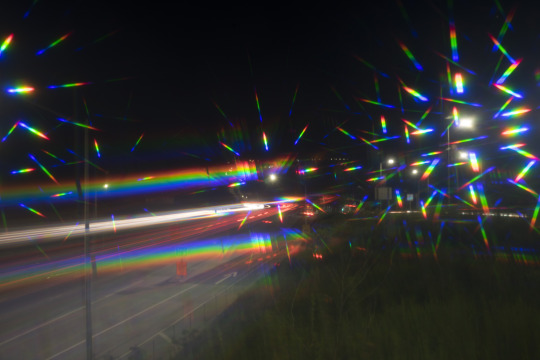
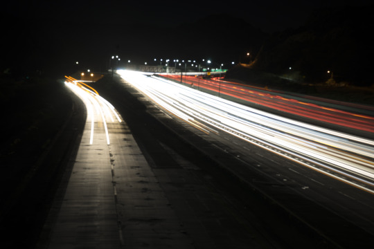
I took these as part of a UCLA photography class. I've been a photographer for decades but often it take the pressure of a deadline to make me work. This is from my street photography series shot here in northern Los Angeles.
3 notes
·
View notes