#map maker
Text
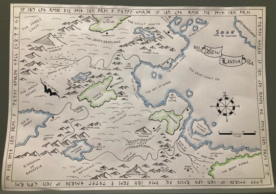
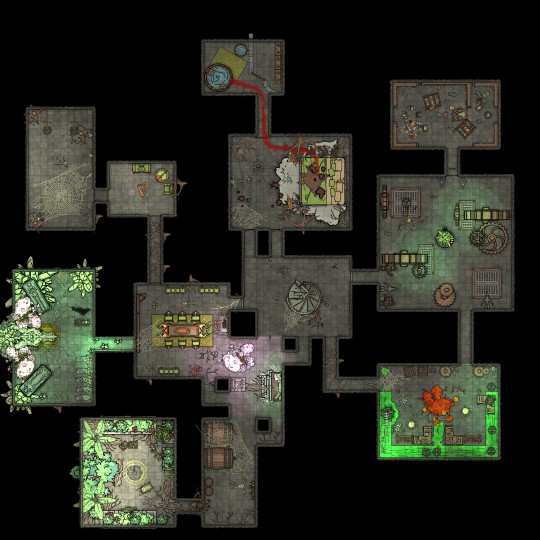
One of my hobbies is map making and I’ll be involved with a production of She Kills Monsters in July a very d&d themed play.
Script called for a map so I did it!
Look out for the little classic d&d themed Easter eggs I chucked in there and bonus points for the runic translation 👀
#dungeons and dragons#dnd maps#fantasy maps#fantasy map#she kills monsters#theatre prop#prop making#map maker#probs one of my best#original art#map art#d&d maps
87 notes
·
View notes
Text

Development screenshots from Fallout Van Buren, featuring the map editor
#web finds#photography#gaming#fallout: van buren#fallout 3#fallout new vegas#map maker#fallout#game development#screenshot
10 notes
·
View notes
Text
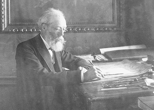
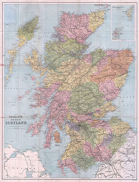


John Bartholomew was born in Edinburgh on December 25th, 1831 in Edinburgh.
If, like my family, you enjoyed playing Scrabble, I think the majority of us had at hand a Bartholomew's dictionary at hand for checking spellings and some of us had one of their atlas's where we could look up exotic places far from Scottish shores that we could only dream of, the world since then has gotten a hell of a lot smaller thanks to the World Wide Web and the Internet.
He was still very young when he acquired the skills of map drawing and engraving directly from his father, John Senior.
He was then sent to London for more formal training as a geographical draughtsman and engraver. He spent two years with the noted German geographer Augustus Petermann. His love for maps and geographical work soon led him to make rapid progress as a cartographer.
Returning to Edinburgh, he continued his father’s business with great energy, and, in conjunction with Dr Petermann, he contributed most of the maps to Fullarton’s Royal Illustrated Atlas, and to the Philip’s Imperial Atlas, drawn and engraved in Edinburgh. Other important works followed including Black’s General Atlas of the World; a large topographical map of Scotland on a scale of four miles to an inch; and afterwards a companion map of England and Wales from the survey just then completed.
In 1859, John married Annie, the daughter of John McGregor, a smith of Greenock. Following his first wife’s death in 1874 he married Anne Cumming, the daughter of Primrose Nimmo, a master brass founder of Edinburgh, and his wife, Anne Philip, who was related to George Philip, the founder of the Liverpool map makers.
From his two marriages, John had two sons, and seven daughters
John was sought after as an engraver in Scotland for work outside his cartographic focus as well, including as illustrated here botanical drawings.
He is said to have had a reserved nature, which made him unwilling to enter fully into public life, but he took great interest in the reformation of the Scottish rights of way and Recreational Society and was elected a fellow of the Royal Geographical Society in 1857.
John travelled widely to obtain new work and introduced a programme of improvements, including the installation of lithographic printing, which brought considerable savings to the business from increased productivity.
His works attracted much public commendation, and received distinguished awards at different international exhibitions. About 1870, as the business gradually extended, several important atlases were undertaken for American and foreign publishers, the Handy General Atlas of the World being published simultaneously in England and America.
John Bartholomew Jr was also commissioned to engrave the map of Treasure Island for Robert L. Stevenson as seen in the pics
In 1888, he retired from active work, leaving the management of his business to his son, John George.
On a trip to London seeking special treatment, he died in March 1893 and was buried in Edinburgh.
12 notes
·
View notes
Text
Dragons


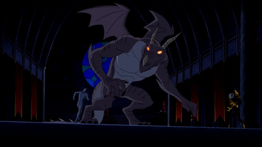


#ben 10#ben 10 alien force#ben 10 ultimate alien#ben 10 uaf#ben 10 omniverse#dragon#forever knights#map maker#dagon#charmcaster#dragoncaster
91 notes
·
View notes
Photo
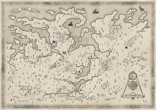
The land of Voreia.
Part of Hollow Adventures World.
#map#fantasy map#rpg#dnd#rpg map#cartography#mapping#map maker#ttrpg#adventure#system neutral#osr#rpg zine#tabletop maps#tabletop roleplaying#Tabletop Games#tabletop rpg#hand drawn
24 notes
·
View notes
Text
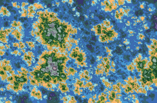
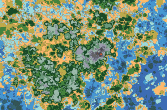

I've been exploring making randomized maps. I just love the look of them!
2 notes
·
View notes
Text
Maps!
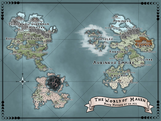
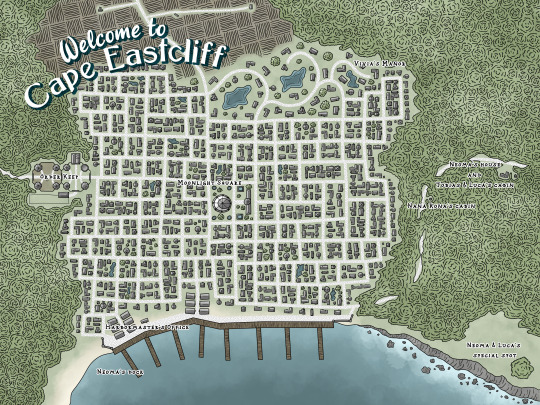
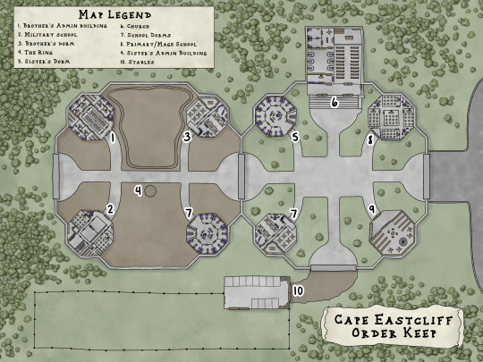
Hi, I make maps for people and myself. Since I was self publishing my first book, Child of the Moon, I realized I could put anything I wanted in the book and since I make maps it seemed only right to include entirely too many maps in the book. Here are the three maps I made for it.
The first map is a world map. Though book one stays 100% in Cape Eastcliff (and the surrounding forest) the story will open up to the rest of the world as books go on. It was important to me for world building purposes to have an idea of the countries and I thought it might be nice for readers to have some reference to places mentioned in the book.
The second map is a city map of Cape Eastcliff highlighting some of the places mentioned in the book. The city isn't really as regimented and planned as it looks in the map. I was running out of time and took the easiest route. I may someday redo this map but for now it's fine as is.
This last map is the Cape Eastcliff Order Keep building layout. I thought it might be fun to include since a good portion of the book takes place here and it's an important place for Neoma.
If you've made it this far, ask me anything about my world! I love talking about world building ^_^
#maps#map#world map#city map#building map#map maker#world building#child of the moon#child of prophecy#art#illustration#illustrators on tumblr#clip studio paint#drawing
32 notes
·
View notes
Photo
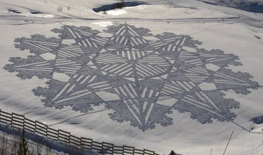
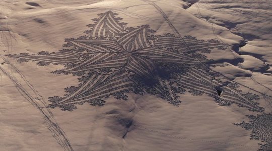
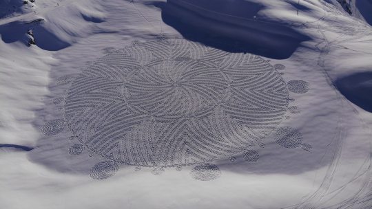
Former Map Maker Walks for Hours in Snow To Create Giant Geometric Patterns in Snowfields
For the creatively minded, snow represents a giant blank canvas for art. But often, it's limited to snowmen or other snow sculptures. Outdoor enthusiast and cartographer Simon Beck had a different idea, and over the course of a decade he has carved a path for himself (literally) in the snow art world. He creates massive land art by walking across soccer ball-sized fields covered in untouched snow. Combined with light and shadow, his geometric designs can only be fully appreciated when viewed from above.
Photos by Simon Beck

#simon beck#photographer#cartographer#map maker#maps#snow#land art#art#geometric designs#snowfields#snow sculptures#artist
13 notes
·
View notes
Text
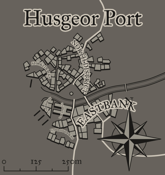
To give you more of a visual when following the characters and lore surrounding Husgeor Port, I made a map using https://watabou.itch.io/medieval-fantasy-city-generator.
It is a free website that couldn’t be easier to use, and is perfect for any writers or DMs in need of a quick, easy map layout. I welcome you to use this particular map in your own ttrpg campaign if you have one, and to explore around and share with me who else you meet around town! There are plenty of adventures to fall into.
#fantasy#cartography#worldbuilding#character creation#map maker#ttrpg stuff#adventure hooks#ttrpg homebrew#ttrpg community#dnd stuff#dnd5e#storytelling
16 notes
·
View notes
Photo

Advance Wars: Dual Strike (2005)
3 notes
·
View notes
Photo

Two floor dragons lair that has been turned into a museum.
Lower level entrance has a back room for sneaking in, as well as a gift shop!
#dungeons and dragons#gaming#tabletop#dnd#d&d#5e#4e#monster#monsters#pathfinder#games#free#freemaps#map maker#dungeon#acid#dragon#tomb#design
5 notes
·
View notes
Photo
Hello! We are a map curator tending to your TTRPG experience! We sell maps to be used in any fantasy based games, weather it be at a table setting or used in virtual table top spaces! We have maps that can fit multiple biomes, ships, towns and more! To shop what's available, please visit https://fantasymapcurators.com/
2 notes
·
View notes
Text
Does anyone know of any good free map makers?
I wanna make maps for some of my wips.
1 note
·
View note
Photo


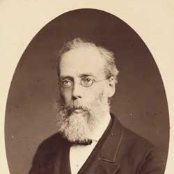
18th August 1661 saw the death of Robert Gordon of Straloch.
Robert Gordon was a poet, mathematician, antiquary and geographer, primarily remembered for his cartography of Scotland.
Born at Kinnundy in Aberdeenshire, on the 14th September, 1580 Gordon is said to have been the first graduate of Marischal College.
Robert Gordon was a bit of a polymath, for those that are unfamiliar with the word, it means they have a wide knowledge or learning, basically they’re clever buggers, us ordinary folk would say they are jack of all trades.
He was a poet, mathematician, antiquary and geographer, primarily remembered for his cartography of Scotland, before he made his maps there were only three maps of Scotland in existence, which were inaccurate and dissatisfactory. He was also a great collector of music, most notably that of the lute, sadly his collection has been mainly lost over the centuries, although some manuscripts do survive.
In his mapmaking work it seems he had a fan in James VI and letters still exist that they sent each other, while most of the letters are said to be just trivial matters it shows a friendship between the two men, the King himself being a very learned man.
Now I’m not a great fan of people with titles but looking back at the family history the Gordons were family with a great pedigree for there service in the military, his Grandfather fell at Pinkie Cleugh,in 1547, which I posted about last week, another relative fell at The Battle of Alford.
The royal connections continued into the reign of Charles I when he wrote an oft-quoted letter, in which he entreated Gordon ‘to reveis the saidis cairtiss’, basically to fill gaps in the existing maps of Scotland. And so it was he went to work with the famous dutch mapmaker Joan Blaeu.
To me I find it incredible that such accuracy existed back then and it shows the skill of these early cartographers. I think that Gordon growing up in a time when Scotland was relative peace with our southern neighbours certainly helped in strides like this, and helped lay the foundations for The Enlightenment a century later.
8 notes
·
View notes
Text
Inktober day 5: map
1 note
·
View note
Photo

Loot Hunters - First Coin rpgzine.
9 notes
·
View notes
Last Seen Blogs

sunskate
Sunskate

tropicallens
We go way back
titanswriter
Fanfiction is Life
“won’t shut my dumbass up”
squishyowl
aka Deadwolfia

kdramalands
care to join me for a ride?