#fantasy maps
Text

Languages of the Mede Empire, 4E197
The languages of the Mede Empire (Cyrodiil, Skyrim, and High Rock) as described in my language-focused apocrypha, Languages of Tamriel, which fleshes out the linguistic situation of Tamriel in the Fourth Era.
>> Direct link to the map <<
Thought it would be cool to see all three of my Cyrodiil, Skyrim, and High Rock language maps combined into one!! Probably won't be able to do any more than these three combined, since I'm already running out of distinctive colors for these languages, but I might make some larger Tamriel-wide ones with language families as a whole.
#the elder scrolls#tes#elder scrolls#elder scrolls lore#maps#fantasy maps#language maps#cyrodiil#skyrim#high rock#morrowind's status in the Empire is kind of ambiguous? but i'm leaving it out since it seems de facto independent#miiiight be able to squeeze Hammerfell into another combined map#we'll see
56 notes
·
View notes
Text

My life is deteriorating but atleast I
Have pink glossy lips!
#lana del rey#girl interrupted syndrome#lizzy grant#girl blogging#tumblr maps#fantasy maps#girlblogging#coquette#girl bloggers#female hysteria#coochieholder🎀#femcel#female manipulator#gloomy coquette#this is what makes us girls#girlblogger#lana del ray aka lizzy grant#girl appreciation#girls girl#this is a girl blog#tumblr girls#femcel core
473 notes
·
View notes
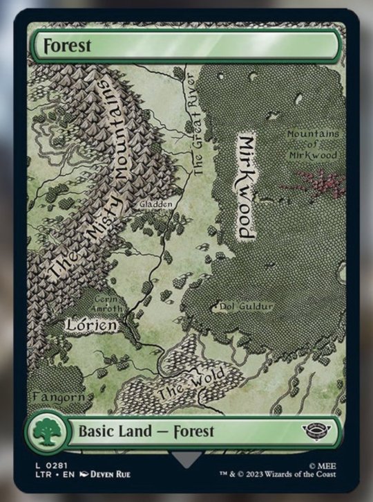
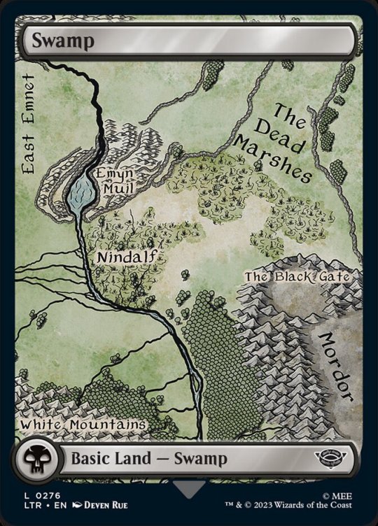
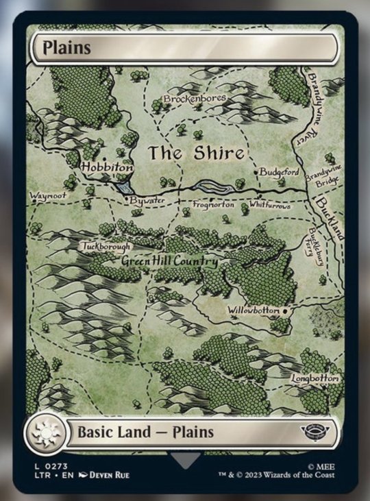
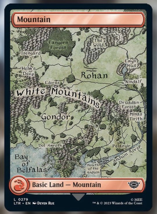
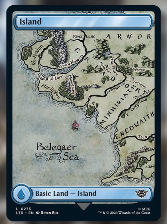
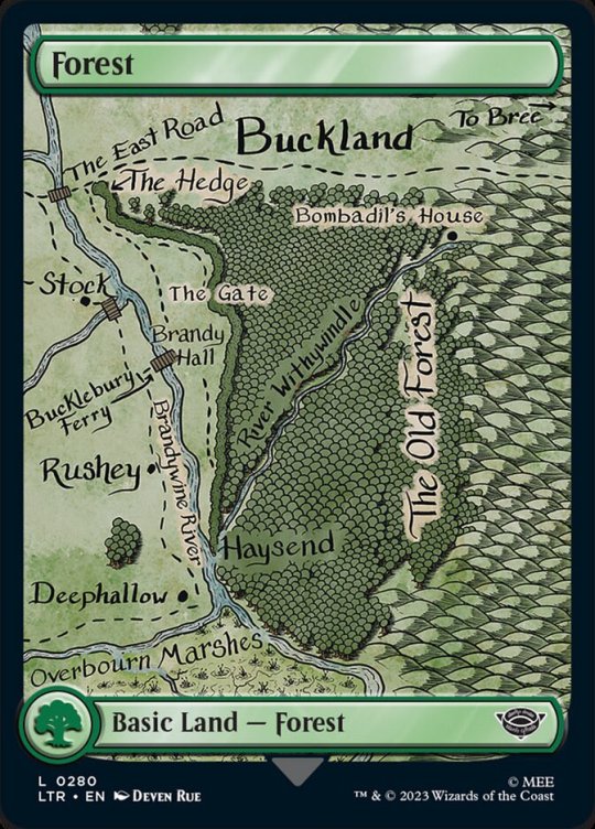
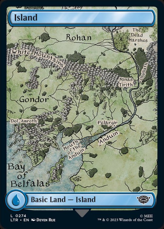
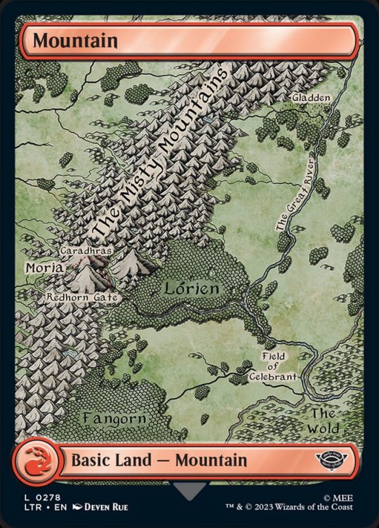
Text
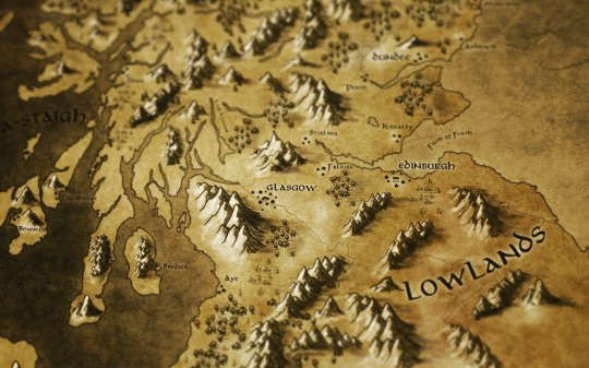

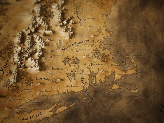
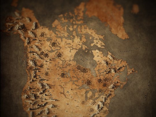
I made a set of Tolkien inspired fantasy maps of real-world locations including Scotland, the UK and Ireland, Europe, New England and North America for fun but turns out people like using them in their games so, here's how you can find them!
You can download copies of all these maps for free with or without labels for printing or use in your TTRPGs over on my Tumblr page here:
Fantasy Maps in a Tolkien Style
You can also buy prints of these maps on my Redbubble page :
If you would like to use these in a commercial project, drop me a DM and I'd love to chat!
#Maps#Tolkien#cartography#middle earth#lotr#fantasy maps#D&D#dnd#pathfinder#ttrpg#map making#hobbits#shire#rpg#roleplaying game#gimp#mountains#Scotland#UK#America#New England#Ireland#Europe#scottish#jrr tolkien#lord of the rings#the hobbit#mapmaking#digital art
2K notes
·
View notes
Text
So I started replaying Octopath II for the one year anniversary, and while playing through Osvald's chapter 1, I noticed he mentions that the distance between Frigit Isle and Cape Cold is four days by sea.
Now, a ship from this period can likely travel 4 knots in an hour in waters like that (seeing as they aren't icy or anything.) Which makes that distance about 442 miles, or 722 kilometers across.
So I decided I had no choice but to figure out what the size of Solistia actually is. The answer is... big.
Keep in mind that a person can walk *maybe* 33 km in a day if they're experienced and prepared.

Solistia would be, if I'm not stupid, about the size of Eurasia...
The Eastern continent alone stretches the distance from Portugal to Kazakhstan.
Now, let's say this ship is moving slower, at more like three knots. Well, then our distance is 540 km, only 75% the initial presumed distance.
Then we're looking at Solistia being 8,664 km across, which is still big, but not *as* big.
In other words, Octopath Traveler II's full story likely took several years to complete in canon.
92 notes
·
View notes
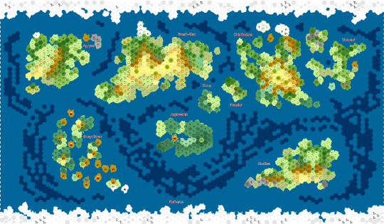
Text

Mana: Land of the four seas and home of the Riptide Pirates
Other versions without the ocean color under the cut!


The islands are not exactly to scale, but I wanted to make sure they were visible. I’ll try to make edits as they visit more islands to try and keep this updated!
And click for the details! Tumblr loves eating the quality
#just roll with it#jrwi#mana#riptide pirates#just roll with it fanart#jrwi fanart#thank you to everyone who helped with this#it really means a lot#fantasy maps#dungeons and dragons#my art#griff art#not bad for my first time making a map!#there were so many mountains#hats off to jrwiblr#i see you and appreciate you#it’s a world yall
651 notes
·
View notes
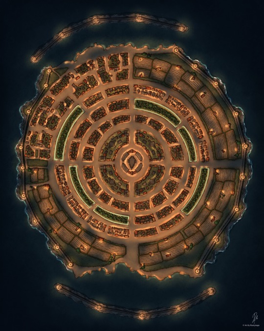
Text
Lonelystar City

#5e#dnd#tabletop#battlemap#criticalrole#pathfinder#dnd5e#ttrpg#5th edition#dice#fantasy#fantasyworld#fantasy maps#fantasymap#dnd campaign#dnd art#dndmap#rpgmaker#town rpg#new rpg#city#rpgmap#battle#top down#fantasymapmaking#dnd maps#dnd character#city rpg#rpg map#rpg
213 notes
·
View notes
Text
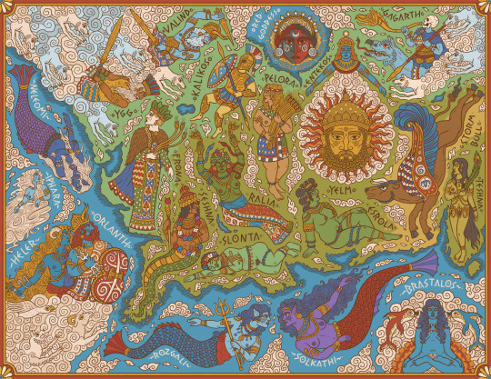
A map of central and western Genertela, showing the major deities of Earth, Sea, and Air.
One of my pieces for Martin Heldson's brilliant Ships & Shores, which you should definitely check out and includes high-res labelled and unlabelled version of this and other maps.
#artists on tumblr#digital art#fantasy#illustration#glorantha#fantasy art#runequest#mythologyart#ttrpg art#ttrpg#fantasy map#map#fantasy maps#rpg maps#i'm especially happy with how the earth goddesses here look#they're very expressive i feel
158 notes
·
View notes
Text


The cards I created for MtG LotR are finally revealed and I'm so proud of them!
434 notes
·
View notes
Text
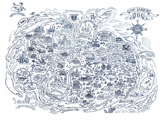
I completed myself a map from Ooo using the official one (appropriately changed to introduce as many locations as possible)
#adventure time#marceline the vampire queen#finn the human#jake the dog#bonnibel bubblegum#fantasy maps#fanart#unofficial#fantasy cartography
345 notes
·
View notes
Text


Made significant progress in my world building pursuits and it made me want to share so look, I did thing.
#dnd#d&d#pathfinder#pathfinder 2e#dungeons and dragons#fantasy worldbuilding#worldbuilding#game master#ttrpg#fantasy maps#map making#maps#worldographer
83 notes
·
View notes
Text
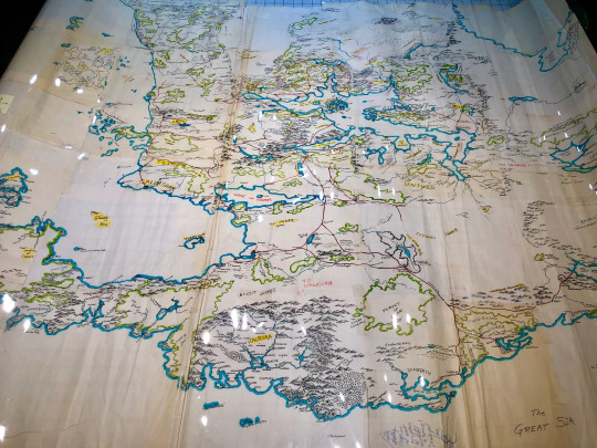
Ed Greenwood's original hand-drawn map of the Forgotten Realms, sent to TSR in 1986… on Map Monday aka Dungeon Day!
Credit: Photo taken by D&D Sage Advice, map from Alex Kammer's collection
#map monday#dungeon day#d&d#dnd#dungeons & dragons#map#maps#cartography#fantasy maps#rpg#forgotten realms#ed greenwood
273 notes
·
View notes
Text
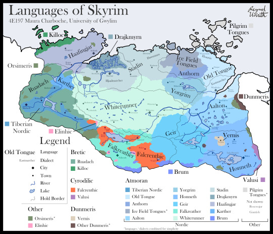
Languages of Skyrim, 4E197
The languages of Skyrim as described in my language-focused apocrypha, Languages of Tamriel, which fleshes out the linguistic situation of Tamriel in the Fourth Era.
>> Direct link to the map <<
#the elder scrolls#tes#elder scrolls#elder scrolls lore#maps#fantasy maps#language maps#skyrim#bethesda can't tell me falkreath used to be colovian then just not do anything with that
463 notes
·
View notes
Text

What do you mean you don’t wanna run away and have kids with me because you looked at me for 0.2 seconds :(
#lana del rey#girl interrupted syndrome#fantasy maps#girl blogging#tumblr girls#gloomy coquette#gone girl#goddess#dream girl#lizzy grant#lana del ray aesthetic#cassy euphoria#euphoria#coquette#girlblogging#coquette dollete#Bambi#dollete core#dollete#ballerina#pricilla movie#female hysteria#coochieholder🎀#girl bloggers#girl pains#femcel
59 notes
·
View notes
Text
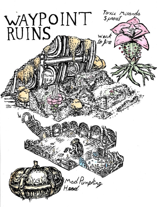

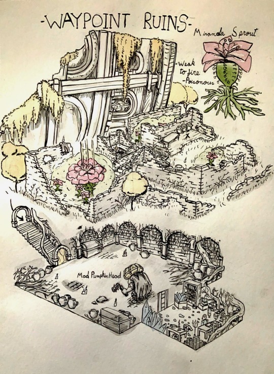

Redoing some of the first pages I did, it’s fun to see the progress in a year.
My Patreon :3
#my art#drawing#fan art#art#fanart#illustration#elden ring#elden ring fanart#artist on tumblr#ink#sellen#map#fantasy maps#map art
57 notes
·
View notes
Text
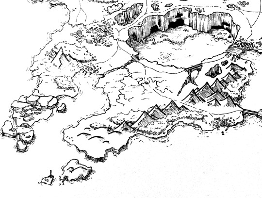
been drawing maps as a way to procrastinate my uni deadlines (they're done thank god, I totally won't have to retake the module...) and its the most fun lil past time ever
I so badly want to draw some of the shattered teeth islands but I need so much more information from Matthew
edit: this isn't one of the shattered teeth just a practice island, feel like I need to add that information. hopefully one day soon
58 notes
·
View notes
Text
🗺️Hunters Bay with some new colors 🗺️
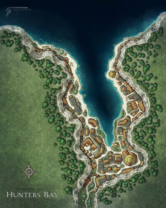
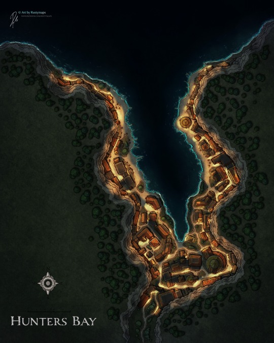
#5e#dnd#tabletop#battlemap#criticalrole#pathfinder#dnd5e#ttrpg#5th edition#dice#fantasy maps#fanatsy#fantasymapmaking#fantasyworld#fantasymap#fantasy#dnd oc#dndmap#dnd character#dnd stuff#dnd maps#rpg map#town rpg#rpgmap#rpgmaker
276 notes
·
View notes
Last Seen Blogs

bourbonandchimes
#beastmode

izzyr11
IzzyR11

flyingbagel
Thoughts and doodles of a time waster

quietpinksapphire
Roxas? Do You Think I Could Be A Friend?

beardyallen
Dear Journal