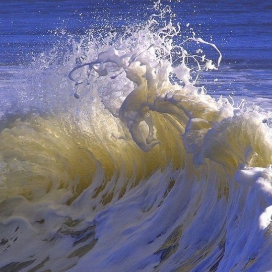
#coastal photography
Text
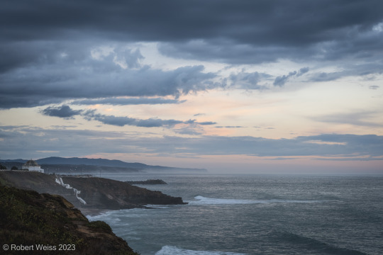
Coastal elite photographer takes coastal elite photograph
#coastal photography#landscapes of tumblr#sunset#photographers on tumblr#original photographers#portugal#ericeira#atlantic#ocean#beach
67 notes
·
View notes
Photo
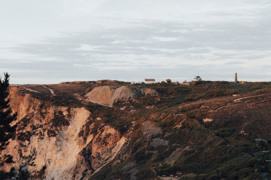
over the cliffs. + instagram
#*photography#photography#photograhers on tumblr#photographers of tumblr#coast#cornwall#coastal photography#sea#ocean#cliff#cliffside#nature#nature photography#horizon#aesthetic#countryside
43 notes
·
View notes
Text
Northumberland Coast November Road Trip
England in November is a season of shorter days and falling temperatures. We expected the weather for our Northumberland coastal road trip to be mixed, and that’s exactly what we got. At times, the conditions were challenging due to considerable periods of drenching rain and temperatures that barely reached double figures.
A road trip along Northumberland's beautiful coast, at any time of year, from Amble in the south to Berwick-upon-Tweed on the northern borders of Scotland, displays some of Britain's finest beaches and spectacular views. An Area of Outstanding Natural Beauty (AONB), this stretch of England’s most northern county is home to expansive stretches of stunning shoreline, wind-swept sand dunes, historic ruins, and charming fishing communities.
The November sun rises just before 8 am and sets about 4 pm, so I didn't have to worry about setting my alarm too early. Since there are less visitors in the area at this time of year, the coastal scenery can be explored without the crowds, having miles of beautiful Northumberland beaches virtually all to ourselves. We found some businesses and attractions understandingly closed or operating less frequently for the winter season. Finding tables at restaurants was easy whereas in the summer months booking ahead would be a necessity.
Our journey spanned five days, which gave us plenty of opportunities to leisurely explore the different places we visited, sometimes even retuning the next day, and time to shelter from the harshest weather conditions. The trip could easily be completed in half the time, especially within the longer days of summer.
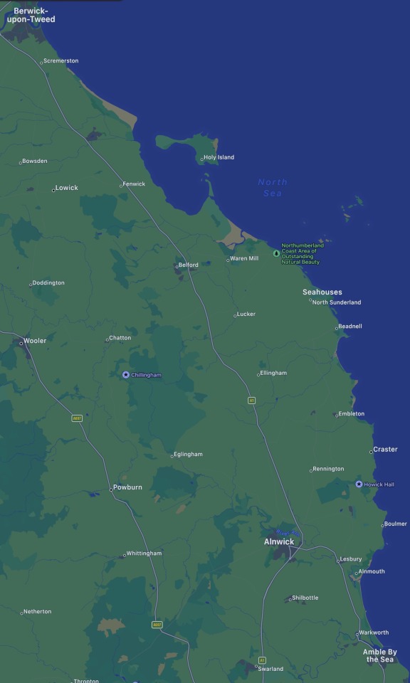
Northumberland map
Highlights of Our Northumberland Coast Road Trip
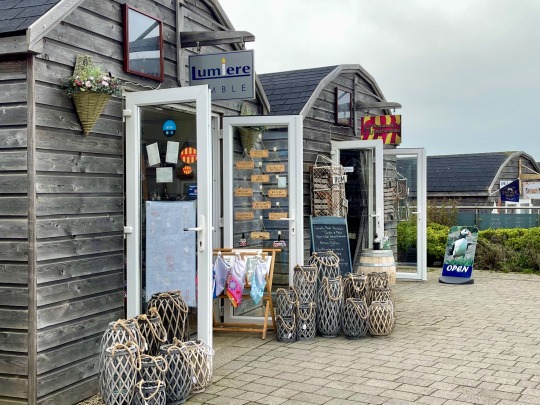
Amble
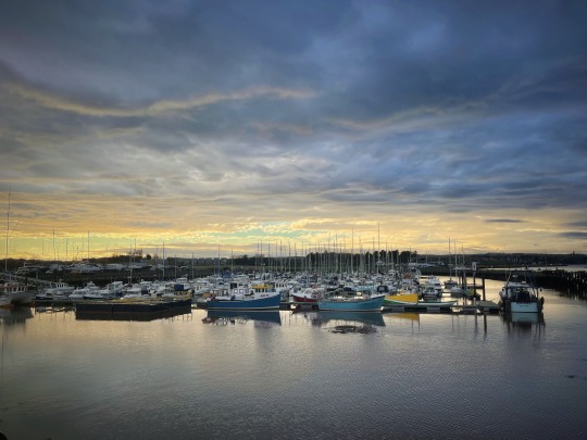
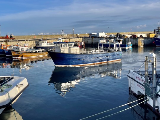
We begin our tour in Amble, known as "The Friendliest Port". A quaint harbour town at the mouth of the River Coquet that can be considered as the southern gateway to the Northumberland Coast. Harbourside seafood restaurants, brightly coloured beach huts, independent retail pods, and a sizable pier can be found in this increasingly popular town.

Amble still functions as a working port and has a small fishing fleet. A 250 berth Marina, situated on the banks of the River Coquet, offers a range of boat yard services. Boat trips operate in the spring-time to view wildlife, notably puffins and roseate terns, on Coquet Island. Sitting a mile off the coast and crammed with birdlife for half the year, the island is a Royal Society for the Protection of Birds (RSPB) managed nature reserve. Boat landings are not permitted and only RSPB wardens are allowed onto the island.


Amble gained the nickname 'the friendliest port' when on 3rd July 1935, the local Council sent the RMS Mauretania a telegram on it's last voyage to the the wreckers yard in Rosyth. 'Still the finest ship on the seas'. To which Mauretania replied with, "Thank you to the last and kindliest port."
Craster
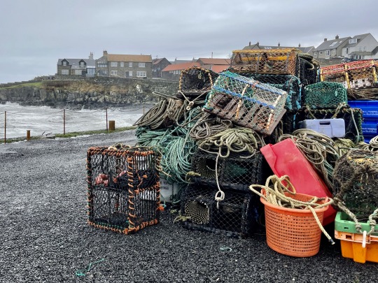
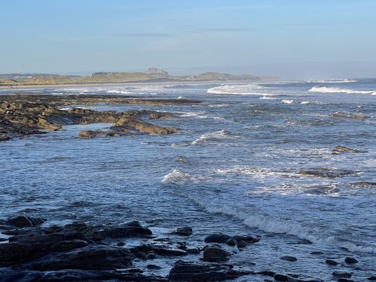
Moving approximately 15 miles north, we reach Craster, a remote coastal haven set amongst rugged rocks, dramatic coastline and beautiful countryside.

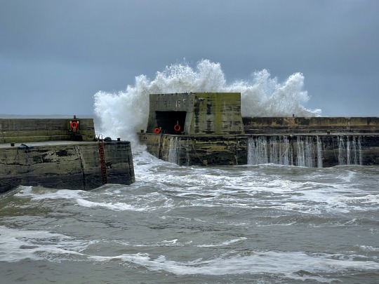
Craster has a small harbour shielded from the wind-whipped North Sea by the guarding embrace of two solid piers. These concrete harbour walls were being put to the test as we arrived. As enormous wave swells pummelled the sea defences with amazing force, we were reminded that no matter how picturesque this coastline may be, the sea can nevertheless be brutal and unforgiving,

As soon as we stepped foot in the village, we were aware of the enticing smell from the L. Robson & Sons fish smokeries. Craster has a reputation for some of the most delicious oak-smoked kippers in the country. Fish is still being cured in the ancient smokehouses, which date back more than 130 years, by this fourth-generation family business.

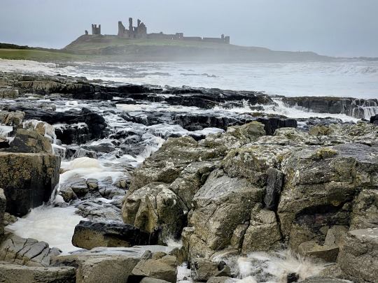
Craster more than makes up for its lack of beaches with a breathtaking, volcanically formed, rocky shoreline. A relatively easy, one mile walk along the headland provides breathtaking sea views as you approach the imposing ruin of Dunstanburgh Castle. One of the most atmospheric and inspiring castles in England, Dunstanburgh Castle was built in the 14th century.
With over 700 sites—more than any other county in England, you will see plenty of castles on your journey up the Northumberland coastal route. This is due to the rather violent past with neighbouring Scotland to the north.
Seahouses

Further up the coast, the bustling market town of Seahouses offers everything you may want for a conventional coastal getaway. A variety of shops, restaurants, pubs, ice cream shops, and fish & chip eateries can be found in addition to fantastic sea views.
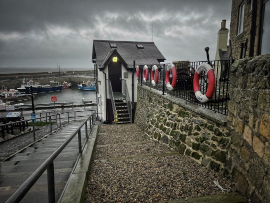
I have a fondness for Seahouses that stretches back over a decade or more. Known to many as ‘The entryway to the Farne Islands’ which are located two to three miles offshore. I’ve made the crossing over to the islands many times to photograph nesting sea birds. As well as being the most famous Sea Bird Sanctuary in the British Isles, the islands are also home to a large colony of Grey Seals. Birds that frequent these islands for nesting include Puffins and several breeds of Terns. Boats depart daily from the busy, colourful harbour.

There are beautiful beaches to the north and south of Seahouses, with the northernmost one being the most popular. Bamburgh Castle provides a magnificent backdrop to this expansive sandy beach which is bordered by grassy sand dunes.
Avian Flu
The worst bird flu outbreak to ever affect the UK has occurred during 2022, and experts have cautioned that the infection rate could increase even further throughout the winter of 2022-2023. The outbreak has had a huge negative impact on agriculture and the environment, killing 97 million birds worldwide (3.8 million in the UK). In response, the Farne Islands have been closed to visitors over the breeding season, as officials attempted to stem the spread of the infections. There is still a worrying battle ahead to rid our shores of this rampant killer disease.
Bamburgh
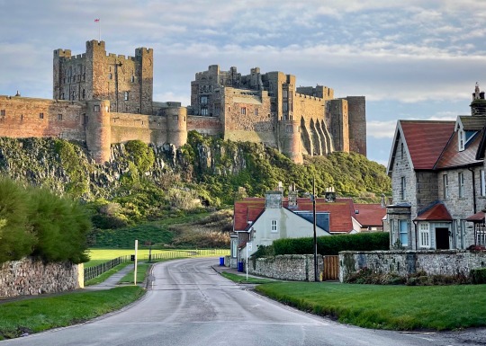
Bamburgh is the next-door neighbour to the community of Seahouses. A picture-postcard village, with English tea rooms, stone cottages, gift shops, eateries and B&Bs. The magnificent, 1,400-year-old Bamburgh Castle is seen before you even get to Bamburgh, majestically rising from the dunes system that fringes the beach, it literally is the stuff of legends.

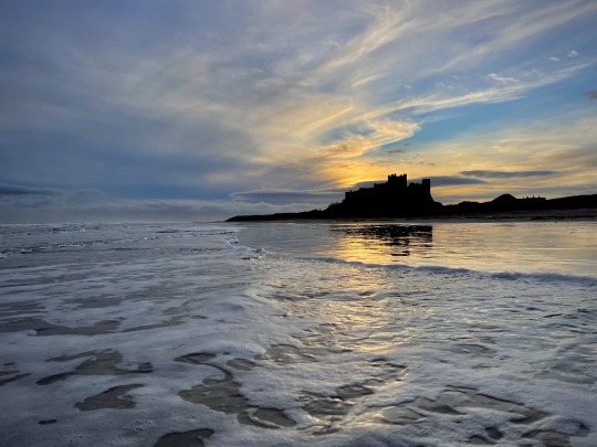
The castle commands sweeping views of a 2.5-kilometer long, immaculate sandy beach with the Farne Islands, Holy Island, and Lindisfarne seen in the distance. Due to its lofty position, Bamburgh Castle is a beautiful subject for photos when shot from the beach.
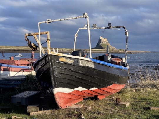
Holy Island

Any visit to the Holy Island of Lindisfarne begins and ends with the vagaries of the tide. The island is cut off from the mainland twice a day during high tide when the causeway that connects the mainland to the island is submerged.
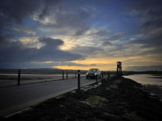
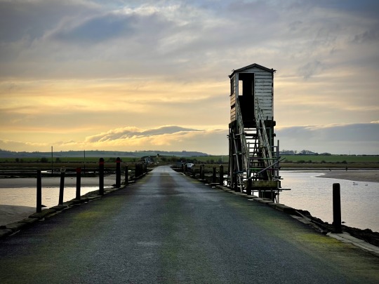
Crossing Holy Island’s causeway is a great experience, beautiful and sometimes eerie. The Road is approx 3 miles long and takes about 10 minutes to drive. Close to the start of the causeway is the famous refuge shelter for anyone unlucky enough that gets caught out by the tide. If you are unfamiliar with the causeway and the workings of the tides, it is best to educate yourself first, so long as you plan your visit for the right times, there is really nothing difficult to the crossing. I double-checked the crossing times before planning our trip.

Holy Island is steeped in history with spectacular coastal scenery. Whether you're interested in history, religion, walking, birdwatching, nature, or beaches, or like me in photography - Holy Island boasts a variety of attractions and activities. I think that it’s safe to say that most visitors are attracted by the extensive ruins of a 12th-century priory church and the associated monastic buildings. The equally famous Lindisfarne Castle is the other main visitor attraction.
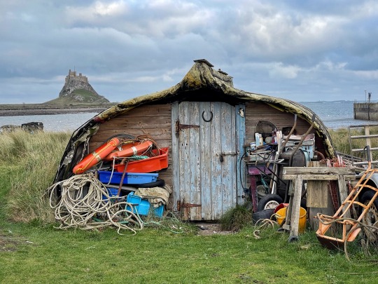
Local boats moor iIn Holy Island Harbour, known as The Ouse. The legendary upside-down boats on a muddy area next to the beach are old herring boats that have been converted into fishermen's sheds.

Lindisfarne Castle dates back to the middle of the sixteenth century and was first used as a garrison. The castle, which is positioned atop the volcanic rock formation known as Beblowe Craig and is one of the Island's most recognisable and appealing sights, can be seen for miles in all directions. The castle we see today was constructed by renowned architect Edwin Lutyens beginning in 1903 and is an amazing blend of a Tudor artillery fort and an Edwardian country home.

Reconnecting with some of our favourite places along the Northumberland Coast has been a wonderful experience. Who wouldn't be captivated by this special place? It's every bit the wild coast you'd want for photography inspiration.
All images © Adrian McGarry
www.adrianmcgarry.com
#Road trip#northumberland#northumberland coast#coast#coastal photography#coastline#amble#craster#Seahouses#bamburgh#dunstanburgh#lindisfarne#holy island#sea#ocean#lighthouse#castle
9 notes
·
View notes
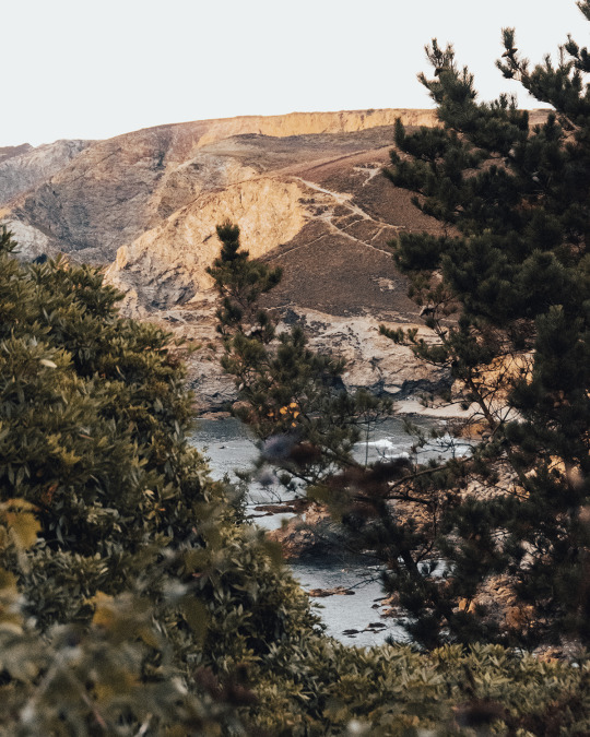
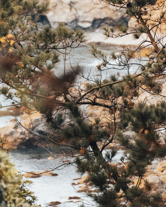
Text

I Will Be Rocks, I Will Be Water
📷: @sjscoyote , 2018
📍: Ketchikan, Alaska
Title from "Rocks and Water" by Deb Talan
#photography#photography is art#nature photography#photographers on tumblr#nature#alaska#ketchikan#water#rocks#landscape photography#coastal#coastal photography#deb talan#rocks and water
1 note
·
View note
Text
#photography#beach#texas#southern photography#film photography#coastal#coastal photography#blurry film#family
0 notes
Text
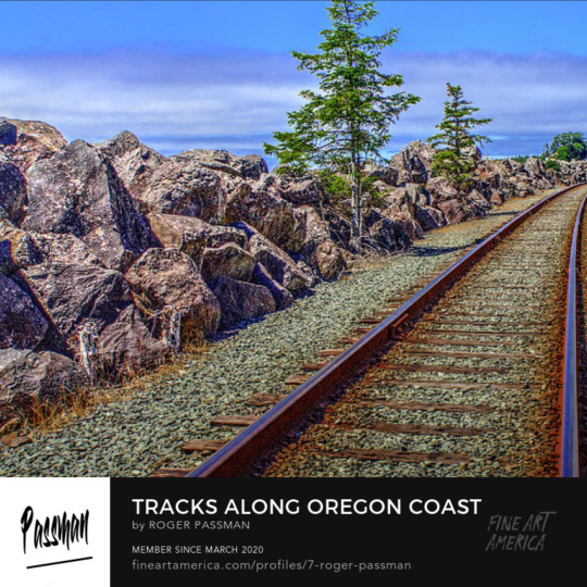
A new Fine Art Photograph by Roger Passman
#fine art#fine art photography#landscape photography#hdr photography#landscape photos#oregon#coastal photography#train tracks#landscape pictures#landscape art
1 note
·
View note
Text
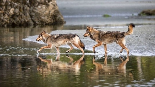
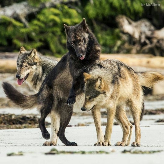
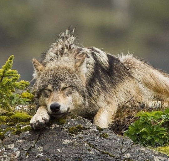
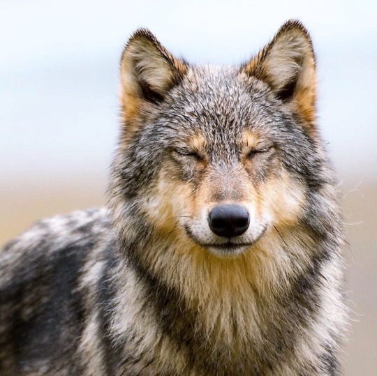

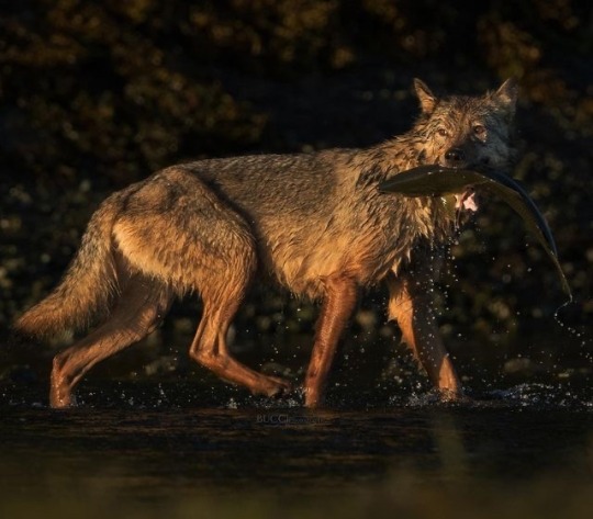

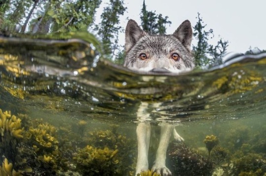
Some coastal wolves for you all!!
#therian#otherkin#alterhuman#wolf posting#wolf therian#wolf otherkin#werewolfkin#wolf photography#coastal wolf therian
720 notes
·
View notes
Text

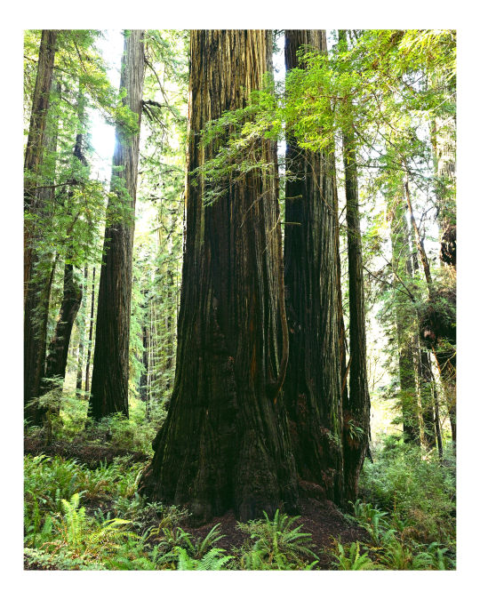
a huge two-stem Redwood with beautiful trunk flare
Redwood National Park, California
#redwoods#forest floor#coastal forest#ancient trees#old growth forest#dendrophilia#redwood national park#public lands#forest photography#nature photography#landscape photography#original photographers#nikon photography#nikon#24mm-120mm#photographers on tumblr
530 notes
·
View notes
Text
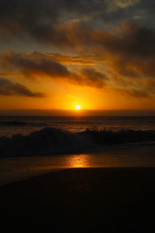
Greet the day
Sebastian Inlet State Park - Jan 24
#photography#nature#seascape#shoreline#coastal#sunrise#dawn#beach#ocean#surf#waves#clouds#sky#florida
527 notes
·
View notes
Text
𓆟𓆞𓆝𓆜𓆛
#white aesthetic#oceancore#ocean waves#seaside#seaside aesthetic#blue aesthetic#water#tropical#indie aesthetic#aesthetic#aesthetics#photography#cinematic photography#coconut girl#coastal
3K notes
·
View notes
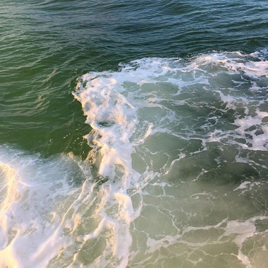
Text

Praia Pequena do Rodízio
#coastal photography#portugal#photographers on tumblr#original photographers#landscape photography#ocean#atlantic#beach#ruins
35 notes
·
View notes
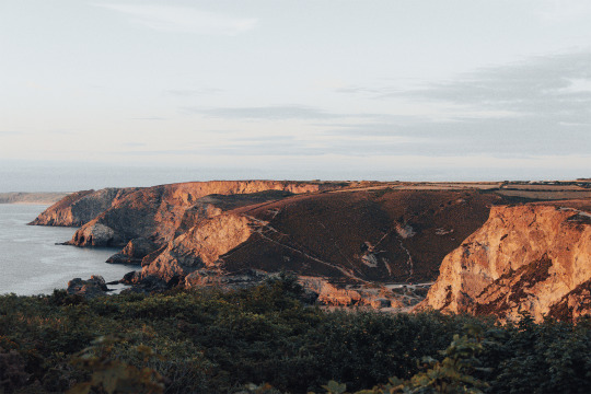
Photo
through the trees. + instagram.
#*photography#photography#photographers of tumblr#coast#cornwall#cornish beaches#beach#evening light#trees#sea#ocean#cliff#cliffside#water#beach photography#coastal photography
31 notes
·
View notes
Text
The North Wales Coast and Why I Love It
For those who enjoy spectacular scenery, North Wales has it all.
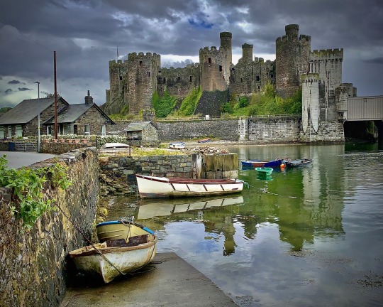
Conwy Castle
With 250 miles of breathtaking coastline, featuring rugged seascapes, tidal islands, secluded coves, historic lighthouses, medieval castles, Victorian fishing piers and delightful coastal towns; the North Wales coastline is a photographer's paradise.
Bordered in the north and west by the Irish Sea, the beaches in North Wales, several of which have been designated Areas of Outstanding Natural Beauty, are among the best in the entire United Kingdom. Tales of legends, myths, shipwrecks and battles are all part of the region’s culture and thousands of years of Welsh history. Away from the coast lies the vast, untamed Snowdonia National Park, home to trails, lakes, waterfalls, and ascent routes to Mount Snowdon; the highest peak in England and Wales.
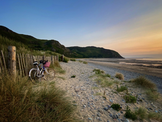
Many of North Wales' beaches are easily accessible
The Wales Coast Path, the first in the world to follow a country’s coastline in its entirety, offers the best way to witness jaw-dropping scenery and connect with the resorts, towns and villages along the way. The 870 miles coastal route offers unbroken, unspoilt, coastal walking with several sections suitable for cyclists and designated as part of the National Cycle Network. The official start and finish points are on the northern border with England near Chester and Chepstow in the south. The North Wales section encompasses the Dee Estuary and travels west to Bangor, then circumventing the Isle of Anglesey (via the Anglesey Coast Path) and onto the Llŷn & Snowdonia Coast.
I live close to the sea at approximately the mid-way point of the northern coastline in the county of Conwy. I can get to a lot of spots for my coastal photography quickly and easily. Further afield, a short drive takes me onto the beautiful Isle of Anglesey and the Llŷn Peninsula is only an hour away.

Golden hour photography on the North Wales coast
As one of the most popular seaside vacation destinations in the UK, the region is host to a number of bustling, coastal resorts. Long, sandy beaches offer plenty of space for recreational, leisure and sports activities. I prefer secluded spots and I photograph mainly in the golden hours around sunrise and sunset. Pensarn and Llanddulas are my local beaches. Neither location will be on most photographer's hit-lists of favourite photo hot-spots, yet these less famous beaches are a constant inspiration for my photography, offering a slower pace of life, time to reflect and create in silence.
Sunset at Llanddulas Beach.
I never run out of themes because the captivation of either calm or wild seas, vast stretches of exposed sand, and an infinite diversity of rocks, cliffs, water, and beach. North Wales offers all of this and more, I feel fortunate and privileged to call this my home.

Morning gallop at Pensarn Beach.
The North Wales coast is easily accessible thanks to the A55 expressway, a major road that extends from the eastern border all the way to Holyhead Port on the Isle of Anglesey. A substantial rail route runs from Holyhead through to Cheshire in England.
All images © Adrian McGarry
#north wales#wales#coast#north wales coast#beach#sea#conwy castle#conwy#pensarn#llanddulas#a55#north wales path#wales coastal path#landscape photogrpahy#coastal photography#seascapes
2 notes
·
View notes
Text
brindleton bay mornings •°. *࿐
#my posts#i'll never get enough of brindleton bay#i want more coastal worlds in ts4!!#the sims community#sims screenshots#sims 4 screenshots#the sims 4#sims 4 photography#ts4 screenshots#ts4#sims 4#the sims 4 photography#ts4 photography
394 notes
·
View notes
Text
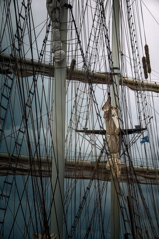
"What ship? All I see is ropes."—Oban, Argyll, Scotland, UK 2023
#tall ship#ship#sailing#rigging#maritime#coastal#original#art photography#original photographers#art#art photographer#fine art photography#art photo
559 notes
·
View notes
Text

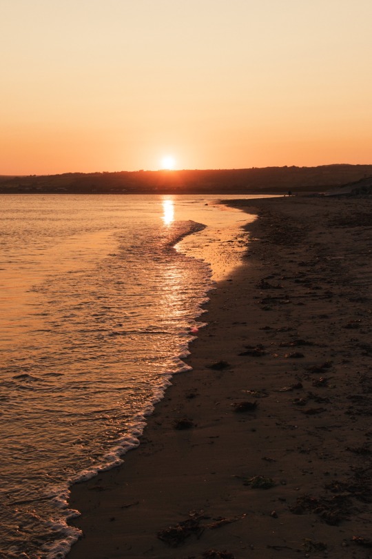

Smell the sea and feel the sky
Let your soul and spirit fly
~ Van Morrison, Into the Mystic
📍Cornwall
#original photographers#photographers on tumblr#lensblr#photography#photooftheday#photosofbritain#uk#landscape#landscape photography#ocean#oceancore#saltwater#salt#salted granola#coastal#coastal granddaughter#cornwall#poldark
702 notes
·
View notes
Last Seen Blogs