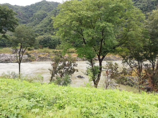
#Kiso Valley
Text

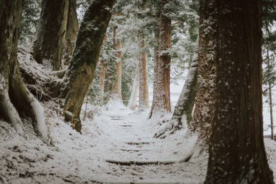
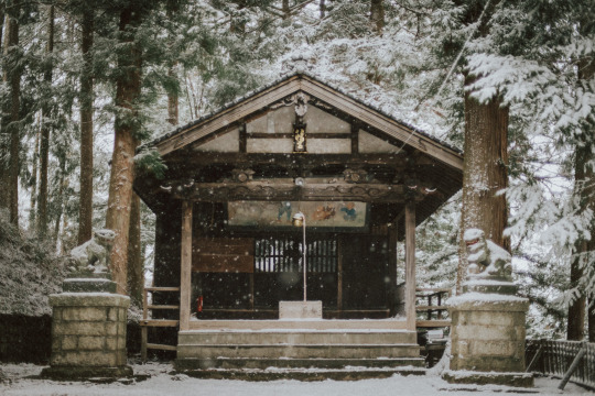
Nakasendo Way: The Kiso Road by Walk Japan Ltd.
840 notes
·
View notes
Text

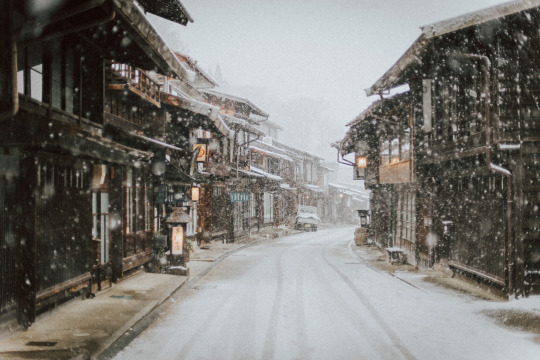
flickr
Narai, Japan
385 notes
·
View notes
Text
The last samurai. Nagano mountain area,
Kiso valley - Japan 🇯🇵.
#The last samurai#Nagano mountain#Kiso valley#Japan#Travel#Beautiful places#Places#downfall#downfalldestiny#Mountain#black mountain#life
124 notes
·
View notes
Video
“ The Last Samurai. “ // Daniel Kordan
Music: Eliott Tordo Erhu - Last Samurai OST
49 notes
·
View notes
Photo
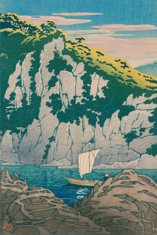
Hōrai Rock, Kiso River, by Kawase Hasui.
49 notes
·
View notes
Photo
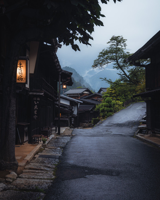
Tsumago-juku, Kiso Valley, Nagano Prefecture, Japan. Photography by
Hisa
@Hisa0808
3K notes
·
View notes
Text
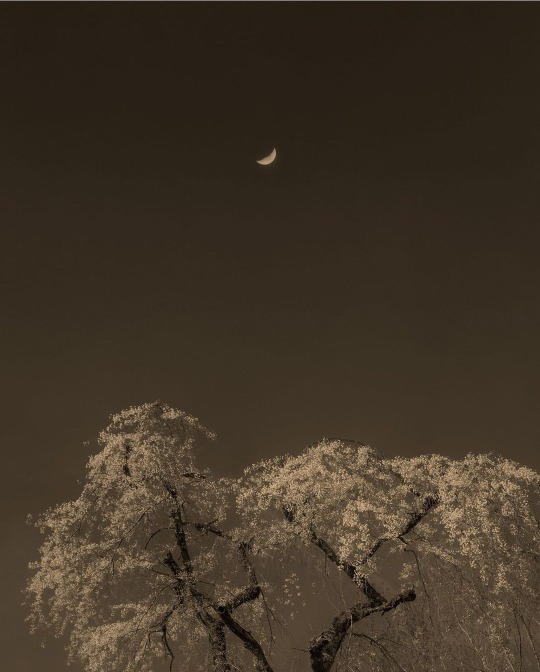
Paul Cupido
Sakura Moon
Kiso valley, Japan 2023
370 notes
·
View notes
Text


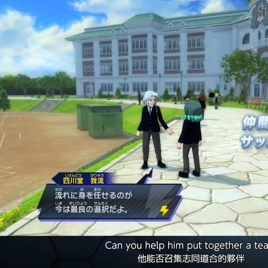


Cross-posting from my twitter, so to say.
We finally have names for some characters outside of Unmei (and Endou Haru ig)
1) Yagyuu Suruga
2) Sakurazaki Jouji
3) Kisoji Heita
4) Shisendou Garyuu
5) Kodoukai Kameo
6) Shinohara Raika
About their meanings (my attempt at them, at least) and some tidbits I've noticed under the cut
1) Both real names. Yagyuu is very likely refers to Yagyuu clan, (upd) also sounds similar to baseball in jpn, as he seems to be part of baseball club) Suruga to former province that used to be located in Shizuoka prefecture. Willow+life fast person\horse+river
2) Cherry blossom (not common way to write it down though?) and Jouji is your normal given name length+2
3) Kiso Valley and Heita is common name. 1st kanji of it means troop/soldier so ig it all plays with his family name due to ties to edo period
4) Sounds the same as 詩仙堂, a buddhist temple in Kyoto. except 2 first kanji p much mean four rivers, so four rivers temple? His name means self-taught/one's own style
5) Ancient road/ancient methods+domesticate/to keep (a pet) and (male) turtle...ig with his giant backpack he reminds of one, huh.
6) sounds like 篠原, field of bamboo grass, which is also an actual surname. Except 1st kanji is 忍 which would be to hide/to endure/etc so hidden field? Her name means next summer. From kanjis in her name I think she might be Natsumi's expy, so to say? She has 原 just like school, and her name is literally next SUMMER (Natsumi means summer)
anyway, most of those give some nod to Edo period and have rural feel, so to say? Ig it all lies well with the setting of school looking more old?
and in attempt to see if they have some parallels with old cast

if this screenshot is anything to judge their actual intended positions by... Shisendou and Endou are both GKs and have 堂 (dou-temple) in their family name funny, 'cause he gives me more of Kirino vibes, so thought he be on DF. Again, as it's just 5 on 5 and you can put anyone on any position, it doesn't implies he's GK 100% yet, or positions of other characters
#uhhh what was my ie tagging#IE#Inazuma Eleven#Inazuma 11#Inazuma Eleven Victory Road#shut up seraph
50 notes
·
View notes
Text
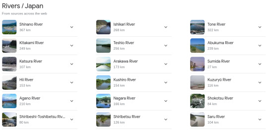
Japan's Rivers:
youtube
Japan is an archipelagic country made up of four big islands: Hokkaido, Honshu, Shikoku, and Kyushu, as well as around 6,800 smaller islands. Mountains and valleys dominate the topography, accounting for more than three-quarters of the total land area. Ice and snow from these mountains have formed several rivers, which are vital to the country's transportation, agriculture, and energy generation. Japan's rivers are often short, steep, and fast-flowing. This makes them great hydropower generators, but it also increases the chance of floods. Despite the hazards of flooding, Japanese communities have built near rivers since ancient times. Many of these rivers have been altered, some dramatically, to compensate for this. Under the River Law of 1967, Japan's streams and rivers are classed as Class A or Class B systems. The majority of Japan's most well-known rivers are classified as Class A, indicating that they are economically or ecologically important to the country.
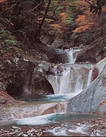
-Waterfall in Yamanashi prefecture, east-central Honshu, Japan.
The growing need for freshwater for paddy (wet-rice) production, industry, and home consumption poses a severe concern. The scarcity of natural water reservoirs, the rapid flow of rivers, and the engineering difficulties of building large-scale dams in the rocky highlands all contribute to supply challenges.

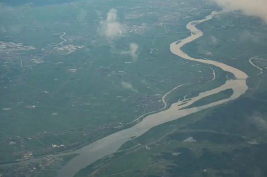
-Ishikari River, western Hokkaido, Japan
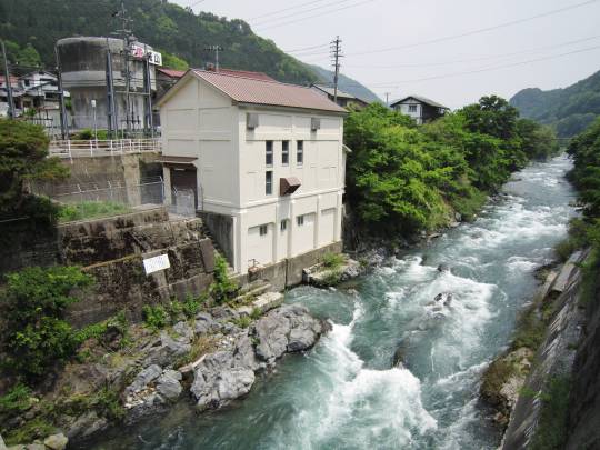
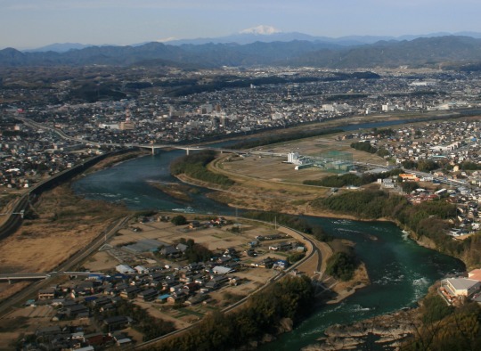
Ishikari River in western Hokkaido, Japan. Japan's rivers are usually short and rapid, fed by tiny drainage basins. The major rivers are the Teshio and Ishikari rivers in Hokkaido, the Kitakami, Tone, Shinano, Kiso, and Tenryū rivers on Honshu, and the Chikugo River in Kyushu. Honshu rivers include Tone, Shinano, Kiso, and Tenryū, as well as Kyushu's Chikugo River. Some rivers from northern Honshu's volcanic zones are acidic, rendering them worthless for irrigation and other reasons.
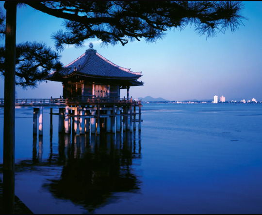
-Ukimi Temple, Lake Biwa, Shiga prefecture, central Honshu, Japan.
Lake Biwa, Japan's biggest, measures 259 square miles (670 square kilometres) in central Honshu. All other large lakes are to the northeast. The majority of coastal lakes, including Honshu's Lakes Kasumi and Hamana, are drowned former valleys with sandbars damming the bay entrances. Honshu's inland lakes, including Biwa, Suwa, and Inawashiro, are located in tectonic depressions formed by geologically recent faults. Volcanic lakes (such as Kutcharo in Hokkaido and Towada and Ashi in Honshu) dominate all others.
The Shinano River, also known as "Shinanogawa" on the island of Honshu, is the longest river in Japan. The river travels north for about 228 miles, from its source at Mount Kobushi in the Japanese Alps to its mouth in the Sea of Japan. The Shinano River flows through some of the country's most populous areas and major cities, including Matsumoto, Nagano, and Niigata. The Shinano River has played an essential role in Japanese life for millennia. It has functioned as a source of drinking water, a transit route, and a recreational and leisure area. Perhaps its most well-known application is to generate hydroelectric power. Actually, the country's first such power plant, the Miyashiro No. 1 power plant, was built along the river in 1904 and is still operational today. The river supports a rich range of plant and animal species, as well as fish, including Cherry Salmon. The Shinano River is a popular swimming and fishing area in the summer, and an ice skating and fishing destination in the winter. There are also several popular Onsen, or hot springs, along the river.
The Tone, or "Tonegawa" River, is one of Japan's most important rivers. This is partly because to its position, running across the densely populated Kanto Plain. The river originates in the mountains of central Japan and flows for approximately 200 miles to the Pacific Ocean. The river's basin, which is the biggest in Japan at 6,540 square miles, is home to nearly 40 million people. This is not just in the country's heart, but also on its greatest plain, which is home to the capital, Tokyo. Tonegawa was formerly a wild and untamed watercourse, but it is now widely regarded as the most intentionally changed of all Japanese rivers. The contemporary path has little similarity to the historic one. Tonegawa now features multiple dams, which serve as reservoirs for the Kanto region's residential and agricultural water needs. The largest of these is the Yagisawa Dam. The river is also utilised for transportation and pleasure, and it is surrounded by Japan's longest car-free cycling trail.

The Teshio, also known as "Teshigahara" in Hokkaido, is Japan's northernmost significant river. It runs for around 159 miles and has a basin area of about 2,160 square miles. The river has an average discharge of around 9,000 cubic feet per second. The Teshio River has been a major commerce and transit waterway since ancient times, and the indigenous Ainu people still utilise it now. The river is an important source of irrigation and hydroelectric power generation.
The Kitakami River, which was an important transit route during the Edo era, is the longest river in the Tohoku area, measuring around 155 miles. It is regarded as one of Japan's most picturesque rivers, with an abundance of cherry blossoms in the spring. The Kitakami is also home to a diverse range of fish and is a popular fishing destination.

Located on the island of Shikoku in Kōchi Prefecture, the Niyodo River is famed for its extraordinary turquoise waters. Its source is Mount Ishizuchi and it flows for just 77 miles.
Japan's Rivers:

Havard references:
The Editors of Encyclopaedia Britannica. (1998). Japan's Rivers [Online]. britannica. Last Updated: 27 October 2023.. Available at: https://www.britannica.com/place/Japan/Soils [Accessed 19 February 2024].
discovery uk. (2023). The Best Known Rivers in Japan. [Online]. discovery uk. Last Updated: 12 January 2023. Available at: https://www.discoveryuk.com/travel-and-exploration/the-best-known-rivers-in-japan/ [Accessed 19 February 2024].
0 notes
Text
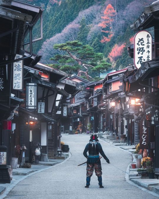
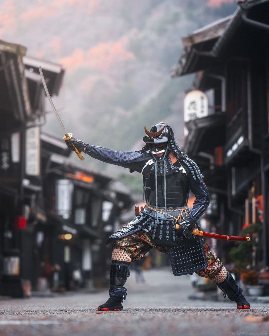
Samurai at Kiso Valley by danielkordan
141 notes
·
View notes
Photo
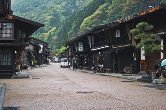
Narai, Japan
736 notes
·
View notes
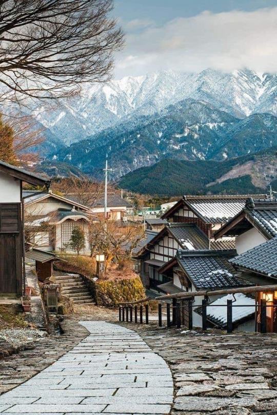
Photo

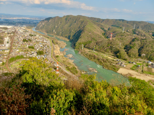
Magome, Kiso Valley, Japan
Discover the enchantment of Magome, a hidden gem in the stunning Kiso Valley of Japan. Prepare to be captivated by its picturesque beauty.
0 notes
Link
Fun Things to Do in Kiso Valley | Travel Guide (2023) | Best Tourist Places
0 notes
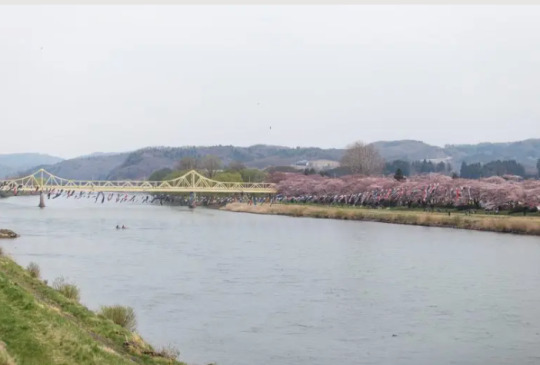
Photo


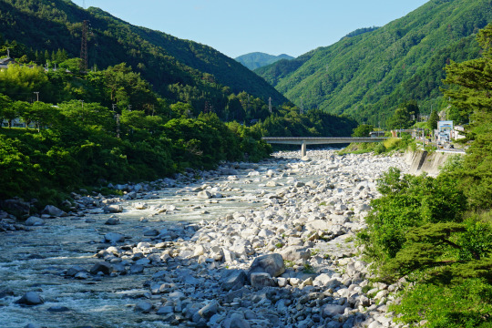
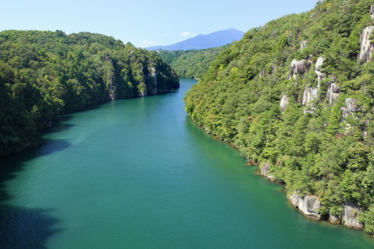
The Kiso River and Kiso Valley in Japan.
3 notes
·
View notes
Photo

Tsumago-juku, Kiso Valley, Nagano Prefecture, Japan. Photography by
Hisa
@Hisa0808
617 notes
·
View notes
Last Seen Blogs

emmasternerradley
Words are the only obvious magic

labelritukumar21
Label Ritukumar

softclinic-software
Untitled

circadiancrunch
Getting Coffee

allmusic
AllMusic